Topanga State Park Photos


You might also consider


More like Topanga State Park
Recommended Reviews - Topanga State Park
Start your review...


Reviews With Photos


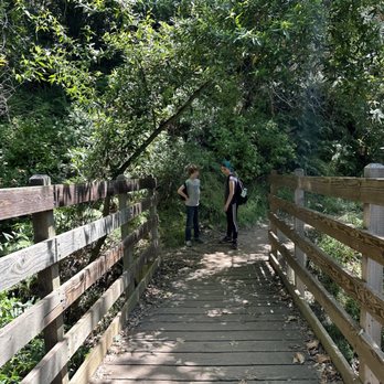
A beautiful spot for hiking and home of one of the most amazing trees my kids have ever climbed. We parked in **I think** the Dead Horse lot. Pay to park unless you have a state park pass. Nice thing is they now take credit cards and if it pains you, feel good in the fact that it goes to the state park system. We had a lovely hike up, crossed a bridge, had some shade, saw lots and lots of pollinators at work and ended up the second parking area which works perfectly because voila, water, restrooms and picnic benches if you feel so inclined. SUNSCREEN AND WATER, hats and sunglasses also wise. Beware the poison oak. Enjoy the beauty.


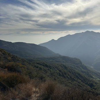
Lovely park it's huge. The rocky mountains of Santa Monica the view is stunning . We pulled into the park we had to pay for parking, I paid 9$ for 3 hours or ten dollar flat fee for the day. There is available parking lot. Many trails and scenery . Eagle rock trail and many more each are unique and different . You get to see many wild life , red hawks , birds California quails ,coyotes . They said they are Bob cats and mountain lions. But I have not catch one on site. Restrooms are available. In some spots. I love how how organised the place is. So there is information map on trails to tell you where u are . With different trail u get to see a lot of seasonal flower and trees. I can't wait to discover more. My four stars comes in for the parking. For natural park I think it's a bit high.


Living in the Twightlight Zone with no nowhere to go or to eat out, I started to look in my own back yard. Some State Parks are finally open. Yippee! This one happens to be open. No rangers and not too crowded yet. The views of Eagle Rock were spectacular and so were the views standing on it . Anything, just not to be cooped up at home but this was more than just anything! Parking is $10 if you don't want to bother with parking behind the white line on Entrada.


We hiked up to Eagle Rock!! It is such a great hike make sure to wear tons of sunscreen and pack water and some snack because you will need it. I was so blowed away bout gorgeous it was and what. Supported me was how clean the bathroom was hahaha. I care about stuff like that I didn't wear any block on my lips and got burned up.


I have no idea why I have waited this long to do this review. Topanga State Park is the closest State Park that I have near my home. I love to hike here with family, friends and/or my boyfriend, Diego R., (hi babe if your reading this!). Parking lot opens at sunrise and there is a parking fee of $10 for the whole day. I normally park outside of the park and walk in to avoid paying but in order to help the park I should. I will next time. My favorite trails to do are the two following: 1. Start at Eagle Junction to Eagle Rock and to complete the loop go down Musch Trail. Total miles are five miles. It is a wide open path and used a lot by trail runners. 2. Another favorite is starting from Eagle Junction towards Parker Mesa Overlook. This is a fairly easy hike and roundtrip mileage is about seven miles. This is an excellent trail for hiking, running, and a few mountain bikes. The views are AMAZING and endless. I could say now that I have completed it that it is one of my favorites. You will encounter some incline at the beginning and a little before reaching the overlook. There is one campground at Musch Trail as a first come, first serve basis. You can honestly spend an entire day here and eat at the picnic tables. What I love about Topanga State Park is that you can do some many different trails. It is also within distance to the San Fernando Valley and beaches.


I hiked the Musch Trail and walked the East Topanga Fire Road today. It was nice. I loved seeing all mountain ranges,foliage, rock formations, and meadows. I saw one lizard while on the Musch Trail. Note: I started my trek from the Trippet Ranch parking lot. Parking was $10 in the lot.


Wooow definitely a challenging hike...I went down the santa ynez trail which is not maintained as posted and it was a challenge coming back up...I ran down it no problem trying to see a waterfall ended up only seeing tears run down my face from the river being dry...I found this place with a hiking app and they said it was easy hence why I came to do it...my skinny fat ass almost passed out going uphill in the sun all alond got some dope shots but not worth my life


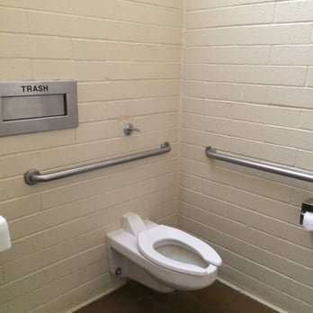
I can't believe I've lived here for so long and not been to Topanga State Park. First suggestion. try to go on a weekday and try to go in the morning. Why? Hardly anyone will be there and you can probably park on Entrada Road, just outside the park entrance and save yourself ten bucks. See pic. The park was in great shape. The bathrooms were the cleanest I've ever experienced at a California State Park. They even have flush toilets, liquid soap, and paper towels. You'll also find plenty of picnic tables and even a covered picnic area. Plenty of well marked trails to choose from. I would say the hiking is at a moderate level because there's very little level terrain. Seems you're either climbing or descending, both on the way up an back. I also like that it's really easy to choose a circular route, so you can have some different sights and terrain to behold. I loved that it wasn't crowded at all. I might have seen ten other hikers the whole time. There may have been more, but there are tons of trails. I like being able to go on a hike and not see tons of people like you would in Runyon Canyon, or Griffith Park. If you chose to enter the park in your car, you'll find ample parking. See pic. I usually hike Paseo Miramar in the Pacific Palisades (it also gets pretty crowded). I think this hiking at Topanga State Park is a little bit easier, but not by much. I still felt like I had a really good workout when I was done with my 4 1/2 mile hike. Oh yah, there was even actually a restroom up there at one of the turning points. I'd recommend bringing a couple water bottles with you. It can get pretty hot and dry there. Most of the trails were very wide and well groomed. They are made for big trucks to use. You will find some narrower rocky trails along the way if you take some of the smaller trails. I was there with a group of people, and most of them were only wearing sneakers, one of them wore Uggs, and still had no problems on the trail. I saw evidence of horses on the trail, but I didn't see any dogs. I'm pretty sure dogs are allowed though, as long as they're on a leash. No excuses, get out there and enjoy a nice hiking experience, not too far away from LA. It'll leave you feeling good, inside and out!


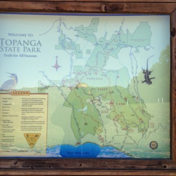
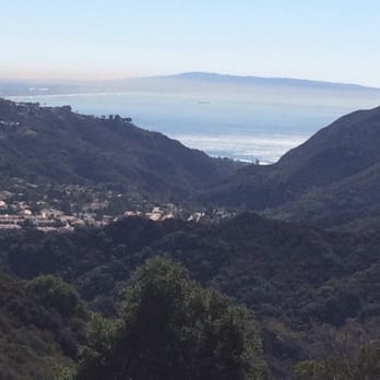
I took the 5-7 mile Eagle Rock Loop. I hike almost every weekend in the (Norcal) Bay Area so I was excited to hike down in Los Angeles with my friend this weekend. It's a good hike. Notable things: Parking - $10 if you don't want to park on the side of the road. Maps - Make sure you take a picture of the map at the entrance to the park. The cell phone connection is spotty so you'll have to rely on your picture if you get lost. Trail Navigation - I always budget time to get lost, especially the first time I try a trail - this time I definitely needed it. Climbing to the top of Eagle Rock, make sure you pay careful attention to all the signs and reference your map. There are a few junction points so it's easy to go the wrong way. Eagle Rock/Vistas - Hiking is the most fun when you have an end goal, a.k.a you summit something and get a cool view. At the end of our 3 mile hike to Eagle Rock, we were rewarded with great views of the Ocean and Malibu pier. There were also a couple of (wannabe?) Instagram models at the top posing awkwardly for pictures. Rattlesnake/Wildlife - Watch out. For the first time in my life, I saw a large adult rattlesnake just chilling on the side of the trail. Luckily, it didn't seem threatened or ready to attack so we were able to calmly walk by it. Aside from the rattlesnake there are a lot of lizards, hawks, and other smaller birds on the trail. Overall - a great hike! I'll be back.


This trail was a very nice place to walk on, there was many amazing things to look at. I would definitely recommend to check it out if you were deciding on spending time somewhere, it's relaxing and there's wonderful breeze in the afternoon.


Beautiful place for to go to walk with panoramic scenic you can feel the nature & that's it


2 years ago
If you are anywhere in Los Angeles you will want to go to Topanga State Park. It is the biggest wild park we have in LA and one of the largest in the State. It is easy to get to and near places you might want to go or already be at. It is right near Malibu and close to Brentwood and the West Side of LA. Parking is easy for a fee. It is not at all crowded on the weekdays, but can get a little congested on the weekends. There are very few staff type people to help you so make sure you have water and can walk, sometimes on rough trails. You can camp there over night, but there are no facilities at all. None. You pack in and pack out. Most people go there just to walk or hike. In the parking area there is a bathroom and a drinking fountain. There is also a nice set of picnic tables for lunch. If you walk far enough you can see the ocean and it is a lovely view. There are also wonderful wild flowers, little critters and great hills to see. It is part of the Santa Monica Mountains. There are about 36 miles of trails through open grassland. It is beautiful. Mountain bikes are allowed but only on fire trails and people will not be happy to see you. We have had fires, a lot, lately (I am writing in Sept of 2024), now none of been here, but there is really bad air right now and it is hot so keep that in mind. If you are healthy you will be fine. If not, maybe wait to take a long hike after fire season is over in late October. Outside the park is the little town of Topanga, you will pass it on your way. There are places to eat there and a few shops. It is very nice. It is a great place to go for a long hike or a short walk. Have a great time and pick up after yourself. read more


I always enjoy a great hike. This hike as I posted before has great opportunities for views as well as steep trails. The trails also include a hike to the waterfall which allows for awesome views. If you run, hike or jog, this is the place to be. read more




3 months ago

1 year ago

A beautiful spot for hiking and home of one of the most amazing trees my kids have ever climbed. We parked in **I think** the Dead Horse lot. Pay to park unless you have a state park pass. Nice thing is they now take credit cards and if it pains you, feel good in the fact that it goes to the state park system. We had a lovely hike up, crossed a bridge, had some shade, saw lots and lots of pollinators at work and ended up the second parking area which works perfectly because voila, water, restrooms and picnic benches if you feel so inclined. SUNSCREEN AND WATER, hats and sunglasses also wise. Beware the poison oak. Enjoy the beauty. read more


2 years ago

Lovely park it's huge. The rocky mountains of Santa Monica the view is stunning . We pulled into the park we had to pay for parking, I paid 9$ for 3 hours or ten dollar flat fee for the day. There is available parking lot. Many trails and scenery . Eagle rock trail and many more each are unique and different . You get to see many wild life , red hawks , birds California quails ,coyotes . They said they are Bob cats and mountain lions. But I have not catch one on site. Restrooms are available. In some spots. I love how how organised the place is. So there is information map on trails to tell you where u are . With different trail u get to see a lot of seasonal flower and trees. I can't wait to discover more. My four stars comes in for the parking. For natural park I think it's a bit high. read more


Living in the Twightlight Zone with no nowhere to go or to eat out, I started to look in my own back yard. Some State Parks are finally open. Yippee! This one happens to be open. No rangers and not too crowded yet. The views of Eagle Rock were spectacular and so were the views standing on it . Anything, just not to be cooped up at home but this was more than just anything! Parking is $10 if you don't want to bother with parking behind the white line on Entrada. read more


We hiked up to Eagle Rock!! It is such a great hike make sure to wear tons of sunscreen and pack water and some snack because you will need it. I was so blowed away bout gorgeous it was and what. Supported me was how clean the bathroom was hahaha. I care about stuff like that I didn't wear any block on my lips and got burned up. read more


I have no idea why I have waited this long to do this review. Topanga State Park is the closest State Park that I have near my home. I love to hike here with family, friends and/or my boyfriend, Diego R., (hi babe if your reading this!). Parking lot opens at sunrise and there is a parking fee of $10 for the whole day. I normally park outside of the park and walk in to avoid paying but in order to help the park I should. I will next time. My favorite trails to do are the two following: 1. Start at Eagle Junction to Eagle Rock and to complete the loop go down Musch Trail. Total miles are five miles. It is a wide open path and used a lot by trail runners. 2. Another favorite is starting from Eagle Junction towards Parker Mesa Overlook. This is a fairly easy hike and roundtrip mileage is about seven miles. This is an excellent trail for hiking, running, and a few mountain bikes. The views are AMAZING and endless. I could say now that I have completed it that it is one of my favorites. You will encounter some incline at the beginning and a little before reaching the overlook. There is one campground at Musch Trail as a first come, first serve basis. You can honestly spend an entire day here and eat at the picnic tables. What I love about Topanga State Park is that you can do some many different trails. It is also within distance to the San Fernando Valley and beaches. read more

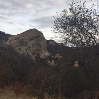
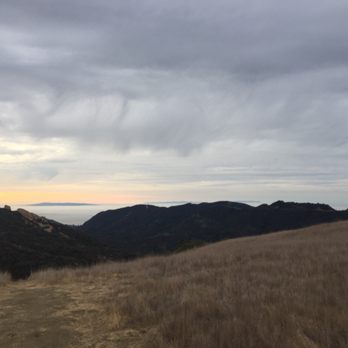


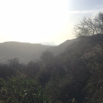

I hiked the Musch Trail and walked the East Topanga Fire Road today. It was nice. I loved seeing all mountain ranges,foliage, rock formations, and meadows. I saw one lizard while on the Musch Trail. Note: I started my trek from the Trippet Ranch parking lot. Parking was $10 in the lot. read more


Wooow definitely a challenging hike...I went down the santa ynez trail which is not maintained as posted and it was a challenge coming back up...I ran down it no problem trying to see a waterfall ended up only seeing tears run down my face from the river being dry...I found this place with a hiking app and they said it was easy hence why I came to do it...my skinny fat ass almost passed out going uphill in the sun all alond got some dope shots but not worth my life read more


7 years ago


3 years ago

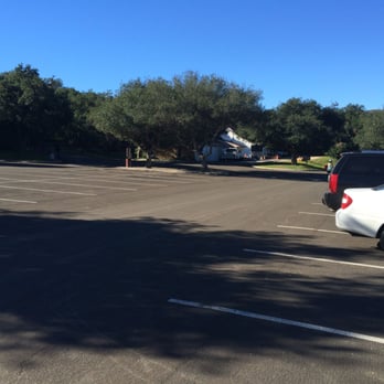
I can't believe I've lived here for so long and not been to Topanga State Park. First suggestion. try to go on a weekday and try to go in the morning. Why? Hardly anyone will be there and you can probably park on Entrada Road, just outside the park entrance and save yourself ten bucks. See pic. The park was in great shape. The bathrooms were the cleanest I've ever experienced at a California State Park. They even have flush toilets, liquid soap, and paper towels. You'll also find plenty of picnic tables and even a covered picnic area. Plenty of well marked trails to choose from. I would say the hiking is at a moderate level because there's very little level terrain. Seems you're either climbing or descending, both on the way up an back. I also like that it's really easy to choose a circular route, so you can have some different sights and terrain to behold. I loved that it wasn't crowded at all. I might have seen ten other hikers the whole time. There may have been more, but there are tons of trails. I like being able to go on a hike and not see tons of people like you would in Runyon Canyon, or Griffith Park. If you chose to enter the park in your car, you'll find ample parking. See pic. I usually hike Paseo Miramar in the Pacific Palisades (it also gets pretty crowded). I think this hiking at Topanga State Park is a little bit easier, but not by much. I still felt like I had a really good workout when I was done with my 4 1/2 mile hike. Oh yah, there was even actually a restroom up there at one of the turning points. I'd recommend bringing a couple water bottles with you. It can get pretty hot and dry there. Most of the trails were very wide and well groomed. They are made for big trucks to use. You will find some narrower rocky trails along the way if you take some of the smaller trails. I was there with a group of people, and most of them were only wearing sneakers, one of them wore Uggs, and still had no problems on the trail. I saw evidence of horses on the trail, but I didn't see any dogs. I'm pretty sure dogs are allowed though, as long as they're on a leash. No excuses, get out there and enjoy a nice hiking experience, not too far away from LA. It'll leave you feeling good, inside and out! read more

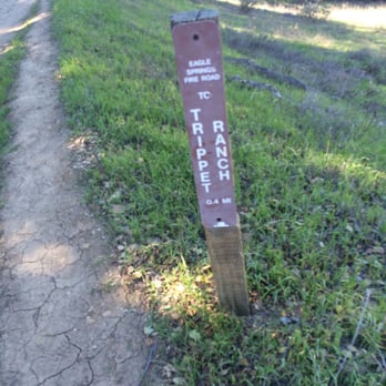




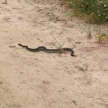
I took the 5-7 mile Eagle Rock Loop. I hike almost every weekend in the (Norcal) Bay Area so I was excited to hike down in Los Angeles with my friend this weekend. It's a good hike. Notable things: Parking - $10 if you don't want to park on the side of the road. Maps - Make sure you take a picture of the map at the entrance to the park. The cell phone connection is spotty so you'll have to rely on your picture if you get lost. Trail Navigation - I always budget time to get lost, especially the first time I try a trail - this time I definitely needed it. Climbing to the top of Eagle Rock, make sure you pay careful attention to all the signs and reference your map. There are a few junction points so it's easy to go the wrong way. Eagle Rock/Vistas - Hiking is the most fun when you have an end goal, a.k.a you summit something and get a cool view. At the end of our 3 mile hike to Eagle Rock, we were rewarded with great views of the Ocean and Malibu pier. There were also a couple of (wannabe?) Instagram models at the top posing awkwardly for pictures. Rattlesnake/Wildlife - Watch out. For the first time in my life, I saw a large adult rattlesnake just chilling on the side of the trail. Luckily, it didn't seem threatened or ready to attack so we were able to calmly walk by it. Aside from the rattlesnake there are a lot of lizards, hawks, and other smaller birds on the trail. Overall - a great hike! I'll be back. read more




4 years ago
This trail was a very nice place to walk on, there was many amazing things to look at. I would definitely recommend to check it out if you were deciding on spending time somewhere, it's relaxing and there's wonderful breeze in the afternoon. read more




5 years ago
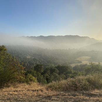
Beautiful place for to go to walk with panoramic scenic you can feel the nature & that's it read more


My friends and I decided that we wanted to go hiking somewhere and I've always wanted to try this place out so we came here! For parking, make sure to park on the side before you enter the street to get to the parking lot. You'll see when you actually go there! You don't want to pay $10 for parking. Save some money!! We came on a Tuesday morning around 10-11am. It was around 72 degrees. Beware of the weather. It was pretty chilly at first but when we start to hike.. That's when everything gets all hot and sweaty. The trail is about 2 miles to get to Eagle Rock. That's where we stopped at first. We took many pictures on the way. The view was really beautiful and you can see the trails, grass, mountains, everything. I had an amazing time with my girls. It was a great experience. Can't wait to come back!! read more


6 years ago
Awesome place to hike and get amazing views of the mountain and the ocean. Can get lost for hours exploring the different paths, but clearly marked where you can find your way back. read more


4 years ago
6 years ago
Simply put, Topanga State Park is a wonderland of Los Angeles County. Don't ever underestimate it's natural beauty. Please follow the rules, enjoy and DO NOT START ANY FIRES (Period end of story). read more





6 years ago

14 years ago
Awesome hike! You first get there and think it's gonna be packed with people from the view of the parking lot but then it's not! There are numerous trails to choose from too which is great. I took one (I believe to the right) that I felt was a great workout and quite a challenge. We did a good 7 miles and got pretty sweaty! I used to go to Palos Verdes and I thought i'dd never find anything as beautiful but this definitely comes close! At the end of the trail I went on there's a huge cliff top view of the ocean and the entire beautiful infrastructure of the houses and town below and surrounding is breathtaking! Things you should know: -Park in the residential area right before the actual entrance- avoid a $10 parking fee -Water! -I doubt you need to buy the map if you're adventurous enough but might be something interesting to look at one day - SUNBLOCK! I always seem to forget I'm white in the sun and now I'm bright red and in pain- bring extra! -Wear a HAT- but not a big annoying one that doesn't stay secure. You don't want the sun beating down on you -Have someone bring at least their phone- a lot of great photo-ops! -The more people you go with the better- if not motivation, the hike still becomes a lot easier when you have people with you to make fun of Beware of the wilderness. I went yesterday for my first time there and well, we got charged by a huge DEER! once it got within 50 yards it turned back and got scared off (luckily) but we also did see a lot of snakes. Have fun ! read more


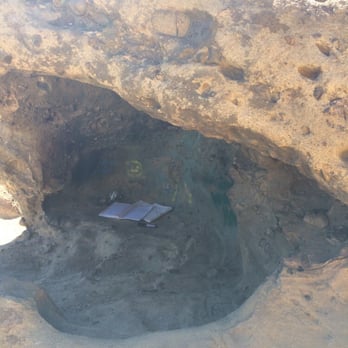
I love Topanga State Park. There is a parking lot here and bathrooms - always convenient - and now they have a machine to pay so you don't have to worry about having cash. There are some nice picnic tables to sit and have lunch which are shaded. The trails are easy to find and there is a map at the trailhead. I love hiking up to Eagle Rock and doing the loop back. This park gets busy on the weekends. You will see a lot of people along the trail and often a bus dropping a group off on the weekends. Eagle rock also gets really busy and young people like to hang out in the little "cave" at the top. read more


Came to Topanga State Park to get to the Parker Mesa Overlook. We started the hike at the Trippet Ranch Trailhead. Parking here is $10 or you can try to find free street parking along the road. The park is pretty huge. Very open and green. The trail head was really open so make sure you have sunscreen and plenty of water. There are a ton of signs so it was easy to follow the trail. Be ready for a long hike, it is almost a 7 mile hike to the overlook and back. You will be out there for a few hours. read more
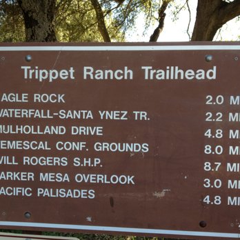



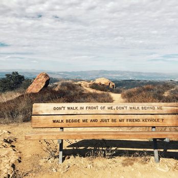
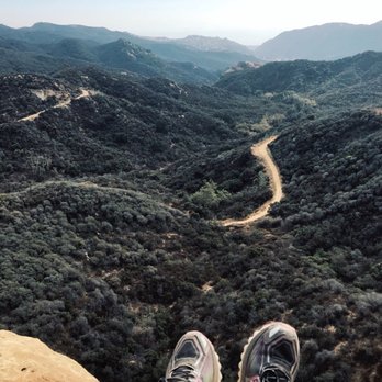
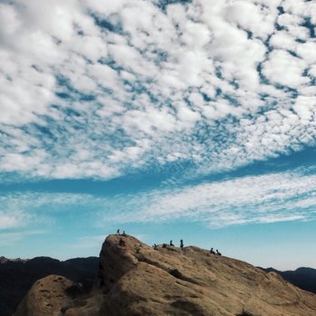
Went out here to hike and ended up loving the trail I went on. I hiked the Musch Trail to Eagle Rock, which ended up being around 10km and took me 2 hours to complete. The trail leads you through wild meadows, shaded forests, and alongside a mountain. It wasn't a difficult hike, but you'll get a great workout in. The view at the top of Eagle Rock is breathtaking. Completely worth the entire hike. One of my favorite hikes in the LA area! All day parking is $10. There are restrooms and water fountains in the parking lot and near the trailhead. Check this park out if you're itching to get a hike in (: read more



5 years ago
3 years ago


3 years ago

6 years ago
I went there with my family is a beautiful place, make sure you bring enough water, you gonna need it read more


12 years ago
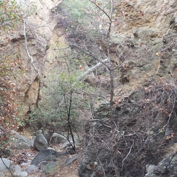
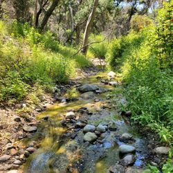
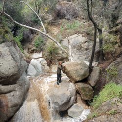
The Stats Distance: 6.5-7 miles Elevation Gain less than 2000 ft. Rating: 5-6/10 Trail: A loop, fire road, single track and bushwhacking. State Park = No Dogs Duration: 4-5 hours Water Warning: Could be water, but probably avoidable. Essentials: Clothing: Long sleeve shirt & pants (poison oak (PO) protection, sort of...PO has been known to get through clothing. There is quite a bit of PO Footwear: Good pair of lug sole shoes to help keep you upright and wool socks Water: At least 3 liters. Also good idea to take some electrolytes to decrease muscle cramps Food: Protein bars (I tend to take items that contain water, i.e. fruit and veggies) The Route Less than a half mile from the Entrada Ave. parking area of Topanga SP descend along the single-track trail. Cross through a dense forest to the first of many creek crossings. Rock hop the babbling waters and follow the trail to a junction. The trail continues to Vereda de La Montura in the Pacific Palisades, while the trail to the left continues toward Santa Ynez Waterfall. Most hikers turn around at the falls, but it is possible to continue up the canyon. A rope to the left of the falls may be used to climb above the waterfall and continue upstream. There is also a path a few hundred feet downstream, on the right as you face away from the falls, which can be used to climb out of the canyon and rejoin the creek above the falls. Take this single track, which drops down to the creek, crosses it, and turn left, heading upstream. Stroll along the calming creek through the quiet forest. Breathe deep and listen to the trickling water. That relaxing fragrance comes from the leaves of the California Bays along the trail. Oaks and sycamores pitch in to add more shade and keep the canyon cool. When the canyon walls close, you are nearing the waterfall. The narrows present a small obstacle. The water pours over a cluster of rocks in the center of the gorge and there is no easy way to continue walking. Some crossed the ledge to the right, passing below a low overhang, while others hopped across the creek and climbed up the rock to the left. Both routes are feasible for agile hikers. Alas, the 18-foot waterfall which is at its best after a good rain. The downside to hiking here after a rain is the about of water hikers have to trudge through to get to the waterfall. This is one of my favorite hikes, why? Because there is no traditional trail, it involves rock scrambling and boulder climbing, 4 rope climbs, as well as the opportunity to climb a ladder. As if hiking for hours on end through dense bush and everything listed above, the climb out of the canyon is about a 350-500 foot elevation gain that can only be done on hands and knees as the dense brush creates only rabbit holes, not walking or blazing trails. Directions: From the Ventura Freeway (101), exit at Topanga Canyon Boulevard, drive south over the crest of the mountains and proceed three miles to Entrada Road (not Entrado!) and turn left. Keep to the left at every opportunity until you reach the park's main parking lot (about one mile) From Pacific Coast Highway, travel north on Topanga Canyon Boulevard, pass the post office at the center of "town," then turn right on Entrada Road. Keep to the left at every opportunity until you reach the park's main parking lot (about one mile). Parking is $10.00 (exact change) in Park. There is some street parking (free) outside of the park on the road. Disclaimer: Hiking is not something that can be taken lightly. It can be life-threatening as you see and hear on the news, people die or get lost all time. Please if you are going to hike, never go alone and prepare for the worst, hope for the best. Remember when going for a hike, no matter how short you think it may be, always be prepare. Carry at least two liters of water for every five miles (more if the weather is warm), protein bar, nuts, and electrolytes. Wear sturdy lug sole shoes and protective clothing. Some areas the weather can change quicker than a fireman can put on his gear. It is also very important, always always always let a family member or friend know where you are going and when you expect to be back. Lastly, have fun when you hike it up. read more



4 years ago


To get here make sure you turn up on Entrada NOT Entrado. Once you turn here just following the signs to the park. You have two choices: you can pay $10 and park in the lot or you can avoid the fee and park on the street. We parked in lot: two great reasons to pay the fee 1) you are supporting the park and 2) after your hike its nice to not have to go walk any further than you have to. There are bathrooms, which is always a plus. And even better the bathrooms are really well maintained. There are many hikes to choose from here. Whatever your in the mood for, long or short you can easily find the trail that will fit your needs. We opted for the Eagle Rock trail that is a 4 mile loop. However, due to a miss turn we ended up back tracking and did a 6 mile hike instead. Either way it was a decent workout. And, it was fun exploring the boulders and caves. Just tread with caution, one miss step and... I would not recognize this hike as one of my favorites, perhaps because there was nothing super special about it. But it was definitely fun exploring and when the weather cools back down I'll be coming back here to enjoy one of the longer hikes. read more


Page 1 of 6
More info about Topanga State Park
Ask the Community - Topanga State Park
I know hikes are dry in the summer but between Topanga State Park and Malibu Creek which would have more green during this time? Asking for a photo shoot I have this week
I am looking into putting on a play in this park. Does anyone know how I would get in touch with someone to ask about permits?
You would want to contact the state park. Google Topanga Canyon State Park private event and you should be able to find the contact information you need
Review Highlights - Topanga State Park
You might also consider

















Why does Yelp recommend reviews?
24 reviews that are not currently recommended
The reviews below are not factored into the business's overall star rating.

13 years ago

6 years ago
6 years ago

13 years ago


6 years ago

15 years ago
4 years ago

16 years ago

7 years ago

12 years ago
15 years ago

18 years ago

9 years ago

12 years ago

12 years ago

6 years ago
15 years ago
14 years ago

16 years ago


