Caballero Canyon Trail Photos



You might also consider


More like Caballero Canyon Trail
Recommended Reviews - Caballero Canyon Trail
Start your review...


Reviews With Photos


5 stars for this trail! Here's why: Good signage visible from the street at the trailhead, with a fair amount of roadside parking. Various options for difficulty levels. The flowing stream...always a fave sound and sight during hikes! Dogs leashed, and no poops left on the trail. Other hikers were pleasant in passing and quiet. This is a great trail, will def return and add it into the rotation. =)


Protected by the Santa Monica Mountains Conservancy, this unspoiled land tucked in the middle of over-developed suburbia reminds us how beautiful the San Fernando Valley used to be. There are several trails throughout the area, some steeper than others. One of the most popular trails follows the wash/creekbed and is lined by beautiful sycamore trees. I saw lots of fall color during my visit, not only from the orange sycamore leaves but also from the bright red toyon berries. Free admission and free street parking near the trailhead.


Caballero Canyon Trail is a nice and easy trail to start with if you're not physically active like myself. There's a decent amount of people going up this trail and they're usually friendly. I saw a lot of people taking their pets in this trail and I took my dog out here as well. It is not very difficult for them to finish. Make sure you bring water to keep them hydrated and your own poopy bags to clean up after your dog - if you ever forget to bring poopy bags, there are some available by the entrance.


Beware, while hiking with my family I was harassed by this man who was accompanied with his wife. Calling my daughter bitch, so many others different names to my self fat b. I reminded him she was a minor. But he didn't care be really careful going up on the trail.


It's amazing how certain places can have so many trails. I usually just go to the top of reseda for the main trail. Driving pass each time and seeing so many cars parked on the side, I knew there was a trail but didn't know where it lead to. Having to actually experience this one for the first time was great. First off, tons of street parking. You'll notice tons of cars along the street so you won't miss it. Starting, there was two paths you could go along. To the right it was going downhill but we went towards the left which was leading uphill. May I say, it was a trek. It was basically up hill incline the whole way. The trail was pretty narrow at certain points. It has spilt in the middle from who knows where so be careful. The view is beautiful and tons of greenery along the way. It was a hot day so be prepared. There's also certain patches that you go through which offered shade covering like a little enchanted forest. What seemed like forever as it was uphill but it wasn't even a mile yet. Once you reach the top, it connected you to the main road that leads you back to top of reseda. But coming back, we came down another way which we noticed people going down. It was easier as you were going downhill but we didn't know where it would lead. Finally, towards the end you noticed that it was the trail at the beginning that was to the right. They basically do a loop at the top. Right side of the trail was more of easier way as the left side was a bit harder as it was uphill the whole way. Beautiful and nice trails. It does get busy as pathway was narrow so be cautious as you may have to move to the side to pass or let others pass.


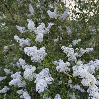
I have hiked this trail numerous times when I lived in southern California. While visiting CA a couple of weeks ago I hiked this trail and it was exactly as I remembered it. Very zen and relaxing! There are various routes that loop around or end at an entrance/exit of the canyon. It's a beautiful and straightforward hiking trail, meaning I have not gotten lost while exploring and veering off to shorter side trails. This last time I hiked here was one of the more beautiful sights of spring blooming! Fall (foliage) is also a nice time to hike this trail. One particular trail that begins right at the Caballero canyon trail sign and veers to the left (at the first bottom fork of the trail) has a pretty steep incline that's a good leg and glutes workout. I have seen several people running the uphill trail as well. It's an easy to moderate level hike no matter what trail you take and the views are great, especially during sunset!


One of the reasons Caballero is a great hike is that it isn't far from me at all. I can get here within 10 minutes from home. I also love that I can get a 3.7 mile loop hike in. Since it is the Santa Monica mountains there are so many options of trails to explore. It is great for hikers and bikers alike.
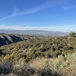
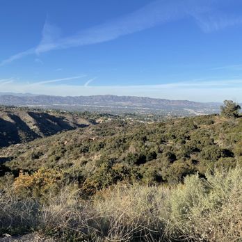
This was a great hike! Whether you're a road warrior and want to bike the trail or like me and want to take your time by foot, this is a great scenic trail. It's well maintained and used often so there are no overgrown area that we encountered. At the top, you'll be treated to a beautiful, panoramic view of the valley. It gets hot in the summers so make sure you bring a water bottle. Also, there's a lot of local fauna, so be cautious. There was a recent mountain lion citing so be cautious and pay attention to animal tracks and scat.
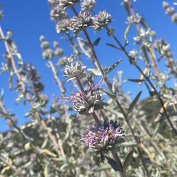

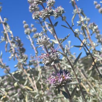
One of My fav hikes (especially when I don't have a whole day to roam around the woods lol) . It's a great workout. Lots of cool unique flowers and sage bushes. Efficient. A quick up and down. Def my go-to
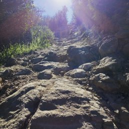

I love the fact that they have so many different trails to choose from and I can always switch it up by difficulty and distance.It's also the closest hiking trail to me.


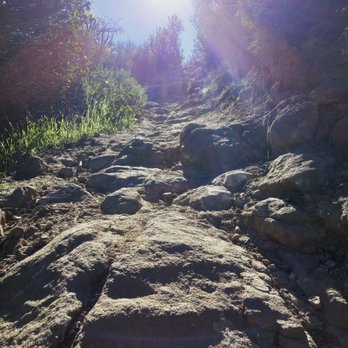
Been a valley girl my entire life, probably not the greatest claim to fame but if there's one thing I know a little something about, its valley hiking and I had NEVER been on this trail. My son's cross country hill training sesh is what brought me out this way and led me to discovering somewhere new to add to my hiking rotation. I've grown a little bored of the same old trails and don't tend to seek out shorter less strenuous hikes nowadays but being that I only had two hours to kill instead of driving home I parked the car at the trail head of Caballero Canyon. After reading a few reviews, it was clear there was a wider trail and a more narrow steep trail. Of course, I found what seemed to be the extremely narrow steep trail. I climbed this in roughly 40 minutes, so it surely couldn't have been very far and then it shot out on a wider trail. Since I'd never been here before and hadn't glanced over any maps I really just went wherever my little heart desired. I ended up venturing up a bit further and then down a fairly steep and somewhat rocky area (hate those slip and slide parts of hikes - this can be seen in others pics coming down from the Topanga lookout) but never back to the way I'd come up and followed a wide trail that let out beneath Topanga State Park in a paid parking lot at the very top of Reseda (past the country club for reference). Did this in less than 2 hours but there were tons of areas to add a lot more mileage in. I felt safe enough to go solo, and with headphones in. Definitely a decent option if you live nearby and are looking to get outdoors.


22 days ago

I love the beginning of this trail especially during the spring as there are plenty of Lupine's at the beginning of the trail. This trail has pretty good incline at the beginning if you are trying to get your sweat on. I would say this is a moderate trail that will connect you in a bout 2 miles to the main fire road. Due to the fires I was informed by a gentleman that they wouldn't be opening the main fire road till July. Parking: Plenty of Street parking. Trail Views: Beautiful views of San Fernando Valley once you get to the top. I love the trails in Los Angeles! If you are running or hiking them it gives you a sense of peace. read more


1 year ago
I could hike here all day long. One of my favorite places in the world. Nice friendly people just walking their dogs. Beautiful views, clean trails. Park Rangers and Park Recreation are super nice, always letting you know what's closed ahead, or when things will open. Always stops to offer hikers cold water. Bikers can be kind of overwhelming at times. Flies are also no joke lol back spray!! read more


5 stars for this trail! Here's why: Good signage visible from the street at the trailhead, with a fair amount of roadside parking. Various options for difficulty levels. The flowing stream...always a fave sound and sight during hikes! Dogs leashed, and no poops left on the trail. Other hikers were pleasant in passing and quiet. This is a great trail, will def return and add it into the rotation. =) read more


Protected by the Santa Monica Mountains Conservancy, this unspoiled land tucked in the middle of over-developed suburbia reminds us how beautiful the San Fernando Valley used to be. There are several trails throughout the area, some steeper than others. One of the most popular trails follows the wash/creekbed and is lined by beautiful sycamore trees. I saw lots of fall color during my visit, not only from the orange sycamore leaves but also from the bright red toyon berries. Free admission and free street parking near the trailhead. read more


2 years ago

2 years ago


Caballero Canyon Trail is a nice and easy trail to start with if you're not physically active like myself. There's a decent amount of people going up this trail and they're usually friendly. I saw a lot of people taking their pets in this trail and I took my dog out here as well. It is not very difficult for them to finish. Make sure you bring water to keep them hydrated and your own poopy bags to clean up after your dog - if you ever forget to bring poopy bags, there are some available by the entrance. read more


6 years ago

6 years ago
Beware, while hiking with my family I was harassed by this man who was accompanied with his wife. Calling my daughter bitch, so many others different names to my self fat b. I reminded him she was a minor. But he didn't care be really careful going up on the trail. read more




It's amazing how certain places can have so many trails. I usually just go to the top of reseda for the main trail. Driving pass each time and seeing so many cars parked on the side, I knew there was a trail but didn't know where it lead to. Having to actually experience this one for the first time was great. First off, tons of street parking. You'll notice tons of cars along the street so you won't miss it. Starting, there was two paths you could go along. To the right it was going downhill but we went towards the left which was leading uphill. May I say, it was a trek. It was basically up hill incline the whole way. The trail was pretty narrow at certain points. It has spilt in the middle from who knows where so be careful. The view is beautiful and tons of greenery along the way. It was a hot day so be prepared. There's also certain patches that you go through which offered shade covering like a little enchanted forest. What seemed like forever as it was uphill but it wasn't even a mile yet. Once you reach the top, it connected you to the main road that leads you back to top of reseda. But coming back, we came down another way which we noticed people going down. It was easier as you were going downhill but we didn't know where it would lead. Finally, towards the end you noticed that it was the trail at the beginning that was to the right. They basically do a loop at the top. Right side of the trail was more of easier way as the left side was a bit harder as it was uphill the whole way. Beautiful and nice trails. It does get busy as pathway was narrow so be cautious as you may have to move to the side to pass or let others pass. read more


4 years ago
I have hiked this trail numerous times when I lived in southern California. While visiting CA a couple of weeks ago I hiked this trail and it was exactly as I remembered it. Very zen and relaxing! There are various routes that loop around or end at an entrance/exit of the canyon. It's a beautiful and straightforward hiking trail, meaning I have not gotten lost while exploring and veering off to shorter side trails. This last time I hiked here was one of the more beautiful sights of spring blooming! Fall (foliage) is also a nice time to hike this trail. One particular trail that begins right at the Caballero canyon trail sign and veers to the left (at the first bottom fork of the trail) has a pretty steep incline that's a good leg and glutes workout. I have seen several people running the uphill trail as well. It's an easy to moderate level hike no matter what trail you take and the views are great, especially during sunset! read more


One of the reasons Caballero is a great hike is that it isn't far from me at all. I can get here within 10 minutes from home. I also love that I can get a 3.7 mile loop hike in. Since it is the Santa Monica mountains there are so many options of trails to explore. It is great for hikers and bikers alike. read more


This was a great hike! Whether you're a road warrior and want to bike the trail or like me and want to take your time by foot, this is a great scenic trail. It's well maintained and used often so there are no overgrown area that we encountered. At the top, you'll be treated to a beautiful, panoramic view of the valley. It gets hot in the summers so make sure you bring a water bottle. Also, there's a lot of local fauna, so be cautious. There was a recent mountain lion citing so be cautious and pay attention to animal tracks and scat. read more

4 years ago

4 years ago
One of My fav hikes (especially when I don't have a whole day to roam around the woods lol) . It's a great workout. Lots of cool unique flowers and sage bushes. Efficient. A quick up and down. Def my go-to read more

5 years ago
I love the fact that they have so many different trails to choose from and I can always switch it up by difficulty and distance.It's also the closest hiking trail to me. read more
3 years ago

11 years ago
Been a valley girl my entire life, probably not the greatest claim to fame but if there's one thing I know a little something about, its valley hiking and I had NEVER been on this trail. My son's cross country hill training sesh is what brought me out this way and led me to discovering somewhere new to add to my hiking rotation. I've grown a little bored of the same old trails and don't tend to seek out shorter less strenuous hikes nowadays but being that I only had two hours to kill instead of driving home I parked the car at the trail head of Caballero Canyon. After reading a few reviews, it was clear there was a wider trail and a more narrow steep trail. Of course, I found what seemed to be the extremely narrow steep trail. I climbed this in roughly 40 minutes, so it surely couldn't have been very far and then it shot out on a wider trail. Since I'd never been here before and hadn't glanced over any maps I really just went wherever my little heart desired. I ended up venturing up a bit further and then down a fairly steep and somewhat rocky area (hate those slip and slide parts of hikes - this can be seen in others pics coming down from the Topanga lookout) but never back to the way I'd come up and followed a wide trail that let out beneath Topanga State Park in a paid parking lot at the very top of Reseda (past the country club for reference). Did this in less than 2 hours but there were tons of areas to add a lot more mileage in. I felt safe enough to go solo, and with headphones in. Definitely a decent option if you live nearby and are looking to get outdoors. read more

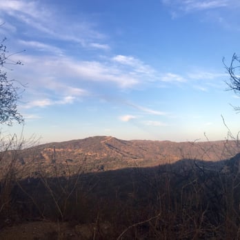
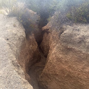


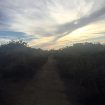


It's a hiking trail with a good view. Simple but make it worthwhile by making it like your kick-ass work out and not a park-strolling pace. Any trail of any kind,I would rate it a 5-star unless it compromises my safety or anyone else. This was fun although we made a 3.14 mile hike only and ran most of it. Hydration is necessary especially during warm days. No shade at all. Street parking only. Lizards are everywhere. Beautiful shrubs! read more


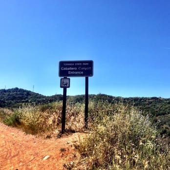


6 years ago

12 years ago
I love this hike. It is located at the end of Reseda blvd (headed south) with plenty of free street parking. There are 3 different trails and difficulty levels to get to the top . I head up the middle every time. It is a steep, no joke hike up for about a mile or so. Once you reach the top there are more trails to take. This hike is never the same, which is exciting and it is always a great workout. Dogs are allowed on leashes and there are a ton of mountain bikers . Everyone is pretty friendly and it is an exceptionally clean trail. read more


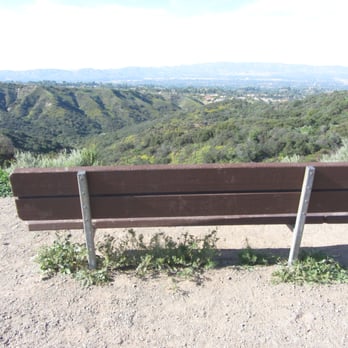
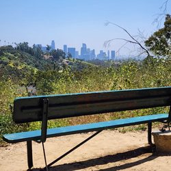
This is another great hiking option if you live in San Fernando Valley. It's very easy to find, off 101, follow Reseda down to the left. You'll drive through a nice neighborhood and you'll see the sign for the Caballero Canyon to the left side. There's plenty of street parking (free) right there, on both sides. Honestly, I don't know where the the actual lot is (that our fellow Yelpers mentioned), I guess we didn't drive that far. Once you get to the sign, you either take the main trail (wider) to the right or the one to the left (smaller) that goes up (this one is harder to conquer, more difficult). We didn't find any maps around, just checked our directions with other nice hikers (I have to mention, there aren't too many people on the trails, but if you ran into somebody, everyone is nice and says "Hi"). There are mountain bikers around, and I don't think that dogs are allowed. There are no restrooms and no water fountains, so bring some water. So we took the main trail, easier, I'd say moderate, first part is pretty flat, later on it's get a bit steep (but not for too long). You'll find a funny half bench at some point, short after it, you'll walk through some gates and then you'll reach the bench to relax and admire nice views of the Valley. From here (Mulholland Drive), you can either go straight back (3 miles round trip) or check out other trails (there's a sign there that can help). We didn't see any ocean views, I guess you need to get higher up for those. The actual trail is nice, wide (a couple of tighter areas), some parts are shady, some not (wear sun protective lotion) , it's springtime so everything is nice and green, there are lots of flowers (and their perfume in the air), butterflies. We saw lots of lizards and a woodpecker. It's a nice, quiet hike. Nothing spectacular, but nice. read more




11 years ago
I've been doing this hike at least once a week for about a year now. Really love that there is a main trail but so many others that connect so you can really decide how much of a challenge you're up for. I used to do the regular 3.8 mile loop, but lately I've been extending it to 5.8 by following the trail at the top to the steeper mountain and around. The views are great - mountains all around. You can easily forget you're in socal. It can get crowded on the weekends, definitely, and you'll need to stay hydrated - you're only in the shade for limited times. If you choose to go harder there will be less shade. The earlier you can start, the better. Parking is free - just go up Reseda until you either get to the roundabout at the top, or the sign on the left further down. I usually park next to the sign and walk up to the roundabout and make my loop that way, since it's a good pre-workout to walk up the paved concrete (also easier on your feet/ankles). The trail is shared with lots of bikers and people with dogs (some leashed, some not). Since I've been doing this often, I've seen: coyotes, snakes, lots of butterflies, a bum in the middle of the trail (twice)... so just remember to be aware of your surroundings. Other than that, it's a really fun trail to run down. read more


4 years ago
I love this place but unfortunately is to many snakes around the trail that's the on issue other than that this place is beautiful. read more


6 years ago
There are many different trails here. It's worth using a hiking app to see all your options and make sure you stay on them. All are good but different lengths and difficulty levels. read more


9 years ago
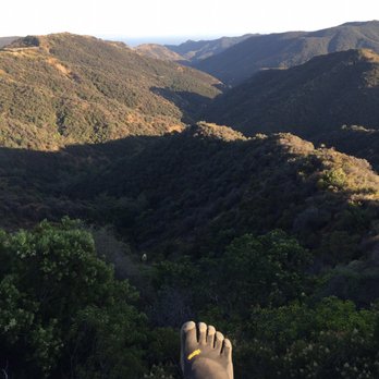
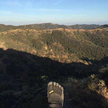
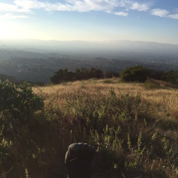
Hike this trail for the first time yesterday. Lots of trail options. Going up and down the mountains. Beautiful views. Lots of shade. The only thing that really bother me about this trail is all the shit on it. There are a lot of shits on the trail. Some big some small. It looks like most of it might be humans. Pretty disgusting. Please pick up after your dog and please don't shit on the trail. read more





10 years ago
HIKIN' AT MISSILE SPEED! Continuing the Conditioning Hike Series of reviews. Several months ago, me and The Crew were headed to the backcountry on a strenuous backpacking trip. To prepare, I wanted to do some conditioning hikes to decrease my chances of having to be airlifted out. This was one of the trails I did several times prior to the trip. STATS: Rating: Intermediate Distance: 8ish miles Elevation Gain: 1,100ft Total Duration: 3.5-4 hours Trail: Single Track, Fire Roads & Breaks There are no restrooms at the trailhead OUR ROUTE: From the trailhead, the trail descends into the canyon. There is a three pronged cold-cut fork on trail, figuratively, not literally, and for this conditioning hike, we took the middle trail which ascends up one steep section followed by a short level section. False peek... Up again, on a narrow dirt trail. After 1.7 miles of climbing up (625 ft), we hit Mulholland (dirt, not pavement). Hang a left here, follow the road to the Nike Missile Site at San Vicente Mountain. This is part of the trek is a relatively flat fire road. This Nike Missile Site was used by our military from 1956-1968 as part of the continental system of defensive missile-launch sites. There are restrooms and a couple picnic, should you need a rest, or hang to watch the sunset, it's spectacular from this elevation. Facing south is the LA Basin and to the north is the San Fernando Valley. Our return path was a little retrace. We headed back on Mulholland, passed the trail we ascended from, till we reached the actual Caballero Canyon trail. It's all downhill from there. WARNING: Caballero Canyon is a bit on the popular side, many hikers, bikers, and four-legged buddies on these trails. Keep your eyes and ears open for what's coming, behind or in front. While bikers are to yield to hikers, sometimes it's just easier for hikers to step aside. In the case of horses versus hikers, hikers yield to horseS, of courseS. DISCLAIMER: Hiking is not something that can be taken lightly. It can be life-threatening as you see and hear on the news, people die or get lost all time. Please, if you are going to hike, never go alone and prepare for the worst, hope for the best. Remember when going for a hike, no matter how short you think it may be, always be prepared. Carry at least two liters of water for every five miles (more if the weather is warm), protein bar, nuts, and electrolytes. Wear sturdy lug sole shoes and protective clothing. Some areas the weather can change quicker than a firefighter can put on his gear. It is also very important, always always always let a family member or friend know where you are going and when you expect to be back. Lastly, have fun when you hike it up. read more


10 years ago
A great local hike for anyone in the Valley. Although the route we took was short (~2miles) the ascent was really quite challenging - steep and rocky (and a bit slippery because of recent rain). This doesn't make for a bad hike though as you get a really good workout and the views of the Valley are amazing! Dropped one star because there is no official parking, just roadside. read more
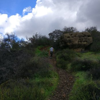


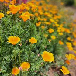
Caballero Canyon Trail trailhead is located on Reseda Blvd right across from the country club. It is the very northern part of Topanga State Park. You can also drive further down Reseda Blvd. and enter the park at the Tarzana fireroad if trail hiking isn't your thing. We easily parked on Reseda. Other parking areas for Topanaga State Park are $5 or more, so skipping the parking fee was a definite plus. There are several trails to take once you get into the park. We took a fairly steep, intense trail (to the left of the fork when you begin), and went straight up the canyon. We ended up on Temescal fire road, and continued through some other paths, hit the backbone for a moment, and ended up at Eagle Rock. The beginning of the trail is a uphill climb through a field of daisies! There were several other wildflowers along the way as well. It was beautiful. Everything on the trail is very wooded, and we saw several bunnies and a lot of lizards. The views include Tarzana, Encino and beyond, and several views over the Santa Monica Mountains. The trails were clean, although Garapito Trail (we took back from Eagle Rock) wasn't cleared very well, and we had to duck under many low branches, and jump around a bit. The fire roads are FULL of bikers, so be on the look out for that (or, go biking!) There were a lot of people out, but it didn't feel too crowded. Everyone was friendly. We went on an overcast morning in 70 degrees or so. The beginning of the trails are in a wooded/shady area, but the sun peeks through, and once you get up into the fire roads there is no shade. There are plenty of options from the trailhead, and this can be a long, short, easy, or strenuous hike. Since it's only 2 miles from my house, I will for sure make this one of my regular routes. read more

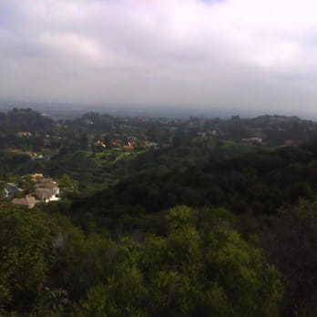


12 years ago
I absolutely love this place. First off the parking is free unless you park at the very top where there is a sign that says there is a $5 fee that you put in an envelop. Yeah right I came to work out so what's a little extra walking. When you first get to the park you up this hill, then when you get to the top they have signs that point to the different trails and they give how many miles the trail is. We went on the trail on the left which the sign said was .9 miles. I like this hike because it was a workout but didn't have the steep hills that some trails have so it makes running these trails easy. The trails are dog friendly but you have to keep them on a lease. CAUTION! We ran into a big snake that our dog chased away thank god. read more


11 years ago
Wonderful trail south of Ventura Blvd. There's plenty of street parking-- completely free. The Caballero trail is on the left hand side on Reseda Blvd before the stop sign on Country Club Pl. If you pass the stop sign you will drive up Reseda Blvd and find more parking and other trails at the top. If you decide to take the steep way up, it's about 30 minutes to the dirt road. On the other side of the dirt road the hiking trail continues up, it will take you about another 10 minutes to get to the very top. It's really quiet up there and the views are gorgeous. I've been hiking this trail for 10+ years and have never seen snakes or coyotes but I know people that have. If you see a snake do your best not to panic. Snakes want nothing to do with a human; if it is approaching you, it doesn't see you. read more


12 years ago
Loved this trailhead! Free parking, diverse terrain, and miles of trail! Visited this trailhead on a Wednesday afternoon and it was so easy to find! Just up Reseda, on the left hand side, with plenty free street parking available! The trail starts off smooth but not to far in the terrain gets really rocky for about 2 miles. This part isn't really "run-able" but once you past this part you reach a fork in the trail and both trails are smith enough for running. I went up the left side today and the incline was manageable with spectacular views of the Valley! I have a feeling if you keep going you might eventually be able to see the coast but I didn't have a chance to get that far. I'll definitely be back to explore this trailhead more! I ran into about 6 people while I was there, so it has enough traffic that I'm not too weary of trekking alone. read more


Page 1 of 3
More info about Caballero Canyon Trail
Topanga State Park
Los Angeles, CA 91356
Pacific Palisades
Directions
Hours
Indoor Amenities
Outdoor Amenities
Ask the Community - Caballero Canyon Trail
Review Highlights - Caballero Canyon Trail
You might also consider
























Why does Yelp recommend reviews?
5 reviews that are not currently recommended
The reviews below are not factored into the business's overall star rating.
11 years ago

10 years ago

7 years ago
11 years ago

12 years ago
Caballero Canyon Trail - hiking - Updated August 2026
Best of Los Angeles
People found Caballero Canyon Trail by searching for…
Hiking Trails in Los Angeles, CA
Beautiful Views in Los Angeles, CA
Stairs Workout in Los Angeles, CA
Abandoned Places in Los Angeles, CA
Sunrise Hike in Los Angeles, CA
Running Trails in Los Angeles, CA
Lookout Points in Los Angeles, CA
Secret Spots in Los Angeles, CA
Walking Trails in Los Angeles, CA
Waterfall Hike in Los Angeles, CA
Watch Sunset in Los Angeles, CA
Places to Walk in Los Angeles, CA
Fall Foliage in Los Angeles, CA
Dog Friendly Hiking Trails in Los Angeles, CA
Scenic Overlook in Los Angeles, CA
Sunrise View in Los Angeles, CA
Trending Searches in Los Angeles, CA
Antiques near Caballero Canyon Trail
Barbershop For Men near Caballero Canyon Trail
Bike Shop near Caballero Canyon Trail
Cliff Jumping near Caballero Canyon Trail
Consignment Shops near Caballero Canyon Trail
Cruising Spots near Caballero Canyon Trail
Dog Friendly Things To Do near Caballero Canyon Trail
Ear Piercing near Caballero Canyon Trail
Eyebrow Threading near Caballero Canyon Trail
Flower Fields near Caballero Canyon Trail
Hair Braiding near Caballero Canyon Trail
Kids Haircut near Caballero Canyon Trail
Lakes near Caballero Canyon Trail
Lookout Points near Caballero Canyon Trail
Mini Golf near Caballero Canyon Trail
Night View near Caballero Canyon Trail
Parks near Caballero Canyon Trail
Pedicure near Caballero Canyon Trail
Permanent Makeup near Caballero Canyon Trail
Picnic Areas near Caballero Canyon Trail
Public Golf Courses near Caballero Canyon Trail
Public Pools near Caballero Canyon Trail
Rock Quarry near Caballero Canyon Trail
Romantic Activities near Caballero Canyon Trail
Running Trails near Caballero Canyon Trail
Scenic Drive near Caballero Canyon Trail
Scenic Night View near Caballero Canyon Trail
Scenic Overlook near Caballero Canyon Trail
Stair Climbing near Caballero Canyon Trail
Sunrise View near Caballero Canyon Trail
Swimming Holes near Caballero Canyon Trail
Things To Do Alone near Caballero Canyon Trail
Tourist Attractions near Caballero Canyon Trail
Trading Card Shops near Caballero Canyon Trail
Used Furniture Stores near Caballero Canyon Trail
Browse Nearby
BEST of Los Angeles, California Coffee near Caballero Canyon Trail
BEST of Los Angeles, California Restaurants near Caballero Canyon Trail
BEST of Los Angeles, California Things to Do near Caballero Canyon Trail
BEST of Los Angeles, California Breakfast near Caballero Canyon Trail
BEST of Los Angeles, California Walking Trails near Caballero Canyon Trail
BEST of Los Angeles, California Parks near Caballero Canyon Trail
BEST of Los Angeles, California Campgrounds near Caballero Canyon Trail
BEST of Los Angeles, California Taxis near Caballero Canyon Trail
Browse Brands
Related Searches in Los Angeles, CA
Best Dog Hiking Trails Around Los Angeles, California
Best Fishing Locations and Guides in Los Angeles, California
Best Nature Trails for Hiking in Los Angeles, California
Best Places for Horseback Riding in Los Angeles, California
Best Saimin Dishes to Try in Los Angeles, California
Best Wood Fired Pizza Available in Los Angeles, California
Check Out Off Road Trails in Los Angeles, California
Discover Authentic Little Italy in Los Angeles, California Neighborhoods
Discover Dog Friendly Trails to Explore in Los Angeles, California
Discover Easy Hiking Trails Near Los Angeles, California
Discover Famous Monuments in Los Angeles, California
Discover Farm to Table Restaurants in Los Angeles, California
Discover Historic Sites and Places in Los Angeles, California
Discover Kid Friendly Hiking Trails in Los Angeles, California
Discover Popular Bike Trails in Los Angeles, California
Discover Popular Landmarks in Los Angeles, California
Discover Popular Photo Spots in Los Angeles, California
Discover Scenic Mountain Bike Trails Near Los Angeles, California
Discover Stunning Skyline View Spots in Los Angeles, California
Discover Top Points of Interest in Los Angeles, California
Discover Walking Parks in Los Angeles, California Near You
Discover a Hiking Trail in Los Angeles, California
Discover a Library Near You in Los Angeles, California
Discover the Best Night Hike Trails in Los Angeles, California
Dog-Friendly Hikes With Dogs in Los Angeles, California
Enjoy Arts & Entertainment in Los Angeles, California
Enjoy Authentic Oxtail Soup Near Los Angeles, California
Enjoy Camping Adventures Around Los Angeles, California
Enjoy Kayaking Adventures in Los Angeles, California
Enjoy Off Leash Dog Hikes in Los Angeles, California
Enjoy Scenic Places to Walk in Los Angeles, California
Enjoy Tent Camping Spots Around Los Angeles, California
Enjoy a Beautiful Waterfall Hike in Los Angeles, California
Enjoy the Best Night View Spots in Los Angeles, California
Enjoy the Best Walking Path in Los Angeles, California
Enjoy the Best Walking Trails in Los Angeles, California
Enjoy the Scenic Boardwalk Attractions in Los Angeles, California
Experience Stunning Sunset Views in Los Angeles, California
Experience the Best Carnival Events in Los Angeles, California
Explore Beautiful Botanical Gardens in Los Angeles, California
Explore Beautiful Parks and Green Spaces in Los Angeles, California
Explore Easy Hikes Perfect for All in Los Angeles, California
Explore Famous Historical Landmarks in Los Angeles, California
Explore Free Things to Do Around Los Angeles, California
Explore Fun Activities to Do in Los Angeles, California
Explore Popular Campgrounds Near Los Angeles, California
Explore Popular Craft Fairs in Los Angeles, California
Explore Popular Dog Walking Trails in Los Angeles, California


