Cancel

    Open app

    Search

    Upheaval Dome

    4.5 (2 reviews)

    Upheaval Dome Photos

    Recommended Reviews - Upheaval Dome

    Your trust is our priority, so businesses can't pay to alter or remove their reviews. Learn more about reviews.
    Yelp app icon
    Browse more easily on the app
    Review Feed Illustration

    2 years ago

    Helpful 1
    Thanks 0
    Love this 2
    Oh no 0

    5 years ago

    Helpful 11
    Thanks 0
    Love this 12
    Oh no 0

    Verify this business for free

    Get access to customer & competitor insights.

    Verify this business

    Whale Rock Trail - Beautiful views from the top

    Whale Rock Trail

    5.0(2 reviews)
    0.6 mi

    This is one of the more underrated hikes in Canyonlands National Park. Mesa Arch and Grand View…read morePoint draw all of the crowds. But I think Whale Rock Trail is just as cool. It is a short hike and there are very few people on the trail. The trail climbs about 100 to 140 feet from its base. I like that you get great panoramic views of the park once you are on top of the dome. It is less than a mile round trip from the parking lot to Whale Rock. They call it Whale Rock because this long sandstone dome resembles the back of a whale from afar. You want to wear shoes with good traction if you want to walk up the side of the dome. It is a steep drop-off if you slip. We came up here before sunset and enjoyed the view of the surrounding canyons and the cool breeze. There is a lot of room to walk around and explore while on top of this mesa. The Upheaval Dome Trail is a short drive from here if you want to check out another part of the park. Whale Rock is part of a large outer ring of sandstone that surrounds the Upheaval Dome formation.

    Absolutely stunning views of the valley from the top of Whale Rock! Although this trail is right…read moredown the road from Upheaval Dome, it doesn't seem to get as many visitors. I basically had this entire trail all to myself and literally only passed 2 people (one on my way up and another on my way back). The trail itself is super short at just one mile long roundtrip and features some of the most picturesque views of the Green River Valley and its' incredible geologic landscapes. The trail starts of pretty easy via a flat path through dry terrain and desert foliage. Soon after, the trail switches from a flat paved path to a scramble up slick rocks. The trail actually becomes a little harder to follow at this point, but there are several cairns that will help lead the way. You'll basically scale up the large rock until you reach a dead end. This dead end is what provides the 360 degree views of the most stunning mesas, buttes, and canyons in the park. The views are just simply breathtaking here! What makes it even more enjoyable is that there aren't many people on this trail. Like, at ALL. Mesa Arch and Upheaval Dome are a lot more popular, but this baby deserves some praise as well. Aside from the amazing views of the valley, the view of Whale Rock itself ain't too shabby. It gets its' name because the long curving spine of this rock resembles that of a whale. At first I couldn't really see it, but then it started to grow on me. It is reminiscent of a whale. It's a super short hike, but it gets really hot up there! Make sure to bring water with you as there aren't any water stations in the park aside from the visitor's center. Since this trail is far less trafficked, parking is pretty must a breeze! There isn't a restroom at this trailhead, but if you need to use one, there are some just up the street at Upheaval Dome. If you're planning on hiking Upheaval Dome, this is a great mini hike to add either before or after since it's so close. Definitely worth a stop for the views and solidarity.

    Photos
    Whale Rock Trail - View from Top of Whale Rock

    View from Top of Whale Rock

    Whale Rock Trail
    Whale Rock Trail - Scaling some rocks

    See all

    Scaling some rocks

    Canyonlands National Park - Mother Nature's amazing decor skills

    Canyonlands National Park

    4.8(269 reviews)
    7.3 mi

    This week's adventure took us through the Island in the Sky district of Canyonlands National Park,…read moreand every stop seemed to top the last. Stop #1: Island in the Sky Visitor Center Started the day with incredible views overlooking the famous Shafer Trail, with its dramatic switchbacks winding down the canyon walls. It's an amazing introduction to the park's vast landscape. Stop #2: Aztec Butte A short hike led us to ancient Puebloan granaries tucked into the sandstone cliffs. Standing where people lived and stored food hundreds of years ago adds a whole new layer to the scenery. Stop #3: Upheaval Dome One of Canyonlands' biggest mysteries! Scientists still debate whether this enormous crater-like formation was created by a meteorite impact or the collapse of an underground salt dome. Whatever its origin, it's a fascinating place to explore. Canyonlands is massive, rugged, and absolutely unforgettable. Every overlook makes you feel tiny in the best possible way.

    As part of our quest to visit all 63 U.S. national parks, we set off on a six week road trip. I…read morehave a personal rule: I only count a national park as "visited" if I actually spend time there, hike or walk through it, and truly experience it. On this trip, we visited 14 national parks, and Canyonlands National Park was another fascinating stop in our Utah adventure. Canyonlands is a park of enormous scale. It is hard to truly understand the size of this landscape until you are standing at the viewpoints looking out over endless canyons, mesas, and cliffs carved by the Colorado and Green Rivers over millions of years. The views are dramatic and humbling. Located close to Moab, Canyonlands has a very different atmosphere from some of the quieter parks we visited. Moab itself is like an outdoor playground, especially for people who love off-road adventures, mountain biking, dirt bikes, four-wheel drives, and exploring the backcountry. That energy definitely carries into the park. Of all the parks we visited on this trip, Canyonlands was probably the busiest and, personally, not one of my favorites. That does not mean it was not beautiful. It absolutely was. It just has a different feeling. Much of Canyonlands is experienced from above, looking down into the incredible maze of canyons below. Getting into the deeper parts of the canyon system requires more time, preparation, and often specialized equipment, especially if you want to explore beyond the main viewpoints. Since we only had two days, we focused on hiking and exploring the more accessible areas. I enjoyed several beautiful trails, including the hike to Mesa Arch, one of the park's most iconic viewpoints. Seeing the arch framing the vast canyon landscape beyond it was spectacular. We also explored other overlooks and trails where the views seemed to go on forever. One challenge for us was accessibility. My husband has mobility limitations, and Canyonlands does not offer as many easy, accessible trails or paved perimeter paths compared with some other national parks. Many of the experiences are geared more toward people who want longer hikes, rugged trails, or backcountry adventures. That said, Canyonlands is still an impressive place. The sheer size, the geology, and the views are unforgettable. Standing above those massive canyons gives you a sense of the incredible forces that shaped this land over millions of years. For visitors who love hiking, off-road exploration, backpacking, or seeing landscapes from dramatic viewpoints, Canyonlands is definitely worth visiting. For us, it was not the emotional favorite of the trip, but it was still an important piece of the incredible diversity we experienced across America's national parks.

    Photos
    Canyonlands National Park - Candlestick tower views

    Candlestick tower views

    Canyonlands National Park - The Neck

    The Neck

    Canyonlands National Park - Mesa Arch sunrise (2/5/23)

    See all

    Mesa Arch sunrise (2/5/23)

    Butler Wash Ruins - Butler wash ruins

    Butler Wash Ruins

    4.0(3 reviews)
    44.6 mi

    This whole area is kind of confusing as the entrances are small and not well marked. I stopped by…read moremultiple visitor centers to see how I could get to the dinosaur track site, and the map I was provided took me down a bumpy dirt road that took a long time to navigate as I was in a sedan - and then when I let the site I found that there's another entrance off the highway that is much more direct and right off the highway. Anyways, it took a while to find the tracks as they're pretty eroded and not protected at all. There are multiple signs saying to not park on the tracks as it's right off the road and I could see that people might park on it mistakenly thinking it was a parking area. I would not recommend visiting the tracksite since it's pretty underwhelming. Visiting the Butler Wash Ruins was a much better experience, although you have to keep an eye out for the entrance off the highway as it's not well marked. It takes you to a parking lot and the trail goes from dirt/gravel to a slickrock area that is well marked with cairns.

    Blanding is a great base from which to explore the area. Not too far away, going southwest on…read moreHighway 95 toward Natural Bridges Monument, are the Butler Wash Ruins dating from about AD 1200. From the parking area, it's a short walk to the overlook from which you can see the cliff dwellings on the other side of a narrow canyon. While you can't get close to the dwellings (unless you're a bit of gecko), you can explore the slick rock area and find a small arch on the other side of the dwellings. (It's not visible from the overlook area.) I've been here a few times and have spent a few hours each time exploring the area. However, most visitors will probably take a few snapshots and be on their way.

    Photos
    Butler Wash Ruins - The tracks - Very slight depressions due to erosion

    The tracks - Very slight depressions due to erosion

    Butler Wash Ruins - Informational sign

    Informational sign

    Butler Wash Ruins - Informational sign

    See all

    Informational sign

    Goblin Valley State Park

    Goblin Valley State Park

    4.8(72 reviews)
    43.6 mi

    We took this as a side trip and we really should have given this more time. If you are thinking of…read morecoming here, I recommend looking at all the activities offered to see how much is here to do so you won't feel as though you missed out on some of what makes this park FUN! As for us, we ran around the valley, played hide and seek, marveled at how these "goblins" were made and just had a great adventure with the time we had.

    A triumph of both western topography and federalism. This is one of those awesome parks that would…read morein some ways be less special if it were "upgraded" to a national park. It's great the way it is. Just a few notes: -- the campsite is just amazing; you are nestled in among caves and washes, and your kids can merrily wander off "to the kids cave" or climb up onto a crest and watch the sunset or the rhythm of the campsite. They do have a shared bathroom with running water, which keeps the place just civilized enough for moderately experienced car campers. -- at the same time, this place is really remote. If you realize at campside that your propane stove doesn't work, you would have to drive an hour each way to Green River to get more. Instead, you will just have to figure out how to boil coffee and macaroni and cheese over a campfire. -- the stars. The city lights are far far far away, and the desert sky is clear, so you can see so so many stars. And if you sit and stare at them you see more. The only place I have ever seen so many stars in my life is standing on the side of the road outside Marfa, TX. -- two decades ago this was one of the first camping trips of my life, and it remains a special place in my heart.

    Photos
    Goblin Valley State Park
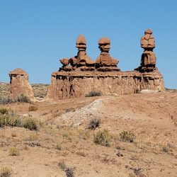
    Goblin Valley State Park - Close up of the Three Sisters.

    Close up of the Three Sisters.

    Goblin Valley State Park - The start of Valley 1. Valley of the Goblins basin has 3 total sections for you to explore however you want.

    See all

    The start of Valley 1. Valley of the Goblins basin has 3 total sections for you to explore however you want.

    Looking Glass Arch

    Looking Glass Arch

    4.3(3 reviews)
    30.1 mi

    The climb is located eastern rib ( 38°16'30.37"N 109°24'11.85"W). Extremely fun, and easy climb…read more Just as stated, 3 pitches to the summit, and accurate information. All solid bolts with the exception of the second bolt on the second pitch are slightly loose but unfortunately didn't have the equipment to fix. Just bolts on third pitch anchors, no chains or rings. A 60m rope runout on a double rap on the third pitch, but it's walkable to pitch 2 anchors --make sure you close the system. Climbed on 06-22-2018. Didn't see any rattlers on this climb --though their holes are everywhere.

    We decided to check out Looking Glass Arch for a quickie climb before we headed back to CO. I had…read moreread about an easy 3-pitch bolted route (Regular Route) that tops out on the summit followed by an ~115 ft free hanging rappel. We were a bit thrashed from climbing Honeymoon Chimney the day prior in nasty winds and my climbing partner was sick, so this seemed like the perfect objective. The amphitheater/arch are quite spectacular and it's worth the short hike even if you don't want to climb. We were there on a Sunday and it wasn't a zoo like some areas in Arches. The arch is ~5 min from the parking lot. No water/bathrooms so plan ahead. DIRECTIONS The easiest way to get to the arch is to turn right on Looking Glass Road (23 miles from central Moab on Hwy 191 south). If you hit Wilson Arch you've gone too far. Once on Looking Glass Road the side road to Looking Glass Rock is signed. The road is passable with 2WD or low clearance vehicles.
    Photos
    Looking Glass Arch
    Looking Glass Arch
    Looking Glass Arch

    See all

    Upheaval Dome - parks - Updated August 2026

    Loading...
    Loading...
    Loading...