Cancel

    Open app

    Search

    Westconnaug Meadows Hiking Trail

    5.0 (1 review)

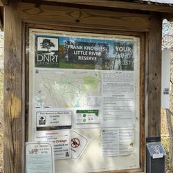
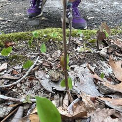
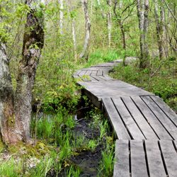
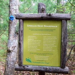
    Westconnaug Meadows Hiking Trail Photos

    You might also consider

    More like Westconnaug Meadows Hiking Trail

    Recommended Reviews - Westconnaug Meadows Hiking Trail

    Your trust is our priority, so businesses can't pay to alter or remove their reviews. Learn more about reviews.
    Yelp app icon
    Browse more easily on the app
    Review Feed Illustration

    6 years ago

    Helpful 3
    Thanks 0
    Love this 3
    Oh no 0

    Verify this business for free

    People searched for Hiking 1,443 times last month within 15 miles of this business.

    Verify this business

    Moosup Valley State Park Trail - Very charming and well maintained path at the beginning.

    Moosup Valley State Park Trail

    4.0(2 reviews)
    11.4 mi

    I hope someday that CT will get enough money to be able to upgrade some of its parks…read more We came here as part of their Sky's the Limit Challenge, and it was a really interesting experience. On paper, this trail goes 5.8 miles from Moosup to the RI border, where it joins the RI Trestle Trail. It starts out at a nice, beautifully framed railroad bridge in Moosup, and then heads off, as a nicely paved path. Then, at Barber Hill Road, about 3/4 of a mile in, the paved part stops. It gets kind of fire road like for a while, and, well, it gets GNARLY. We were there in winter, and there was a lot of frozen and semi frozen water on the path. I am guessing it might stay that way year round (wet at least) because there are plenty of desire trails along the sides at times, allowing you to bypass the wettest parts. Eventually, it starts undulating, and this is because a lot of dirt bikers seem to like to use this trail, in opposition to what the regulations say the trail is meant to be used for. One dirt biker politely made his way past us, so they at least have some etiquette, even though they're doing some erosion damage to the trail. We didn't hike the full path, and I'm really glad we didn't try to take our bikes on this, as it would have been impossible. Like I said, maybe someday there will be money to turn this into a real rail trail all the way east. Until then, make sure you wear good hiking boots!

    This trail runs along side moosup river. There are a couple waterfalls that can be viewed. Sections…read moreof trail are paved this is a small section behind Rogers Corp. On River Rd. Trail runs into Rhode island.

    Photos
    Moosup Valley State Park Trail - Watch out for dirt bikes, who can (and did) drive their bikes over this bridge.

    Watch out for dirt bikes, who can (and did) drive their bikes over this bridge.

    Moosup Valley State Park Trail - And eventually, the trail becomes rather .... in need of maintenance.

    And eventually, the trail becomes rather .... in need of maintenance.

    Moosup Valley State Park Trail - Nice view from a bridge just off the trail

    See all

    Nice view from a bridge just off the trail

    Sprague Farm - A big house at one time

    Sprague Farm

    4.0(3 reviews)
    9.7 mi

    History on your own backyard! Remains of farms, homesteads and amazing trails are awaiting you…read more Don't miss this easy trail area with miles of area to take in. Parking area provided and trails are well marked

    Foundations cemeteries…read more and history Sprague Farm is a roughly one thousand acre hiking area that served for generations as a farm and agricultural center. It is now owned by the town of Glocester and has been allowed to revert back to it's natural state. Even though the trees and plants are all grown back many signs of it's agrarian past are still present. Lots of stone walls and cool old foundations, many of them massive are still around and give a hint of what the area was like hundreds of years ago. Some huge trees are growing from the edifices, giving quiet testimony that the places have been abandoned for a long, long time. I'm not sure if any organized archaeological digs have ever been done but the sheer number of foundations and rusty old metal thingies just hanging around suggests that this would be a fascinating place for some digging and research. The area is also a haven for wildlife. Numerous deer, foxes, fishers, and a large number of birds including cool hawks and owls can be seen by the careful and quiet observer. Even the huge pilated woodpecker has been reported seen in these woods. Recently nests of the black-throated blue warbler, long thought to be extinct have been found. The hiking itself is quit easy with no difficult or dangerous climbs or cliffs. Just a nice pleasant place to quietly walk, look and explore, with interesting things around every corner or hill. Just poking around all the old foundations will consume several hours. A cool old Sprague family cemetery is also located way out in the middle of the woods. It served the family for generations. The area supplied generations of farmers a great place to grow their food and to live and prosper. Once the people left the trees, plants and critters have once again taken over the land with a vengeance.

    Photos
    Sprague Farm
    Sprague Farm
    Sprague Farm - Great foundation

    See all

    Great foundation

    Mount Tom Trail

    Mount Tom Trail

    4.3(6 reviews)
    13.1 mi

    Online it says it's permanently closed, but it's not. Nice trail, although I didn't go very far…read moredue to getting a little spooked by some bear scat on the trail What I did hike was well maintained and easily accessible.

    Go take a…read more hike Mount Tom is a well known hiking trail that is part of the Arcadia Wildlife Management Area. Like many of the trails in this part of Rhode Island it is maintained by the Appalachian Mountain Club and is well marked and easy to follow. Even though over 8,000 acres of woods in this area were destroyed by a devastating fire in 1951 the only evidence now of that horrible event are the numerous pines that were replanted over the years. Nature returned with a vengence. The entire trail is only a little over five miles but it crosses many other paths so you can walk all day in Arcadia if you desire. The hiking isn't difficult even though it does ramble up and down for most of it's length. Very few ruts, roots or loose rocks to trip you up and no extremely severe climbs, with a little care you can make good time on this path . Even though there are several nice places for distant views you never really know exactly when you get to the summit. It doesn't really matter because it's not very high, probably only around 500 feet or so and the woods are pretty thick. There are some nice cliffs and ledges and numerous rock formations but nothing dangerous or spooky unless you decide to do something really stupid. There are several parking areas but the most convenient is the Acadia Canoe Launch and Check Station. A huge sign marks the parking lot and there are plenty of parking spaces, nice bathrooms and even a pleasant brook to sit by after the hiking is done. The Mt Tom Trail might not be the highest or longest or most scenic hike in the state but it is one that I always find pleasant, entertaining and interesting.

    Photos
    Mount Tom Trail
    Mount Tom Trail - Bear scat?

    Bear scat?

    Mount Tom Trail

    See all

    Barden Reservoir - Ponaganset Falls at Barden reservoir

    Barden Reservoir

    4.5(2 reviews)
    4.0 mi

    Beautiful and spectacular lake out in Foster, with a gorgeous waterfall over the reservoir dam…read more Though technically you're trespassing on this land (being the reservoir for the city of Providence), lots of people walk the trail loop around the lake. On this bright mild winter's day, the walk was pleasant and tranquil through stately spruce stands and beguiling views of the water. We plan to come back in the spring when the trees start greening; and in the fall when the colors are in full glory.

    A place with water…read more trees stones and lots of dead people Even though you can't actually go on the water Barden Reservoir is still a great place to hike. Since there are little dirt roads with virtually no traffic, many individuals and hiking clubs use a loop around the reservoir as a place for a nice hike through the woods when the snow or mud makes a trek through the deep woods difficult. Of course the primarily attraction of Barden Reservoir is the water. The huge reservoir is punctuated with small islands and looks like it would be a fantastic place to canoe or kayak, but I suspect the authorities would view someone boating on the public water supply rather harshly. Best just to view the reservoir as well as the cool waterfalls and numerous streams from a small distance. Another thing that becomes quite obvious is the huge abundance of stones. Boulders and walls everywhere. The whole area was heavily glaciated 20,000 years ago and the glacial debris must have made the area a nightmare for people to farm. Yet they managed quite nicely. One of the curious things that new people to the state notice is the large number of small cemeteries scattered about everywhere. Not only in the middle of the woods but also in cities and on quiet little side sides in the suburbs. Rhode Island has a thing for historical cemeteries and has preserved and protected over 3,600 on them. Most are very old and tiny things with a just family or two. There are a number of these diminutive graveyards in Barden Reservoir and I suspect they contain the remains of the original settlers that first turned the land. There is a project going on to record and document every name on every stone. Unfortunately many of the stones are sandstone which erodes very quickly and the names are no longer legible. Barden is a nice place for a easy hike, especially when you don't want to trudge through deep snow or mud and history drips from every wall and foundation. Great water views on all sides and plenty of wildlife to observe. Just make sure you thread lightly and don't disturb the dead.
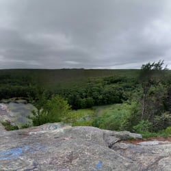
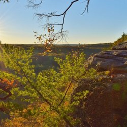
    Photos
    Barden Reservoir - View of Ponagansett river flowing out of the lake

    View of Ponagansett river flowing out of the lake

    Barden Reservoir - View of Barden reservoir

    View of Barden reservoir

    Barden Reservoir - View of Barden reservoir's tranquil waters

    See all

    View of Barden reservoir's tranquil waters

    Westconnaug Meadows Hiking Trail - hiking - Updated July 2026

    Loading...
    Loading...
    Loading...