Cancel

    Open app

    Search

    Western Powerline Trail

    4.0 (1 review)

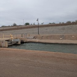
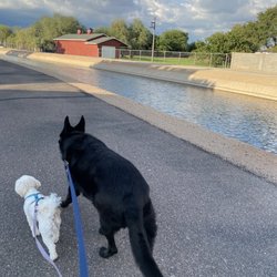
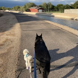
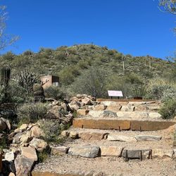
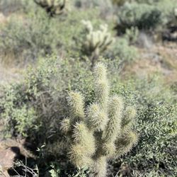
    Western Powerline Trail Photos

    You might also consider

    More like Western Powerline Trail

    Recommended Reviews - Western Powerline Trail

    Your trust is our priority, so businesses can't pay to alter or remove their reviews. Learn more about reviews.
    Yelp app icon
    Browse more easily on the app
    Review Feed Illustration
    Photo of Mark O.
    127
    449
    124

    11 years ago

    Helpful 1
    Thanks 0
    Love this 1
    Oh no 0

    You might also consider
    Verify this business for free

    People searched for Hiking 1,160 times last month within 15 miles of this business.

    Verify this business

    San Tan Mountain Regional Park - Cactus skeleton

    San Tan Mountain Regional Park

    4.6(79 reviews)
    14.4 mi

    Went for a hike, decided to do the 2 miler, the area and weather is gorgeous, no humidity! The…read moretrails are clearly marked and we decided when we got to the turn around point to go even farther, ended up doubling our mileage and seeing some gorgeous views!!! There are trails that are easy and flat and of course some that are hilly and challenging, great for exercising! They also have tortoises and a small "museum" area with some of the wildlife....

    This is a solid, vey large County Park all-around. There are trails for all skill levels. Most of…read morethe trails come off the Phillips Road entrance, which is coincidentally where the nature center is located. If you need a bathroom or to buy a Parks Pass, this is where you'll go. The other two entrances are off Hunt Highway (Wagon Wheel Drive) and Brenner Pass. Most of the easy/family-friendly trails are off Phillips Road- lots of loops with gradual, minimal rolling hills. The Wagon Wheel trails definitely have more elevation and challenging features. Both of the parking lots I've been to are wide, allowing plenty of car and equine parking. It's so fun to see the horses and riders out on the trails! You'll also see bikers too. This is also a popular park for races - running and biking, based on some friends experiences. Make sure to bring cash for parking if you don't have a Parks Pass, in case of emergency and/or if there's not a ranger manning each station.

    Photos
    San Tan Mountain Regional Park - Parking lot

    Parking lot

    San Tan Mountain Regional Park
    San Tan Mountain Regional Park - DON'T PICK THE FLOWERS - they won't continue to flourish if you do! Leave nature as you found it

    See all

    DON'T PICK THE FLOWERS - they won't continue to flourish if you do! Leave nature as you found it

    Wind Cave Trail - The best pic I have taken hiking thus far

    Wind Cave Trail

    4.4(67 reviews)
    11.4 mi

    I had heard good things about this trail and it has a cool name, so I decided to check it out one…read moremorning. I didn't want to pay for parking so I started at a different trailhead and hiked a few kilometers to get to the beginning of this trail. I saw a good amount of people along the way, but not too many. They were all courteous and respectful of the trail and its rules. There are lots of switchbacks and some decent elevation, I'd classify it as a moderate hike. The top with the "cave" was nice, more like an indentation, and I saw 2 chipmunks. I guess I didn't make it all the way to the top according to my map, but close enough. I went back down the trail and continued on my loop back to the parking lot I came from. There isn't much cover from the sun so be sure to dress appropriately, wear sunscreen, a hat, drink water, etc. I'm glad I got to do this trail.

    This was a good workout and moderately challenging trail. We got started a bit too late so it was…read more"hot" on the trail. I'm glad I was wearing a hat, sunscreen, and had plenty of water. The weather was nice today, it's just a lot of sun exposure on the trail. I saw people of all ages on the trail and dogs are allowed. Personally it was a bit busy on the trail for my liking and I don't love paying $7 to access a trail but we were hiking with a friend who is new to the area and thought this is a nice intro to AZ hiking. There are plenty of other trails in the Usery Mountain Regional Park to check out as well, but we were ready to head out after this trail. Wind cave trail is 3.2 miles out and back, it's about 1,000ft elevation gain and on average takes about 2 hrs to complete. One interesting thing we found at the "cave" area at the top was large honey comb coming out of the rock. There are quite a few bees there and man I would have loved to eat that honey comb haha. That added an element of interest. Overall, nice hike and a good mix of effort. I would have liked to do it earlier in the day, but I'm sure it was even busier then so it worked out.

    Photos
    Wind Cave Trail
    Wind Cave Trail
    Wind Cave Trail

    See all

    Paseo Trail

    Paseo Trail

    4.4(17 reviews)
    5.1 mi

    Nice trail to walk especially with doggos! They love seeing all the bunnies and ducks on the trail…read moreas we walk and are always ready for naps by the end of it. Such nice scenery and very well lit at night as well on one segment of the trail which is about .50 long and enough to get their energy out at night while still feeling safe

    The Paseo Trail travels through Chandler along the Consolidated Canal. It runs mostly N-S,…read moreconnecting to other trails along the canal in Mesa and Gilbert, totaling around 18 miles. The trail is mostly paved on the east side of the canal and pea gravel hard pack on the west side. It runs along subdivisions, golf courses and even a couple farms. The grade is very gentle throughout. I would consider the trail primarily for use by joggers, bicyclists and equestrians. There is parking at the address listed for the trail and nearby parking at Tumbleweed Recreation Center at McQueen and Germann. There is also easy to find street parking near many of the junctions with major streets. A good southern starting point is off of Riggs Rd. between Arizona and McQueen. There is plenty of street parking. From here the ride north is mostly a slight uphill ride, making the return trip a nice relaxing roll. One issue with the trail is crossings with major streets. Most are not marked for motorists as trail crossings and there is no crosswalk so you may be faced with a relatively long wait to get a break in traffic or forcing the issue and forging ahead with care.

    Photos
    Paseo Trail
    Paseo Trail - Walking the trail with my hot hubby

    Walking the trail with my hot hubby

    Paseo Trail

    See all

    Echo Canyon Trail

    Echo Canyon Trail

    4.6(36 reviews)
    17.8 mi

    Hiked the death trap that is echo canyon trail and it did not disappoint…read more Made for mountain goats aka I recommend it if you're okay with basically rock climbing the whole way up, it's pretty vertical. It's a fun hike and definitely a good workout. It's also very well marked for people who frequently get lost on trails like me. I wasn't super impressed with the view at the top since it's just overlooking the city but it's probably one of the highest vantage points compared to other hikes. Tips: There is one part where the stairs and rails are where it gets very windy so sunglasses can help. You don't necessarily need gloves to do the hike, just be careful with how you pivot with your hands, I got through it without any callouses, scabs or scratches. Like others said, try to wear shoes with some type of traction, I got through it with sneakers. Very small parking lot so come at sunrise or if you come around 7am, sometimes the early risers leave around that time. There's bathrooms and a water fountain at the beginning. Have fun and be safe!

    The views on this trail the higher you go are priceless. However, one time is enough for me lol. It…read moretook an hour and a half up and another hour and a half down. This was my first time doing a hike like this and it's definitely not a "beginners" hike but I had no expectations & didn't know what I was getting myself into. On the way down, I fell and busted my knee. My only recommendation is to take your time & take breaks while going up/down the mountain. & listen to your body if you get tired!

    Photos
    Echo Canyon Trail - Camelbacksanta

    Camelbacksanta

    Echo Canyon Trail
    Echo Canyon Trail

    See all

    Hole-in-the-Rock - Sunset crew

    Hole-in-the-Rock

    4.5(385 reviews)
    13.7 mi

    As a respectable hiker, I'm not going to call this a hike but it is a cool experience. I stopped by…read moreon Memorial Day in the afternoon by design. It was 95 degrees so I knew a challenging hike would be out of the question. Something like Hole-in-the-Rock though, easy peasy. While there were a decent number of people there, I had no trouble finding free parking. This natural wonder is located in Papago Park close to the Phoenix Zoo and the Desert Botanical Garden. After you park, you'll have a five-minute walk to get to Hole-in-the-Rock. You'll have to climb an incline to get in the hole, so definitely be careful, but there are kids that do it too. And a lot of tourists that show up. So that pretty much sums it up. Once you get inside, you'll have an awesome view of the Phoenix through a literal hole in a big rock. You'll see a lot of people using it as a photo opp. That's not really my style, so instead, I took a seat and enjoyed the beauty for 10 minutes or so. It can get pretty crowded so keep that in mind if you stop by on a weekend. Hole-in-the-Rock is one of the top attractions on TripAdvisor in Phoenix. Definitely a cool (and short) adventure to cross of the bucket list. I spent 30 minutes there (which included hanging out in the rock for half the time).

    A truly mystical and magical place. They close at 7:00 p.m…read more Most people try to get there later in the day to avoid the scorching 110 deg. weather and hot sun. There is a pond with tons of geese. I saw a man fly fishing.

    Photos
    Hole-in-the-Rock - At the top

    At the top

    Hole-in-the-Rock - Trail map

    Trail map

    Hole-in-the-Rock - 1/12/25 FYI. Cool views.

    See all

    1/12/25 FYI. Cool views.

    Western Powerline Trail - hiking - Updated September 2026

    Loading...
    Loading...
    Loading...