Cancel

    Open app

    Search

    Wildcat Canyon

    4.0 (1 review)

    Wildcat Canyon Photos

    You might also consider

    Recommended Reviews - Wildcat Canyon

    Your trust is our priority, so businesses can't pay to alter or remove their reviews. Learn more about reviews.
    Yelp app icon
    Browse more easily on the app
    Review Feed Illustration

    10 years ago

    Helpful 0
    Thanks 0
    Love this 0
    Oh no 0

    Verify this business for free

    People searched for Hiking 273 times last month within 15 miles of this business.

    Verify this business

    Zion National Park - Don't feed the squirrels

    Zion National Park

    4.7(1.6k reviews)
    11.4 mi

    Zion National Park covers nearly 150,000 acres. Most people will go the most popular area in…read moreSpringdale, but there's a separate area known as Kolob Canyons which is located in a different area of the park about an hour's drive away. Kolob Canyons is a very pretty area, but less developed than Zion Canyon. Anyway, Zion has steep and sheer cliffs that leave you breathless. It also has a river and swampland, as well as emerald pools and waterfalls. It is so varied in its landscape, I really can't compare it to anything else. I hiked a whole bunch here: Angel's Landing, Emerald Pools, Weeping Rock, Riverside Walk, Canyon Overlook, even a bit of the Narrows. I want to do a through hike of the Narrows next time - I didn't have enough time in my schedule this time unfortunately. I saw more wildlife than expected too. I think a lot of the animals are habituated to humans, and aren't frightened at all. I also love how well run the shuttle system is. The bus drivers will radio to each other if there's a long line at any stop, and they will send an empty bus there to help avoid extended waits. It's so thoughtful. I stayed in the Zion Lodge, but I'm sure that the gateway town of Springdale has a similarly efficiently run shuttle system as well.

    Haven't been to Zion national park in a few years. Used to come visit from Las Vegas all the time,…read moreenjoyed all the trails and camping in the park. This visit arrived with 2 nights reserved at south campground $70. Entered park gate for $35. We get to the campground and the first thing we see "no fires" sign....it would of been nice to see that on the website before reserving, glad I brought steaks/pork/fish to grill... Woke up early before sunrise and headed straight for the trails of Zion, only to arrive at a gate with a code box reading "reservations only" ......huh?? Either this gate was never there before or it was always open, in all of my visits in the past. So I drove back to the entrance gate to ask if the trails were available. I simply ask the lady at the front gate "hi are the trails available to hike?" She replies in a very assertive voice "did u get a map!?" Me "yes I did", gate lady "well if u read right here it says reservations only". I reply with oh is that gate new? I've come to this park many times in the past and have never had to stop there." Gate lady: "that gate has been there many years" ....i guess I was hallucinating all those years i did those trials and all these pictures of all the trials I've done in Zion are fake? Gatelady really made me feel warm and welcome at Zion. We left as soon as we were done talking, I'll take the loss on my 2nd night at the campground, what are we supposed to do spend a whole day doing the "scenic route" a small driving only route jammed with traffic and lines. No thanks. I took time off work and my life to come out here to hike and enjoy nature, Zion was a waste of time and money will never be returning. Glad I got to enjoy the park before it became a tourist trap
    Photos
    Zion National Park - Me in the road

    Me in the road

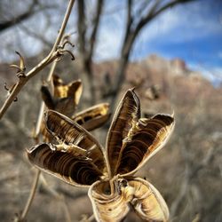
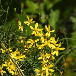
    Zion National Park - Very cool late February & early March dry flowers.

    Very cool late February & early March dry flowers.

    Zion National Park - Friend met on Kayenta Trail

    See all

    Friend met on Kayenta Trail

    Riverside Walk

    Riverside Walk

    4.5(59 reviews)
    10.9 mi

    Located at the Temple of Sinawava, which is shuttle stop #9 when the shuttle is running, this is a…read morenice paved two mile round trip walk alongside the Virgin River. I got to see turkeys and deer though, so don't go rushing through or else you might miss some sweet wildlife viewing. If it has rained recently, there might be puddles or spots of mud. The trail ends at the river where The Narrows begin - aptly named as it's the most narrow part of the gorge. This hike passes through some swampland which is unusual terrain in the desert. It's due to the erosive forces of flash floods. Speaking of which, you shouldn't enter the The Narrows if there's any rain in the weather forecast or any rain in the surrounding areas. It's too risky to be caught in the canyon with any chance of flash floods. The trailhead/parking lot has water, as well as a lot of porta-potties.

    This hike is everything I read about it - chill, easy, paved, and CROWDED. Lots of families with…read morekids and strollers and people just headed to the narrows along this path. I still enjoyed it and had fun going to the beginning of the narrows before turning back (which lots of people do who don't want to get wet). It's not a long walk either, like a mile or so so you can do it fast. It starts at the temple of Sinawava, plenty of signs point the way towards it. Would rec the walk even if you aren't going to do the narrows itself, just for the vibes :)

    Photos
    Riverside Walk
    Riverside Walk - View along the Riverside Walk hike

    View along the Riverside Walk hike

    Riverside Walk - Reminds me of clear quartz crystals.

    See all

    Reminds me of clear quartz crystals.

    The Grotto Trail - Friendly deer was hungry, it looked so skinny.  Poor thing.

    The Grotto Trail

    4.4(5 reviews)
    11.3 mi

    I stayed at the Zion Lodge, and so it was a no-brainer to walk around on the Grotto Trail. It's…read morepretty flat and shaded, so it's not too strenuous and great for a post dinner stroll. It begins and ends at a shuttle stop, so if you're too tired to walk back, just take the shuttle! If you want something more, you can continue on with the Emerald Pools and Kayenta Trails to create a loop. Overall nice, easy, and well maintained trail.

    Short, pretty little trail that is almost a guaranteed on your visit if you're doing one of the…read moremain attraction hikes and depending on parking situations. It's only about 1 mile round trip and links you up to either Angel's Landing trail, Emerald Pools trail or the West Rim trail - so I wouldn't call this one an independent hike - you wouldn't be doing this one all on its own. It's more of a place for overflow parking for some of the main hikes with a small trail to get you to those actual trailheads. Bc of the parking issues for Angel's Landing, we had to park at the Grotto trailhead which is how we ended up on this trail. It's mostly flat, very well maintained, has a picnic area and nice restrooms. You get amazing views all along it, especially of Angel's Landing off in the distance! It's a great way to start the Angel's Landing hike tbh. We even saw deer!! And on our way out, some crazy clouds had rolled in and made the rock formations and mountains look so other-worldly and we even got snow as a bonus!! Definitely not disappointed we had to add some extra steps to our Angel's Landing hike! I got some great shots!

    Photos
    The Grotto Trail - Zion National Park: The Grotto Trail

    Zion National Park: The Grotto Trail

    The Grotto Trail - Zion National Park: The Grotto Trail

    Zion National Park: The Grotto Trail

    The Grotto Trail - Grotto Trail @ stop #6 - 9/10/24

    See all

    Grotto Trail @ stop #6 - 9/10/24

    Angel's Landing

    Angel's Landing

    4.9(329 reviews)
    10.9 mi

    This is an amazing hike! The NPS implemented a lottery system to cap the number of hikers per day…read moreto ensure safety. There are chains which you use to help navigate the trail, so if the trail is overloaded it could get backed up and potentially increase the number of slips and (potentially life threatening) falls. When I visited, someone had actually fallen to their death a day or two prior (RIP), and when I got to Scout Lookout, I overhead several people deciding to not complete the trail despite having permits. I think this helped reduce congestion. Another tip is that not a lot of people want to hike this later in the day, so if you start hiking past 2-3 PM, not a lot of hikers will be on the chains. The end of the trail will give expansive views of Zion Canyon. You will definitely want to take a rest here and enjoy some snacks of one of the most scenic views in the United States. The ground squirrels and chipmunks are also quite friendly, having associated people with accidentally dropped food during snack breaks. They will literally crawl on you and are quite persistent on trying to share your food. There are bathrooms on Scout Lookout, but no water. There's an NPS ranger and a volunteer who will check your permits. They usually leave by mid afternoon. Have permits printed out as reception may be spotty. 100/10 hike

    This was a thrilling hike and definitely a national park bucket list item to check off! We were…read morelucky to both get next day lottery permits for Friday afternoon, but it turns out there were no rangers stationed there in the afternoon. I have heard rangers are usually only there in the morning, so one could probably hike without permits if you wait for later in the day. Including breaks and 20 minutes at the top, we took three hours in total. Even in March, it was hot, and I probably should've brought more than 1.5 L of water. I logged a 4.8-4.9 mile hike from the Grotto trailhead up to Angels Landing and back down again. The hike up to Scout Lookout was challenging because of the elevation, while Angels Landing was more challenging due to the technical aspect. They have chains to hold on to in most of the sections. People brought their young children to hike, which I think is irresponsible and dangerous when one small slip could mean a tumble down the canyon.

    Photos
    Angel's Landing
    Angel's Landing - Clearing before the final Angel's Landing summit - this is where we turned around, where the bathrooms are, and where the chains begin

    Clearing before the final Angel's Landing summit - this is where we turned around, where the bathrooms are, and where the chains begin

    Angel's Landing - View on the Angel's Landing hike

    See all

    View on the Angel's Landing hike

    Many Pools Trail - Stopping for lunch at 6008 feet!

    Many Pools Trail

    4.5(2 reviews)
    10.9 mi

    This might just be my fave hike that we did during our whole trip to Zion! It's quite an adventure…read more- made me feel like a true explorer!! You'll be walking in dry creek beds and scrambling up dry, smooth waterfalls with chains of little pools (some really deep!) spilling down the mountains- and lots of rock scrambling up the mountains too- very similar to Angels Landing, but without the chains and maybe not quite as steep or dangerous for the most part. You start out going down the steep hill from the parking lot down into the Clear Creek bed and follow that until you get to the cool tunnel that takes you under highway 9. That's when you get into the Pine Creek bed that you'll pretty much follow the whole way. We definitely needed our poles and proper hiking boots. The rocks are smooth, slanted greatly in lots of places, and slick. This trail is definitely NOT for beginners - it's moderate in places and pretty strenuous in others. We made it up over 6000 feet as well! The trail isn't marked at all - very unclear - you'll really be dependent on a trail map - and it's not on the National Parks website or their maps! I think they like to keep it a secret lol. Luckily I had downloaded the trail map on the AllTrails app or we wouldn't never been able to do the whole trail. I highly recommend you do the same - and be sure to do it before you come into the park Bc we had ZERO signal most of the time. It's very much a hidden gem - we didn't see another soul and had the whole hike to ourselves! That being said, I would strongly recommend you don't hike this alone and bring bear spray and take all back country trail safety precautions. Parking is in a small lot not too long after the Mt Carmel tunnel (the big, main tunnel) and it'll be on your right. It has a tiny little building in it with a green roof which is the bathrooms yay!! They were fairly clean and well maintained but hardly had any TP so you may wanna bring some just in case.

    It was a bit hard to locate the trailhead, but so happy we didn't give up wandering in circles &…read morewere able to run into people who pointed us in the right direction, because it was gorgeous & fun! When parking at the main lot, where GPS "Many Pools Trailhead" will bring you to, stand facing the bathrooms, with the larger river on your right. Then head all the way to the left, down the hill towards the woods. You'll be able to see a small trail in the sand headed down the hill around the left, almost seemingly under the road...that's it! The trail leads through the wooded area, through a tunnel (easy to navigate despite having ample water), and into a clearing where you being to hike up flat rocks, seeing the pools as you ascend to the top. We thought the pools were fascinating, as they had various shapes, depths, and the occasional waterfall. Would say this is a moderate hike, because of the incline, timing is based solely on how long you'd want to wander around each section- we also explored the river section opposite the trail if you go right from the parking lot down to the "beach area"

    Photos
    Many Pools Trail - Some of the many pools!

    Some of the many pools!

    Many Pools Trail - Mountain Chickadee on the trail!

    Mountain Chickadee on the trail!

    Many Pools Trail - Views of some of the many pools from the trail

    See all

    Views of some of the many pools from the trail

    Weeping Rock - It has finally reopened!

    Weeping Rock

    4.4(40 reviews)
    10.9 mi

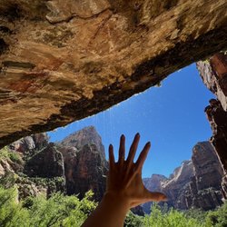
    When the Zion Canyon Shuttle is running, Weeping Rock is shuttle stop #7…read more This trail is pretty short at 0.4 miles, but it is pretty steep with stairs at the end! If you are fit and fast, maybe you could do it in 10 minutes, but if you want to enjoy a slower pace or have small kids, maybe budget closer to 45 minutes. This area drips continuously since the Navajo Sandstone layer is porous like a sponge and so water runs through it and seeps out due to gravity. Do not expect a waterfall at the end of this hike. Standing in the alcove, you can see down the valley and admire Angels Landing, the Great White Throne, etc. The hike is definitely unique and worth checking out if you have some time in your schedule. It does get crowded and there were a bunch of people filming themselves at the end of the trail (for social media?) so if you're looking for solitude this place isn't it.

    Weeping Rock was one of my favorite hikes at Zion National Park!…read more It's considered an easy trail, but just a heads up, it is steep going up. It's not a long hike at all, but that incline definitely caught me a little off guard. If you take your time, though, it's very doable and completely worth it. You get to it from shuttle stop #7, so it's easy to add into your day if you're already using the Zion shuttle. Once you make your way up, the view is beautiful. You get this really pretty look at Zion, and then you have the water dripping down from the rocks, almost like little waterfalls. That part was my favorite. It felt peaceful, cool, and different from the other stops I visited in the park. There's just something about standing there with the canyon around you and the water coming down that makes it feel special! Even with the steep walk up, I'm so glad I did this trail! It was short, scenic, and ended up being one of the most memorable parts of my Zion trip! If Weeping Rock is open when you visit, I'd definitely make time for it.

    Photos
    Weeping Rock
    Weeping Rock
    Weeping Rock

    See all

    Wildcat Canyon - hiking - Updated July 2026

    Loading...
    Loading...
    Loading...