Cancel

    Open app

    Search

    Wilkowski Park

    5.0 (1 review)

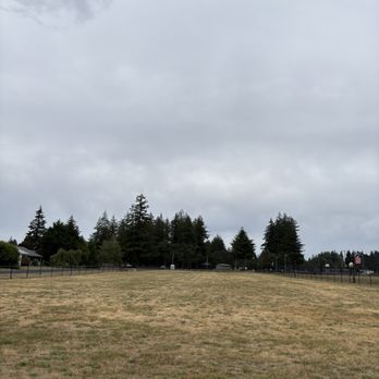
    Wilkowski Park Photos

    You might also consider

    Recommended Reviews - Wilkowski Park

    Your trust is our priority, so businesses can't pay to alter or remove their reviews. Learn more about reviews.
    Yelp app icon
    Browse more easily on the app
    Review Feed Illustration

    2 months ago

    Helpful 0
    Thanks 0
    Love this 0
    Oh no 0

    Verify this business for free

    People searched for Parks 797 times last month within 15 miles of this business.

    Verify this business

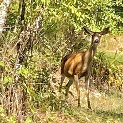
    Alder Lake Park - A friendly deer grazing at one of the camp sites.

    Alder Lake Park

    3.8(31 reviews)
    19.7 mi

    Nice little stop over on the way to Mt Rainier or if you are exploring the area…read more We went on a weekday in the fall so parking was plentiful and it was very quiet. The weather was also clear enough to see the lake, with a dock to walk around and stretch our legs. I didn't see much else to do aside from exploring the lake and whatever other water activities are involved like fishing, kayaking, etc. The restrooms are actual flush toilets with soap and water, and they were pretty clean aside from the hard water stains on the toilet bowl that is inevitable with park bathrooms. Still a better option that pit toilets. Fun Fact: The code name for Intel's 12th gen desktop processors was based on this lake.

    There are two elements for me when it came to camping. One is the campground facility itself, the…read moresecond one is the campers demography, or mainly the neighbors. For the campground facility I'd say this park checked all the boxes for me. There's natural water body, clean toilet (even with shower, although I didn't use it), and I got to see deers! There's also a convenient store right outside the campground. What I hate was my neighbor. To be specific, the group of people check in later on the 5th of July at the campsites of 66 and 65. I've never seen campers this obnoxious in my life. Not only they arrived late and make a scene, they also kept their boring unseasoned music all the way til almost 1am! Like what kind of etiquette was that? Who raise those people? And they also had kids too. Yeah so besides these annoying neighbor I actually find this campground quite nice.

    Photos
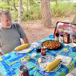
    Alder Lake Park - Eating outside so enjoyable, park well maintained and overseen constantly, no riff raff or noise.

    Eating outside so enjoyable, park well maintained and overseen constantly, no riff raff or noise.

    Alder Lake Park - Enjoying family time!

    Enjoying family time!

    Alder Lake Park - Our campsite 205

    See all

    Our campsite 205

    Mount Rainier National Park - Incline Cider

    Mount Rainier National Park

    4.8(307 reviews)
    37.8 mi

    The most beautiful park. There was a lot of closures when I visited in 8/26, especially on the est…read moreside of park, so my access was limited. There are 4 main areas of the park: Longmire, Paradise, Stevens Canyon and Sunrise. Longmire: Very historical, with a walking Historical tour of the buildings, park inn, museum, old gas station, wilderness center and general store. Paradise: extremely busy! Get here before 7am or after 2pm to get a parking space. Includes an inn with gift shop, visitors center woth deli and store and ranger station. This is where the most popular Skyline Trail is located (5.5 miles, 1700ft elevation gain). Steven's Canyon/Ohanapecosh: campground, visitors center (both currently closed) Sunrise/White River: currently closed Even if you have mobility issues, there is plenty to see in this park. Along the southern border, there are 4-5 easy trails. A few are even paved and ADA accessible. There are several beautiful waterfalls and rivers to see just from the road pullouts too. 34/63

    One of America's most majestic peaks, Mount Rainier towers over the Washington landscape like a…read morebeacon, easily visible on clear days from downtown Seattle, 70 miles to the north. Close up, the mountain's 14,000' peak often disappears behind treetops and fog, playing a game of hide and seek with visitors traversing the winding roads of its sprawling national park, craning their necks for a glimpse of the summit. But a visit to Mount Rainier National Park is like a game of chance. You can leave Seattle, as we did recently, under clear morning skies, with the mountain looming far in the distance, and then watch the clouds slowly close in as you near your destination. Weather conditions can make all the difference here, so make sure you pay close attention before setting out. Mid July through early September provide the best window to see the mountain in all its summertime glory -- come earlier in the year and you may find an environment decidedly less accommodating for the casual hiker. Rainier offers dozens of hiking trails, waterfalls, lakes and scenic vistas, and the ideal visit requires multiple days to experience it all. If you're coming for a day trip from the Seattle area, arrive early to beat the traffic at the entrance and prioritize easily accessible spots like Narada Falls, Reflection Lake and Paradise Meadows, where parking spots quickly disappear by noon. We arrived at the South Entrance on a weekday around 9 a.m. and drove right up to the entrance gate, but the lines to enter during peak season, especially on weekends, can be notoriously long. A highly recommended stop is the Longmire Visitor Center, where the rangers will advise you on road and trail conditions and help you plan your day. The park's showstopper is the popular Skyline Trail, a moderately challenging 5.5-mile loop that climbs 1,500' from the parking lot at Paradise Meadows to the spectacular Panorama Point Overlook. In summer, the trail meanders through a breathtaking sea of wildflowers and offers views of glaciers and waterfalls as it works its way across Rainier's southern slope. But on our recent visit, in early June, we found out that a even a light rain can makes the park's spectacular Skyline Trail a dicey expedition. The cold drizzle we encountered at the trailhead quickly evolved into an icy mix of sleet and snow as our family neared Panorama Point, making the narrow trails dangerously slick. Despite coming equipped with winter jackets, warm gloves and sturdy hiking boots, the conditions forced us to retreat before reaching the trail's famous overlook, which was already shrouded in dense fog. Despite not being able to enjoy the views and scenery we had hoped for, our visit to Mount Rainier was an unforgettable experience -- a challenging but highly rewarding winter hike on snow-covered trails surrounded by glaciers, icy peaks, and furry marmots who bounded around us like giant squirrels posing for candid photos. It was also a reminder that any visit to a national park is subject to the grace of Mother Nature, and inspired us to plan a return trip to this spectacular place -- hopefully when we can see Rainier's summit against a blue Washington sky.

    Photos
    Mount Rainier National Park - Mount Rainier Wild Huckleberry Razzle Candy Bar

    Mount Rainier Wild Huckleberry Razzle Candy Bar

    Mount Rainier National Park - Mount Fremont Lookout Trail | Instagram: @telephonesmoothie

    Mount Fremont Lookout Trail | Instagram: @telephonesmoothie

    Mount Rainier National Park - Tolmie Peak Trail | Instagram: @telephonesmoothie

    See all

    Tolmie Peak Trail | Instagram: @telephonesmoothie

    Lake Sylvia State Park - Lake Sylvia State Park - forestry loop trail

    Lake Sylvia State Park

    4.5(22 reviews)
    43.4 mi

    We were passing through after visiting Olympic Park and looking for a hiking spot in the area. Lake…read moreSylvia seemed like a possibility so we stopped off last Sunday around 10am. There were a few hikers there, but otherwise mostly those preparing to fish. We didn't visit the camping section, but they've got a decent sized day-use area with a good amount of parking, tables, and restrooms. We took the forest loop trail that leads from the lake along the stream through the forest and back around to the day-use, about 2 1/2 miles. There are sections of the trail that are simply gorgeous, and other parts not quite as pretty. But the trail is pretty fun, ups and downs, winding with steps and bridges. While the path is completely passable right now, it was very muddy in many places. A bit precarious at times, as some of the soupiest, slickest spots happened to be on inclines and declines. You'll definitely need waterproof shoes and prepare to get dirty, but Sylvia is good for a quick hike. They've got some interesting educational info along the trail too...and the lake has a very peaceful feeling.

    This place is quite the gem for a family trip ! Camping is very reasonably priced. Our walk in…read moreprimitive sight was $20 a night. If you have children the walk in spots are best because the are closest to the swimming and playground and bathrooms! There are plenty of amazing trails and all well kept! ***WATER FALL ALERT*** yes there is a waterfall and also a really neat dam that creates a man man water fall affect . Fishing is aloud (no motor I believe) Dogs on leash Swim at your own risk Drinks aloud (I think ... I see lots of them) Also a group camping site that is at the top of a hill and looks down at the water. Easily fits 8-10 tents and has a covered shelter ! Perfect for a family reunion camping trip and honestly a beautiful place to even consider as a wedding venue.

    Photos
    Lake Sylvia State Park - Lake Sylvia State Park - forestry loop trail

    Lake Sylvia State Park - forestry loop trail

    Lake Sylvia State Park - Lake Sylvia State Park

    Lake Sylvia State Park

    Lake Sylvia State Park - Lake Sylvia State Park

    See all

    Lake Sylvia State Park

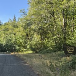
    Olympic National Forest - Berries along the trail
    Olympic National Forest

    4.4(17 reviews)
    15.5 mi

    This is the biggest national forest I've ever visited! There are many ways to get in, but one thing…read moreis for sure..do not follow this Yelp address. It will only take you to the headquarters. The forest is an hour away from this building. You can type in the name into any map and choose one of the entrances. The way we went was through a back road passing several homes in the flat valley that's surrounded by mountains and woods. It will lead you to the welcome sign, then you'll pass a camp ground. There are less people going this way, so the hikes might only have 1/2 a dozen people on it. You will see many trails options, and they will all be gorgeous! The Skokomish Lower South Fork Trail is a great one. It has a very small gravel parking area, and it is a 6 mile hike in total. You'll go in 3 miles to Brown Creek, and then back 3 miles. I would say it's a semi strenuous hike. There's some down hill, and uphill, but mostly its level. Bring plenty of water, SPF, and snacks. Also stop at the restroom just before heading up the gravel road to the beginning of the trail. You'll pass a few little ice cold babbling brooks that will be very easy to walk across without getting your feet wet.

    went here with Brandon and it was so nice with the clean air coming in at any elevation. There are…read moreshort and long hikes, so up to you what you want to do. There are levels to the hiking trails if you want steepness or not. Just do your research beforehand where it is you want to go and what it is you want because there is no signal here at times. this is a reeaaalllly big park, so a lot to do, but also a lot where you could get lost. there are winding roads to drive through and it gets a bit scary if you going during nighttime because the downhills make u go fast...especially with the snow ;-; watch urself and have gps on!!!!

    Photos
    Olympic National Forest - One of the welcome signs

    One of the welcome signs

    Olympic National Forest - Skokomish Lower South Fork Trail ends at Brown Creek

    Skokomish Lower South Fork Trail ends at Brown Creek

    Olympic National Forest - Trail becomes a tunnel at one point

    See all

    Trail becomes a tunnel at one point

    Wilkowski Park - parks - Updated August 2026

    Loading...
    Loading...
    Loading...