
Wire Pass Trailhead Photos


You might also consider

More like Wire Pass Trailhead
Recommended Reviews - Wire Pass Trailhead
Start your review...


Reviews With Photos
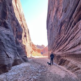

What a fun, easy, and good distance hike! First time visiting slot canyons and I was not disappointed in the slightest! Trail was super easy to navigate and easy to get through. The only downside was the almost 9 miles you have to drive on unpaved road, that part was not ideal but it was easy to get through if you go slow. We didn't get to see all of the slot canyons due to water blocking our path on the final two. But at that point we had already walked nearly 2 miles in and were ready to head back. If you are in the area and cannot get a day pass for the wave I would recommend trying this place out. It is absolutely gorgeous and totally worth the unpaved road. Would visit in a heartbeat if I'm the area!
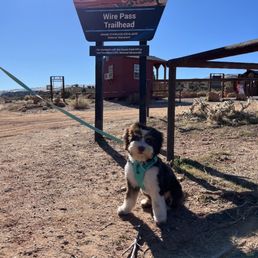

Awesome trail and easy to navigate the path with clear signs! The park was super clean and not overpowering. It is a little difficult to get to the park bu my it was a Great day getting some sun and hiking time in. The slot canyons were incredibly beautiful and just jaw dropping on how incredible they are while walking through them. We brought our pup and she had an absolute blast, so this trail is easy for pups and not hard on their bodies. We were able to get through most of the slot canyons, but Unfortunately the last two were blocked by sitting water.definitely recommend checking this place out and you are in the area, it is totally worth the drive. The only downside is the 9mile drive just before you park only because that whole 9 miles is unpacked road

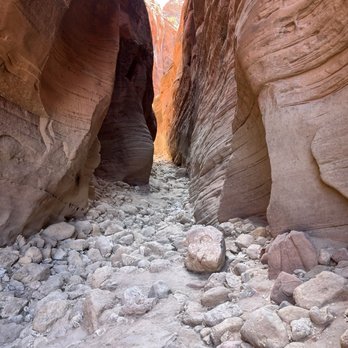
Rough road going in, air down! Big parking lot at the trailhead. We already got our permits, so listed the number on the form on our windshield. Hot spell in October, and we started close to noon. We had water, but I worried it may not be enough. The hike in was right at 1.5 miles. Then the excitement and cooler slots began! What a wonderful experience this was! Lots of mud if you went The Buckskin direction, and then very rocky if you went the other direction at the crossroads. We went a short distance both ways, then hung out in the "amphitheater" area where it was like a wind tunnel for a bit to cool down. Fabulous experience!


This is an excellent hike through the beautiful wash on Wire Pass into Buckskin Gulch in Paria Canyon-Vermilion Cliffs, managed by BLM. You can hike along Buckskin gulche, either up or downriver, up to 20 miles. Finding the trailhead: Follow U.S. 89 to an unsigned southbound dirt road that branches off the highway at the west end of a 50 mph right-angle curve just west of The Cockscomb. Find the turnoff 0.8 mile west of milepost 25 and 34 miles northwest of Page, Arizona, or 0.2 mile south of milepost 26 and 37.5 miles east of Kanab, Utah. This dirt road (known as House Rock Valley Road) is passable to cars in dry weather, barring severe runoff damage, and steadily ascends for 2.5 miles to a saddle separating The Cockscomb and Buckskin Mountain. Ignore the right fork to Fivemile Mountain at the saddle, then descend to a crossing of the Buckskin Gulch wash after 4.4 miles, where the road is subject to flood damage. The signed turnoff to Buckskin Gulch Trailhead (located 0.2 mile east of the road), which you avoid, is located a short distance south of the wash. Wire Pass Trailhead is tricky as there are several trailheads that provide access to Buckskin Gulch. Wire Pass Trailhead offers the most direct access for a day hike, just about two miles to Buckskin Gulch. Don't take the Buckskin Trailhead, which follows a wash for at least 6 miles before intersecting with Wire Pass Trail and then the confluence with the Paria River. My hike is in early March. It's pleasant but it can get very cold and windy. Gloves, hat, and light wind jacket are recommended. The hike can be easy to moderate difficulty, depending on how far you want to hike in along the Gulch! Having a good pair of hiking boots and bringing enough drinking water and snacks would help for sure. Reservations for permits for overnight use required; Day-use permits can be purchased in advance at recreation.gov or digitally at the trailhead. There is a little signal at the trailhead, depending on your service carrier. Children age twelve and under are free! $6 dollars per dog. Highly recommended for everyone, young to old! This place is magical and magnificent. It's remarkable that we are allowed to walk through this special place. Super wild. Super EPIC! Super happy. Please make sure to keep this place clean and beautiful as you find it. Happy hike!


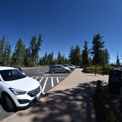
To get to here, you will need to drive on House Rock Valley Road which is an unpaved road. I did it in a 2WD sedan, but made sure that the weather was dry so there was no mud. There's a large parking lot with a few composting toilets. You do need to pay for a permit - the trailhead allows you to use your credit card to pay and prints out a copy of the permit. Anyway, this is an awesome slot canyon! Follow the stream bed until you enter the canyon. It's a short canyon that leads to a petroglyph panel. There's a ladder section, but also an alternative trail if you have a dog or can't navigate the ladder. At the petroglyph panel, you can then explore the Buckskin Gulch narrows (the full Gulch is an overnight hike). I had to turn around at some point since there were huge puddles of water - some over knee deep that I didn't want to risk accidentally falling into when balancing on rocks. I would definitely visit again!!! read more


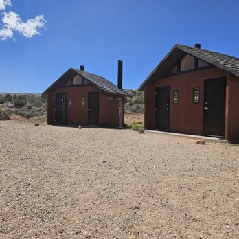


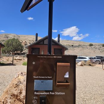


Disclaimer please check Ranger stations and understand with any amount of rain whatsoever slot canyons can be dangerous and flash floods are deadly. It was dry when we went. I can't recommend this enough. If you want a rugged wonderlust adventure, skip antelope canyon and try this hike instead . On the way in we went up over the trail over the canyon and it was pretty rugged. On the way out we stayed in the river bed and there was a ladder and this was an easier route. If you want the easier route in just stay in the riverbed for the entire hike. When you finally reach the end of the wire pass and you meet the convergence of buckskin Gulch, hang a right. It is a "T" shape and you have to choose right or left. The left is a lot of black rock and not as dramatic view. The right has more oranges and reds and is more dramatic with lighting. We hiked approximately 45 minutes into buckskin Gulch and the views were absolutely breathtaking and dramatic. I think the lighting for awesome photos would be best from eight or 9 AM until maybe one or 2 PM. You can go as far as you want but eventually you might reach water puddles that you don't want to go through. We chose to hike two hours in to buckskin gulch and then come back out wire pass. Remember to get online and get your permit and write down the permit number and stick it in your windshield or you will get a ticket on your windshield. You can buy the wire Pass day pass on recreation.gov. I've already been to antelope Canyon and I was at Zion. Not overly thrilled with crowds and it feels very structured. If you want unstructured beauty and no crowds I would suggest this instead because it's just as beautiful and dramatic. A lot of the features that you would see at White pocket and other places you will find in small areas of this hike. read more


2 years ago
What an amazing experience going through the canyons ,a bit rough on the road driving into the trailhead due to flood damage so a 4x4 is way better ,once you arrive bathrooms are clean . read more


What a fun, easy, and good distance hike! First time visiting slot canyons and I was not disappointed in the slightest! Trail was super easy to navigate and easy to get through. The only downside was the almost 9 miles you have to drive on unpaved road, that part was not ideal but it was easy to get through if you go slow. We didn't get to see all of the slot canyons due to water blocking our path on the final two. But at that point we had already walked nearly 2 miles in and were ready to head back. If you are in the area and cannot get a day pass for the wave I would recommend trying this place out. It is absolutely gorgeous and totally worth the unpaved road. Would visit in a heartbeat if I'm the area! read more
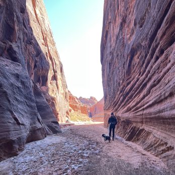
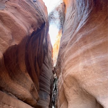


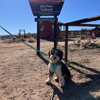
Awesome trail and easy to navigate the path with clear signs! The park was super clean and not overpowering. It is a little difficult to get to the park bu my it was a Great day getting some sun and hiking time in. The slot canyons were incredibly beautiful and just jaw dropping on how incredible they are while walking through them. We brought our pup and she had an absolute blast, so this trail is easy for pups and not hard on their bodies. We were able to get through most of the slot canyons, but Unfortunately the last two were blocked by sitting water.definitely recommend checking this place out and you are in the area, it is totally worth the drive. The only downside is the 9mile drive just before you park only because that whole 9 miles is unpacked road read more


2 years ago
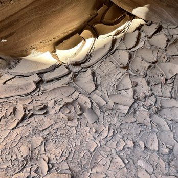
Rough road going in, air down! Big parking lot at the trailhead. We already got our permits, so listed the number on the form on our windshield. Hot spell in October, and we started close to noon. We had water, but I worried it may not be enough. The hike in was right at 1.5 miles. Then the excitement and cooler slots began! What a wonderful experience this was! Lots of mud if you went The Buckskin direction, and then very rocky if you went the other direction at the crossroads. We went a short distance both ways, then hung out in the "amphitheater" area where it was like a wind tunnel for a bit to cool down. Fabulous experience! read more




5 years ago
This is an excellent hike through the beautiful wash on Wire Pass into Buckskin Gulch in Paria Canyon-Vermilion Cliffs, managed by BLM. You can hike along Buckskin gulche, either up or downriver, up to 20 miles. Finding the trailhead: Follow U.S. 89 to an unsigned southbound dirt road that branches off the highway at the west end of a 50 mph right-angle curve just west of The Cockscomb. Find the turnoff 0.8 mile west of milepost 25 and 34 miles northwest of Page, Arizona, or 0.2 mile south of milepost 26 and 37.5 miles east of Kanab, Utah. This dirt road (known as House Rock Valley Road) is passable to cars in dry weather, barring severe runoff damage, and steadily ascends for 2.5 miles to a saddle separating The Cockscomb and Buckskin Mountain. Ignore the right fork to Fivemile Mountain at the saddle, then descend to a crossing of the Buckskin Gulch wash after 4.4 miles, where the road is subject to flood damage. The signed turnoff to Buckskin Gulch Trailhead (located 0.2 mile east of the road), which you avoid, is located a short distance south of the wash. Wire Pass Trailhead is tricky as there are several trailheads that provide access to Buckskin Gulch. Wire Pass Trailhead offers the most direct access for a day hike, just about two miles to Buckskin Gulch. Don't take the Buckskin Trailhead, which follows a wash for at least 6 miles before intersecting with Wire Pass Trail and then the confluence with the Paria River. My hike is in early March. It's pleasant but it can get very cold and windy. Gloves, hat, and light wind jacket are recommended. The hike can be easy to moderate difficulty, depending on how far you want to hike in along the Gulch! Having a good pair of hiking boots and bringing enough drinking water and snacks would help for sure. Reservations for permits for overnight use required; Day-use permits can be purchased in advance at recreation.gov or digitally at the trailhead. There is a little signal at the trailhead, depending on your service carrier. Children age twelve and under are free! $6 dollars per dog. Highly recommended for everyone, young to old! This place is magical and magnificent. It's remarkable that we are allowed to walk through this special place. Super wild. Super EPIC! Super happy. Please make sure to keep this place clean and beautiful as you find it. Happy hike! read more


Wire Pass is a geological wonder in south Utah with the exceptional beauty of Paria Canyon and Vermilion Cliffs. A parking lot at the trailhead with public bathrooms. We planned for 3+ hour hike, 1 1/2 hour down and the back. It was pretty easy with some moderate level hiking and one ladder within the narrow canyon with several steps. The route follows Coyote Wash before entering the narrows of Wire Pass. Then observing Petroglyph Panel before continuing into the Buckskin Gulch narrows. read more


4 years ago
More info about Wire Pass Trailhead
Ask the Community - Wire Pass Trailhead





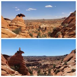
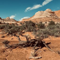

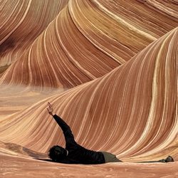


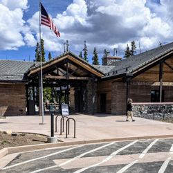
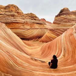

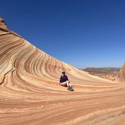
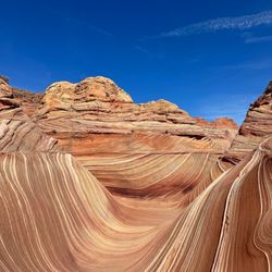


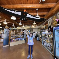







Wire Pass Trailhead - hiking - Updated September 2026
Best of Kanab
People found Wire Pass Trailhead by searching for…
Trending Searches in Kanab, UT
Barbers near Wire Pass Trailhead
Bike Shop near Wire Pass Trailhead
Cliff Jumping near Wire Pass Trailhead
Consignment Shops near Wire Pass Trailhead
Dog Friendly Things To Do near Wire Pass Trailhead
Hiking near Wire Pass Trailhead
Lakes near Wire Pass Trailhead
Lookout Points near Wire Pass Trailhead
Mini Golf near Wire Pass Trailhead
Parks near Wire Pass Trailhead
Pedicure near Wire Pass Trailhead
Picnic Areas near Wire Pass Trailhead
Playgrounds near Wire Pass Trailhead
Scenic Night View near Wire Pass Trailhead
Browse Articles
Browse Brands
Related Searches in Kanab, UT
Affordable Kayak Rental Services in Kanab, Utah
Best Dog Hiking Trails Around Kanab, Utah
Best Fishing Locations and Guides in Kanab, Utah
Best Lookout Points to Visit in Kanab, Utah
Best Parks for Parties and Events in Kanab, Utah
Best Places for Horseback Riding in Kanab, Utah
Best Water Parks for Kids in Kanab, Utah
Best Waterfalls and Swimming Holes in Kanab, Utah
Book Engaging Historical Tours in Kanab, Utah
Check Out Great Playgrounds in Kanab, Utah
Check Out Off Road Trails in Kanab, Utah
Discover Charming Historic Homes in Kanab, Utah
Discover Dog Friendly Trails to Explore in Kanab, Utah
Discover Fun Activities to Do in Kanab, Utah
Discover Historic Sites and Places in Kanab, Utah
Discover Popular Landmarks in Kanab, Utah
Discover Popular Photo Spots in Kanab, Utah
Discover Top Nature Parks to Visit in Kanab, Utah
Discover a Hiking Trail in Kanab, Utah
Discover a Library Near You in Kanab, Utah
Discover the Best Beaches in Kanab, Utah
Discover the Best Dinosaur Park Experiences in Kanab, Utah
Discover the Best Night Hike Trails in Kanab, Utah
Dog-Friendly Hikes With Dogs in Kanab, Utah
Enjoy Arts & Entertainment in Kanab, Utah
Enjoy Camping Adventures Around Kanab, Utah
Enjoy Exciting Mountain Biking Adventures in Kanab, Utah
Enjoy Hiking Adventures in Kanab, Utah
Enjoy Kayaking Adventures in Kanab, Utah
Enjoy Off Leash Dog Hikes in Kanab, Utah
Enjoy Scenic Night View Experiences in Kanab, Utah
Enjoy Tent Camping Spots Around Kanab, Utah
Enjoy the Best Picnic Spots and Ideas in Kanab, Utah
Enjoy the Best Walking Trails in Kanab, Utah
Experience Stunning Sunset Views in Kanab, Utah
Experience the Best Family Fun in Kanab, Utah for All
Explore Beautiful Castles and Landmarks in Kanab, Utah
Explore Beautiful Parks and Green Spaces in Kanab, Utah
Explore Easy Hikes Perfect for All in Kanab, Utah
Explore Free Picnic Areas Around Kanab, Utah
Explore Free Things to Do Around Kanab, Utah
Explore Fun Activities to Do in Kanab, Utah
Explore Picnic Parks Near Kanab, Utah
Explore Popular Campgrounds Near Kanab, Utah
Explore Popular Picnic Areas Around Kanab, Utah


