Woody Gap Recreation Area Photos


You might also consider

More like Woody Gap Recreation Area
Recommended Reviews - Woody Gap Recreation Area
Start your review...


Reviews With Photos


Beautiful overlook, overcrowded parking and lots of litter ruining it though. The AT passes through this area, it's a nice respite from the mountain trails and woods. An open area bustling with people and motor vehicles. People parking to do some day hikes or just to stop for a quick photo. All well and good except those quick trip folks seem to disregard the ample garbage cans available and just kinda chuck it down the mountainside. The area is well marked, has maps and various information regarding the wilderness and The AT as well as side trails you can wander. No printed out maps you can take with you but, the map is large enough that you can snap a pic with your phone and still be able to make out where you want to go and explore. Definitely a beautiful spot to see, just please mind your litter.


Woody Gap works a few ways for a few different people. If you're into just catching a great view, Woody Gap has that for you right at the parking lot. In fact, when I arrived on a Sunday morning, there were a few people taking in a sunrise breakfast from the trunk of their car. If you're up for a nice quick hike to an even better view at Preacher's rock, which is less than 2 miles from the Woody Gap parking lot (you can't miss it due to the outcrop clearing and endless mountain views), you can find that here too. This hike is easily hiked by all comers, as this trail isn't really tough at all, and will be flat in about half of the trail. Finally, if you want a long scenic hike, say to Blood mountain, Neel's Gap, or any place you'd like to stop along the Appalachian trail, again, Woody Gap has you covered. Blood mountain is about 12 miles away from the parking lot of Woody Gap, and a decent map at the parking lot marks several "to see" locations on the map. Just remember, this is 12 miles one way, so either park a car at both Appalachian locations, or be prepared to get in a 24 mile round trip hike. There is no welcome center at the Woody Gap lot, and while there is a bathroom, it's more of an outhouse than anything...and bring your own tissue/hand sanitizer just in case. Several benches are littered around, and while there are two lots, they both can fill up pretty quickly. Woody Gap is on Highway 60, and I found it easy to get here by just pushing the "directions" feature on the yelp app, as both waze and my in dash gps located me on highway 60, but not at the woody gap location. Very nice area that you definitely must check out if you're anywhere near the Dahlonega area.


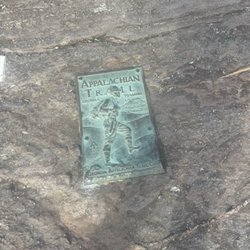
If you're in the Dahlonega area and want a nice overlook, visit Woody Gap. Follow GA 60 northwest of Dahlonega and follow the signs to Woody Gap Recreation Area. You'll know it when you see it -- there's a clearing at near the top of the mountain. The overlook is on the left (if coming from the southeast). Additional parking and toilet facilities are on the right. The Appalachian trail crosses the recreation area. Southwest from Woody Gap is the trail to Gooch Gap. North and east trail head in the direction of Blood Mountain. We love the winding drive up to this overlook, and we always bring our dogs with us to enjoy the view and a brief walk down the trail. We think you'll enjoy it too.
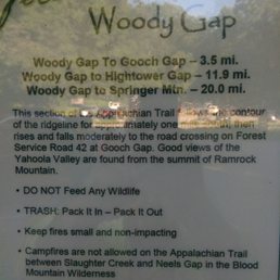

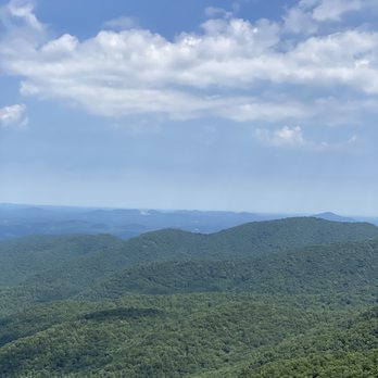
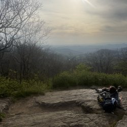
Stunning view of a valley and...stuff in the valley. My eyesight isn't what it used to be and I wished that I had my binoculars with me. If you are planning a trek around the area, tote your telescope or binoculars. There's probably neat stuff to spy upon down in that valley. You could stroll the trail, but we didn't. We sat on some rocks overlooking the vista and enjoyed the cool, clear day and the natural beauty. Lots of that, especially if you, like me, are from Florida, where the landscape rarely varies much in altitude or flora. Don't get in a hurry on the roads leading to and from here, because they are incredibly twisty. We got passed in a no-passing zone although we were traveling at the posted speed limit...that reckless moron came within 50 feet of a head-on collision with an oncoming vehicle. Be safe, enjoy the great outdoors, and be kind.
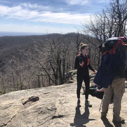

PREACHERS ROCK. About a 20 minute fairly simple hike. 1.8 mile I believe. View from the top is magnificent and you'll see many AT hikers starting or continuing their hike. There's enough rock for multiple groups to sit and enjoy their time. I'd highly recommend this. Easy enough I'd say as well to take a in shape pup up to as well!


I recently ran from Woody Gap trailhead to the top of Blood Mountain and back for the first time which totaled around 16.5 miles round trip. It is a very beautiful section to hike, run and/ or camp on! Along the route you will pass over Preachers Rock! This is one of the best spots to watch sunrise if you're able to get up there before it begins! It is just over a mile from the parking lot of Woody Gap to the top of Preachers Rock. Along the route to Blood Mountain you will pass several designated camping spots (free to camp, first come first serve). I have yet to camp on this section, but I've picked a couple spots to try out next time! There are 3 water crossings along the route that you can fill up at; just make sure to filter the water before you drink it. I recommend bringing a Sawyer Mini water filter. It fits into the palm of your hands, so it doesn't take up any room in your pack. The trail itself is very easy to follow. I was a little nervous at first that I may get off course or take a wrong turn/ trail, but I can assure you that there is only one main trail that runs from Woody to Blood. There are some side trails that intersect, BUT they either lead to campsites or shelters. As long as you stay on the main trail, it is hard to get lost! I can't wait to go Bach again and run from Woody Gap to Neel Gap which will be around 20 miles round trip. read more


2 years ago
It was a 30 minute hike and worth it because the view is beautiful! It's a little steep towards the end but it's doable. read more




9 years ago
Beautiful overlook, overcrowded parking and lots of litter ruining it though. The AT passes through this area, it's a nice respite from the mountain trails and woods. An open area bustling with people and motor vehicles. People parking to do some day hikes or just to stop for a quick photo. All well and good except those quick trip folks seem to disregard the ample garbage cans available and just kinda chuck it down the mountainside. The area is well marked, has maps and various information regarding the wilderness and The AT as well as side trails you can wander. No printed out maps you can take with you but, the map is large enough that you can snap a pic with your phone and still be able to make out where you want to go and explore. Definitely a beautiful spot to see, just please mind your litter. read more


11 years ago
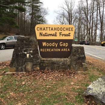
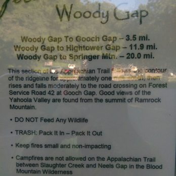
Woody Gap works a few ways for a few different people. If you're into just catching a great view, Woody Gap has that for you right at the parking lot. In fact, when I arrived on a Sunday morning, there were a few people taking in a sunrise breakfast from the trunk of their car. If you're up for a nice quick hike to an even better view at Preacher's rock, which is less than 2 miles from the Woody Gap parking lot (you can't miss it due to the outcrop clearing and endless mountain views), you can find that here too. This hike is easily hiked by all comers, as this trail isn't really tough at all, and will be flat in about half of the trail. Finally, if you want a long scenic hike, say to Blood mountain, Neel's Gap, or any place you'd like to stop along the Appalachian trail, again, Woody Gap has you covered. Blood mountain is about 12 miles away from the parking lot of Woody Gap, and a decent map at the parking lot marks several "to see" locations on the map. Just remember, this is 12 miles one way, so either park a car at both Appalachian locations, or be prepared to get in a 24 mile round trip hike. There is no welcome center at the Woody Gap lot, and while there is a bathroom, it's more of an outhouse than anything...and bring your own tissue/hand sanitizer just in case. Several benches are littered around, and while there are two lots, they both can fill up pretty quickly. Woody Gap is on Highway 60, and I found it easy to get here by just pushing the "directions" feature on the yelp app, as both waze and my in dash gps located me on highway 60, but not at the woody gap location. Very nice area that you definitely must check out if you're anywhere near the Dahlonega area. read more




14 years ago
If you're in the Dahlonega area and want a nice overlook, visit Woody Gap. Follow GA 60 northwest of Dahlonega and follow the signs to Woody Gap Recreation Area. You'll know it when you see it -- there's a clearing at near the top of the mountain. The overlook is on the left (if coming from the southeast). Additional parking and toilet facilities are on the right. The Appalachian trail crosses the recreation area. Southwest from Woody Gap is the trail to Gooch Gap. North and east trail head in the direction of Blood Mountain. We love the winding drive up to this overlook, and we always bring our dogs with us to enjoy the view and a brief walk down the trail. We think you'll enjoy it too. read more


Stunning view of a valley and...stuff in the valley. My eyesight isn't what it used to be and I wished that I had my binoculars with me. If you are planning a trek around the area, tote your telescope or binoculars. There's probably neat stuff to spy upon down in that valley. You could stroll the trail, but we didn't. We sat on some rocks overlooking the vista and enjoyed the cool, clear day and the natural beauty. Lots of that, especially if you, like me, are from Florida, where the landscape rarely varies much in altitude or flora. Don't get in a hurry on the roads leading to and from here, because they are incredibly twisty. We got passed in a no-passing zone although we were traveling at the posted speed limit...that reckless moron came within 50 feet of a head-on collision with an oncoming vehicle. Be safe, enjoy the great outdoors, and be kind. read more

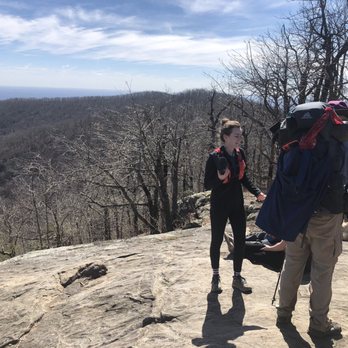
PREACHERS ROCK. About a 20 minute fairly simple hike. 1.8 mile I believe. View from the top is magnificent and you'll see many AT hikers starting or continuing their hike. There's enough rock for multiple groups to sit and enjoy their time. I'd highly recommend this. Easy enough I'd say as well to take a in shape pup up to as well! read more


7 years ago
Wonderful first hike on the AT for our kiddos! It's about 1 1/2 miles to Preacher's Rock. Walkway is nice and gentle until the last 1/2 mile or so and then it gets rocky. Our kids are 7,8,10,12 and 19. They all made it bubbling and bouncing up the trail. Once at the top - the view was worth the last 1/2 mile! It's gorgeous. You will meet several through hikers. It's just a great community of folks walking the AT trail! Pictures just don't do it justice! read more


More info about Woody Gap Recreation Area
Highway 60
Dahlonega, GA 30533
Directions
Hours
Outdoor Amenities
Ask the Community - Woody Gap Recreation Area
Review Highlights - Woody Gap Recreation Area















Woody Gap Recreation Area - hiking - Updated September 2026
Best of Dahlonega
People found Woody Gap Recreation Area by searching for…
Hiking Trails With Waterfalls in Dahlonega, GA
Places to Take Pictures in Dahlonega, GA
Off Road Trails in Dahlonega, GA
Beautiful Views in Dahlonega, GA
Places to Swim in Dahlonega, GA
Lookout Points in Dahlonega, GA
Running Trails in Dahlonega, GA
Waterfalls and Swimming Holes in Dahlonega, GA
Scenic Overlook in Dahlonega, GA
Parks BBQ Grills in Dahlonega, GA
Trending Searches in Dahlonega, GA
Apple Orchards near Woody Gap Recreation Area
Apple Picking near Woody Gap Recreation Area
Archery near Woody Gap Recreation Area
Baseball Fields near Woody Gap Recreation Area
Beautiful Views near Woody Gap Recreation Area
Bike Shop near Woody Gap Recreation Area
Blow Dry Bar near Woody Gap Recreation Area
Casinos near Woody Gap Recreation Area
Cliff Jumping near Woody Gap Recreation Area
Consignment Shops near Woody Gap Recreation Area
Cruising Spots near Woody Gap Recreation Area
Dog Swimming near Woody Gap Recreation Area
Eyebrow Threading near Woody Gap Recreation Area
Eyelash Extensions near Woody Gap Recreation Area
Hiking Trails near Woody Gap Recreation Area
Hiking Trails With Waterfalls near Woody Gap Recreation Area
Kids Birthday Party near Woody Gap Recreation Area
Lakes & Ponds near Woody Gap Recreation Area
Makeup Artists near Woody Gap Recreation Area
Nail Technicians near Woody Gap Recreation Area
Off Road Trails near Woody Gap Recreation Area
Parks near Woody Gap Recreation Area
Photo Spots near Woody Gap Recreation Area
Picnic Areas near Woody Gap Recreation Area
Places To Take Pictures near Woody Gap Recreation Area
Playgrounds near Woody Gap Recreation Area
Private Schools near Woody Gap Recreation Area
Public Running Track near Woody Gap Recreation Area
Public Shower near Woody Gap Recreation Area
Rock Quarry near Woody Gap Recreation Area
Scenic Night View near Woody Gap Recreation Area
Scenic Overlook near Woody Gap Recreation Area
Star Gazing near Woody Gap Recreation Area
Sunrise View near Woody Gap Recreation Area
Swimming Holes near Woody Gap Recreation Area
Teeth Whitening near Woody Gap Recreation Area
Tennis Courts near Woody Gap Recreation Area
Browse Nearby
BEST of Dahlonega, Georgia Things to Do near Woody Gap Recreation Area
BEST of Dahlonega, Georgia Parks near Woody Gap Recreation Area
BEST of Dahlonega, Georgia Coffee near Woody Gap Recreation Area
BEST of Dahlonega, Georgia Lakes near Woody Gap Recreation Area
BEST of Dahlonega, Georgia Restaurants near Woody Gap Recreation Area
BEST of Dahlonega, Georgia Campgrounds near Woody Gap Recreation Area
BEST of Dahlonega, Georgia Breakfast near Woody Gap Recreation Area
BEST of Dahlonega, Georgia Taxis near Woody Gap Recreation Area
BEST of Dahlonega, Georgia Ski Resorts near Woody Gap Recreation Area
Browse Brands
Related Searches in Dahlonega, GA
Affordable Kayak Rental Services in Dahlonega, Georgia
Best Dog Hiking Trails Around Dahlonega, Georgia
Best Fishing Locations and Guides in Dahlonega, Georgia
Best Nature Trails for Hiking in Dahlonega, Georgia
Best Off Leash Dog Parks in Dahlonega, Georgia
Best Parks for Parties and Events in Dahlonega, Georgia
Best Places for Horseback Riding in Dahlonega, Georgia
Best Water Parks for Kids in Dahlonega, Georgia
Best Waterfalls and Swimming Holes in Dahlonega, Georgia
Check Out Great Playgrounds in Dahlonega, Georgia
Check Out Off Road Trails in Dahlonega, Georgia
Discover Baseball Fields Around Dahlonega, Georgia
Discover Dog Friendly Trails to Explore in Dahlonega, Georgia
Discover Easy Hiking Trails Near Dahlonega, Georgia
Discover Fun Toddler Parks in Dahlonega, Georgia for Your Little One
Discover Kid Friendly Hiking Trails in Dahlonega, Georgia
Discover Popular Bike Trails in Dahlonega, Georgia
Discover Scenic Mountain Bike Trails Near Dahlonega, Georgia
Discover Soccer Fields in Dahlonega, Georgia Near You
Discover Top Nature Parks to Visit in Dahlonega, Georgia
Discover Top State Parks to Visit in Dahlonega, Georgia
Discover a Hiking Trail in Dahlonega, Georgia
Discover the Best Beaches in Dahlonega, Georgia
Discover the Best Night Hike Trails in Dahlonega, Georgia
Dog-Friendly Hikes With Dogs in Dahlonega, Georgia
Enjoy Camping Adventures Around Dahlonega, Georgia
Enjoy Hiking Adventures in Dahlonega, Georgia
Enjoy Kayaking Adventures in Dahlonega, Georgia
Enjoy Off Leash Dog Hikes in Dahlonega, Georgia
Enjoy River Tubing Adventures in Dahlonega, Georgia
Enjoy Tent Camping Spots Around Dahlonega, Georgia
Enjoy a Beautiful Waterfall Hike in Dahlonega, Georgia
Enjoy the Best Picnic Spots and Ideas in Dahlonega, Georgia
Enjoy the Best Walking Trails in Dahlonega, Georgia
Experience Thrilling White Water Rafting in Dahlonega, Georgia
Explore Beautiful Parks and Green Spaces in Dahlonega, Georgia
Explore Easy Hikes Perfect for All in Dahlonega, Georgia
Explore Family-Friendly Zoos and Wildlife in Dahlonega, Georgia
Explore Free Picnic Areas Around Dahlonega, Georgia
Explore Fun Activities to Do in Dahlonega, Georgia
Explore Parks With Pull Up Bars in Dahlonega, Georgia
Explore Picnic Parks Near Dahlonega, Georgia
Explore Popular Campgrounds Near Dahlonega, Georgia
Explore Popular Picnic Areas Around Dahlonega, Georgia
Explore Popular RV Parks Around Dahlonega, Georgia
Explore Scenic Lakes to Visit in Dahlonega, Georgia
Explore Top Dog Parks in Dahlonega, Georgia Near You


