Ausable River Association
Ausable River Association Photos


More like Ausable River Association
Recommended Reviews - Ausable River Association
Start your review...



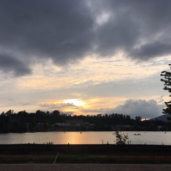
You don't want to miss this , even if u r staying in lake George .. loveeee the serenity and calmness in mirror lake .. wish we stayed back a night ... the whole town is so relaxed .. it's a lil expensive though ... parking is a mess here and that's why the 4 rating.. if not it would be a five out of five :) Wait for the sunset and then the magic starts .. clouds and reflections are breathtaking during sunset .. it truly looks like a mirror . Love this place and will visit back again .. 4/5 read more


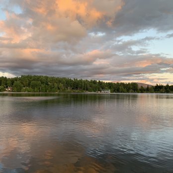

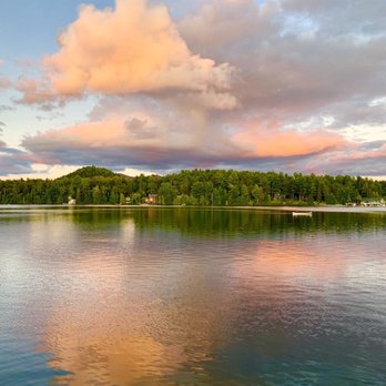
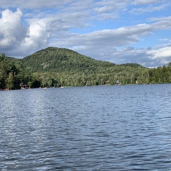

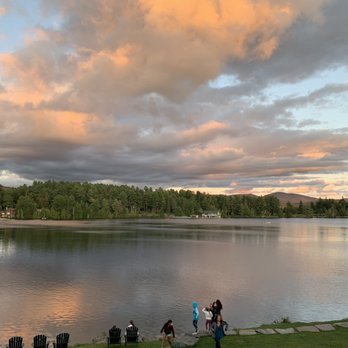


This is the main attraction and center of Lake Placid. I came in November so the lake wasn't frozen over yet. If you come when it's frozen, you can ice skate or tobagganing ($5 for kids and double the cost for adults). They have a 30 foot ramp/chute that tobaggans can go on. It looks scary to me but I am sure it's fun for those adrenaline junkies and brave tobagganers. In the summer you can canoe, kayak, or stand-up paddle-board. Ironman competitions take place here too. There are fun ducks and seagulls to look at around the lake. It was more boring during the time that I came since it was too late for summer lake activities and too early for winter lake activities. read more


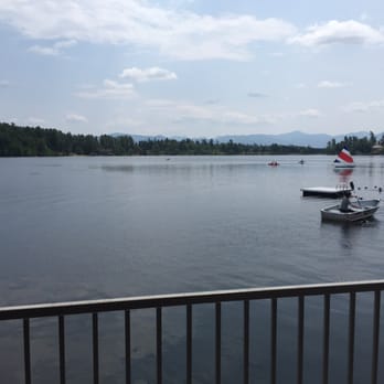
Highlight of a visit to Lake Placid is mirror lake! There's a 2.7 mile walking path that surrounds Mirror Lake that is full of runners and walkers every morning. In the summer, there are a number of non motorized water sports you can enjoy: paddle boarding, pedal boats, kayaks, hydro bikes, row boats, and more! Rentals are available on Main Street or if you're lucky to stay at The Golden Arrow or High Peaks, some water sport equipment is provided. In the winter, Mirror Lake freezes over and you can ice skate, ski, walk, or do a dog sled ride over the frozen lake. read more


8 years ago

11 years ago
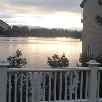
Walking around Mirror Lake makes for an easy and relaxing hike in Lake Placid. There is a red brick walking path that goes all around the lake, so it's really easy to follow. It takes less than an hour to go all around at a decent walking pace. My favorite part is from the south end, where you find a small beach area, and all the way up to the north end, while walking on the east shore. Around the southeast area, you have a very nice view on the lake and the surrounding mountains. Then you can have a view on the downtown area as you walk on the east bank, Then around the north end and on the west bank, you get to see mostly trees and houses (the lake is kind of hidden behind). And the west bank is the business district, where you have several places to snack, dine, have a drink, or buy souvenirs. It is also the busiest part of the hike. I liked the fact that there is a lot of variety in the views when getting around the lake. Also I liked that it was not too long, just good for a little afternoon walk. And it's nice to finish up with the business area, because if you are a bit tired, you can slow down and just look at the boutiques. read more


More info about Ausable River Association
Ask the Community - Ausable River Association






Ausable River Association - hiking - Updated August 2026
Best of Wilmington
People found Ausable River Association by searching for…
Swimming Holes in Wilmington, NY
Things to Do in Wilmington, NY
Animal Shelters in Wilmington, NY
Watch Sunset in Wilmington, NY
Kayak Rental in Wilmington, NY
Walking Trails in Wilmington, NY
Hiking Trails With Waterfalls in Wilmington, NY
Secret Spots in Wilmington, NY
Dog Friendly Beaches in Wilmington, NY
Fishing Spots in Wilmington, NY
Scenic Drive in Wilmington, NY
Scenic Overlook in Wilmington, NY
Swimming Lakes in Wilmington, NY
Trending Searches in Wilmington, NY
Auto Detailing near Ausable River Association
Auto Repair near Ausable River Association
Beautiful Views near Ausable River Association
Boating near Ausable River Association
Body Shops near Ausable River Association
Car Inspection near Ausable River Association
Cliff Jumping near Ausable River Association
Contractors near Ausable River Association
Dog Daycare near Ausable River Association
Fishing Spots near Ausable River Association
Foundation Repair near Ausable River Association
Junkyards near Ausable River Association
Lakes near Ausable River Association
Movers near Ausable River Association
Outdoor Activities near Ausable River Association
Parks near Ausable River Association
Pest Control near Ausable River Association
Pet Training near Ausable River Association
Roofing near Ausable River Association
Scenic Overlook near Ausable River Association
Sewing & Alterations near Ausable River Association
Swimming Holes near Ausable River Association
Tires near Ausable River Association
Browse Articles
Browse Nearby
BEST of Wilmington, New York Restaurants near Ausable River Association
BEST of Wilmington, New York Things to Do near Ausable River Association
BEST of Wilmington, New York Parks near Ausable River Association
BEST of Wilmington, New York Coffee near Ausable River Association
BEST of Wilmington, New York Campgrounds near Ausable River Association
BEST of Wilmington, New York Snow Tubing near Ausable River Association
BEST of Wilmington, New York Breakfast near Ausable River Association
BEST of Wilmington, New York Swimming Holes near Ausable River Association
BEST of Wilmington, New York Ski Resorts near Ausable River Association
Browse Brands
Related Cost Guides
Related Searches in Wilmington, NY
Affordable Kayak Rental Services in Wilmington, New York
Best Animal Shelters for Pets in Wilmington, New York
Best Discount Store Options in Wilmington, New York
Best Dog Hiking Trails Around Wilmington, New York
Best Fishing Locations and Guides in Wilmington, New York
Best Places for Horseback Riding in Wilmington, New York
Best Pontoon Boat Rentals Near Wilmington, New York
Best Things to Do on a Rainy Day in Wilmington, New York
Best Waterfalls and Swimming Holes in Wilmington, New York
Blood & Plasma Donation Centers Near Wilmington, New York
Browse Second Hand Furniture Options in Wilmington, New York
Browse Top Consignment Shops in Wilmington, New York
Check Out Off Road Trails in Wilmington, New York
Clothes Donation Drop Off Points in Wilmington, New York
Discover Dog Friendly Trails to Explore in Wilmington, New York
Discover Family-Friendly Aquariums in Wilmington, New York
Discover Lakes & Ponds to Explore in Wilmington, New York
Discover Top Boat Tours in Wilmington, New York for All Ages
Discover Top Yoga Options and Studios in Wilmington, New York
Discover a Hiking Trail in Wilmington, New York
Discover the Best Beaches in Wilmington, New York
Discover the Best Night Hike Trails in Wilmington, New York
Discover the Best Running Track in Wilmington, New York
Dog-Friendly Hikes With Dogs in Wilmington, New York
Enjoy Arts & Entertainment in Wilmington, New York
Enjoy Hiking Adventures in Wilmington, New York
Enjoy Kayaking Adventures in Wilmington, New York
Enjoy Off Leash Dog Hikes in Wilmington, New York
Enjoy Tent Camping Spots Around Wilmington, New York
Enjoy a Beautiful Waterfall Hike in Wilmington, New York
Enjoy the Best Tubing Experiences in Wilmington, New York
Enjoy the Best Walking Trails in Wilmington, New York
Experience Thrilling White Water Rafting in Wilmington, New York
Explore Art Classes Available in Wilmington, New York
Explore Beautiful Parks and Green Spaces in Wilmington, New York
Explore Boat Rentals for Every Need in Wilmington, New York
Explore CPR Classes Available in Wilmington, New York
Explore Children's Museums Near Wilmington, New York
Explore Easy Hikes Perfect for All in Wilmington, New York
Explore Family-Friendly Petting Zoos in Wilmington, New York
Explore Fun Activities to Do in Wilmington, New York
Explore Meditation Centers Near Wilmington, New York
Explore Non Profit Organizations Based in Wilmington, New York
Explore Parks With Lakes to Visit in Wilmington, New York
Explore Popular Boat Charters Near Wilmington, New York
Explore Popular Campgrounds Near Wilmington, New York


