Cancel

    Open app

    Search

    Balanced Rock & Balanced Rock Park

    4.3 (7 reviews)

    Balanced Rock & Balanced Rock Park Photos

    More like Balanced Rock & Balanced Rock Park

    Recommended Reviews - Balanced Rock & Balanced Rock Park

    Your trust is our priority, so businesses can't pay to alter or remove their reviews. Learn more about reviews.
    Yelp app icon
    Browse more easily on the app
    Review Feed Illustration

    Reviews With Photos

    J R.

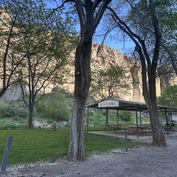
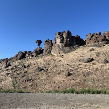
    OK, at first I thought "there is one I can miss." when I was told about the things to see around Twin Falls. I am glad I went during the spring of 2020 as there was little else to do in Twin Falls during quarantine. The drive out is rural farming roads that are as flat as can be and just when you start to think "where is this rock at?" You turn one corner and drop down into a canyon. In the canyon is not just the rock, but beauty that resembles the canyons of the Grand Canyon, a charming day use park, a stream, people fishing, and hills to ride ATV's in. The hike to the rock is steep and requires good shoe traction. It just take 15-20 minutes to climb to where you can touch the rock. Only 10 minutes to slide down. The rock is quite amazing up close up.

    BD K.

    Great place for hiking and adventure. This place is in the middle of nowhere! You will pass through small farm towns and see nothing but farmlands, but if you continue to smell cow and sheep poop, soured milk and see cornfields; you're going the right way. I enjoyed the smells and ride finding this place! Great ride to explore!

    Emily H.

    The little trailer had just been groomed prior to our visit. A good easy little hike with kids up to the rock with nice views. There are port-a-potty's in the parking area. A bit of a drive and not for those who are looking for a challenging climb but we enjoyed our visit.

    Looking up

    See all

    1 year ago

    Helpful 2
    Thanks 0
    Love this 3
    Oh no 0
    Photo of D. P.
    0
    39
    13

    10 months ago

    Helpful 0
    Thanks 0
    Love this 0
    Oh no 0
    Photo of Halle B.
    127
    195
    652

    2 years ago

    Helpful 0
    Thanks 0
    Love this 0
    Oh no 0

    6 years ago

    Helpful 6
    Thanks 0
    Love this 5
    Oh no 0
    Photo of BD K.
    1
    201
    245

    8 years ago

    Helpful 1
    Thanks 0
    Love this 0
    Oh no 0
    Photo of Emily H.
    24
    21
    13

    7 years ago

    Helpful 0
    Thanks 0
    Love this 0
    Oh no 0

    7 years ago

    Helpful 0
    Thanks 0
    Love this 0
    Oh no 0

    Ask the Community - Balanced Rock & Balanced Rock Park

    Verify this business for free

    Get access to customer & competitor insights.

    Verify this business

    Shoshone Falls Park - Caught a rainbow at the base of the larger falls!! March 2023

    Shoshone Falls Park

    4.5(214 reviews)
    28.5 mi

    - Only one way in and out of the park. -- Man, no wonder a…read morelong slow line of vehicles formed out the entrance that Sun afternoon. Think I waited 20-30min before finally entering the park. . $5/car. - Crowded parking. Had to seek the overflow parking, - The overflow parking in the picnic area is about a 2min walk to the overlook. + but at least the overflow parking is shaded; - The main parking closer to the vista isn't. - Limited restrooms. . Ah, the kayakers you see down there stay far from the falls cuz the turbulence can continuously flip the boat and the mist can make it hard to breathe and see. . Note: Early autumn, irrigation needs divert upstream Snake River, reducing Shoshone Falls to a trickle. Enjoy while you can. Nice they post a livefeed [ https://www.tfid.org/309/Shoshone-Falls ] to let you know beforehand today's volumetric flow. Given this con:pro ratio, Shoshone Falls is a tourist trap. Just go see Niagara Falls lol

    Niagra of the West!…read more The 212ft waterfall is a jewel destination for the state of Idaho. Spectacular viewpoints, paved pathways for hiking and bicycling. Picnic tables with views. Boat ramp available. *If you have the time, hike the pathway for a few miles to the famous launch site of Evil Knievil's attempt to jump across the Snake River!

    Photos
    Shoshone Falls Park - Info signs around the park! Very interesting history!

    Info signs around the park! Very interesting history!

    Shoshone Falls Park - The staircase leading down towards the observation point at Shoshone Falls.

    The staircase leading down towards the observation point at Shoshone Falls.

    Shoshone Falls Park - My son and his adorable gf at the falls - March 2023

    See all

    My son and his adorable gf at the falls - March 2023

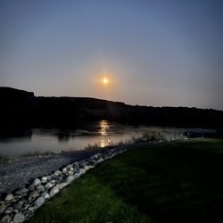
    Ritter Island State Park - Moon

    Ritter Island State Park

    4.8(6 reviews)
    14.6 mi

    I am really confused. How is this possible??? I thought Idaho was known as..."the potato state"…read more But I am wrong. I admit it and I take responsibility. Idaho is really known for its WATERFALLS!!! Yes, waterfalls! I am from Florida and now I know going forward, if you're interested in exploring around some of the USA's most beautiful waterfalls...then come visit Idaho! And so with that dramatic introduction, lol...I'd like to present, well...it's not really Ritter Island State Park...it's more like...LEMMON FALLS located inside Ritter Island. Lemmon Falls is absolutely jaw dropping fantastic! It was the highlight of my visit here. I don't know the height of Lemmon Falls and I tried searching for it online and couldn't find the exact number. But, regardless...it splashes down the cliffside in front of your eyes. You don't have to work hard to be rewarded. Let me explain... You can plug Lemmon Falls into Google Maps and be guided into the park just fine. Once you find a parking spot, you'll notice Lemmon Falls as the focal point of the surrounding backdrop off to the left hand side of the main entrance. Simply walk over to the falls. It's a 5 - 10 minute stroll. From the pathway, you have access to Lemmon Falls and opportunities for magical picture moments. Some visitors climbed on the rocks for closer perspectives, but I didn't find that necessary. From the pedestrian path, photos were very impressive. Lemmon Falls, alongside Perrine Coulee Falls and Fall Creek Falls have been some of my favorite waterfalls exploring around Southern Idaho. Now...there's more to see and do here at Ritter Island SP... One thing, I know this may sound confusing...Ritter Island is really a subsection unit of Thousand Springs State Park. Regardless of this info, there's another waterfall here on Ritter Island I'd like to mention, and that's...Minnie Miller Springs. To gain access to Minnie Miller Springs waterfall, you cross a footbridge to arrive at an overlook viewpoint. This footbridge isn't always open. Specific hours are...Memorial Day through Labor Day, Thursday - Monday 10am - 3pm. Closed Tuesdays and Wednesdays. There's a bridge volunteer attendant who is there to answer questions. The pathway is easy to Minnie Miller Springs. It's only half a mile. Along the way you'll pass by old fashioned Guernsey Barn which you can walk inside if interested. It's like taking a stroll down memory lane of what life was like back in the day here at Ritter Island. Next, make sure to veer to the right beside the Snake River when leaving the barn area. You'll pass underneath some trees offering shade from the summer sun. Then you'll approach a picnic table and this the lookout point, and in my opinion, the best glance at viewing Minnie Miller Springs. Minnie Miller Springs is a cascading waterfall hung in the background like an art painting. The setting is quaint and charming and if you visit in the afternoon time, the sun will be at your back which creates scenic photo opps. Only problem is the waterfall is located far in the distance. It's not accessible like Lemmon Falls. So basically, you can grab a few pictures of the lush surroundings before returning back towards the footbridge. If you decide you're enjoying the walking path, you can complete the 1.8 mile roundtrip loop around the farm. If not, it's half a mile back to where you started. While here on Ritter Island, people had their canoes, kayaks and paddle boards enjoying the waters. Folks barbecued under trees while lounging around. It was extremely crowded on a Sunday during early August. Granted, it was 105 degrees outside. For me, I had to go swimming and cool off. I just found a little spot beside the banks of the river and hopped in. Surprisingly, Snake River waters were frigid. I couldn't believe how hot it was and you'd assume that'd translate into relaxing swimming conditions, yet that wasn't the case. I think I had a brain freeze from the chilly waters. Still, you adjust to the cold and eventually it's refreshing hanging out in the river on a lazy Sunday. Last extra notes... - It's a $7 fee for day use. You can fill out a slip with payment and drop it into a lockbox. They accept checks. - Ritter Island is located in Wendell, Idaho which is a small town. But, it's 35 miles northwest of Twin Falls, ID, a great city to explore. - I'd suggest arriving sooner than later as there's only so many parking spaces during prime summer visitation season. Overall, coming here to Ritter Island and getting to experience Lemmon Falls was breathtaking. Imo, it's the standout highlight. Minnie Miller Springs is decent and a quiet hike to arrive at. And lastly, taking time to lounge on the grass and have access to the Snake River to cool off on hot summer days is why families make frequent visits. Btw, for those waterfall enthusiasts out there, check out Box Canyon Springs next, 5.5 miles away.

    Cool state park. I liked the hike/ path to the waterfalls. Very beautiful and full of wildlife …read more The recreation area was nice for families with picnic tables and grassy areas to have a picnic and play in or fish the river. I was disappointed that many people enjoying the nature didn't pick up their trash . There is a dumpster to dispose of waste when leaving.

    Photos
    Ritter Island State Park - Minnie Miller Springs was a little too far away to really connect with, imo.

    Minnie Miller Springs was a little too far away to really connect with, imo.

    Ritter Island State Park - Lemmon Falls is the standout attraction of Ritter Island State Park.

    Lemmon Falls is the standout attraction of Ritter Island State Park.

    Ritter Island State Park - Very cold water but very beautiful!

    See all

    Very cold water but very beautiful!

    Malad Gorge State Park - The trailhead sign for Devil's Washbowl lookout point.

    Malad Gorge State Park

    4.3(11 reviews)
    22.6 mi

    Wow! Amazing views and depths will be seen here! Colorful shades of blue in the water . Crazy…read moresteep drops, so be careful where you view. No risky selfies please.

    Malad Gorge State Park is located in Hagerman, Idaho and is one of several units of the Thousand…read moreSprings State Park area. Other nearby sections include...Niagara Springs, Box Canyon Springs and Ritter Island. For visiting Malad Gorge, yes...you do have pleasant surroundings from high above. But the frequently talked about highlight for coming here is getting to see Devil's Washbowl. Devil's Washbowl is a 150 foot waterfall splashing down into the Snake River that cuts between the canyon gorge. All you have to do is walk a short pathway from the parking lot (1/4 of a mile) to an overlook vista point to catch the best glimpses of Devil's Washbowl. ***But, here was my problem...Devil's Washbowl was so far off into the distance, it's virtually impossible to get a quality photo of (if you're using your phone and not a professional camera). That was disappointing. If you simply view Devil's Washbowl with your own eyes, it can be nice. It can be dramatic. But I was expecting to be standing a lot closer to the waterfall and this distant lookout point was a letdown because I had high expectations after getting to see other colorful waterfalls around Thousand Springs. It takes 2 minutes to watch Devil's Washbowl from the observation point. If you'd like, you can continue along the 2.5 mile walking pathway from high above the gorge, but there's not much to see. Extras to mention... - When walking over to Devil's Washbowl vista point, you cross over a footbridge beside I-84. Although it is noisy outside from the passing cars on the highway, the views looking down through the gorge were picturesque. Plus, Devil's Washbowl is actually located right underneath this footbridge. So...if you're not afraid of heights and don't mind leaning over the bridge, you can get a closer view of the falls standing on top of them. But, during my research, I read it was still difficult taking pictures from atop the footbridge. I didn't attempt this because if I ever somehow dropped my phone, I'd have problems, lol. - It's $7 day use entry for visiting Malad Gorge SP. But, this $7 is good at the other units as well like Box Canyon, Ritter Island and Niagara Springs...the parks that I stopped at for the day. - Devil's Washbowl is located off to the right hand side when you enter Malad Gorge SP. There's a roughly 5 mile scenic loop road you can drive around the park. It offers different viewpoints of the gorge, but nothing will get you closer to Devil's Washbowl than the primary lookout point beside the footbridge. Off to the left hand side when entering is a large picnic pavilion with plenty of grass. In the end, Malad Gorge State Park is a quick visit. I know I've said this before in many prior reviews where I don't have the most fulfilling experiences, I'd just relay to others to maybe temper expectations when seeing Devil's Washbowl. It's not so special and I found better opportunities at nearby waterfalls...Lemmon Falls, Minnie Miller Springs and Box Canyon Springs.

    Photos
    Malad Gorge State Park - Entrance sign for Malad Gorge State Park

    Entrance sign for Malad Gorge State Park

    Malad Gorge State Park - Bridge directly above Devil's Washbowl waterfall.

    Bridge directly above Devil's Washbowl waterfall.

    Malad Gorge State Park - Walking over to Devil's Washbowl viewpoint

    See all

    Walking over to Devil's Washbowl viewpoint

    Bruneau Dunes State Park - Observatory area

    Bruneau Dunes State Park

    4.6(33 reviews)
    45.9 mi

    Food: NA/5 Service: NA/5…read moreAmbiance: 5/5 Parking: 4/5 Family friendly: 5/5 Stroller friendly: 3/5 ADA accessible: 3/5 My family and I came here strictly for the sand dunes and observatory, late on a Sunday evening around 845-9pm. (Apparently the observatory is closed on Sunday?). Entrance fee is $7 cash or check when the gate is closed. You have to be in some type of shape as ascending the 60 deg incline hill of sand takes a bit of muscle and cardio endurance to make it up. Once at the top though, it's a serene and calming experience. On the backside of the first sand dune, the Snake River runs through. Similar to an Oasis in the desert. However, as some people may know or experience, wherever there is water, comes the bugs. As the sun dipped below the horizon, the bugs (mosquitoes) attacked. Not just one or two, swarms of mosquitoes. If you're like me and have allergic itching reactions to pest bites, be warned and have full body covering along with repellent. By the time we escaped to the car my son had been bit on the head and face. Just a forewarning. Bruneau Dunes State Park seems like a cool place to be. There were 3-4 individual camping locations that's were RV friendly and vast spaces for kids to run around. Sand Dunes themselves are not WC friendly unless you invent some type of sled to push/pull the WC up the hill. Also, make sure when dusk arrives, COVER UP!

    I'm always on the hunt for an adventure so when I saw this was only 30 mins from my hotel, I knew I…read morehad to make a morning out of it! The entry fee was $7 and the drive to the dunes was quiet and peaceful. I went by myself and felt safe enough exploring the area alone. The views were gorgeous! This is truly a hidden gem tucked away in the farm lands. If you're in the mountain home area, check this place out!

    Photos
    Bruneau Dunes State Park
    Bruneau Dunes State Park
    Bruneau Dunes State Park

    See all

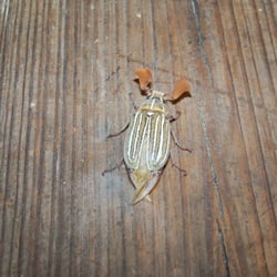
    City of Rocks National Reserve - Freaky beetle, possibly a 10-lined June Beetle.  Seemed harmless, other than being a little too friendly!

    City of Rocks National Reserve

    4.8(14 reviews)
    74.7 mi

    Highly recommend going here. It's a bit off the beaten path but well worth the drive. The…read moreformations are amazing. It's like a whole natural rock city in the middle of nowhere. We lived in Idaho for three years and thus was probably my favorite place. We aren't climbers but we walked, drove and picnicked. Perfect place for kids to expend some energy. We went two times and it was never jam packed or crowded. Beautiful place.

    Eleven Yelp reviews and not a single one from an Idahoan. Until now…read more I'm not sure why this magnificent spot, along the Applegate Trail between Fort Hall and Southern Oregon, doesn't get more attention. It's certainly known by Idaho residents and by rock climbers; I guess they just aren't huge Yelp users. Oregon pioneer brothers Jesse and Lindsay Applegate, who each lost a son to drowning in the Columbia River when coming out on the Oregon Trail in 1843, set out to find a safer route. They came up with what was originally known as the Southern Route before a critic who made the first trip derisively called it the Applegate Trail, which stuck. The route from Fort Hall was also part of the California Trail. The City of Rocks was long a gathering place for the Shoshone tribe, whose members came to collect pine nuts. They also hunted rock chucks and game animals and dug root vegetables. The rocks are stunning. Walking along some of the trails gives a different view everywhere you turn. And the changing light provides a change in how the rocks look. Campsites, both for campers and for tents, are spread out. There's no electricity or running water at the sites, but potable water can be gathered at stations and vault toilets are available in several parts of the park. If you plan to travel from Boise or other locations west of City of Rocks, take Interstate 84 to the Declo exit and head south on Highway 77. We took the Burley exit and went through Oakley. The dirt road outside Oakley took nearly an hour. It was much quicker leaving through the eastern side of the park and Highway 77.

    Photos
    City of Rocks National Reserve - Trees growing on a stand of rocks.

    Trees growing on a stand of rocks.

    City of Rocks National Reserve - Our campsite

    Our campsite

    City of Rocks National Reserve

    See all

    Balanced Rock & Balanced Rock Park - hiking - Updated August 2026

    Loading...
    Loading...
    Loading...