Cancel

    Open app

    Search

    Ballinger Canyon Ohv

    5.0 (1 review)

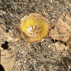
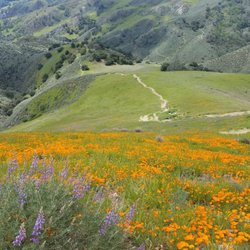
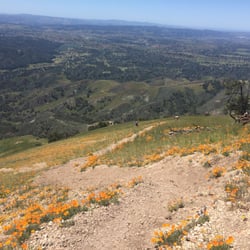
    Ballinger Canyon Ohv Photos

    You might also consider

    Recommended Reviews - Ballinger Canyon Ohv

    Your trust is our priority, so businesses can't pay to alter or remove their reviews. Learn more about reviews.
    Yelp app icon
    Browse more easily on the app
    Review Feed Illustration

    10 months ago

    Helpful 0
    Thanks 0
    Love this 0
    Oh no 0

    Verify this business for free

    Get access to customer & competitor insights.

    Verify this business

    The Wildlands Conservancy's Wind Wolves Preserve - Movie night. Disney Cars. Yay!

    The Wildlands Conservancy's Wind Wolves Preserve

    4.8(81 reviews)
    16.6 mi

    I've been to Windwolves several times for a hike over the past few years. We recently visited Wind…read moreWolves Preserve and had such a wonderful experience! My husband and I went for a hike, and it ended up being the perfect day to be outdoors. The trails were clean, well-maintained, and easy to follow, which made the hike really enjoyable. The weather was absolutely beautiful with clear skies and just the right temperature making it ideal for taking in the scenery and spending quality time together. It's such a peaceful spot to disconnect and enjoy nature. We'll definitely be back for another hike!

    This is a beautiful land reserve that is huge! I didn't realize how big it is until we went on a…read moreguided hike yesterday with a ranger. There are so many trails and cool things to see. I have been here twice now, once when it was sunny and beautiful. Yesterday it was foggy and we couldn't really see much, but it was still beautiful and a cool hike. We hiked the Los Osos Trail, we signed up on their website so we got to ride to the trailhead in the rangers car. Which saves time and energy. To get to Los osos trail is a hike itself. The rangers were super knowledgeable and made it a fun experience! I would definitely sign up for a guided hike with them and check this park out! Camping is also free here the informed us and parking is also free! Entry to the park is also free! You can also volunteer or become a docent here

    Photos
    The Wildlands Conservancy's Wind Wolves Preserve - San Emigdio Campground

    San Emigdio Campground

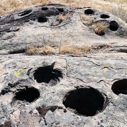
    The Wildlands Conservancy's Wind Wolves Preserve - Native American mortar grinding holes in some bedrock!

    Native American mortar grinding holes in some bedrock!

    The Wildlands Conservancy's Wind Wolves Preserve - Beautiful mural in administration building

    See all

    Beautiful mural in administration building

    Willett Hot Springs - One of the cabins

    Willett Hot Springs

    3.9(8 reviews)
    32.2 mi

    Came here on dry New Year's eve 2 years ago. Wasn't Sespe hot springs, but still a nice experience…read moreon the way to them; nice half way point too.

    So a friend emailed me last week saying he was planning an overnight backpacking trip in the Sespe…read moreWilderness to Willett Hot Springs and asked if I wanted to join on the trek. Heck yes! I had a week to research and read up about the area, and I was poking around online I felt there was no detailed directions of the trail to the hot springs, just a few nondescript write ups and summaries here and there. So this review, I hope will help others find the hot spring easier since we got lost for over an hour in rain.... Backpacked 11/2/15-11/3/15 Miles: 20 miles out and back Time took: 30 hours (we overnighted it) elevation gain: less than 400 ft Adventure Pass needed Water: there were 2-3 spots to filter water Directions: on Google maps, type in Piedra Blanca Trailhead. Piedra Blanca Trailhead and Sespe River Trail start at the same parking lot, so it pulls up and you can use the app when you loose cell service. We came from LA, so we ended up taking the 33N to Rose Valley Rd, this area is considered Ventura County Trailhead: Adventure pass is needed to park here. There are pit toilets, when I went they also had toilet paper and weren't too dirty. There's some informational sign around here talking about the local animals you can find, a trail map, and some shaded picnic benches where you can have a nice picnic. The hike: we started at 9:45 AM Monday morning, the first 2-3 miles in the trail was dry with no sight on water. Do not be discouraged, right around 2-3 miles, we didn't spot it right away, but when we hiked further up, we spotted a pool of water off the trail. So if it had been necessary, we would have gone off trail to that water source. But at 3 miles in, I heard running water. We hiked off trail and found the source and actually filtered at this spot. It's a nondescript spot, you just have to keep alert of the sound of running water. Going to this spot was unnecessary though, if you know the trail well, you know that Bear Canyon Campground is right around the corner at 3.5 miles in and there is a spring fed pond here with moving water that is easier to filter at. We talked to a guy here and he said there seems to always be water here and it's a good swimming hole. The trail is decently well beaten and well marked. About 8 miles in you will come upon a big metal trail sign. It's faded and kind of hard to read, but points you in the direction of Ladybug Campground and Hines Peak. Scratched into the sign it says Willett and tell you to stay on the trail you are at. Shortly after that sign, keep a look out for the trail sign on the right. We actually got lost here and walked past it. If you walked past it and come to a camp spot with a fire circle and shovel, you've come too far. We scrambled in the river wash for a while here having lost the trail. Back track and find that small trail sign, it makes you cross the river wash here. Once you cross the river wash, the trail keeps going. look for a fork in the trail and go left. It's a pretty small fork, we put up cairns here the other day, but it is easy to miss. We got lost here too and had to keep backtracking. You cross a swampy area right here. Right when you cross and get to the other side, you will shortly come across the house/shack/a fenced area. Woohoo! You are almost there! Go past that house. With the house behind you, you will see a stone stack/chimney, take the trail above and to the right of it. From there, it's an upward climb, but you're only a few hundred yards away from the Willett Hot Spring tub. You will first come across a small camp spot here. There was a fire ring here the other day. Go past that, and into the foresty area and go up. There you will find the tub, wedged into the crevice of the mountain. Tips: bring a water filter. Depending on time of year, be prepared for rain. Bring sandals if you don't want to go barefoot in the tub, and a towel to dry off. Don't give up. We soaked in the hot spring for a good hour Tuesday morning and had the place all to ourselves. Temp we would guess was around 108 degrees. There are scrubs left there to scrub some of the sliminess. I didn't care, I got right in. Good luck!
    Photos
    Willett Hot Springs - Beginning of the trail from trailhead

    Beginning of the trail from trailhead

    Willett Hot Springs
    Willett Hot Springs - A view of Sespe Creek from the trail to Willett Hot Springs

    See all

    A view of Sespe Creek from the trail to Willett Hot Springs

    Mount Pinos

    Mount Pinos

    4.3(43 reviews)
    25.1 mi

    I turned on Google navigation, but it led me to a completely wrong mountain road. I wandered around…read morein the mountains for about 20 minutes before finally getting out, so I just came back home. If you plan to go, make sure to double-check the route at least once before heading out.

    A friend and I came here to hike on a recent visit to Pine Mountain Club. We didn't camp, so this…read morereview is for hiking only. We took the Tumamait trail to the weather station at the Mount Pinos summit and picnicked at the top by the Iwhihinmu plaque. After returning to the first fork in the trail, we then hiked to the meadow and back. Altogether, this was a full day of beautiful hiking. The crisp mountain air, pine trees, high elevation buckwheat and lichen meadows, and views were all fantastic. As other reviewers have said, the hikes aren't intensely strenuous, but they can be long if you want them to be. Both Tumamait and the meadow paths are partially shaded with sunny patches. Going to the meadow, most of the hike is a small downhill slope, so keep in mind it will be mildly strenuous coming back up. For hiking, my friend and I did not have a parking pass nor could we find a place to buy one at the Nordic Station parking lot (the drive up the mountain to the lot is lovely, by the way!) We were slightly concerned, but nothing happened. No ticket, no ranger presence. Our visit was in late April, 2022. Spending time in this powerful Chumash site was wonderful. We stayed on the mountain peak for at least an hour feeling the wind whip our faces, enjoying our picnic and the views, looking at the trees and plants and snow, and enjoying being at the "top of the world." There weren't many people around, and we said hello to everyone we passed. It felt convivial and isolated at the same time. A pretty cool combination.

    Photos
    Mount Pinos
    Mount Pinos
    Mount Pinos

    See all

    Los Padres National Forest - Nordic Base 8.8k ft elevation

    Los Padres National Forest

    4.9(17 reviews)
    28.7 mi

    How have I never been here before…read more... Sunday with no plans on the book. Let's take a drive to Frazier Park and go hiking. Same with that, never been to this little town as well. It's literally off the 5 freeway a couple miles in and you at the town. It was about half hour or 45 minutes drive up the mountain from the freeway till where the mountain start. There's different sections that you could go to if you wanted to hike or camp. We didn't really know where and what trails there was. Just ended up at of the campsite parking lot and went from there. There's loads of trails to choose from. Theres sign at the base that'll tell you the levels of hike and the distance. Also, the path was pretty wide on the one we were at which was nice. Right when you get out of the car, you could already smell the difference in air quality. Mountain air, being in nature with all the beautiful trees and noise of the birds. This place was beautiful. The path was nice to walk, slightly uphill and not hard. We passed loads of people but it still felt very quiet as you're in the woods. There's still loads of wildflowers growing. Temperature wise, it was perfect as your at a higher elevation and there was also nice breeze. Just walking and seeing all the beautiful trees, some covered in moss. The chipmunks running past you along the paths, it's a completely different experience from the hustle and bustle of the city. The views were amazing. When you get to the lookout point where the tower is, there was two tins/cans along the rocks that you could leave a message. Notebook and pen was provided for signing. This particular trail wasn't hard even though it said it was but very manageable. About 2 miles each way. But the views along and at the top of the lookout was spectacular. It's amazing that an hour or so from the city, there's so many hidden gems. Nature is beautiful if you haven't noticed. And another place for hiking on our lists.

    Overlooked forest since Angeles Forest is nearby. We love Los Padres National Forest. The little…read moretown of Frazier Park is the last town before going up to Los Padres. We love the quietness and solitude you find here. The trees and winds make this beautiful sound. I honestly think this place is sacred. We have camped at McGill Campground and have hiked up to Mt. Pinos. Only about an hour drive from Los Angeles/Santa Clarita. The forest does get snow fall and I think we just had the first big dump of snowfall last night.

    Photos
    Los Padres National Forest
    Los Padres National Forest
    Los Padres National Forest

    See all

    Enchanted Forest Trailhead - Fireplace

    Enchanted Forest Trailhead

    4.7(3 reviews)
    16.4 mi

    The Enchanted Forest Trail is one of the closest trailheads to the center of Pine Mountain Club,…read moreand one that was marked on both Google Maps and on the map of hiking trails provided by the Pine Mountain Inn (5*). With such an inviting name, my friend and I wanted to be sure to check it out. Arriving in Pine Mountain Club on a Friday afternoon in April, we decided to save a longer trail for Saturday and visit the Enchanted Forest Trail with about 1.5 hours remaining before sundown. The trailhead is very simple to find. From there, the trail was not difficult to follow until it brought us to a rocky dry watercourse on the mountain. We had read that the track might get lost, but most of the reviews on AllTrails saying that were from winter. We had followed the path pretty easily until the watercourse, but at that point we lost it. We considered scrambling up the rocky gorge but that seemed wrong. At that moment, we heard voices echoing in the canyon, and that directed my attention over across the watercourse into the underbrush. We realized we could cross the gulch and find the trail on the other side. Locating the path, we soon passed the people coming down from the trail's end. We asked how it was, and they said "it gets steep and rocky." It had already been like that, so we wondered how much steeper and more rocky it might be. After going on for another 5-7 minutes, we arrived at an area on the path that felt like it was vibrating with energy. Neither of us is particularly spiritual but this place, where a large redwood had fallen with a tremendous, splintered split across its trunk and where someone had placed a stone cairn, felt inexplicably mysterious. (See my pic. The place where the trunk splits is taller than the height of a person.) The sun had just dipped behind the ridgeline, and we decided this would be where we would stop. It's an out-and-back trail, so why not make this our back point? On the way down the trail, I started to get tinnitus in my right ear. This isn't something that has happened to me in recent memory. Maybe because the area is so quiet, I could hear a ringing in my ears. But then, out of nowhere, a tree started dropping its leaves on the path to our left. No wind blew, nothing discernible changed. Leaves just started dropping. We thanked the forest for hosting us, and made our way down the path--without urgency, but expeditiously. Whatever's enchanting this forest was probably having a good time. We did too. Just be ready for a hint of the chills as you hike along.

    I like this trail, it lives up to its name and is very much like walking through a movie forest…read more Trees split in half, old rock slides, echo-y mountains give this trail such a good and on edge vibe. Unfortunately we had to head back early because the ground was too frozen to walk on without some sort of special ice gear.

    Photos
    Enchanted Forest Trailhead - Giant tree knocked over

    Giant tree knocked over

    Enchanted Forest Trailhead - Trail

    Trail

    Enchanted Forest Trailhead - Mountainside

    See all

    Mountainside

    Ballinger Canyon Ohv - hiking - Updated September 2026

    Loading...
    Loading...
    Loading...