Black Elk Peak Photos


You might also consider
More like Black Elk Peak
Recommended Reviews - Black Elk Peak
Start your review...

Reviews With Photos

This is the highest point in South Dakota and highest point east of the Rockies in the United States. We took the 4.5 hour hike round trip up to Black Elk Peak. This was formerly named Harney Peak. It was renamed due to political correctness. You may still see reference to Harney, so just know it is the same place. We took the long loop that was trails 4 and back on 9. Amazing hike, but it gets steep and challenging. I did see some older people and kids at the top, but know your limits before attempting this. Bring water and snacks. There is a lookout/fire tower at the top. View is the best in all of South Dakota. You will be tired and sore after hiking this. We started in the trail at 7:30 am to avoid the heat and crowds. The parking lot fills up and it can be hard to park due to the lake and popularity. I would give this ten stars if

Amazing hike. Can't recommend it enough. I would do it again and again if my life allowed for it. Seriously can't wait to go back and do it again. I want to take everyone I love so that they can experience it too.... Absolutely worth it when you get to the tower too. Loved it. Breathtaking.

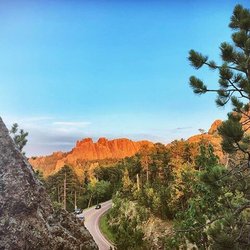
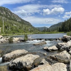
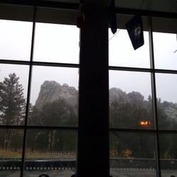
We went hiking here during our stay in Custer state park and it was truly one if the best hikes I've been on. We started at the Sylvan campground trailhead, although there are other trailheads that converge I believe. It's 3.5 mile hike one way and the beginning part is relatively easy and the end moderate. Overall, I find it to be a very doable hike for multiple levels. It may take some longer than others, but certainly doable. I think it took us a few hours total and that's with a good 1/2 at the top. The first part of the hike has beautiful forest scenery with plants and trees and fun mushrooms and flowers. There are some amazing views on the way that you'll have to stop for. The second part is more mountainous, rock formations and less trees. As you approach the lookout you go in through a rock tunnel. The lookout itself is magnificent! Built out of rock and wood, you can go all the way to the top of the lookout for one unbelievable view. The bottom of the lookout is neat too with a couple of empty rooms no longer in use. You can take a path from here behind the lookout to the pump house where there is a peaceful water reservoir that is protected from wind. All in all, unbelievable hike! Don't miss it if you're in Custer area.

I hiked/climbed Mt. Harney on the morning of September 13, 2013. My journey began at Sylvan Lake around 9:30am. The hike to the summit from here is roughly 4 miles, so with side jaunts aside it's about an 8 mile round trip hike. The morning air was a cool 54 degree's so I wore layers and breakaway's for adjustments. Just a mile into my climb the top layer came off as my heat buildup started. It didn't take long to get up to a level where I had a nice overlook, but overcast conditions limited that going forward. Visibility diminished the higher I climbed due to the fog and sporadic drizzle. I continued the marked path which is very easy to follow and well traveled. On my way up I recorded and photographed several segments. Passed about 30 people up to the summit, the majority of which were going the same way. About half way to the summit a peak called 'Little Devils Tower' sits off to the right of the path. It's aptly named for its similarity to the real tower in WY. As I ascended higher the temps were dropping a tad, but I was sweating too much to consider layers. The biggest difference was the final ascent, which is maybe a half mile. Temps dropped dramatically over the last half mile to the top, and a misty rain and constant fog enveloped the area. When I arrived at the building atop Harney the temps plummeted. A fellow hiker with a thermometer said it was 36 degree's and it felt like it! I spent a few minutes at the top looking at the building and shooting a short video. Since there was absolutely no visibility and I was starting to freeze, I started my way back. My hike back was nice and relaxing until about the final mile or so, when the mist-rain turned to a subtle drip, then a full rain. By the time I got back down to the Sylvan Lake I was drenched. It took me about an hour and forty five minutes to climb up and about an hour and fifteen minutes to climb down. It was unfortunate to have inclement weather but that didn't divert from the accomplishment that I set out for, and that was to climb to the top of Mt. Harney.

The views at the top of Black Elk Peak are so beautiful! The trail leading up to the peak is a steady incline with one short stretch where it goes downhill. Due to the incline, I recommend wearing a water pack to make sure you stay hydrated. It's the highest point in South Dakota and you will want to spend some time at the top taking in the views! There are also plenty of photo opportunities along the way. Make sure to wear good hiking shoes and enjoy soaking in the views! read more


1 year ago
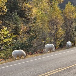
We're all doing our part to abide by social distancing, while trying to keep ourselves sane and healthy. Hiking the Black Elk Wilderness for 11hrs seemed like a good way to pull off "all of the above" & it was! First: Expect to spend +4hrs hiking just to the summit and back. Additional time for side trails & photography, if applicable. As a diehard shutterbug, it took me almost 5hrs to get to the top. It isn't a race, take in your surroundings. Pack accordingly. It may be warm at the bottom & you end up in snow falling at the top, not too mention the "breeze" whipping. Layers work best & I found myself changing in and out of them. WATER- bring plenty of water, as well as food & sanitary items needed. The only toilets are at the start/end so be prepared to rough it a bit. PACK IT IN, PACK IT OUT. You will hit a Wilderness registration area and are required to register at that point, in order to continue. I would say it's a moderate trail. Along the way you can expect to encounter some wildlife- we had several deer encounters, nesting birds, chipmunks, squirrels, frogs and whatever else we didn't see! There are some magnificent views of the hills, rock formations & interesting vegetarian - fresh air & friendly faces. Easily among my favorites. read more


 - highest summit East of the Rockies - Hiking Near Me - Hill City, South Dakota")

This is the highest point in South Dakota and highest point east of the Rockies in the United States. We took the 4.5 hour hike round trip up to Black Elk Peak. This was formerly named Harney Peak. It was renamed due to political correctness. You may still see reference to Harney, so just know it is the same place. We took the long loop that was trails 4 and back on 9. Amazing hike, but it gets steep and challenging. I did see some older people and kids at the top, but know your limits before attempting this. Bring water and snacks. There is a lookout/fire tower at the top. View is the best in all of South Dakota. You will be tired and sore after hiking this. We started in the trail at 7:30 am to avoid the heat and crowds. The parking lot fills up and it can be hard to park due to the lake and popularity. I would give this ten stars if read more

4 years ago
Amazing hike. Can't recommend it enough. I would do it again and again if my life allowed for it. Seriously can't wait to go back and do it again. I want to take everyone I love so that they can experience it too.... Absolutely worth it when you get to the tower too. Loved it. Breathtaking. read more


12 years ago
We went hiking here during our stay in Custer state park and it was truly one if the best hikes I've been on. We started at the Sylvan campground trailhead, although there are other trailheads that converge I believe. It's 3.5 mile hike one way and the beginning part is relatively easy and the end moderate. Overall, I find it to be a very doable hike for multiple levels. It may take some longer than others, but certainly doable. I think it took us a few hours total and that's with a good 1/2 at the top. The first part of the hike has beautiful forest scenery with plants and trees and fun mushrooms and flowers. There are some amazing views on the way that you'll have to stop for. The second part is more mountainous, rock formations and less trees. As you approach the lookout you go in through a rock tunnel. The lookout itself is magnificent! Built out of rock and wood, you can go all the way to the top of the lookout for one unbelievable view. The bottom of the lookout is neat too with a couple of empty rooms no longer in use. You can take a path from here behind the lookout to the pump house where there is a peaceful water reservoir that is protected from wind. All in all, unbelievable hike! Don't miss it if you're in Custer area. read more


I hiked/climbed Mt. Harney on the morning of September 13, 2013. My journey began at Sylvan Lake around 9:30am. The hike to the summit from here is roughly 4 miles, so with side jaunts aside it's about an 8 mile round trip hike. The morning air was a cool 54 degree's so I wore layers and breakaway's for adjustments. Just a mile into my climb the top layer came off as my heat buildup started. It didn't take long to get up to a level where I had a nice overlook, but overcast conditions limited that going forward. Visibility diminished the higher I climbed due to the fog and sporadic drizzle. I continued the marked path which is very easy to follow and well traveled. On my way up I recorded and photographed several segments. Passed about 30 people up to the summit, the majority of which were going the same way. About half way to the summit a peak called 'Little Devils Tower' sits off to the right of the path. It's aptly named for its similarity to the real tower in WY. As I ascended higher the temps were dropping a tad, but I was sweating too much to consider layers. The biggest difference was the final ascent, which is maybe a half mile. Temps dropped dramatically over the last half mile to the top, and a misty rain and constant fog enveloped the area. When I arrived at the building atop Harney the temps plummeted. A fellow hiker with a thermometer said it was 36 degree's and it felt like it! I spent a few minutes at the top looking at the building and shooting a short video. Since there was absolutely no visibility and I was starting to freeze, I started my way back. My hike back was nice and relaxing until about the final mile or so, when the mist-rain turned to a subtle drip, then a full rain. By the time I got back down to the Sylvan Lake I was drenched. It took me about an hour and forty five minutes to climb up and about an hour and fifteen minutes to climb down. It was unfortunate to have inclement weather but that didn't divert from the accomplishment that I set out for, and that was to climb to the top of Mt. Harney. read more


8 years ago
8 years ago
This hike is absolutely breathtaking, and you don't need to be a big hiker to do it either. It's a relatively moderate hike and it is well worth it! It was the best hike I have ever taken! read more

More info about Black Elk Peak
Ask the Community - Black Elk Peak


Why does Yelp recommend reviews?
1 review that is not currently recommended
The reviews below are not factored into the business's overall star rating.
5 years ago
Black Elk Peak - hiking - Updated June 2026
Best of Hill City
People found Black Elk Peak by searching for…
Lakes in Hill City, South Dakota
Things to Do in Hill City, South Dakota
Parks in Hill City, South Dakota
Hiking Trails in Hill City, South Dakota
Sunset View in Hill City, South Dakota
Parks for Kids in Hill City, South Dakota
Attractions in Hill City, South Dakota
Hikes With Waterfalls in Hill City, South Dakota
Swimming Lakes in Hill City, South Dakota
Waterfalls in Hill City, South Dakota
Running Trails in Hill City, South Dakota
Sunrise View in Hill City, South Dakota
Walking Trails in Hill City, South Dakota
Picnic Areas in Hill City, South Dakota
Easy Hikes in Hill City, South Dakota
Scenic Views in Hill City, South Dakota
State Parks Camping in Hill City, South Dakota
Scenic Overlook in Hill City, South Dakota
Dog Friendly Trails in Hill City, South Dakota
Hikes With Dogs in Hill City, South Dakota
Hiking With Kids in Hill City, South Dakota
Lookout Points in Hill City, South Dakota
Trending Searches in Hill City, SD
Dog Friendly Trails near Black Elk Peak
Fishing Spots near Black Elk Peak
Free Kids Activities near Black Elk Peak
Public Shower near Black Elk Peak
Scenic Night View near Black Elk Peak
Scenic Overlook near Black Elk Peak
Swimming Holes near Black Elk Peak
Swimming Lakes near Black Elk Peak
Browse Articles
Browse Nearby
Browse Brands
Related Searches in Hill City, SD
Best Fishing Locations and Guides in Hill City, South Dakota
Best Lookout Points to Visit in Hill City, South Dakota
Best Nature Trails for Hiking in Hill City, South Dakota
Best Places for Horseback Riding in Hill City, South Dakota
Check Out Off Road Trails in Hill City, South Dakota
Discover Dog Friendly Trails to Explore in Hill City, South Dakota
Discover Exciting Adventure Options in Hill City, South Dakota
Discover Fun Activities to Do in Hill City, South Dakota
Discover Fun Kid Activities to Enjoy in Hill City, South Dakota
Discover Fun Recreation Activities in Hill City, South Dakota
Discover Kids Play Area Spots in Hill City, South Dakota
Discover Popular Bike Trails in Hill City, South Dakota
Discover Popular Photo Spots in Hill City, South Dakota
Discover Top Nature Parks to Visit in Hill City, South Dakota
Discover Top Yoga Options and Studios in Hill City, South Dakota
Discover a Hiking Trail in Hill City, South Dakota
Discover the Best Night Hike Trails in Hill City, South Dakota
Discover the Best Running Track in Hill City, South Dakota
Dog-Friendly Hikes With Dogs in Hill City, South Dakota
Enjoy Camping Adventures Around Hill City, South Dakota
Enjoy Exciting Mountain Biking Adventures in Hill City, South Dakota
Enjoy Hiking Adventures in Hill City, South Dakota
Enjoy Scenic Night View Experiences in Hill City, South Dakota
Enjoy Tent Camping Spots Around Hill City, South Dakota
Enjoy the Best Tubing Experiences in Hill City, South Dakota
Enjoy the Best Walking Trails in Hill City, South Dakota
Explore Beautiful Parks and Green Spaces in Hill City, South Dakota
Explore Bike Rentals Throughout Hill City, South Dakota
Explore Free Kids Activities Near Hill City, South Dakota
Explore Free Things to Do Around Hill City, South Dakota
Explore Fun Activities to Do in Hill City, South Dakota
Explore Martial Arts Options in Hill City, South Dakota
Explore Popular Campgrounds Near Hill City, South Dakota
Explore Popular RV Parks Around Hill City, South Dakota
Explore Popular Scenic Overlook Points in Hill City, South Dakota
Explore Popular Scenic Views Near Hill City, South Dakota
Explore Scenic Lakes to Visit in Hill City, South Dakota
Explore Secret Spots Worth Visiting in Hill City, South Dakota
Explore Top Dog Parks in Hill City, South Dakota Near You
Explore Top Gyms in Hill City, South Dakota Now
Explore the Best Swimming Holes Around Hill City, South Dakota
Explore the Best Trail Options in Hill City, South Dakota
Family Friendly Hiking With Kids in Hill City, South Dakota
Find Beautiful Views in Hill City, South Dakota
Find Fun Kids Activities Outdoor in Hill City, South Dakota
Find Parks and Recreation Activities in Hill City, South Dakota
Find the Best Parks for Picnics in Hill City, South Dakota
Find the Best Playgrounds to Visit in Hill City, South Dakota
Find the Best Swimming Pools in Hill City, South Dakota Today
People who viewed Black Elk Peak also viewed
Sunday Gulch Trail
1 review
Sylvan Lake
2 reviews
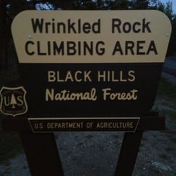
Wrinkled Rock Climbing Area
2 reviews
Legion Lake hiking trail
2 reviews
Black Hills National Forest
29 reviews
Zip Line & Aerial Adventure Park
8 reviews
Hollingsworth Horses
16 reviews
Harbach Centennial Park
1 review
On The Water
1 review
Jewel Cave National Monument
65 reviews