Blue Ridge Trail Photos


You might also consider


More like Blue Ridge Trail
Recommended Reviews - Blue Ridge Trail
Start your review...


Reviews With Photos


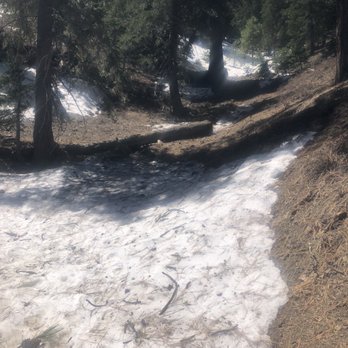
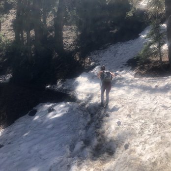
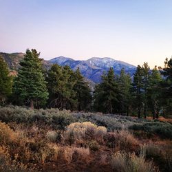
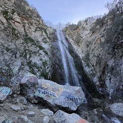
This has become one of my fave local trails - a great workout, gorgeous views, peace & quiet, small waterfall, snow in season!! Everything you could want in a trail! I say local but, well, sorta "local" I guess - it's about an hour from the greater LA area near Wrightwood but well worth the drive! Google maps takes you right to the trailhead parking lot - it's small but we've always found parking. There are bathrooms too but sometimes they're locked so plan ahead. AllTrails has the trail right at 4 miles and 1,079 feet elevation gain. But the trail also links up with the PCT so you can go further and I highly recommend it if you can - you'll be rewarded with some pretty incredible sweeping mountain vistas! Last time we went, we did around 7 1/2 miles and just over 1500 feet - I was whooped but it was 100% worth it! And there are no bathrooms along the trail or at the end either. The trail is moderate when there's no snow and mostly shaded - a true mountain pine forest habitat. But when there's snow, I'd bump it up to moderate-hard. The snow can last all the way into late April sometimes - it gets deep and the trail is very narrow in lots of places. With snow on the trail, you'll definitely need micro spikes and poles - and a good trail map bc the snow is deceiving regarding trail width and you'll fall if you misstep. To find the part that links up with the PCT, just keep going at the end of the AllTrails map towards the ski lift to the left and you'll see the signs - about another mile and a half and you'll reach the top and there's all the gorgeous views!! It also shows all the area trails that link up inside the AllTrails app so I highly recommend downloading it before you go bc the signal is very spotty out there. And I would recommend snacks and bear spray too.


If you do it in the snow it is a 4 but if not I would imagine it is more of a 3. Go past the campground area just about a 1/4 mile for better views. The views on most of the way up aren't that great but it is a beautiful area you are hiking in. Small parking lot and an adventure pass is needed.


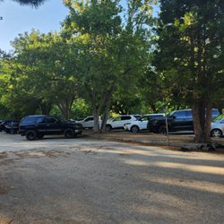
Great trail with LOTS OF SHADE and trees everywhere. Perfect for a short summer hike. Parking along street available for those without a pass too...arrive early on weekends as it can fill up fast (before 8am to get a parking spot)


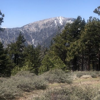
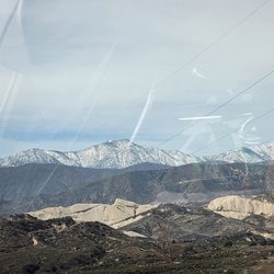
I've been having a really tough time finding out what trails are open for hiking during COVID-19. After a long stressful search with a friend in LA, we found this one, and I can confirm as of 5/2/20 the trail was open. Drove up from San Diego in a quick traficless 2 1/2 hour drive. There are 2 parking lots open, one on the side of this trailhead and one across the street that say you need an Adventurepass, but we don't believe they're ticketing right now, and can confirm we did not have a pass displayed and also didn't get a ticket. My friend also mentioned if it's your first ticket, the cost is only $5 (the cost of an Adveturepass). I had cell service for most of the hike, up until the campgrounds. All facilities are closed right now, so bring tissues etc if you need to go to the bathroom This path was BEAUTIFUL and just the touch of nature we needed! Wear your boots, as of 5/2 there was still snow/slush on the ground, in certain spots quite a bit. And I'd imagine it'll start to melt, but it'll only get muddy after that! We passed about 5-6 groups total on the whole trail, everyone was very courteous and stayed out of each other's way. The trail itself I'd rate as moderate, we took our time enjoying the beautiful sites of snow capped mountains in the distance and just enjoyed being surrounded by trees. When you get to the top there's a campground where you can enjoy your lunches and snacks and take in the beautiful surrounding views. The trail also meets up with the PCT, so if you want to add some mileage you can hike the PCT for a bit in either direction for some additional sites.


Beautiful trail, mostly shaded. Dog friendly. Parking was easily accessible. Hiked up to the top which lands you at the campground and ski lift area.
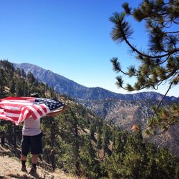

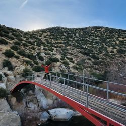
9/3/16 We used Alltrails app for direction. Took N Hwy 2. At the Forest Information Bldg (rock pillar-you can't miss it) make a u turn and park in the small parking lot next to the bathroom. There were about 6 spots but we saw cars parked closer to the actual trailhead. From the bathroom, we walked across the road to the dirt trailhead. Trail started off with a slight incline but leveled off, only to incline again. It's not steep though so a beginner can easily make this hike. You'll come to a bridge about 1/8 mile in. Only trickling water in Sept so I wonder if it's more magnificent in the spring after the snow had melted. There's a bench at the halfway mark to rest a bit. You can go right to Big Pine or left to Blue Ridge. The trail is shaded and it was a breezy, gorgeous day when we went. Some nice view. We stopped for photo ops along the way. There's a campground at the top near the ski lift. We went right to find the optimal view of the valley below. It was cloudy but still a great view. Took more pictures. Ate our snacks and headed back down. The trail was mostly dirt with a couple of rocky spots but well maintained. Overall, a good hike if you're short on time. Started: 9am Finished: 12:00pm (many stops to enjoy the view/snack) 4.3 miles round trip (AllTrails) 1105 elevation gain https://youtu.be/RzACnPVcp_I

The view is stunning! My husband and I recently went to Wrightwood on a family trip. We decided to go hiking on the Sunday before we returned home. We kept missing the Blue Ridge Trail parking lot. There wasn't a big sign indicating where it was. We also didn't know you had to purchase a day pass to hike. We are from an area where all hiking is free and you don't have to pay for anything. After we got that all situated we started our hike! It was peaceful, beautiful and serene. There were so many bugs flying around the trail but that's to be expected in the summer! We aren't used to the elevation so it was difficult to breathe at times. I would highly recommend hiking here. Make sure you grab a day pass at the Visitors Center or Jenson's Finest Foods!


The trails were very well maintained and the views were breathtaking! We hiked up to the top and played in the snow until sunset. Parking was abundant and the restrooms were decently clean.


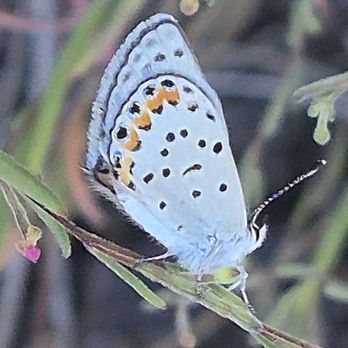
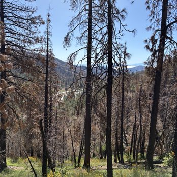
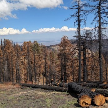
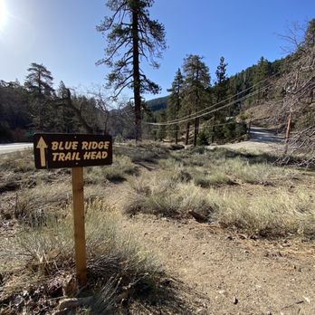
Gorgeous trail in an area of the forest that is recovering from the Bridge Fire in 2024. While it's shocking to see so many burnt trees, it's also cool to see signs of life emerging from the ashes. There were many pine seedlings to be found along the trail and lots of wildflowers called "fire-followers" that actually require and benefit from the fire to bloom. To find the trailhead, look for the Big Pines Visitor Center. The parking lot for the trail is right across the street and the standard Adventure Pass is required to park in this lot (thank goodness, it is not part of the Mountain High Ski Resort cabal, so you don't have to buy the "Big Pines" parking pass as well.) It was a bit tricky to find the actual trailhead, as it's a few feet away from the parking lot. The parking lot does have restrooms as well as ADA parking available. The trail itself is very well maintained and offers stunning views. It's pretty much uphill all the way to the Blue Ridge Campsite and (of course) downhill all the way back. It's mostly in the shade but can get warm, so make sure you have plenty of water and snacks. Look for fungi, mariposa lilies, butterflies, squirrels and birds. Highly recommended! read more

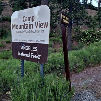


The good: I came on a Tuesday and it was completely empty and serene. We came with our almost 3 year old but we carried him most of the time. The trail was mostly shaded and there were creeks with running water. We saw blue jays, chipmunks, squirrels, woodpecker and other birds. It was breezy with nice views of the mountains and far out in the canyon areas. The bad: We didn't get to finish the trail because we had a toddler. I think there were only 2 parking spots. I am not sure if there were other areas you can park. It was just on the dirt by the campgrounds sign. The interesting: Lots of the trees were burnt and fallen over. We saw red plants and some interesting mushroom growing on the trees. Some areas of the trail are more narrow with a sloping hill off to the side so be careful if you're coming with kids. read more


11 months ago
Well maintained trail with lots of shade and high elevation. Some parking available in a small lot near the beginning of the trailhead. The map had me go through the ski resort next door to safely get to the off road to park. I was confused at first but realized that Google Maps would not break any traffic laws therefore I couldn't cross the double yellow lines and make a left into the lot. The trail was peaceful with birds chirping, the sound of water flowing from a stream and beautiful views. I didn't see a bridge as I had in a couple pictures online, not sure if they removed it? I hiked the trail on the AllTrails app and noticed there was a fork near the bench (about the half-way). It's possible that the bridge was on one of those offshoot trails. The trail leads up to a campground area and also the Discovery ski lift connected with the ski resort nextdoor. A little beyond the trail you will find the PCT. I met five people and two dogs on the trail. It was a beautiful day and a good hike. Oh, I placed my annual pass signature side up on my dashboard of my car for the hike but I'm not sure if anyone checked. I went to what appeared to be a ranger station after my hike and it was closed, no one was there. It said it was open to the public on Saturday I think. Either way it's better safe than sorry. You never know when someone will check for the adventure pass (or interagency pass) so yes, I believe a pass is still recommended. read more




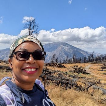


This has become one of my fave local trails - a great workout, gorgeous views, peace & quiet, small waterfall, snow in season!! Everything you could want in a trail! I say local but, well, sorta "local" I guess - it's about an hour from the greater LA area near Wrightwood but well worth the drive! Google maps takes you right to the trailhead parking lot - it's small but we've always found parking. There are bathrooms too but sometimes they're locked so plan ahead. AllTrails has the trail right at 4 miles and 1,079 feet elevation gain. But the trail also links up with the PCT so you can go further and I highly recommend it if you can - you'll be rewarded with some pretty incredible sweeping mountain vistas! Last time we went, we did around 7 1/2 miles and just over 1500 feet - I was whooped but it was 100% worth it! And there are no bathrooms along the trail or at the end either. The trail is moderate when there's no snow and mostly shaded - a true mountain pine forest habitat. But when there's snow, I'd bump it up to moderate-hard. The snow can last all the way into late April sometimes - it gets deep and the trail is very narrow in lots of places. With snow on the trail, you'll definitely need micro spikes and poles - and a good trail map bc the snow is deceiving regarding trail width and you'll fall if you misstep. To find the part that links up with the PCT, just keep going at the end of the AllTrails map towards the ski lift to the left and you'll see the signs - about another mile and a half and you'll reach the top and there's all the gorgeous views!! It also shows all the area trails that link up inside the AllTrails app so I highly recommend downloading it before you go bc the signal is very spotty out there. And I would recommend snacks and bear spray too. read more


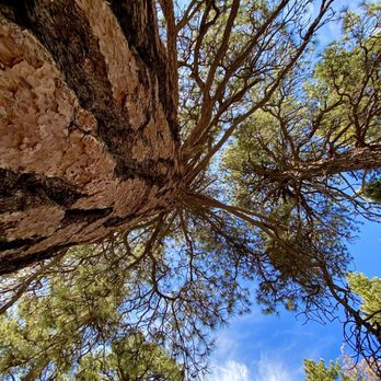

If you do it in the snow it is a 4 but if not I would imagine it is more of a 3. Go past the campground area just about a 1/4 mile for better views. The views on most of the way up aren't that great but it is a beautiful area you are hiking in. Small parking lot and an adventure pass is needed. read more


3 years ago
Great trail with LOTS OF SHADE and trees everywhere. Perfect for a short summer hike. Parking along street available for those without a pass too...arrive early on weekends as it can fill up fast (before 8am to get a parking spot) read more


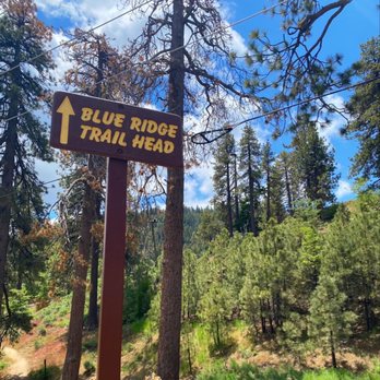
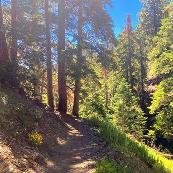

I've been having a really tough time finding out what trails are open for hiking during COVID-19. After a long stressful search with a friend in LA, we found this one, and I can confirm as of 5/2/20 the trail was open. Drove up from San Diego in a quick traficless 2 1/2 hour drive. There are 2 parking lots open, one on the side of this trailhead and one across the street that say you need an Adventurepass, but we don't believe they're ticketing right now, and can confirm we did not have a pass displayed and also didn't get a ticket. My friend also mentioned if it's your first ticket, the cost is only $5 (the cost of an Adveturepass). I had cell service for most of the hike, up until the campgrounds. All facilities are closed right now, so bring tissues etc if you need to go to the bathroom This path was BEAUTIFUL and just the touch of nature we needed! Wear your boots, as of 5/2 there was still snow/slush on the ground, in certain spots quite a bit. And I'd imagine it'll start to melt, but it'll only get muddy after that! We passed about 5-6 groups total on the whole trail, everyone was very courteous and stayed out of each other's way. The trail itself I'd rate as moderate, we took our time enjoying the beautiful sites of snow capped mountains in the distance and just enjoyed being surrounded by trees. When you get to the top there's a campground where you can enjoy your lunches and snacks and take in the beautiful surrounding views. The trail also meets up with the PCT, so if you want to add some mileage you can hike the PCT for a bit in either direction for some additional sites. read more





6 years ago
Beautiful trail, mostly shaded. Dog friendly. Parking was easily accessible. Hiked up to the top which lands you at the campground and ski lift area. read more


10 years ago
9/3/16 We used Alltrails app for direction. Took N Hwy 2. At the Forest Information Bldg (rock pillar-you can't miss it) make a u turn and park in the small parking lot next to the bathroom. There were about 6 spots but we saw cars parked closer to the actual trailhead. From the bathroom, we walked across the road to the dirt trailhead. Trail started off with a slight incline but leveled off, only to incline again. It's not steep though so a beginner can easily make this hike. You'll come to a bridge about 1/8 mile in. Only trickling water in Sept so I wonder if it's more magnificent in the spring after the snow had melted. There's a bench at the halfway mark to rest a bit. You can go right to Big Pine or left to Blue Ridge. The trail is shaded and it was a breezy, gorgeous day when we went. Some nice view. We stopped for photo ops along the way. There's a campground at the top near the ski lift. We went right to find the optimal view of the valley below. It was cloudy but still a great view. Took more pictures. Ate our snacks and headed back down. The trail was mostly dirt with a couple of rocky spots but well maintained. Overall, a good hike if you're short on time. Started: 9am Finished: 12:00pm (many stops to enjoy the view/snack) 4.3 miles round trip (AllTrails) 1105 elevation gain https://youtu.be/RzACnPVcp_I read more


8 years ago
The view is stunning! My husband and I recently went to Wrightwood on a family trip. We decided to go hiking on the Sunday before we returned home. We kept missing the Blue Ridge Trail parking lot. There wasn't a big sign indicating where it was. We also didn't know you had to purchase a day pass to hike. We are from an area where all hiking is free and you don't have to pay for anything. After we got that all situated we started our hike! It was peaceful, beautiful and serene. There were so many bugs flying around the trail but that's to be expected in the summer! We aren't used to the elevation so it was difficult to breathe at times. I would highly recommend hiking here. Make sure you grab a day pass at the Visitors Center or Jenson's Finest Foods! read more


6 years ago

10 years ago

10 years ago
The trails were very well maintained and the views were breathtaking! We hiked up to the top and played in the snow until sunset. Parking was abundant and the restrooms were decently clean. read more


10 years ago
Blue Ridge Truck Trail- Path To The High Country Blue Ridge is the way to get to some fine high country peaks. I have used it to reach Blue Ridge's high point at 8,500' and to link up with the Pacific Crest Trail (both intersect several times) to a use trail to summit Wright Mountain (8,505'). The road itself is not very steep, as it has generally a gentle slope. It provides access to both Blue Ridge and Guffy Campgrounds, ad a couple down slope from there. It also provides access to the more strenuous peak climbs like Pine Mountain (9,648'), Dawson Peak (9,575'), West Baldy (9,988'), and Baldy (Mt. San Antonio- 10,064'). Some areas are well-forested, and some areas are very exposed to the strong, high altitude sun on a south-facing slope, so sun screen is a must. Blue Ridge can be accessed from near Big Pines on Hwy-2. I typically park at Inspiration Point at 7,381' elevation, where there is good parking and restroom access, and sweet views. read more


9 years ago
More info about Blue Ridge Trail
6060 Park Dr
Wrightwood, CA 92397
Directions
(760) 249-3440
Call Now
Hours
Outdoor Amenities
Ask the Community - Blue Ridge Trail
Review Highlights - Blue Ridge Trail
You might also consider



























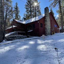


Blue Ridge Trail - hiking - Updated August 2026
Best of Wrightwood
People found Blue Ridge Trail by searching for…
Things to Do in Wrightwood, CA
Hiking Trails in Wrightwood, CA
Waterfall Hike in Wrightwood, CA
Places to Take Pictures in Wrightwood, CA
Swimming Lakes in Wrightwood, CA
Off Road Trails in Wrightwood, CA
Visitor Centers in Wrightwood, CA
Beautiful Views in Wrightwood, CA
Dog Friendly Hiking Trails in Wrightwood, CA
Running Trails in Wrightwood, CA
Free Campgrounds in Wrightwood, CA
Parks for Kids in Wrightwood, CA
Picnic Areas in Wrightwood, CA
Skyline View in Wrightwood, CA
Trending Searches in Wrightwood, CA
Barbershop For Men near Blue Ridge Trail
Bike Shop near Blue Ridge Trail
Cliff Jumping near Blue Ridge Trail
Consignment Shops near Blue Ridge Trail
Cruising Spots near Blue Ridge Trail
Dog Friendly Things To Do near Blue Ridge Trail
Ear Piercing near Blue Ridge Trail
Eyebrow Threading near Blue Ridge Trail
Flower Fields near Blue Ridge Trail
Hair Braiding near Blue Ridge Trail
Kids Haircut near Blue Ridge Trail
Mini Golf near Blue Ridge Trail
Pedicure near Blue Ridge Trail
Permanent Makeup near Blue Ridge Trail
Picnic Areas near Blue Ridge Trail
Preschools near Blue Ridge Trail
Public Golf Courses near Blue Ridge Trail
Public Pools near Blue Ridge Trail
Rock Quarry near Blue Ridge Trail
Running Trails near Blue Ridge Trail
Scenic Night View near Blue Ridge Trail
Scenic Overlook near Blue Ridge Trail
Sunrise View near Blue Ridge Trail
Swimming Holes near Blue Ridge Trail
Trading Card Shops near Blue Ridge Trail
Used Furniture Stores near Blue Ridge Trail
Browse Articles
Browse Nearby
BEST of Wrightwood, California Parks near Blue Ridge Trail
BEST of Wrightwood, California Things to Do near Blue Ridge Trail
BEST of Wrightwood, California Coffee near Blue Ridge Trail
BEST of Wrightwood, California Restaurants near Blue Ridge Trail
BEST of Wrightwood, California Walking Trails near Blue Ridge Trail
BEST of Wrightwood, California Breakfast near Blue Ridge Trail
BEST of Wrightwood, California Campgrounds near Blue Ridge Trail
BEST of Wrightwood, California Visitor Centers near Blue Ridge Trail
BEST of Wrightwood, California Sledding near Blue Ridge Trail
Browse Brands
Related Searches in Wrightwood, CA
Best Dog Hiking Trails Around Wrightwood, California
Best Fishing Locations and Guides in Wrightwood, California
Best Places for Horseback Riding in Wrightwood, California
Check Out Off Road Trails in Wrightwood, California
Discover Dog Friendly Trails to Explore in Wrightwood, California
Discover Easy Hiking Trails Near Wrightwood, California
Discover Kid Friendly Hiking Trails in Wrightwood, California
Discover Popular Bike Trails in Wrightwood, California
Discover Scenic Mountain Bike Trails Near Wrightwood, California
Discover Walking Parks in Wrightwood, California Near You
Discover a Hiking Trail in Wrightwood, California
Discover the Best Night Hike Trails in Wrightwood, California
Dog-Friendly Hikes With Dogs in Wrightwood, California
Enjoy Camping Adventures Around Wrightwood, California
Enjoy Kayaking Adventures in Wrightwood, California
Enjoy Off Leash Dog Hikes in Wrightwood, California
Enjoy Scenic Places to Walk in Wrightwood, California
Enjoy Tent Camping Spots Around Wrightwood, California
Enjoy a Beautiful Waterfall Hike in Wrightwood, California
Enjoy the Best Picnic Spots and Ideas in Wrightwood, California
Enjoy the Best Walking Path in Wrightwood, California
Enjoy the Best Walking Trails in Wrightwood, California
Explore Beautiful Parks and Green Spaces in Wrightwood, California
Explore Easy Hikes Perfect for All in Wrightwood, California
Explore Fun Activities to Do in Wrightwood, California
Explore Popular Campgrounds Near Wrightwood, California
Explore Top Dog Parks in Wrightwood, California Near You
Explore Top Water Parks in Wrightwood, California Today
Explore the Best Swimming Holes Around Wrightwood, California
Family Friendly Hiking With Kids in Wrightwood, California
Find Parks and Recreation Activities in Wrightwood, California
Find Top-Rated Waterfalls in Wrightwood, California Now
Find the Best Parks for Picnics in Wrightwood, California
Find the Best Playgrounds to Visit in Wrightwood, California
Hiking Trails With Waterfalls in Wrightwood, California
Off Leash Dog Hiking Trails in Wrightwood, California
Picnic Areas With BBQ Pits Available in Wrightwood, California
Popular Outdoor Activities to Try in Wrightwood, California
Popular Picnic Spots to Visit in Wrightwood, California
Popular Waterfall Hiking Trails in Wrightwood, California
Safe River Swimming Areas in Wrightwood, California
Safe and Fun Parks for Kids in Wrightwood, California
Top Hiking Trails to Explore in Wrightwood, California
Top Playgrounds for Kids to Enjoy in Wrightwood, California
Top Running Trails to Explore in Wrightwood, California
Top Swimming Lakes to Enjoy in Wrightwood, California
Top Swimming Spots and Pools in Wrightwood, California


