Islip Saddle Photos


You might also consider


More like Islip Saddle
Recommended Reviews - Islip Saddle
Start your review...


Reviews With Photos
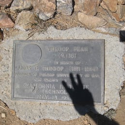

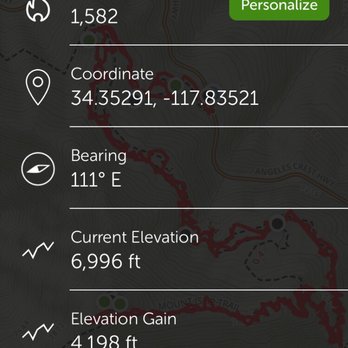
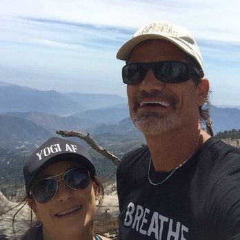
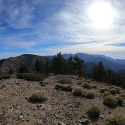
5-PEAKS IS NOT FOR THE WEAK AT HEART BACKGROUND: Mt Islip is named for George Islip, a Canadian prospector who moved to Los Angeles in the 1850's. He first inhabited the abandoned "halfway house" that Wilson constructed (then abandoned) along his lumber hauling trail in Little Santa Anita Canyon. It's noted that Islip planted a small grove of cherry, apple, pear and plum trees on a sloping bench just behind the hut. Mt. Hawkins is named by the USFS for Nellie Hawkins, a very popular waitress at the rustic "Squirrel Inn" at nearby Crystal Lake (1901-06). It's rumored that "she charmed and attracted miners, hunters, campers-just about every mountain man for miles around." Throop peak was named for Anne G. Throop, founder of Caltech, formerly called Throop College. Mt. Burnham is named for Frederick Russell Burnham the famous American military scout who taught Scoutcraft to Robert Baden-Powell became one of the inspirations for the founding of the Boy Scouts. Mount Burnham was officially recognized by the USGS at a dedication ceremony in 1951. Its original designation was (West Twin) "North Baldy Mountain". Lord Baden-Powell, was a lieutenant-general in the British Army, writer, and founder of the Boy Scout Movement. Mount Baden-Powell is a peak in the San Gabriel Mountains of California. It was officially recognized by the USGS at a dedication ceremony in 1931. Its first designation was East Twin or North Baldy named by C. F. Saunders in 1923. At 9,407 feet in elevation, Mount Baden-Powell is the 4th highest peak of the San Gabriel Range. STATS: Distance: 14.5 miles Elevation Gain: 5000 Trail: One way car shuttle Rating: Strenuous-for seasoned hikers ESSENTIALS: At least 2 liters of water Know your limits Comfy hiking shoes with good lugs Layered Clothing High protein food/snacks Electrolytes Camera Hat (optional) Sunscreen Trek poles CHECK THE WEATHER!! OUR ROUTE: Me and The Crew met at the Vincent Gap Parking Lot, consolidated cars and shuttled to the Mt. Islip Saddle where we began our one way hike back to the cars that were left at Vincent Gap (a.k.a. shuttle hike). From the words, "Let's hike it up," "up" was the operative word. About 60% of this hike is uphill and doesn't level off until Little Jimmy Campground, mile two. But don't set your poles down, there is so much more to climb. From Little Jimmy, we followed the trail toward to Mt. Hawkins, at 7,782 ft. followed by Throop Peak, 9,142 ft. The views from Throop are far and wide, with a 360 degree view you can see Mt. Baldy, Mt. Baden-Powell, the Mojave Desert, and the ocean. Onward and upward to Mt. Burnham, one of the highest peaks in the San Gabriel Mountains sits at 8,997 ft. finishing off with Mt. Baden-Powell, 9,406 ft. Trails are fairly easy to follow and directional signs are posted along the way and much of this trail runs parallel to the Angeles Crest Highway which detracts from the feel of seclusion. It's fun to follow the ridge to bag Throop, Burnham and Hawkins on the way down. If you're looking for a roller coaster ride of a trail, one with lots of up and down, do this hike. If you're looking for more seclusion, try something else. DISCLAIMER: Hiking is not something that can be taken lightly. It can be life-threatening as you see and hear on the news, people die or get lost all time. Please, if you are going to hike, never go alone and prepare for the worst, hope for the best. Remember when going for a hike, no matter how short you think it may be, always be prepared. Carry at least two liters of water for every five miles (more if the weather is warm), protein bar, nuts, and electrolytes. Wear sturdy lug sole shoes and protective clothing. Some areas the weather can change quicker than a fireman can put on his gear. It is also very important, always always always let a family member or friend know where you are going and when you expect to be back. Lastly, have fun when you hike it up.


Beautiful hike near the intersection of the 2 and the 39. Parking lot and pristine trails are well-maintained. Well worth the drive up from the Los Angeles basin. Check traffic, weather and fire status; the forest is extremely flammable at the moment. Bring water, snacks and first aid kit. An Adventure Pass is required to park within Angeles National Forest. Be prepared for a work-out and some beautiful views. read more

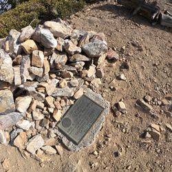
This is a strong 4 star hike...near Mount Baden-Powell and similar in many ways. Use the All Trails app to get directions. Parking and the trailhead is on Hwy 2. We took the 210 to the 2 Hwy near La Canada Flintridge and it took us about 50 mins and 40 miles of twists and turns while sharing the road with motorcycles and high performance cars that are testing their cars handling. You will pass the parking area for Switzer Falls (see my review for that one) and you will pass the Red Box parking area you can use to do the Strawberry Peak hike (see my review haha) and still will need to continue on Angeles Crest Hwy for about 25 more minutes. If you want you can continue tpass the main parking area for the Islip saddle about one mile to the east and find some parking on the side of the highway that will allow you to take a shortcut trail that connects with the main trail but is about .4 miles shorter, so .8 miles RT...you can see the start of the trail near the metal barrier blocking any traffic on the access road. The first .6 miles is pretty steep and then you connect to the main trail and head left to the Little Jimmy Campground which is 1.1 miles and pretty flat. When you reach the campground it gets a bit confusing with intersecting trails. Don't stop here, continue on for about 1.5 miles to reach the Mt. Islip peak. The 3rd mile is the steepest and you will gain about 550 ft and pass the 8,000 ft elevation level and come to a fork in the trail that is well marked and you will make a right to go about .2 miles to the peak. It was 3.2 miles to the peak and 6.4 miles RT using the shortcut starting area that I mentioned in the first paragraph. At the top is the ruins of a small structure, some concrete squares, and a plastic and metal box with some notebooks. There is no sign with the name and elevation of the peak but it is about 8,250 ft. above sea level. There are some great views, not quite as great as Baden-Powell. This is a moderate hike, definitely not hard. We completed the hike in 2.5 hrs with no running. There are parts that are exposed to the sun, but equal amounts that have shade. I loved that we only came across 6 total people while hiking. I just hate that it takes so long to get here and especially the amount of driving the incredibly curvy Hwy 2. read more



8 years ago
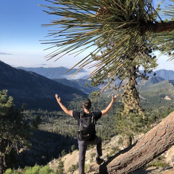
This is a Lovely hike with Phenomenal Views of the High Desert, Crystal Lake & Panoramic Views all the way to the Pacific & Catalina on a clear day. Although All Trails rates this trail as easy, I would consider it moderate. It is an 8.6 round trip mile out & back trail that starts off of Hwy 2 & is unmarked. It starts from a closed fire road with yellow gates, which is 1 mile uphill all the way. Once you merge with the trail it takes you through shady groves of pine that are a nice respite from the hot sun. You follow the trail to Jimmy Springs and past continuing on up to the peak on a series of moderate switchbacks. When you reach the saddle at Windy Gap, you turn off to the right and head about another mile to the peak. The views are rewarding for the effort and I'd say you need some level of fitness to complete as well as 2 liters of water per person. read more





11 years ago
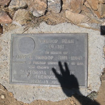
5-PEAKS IS NOT FOR THE WEAK AT HEART BACKGROUND: Mt Islip is named for George Islip, a Canadian prospector who moved to Los Angeles in the 1850's. He first inhabited the abandoned "halfway house" that Wilson constructed (then abandoned) along his lumber hauling trail in Little Santa Anita Canyon. It's noted that Islip planted a small grove of cherry, apple, pear and plum trees on a sloping bench just behind the hut. Mt. Hawkins is named by the USFS for Nellie Hawkins, a very popular waitress at the rustic "Squirrel Inn" at nearby Crystal Lake (1901-06). It's rumored that "she charmed and attracted miners, hunters, campers-just about every mountain man for miles around." Throop peak was named for Anne G. Throop, founder of Caltech, formerly called Throop College. Mt. Burnham is named for Frederick Russell Burnham the famous American military scout who taught Scoutcraft to Robert Baden-Powell became one of the inspirations for the founding of the Boy Scouts. Mount Burnham was officially recognized by the USGS at a dedication ceremony in 1951. Its original designation was (West Twin) "North Baldy Mountain". Lord Baden-Powell, was a lieutenant-general in the British Army, writer, and founder of the Boy Scout Movement. Mount Baden-Powell is a peak in the San Gabriel Mountains of California. It was officially recognized by the USGS at a dedication ceremony in 1931. Its first designation was East Twin or North Baldy named by C. F. Saunders in 1923. At 9,407 feet in elevation, Mount Baden-Powell is the 4th highest peak of the San Gabriel Range. STATS: Distance: 14.5 miles Elevation Gain: 5000 Trail: One way car shuttle Rating: Strenuous-for seasoned hikers ESSENTIALS: At least 2 liters of water Know your limits Comfy hiking shoes with good lugs Layered Clothing High protein food/snacks Electrolytes Camera Hat (optional) Sunscreen Trek poles CHECK THE WEATHER!! OUR ROUTE: Me and The Crew met at the Vincent Gap Parking Lot, consolidated cars and shuttled to the Mt. Islip Saddle where we began our one way hike back to the cars that were left at Vincent Gap (a.k.a. shuttle hike). From the words, "Let's hike it up," "up" was the operative word. About 60% of this hike is uphill and doesn't level off until Little Jimmy Campground, mile two. But don't set your poles down, there is so much more to climb. From Little Jimmy, we followed the trail toward to Mt. Hawkins, at 7,782 ft. followed by Throop Peak, 9,142 ft. The views from Throop are far and wide, with a 360 degree view you can see Mt. Baldy, Mt. Baden-Powell, the Mojave Desert, and the ocean. Onward and upward to Mt. Burnham, one of the highest peaks in the San Gabriel Mountains sits at 8,997 ft. finishing off with Mt. Baden-Powell, 9,406 ft. Trails are fairly easy to follow and directional signs are posted along the way and much of this trail runs parallel to the Angeles Crest Highway which detracts from the feel of seclusion. It's fun to follow the ridge to bag Throop, Burnham and Hawkins on the way down. If you're looking for a roller coaster ride of a trail, one with lots of up and down, do this hike. If you're looking for more seclusion, try something else. DISCLAIMER: Hiking is not something that can be taken lightly. It can be life-threatening as you see and hear on the news, people die or get lost all time. Please, if you are going to hike, never go alone and prepare for the worst, hope for the best. Remember when going for a hike, no matter how short you think it may be, always be prepared. Carry at least two liters of water for every five miles (more if the weather is warm), protein bar, nuts, and electrolytes. Wear sturdy lug sole shoes and protective clothing. Some areas the weather can change quicker than a fireman can put on his gear. It is also very important, always always always let a family member or friend know where you are going and when you expect to be back. Lastly, have fun when you hike it up. read more


7 years ago

10 years ago
Islip Saddle... I slipped. So, I'm not sure how this trail is while in the spring, summer, or fall, but in the wintertime... boy, you better get shoes that grip. I went to islip saddle to take the trail leading towards the campground little jimmy. It's an incline trail, leading you about 3 miles before reaching Little Jimmy. At 7000ft already, the air is thin and there was some wind chill mixed into that, so be sure to pack water and make it accessible to you. That said, I started my journey towards Little Jimmy, and came across a trail of mixed dirt, gravel, small rocks, sleet, and ice. Wearing breathable running shoes was definitely not the right footwear, and I ended up slipping on the ice once. Now, slipping already sucks, but I was scared for my life. The trail is small, with a sharp angle going up and down next to you. Had my heavy pack not fell towards the mountain, the weight of it would have tumbled me off the trail and plummeting off the mountain, where there weren't many trees close enough to stop my descent. Given how fast and hard I would've fell, by the time I would catch myself or collide with something, it would've resulted in serious injury... or worse. Islip Saddle, or any trail for that matter, is not something that you should take lightly. If you backpack overnight, like I did, be sure to take your essentials and have a emergency plan if ever should the situation arise. Nonetheless, the whole journey really helped me learn about myself, appreciate the little things in life, and take in the beauty around me. It really is a beautiful place to go to, and I would seriously recommend it... but I recommend it, also, not to do it the way I did it-- alone. If this is your first time, bring someone with you. And be sure to enjoy it! Your safety is the #1 priority, but take in the landscape and everything around you. And, as always, happy trails. :) read more


More info about Islip Saddle
Pearblossom, CA 93553
Directions
Hours
Outdoor Amenities
Ask the Community - Islip Saddle
You might also consider

















Why does Yelp recommend reviews?
1 review that is not currently recommended
The reviews below are not factored into the business's overall star rating.

3 months ago
Islip Saddle - hiking - Updated August 2026
Best of Pearblossom
People found Islip Saddle by searching for…
Beautiful Views in Pearblossom, CA
Hot Springs in Pearblossom, CA
Campgrounds in Pearblossom, CA
Things to Do in Pearblossom, CA
Hiking Trails in Pearblossom, CA
Running Trails in Pearblossom, CA
Attractions in Pearblossom, CA
View Points in Pearblossom, CA
Off Road Trails in Pearblossom, CA
Waterfall Hike in Pearblossom, CA
Fishing Spots in Pearblossom, CA
Abandoned Buildings in Pearblossom, CA
Walking Trails in Pearblossom, CA
Lakes & Ponds in Pearblossom, CA
Abandoned Places in Pearblossom, CA
Camping Sites in Pearblossom, CA
Scenic Night View in Pearblossom, CA
National Parks in Pearblossom, CA
Browse Nearby
BEST of Pearblossom, California Restaurants near Islip Saddle
BEST of Pearblossom, California Coffee near Islip Saddle
BEST of Pearblossom, California Things to Do near Islip Saddle
BEST of Pearblossom, California Parks near Islip Saddle
BEST of Pearblossom, California Breakfast near Islip Saddle
BEST of Pearblossom, California Lakes near Islip Saddle
BEST of Pearblossom, California Campgrounds near Islip Saddle
BEST of Pearblossom, California Ski Resorts near Islip Saddle


