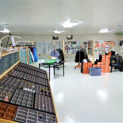
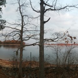
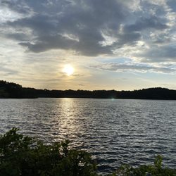
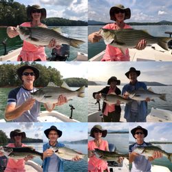
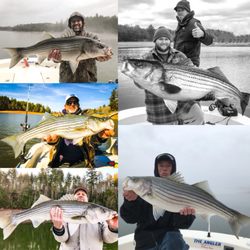
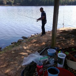
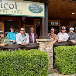
Brookton Bait and Tackle Photos


You might also consider
More like Brookton Bait and Tackle
Recommended Reviews - Brookton Bait and Tackle
Start your review...

20 days ago
Dropped in for lunch and was not disappointed! The catfish was perfect and the dipping sauce was on point! I also had the Jalapeño slaw and it was a one of a kind!! The fried shrimp breading was nice and light! I'll stop by again. Oh.... and the bait barn has a lot of live bait for fishing on the lake! read more


More info about Brookton Bait and Tackle
2807 Dawsonville Hwy
Gainesville, GA 30506
Directions
(678) 971-5607
Call Now
Hours
Outdoor Amenities


Brookton Bait and Tackle - fishing - Updated June 2026
Best of Gainesville
People found Brookton Bait and Tackle by searching for…
Live Bait Shop in Gainesville, Georgia
Bait Shops in Gainesville, Georgia
Bait and Tackle Shop in Gainesville, Georgia
Fun Things to Do in Gainesville, Georgia
Fishing Spots in Gainesville, Georgia
Fishing Bait Shop in Gainesville, Georgia
Fishing Tackle Shop in Gainesville, Georgia
Catfish in Gainesville, Georgia
Hunting & Fishing Supplies in Gainesville, Georgia
Tackle Shop in Gainesville, Georgia
Boat Rental in Gainesville, Georgia
River Swimming in Gainesville, Georgia
Fishing Ponds in Gainesville, Georgia
Fishing Pier in Gainesville, Georgia
Fishing Lake in Gainesville, Georgia
Watch Sunset in Gainesville, Georgia
Fishing Trips in Gainesville, Georgia
Closest Beach in Gainesville, Georgia
Lakes & Ponds in Gainesville, Georgia
Swimming Lakes in Gainesville, Georgia
Horseback Riding for Kids in Gainesville, Georgia
Trending Searches in Gainesville, GA
Bait And Tackle Shop near Brookton Bait and Tackle
Black Owned Nail Salons near Brookton Bait and Tackle
Boat Rental near Brookton Bait and Tackle
Day Trips near Brookton Bait and Tackle
Fishing Charter near Brookton Bait and Tackle
Fishing Spots near Brookton Bait and Tackle
Jet Ski Rental near Brookton Bait and Tackle
Kayak Rental near Brookton Bait and Tackle
Lakes near Brookton Bait and Tackle
Pick Your Own Farms near Brookton Bait and Tackle
Picnic Spots near Brookton Bait and Tackle
Pontoon Boat Rentals near Brookton Bait and Tackle
Scenic Drive near Brookton Bait and Tackle
Soccer Store near Brookton Bait and Tackle
Splash Pad near Brookton Bait and Tackle
Strawberry Picking near Brookton Bait and Tackle
Sunset Cruise near Brookton Bait and Tackle
Swimming Holes near Brookton Bait and Tackle
Swimming Lakes near Brookton Bait and Tackle
Browse Articles
Browse Nearby
BEST of Gainesville, Georgia Coffee near Brookton Bait and Tackle
BEST of Gainesville, Georgia Restaurants near Brookton Bait and Tackle
BEST of Gainesville, Georgia Parks near Brookton Bait and Tackle
BEST of Gainesville, Georgia Things to Do near Brookton Bait and Tackle
BEST of Gainesville, Georgia Hiking near Brookton Bait and Tackle
BEST of Gainesville, Georgia Campgrounds near Brookton Bait and Tackle
BEST of Gainesville, Georgia Seafood near Brookton Bait and Tackle
Browse Brands
Related Searches in Gainesville, GA
Affordable Fishing Rental Services in Gainesville, Georgia
Affordable Jet Ski Rental Options in Gainesville, Georgia
Affordable Kayak Rental Services in Gainesville, Georgia
Best Nature Trails for Hiking in Gainesville, Georgia
Best Places for Horseback Riding in Gainesville, Georgia
Discover Exciting Adventure Options in Gainesville, Georgia
Discover Fun Activities to Do in Gainesville, Georgia
Discover Lakes & Ponds to Explore in Gainesville, Georgia
Discover Top Boat Tours in Gainesville, Georgia for All Ages
Discover the Best Fishing Lake in Gainesville, Georgia
Discover the Best Sunset Cruise Tours in Gainesville, Georgia
Enjoy Camping Adventures Around Gainesville, Georgia
Enjoy Fishing With Kids in Gainesville, Georgia Safely
Enjoy Hiking Adventures in Gainesville, Georgia
Enjoy Kayaking Adventures in Gainesville, Georgia
Enjoy River Tubing Adventures in Gainesville, Georgia
Enjoy Tent Camping Spots Around Gainesville, Georgia
Enjoy Water Activities and Fun in Gainesville, Georgia
Enjoy the Best Family Activities in Gainesville, Georgia
Enjoy the Best Picnic Spots and Ideas in Gainesville, Georgia
Enjoy the Best Tubing Experiences in Gainesville, Georgia
Enjoy the Best Walking Trails in Gainesville, Georgia
Exciting Cliff Jumping Spots in Gainesville, Georgia
Experience Thrilling White Water Rafting in Gainesville, Georgia
Experienced Fishing Guides Available in Gainesville, Georgia
Explore Beautiful Parks and Green Spaces in Gainesville, Georgia
Explore Fun Activities to Do in Gainesville, Georgia
Explore Popular Boat Charters Near Gainesville, Georgia
Explore Popular RV Parks Around Gainesville, Georgia
Explore Scenic Lakes to Visit in Gainesville, Georgia
Explore Top Marinas Near Gainesville, Georgia
Explore the Best Bait Shops Around Gainesville, Georgia
Explore the Best Boating Spots in Gainesville, Georgia
Explore the Best Swimming Holes Around Gainesville, Georgia
Find Popular Ziplining Spots Around Gainesville, Georgia
Find Top Dog Swimming Spots in Gainesville, Georgia
Popular Fishing Spots to Explore in Gainesville, Georgia
Popular Outdoor Activities to Try in Gainesville, Georgia
Popular Picnic Spots to Visit in Gainesville, Georgia
Safe River Swimming Areas in Gainesville, Georgia
Top Fishing Charter Experiences in Gainesville, Georgia
Top Fishing Ponds to Visit in Gainesville, Georgia
Top Fly Fishing Shop Options in Gainesville, Georgia
Top Hiking Trails to Explore in Gainesville, Georgia
Top Live Bait Shops to Visit in Gainesville, Georgia
Top Paddleboarding Activities in Gainesville, Georgia
Top Places for Snorkeling in Gainesville, Georgia
Top Running Trails to Explore in Gainesville, Georgia