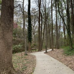
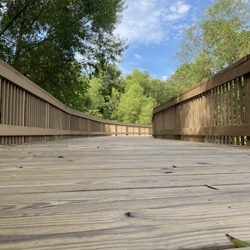
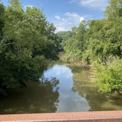
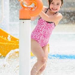
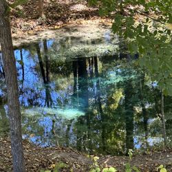
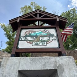
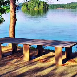
Thompson Creek Park Photos

You might also consider
More like Thompson Creek Park
Recommended Reviews - Thompson Creek Park
Start your review...

9 years ago
We were looking for a park to sit and enjoy some food that we had bought did not like to sit in a food court . I came to the outlet mall and I was looking for some park nearby to have my food . Mostly this park is mostly used for people with boat who will have great access to the lake. It has got a shelter and we came as a family and had our food. The shelter had got few tables and also got one open access grill. When we visited around 1pm the restrooms were locked. I would not recommend if u want to spend some time more in the park. This park is exactly for people who needs to get their boats into the lake . read more


4 years ago
More info about Thompson Creek Park
570 Thompson Creek Park Rd
Dawsonville, GA 30534
Directions
(770) 945-9531
Call Now
Hours
Outdoor Amenities


Thompson Creek Park - skate_parks - Updated July 2026
Best of Dawsonville
People found Thompson Creek Park by searching for…
Places to Take Pictures in Dawsonville, Georgia
Scenic Overlook in Dawsonville, Georgia
Roller Skating in Dawsonville, Georgia
Things to Do in Dawsonville, Georgia
Scenic View in Dawsonville, Georgia
Scenic Drive in Dawsonville, Georgia
Places to Swim in Dawsonville, Georgia
Walking Trails in Dawsonville, Georgia
Photo Spots in Dawsonville, Georgia
Picnic Areas in Dawsonville, Georgia
Running Trails in Dawsonville, Georgia
Attractions in Dawsonville, Georgia
Beautiful Views in Dawsonville, Georgia
Skating in Dawsonville, Georgia
Parks With Lakes in Dawsonville, Georgia
Pump Track in Dawsonville, Georgia
Waterfalls in Dawsonville, Georgia
Swimming Holes in Dawsonville, Georgia
Swimming Lakes in Dawsonville, Georgia
Watch Sunset in Dawsonville, Georgia
Browse Nearby
Browse Brands
Trending Searches in Dawsonville, GA
4th Of July Fireworks near Thompson Creek Park
Black Owned Nail Salons near Thompson Creek Park
Boat Rental near Thompson Creek Park
Day Trips near Thompson Creek Park
Fireworks near Thompson Creek Park
Jet Ski Rental near Thompson Creek Park
Kayak Rental near Thompson Creek Park
Public Pools near Thompson Creek Park
River Swimming near Thompson Creek Park
Soccer Store near Thompson Creek Park
Splash Pad near Thompson Creek Park
Strawberry Picking near Thompson Creek Park
Swimming Holes near Thompson Creek Park
Browse Articles
People who viewed Thompson Creek Park also viewed
Mary Alice Park
14 reviews
Hurricane Shoals Park
19 reviews
Yahoola Creek Park
10 reviews
Amicalola Falls State Park and Lodge
120 reviews
Veteran's Park
3 reviews
Lake Sidney Lanier
26 reviews
Coal Mountain Park
3 reviews
Fins Up Water Park
20 reviews
Chestatee Wild Life Preserve
63 reviews
Madeleine K Anthony Park
1 review