Cancel

    Open app

    Search

    Calhoun Falls State Park

    4.1 (8 reviews)

    Calhoun Falls State Park Photos

    Recommended Reviews - Calhoun Falls State Park

    Your trust is our priority, so businesses can't pay to alter or remove their reviews. Learn more about reviews.
    Yelp app icon
    Browse more easily on the app
    Review Feed Illustration

    Reviews With Photos

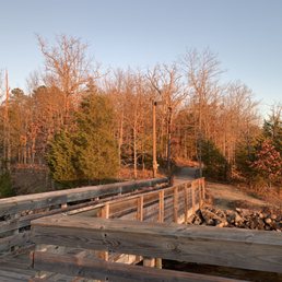
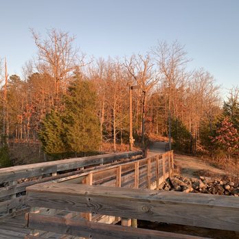
    Trail to fishing dock
    Alicen E.

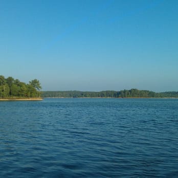
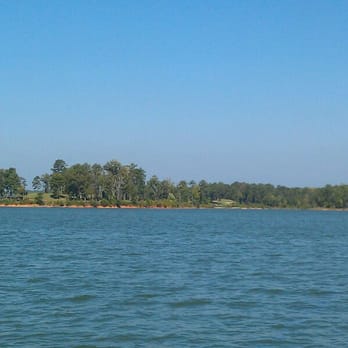
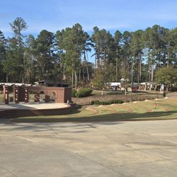
    I really don't have anything bad to say about this campground. My family and I drove from Florida to stay here for New Years, it was definitely worth the drive. All of the camp sites are very well maintained, you have a beautiful view of the lake from everywhere in the campground. They have parks for kids, basketball and tennis courts if I remember correctly and a swimming area which was closed when we went because it was so cold. The staff there was very helpful and super nice, we'll definitely be back soon. The only downfalls I had personally is the bathrooms are in need of a major face lift and there are no boating rentals to rent when you're there. It would have been nice to take a pontoon boat or something out to explore. But other than that everything was pretty perfect.

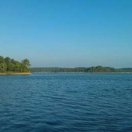
    We enjoy camping at this state park as well as spending time at the day use area. There are updates that need to be done for sure but overall, we enjoy making wonderful memories here!

    Lake Russell

    See all

    1 year ago

    Helpful 0
    Thanks 0
    Love this 0
    Oh no 0

    2 years ago

    Helpful 0
    Thanks 0
    Love this 0
    Oh no 0

    3 years ago

    Helpful 0
    Thanks 0
    Love this 0
    Oh no 0

    7 years ago

    Helpful 2
    Thanks 0
    Love this 0
    Oh no 0

    7 years ago

    Helpful 0
    Thanks 0
    Love this 0
    Oh no 0

    6 years ago

    Helpful 0
    Thanks 0
    Love this 0
    Oh no 0

    6 years ago

    Helpful 0
    Thanks 0
    Love this 0
    Oh no 0

    14 years ago

    Helpful 0
    Thanks 0
    Love this 0
    Oh no 0

    Ask the Community - Calhoun Falls State Park

    Verify this business for free

    Get access to customer & competitor insights.

    Verify this business

    Riley Moore Falls

    Riley Moore Falls

    5.0(4 reviews)
    54.3 mi

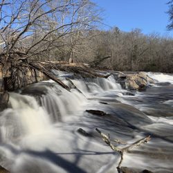
    This is the best waterfall we got to visit in SC this far. After we left Reedy Branch Falls we…read moredrove here. Well, as close as we could get. I didn't realize that we couldn't drive all the way to the trailhead so we had a long hike in store due to me having to carry my toddler most of the time. I should have re-read the previous reviews before coming. My friend did help me carry her as well and for that I was very thankful. So definitely don't recommend this hike with a little one unless strapped in a carrier. Also, I don't recommend it for the elderly either. It's definitely a wilderness hike deal with roots and elevation change. In fact, it's mostly downhill on the way to the falls, but on the way back it's pretty much all uphill, which was not fun with aforementioned young child. It's about a half mile to the actual trailhead and then another 0.7 mile to the falls. That's about 2.4 miles round trip. The reason of course that my boys absolutely became enamored with this place is the large swimming hole. It is wonderful and has plenty of space. The waterfall itself is beautiful and although it's not as tall as others, its width is quite impressive. I was trying to get as close as I could and even noticed a hidden part of the falls inside of the rock structure. That was so cool!! The sand at the base and shore give it a beachy vibe. We definitely packed it in and out making sure not to leave anything behind as to preserve the area as best as possible. Needless to say we were wiped by the time we made it back to our vehicles, but we're still glad we decided to venture here. Coming back with my hubby and boys in the very near future. Happy yelping!

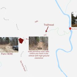
    I just wanted to update my 3/15/20 review below to add I've now done this hike several times, but…read moreTHIS time I had the chance to hike it with a friend who is directly related to the namesake of the waterfall... Riley Moore. Sandie is a church friend of mine and Riley Moore was her Great Great Uncle (I believe that's right). He once upon a time operated a grist mill here at the top of the falls. She's been trying to get here to see the waterfall, but couldn't find it and wanted to join us (along with her family) since I knew the way. Upon further research I discovered there are actually still remnants of the mill including visible drill holes, spikes and bolts. Thought that was pretty cool info to share! [ [ [ PREVIOUS REVIEW ] ] ] Riley Moore Falls is small in height but HUGE in personality. It's located off State Road S37-748, which is a nicely maintained gravel road where cars and trucks alike can comfortably traverse. ~~~ DIRECTIONS From Westminster, SC - DO NOT turn onto Cobb Bridge Road from Long Creek Hwy (Hwy 76) where you will see the brown & white sign pointing you in the direction of Riley Moore Falls. Our GPS had us go this way, then left onto State Road S37-748, but the road was CLOSED during our visit! INSTEAD, turn onto PU-32 also known as Rocky Fork Road. Turn left onto a gravel road near Rocky Fork Baptist Church and follow that until it dead ends @ State Road S37-748 (also known as Spy Rock Road). Turn right and drive approx. 1.4 miles (4 minutes) to 748c (aka Riley Moore Shoals Road). Park at the intersection of State Road S37-748 and 748c. DO NOT ATTEMPT TO DRIVE 748c in a car or minivan. Low clearance vehicles will find the terrain on this road to be VERY difficult to navigate without bottoming out or getting stuck. I'd also recommend 4x4 capability on wet days! There can be several deep-pocketed muddy areas after heavy rains. ~~~ THE TRAIL Once you reach the intersection of Spy Rock Rd (S37-748) and 748c, park roadside on Spy Rock, secure your vehicle and begin your hike approx. 1/2 mile down the "primitive road." IF you have a high ground clearance SUV or truck, you can drive the primitive road another half mile or so to a second parking area near the trailhead. The primitive road is VERY BUMPY  and can be muddy in spots after heavy rains, so a 4x4 is best. After reaching the second parking area, follow the marked trail on the left!!! The trail is a little over a 1/2 mile to the falls from here. The trail is fairly straightforward and easy to follow. ~~~ THE FALLS Once you reach the Chauga River, you will notice a large sandy area with plenty of room for an entire horde of hikers!!! Riley Moore Falls is not very tall (only about 12 feet), but it is very wide and has a deep base pool. PRO TIP - Bring swimwear, towels and a picnic, but be sure to pack it in and pack it out. ~~~ THINGS TO KNOW Hiking Distance: 2 miles (round trip to falls from S37-748) Difficulty of hiking 748c: All downhill to trailhead (moderate return) Difficulty of hiking trail to falls: EASY Creek Crossings: NO Elevation Gain: 357 feet Waterfall Height: Approx 12 feet Access to top of falls: NO - not without getting wet Access to base of falls: YES Pool of water @ base of Falls: YES Sitting areas @ base: YES + sandy beach RESTROOMS: NO PARKING: YES (along road) + secondary parking area closer to trailhead for trucks and high ground clearance vehicles with room for about 6 cars. ~~~ [ FINAL THOUGHTS ] A lovely waterfall in any season, but also a great spot for a summer swim. While we had the waterfall practically to ourselves during our Mid-March expedition, be advised other trail website reviews say it gets trashy & crowded in summer months. What a shame if that is true because it truly is a treasure. ENJOY! 2022 / 74 #UPDATE 178

    Photos
    Riley Moore Falls
    Riley Moore Falls - CREATED FROM GOOGLE MAPS

    CREATED FROM GOOGLE MAPS

    Riley Moore Falls

    See all

    Tallulah Gorge State Park

    Tallulah Gorge State Park

    4.5(210 reviews)
    62.5 mi

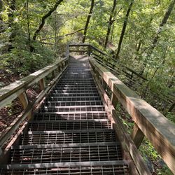
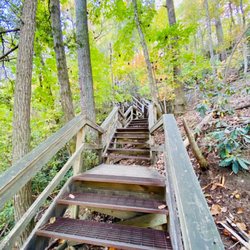
    I came here on a very hot summer day with the plans to see some waterfalls. We got here around…read more8:30am which I believe is when the park opens. We took the South Rim (At least I think it was the South Rim) and went to all 5 viewing points which is a flat walk and a round trip of about 1.5 miles. Then we went down into the Gorge which includes 1,099 steps (actual staircase) to the bottom and of course that many steps back up. You can't go all the way to the Gorge floor without a permit but that just means you can only walk down 1,089 steps to a platform. There are plenty of places to stop including a very cool suspension bridge that overlooks Hurricane Falls. This was pretty tough for a 50-year-old fat boy like me but it's doable if you can simply climb stairs. The views are amazing and worth the quads burning for the next 3 days. The visitor's center is really nice. There is of course a gift shop. a huge display of taxidermy of all the local wildlife and a very nice museum that goes through the history of the region. The most important part is they have air conditioning. Suck it up, take the stairs and buy the t-shirt saying you did it when you are done.

    The visitor center is phenomenal! Movie was down for some reason. The gift shop has loads to choose…read morefrom and the rest rooms were clean and there were many stalls available. There is almost a museum quality to the taxidermy animal scene they have in the middle of the room and along the walls. Truly a special visit! The hike to see the inspirational point and the swinging bridge wasn't too strenuous for my 4 or 5 year old for people's reference when considering it. We are an active family who hikes etc. There were a lot of warnings but we found it wasn't as bad as it seemed.

    Photos
    Tallulah Gorge State Park - Part of the 1,099 steps to bottom of Hurricane Falls

    Part of the 1,099 steps to bottom of Hurricane Falls

    Tallulah Gorge State Park
    Tallulah Gorge State Park - 10.22 towards the S Rim 568 stairs up

    See all

    10.22 towards the S Rim 568 stairs up

    South Carolina Botanical Garden

    South Carolina Botanical Garden

    4.4(38 reviews)
    40.7 mi

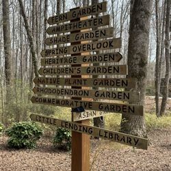
    Tucked away off the campus of Clemson on a vast plot of land is the South Carolina Botanical…read moreGardens. Like some other college-affiliated gardens, this one is free of charge to all visitors. It's a bit tough to get your bearings at first since the property is really spread out, and requires quite a bit of driving to get from place to place, where first time visitors (like me) are sure to get lost along the way, even with a map of the property. I recommend starting your visit with the visitors center, carriage house, and geology museum, which are adjacent to the desert and Jurassic gardens. I tried to get intel on best places to see blooms at the visitors center, but staff weren't overly helpful in assisting where to explore, so I basically grabbed the map and drove off meandering around the back roads, winding up at the Hanover House (super friendly staff here) and the Caboose and President's gardens (some blooms in this area). Despite feeling a bit lost while exploring and encountering very few blooms, I did overall enjoy my visit to the South Carolina Botanical Gardens. I would rate it as a 3.5 out of 5 experience overall, as much of the land on property seemed not to serve much of a purpose, and you really have to spend time exploring (and getting lost) to find interesting blooms.

    I took my 88 yr old neighbor with me. We walked around the circle near the bell. Just so special…read moreand peaceful.

    Photos
    South Carolina Botanical Garden
    South Carolina Botanical Garden - Side

    Side

    South Carolina Botanical Garden

    See all

    Todd Creek Falls - The trail becomes more beautiful past the falls and leads to a large lake

    Todd Creek Falls

    3.3(4 reviews)
    45.6 mi

    July 28 2025 - Todd Creek Falls Trail is too overgrown with high bushes from both sides the first…read more1/4 part of trail with thorns, poison ivy, etc. And the area around the small pool area at the base of waterfalls is also overgrown and difficult to approach. The trail continuing on from the waterfall into the woods is not approachable at all. Spring and late fall are best to navigate. Too bad there isn't a group that could keep the trail better managed. Otherwise, the falls is running full and beautiful. Normally, a wonderful place to visit and cool off in the summer.

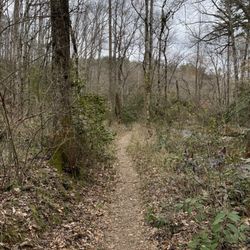
    This trek gets high marks because it is a quick, easy hike to beautiful waterfalls and a…read morewell-maintained trail. The trail isn't well-marked at the head but it is quite easy to follow. It's maintained and well-used. Park at the clearing on Brookbend Road near the bridge and cross the street and head South. The power lines are quite visible and the trail is on the right-away under them. It's maybe a half mile to the waterfall which will be visible to your right. Head downhill and enjoy the beauty from many spots. Continue forward beyond the falls and the trail is much nicer. It meanders through the forest and you can see the spillway from the dam. Be careful, but you can actually walk on it but you are risking your life by doing so! The spillway provides a nice waterfall as well. The trail continues and becomes a loop or it can be followed to the lake. The negatives: aside from the powerlines and the lack of marking on the trail head, this place should have a map posted to indicate what the history is and where you are. A missed opportunity! Head to Waldrop Stone Falls, which is very close when you are done!

    Photos
    Todd Creek Falls - Waterfall

    Waterfall

    Todd Creek Falls
    Todd Creek Falls

    See all

    Watson Mill Bridge State Park

    Watson Mill Bridge State Park

    4.5(17 reviews)
    26.9 mi

    Wonderful morning on the trails for a group hike! We did two loops…read more The trails are well maintained and clearly marked. There are some inclines, making it a moderate hike. Several people enjoyed the sliding rocks and waterfall afterward. Great outing for family and/or friends .

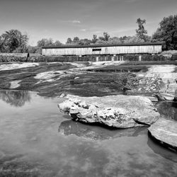
    It's been almost 15 years since I've visited Watson Mill Bridge. The kids in my original pictures…read moreare now 25, 24 and 22 years old. My how time flies! The park looks much better maintained than my previous visit with little to no trash anywhere! I felt encouraged to take a small hike to the old powerhouse ruins and also explored the wide open shoals on the east side of the bridge. The powerhouse once generated electricity for a textile mill 10 miles away in Crawford, GA formerly known as Crawford Cotton Mill and later Jefferson Textile Mills. The bridge looks great to be 141 years old and at 236 feet (based on the monument sign near the bridge) it is the longest original-site covered bridge still in use in the state. It was built in 1885 by Washington W. King, the son of the famous slave turned bridge builder Horace King. It is designed using their signature Town lattice truss system held with wooden pegs. As a state park they offer several amenities including: 7 miles of hiking trails 5 miles of biking trail 14 miles of horse trails 21 Tent, Trailer & RV Campsites 11 Equestrian Campsites 1 Buddy Equestrian Campsite 22 Horse Stables 3 Log Cabin Bunkhouses 1 Group Shelter 3 Picnic Shelters 70 picnic sites 3 Pioneer Campsites Kayak/canoe rentals Geocaching Playground Paddling Fishing 1,118 Acres overall Visitor Center w/restrooms Parking has increased to $10 Annual Georgia Parks passes are $70 Overall the best features of this park are the historic bridge and shoals.

    Photos
    Watson Mill Bridge State Park - Playground

    Playground

    Watson Mill Bridge State Park
    Watson Mill Bridge State Park - Play ground which has been updated recently and I'll get new pictures soon

    See all

    Play ground which has been updated recently and I'll get new pictures soon

    Calhoun Falls State Park - parks - Updated September 2026

    Loading...
    Loading...
    Loading...