Mount Zion Trail Photos


You might also consider


More like Mount Zion Trail
Recommended Reviews - Mount Zion Trail
Start your review...


Reviews With Photos


An incredible and moderately challenging hike from Chantry Flat Grounds. Taking a left at the paved road will get you to the peak of Mount Zion. Ranging at about a 4 mile hike up into the peak, you can walk around and see other areas through off paths of the mountain. There are tons of shaded areas and wooded paths along the main trail that you can explore and I would highly suggest doing so. I went on a Thursday Morning and started around 8 AM which was cool weather and perfect climate for a nice leisure hike. The sights at the top were incredible, overlooking the three majors cities surrounding LA and the big city buildings itself. Be cautious when hiking since para rescue does make their rounds in the mornings due to falling rocks and wild life. This trail seems good for cyclists and morning joggers however it is privately owned and does not have POV access. Great time, nice seclusion to collect yourself and I good wake up in the morning! 10/10 with no complaints!


Liked the litter free trail, nice views, shelter in trees from sun glare. Sorry to say parking lot tends to fill quickly on a nice day - filled by 8 am on MLK day. Lots of cars parked up to 1 mile down the access road. Enjoyed Sturtevant Falls and Sturtevant Camp as well. Got a nice map bandana for $8 and a souvenir patch for $3. Julie, helping with parking, was pleasant as were sales helpers. Refilled water bottle at Sturtevant Camp.


This is an awesome hike!! Never boring, always changing, and a GREAT workout! From the parking lot, it's an 11 mile round-trip hike that will take anywhere from 3-5 hours depending on if you jog/run on the trail or just walk. I much prefer it to Mt. Wilson. It's about 2 miles shorter each way, but I feel you get a better workout and experience because there are fewer rocks to worry about and my feet didn't ache after the hike like they do when I climb Wilson. Also, when you get to the top, it's incredible...i've never been on top of an area like that before. It was like being in a cloud! Great views, enjoyable terrain, and all-around loved it!! If you like a challenge, peaceful waterfalls, pretty plants, and a trail you can run on at times (with agile footing, of course)...try Mt. Zion! xo- andrea
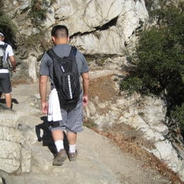

Date of Visitation: 7/15/12 Weather: high 70's, mid 80's Length of Hike: 11 miles Departure/Arrival: 830-1330 Difficulty Level: Moderate Parking: Small lot, street parking, park pass required Type of Trail: dirt, rocky, steady & steep incline and decline, shady (80% of the trail), loop Usage: Mainly hiking, few multi-use (horses and bike) Snacks: protein bar, beef jerky Memorable Moments: 2 snake sightings, bottomless child sighting (uuuuummm, yeah) Trail Features: nature, several water/stream locations to take rest, walking alongside the water/stream, sufficient natural canopy, waterfall, good elevation gain Side Note: Arrive early for close parking, parking pass required and a day pass can be obtained at the ranger office for $5 at entrance, do not stand still in one spot for long, bugs will start to form around you. Pack enough water and/or snacks if taking the long route, trail was not overly crowded
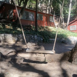

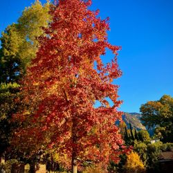
Although this is not a trail in Zion National Park (I wish!), it is still a lovely hike through the San Gabriel Mountains. Parking: The start of the trail is from the Chantry Flats parking lot. I googled the Chantry Flats parking lot and here was the address that came up: 2201-2299 Forest Route 2N40, Sierra Madre, CA 91011. Parking is also available outside of the parking lot along the side of the mountains. Don't forget to display your adventure pass. If you don't have one, you can buy one at the parking lot for $5 or any sport shops such as REI, Big 5 Bass Pro Shop, Sport Chalet. There are three different parking lots (top, middle, bottom). To get a parking spot, I would definitely come early. My friend and I arrived at around 6:45am and the bottom parking lot was already full. We got a spot in the middle parking lot. Direction: The trail is towards the entrance of the parking lot and starts out as asphalt-paved. Restrooms are available at the beginning of the trail and there may be some throughout the trail but I would use the one at the start to be safe. Follow the directions to Spruce Grove Campground where you will pass a mini bridge, dams and cabins along this trail. At the campground, there are picnic benches to sit which is where we took our break. After you get here, follow the signs to Camp Sturtevant. You will go through the camp which has a cool swing that you can swing on :) There will be signs and arrows that said "Mt. Wilson and Mt. Zion this way", so you won't get lost. When you are going through Camp Sturtevant, head left which will lead you out of the camp and make another left. If you make a right, you are heading towards Mt. Wilson. There is a trail sign towards the left which can be easily missed, but just remember when you get outside of the camp and the trail splits, head LEFT! You will then have to climb over this huge trunk which have handles to help you climb over it. Thank you to whoever did that! Continue onward and eventually you will see the Mt. Zion "plaque". Head left and you will arrive at an open area and that is it! YOU MADE IT! You will see the San Gabriel Mountains and the city behind it. The view isn't like absolutely amazing but it's still pretty. Kind of sucks that there were lots of bushes around which ruins the view a bit. There wasn't anywhere to sit so my friend and I just sat in the shade in the dirt and relaxed. Experience: The trail is mostly shady and narrow, but it's wide enough to let people through if you need to. There were lots of annoying gnats throughout the trail, so I would recommend wearing a net to avoid getting them into your ears, mouth or eyes. I accidentally ate one... or maybe two. You can rent one of those mosquito head net gear from REI. The trail is approximately 9 miles roundtrip. It took about 5 hours roundtrip (2.5 hrs one way) to complete the hike. I'm sure you can do it faster if you don't rest or take pictures which we did. It's a relatively easy hike with a small amount of steepness here and there. Since it is fall, it was great to see yellow leaves on the trees and on the ground amongst the green trees. What made this hike enjoyable (despite the gnats), were the shade, the cool/cute cabins, and Camp Sturtevant. The view isnt spectacular but still a nice hike. You can get to Mt. Wilson and Sturtevant Falls partially on this trail. We were going to stop by the waterfall when we were heading back but forgot haha. Next time!


A local ride/hike for me. Been doing this for years and love the almost 11 mile loop from car to car. In the passed few months, someone has been working on Zion trail. They might think they're doing good trail work but in actuality, they are ruining a perfectly good trail. Removing embedded rocks from trails does not improve the trail. It only weakens the soil, which will create ruts and run offs. No one who hikes or rides here is looking for paved trails. We like it rocky and natural. Brush work and re-enforcement of trail where there's potential for slides or wash outs are good and appreciated but not removing and destroying embedded rocks. Who ever is doing this, please stop immedietely!
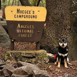

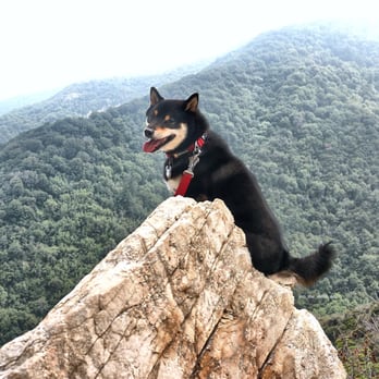
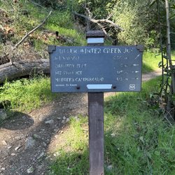
Beautiful forest hike! We went to the Mt Zion summit from Lower Creek and went back the same way so we didn't do the loop. Total miles of 7.6 miles with a 2182 ft gain. The hike was mostly shaded and was extremely peaceful. Once you go down the fire road from the Chantry Flats parking lot (maybe 0.5 miles or so), the trail splits after you cross the wooden bridge. It seemed like most people went to Sturtevent Falls as I barely ran across anyone at the Lower Creek trail to Mt Zion. I saw about 3 to 4 groups on the way up and saw no one on the way back until I reached that trail split I mentioned above. I didn't expect such a quiet and peaceful trail since the parking lot is so crowded! There are several creek crossings but nothing too big (my Shiba Inu was able to do it with no problem). There were multiple cabins on the way up but most of them looked abandoned...or maybe it's just poorly maintaned? Not really sure. After a few miles going up, you reach Hoegee's Campground. I did see a tent here so it looks like an active campground. Once you pass that, you will see a sign that tells you the way to upper winter creek and Mt Zion, I was initially going to go to the Upper Winter Creek trail to do the loop, but mountain summits always tend to seem more attractive to me so I decided to follow the Mt Zion trail. The forest hike does change once you go on the Mt Zion trail. You will be exposed to the sun and the path becomes a lot more narrow and the trail is not maintained as well. Brushes were overgrown but nothing too bad. There were a LOT of bees and I had a constant buzz sound near my ears. I'd probably not recommend it if you are allergic to bees. The summit was unfortunately not as amazing! There were so many brushes and trees around you, that it just didn't really seem like a summit to me. And again....bees! Although the summit wasn't as great, the trail to get there is actually really nice! I think the view on the way back at certain areas are actually better than the summit! Overall, I don't think this is a difficult hike since the incline is not steep at all and it's mostly shaded. Must do Mt Wilson next time! Btw, I would not use the restrooms at the Chantry Flats parking lot.....I'm not sure how often they are cleaned but it was by far one of the worst I have seen (I have hiked at least 30 different trails this year)....so bad that you can't really get to the toilet without stepping on "accidents." Word of advice, go to the restroom before you drive up Chantry Flats Rd!


+ Mt Zion Trail is a great hike. Good amounts of shade and opportunities to see animals throughout the trail. + I encountered a family of deer during my ascent, and a big bear during my descent! Both the bear and I were startled by each other. The bear quickly scampered away, thankfully. I didn't have to be the one to choose fight or flight. + A good next-door alternative to the burned down Mt Wilson Trail. + Nice thing about this hiking area is there's a restaurant both at the base (Adams Pack Station) and at the alternative summit (Cosmic Café at the end of Mt Wilson Trail). . Chantry Flat has a decent parking lot size. I found a spot right away at 10am, likely because it was a hot weekday. - The trail's often overrun with flies. Two flew in my mouth during my hike. Tasted bitter. Managed to spit them out. - Restrooms lacking amenities and in need of repair. No hand-washing sink or hand sanitizer available. - Required parking pass ($5/day). - No registry at the summit. Still decent view of Pasadena though. read more


2 years ago

7 years ago

An incredible and moderately challenging hike from Chantry Flat Grounds. Taking a left at the paved road will get you to the peak of Mount Zion. Ranging at about a 4 mile hike up into the peak, you can walk around and see other areas through off paths of the mountain. There are tons of shaded areas and wooded paths along the main trail that you can explore and I would highly suggest doing so. I went on a Thursday Morning and started around 8 AM which was cool weather and perfect climate for a nice leisure hike. The sights at the top were incredible, overlooking the three majors cities surrounding LA and the big city buildings itself. Be cautious when hiking since para rescue does make their rounds in the mornings due to falling rocks and wild life. This trail seems good for cyclists and morning joggers however it is privately owned and does not have POV access. Great time, nice seclusion to collect yourself and I good wake up in the morning! 10/10 with no complaints! read more




9 years ago
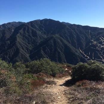
Liked the litter free trail, nice views, shelter in trees from sun glare. Sorry to say parking lot tends to fill quickly on a nice day - filled by 8 am on MLK day. Lots of cars parked up to 1 mile down the access road. Enjoyed Sturtevant Falls and Sturtevant Camp as well. Got a nice map bandana for $8 and a souvenir patch for $3. Julie, helping with parking, was pleasant as were sales helpers. Refilled water bottle at Sturtevant Camp. read more


This is an awesome hike!! Never boring, always changing, and a GREAT workout! From the parking lot, it's an 11 mile round-trip hike that will take anywhere from 3-5 hours depending on if you jog/run on the trail or just walk. I much prefer it to Mt. Wilson. It's about 2 miles shorter each way, but I feel you get a better workout and experience because there are fewer rocks to worry about and my feet didn't ache after the hike like they do when I climb Wilson. Also, when you get to the top, it's incredible...i've never been on top of an area like that before. It was like being in a cloud! Great views, enjoyable terrain, and all-around loved it!! If you like a challenge, peaceful waterfalls, pretty plants, and a trail you can run on at times (with agile footing, of course)...try Mt. Zion! xo- andrea read more


14 years ago
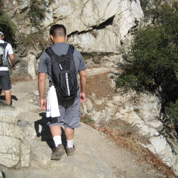
Date of Visitation: 7/15/12 Weather: high 70's, mid 80's Length of Hike: 11 miles Departure/Arrival: 830-1330 Difficulty Level: Moderate Parking: Small lot, street parking, park pass required Type of Trail: dirt, rocky, steady & steep incline and decline, shady (80% of the trail), loop Usage: Mainly hiking, few multi-use (horses and bike) Snacks: protein bar, beef jerky Memorable Moments: 2 snake sightings, bottomless child sighting (uuuuummm, yeah) Trail Features: nature, several water/stream locations to take rest, walking alongside the water/stream, sufficient natural canopy, waterfall, good elevation gain Side Note: Arrive early for close parking, parking pass required and a day pass can be obtained at the ranger office for $5 at entrance, do not stand still in one spot for long, bugs will start to form around you. Pack enough water and/or snacks if taking the long route, trail was not overly crowded read more


12 years ago


13 years ago

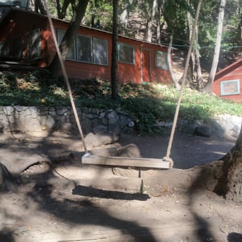
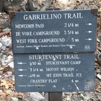
Although this is not a trail in Zion National Park (I wish!), it is still a lovely hike through the San Gabriel Mountains. Parking: The start of the trail is from the Chantry Flats parking lot. I googled the Chantry Flats parking lot and here was the address that came up: 2201-2299 Forest Route 2N40, Sierra Madre, CA 91011. Parking is also available outside of the parking lot along the side of the mountains. Don't forget to display your adventure pass. If you don't have one, you can buy one at the parking lot for $5 or any sport shops such as REI, Big 5 Bass Pro Shop, Sport Chalet. There are three different parking lots (top, middle, bottom). To get a parking spot, I would definitely come early. My friend and I arrived at around 6:45am and the bottom parking lot was already full. We got a spot in the middle parking lot. Direction: The trail is towards the entrance of the parking lot and starts out as asphalt-paved. Restrooms are available at the beginning of the trail and there may be some throughout the trail but I would use the one at the start to be safe. Follow the directions to Spruce Grove Campground where you will pass a mini bridge, dams and cabins along this trail. At the campground, there are picnic benches to sit which is where we took our break. After you get here, follow the signs to Camp Sturtevant. You will go through the camp which has a cool swing that you can swing on :) There will be signs and arrows that said "Mt. Wilson and Mt. Zion this way", so you won't get lost. When you are going through Camp Sturtevant, head left which will lead you out of the camp and make another left. If you make a right, you are heading towards Mt. Wilson. There is a trail sign towards the left which can be easily missed, but just remember when you get outside of the camp and the trail splits, head LEFT! You will then have to climb over this huge trunk which have handles to help you climb over it. Thank you to whoever did that! Continue onward and eventually you will see the Mt. Zion "plaque". Head left and you will arrive at an open area and that is it! YOU MADE IT! You will see the San Gabriel Mountains and the city behind it. The view isn't like absolutely amazing but it's still pretty. Kind of sucks that there were lots of bushes around which ruins the view a bit. There wasn't anywhere to sit so my friend and I just sat in the shade in the dirt and relaxed. Experience: The trail is mostly shady and narrow, but it's wide enough to let people through if you need to. There were lots of annoying gnats throughout the trail, so I would recommend wearing a net to avoid getting them into your ears, mouth or eyes. I accidentally ate one... or maybe two. You can rent one of those mosquito head net gear from REI. The trail is approximately 9 miles roundtrip. It took about 5 hours roundtrip (2.5 hrs one way) to complete the hike. I'm sure you can do it faster if you don't rest or take pictures which we did. It's a relatively easy hike with a small amount of steepness here and there. Since it is fall, it was great to see yellow leaves on the trees and on the ground amongst the green trees. What made this hike enjoyable (despite the gnats), were the shade, the cool/cute cabins, and Camp Sturtevant. The view isnt spectacular but still a nice hike. You can get to Mt. Wilson and Sturtevant Falls partially on this trail. We were going to stop by the waterfall when we were heading back but forgot haha. Next time! read more




13 years ago

17 years ago

14 years ago
A local ride/hike for me. Been doing this for years and love the almost 11 mile loop from car to car. In the passed few months, someone has been working on Zion trail. They might think they're doing good trail work but in actuality, they are ruining a perfectly good trail. Removing embedded rocks from trails does not improve the trail. It only weakens the soil, which will create ruts and run offs. No one who hikes or rides here is looking for paved trails. We like it rocky and natural. Brush work and re-enforcement of trail where there's potential for slides or wash outs are good and appreciated but not removing and destroying embedded rocks. Who ever is doing this, please stop immedietely! read more


10 years ago
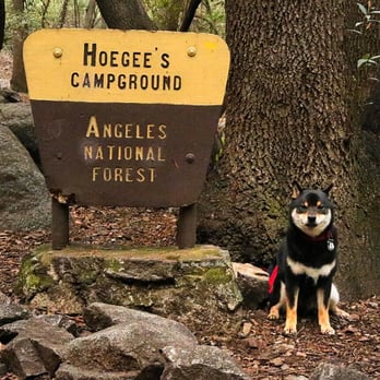
Beautiful forest hike! We went to the Mt Zion summit from Lower Creek and went back the same way so we didn't do the loop. Total miles of 7.6 miles with a 2182 ft gain. The hike was mostly shaded and was extremely peaceful. Once you go down the fire road from the Chantry Flats parking lot (maybe 0.5 miles or so), the trail splits after you cross the wooden bridge. It seemed like most people went to Sturtevent Falls as I barely ran across anyone at the Lower Creek trail to Mt Zion. I saw about 3 to 4 groups on the way up and saw no one on the way back until I reached that trail split I mentioned above. I didn't expect such a quiet and peaceful trail since the parking lot is so crowded! There are several creek crossings but nothing too big (my Shiba Inu was able to do it with no problem). There were multiple cabins on the way up but most of them looked abandoned...or maybe it's just poorly maintaned? Not really sure. After a few miles going up, you reach Hoegee's Campground. I did see a tent here so it looks like an active campground. Once you pass that, you will see a sign that tells you the way to upper winter creek and Mt Zion, I was initially going to go to the Upper Winter Creek trail to do the loop, but mountain summits always tend to seem more attractive to me so I decided to follow the Mt Zion trail. The forest hike does change once you go on the Mt Zion trail. You will be exposed to the sun and the path becomes a lot more narrow and the trail is not maintained as well. Brushes were overgrown but nothing too bad. There were a LOT of bees and I had a constant buzz sound near my ears. I'd probably not recommend it if you are allergic to bees. The summit was unfortunately not as amazing! There were so many brushes and trees around you, that it just didn't really seem like a summit to me. And again....bees! Although the summit wasn't as great, the trail to get there is actually really nice! I think the view on the way back at certain areas are actually better than the summit! Overall, I don't think this is a difficult hike since the incline is not steep at all and it's mostly shaded. Must do Mt Wilson next time! Btw, I would not use the restrooms at the Chantry Flats parking lot.....I'm not sure how often they are cleaned but it was by far one of the worst I have seen (I have hiked at least 30 different trails this year)....so bad that you can't really get to the toilet without stepping on "accidents." Word of advice, go to the restroom before you drive up Chantry Flats Rd! read more




13 years ago
Lots of fun different trails... just great to be able to get out of the City and get in a great hike. Best thing is it isnt too far away for most people. read more


12 years ago


9 years ago

10 years ago
More info about Mount Zion Trail
Santa Anita Canyon Rd
La Canada Flintridge, CA 91011
Directions
Hours
Outdoor Amenities
Ask the Community - Mount Zion Trail
Review Highlights - Mount Zion Trail
You might also consider




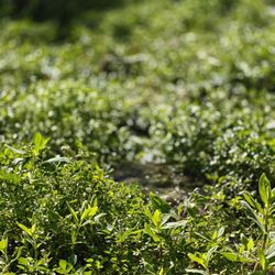
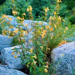


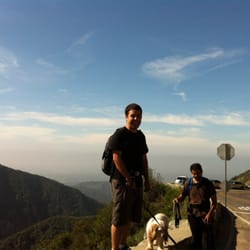
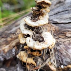








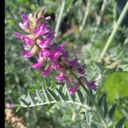

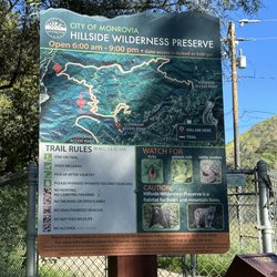


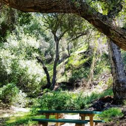


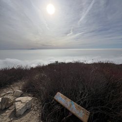

Mount Zion Trail - hiking - Updated September 2026
Best of La Canada Flintridge
People found Mount Zion Trail by searching for…
Hiking Trails in La Canada Flintridge, CA
Waterfall Hike in La Canada Flintridge, CA
Parks in La Canada Flintridge, CA
Campgrounds in La Canada Flintridge, CA
Beautiful Views in La Canada Flintridge, CA
Running Trails in La Canada Flintridge, CA
Places to Take Pictures in La Canada Flintridge, CA
Easy Hikes in La Canada Flintridge, CA
Fall Foliage in La Canada Flintridge, CA
Walking Trails in La Canada Flintridge, CA
Abandoned Places in La Canada Flintridge, CA
Shaded Hike in La Canada Flintridge, CA
Scenic View in La Canada Flintridge, CA
Abandoned Buildings in La Canada Flintridge, CA
Trail in La Canada Flintridge, CA
Natural Hot Springs in La Canada Flintridge, CA
Off Road Trails in La Canada Flintridge, CA
Hiking Trails Kid Friendly in La Canada Flintridge, CA
National Parks in La Canada Flintridge, CA
Picnic Areas in La Canada Flintridge, CA
Pump Track in La Canada Flintridge, CA
Waterfall in La Canada Flintridge, CA
Browse Nearby
BEST of La Canada Flintridge, California Coffee near Mount Zion Trail
BEST of La Canada Flintridge, California Things to Do near Mount Zion Trail
BEST of La Canada Flintridge, California Walking Trails near Mount Zion Trail
BEST of La Canada Flintridge, California Restaurants near Mount Zion Trail
BEST of La Canada Flintridge, California Parks near Mount Zion Trail
BEST of La Canada Flintridge, California Breakfast near Mount Zion Trail
BEST of La Canada Flintridge, California Campgrounds near Mount Zion Trail
BEST of La Canada Flintridge, California Motel near Mount Zion Trail
BEST of La Canada Flintridge, California Taxis near Mount Zion Trail


