Confederate Hospital Historical Marker Photos


More like Confederate Hospital Historical Marker
Recommended Reviews - Confederate Hospital Historical Marker
Start your review...

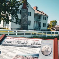
This marker along US-11 which is known as Old Valley Pike in Mount Jackson points out the hospital structure that was nearby during the Civil War. This original site is now a convenience store and gas station The marker reads, "The Confederate hospital was built here under the direction of Dr. Andrew Russell Meem, by order of the Confederate Medical Department in Sept. 1861. The hospital consisted of three two-story buildings, each 150 feet long, accommodating 500 patients. At the end of the war, the 192nd Ohio Volunteer Militia tore down the hospital and used the lumber to construct a large military installation that included a courthouse, guardhouse, gallows, and ballroom on Rude's Hill, three miles south of Mount Jackson. Federal occupation forces used these structures throughout the Reconstruction period. The cemetery, which was established directly across the Valley Pike in 1861, was dedicated in 1866." [Review 15266 overall, 768 of 2021, number 1333 in Virginia.] read more


More info about Confederate Hospital Historical Marker


Confederate Hospital Historical Marker - landmarks - Updated July 2026
Best of Mount Jackson
People found Confederate Hospital Historical Marker by searching for…
Things to Do in Mount Jackson, Virginia
Historical Sites in Mount Jackson, Virginia
Attractions in Mount Jackson, Virginia
Courthouses in Mount Jackson, Virginia
Things to See in Mount Jackson, Virginia
Scenic Overlook in Mount Jackson, Virginia
Photo Spots in Mount Jackson, Virginia
Scenic Drive in Mount Jackson, Virginia
View Points in Mount Jackson, Virginia
Historical Tours in Mount Jackson, Virginia
Birthday Party Venues in Mount Jackson, Virginia
Lookout Points in Mount Jackson, Virginia
Tourist Attractions in Mount Jackson, Virginia
Places to Take Pictures in Mount Jackson, Virginia
Watch Sunset in Mount Jackson, Virginia
Castles in Mount Jackson, Virginia
Night View in Mount Jackson, Virginia
Museums in Mount Jackson, Virginia
Unemployment Office in Mount Jackson, Virginia
To Do in Mount Jackson, Virginia
What to Do in Mount Jackson, Virginia
Sightseeing in Mount Jackson, Virginia
Browse Articles
Browse Nearby
BEST of Mount Jackson, Virginia Restaurants near Confederate Hospital Historical Marker
BEST of Mount Jackson, Virginia Photo Spots near Confederate Hospital Historical Marker
BEST of Mount Jackson, Virginia Scenic Drive near Confederate Hospital Historical Marker
BEST of Mount Jackson, Virginia Things to Do near Confederate Hospital Historical Marker
BEST of Mount Jackson, Virginia Coffee near Confederate Hospital Historical Marker
BEST of Mount Jackson, Virginia Campgrounds near Confederate Hospital Historical Marker
BEST of Mount Jackson, Virginia Ski Resorts near Confederate Hospital Historical Marker
BEST of Mount Jackson, Virginia Breakfast near Confederate Hospital Historical Marker
BEST of Mount Jackson, Virginia Hotels near Confederate Hospital Historical Marker
Browse Brands
Trending Searches in Mount Jackson, VA
Blueberry Picking near Confederate Hospital Historical Marker
Boat Rental near Confederate Hospital Historical Marker
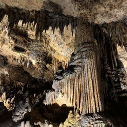
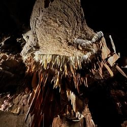
Caves near Confederate Hospital Historical Marker
Cliff Jumping near Confederate Hospital Historical Marker
Fireworks near Confederate Hospital Historical Marker
Flower Fields near Confederate Hospital Historical Marker
Historical Sites near Confederate Hospital Historical Marker
Kayak Rental near Confederate Hospital Historical Marker
Landmarks & Historical Buildings near Confederate Hospital Historical Marker
Lookout Points near Confederate Hospital Historical Marker
Peach Picking near Confederate Hospital Historical Marker
Picnic Areas near Confederate Hospital Historical Marker
River Swimming near Confederate Hospital Historical Marker
River Tubing near Confederate Hospital Historical Marker
Secluded Spots near Confederate Hospital Historical Marker
Splash Pad near Confederate Hospital Historical Marker
Strawberry Picking near Confederate Hospital Historical Marker
Swimming Holes near Confederate Hospital Historical Marker
Swimming Lakes near Confederate Hospital Historical Marker
Things To See near Confederate Hospital Historical Marker
People who viewed Confederate Hospital Historical Marker also viewed
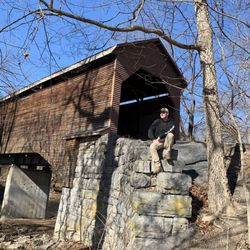
Meem's Bottom Bridge
12 reviews
Belle Grove Plantation
13 reviews
McNeil's Last Charge Historic Marker
1 review
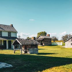
New Market Battlefield State Historical Park
20 reviews
Riverton Park
3 reviews
Town of New Market
1 review
USPS - Lacey Spring
1 review
Blue Star Memorial Highway
1 review
$
USPS post office - Washington VA
1 review
Virginia Department of Motor Vehicles
9 reviews