Daisy Mountain Trailhead Photos


You might also consider


More like Daisy Mountain Trailhead
Recommended Reviews - Daisy Mountain Trailhead
Start your review...


Reviews With Photos


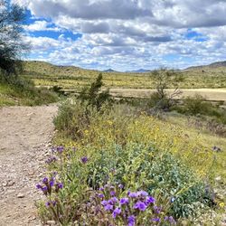
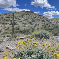
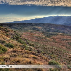
Daisy Mountain is a fantastic gem of a hike situated far enough north of the valley that you will be able to have some one on one time with the desert - without the massive crowds you'll find at the more popular trails. The trailhead is not clearly marked, which is probably for the best, as it keeps away crowds. However, you can find lots of parking on the street. On a Sunday morning, there were only eight or so cars total around the jumping off point. Compare that to Camelback or Pinnacle Peak and you can maybe understand why I love hikes like this. The trail starts easy, with about 2 miles of almost totally level ground. It is after this point that the real hike starts. You can execute Daisy Mountain on a loop trail, hiking up one ridge and descending down the other, which is exactly what we did. Elevation gain is about 1400 feet, and it's close to 7 miles of total hiking if you do the full loop. The scenery is beautiful, once you start gaining some elevation, the trail narrowly hugs the side of the mountain, and you'll find yourself traversing up and down several washes, which nicely creates up and down segments to keep things interesting. There two main peaks at the top. Both are marked by large cairns, and one has a large American flag with some green patio type chairs someone decided to haul up there. The views are spectacular and totally worth the trek up. If you're a lover of nature, the outdoors, hiking, or getting a great workout, bring your friends, haul yourself up to Anthem, and knock this mountain off. You'll have a great time!


2 years ago
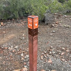
My son and I were in town for the Arizona Cup and after he shot we needed somewhere to explore. This was close and wasn't supposed to be to hard and only 3.3 miles. Not sure where they started there measurements from but my Garmin watch clocked over 10 miles. The trail is not well marked but we did make going to the right and up and around. The suggestions were to go left but the lack of trail markers and a well defined trail we opted for the clearer path. Great hike. I am over 50 and over weight and made it fine. Bring water and snacks and enjoy a great hike. read more


6 years ago
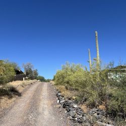
This is as near as you can probably get for a desert wilderness hike this close to civilization. Daisy Mt. is about the best one around that is considered an established trail. It gets a 4 because although it and Gavalin Peak are both the best around, neither are true back country hikes. Impossible to get lost but it is very possible to get hurt if you are not mindful on the steep & slippery slopes. For Daisy you start off following an old access road for a couple of miles until it splits to a regular trail one way going south, up the south peak of the Daisy chain. Or you can take the trail split north, winding up on the north peak of the Daisy chain. Between the two peaks is a trail across a saddle which will take you from one to the other. If you hit the N one first then cross to the south peak do NOT take the trail you see right across the ridge going toward the golf course or you will wind up far far away where you started at the Livingstone trailhead. Going up the N side is easy to follow and not bewildering if you backtrack back down the way you started. Going up the S peak first, which is more of a ridge I would say, finding your way to the saddle crossing is not obvious but just keep your eye the N peak, following the ridge east until you see the saddle trail going over to the N. peak. This is the only "official" trail up Daisy but there are are at least three others coming in from different compass points. Bushwacking is possible but this is all real desert; steep & rocky with a lot of loose scree. Save yourself a lot of grief and stick to what looks like a trail. read more


Daisy Mountain is a fantastic gem of a hike situated far enough north of the valley that you will be able to have some one on one time with the desert - without the massive crowds you'll find at the more popular trails. The trailhead is not clearly marked, which is probably for the best, as it keeps away crowds. However, you can find lots of parking on the street. On a Sunday morning, there were only eight or so cars total around the jumping off point. Compare that to Camelback or Pinnacle Peak and you can maybe understand why I love hikes like this. The trail starts easy, with about 2 miles of almost totally level ground. It is after this point that the real hike starts. You can execute Daisy Mountain on a loop trail, hiking up one ridge and descending down the other, which is exactly what we did. Elevation gain is about 1400 feet, and it's close to 7 miles of total hiking if you do the full loop. The scenery is beautiful, once you start gaining some elevation, the trail narrowly hugs the side of the mountain, and you'll find yourself traversing up and down several washes, which nicely creates up and down segments to keep things interesting. There two main peaks at the top. Both are marked by large cairns, and one has a large American flag with some green patio type chairs someone decided to haul up there. The views are spectacular and totally worth the trek up. If you're a lover of nature, the outdoors, hiking, or getting a great workout, bring your friends, haul yourself up to Anthem, and knock this mountain off. You'll have a great time! read more


6 years ago
Great views hard to follow the trail after a rain Be prepared lots of water and dress accordingly. read more

More info about Daisy Mountain Trailhead
North Livingstone Way & Navigation Way
New River, AZ 85086
Directions
Hours
Outdoor Amenities
You might also consider








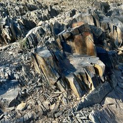

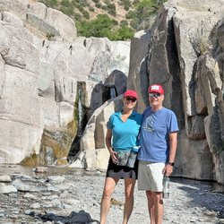


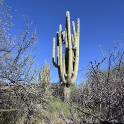




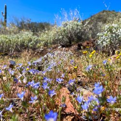









Daisy Mountain Trailhead - hiking - Updated August 2026
Best of New River
People found Daisy Mountain Trailhead by searching for…
Hiking Trails in New River, AZ
Scenic Night View in New River, AZ
Off Road Trails in New River, AZ
Places to Walk in New River, AZ
Beautiful Views in New River, AZ
Walking Trails in New River, AZ
Nature Trails in New River, AZ
Restaurants With a View in New River, AZ
Off Leash Dog Hikes in New River, AZ
Waterfall Hike in New River, AZ
Stroller Friendly Hikes in New River, AZ
Trending Searches in New River, AZ
Barbershop For Men near Daisy Mountain Trailhead
Bike Shop near Daisy Mountain Trailhead
Cliff Jumping near Daisy Mountain Trailhead
Consignment Shops near Daisy Mountain Trailhead
Cruising Spots near Daisy Mountain Trailhead
Dog Friendly Things To Do near Daisy Mountain Trailhead
Ear Piercing near Daisy Mountain Trailhead
Elementary Schools near Daisy Mountain Trailhead
Eyebrow Threading near Daisy Mountain Trailhead
Flower Fields near Daisy Mountain Trailhead
Hair Braiding near Daisy Mountain Trailhead
Kids Haircut near Daisy Mountain Trailhead
Lakes near Daisy Mountain Trailhead
Lookout Points near Daisy Mountain Trailhead
Parks near Daisy Mountain Trailhead
Pedicure near Daisy Mountain Trailhead
Picnic Areas near Daisy Mountain Trailhead
Preschools near Daisy Mountain Trailhead
Public Golf Courses near Daisy Mountain Trailhead
Rock Quarry near Daisy Mountain Trailhead
Running Trails near Daisy Mountain Trailhead
Scenic Night View near Daisy Mountain Trailhead
Scenic Overlook near Daisy Mountain Trailhead
Sports Card Shops near Daisy Mountain Trailhead
Sunrise View near Daisy Mountain Trailhead
Swimming Holes near Daisy Mountain Trailhead
Trading Card Shops near Daisy Mountain Trailhead
Uniforms near Daisy Mountain Trailhead
Browse Articles
Browse Nearby
BEST of New River, Arizona Coffee near Daisy Mountain Trailhead
BEST of New River, Arizona Restaurants near Daisy Mountain Trailhead
BEST of New River, Arizona Scenic View near Daisy Mountain Trailhead
BEST of New River, Arizona Things to Do near Daisy Mountain Trailhead
BEST of New River, Arizona Parks near Daisy Mountain Trailhead
BEST of New River, Arizona Breakfast near Daisy Mountain Trailhead
BEST of New River, Arizona Campgrounds near Daisy Mountain Trailhead
BEST of New River, Arizona Day Trips near Daisy Mountain Trailhead
BEST of New River, Arizona Motel near Daisy Mountain Trailhead
Browse Brands
Related Searches in New River, AZ
Affordable Kayak Rental Services in New River, Arizona
Best Dog Hiking Trails Around New River, Arizona
Best Fishing Locations and Guides in New River, Arizona
Best Nature Trails for Hiking in New River, Arizona
Best Places for Horseback Riding in New River, Arizona
Best Sightseeing Experiences Available in New River, Arizona
Check Out Off Road Trails in New River, Arizona
Discover Dog Friendly Trails to Explore in New River, Arizona
Discover Easy Hiking Trails Near New River, Arizona
Discover Kid Friendly Hiking Trails in New River, Arizona
Discover Popular Bike Trails in New River, Arizona
Discover Walking Parks in New River, Arizona Near You
Discover a Hiking Trail in New River, Arizona
Discover the Best Night Hike Trails in New River, Arizona
Dog-Friendly Hikes With Dogs in New River, Arizona
Enjoy Camping Adventures Around New River, Arizona
Enjoy Kayaking Adventures in New River, Arizona
Enjoy Off Leash Dog Hikes in New River, Arizona
Enjoy Scenic Places to Walk in New River, Arizona
Enjoy Tent Camping Spots Around New River, Arizona
Enjoy a Beautiful Waterfall Hike in New River, Arizona
Enjoy the Best Walking Path in New River, Arizona
Enjoy the Best Walking Trails in New River, Arizona
Experience Stunning Sunset Views in New River, Arizona
Explore Easy Hikes Perfect for All in New River, Arizona
Explore Fun Activities to Do in New River, Arizona
Explore Popular Campgrounds Near New River, Arizona
Explore Top Dog Parks in New River, Arizona Near You
Family Friendly Hiking With Kids in New River, Arizona
Find Cozy Camping Cabins in New River, Arizona
Find Top-Rated Waterfalls in New River, Arizona Now
Find the Best Parks for Picnics in New River, Arizona
Find the Best Playgrounds to Visit in New River, Arizona
Find the Best Scenic View Locations in New River, Arizona
Hiking Trails With Waterfalls in New River, Arizona
Off Leash Dog Hiking Trails in New River, Arizona
Plan a Scenic Drive Route Near New River, Arizona
Popular Outdoor Activities to Try in New River, Arizona
Popular Picnic Spots to Visit in New River, Arizona
Safe River Swimming Areas in New River, Arizona
Safe and Fun Parks for Kids in New River, Arizona
Top Hiking Trails to Explore in New River, Arizona
Top Playgrounds for Kids to Enjoy in New River, Arizona
Top Running Trails to Explore in New River, Arizona
Top Swimming Lakes to Enjoy in New River, Arizona
Top Swimming Spots and Pools in New River, Arizona
Top-Rated Camping Sites in New River, Arizona


