Cancel

    Open app

    Search

    High Desert Trailhead

    5.0 (2 reviews)

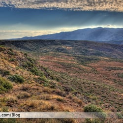
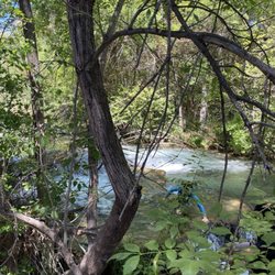
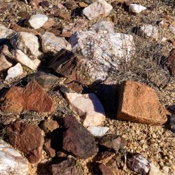
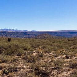
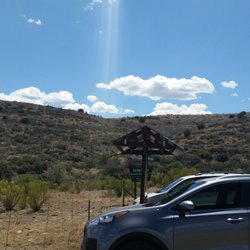
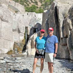
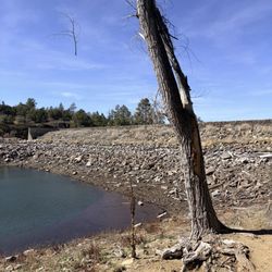
    High Desert Trailhead Photos

    You might also consider

    Recommended Reviews - High Desert Trailhead

    Your trust is our priority, so businesses can't pay to alter or remove their reviews. Learn more about reviews.
    Yelp app icon
    Browse more easily on the app
    Review Feed Illustration

    3 years ago

    Helpful 0
    Thanks 0
    Love this 0
    Oh no 0

    2 years ago

    Great place to do easy hiking close to Phoenix. Not a crowded trail. Gets you close to nature and fresh air.

    Helpful 0
    Thanks 0
    Love this 0
    Oh no 0

    Verify this business for free

    Get access to customer & competitor insights.

    Verify this business

    Fossil Creek Wilderness

    Fossil Creek Wilderness

    4.2(87 reviews)
    37.6 mi

    FYI: If you're planning to go during the government shutdown, you can't drive all the way to the…read moreparking lot -- it's about an 8-mile hike (a lot of it on gravel). But honestly, it's worth every step! Just when you think you've reached the falls... you haven't. Keep going! The road in is pure washboard -- about 13 miles of bump city -- so make sure you have a 4-wheel drive and that nothing inside your car is loose. Fossil Creek is absolutely stunning, and bonus -- no permit needed after October 1st. The other thing says this trail is easy. No, it's not to be careful if you're taking somebody elderly over that doesn't have good mobility because there's some rocks you had a climb and what not also make sure you take plenty of water to drink and a little snack everything you pack in your pack. I would also suggest leaving the house by three 330. No later you don't wanna be hiking in the pitch dark.

    People really need to be better educated on the permit process and the strict requirements that are…read morenow being enforced. We had our permit that one of our husbands printed for us but since he was not in vehicle, they would not allow us to enter!! Worse than our problem were 2 women in thier turn around lot at thier gate and those 2 women were still stranded in the heat nearly 6 hours later. We the park rangers failed to relay a hugely important message to those ladies about thier spare tire being In the middle of the road 10 miles back !! Again a huge disappointment for those park employees who witnessed these women being stranded, and we feel with 3 employees and 2 trucks could have easily assisted these women or at the very least let them know where thier spare was located ! We were hugely inconvenienced by driving back several miles to pile into one car as the option they offered us, but these poor ladies we believe were clearly suffering unnecessary while not one of those employees told them where thier spare was located or possibly offered to get it for them .

    Photos
    Fossil Creek Wilderness
    Fossil Creek Wilderness
    Fossil Creek Wilderness

    See all

    Black Canyon National Recreation Trail - Trail near Antelope Creek Rd and #59

    Black Canyon National Recreation Trail

    4.5(2 reviews)
    21.0 mi

    If you want to rock hunt and experience a remote mining area with classic high desert landscape,…read more the portion of Black Canyon Trail starting at the intersection of Antelope Creek Rd and Crown King Forest Rd 59 is a great trail. The parking area is easy to access from the I-17 by taking the Bloody Basin exit, driving 3 miles west on a good dirt road, then heading south for 2.7 miles on Antelope Creek Rd (179), take a left at the fork and drive 1.3 more miles and turn left at a stop sign and another immediate left to park at a round water tank and corral. The hike heads across FR 59 following a single track, signed trail to the south. Numerous mountain bike tracks were seen on the trail, though on a Friday we did not see any cyclists or other hikers. There are numerous outcrops of quartz and iron rich rocks that are fun to search through, and excellent views to the Bradshaws and the valleys to the east and south. Walk as far as you like on the easy trail. As you return to your vehicle, take a detour to the old Hidden Treasure Mine a short distance up a Jeep trail. There is a rusted tank, some pipes and an old Adobe structure to look at, though no rock hunting. Give the old talus piles a miss as they have clearly been used to target practice with a lot of scattered glass bottles and rusted tin cans. Before leaving the area walk around the corral to the south where there is a lovely pond with a few old sycamores and water reeds. We did not see a pump, so the water may be from a natural spring.

    Doing another hike today! Going to see how far I can make it this time last time I did 1 mile and 1…read moremile back in so let's see if I can go one mile and a half to two miles okay thank you it will be a great Trail today I like it it's a bright sunny day the trails Mark there's no getting lost all you need is moderate shoes and socks to do this Trail.

    Photos
    Black Canyon National Recreation Trail - Great rock hunting near Crown King Road

    Great rock hunting near Crown King Road

    Black Canyon National Recreation Trail - View to the east near Hidden Treasure Mine

    View to the east near Hidden Treasure Mine

    Black Canyon National Recreation Trail - The mountains

    See all

    The mountains

    Blue Wash Trail - Flag

    Blue Wash Trail

    4.6(7 reviews)
    22.6 mi

    What a beautiful trail! And such a pleasant/ easy hike. The most effort you put in here is driving…read moreall the way past Cave Creek, other than that, it's such a peaceful & relaxing place. We hiked over to Camp Creek Falls and back. Couldn't have been more than 3 miles round trip. I didn't look at my watch afterwards. During the golden hour it was gorgeous. I fully recommend this place. But please, it's a super clean and well kept trail. Keep it that way. Otherwise I'll regret sharing it on yelp ;)

    The kids, dogs, and I spent 3 hours hiking and playing in the AZ desert. It's been a couple of…read moreyears since we've gone. This time of the year, the water is pretty low, but there's water and a waterfall, so the kids and dogs loved it! We had the waterfall to ourselves for a good half hour. My daughter played with her mermaids, and my son enjoyed rock climbing above the falls. It was wonderful being in the fresh AZ nature... until we had to hike back uphill to the car. The top thing to know is to turn LEFT at the American flag. There are some well placed rocks pointing the way. Also, you do have to climb down and over some big rocks... You do have to climb down and over some big rocks. And then back up and over them on the way back. Be sure to save energy for the hike back because it's inclined the whole way. Don't forget sunscreen! Maybe take water shoes if the kids want to play in the water. Stop by Raven's View restaurant on the way home. Enjoy!

    Photos
    Blue Wash Trail - What a great Mother's Day hike this is!

    What a great Mother's Day hike this is!

    Blue Wash Trail
    Blue Wash Trail

    See all

    Lynx Lake - Path by the dam

    Lynx Lake

    4.1(59 reviews)
    34.5 mi

    I have camped in Prescott before, but never at this lake. I had heard great things about Lynx Lake…read moreand have always wanted to check it out. This lake was formed in the 1960s when they dammed Lynx Creek. It is stocked for fishing and has a campground and hiking trails around it. There are lots of animals that are native to this area like mule deer, osprey and bald eagles. I booked a campsite here during the summer because I own a kayak and wanted to get out on the water. After setting up my site, I headed over to Lynx Lake. I was a little disappointed to see the water so low. I guess in late 2024, the lake was partially drained to fix a mechanical failure in the dam's outlet valve. It has to rely entirely on natural rain and snow to be refilled and could take years to get back to normal. So we just did a hike around the lake and headed back to our campsite. Lynx Campground has around 35 campsites with a picnic table, fire ring and a grill at each site. There are no RV hook-ups, but they do have drinking water and toilets. The campsite is about half a mile directly south of Lynx Lake. We enjoyed our campsite and had a fun time. We had to partially share our site with another family because their giant tent spilled onto our site (which was annoying). But we made the most of it. The nice thing is that the Town of Prescott isn't too far away if you need any food or supplies. As for kayaking, we were able to do that over at Watson Lake. You can book a campsite ahead of time on Recreation.gov.

    I've been to Lynx Lake a few times, and this recent visit was pretty similar to my past…read moreexperiences. I'm giving it a 3-star review mainly because the lake has recently been drained and they want it to refill naturally, so it's unclear when water levels will return to normal. There is also a $5 day-use fee to enter the park. You can pay cash or card. Currently, the park opens at 7:00 AM and the gates close at 5:00 PM. The trail around the lake is about 2.5 miles and offers a few different routes, including at least one path that leads to a small waterfall (or what would be a waterfall if the lake wasn't drained). The west side of the lake is more paved and level, making it easier for walking, while the east side is more rugged with a dirt trail. One thing to add, the bathrooms were clean, but they had smell in them was hard to ignore and really unpleasant. Overall, it's still a nice area for a casual walk around the lake, especially if you're in the area.

    Photos
    Lynx Lake - Site 13C

    Site 13C

    Lynx Lake - East side trail

    East side trail

    Lynx Lake

    See all

    Sears Kay Ruins

    Sears Kay Ruins

    4.3(7 reviews)
    22.7 mi

    When driving around the area I came across these ruins. I decided to park and take the trek up to…read moresee the historical ruins at the top. The hike up to the top is easy (in my opinion), but there is a notable climb to the top which could be more of a moderate climb for some people. While there is an ADA parking spot, the hike itself isn't wheelchair accessible as there are no paved areas of the trail. Everyone's abilities vary but I wanted to provide that call out if there's anyone wondering about wheel chair accessibility. There are nice picnic areas and a restroom that are accessible for anyone using a wheelchair. There were some pretty flowers along the trail and the sights are beautiful.

    a really cool spot to check out. It is not a long hike, but there is a bit of a vertical climb to…read moreget to the top. Nothing too crazy, just enough to get your legs working a little. At the top, you get to see what a small Hohokam outpost was like, which is pretty awesome. It is wild to think about people living up there and using that hill as a lookout and settlement area. You can still see the outlines of the old structures and get a real sense of the history. The views from the top are amazing too. You get a great look at the surrounding desert and mountains, which makes the climb totally worth it. If you are into local history or just want a short hike with a payoff at the top, Sears Kay Ruins is definitely worth the visit.

    Photos
    Sears Kay Ruins
    Sears Kay Ruins
    Sears Kay Ruins

    See all

    Cholla Trail

    Cholla Trail

    4.3(104 reviews)
    39.6 mi

    Let me start by saying that before, taking any hike, please take heed to every warning sign that is…read moreposted. I made the mistake of seeing extremely difficult and comparing it to a hike I did in New Mexico that was difficult thinking that this was just slightly higher than the one in New Mexico. I only looked at the distance and did not pay attention to the incline. This trail is 1.47 miles but has a gain of over 1300 feet. It is extremely steep and that is the part that will take you out! No pets are allowed on this trail, which is definitely a wise decision given how steep and narrow it is. Another hiker told us that there are a total of 36 markers along the trail, I made it to marker five, my husband made it to marker seven. By the time I hit marker five I was dizzy and nauseous. I was definitely not ready for how extremely difficult this hiking trail was. I feel like I looked at the warning signs, but didn't quite register what they were saying. It is a beautiful hike, but you definitely have to be accustomed to the incline and the altitude. The views were beautiful, but you absolutely must be careful, I would recommend a hiking stick to help keep your balance, especially on the way down. So my rating of five star is that they 100% accurately described the trail, it was absolutely beautiful, I just failed to register the warnings.

    Quality/Quantity - 2-3 hour round trip hike (my guest does this hike in 4 hours, lol). We got here…read morelate, so we only did 1 hour as we did not want to get a $118 ticket for staying past sunset. So we only hiked to marker 8. A fairly steep rocky trail. No shade, but perfect weather for us on this winter afternoon. Beautiful views; see my pictures. Views of Scottsdale and Phoenix. Atmosphere - At the start of the trail there were restrooms, drinking fountain, bike rack, etc. Very limited parking, make sure you pay attention to the street signs. We got lucky and got a perfect space, probably because we got here an hour before closing and most people had already left. Summit - 2,704 feet. Animals - We saw loose dogs, rabbits, etc. Open from sunrise to sunset. Service - Self service. Price - Free. Owner Comment - Congrats on your success since 1960's since The Preservation of Camelback Mountain Foundation.

    Photos
    Cholla Trail
    Cholla Trail - Views at bottom

    Views at bottom

    Cholla Trail - Up and up

    See all

    Up and up

    High Desert Trailhead - parks - Updated September 2026

    Loading...
    Loading...
    Loading...