Desolation Wilderness Photos


You might also consider


More like Desolation Wilderness
Recommended Reviews - Desolation Wilderness
Start your review...


Reviews With Photos


We did a backpacking trip to Desolation wilderness in July to Zone 33 and it was wonderful. The hike was strenuous but the challenge was worth the beautiful views. The trails are heavy traffic due to day hikes but everyone was mindful of covid safety. Starting the hike early is good to avoid harsh sun. Not many bug except at night. Overall, loved desolation wilderness.


The scenery was GREAT. Beautiful. I went backpacking here. Started at Echo Lake and Lake Aloha(6 miles each way, just 600 feet elevation gain) Easy backpacking. The second day, hiked from Lake Aloha to Clyde Lake, Heather Lake. Water taxi is also available at Echo Lake (lower-upper) $12/each way. no round-trip ticket. a bit expensive. runs 8 a.m.-6 p.m. Everything is pretty but one thing I didn't like is that some non-hardcore backpackers are selfish and violate rules. Probably this can't be avoidable because it's Lake Tahoe area.


Desolation wilderness definitely exceeded my expectations! Prior to arrival, we thought there was going to be a little bit of snow which might be a little bit hard to hike in. There was no snow and sunny the whole day! The views, scenery were breathtaking, something out of a book. Pictures don't do justice! We parked at the trail head at Lower Echo Lake and got here around 8 am. You need to get a permit to hike here. There is limited parking there so try to get there early. The hike was about 8-9 miles. Honestly, I couldn't ask for a better day! clear perfect blue skies, the sun out and a cool breeze!


there is no place like this. every part of lake tahoe is so pleasant, exciting, and beautiful, but this popular hiking spot was the BEST i've ever been to. if you are not a local (like me) be WARNED, the oxygen levels are lower here so you will feel a bit more tired and breathless than usual. i am fortunate to have learned that on day 1 of my trip here after doing some research, but my colleagues were exhausted!! lol granted they are college students and spent more time studying than exercising, but we only walked 3 miles and they almost passed out lollll. (i believe this is supposed to be a 6 mile walk). i had a blast! we went in october (mid fall season) so the trees were a range of beautiful earth colors. this photo i took looks like a bob ross painting?!! is that not crazy! fortunately we went during the less populated hours so around noon and we made back around 5pm. we had fun blasting music and cracking jokes on this scenic walk. i will be planning my own solo walk to just enjoy the scenery a little more. if i had a dog i would walk it here all the time haha. if you're coming to tahoe and you're a bit adventurous, definitely make room in your schedule to check this spot out!! (:


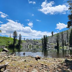
A Desolation Wilderness hike was on my hiking bucket list and yesterday I made it happen with a hike up to Velma Lakes. There are several ways to access trails, one of the more popular being Eagle Falls trailhead. From the lot, you will be able to fill out your day use permit and then head on up. My particular hike was focused on Velma Lakes and I had done my research in advance and mapped my route. If you're going further than Eagle Lake, be prepared-the higher elevation hikes are not for novices. The trail to Velma Lakes splits off to the left before Eagle Lake and you're climbing up and up over rocky boulders, twisted tree roots and bark strewn forest floors. You weave in and out of pine forest and along the way can catch views of Eagle Lake below and Maggie's Peak when the tree cover gives way. This is a very pretty trail but tough! You are climbing from the Eagle Falls trailhead to the junction of the Bayview trail for at least 3 miles. On our featured hike we hit the Bayview junction and followed the signs to Velma Lakes. Along the way we climbed through fields of boulders, passed several smaller lakes, had to cross a rushing stream and had sweeping views of the higher peaks. Pay attention to the trail-it can be disorienting in the sections that are boulder strewn. There is good signage at major intersections but no others along the way. We followed signs to Middle Velma and hit the lake...you can opt to overlook it from some higher boulders or if you follow the PCT trail to the right and go about a quarter mile, you can scramble along the rocks, leaving the trail and hitting the shore (be mindful of where you exited the trail.) Middle Velma was spectacular! Small islands dotted the lake and it was carved in to the surrounding granite giving each section of the lake unique lighting and reflections. I wish I could have spent more time there but we still had Upper Velma to explore and it was later in the day. We had passed the junction of Upper Velma en route to Middle Velma and then simply back tracked and headed up to the lake. It was about 1/2 mile total detour and so worth it! Gorgeous peaceful lake with ducks, lots of greenery and mountain reflections in the water. Lots of mosquitoes, though, in Mid August. From there it was a long journey back-I feel like it took us longer going down as we had to be extra mindful of the downhill portions. At the bottom of our hike we detoured to Eagle Lake and spent some time enjoying the early evening breeze and relaxing our legs before the final 1 mile push back to the car. There is no place like Desolation Wilderness that I've ever visited-so vast and peaceful. While the hike was strenuous, I felt euphoric and just happier than I've been in while. Definitely my most memorable Tahoe experience. More to know before you go: -Be prepared! While the Middle Velma Lake is popular (we ran in to about 9 or 10 other parties) you still have long stretches where you see no one. Familiarize yourself with the trails, map your route and ideally have a hiking buddy. -it's about 10 miles round trip to Middle Velma from Eagle Falls and it's a tough 10 miles (elevation, rough terrain in areas and steep descent on the way down) Know your limits and it's best to have some 10+ mile hikes under your belt before trying this -2 + liters of water per person at least -some shade on the trail but much of it in the open-sunscreen and hats recommended -over the ankle hiking boots ideal -fuel yourself with a good breakfast and bring high energy snacks to enjoy along the lakes -start early! We began at 11 and the whole trip took us 8 hours-that included several stops to pause and enjoy the lakes. We also took our time in certain sections to take in the views and took lots of photos (some hikers may be able to do the route in 5-6 hours but that's with very little stops and at a brisk pace, in my opinion) -high bear activity has been noted-particularly at Middle Velma Lake-we were vigilant but didn't see any. -pack in, pack out and enjoy!
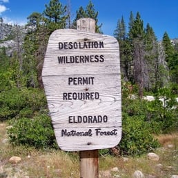

Amazingly breathtaking beauty. Literally breathtaking hikes! Desolation is where I like to go when I'm having a "screw you, civilization!!" moment. I like to start near Horsetail Falls. The hike can be a little crazy if you aren't wearing the proper shoes (last time I went I was sliding too much and couldn't get all the way to the top - so bummed!). There isn't an obvious trail for much of the way and you have to keep an eye out for markers (stacks of rocks). There are lakes, waterfalls, creeks and rivers. The views are spectacular so don't forget your camera. I would NOT recommend much of it for Grandma unless she is super fit and able to handle wilderness- a virtual Artemis! The same goes for kids. Little guys can handle some of the easier places, but the hike to the lakes at the top can be pretty hairy and you might not want to risk it. Finally, if you want to hike to the top of a mountain, smoke a cigarette (stunned you can even manage that!), eat some Fritos and drink a Gatorade that's your business... but PACK IT OUT!


This past August, four old pals of mine from growing up and I got organized for two nights in the Desolation Wilderness. It had been 7 years since we'd done this trip, and it did not disappoint. Starting at the trailhead at the back of Emerald Bay off of Lake Tahoe, we trudged about 6 miles up the granite to the Velma Lakes where we pitched our tents and busted out the bladders of wine. (Franzia... who knew?) We camped at the Velma Lakes, which is a spectacular spot and a relatively easy way to access the incredibly idyllic high Sierra. When I say relatively easy, I mean simple, as the hike itself is quite strenuous at 8,000 feet elevation with or without copious amounts of malt beverages in your pack. The camping is epic, if a bit "hard" as essentially this is one gigantic slab of granite that is studded with hundreds-of-years-old trees and high mountain lakes filled with snow-melt. This place is also fun for fly fisherman, which I'm not. I mean, I like the idea of fishing, and I really like to eat fish, but I'm hurting on the gear. See you in 2014, boys!


Desolation wilderness is one of the epic areas in all of California to day hike of multi day backpacking. You'll need to have reservations the limit the number of people backpacking in from all of the entry points. The Regional Forestry Service office is right off Al Tahoe where you can pick up your permit an make your reservations. Word to the wise here make sure you bring a bear proof food storage container an use it per instructions. Don't leave food in tents you'll have a pile of rags when you return. The views are amazing it's the easiest way to hike up to the top of Mt Tallac ( 9739ft )to view the Tahoe basin.


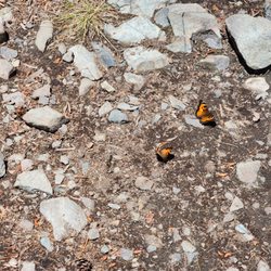
It's been way too long since I've backpacked and about 1 year since I've gone camping so I decided to help plan a trip with my brother. He picked the site and I just came along, eager for getting out of the city and doing some hiking and camping. We started mid afternoon at the Glen Alpine trail-head and started our 4 mi. hike into Susie Lake, where we were required to stay the first night. Along the way, we ran into many day hikers coming back from various hikes, saw a bunch of pretty flowers and waterfalls. The hike was pretty strenuous (or maybe my pack was just a bit heavy for me and I hadn't gotten used to the altitude yet), mostly up hill, gaining 1500 ft. of elevation. Since we were hiking at mid-afternoon/evening, the mosquitoes were swarming us, so don't forget to apply over exposed and non-exposed areas (because they will bite under clothes! I have 12 bites under my left shoulder sleeve as proof!). Susie Lake was beautiful. Didn't see too many campers during the July 4th weekend. Nobody really listens to the rule of staying 200 ft. from the water or from the trail. We stayed on a slight hill because we figured the mosquitoes are closer to the water, but I think they're just out no matter where you are. The next day we did a day hike to Lake Aloha which was beautiful, but it was quite windy and blustery so we didn't attempt to walk along the shoreline. We headed back to base-camp at Lake Susie and just relaxed. We found a small lake with fresh water flowing in and filtered ourselves some water. The water at all the lakes were clean, clear and freezing! On the way out we ran into more hikers: some with dogs (some without), some hikers with strollers and children and some bikers. Coming back was beautiful, seeing the mountains and flowers and butterflies that would fly by your feet.


This is my favorite spot to hike in Tahoe. There is a trail for everyone, whether you're a beginner or an avid hiker, your will surely find a trail that fits your skill level. The scenery in this area is beautiful. Depending on the season, you might be able to see some waterfalls cascading over some cliffs. Overall this place has everything a hiker can expect, like trails that lead to a secluded lakes, waterfalls, wild flowers, open trails that let's you explore off the beaten path; there's even a rock climbing area near the Eagle Falls Lake Trail. I highly recommend this place if you like the outdoors.
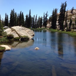

First time at Desolation wilderness , we decide to hike to Lyons lake, first 4 miles are moderate with a lot of shade, wile flowers, great trails ;once you get to the last mile it becomes challangin due to altitude and path has a lot of rocks ,when you arrive to Lyons Lake you feel that you arrive to a piece of heaven. Next time i would like to start hike not later 8:00 and bring a swimming suit enjoy the lake.
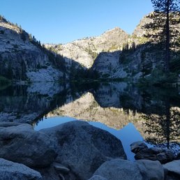

This is a review for the Granite Lake and Maggie's Peak Hike in this area. It is not the easiest hike but boy is the view (and the bonus mirror-like lake halfway through) worth it. You'll be rewarded with a gorgeous, panoramic view of Lake Tahoe and Fallen Leaf Lake. Parking is $12. read more


This review is for Granite Lake and Maggie's Peaks which was a ~4.1 miles round trip (from the trailhead) that took ~3 hours to complete. Bayview Campground was currently closed so parking was on the side of the highway. From the highway to the start of the trailhead would be another ~0.35 miles. Steep inclines to the top! No formal trail at the peak; just look for a spot with the best views of Lake Tahoe, Emerald Bay, Granite Lake and Cascade Lake. Short video of the hike for those interested! https://youtu.be/IHKx9NmL7K8 read more


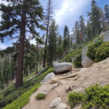


What a beautiful trail... The trail is easy in some parts and very hard in others and non existing in other areas. You need to arrive early to get a good parking space in the lot and remember to pay the box. You can hike for an hour or all day. There is over night hiking too. Bring sun screen, water and snacks for a day hike. Backpacks are a must as well as sunscreen and mosquito repellent. I did about a 6 mile hike and it was perfect. Mid-week is the time to come if you do not want to see anyone. What a beautiful place and soak up nature. read more


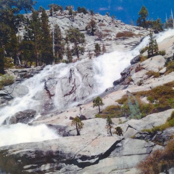
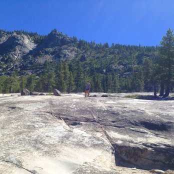


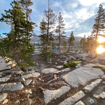
We did a backpacking trip to Desolation wilderness in July to Zone 33 and it was wonderful. The hike was strenuous but the challenge was worth the beautiful views. The trails are heavy traffic due to day hikes but everyone was mindful of covid safety. Starting the hike early is good to avoid harsh sun. Not many bug except at night. Overall, loved desolation wilderness. read more


7 years ago

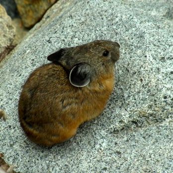
The scenery was GREAT. Beautiful. I went backpacking here. Started at Echo Lake and Lake Aloha(6 miles each way, just 600 feet elevation gain) Easy backpacking. The second day, hiked from Lake Aloha to Clyde Lake, Heather Lake. Water taxi is also available at Echo Lake (lower-upper) $12/each way. no round-trip ticket. a bit expensive. runs 8 a.m.-6 p.m. Everything is pretty but one thing I didn't like is that some non-hardcore backpackers are selfish and violate rules. Probably this can't be avoidable because it's Lake Tahoe area. read more




Desolation wilderness definitely exceeded my expectations! Prior to arrival, we thought there was going to be a little bit of snow which might be a little bit hard to hike in. There was no snow and sunny the whole day! The views, scenery were breathtaking, something out of a book. Pictures don't do justice! We parked at the trail head at Lower Echo Lake and got here around 8 am. You need to get a permit to hike here. There is limited parking there so try to get there early. The hike was about 8-9 miles. Honestly, I couldn't ask for a better day! clear perfect blue skies, the sun out and a cool breeze! read more


there is no place like this. every part of lake tahoe is so pleasant, exciting, and beautiful, but this popular hiking spot was the BEST i've ever been to. if you are not a local (like me) be WARNED, the oxygen levels are lower here so you will feel a bit more tired and breathless than usual. i am fortunate to have learned that on day 1 of my trip here after doing some research, but my colleagues were exhausted!! lol granted they are college students and spent more time studying than exercising, but we only walked 3 miles and they almost passed out lollll. (i believe this is supposed to be a 6 mile walk). i had a blast! we went in october (mid fall season) so the trees were a range of beautiful earth colors. this photo i took looks like a bob ross painting?!! is that not crazy! fortunately we went during the less populated hours so around noon and we made back around 5pm. we had fun blasting music and cracking jokes on this scenic walk. i will be planning my own solo walk to just enjoy the scenery a little more. if i had a dog i would walk it here all the time haha. if you're coming to tahoe and you're a bit adventurous, definitely make room in your schedule to check this spot out!! (: read more


9 years ago
A Desolation Wilderness hike was on my hiking bucket list and yesterday I made it happen with a hike up to Velma Lakes. There are several ways to access trails, one of the more popular being Eagle Falls trailhead. From the lot, you will be able to fill out your day use permit and then head on up. My particular hike was focused on Velma Lakes and I had done my research in advance and mapped my route. If you're going further than Eagle Lake, be prepared-the higher elevation hikes are not for novices. The trail to Velma Lakes splits off to the left before Eagle Lake and you're climbing up and up over rocky boulders, twisted tree roots and bark strewn forest floors. You weave in and out of pine forest and along the way can catch views of Eagle Lake below and Maggie's Peak when the tree cover gives way. This is a very pretty trail but tough! You are climbing from the Eagle Falls trailhead to the junction of the Bayview trail for at least 3 miles. On our featured hike we hit the Bayview junction and followed the signs to Velma Lakes. Along the way we climbed through fields of boulders, passed several smaller lakes, had to cross a rushing stream and had sweeping views of the higher peaks. Pay attention to the trail-it can be disorienting in the sections that are boulder strewn. There is good signage at major intersections but no others along the way. We followed signs to Middle Velma and hit the lake...you can opt to overlook it from some higher boulders or if you follow the PCT trail to the right and go about a quarter mile, you can scramble along the rocks, leaving the trail and hitting the shore (be mindful of where you exited the trail.) Middle Velma was spectacular! Small islands dotted the lake and it was carved in to the surrounding granite giving each section of the lake unique lighting and reflections. I wish I could have spent more time there but we still had Upper Velma to explore and it was later in the day. We had passed the junction of Upper Velma en route to Middle Velma and then simply back tracked and headed up to the lake. It was about 1/2 mile total detour and so worth it! Gorgeous peaceful lake with ducks, lots of greenery and mountain reflections in the water. Lots of mosquitoes, though, in Mid August. From there it was a long journey back-I feel like it took us longer going down as we had to be extra mindful of the downhill portions. At the bottom of our hike we detoured to Eagle Lake and spent some time enjoying the early evening breeze and relaxing our legs before the final 1 mile push back to the car. There is no place like Desolation Wilderness that I've ever visited-so vast and peaceful. While the hike was strenuous, I felt euphoric and just happier than I've been in while. Definitely my most memorable Tahoe experience. More to know before you go: -Be prepared! While the Middle Velma Lake is popular (we ran in to about 9 or 10 other parties) you still have long stretches where you see no one. Familiarize yourself with the trails, map your route and ideally have a hiking buddy. -it's about 10 miles round trip to Middle Velma from Eagle Falls and it's a tough 10 miles (elevation, rough terrain in areas and steep descent on the way down) Know your limits and it's best to have some 10+ mile hikes under your belt before trying this -2 + liters of water per person at least -some shade on the trail but much of it in the open-sunscreen and hats recommended -over the ankle hiking boots ideal -fuel yourself with a good breakfast and bring high energy snacks to enjoy along the lakes -start early! We began at 11 and the whole trip took us 8 hours-that included several stops to pause and enjoy the lakes. We also took our time in certain sections to take in the views and took lots of photos (some hikers may be able to do the route in 5-6 hours but that's with very little stops and at a brisk pace, in my opinion) -high bear activity has been noted-particularly at Middle Velma Lake-we were vigilant but didn't see any. -pack in, pack out and enjoy! read more


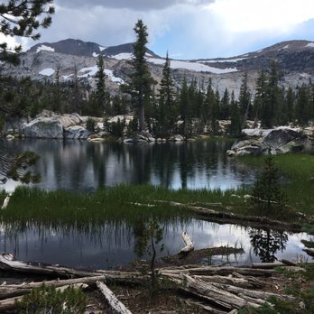

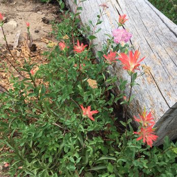


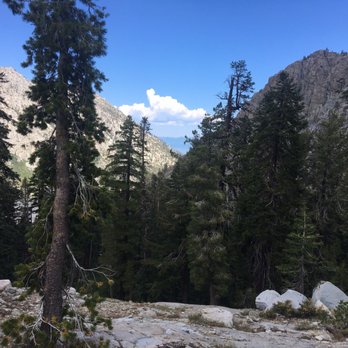

Amazingly breathtaking beauty. Literally breathtaking hikes! Desolation is where I like to go when I'm having a "screw you, civilization!!" moment. I like to start near Horsetail Falls. The hike can be a little crazy if you aren't wearing the proper shoes (last time I went I was sliding too much and couldn't get all the way to the top - so bummed!). There isn't an obvious trail for much of the way and you have to keep an eye out for markers (stacks of rocks). There are lakes, waterfalls, creeks and rivers. The views are spectacular so don't forget your camera. I would NOT recommend much of it for Grandma unless she is super fit and able to handle wilderness- a virtual Artemis! The same goes for kids. Little guys can handle some of the easier places, but the hike to the lakes at the top can be pretty hairy and you might not want to risk it. Finally, if you want to hike to the top of a mountain, smoke a cigarette (stunned you can even manage that!), eat some Fritos and drink a Gatorade that's your business... but PACK IT OUT! read more
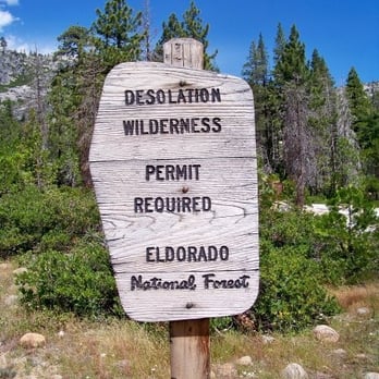


This past August, four old pals of mine from growing up and I got organized for two nights in the Desolation Wilderness. It had been 7 years since we'd done this trip, and it did not disappoint. Starting at the trailhead at the back of Emerald Bay off of Lake Tahoe, we trudged about 6 miles up the granite to the Velma Lakes where we pitched our tents and busted out the bladders of wine. (Franzia... who knew?) We camped at the Velma Lakes, which is a spectacular spot and a relatively easy way to access the incredibly idyllic high Sierra. When I say relatively easy, I mean simple, as the hike itself is quite strenuous at 8,000 feet elevation with or without copious amounts of malt beverages in your pack. The camping is epic, if a bit "hard" as essentially this is one gigantic slab of granite that is studded with hundreds-of-years-old trees and high mountain lakes filled with snow-melt. This place is also fun for fly fisherman, which I'm not. I mean, I like the idea of fishing, and I really like to eat fish, but I'm hurting on the gear. See you in 2014, boys! read more


12 years ago

9 years ago
Desolation wilderness is one of the epic areas in all of California to day hike of multi day backpacking. You'll need to have reservations the limit the number of people backpacking in from all of the entry points. The Regional Forestry Service office is right off Al Tahoe where you can pick up your permit an make your reservations. Word to the wise here make sure you bring a bear proof food storage container an use it per instructions. Don't leave food in tents you'll have a pile of rags when you return. The views are amazing it's the easiest way to hike up to the top of Mt Tallac ( 9739ft )to view the Tahoe basin. read more


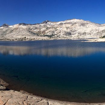


It's been way too long since I've backpacked and about 1 year since I've gone camping so I decided to help plan a trip with my brother. He picked the site and I just came along, eager for getting out of the city and doing some hiking and camping. We started mid afternoon at the Glen Alpine trail-head and started our 4 mi. hike into Susie Lake, where we were required to stay the first night. Along the way, we ran into many day hikers coming back from various hikes, saw a bunch of pretty flowers and waterfalls. The hike was pretty strenuous (or maybe my pack was just a bit heavy for me and I hadn't gotten used to the altitude yet), mostly up hill, gaining 1500 ft. of elevation. Since we were hiking at mid-afternoon/evening, the mosquitoes were swarming us, so don't forget to apply over exposed and non-exposed areas (because they will bite under clothes! I have 12 bites under my left shoulder sleeve as proof!). Susie Lake was beautiful. Didn't see too many campers during the July 4th weekend. Nobody really listens to the rule of staying 200 ft. from the water or from the trail. We stayed on a slight hill because we figured the mosquitoes are closer to the water, but I think they're just out no matter where you are. The next day we did a day hike to Lake Aloha which was beautiful, but it was quite windy and blustery so we didn't attempt to walk along the shoreline. We headed back to base-camp at Lake Susie and just relaxed. We found a small lake with fresh water flowing in and filtered ourselves some water. The water at all the lakes were clean, clear and freezing! On the way out we ran into more hikers: some with dogs (some without), some hikers with strollers and children and some bikers. Coming back was beautiful, seeing the mountains and flowers and butterflies that would fly by your feet. read more


13 years ago

16 years ago
This is my favorite spot to hike in Tahoe. There is a trail for everyone, whether you're a beginner or an avid hiker, your will surely find a trail that fits your skill level. The scenery in this area is beautiful. Depending on the season, you might be able to see some waterfalls cascading over some cliffs. Overall this place has everything a hiker can expect, like trails that lead to a secluded lakes, waterfalls, wild flowers, open trails that let's you explore off the beaten path; there's even a rock climbing area near the Eagle Falls Lake Trail. I highly recommend this place if you like the outdoors. read more


14 years ago

11 years ago

5 years ago


10 years ago
First time at Desolation wilderness , we decide to hike to Lyons lake, first 4 miles are moderate with a lot of shade, wile flowers, great trails ;once you get to the last mile it becomes challangin due to altitude and path has a lot of rocks ,when you arrive to Lyons Lake you feel that you arrive to a piece of heaven. Next time i would like to start hike not later 8:00 and bring a swimming suit enjoy the lake. read more
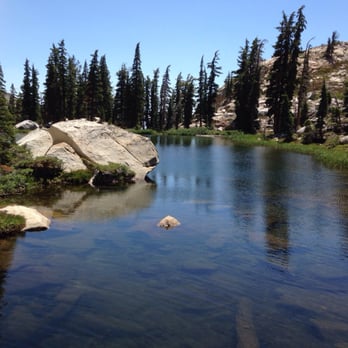


10 years ago
Came here a few weeks ago with friends and it was definitely one of the most picturesque hikes I've been on since I can remember. We initially weren't planning on doing this hike, but I'm glad we did. We only hiked a short portion of Desolation Wildnerness starting at Eagle Falls Trailhead and it was a relatively easy to get to the lake. Only thing is we had to get there SUPER early because of the parking situation at Emerald Bay. Aside from the ridiculously early wakeup call, we loved the hike and the view at dawn was just breathtaking. read more
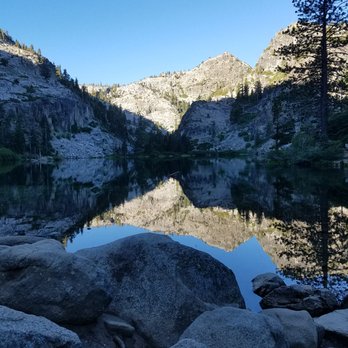


It's called desolation for a reason... you're going to feel quite small in this grand wonder of nature. Great for long day hikes and overnight stays in the summer and shoulder seasons. You must bring food and water, and be careful with the wild animals in the area. read more


10 years ago

18 years ago


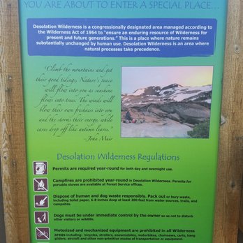
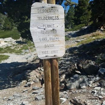
Stunning views of the lakes. We parked at the trail head at Lower Echo Lake, got there around 7:30am and was able to park really close to the TH. We started our journey as soon as we cross the bridge. Clear blue skies, approx 60 degrees. Couldn't have asked for a more perfect day. We ended up hiking up towards Upper Echo Lake, with an amazing view of the lake to the left during the hike from Lower to Upper lake. Go just a bit further you'll get to the "taxi", a small wooden sign that can easily be missed but you'll see a call box, literally a wooden standing phone booth but the phone is on the outside of it. It's to call for a ferry ride back to the TH, $14 per person, $5 dog, not sure for children. We stopped by here, hung out on the deck to dip our feet in the water and have our early lunch. I believe we were 2.5 miles in from the TH to the taxi deck. We got back on the trail and headed to Tamarack Lake. Each group needs to pick up a permit near the ferry waiting area, to go further into Desolation Wilderness. About .5 miles from the taxi area after passing a sign that states you were in Desolation Wilderness, it was probably another mile to Tamarack Lake. Look for stacked rocks and post signs for the trail you're wanting to take. We passed by alot of backpackers, a lady we stopped to talk to said she came from Donner Pass, doing the Pacific Crest Trail and had 550miles to the next stop. More power to her! Must visit, such a view. Plan to be back for backpacking further into Desolation Wilderness. read more





17 years ago


11 years ago
10 years ago
14 years ago
More info about Desolation Wilderness
South Lake Tahoe, CA 96158
Directions
(530) 644-2349
Call Now
Hours
Indoor Amenities
Outdoor Amenities
Ask the Community - Desolation Wilderness
Review Highlights - Desolation Wilderness
You might also consider


















Why does Yelp recommend reviews?
2 reviews that are not currently recommended
The reviews below are not factored into the business's overall star rating.
17 years ago
11 years ago
Desolation Wilderness - hiking - Updated September 2026
Best of South Lake Tahoe
People found Desolation Wilderness by searching for…
Things to Do in South Lake Tahoe, CA
Campgrounds in South Lake Tahoe, CA
Watch Sunset in South Lake Tahoe, CA
Hiking Trails With Waterfalls in South Lake Tahoe, CA
Scenic View in South Lake Tahoe, CA
Fishing Spots in South Lake Tahoe, CA
Fishing in South Lake Tahoe, CA
Sunrise View in South Lake Tahoe, CA
Secret Spots in South Lake Tahoe, CA
Natural Hot Springs in South Lake Tahoe, CA
Rock Climbing in South Lake Tahoe, CA
Scenic Drive in South Lake Tahoe, CA
Walking Trails in South Lake Tahoe, CA
Playgrounds in South Lake Tahoe, CA
Parks for Kids in South Lake Tahoe, CA
Sunset View in South Lake Tahoe, CA
Tent Camping in South Lake Tahoe, CA
Camping Sites in South Lake Tahoe, CA
Sunrise Hike in South Lake Tahoe, CA
Free Campgrounds in South Lake Tahoe, CA
Night Hiking in South Lake Tahoe, CA
Trending Searches in South Lake Tahoe, CA
Apple Orchards near Desolation Wilderness
Apple Picking near Desolation Wilderness
Barbershop near Desolation Wilderness
Bike Shop near Desolation Wilderness
Casinos near Desolation Wilderness
Cliff Jumping near Desolation Wilderness
Consignment Shops near Desolation Wilderness
Cruising Spots near Desolation Wilderness
Dog Friendly Things To Do near Desolation Wilderness
Estheticians near Desolation Wilderness
Eyelash Extensions near Desolation Wilderness
Hiking Trails With Waterfalls near Desolation Wilderness
Kids Birthday Party near Desolation Wilderness
Lakes & Ponds near Desolation Wilderness
Makeup Artists near Desolation Wilderness
Middle Schools & High Schools near Desolation Wilderness
Musical Instruments & Teachers near Desolation Wilderness
Off Road Trails near Desolation Wilderness
Parks near Desolation Wilderness
Picnic Areas near Desolation Wilderness
Places To Take Pictures near Desolation Wilderness
Private Schools near Desolation Wilderness
Public Shower near Desolation Wilderness
Rock Quarry near Desolation Wilderness
Scenic Overlook near Desolation Wilderness
Sunrise View near Desolation Wilderness
Swimming Holes near Desolation Wilderness
Browse Articles
Browse Nearby
BEST of South Lake Tahoe, California Coffee near Desolation Wilderness
BEST of South Lake Tahoe, California Things to Do near Desolation Wilderness
BEST of South Lake Tahoe, California Restaurants near Desolation Wilderness
BEST of South Lake Tahoe, California Breakfast near Desolation Wilderness
BEST of South Lake Tahoe, California Walking Trails near Desolation Wilderness
BEST of South Lake Tahoe, California Parks near Desolation Wilderness
BEST of South Lake Tahoe, California Campgrounds near Desolation Wilderness
BEST of South Lake Tahoe, California Caves near Desolation Wilderness
BEST of South Lake Tahoe, California Sightseeing near Desolation Wilderness
Browse Brands
Related Searches in South Lake Tahoe, CA
Affordable Kayak Rental Services in South Lake Tahoe, California
Best Dog Hiking Trails Around South Lake Tahoe, California
Best Fishing Locations and Guides in South Lake Tahoe, California
Best Places for Horseback Riding in South Lake Tahoe, California
Best Sightseeing Experiences Available in South Lake Tahoe, California
Check Out Off Road Trails in South Lake Tahoe, California
Discover Dog Friendly Trails to Explore in South Lake Tahoe, California
Discover Easy Hiking Trails Near South Lake Tahoe, California
Discover Kid Friendly Hiking Trails in South Lake Tahoe, California
Discover Popular Bike Trails in South Lake Tahoe, California
Discover a Hiking Trail in South Lake Tahoe, California
Discover the Best Night Hike Trails in South Lake Tahoe, California
Dog-Friendly Hikes With Dogs in South Lake Tahoe, California
Enjoy Camping Adventures Around South Lake Tahoe, California
Enjoy Kayaking Adventures in South Lake Tahoe, California
Enjoy Off Leash Dog Hikes in South Lake Tahoe, California
Enjoy Tent Camping Spots Around South Lake Tahoe, California
Enjoy a Beautiful Waterfall Hike in South Lake Tahoe, California
Enjoy the Best Picnic Spots and Ideas in South Lake Tahoe, California
Enjoy the Best Walking Path in South Lake Tahoe, California
Enjoy the Best Walking Trails in South Lake Tahoe, California
Experience Thrilling White Water Rafting in South Lake Tahoe, California
Explore Easy Hikes Perfect for All in South Lake Tahoe, California
Explore Fun Activities to Do in South Lake Tahoe, California
Explore Popular Campgrounds Near South Lake Tahoe, California
Explore Popular State Park Destinations in South Lake Tahoe, California
Explore Top Dog Parks in South Lake Tahoe, California Near You
Explore the Best Beach Spots in South Lake Tahoe, California
Family Friendly Hiking With Kids in South Lake Tahoe, California
Find Fun Kids Activities Outdoor in South Lake Tahoe, California
Find Parks and Recreation Activities in South Lake Tahoe, California
Find Popular Ziplining Spots Around South Lake Tahoe, California
Find Top Dog Friendly Parks to Visit in South Lake Tahoe, California
Find Top-Rated Waterfalls in South Lake Tahoe, California Now
Hiking Trails With Waterfalls in South Lake Tahoe, California
Off Leash Dog Hiking Trails in South Lake Tahoe, California
Popular Outdoor Activities to Try in South Lake Tahoe, California
Popular Picnic Spots to Visit in South Lake Tahoe, California
Popular Waterfall Hiking Trails in South Lake Tahoe, California
Safe and Fun Parks for Kids in South Lake Tahoe, California
Top Hiking Trails to Explore in South Lake Tahoe, California
Top Playgrounds for Kids to Enjoy in South Lake Tahoe, California
Top Running Trails to Explore in South Lake Tahoe, California
Top Swimming Lakes to Enjoy in South Lake Tahoe, California
Top Swimming Spots and Pools in South Lake Tahoe, California
Top Things to Do With Kids in South Lake Tahoe, California
Top-Rated Camping Sites in South Lake Tahoe, California
Walk Dog Friendly Hiking Trails in South Lake Tahoe, California
Walk the Best Paved Walking Trails in South Lake Tahoe, California


