Devil's Churn Photos


You might also consider

More like Devil's Churn
Recommended Reviews - Devil's Churn
Start your review...


Reviews With Photos


Stop & See the Devil in action! A scary name but you gotta see it! There are many great spots to see along the Oregon coast and this one's a must do. You can catch a glimpse from the top of take the small hike down to the bottom and get a closer look and feel the trill of the devil himself lol! But don't go during a king tide or that devil might catch ya!


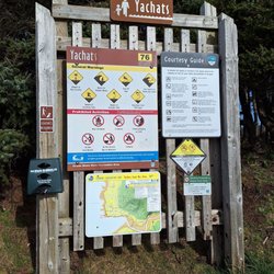
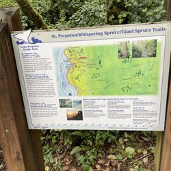
Devils Churn is another popular stop along Oregon's amazing coastal Highway 101 drive. But here's the thing, if you're not witnessing the dramatic pounding of crashing waves against the inlet shoreline, the visit could be pretty mundane. And that sums up my story...I visited Devils Churn around 5:30pm in early August and believe high tide had already come in. So the action I was anticipating had passed. And I think that's how the process works. There wasn't that exploding riptide occurrence. Then Devils Churn becomes just another quick roadside lookout. There is a $5 Day Use fee to stop by and explore around Devils Churn. The parking lot is small maybe accommodating less than 10 cars at a time. There were also a few spots available for 15 minute parking if you'd like to exit your car and take in the sights from the Overlook section. If you'd prefer to get a closer experience, along Trail of the Restless Waters pathway, you can veer off for the 0.5 mile "moderate" loop down to the bottom of Devils Churn. Taking a few excerpts from the 0.5 mile loop trailhead sign.... "Walk beneath the awesome arms of giant Sitka spruce to Devils Churn. Ocean waves careen up the chasm and crash into the volcanic rock thousands of times every day, as the dynamic forces of nature continue to carve this remarkable chasm". "Don't let Devils Churn get you!" - Beware of sneaker waves - don't turn your back on the ocean. - Stay back from the chasm edges or you may end up in the churn. - Watch your footing - rock is uneven and slippery. "As you approach Devils Churn, you'll feel the power of the churn like thunder in your bones, and anticipate each collision of wave and rock like bursting fireworks!" That description sounded quite enticing but on my walk down to Devil's Churn, the waters were mellow. I kept anticipating that forceful/unforgiving impact to occur at some point, but ultimately I kept waiting and waiting...watching every incoming wave passively subside, I was a little perplexed. It simply would not happen. I started pondering why?... Maybe arriving at 5:30pm was too late in the day? Maybe 3 - 3:30pm would have been better? Maybe since it was a gorgeous day outside with calm winds there wasn't enough impactful weather? Maybe depending when ships navigate Pacific Ocean waters, they help assist in creating waves? Maybe some days you just get lucky, and other days you don't, lol? Although Devils Churn didn't work out in the moment, it's still worthy of a visit and efficiently located in the heart of the local action. Across the street is Cape Perpetua Lookout and just down the road is Thor's Well and Spouting Horn, more chances to hopefully catch those rugged waves colliding with Oregon's coastline.


A definite "pull-off the 101 and check it out" spot along the coast! It's a short jaunt down to the rocky inlet. You can walk right out to the edge of the churn, but it becomes quickly apparent how dangerous it can be. I was taking in the views up close and personal when I got a decent sudden splash which served as my cue to back off. The next couple who took my place wasn't so lucky, as they got taken down onto the jagged rocks by a much larger wave. They walked...well, limped away, luckily. So go out for a closer view, but watch carefully and don't take the waves for granted here! There's a nice loop path you can take from the top of the stairs around and back to the lot, short but fun. Decent amount of parking available and restrooms. Beautiful spot!


I want to start by saying that we visited at low tide, which means that we missed out on full "churn". This spot is just a few minutes drive from the Cape Perpetual Visitors Center and is worth the short trip. There are great views from the parking lot but it is probably worth walking down the path to get a better view of the ravine. Again, we visited at low tide, so we were able to get all the way down to the rocks but I am not sure if this is always possible. I think it is easy to be overwhelmed with all of the things to see in Yachats but it is worth spending half a day here to explore and take pictures. I am sure glad that we did!
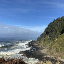

Not the most dramatic of its type, but worth an easy qander off of 101. There is free fifteen minute parking if you just want to walk down and spend a few minutes to look. It is a short trail to the lower platform.


The crashing wave may the awesome sound when they hit the rock. Devil's Churn is a crack at the extruded cliff. This attraction is located at mile marker 166 of the Pacific Coast Highway 101. The sound of wave crashes to the rock wall is magnificent. The wave got diminished when they get close to smaller churn. We can see some sea vegetation on the side of the cliff take the impact very well. The vegetation swinging like nothing happening. It great to take time to stay still to listen to the pounding of the wave. It is like music that is not sequential arranged. When you fix your eye on the far side you see different beauty of the ocean. God made nature is great to appreciate with hear beat of the smashing sound of the wave. Parking is limited. There is a trail take you to bottom of the rock. It is easy walking on the trail.


One of my favorite spots on the Oregon Coast. I picked up some breakfast at a local spot and went to take it to Devil's Churn. It is a small hike, maybe 20 minutes max, to get down to the bottom. As water comes into the little channel, it crashes up and appears to be very active. The smell of the ocean water surrounded by greenery make this a wonderful spot to spend a few hours on the Oregon Coast. Along with this I would recommend visiting Thor's Well also.


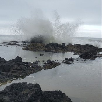
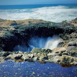
As far as Churn's go this is hands down my favorite! So what is Devil's Churn? It's a narrow inlet that was formed over thousands of years as waves crashed into the basalt shoreline. As the waves crashed they formed a sea cave that eventually collapsed. As the tide comes in and the water level comes up the swells that form and move into the inlet crash at the end of the churn, throwing water into the air (supposedly can reach heights of 100's of feet). There is a nice overview area several hundred feed above the churn making it possible for anyone to enjoy the scene. A moderate hike down a paved path and then some final steps at the end and you can climb out on the rocks yourself to experience a much more up close viewing. CAUTION: You have to always pay attention down here (several markers indicate the potential danger in being in this area) - sneaker waves can come in unexpected and take you out to sea before you know what has happened - always pay attention when close to the water. That being said, it made for some spectacular viewing and we were glad we spent a few minutes to make our way down to this closer viewing area. If you find yourself north of the Sea Lion Caves, you should take a few minutes and stop off to witness the wave crashing show.


The power of the waves on the Oregon coast was extreme. I was happy to stop and take in the salty air. The short hike was a great way to stretch your legs and have a picnic.


We went two days in a row. The second time we walked all the way down to the bottom. You can walk on the rocks. This was awesome. I highly recommend it! The sights and sounds are amazing! I took some great photos!! Be safe though. It's slippery. Be careful leaving. Look for cars. It sits on a curve and can be tricky. They have restrooms and a little coffee shop!


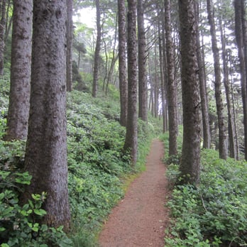
Fantastic ocean wave action in a narrow channel leading from the larger cove to a cave. The waves thunder like bombs when they hit the cave just right. I think a lot of people miss out on the best part - four people saw us coming back from the end of the channel and asked if there was anything to see there. Yes! The narrow channel is not obvious from the lookout or from the bottom of the stairs. The loop trail to the churn is pretty scenic and well worth the time. Good ocean views and some fabulous gnarly trees. Parking and a restroom available.
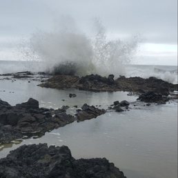

Just the fact that you can walk out so far, being mindful of the ocean crashing up. No words can describe the experience but my family had a blast. Walking down and around to see the Churn was so awesome and beautiful. Make the stop along the way to wherever you are headed.


Another beautiful place in Oregon Coast. I might as well say the whole entire Oregon Coast is beautiful because that is what it is. I love visiting here. I came 2 times in a row. Once in 2014 and once in 2015. I am so glad my friend introduce me to this place. Its beautiful. Its a good walk with beautiful scenery. Ok I basically when photo crazy here. Yes I posted so many photos of this place on FB, that all my friends said its beautiful. Parking is free and there are many of them. This is a good place for hiking and taking pictures. Especially when the tide coming in, if you have timed it right.


6 months ago
Super easy hike down to devils churn with accessible parking. I would highly recommend checking to see where the tide is at before going down for your safety. Came here with my friend on our way to Florence . read more
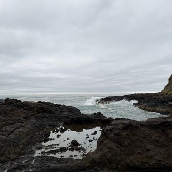

In order to get the full effect of this, you need to go during high tide. Unfortunately, in August, this usually means early in the morning or just before sunset. It's a beautiful landscape, but there is a little turn during prime time. It's worth noting that when we were there in August, the railing in places was unstable. read more


6 months ago

8 months ago
Stop & See the Devil in action! A scary name but you gotta see it! There are many great spots to see along the Oregon coast and this one's a must do. You can catch a glimpse from the top of take the small hike down to the bottom and get a closer look and feel the trill of the devil himself lol! But don't go during a king tide or that devil might catch ya! read more


Devils Churn is another popular stop along Oregon's amazing coastal Highway 101 drive. But here's the thing, if you're not witnessing the dramatic pounding of crashing waves against the inlet shoreline, the visit could be pretty mundane. And that sums up my story...I visited Devils Churn around 5:30pm in early August and believe high tide had already come in. So the action I was anticipating had passed. And I think that's how the process works. There wasn't that exploding riptide occurrence. Then Devils Churn becomes just another quick roadside lookout. There is a $5 Day Use fee to stop by and explore around Devils Churn. The parking lot is small maybe accommodating less than 10 cars at a time. There were also a few spots available for 15 minute parking if you'd like to exit your car and take in the sights from the Overlook section. If you'd prefer to get a closer experience, along Trail of the Restless Waters pathway, you can veer off for the 0.5 mile "moderate" loop down to the bottom of Devils Churn. Taking a few excerpts from the 0.5 mile loop trailhead sign.... "Walk beneath the awesome arms of giant Sitka spruce to Devils Churn. Ocean waves careen up the chasm and crash into the volcanic rock thousands of times every day, as the dynamic forces of nature continue to carve this remarkable chasm". "Don't let Devils Churn get you!" - Beware of sneaker waves - don't turn your back on the ocean. - Stay back from the chasm edges or you may end up in the churn. - Watch your footing - rock is uneven and slippery. "As you approach Devils Churn, you'll feel the power of the churn like thunder in your bones, and anticipate each collision of wave and rock like bursting fireworks!" That description sounded quite enticing but on my walk down to Devil's Churn, the waters were mellow. I kept anticipating that forceful/unforgiving impact to occur at some point, but ultimately I kept waiting and waiting...watching every incoming wave passively subside, I was a little perplexed. It simply would not happen. I started pondering why?... Maybe arriving at 5:30pm was too late in the day? Maybe 3 - 3:30pm would have been better? Maybe since it was a gorgeous day outside with calm winds there wasn't enough impactful weather? Maybe depending when ships navigate Pacific Ocean waters, they help assist in creating waves? Maybe some days you just get lucky, and other days you don't, lol? Although Devils Churn didn't work out in the moment, it's still worthy of a visit and efficiently located in the heart of the local action. Across the street is Cape Perpetua Lookout and just down the road is Thor's Well and Spouting Horn, more chances to hopefully catch those rugged waves colliding with Oregon's coastline. read more


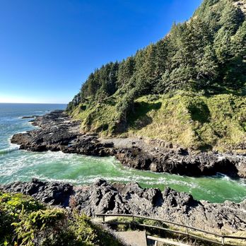


A definite "pull-off the 101 and check it out" spot along the coast! It's a short jaunt down to the rocky inlet. You can walk right out to the edge of the churn, but it becomes quickly apparent how dangerous it can be. I was taking in the views up close and personal when I got a decent sudden splash which served as my cue to back off. The next couple who took my place wasn't so lucky, as they got taken down onto the jagged rocks by a much larger wave. They walked...well, limped away, luckily. So go out for a closer view, but watch carefully and don't take the waves for granted here! There's a nice loop path you can take from the top of the stairs around and back to the lot, short but fun. Decent amount of parking available and restrooms. Beautiful spot! read more

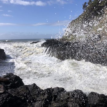


I want to start by saying that we visited at low tide, which means that we missed out on full "churn". This spot is just a few minutes drive from the Cape Perpetual Visitors Center and is worth the short trip. There are great views from the parking lot but it is probably worth walking down the path to get a better view of the ravine. Again, we visited at low tide, so we were able to get all the way down to the rocks but I am not sure if this is always possible. I think it is easy to be overwhelmed with all of the things to see in Yachats but it is worth spending half a day here to explore and take pictures. I am sure glad that we did! read more


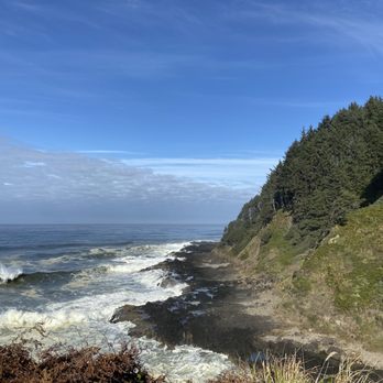


The crashing wave may the awesome sound when they hit the rock. Devil's Churn is a crack at the extruded cliff. This attraction is located at mile marker 166 of the Pacific Coast Highway 101. The sound of wave crashes to the rock wall is magnificent. The wave got diminished when they get close to smaller churn. We can see some sea vegetation on the side of the cliff take the impact very well. The vegetation swinging like nothing happening. It great to take time to stay still to listen to the pounding of the wave. It is like music that is not sequential arranged. When you fix your eye on the far side you see different beauty of the ocean. God made nature is great to appreciate with hear beat of the smashing sound of the wave. Parking is limited. There is a trail take you to bottom of the rock. It is easy walking on the trail. read more


5 years ago
One of my favorite spots on the Oregon Coast. I picked up some breakfast at a local spot and went to take it to Devil's Churn. It is a small hike, maybe 20 minutes max, to get down to the bottom. As water comes into the little channel, it crashes up and appears to be very active. The smell of the ocean water surrounded by greenery make this a wonderful spot to spend a few hours on the Oregon Coast. Along with this I would recommend visiting Thor's Well also. read more


As far as Churn's go this is hands down my favorite! So what is Devil's Churn? It's a narrow inlet that was formed over thousands of years as waves crashed into the basalt shoreline. As the waves crashed they formed a sea cave that eventually collapsed. As the tide comes in and the water level comes up the swells that form and move into the inlet crash at the end of the churn, throwing water into the air (supposedly can reach heights of 100's of feet). There is a nice overview area several hundred feed above the churn making it possible for anyone to enjoy the scene. A moderate hike down a paved path and then some final steps at the end and you can climb out on the rocks yourself to experience a much more up close viewing. CAUTION: You have to always pay attention down here (several markers indicate the potential danger in being in this area) - sneaker waves can come in unexpected and take you out to sea before you know what has happened - always pay attention when close to the water. That being said, it made for some spectacular viewing and we were glad we spent a few minutes to make our way down to this closer viewing area. If you find yourself north of the Sea Lion Caves, you should take a few minutes and stop off to witness the wave crashing show. read more


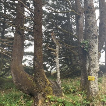
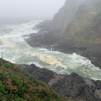


We went two days in a row. The second time we walked all the way down to the bottom. You can walk on the rocks. This was awesome. I highly recommend it! The sights and sounds are amazing! I took some great photos!! Be safe though. It's slippery. Be careful leaving. Look for cars. It sits on a curve and can be tricky. They have restrooms and a little coffee shop! read more


Fantastic ocean wave action in a narrow channel leading from the larger cove to a cave. The waves thunder like bombs when they hit the cave just right. I think a lot of people miss out on the best part - four people saw us coming back from the end of the channel and asked if there was anything to see there. Yes! The narrow channel is not obvious from the lookout or from the bottom of the stairs. The loop trail to the churn is pretty scenic and well worth the time. Good ocean views and some fabulous gnarly trees. Parking and a restroom available. read more




5 years ago
Just the fact that you can walk out so far, being mindful of the ocean crashing up. No words can describe the experience but my family had a blast. Walking down and around to see the Churn was so awesome and beautiful. Make the stop along the way to wherever you are headed. read more

Another beautiful place in Oregon Coast. I might as well say the whole entire Oregon Coast is beautiful because that is what it is. I love visiting here. I came 2 times in a row. Once in 2014 and once in 2015. I am so glad my friend introduce me to this place. Its beautiful. Its a good walk with beautiful scenery. Ok I basically when photo crazy here. Yes I posted so many photos of this place on FB, that all my friends said its beautiful. Parking is free and there are many of them. This is a good place for hiking and taking pictures. Especially when the tide coming in, if you have timed it right. read more


Follow the GPS directions to get here. When you see the information center, you've made it. Go say hi to the knowledgeable people working there and find out the tide times for Thor's Well and the Spouting Horn. Be a kind Samaritan and pay the $5 parking fee for the day to park at the information center or any of the Cape Perpetua campgrounds and hiking areas. The walk down from the parking lot was very easy, but the rock area is a bit difficult to gallivant around, so be careful and don't fall in. Beautiful area to explore and capture some amazing photos. read more


9 years ago


10 years ago
Devil's Churn is a must-see when traveling along the beautiful Oregon Coast and we'll worth the $5 day fee. In-fact the day fee is good for every coastal hotspot along Oregon! The churn itself is quite impressive. Razor-sharp rocks outline the innermost edge, and around it you can expect to see a plethora of tidepools featuring sea anemone and crabs. It's a really neat place as long as you're careful and don't get too wet. read more


7 years ago

5 years ago

12 years ago
It was a really pretty view off the Oregon coast. I read it was an inlet that water shot up through, creating a 30 foot splash. I did not see this and I was there during high tide (5:00); however, it may just depend on the season or day. Aside from that, it was a truly beautiful view. read more

11 years ago
Wow. This is very medieval looking place! We've arrived too early and parked there until we get a bit of light. (Not recommended) Restroom is a PLUS!!! Parking space is a PLUS!!! We were there on an early weekday so there weren't many people around. There are little nice hiking trails. It's far from where we live but I will definitely be coming back in the future! read more


8 years ago

10 years ago
10 years ago
More info about Devil's Churn
2400 US 101
Yachats, OR 97498
Directions
Hours
Outdoor Amenities
Ask the Community - Devil's Churn
Where is a local hotel or motel? Restaurants? How long a drive from Portland?
Review Highlights - Devil's Churn
























Why does Yelp recommend reviews?

Devil's Churn - parks - Updated August 2026
Best of Yachats
People found Devil's Churn by searching for…
Trending Searches in Yachats, OR
Barbershop For Men near Devil's Churn
Casinos With Slot Machines near Devil's Churn
Cliff Jumping near Devil's Churn
Consignment Shops near Devil's Churn
Dog Friendly Beaches near Devil's Churn
Ear Piercing near Devil's Churn
Elementary Schools near Devil's Churn
Eyebrow Threading near Devil's Churn
Fishing Spots near Devil's Churn
Fun Things To Do With Kids near Devil's Churn
Kids Haircut near Devil's Churn
Lookout Points near Devil's Churn
Picnic Areas near Devil's Churn
Playgrounds near Devil's Churn
Public Beaches near Devil's Churn
Rock Quarry near Devil's Churn
Running Trails near Devil's Churn
Scenic Overlook near Devil's Churn
Sports Card Shops near Devil's Churn
Sunrise View near Devil's Churn
Swimming Holes near Devil's Churn
Trading Card Shops near Devil's Churn
Used Book Stores near Devil's Churn
Browse Articles
Browse Nearby
Browse Brands
Related Searches in Yachats, OR
Affordable Kayak Rental Services in Yachats, Oregon
Best Dog Hiking Trails Around Yachats, Oregon
Best Fishing Locations and Guides in Yachats, Oregon
Best Parks for Parties and Events in Yachats, Oregon
Best Places for Horseback Riding in Yachats, Oregon
Best Sightseeing Experiences Available in Yachats, Oregon
Best Water Parks for Kids in Yachats, Oregon
Check Out Great Playgrounds in Yachats, Oregon
Check Out Off Road Trails in Yachats, Oregon
Discover Baseball Fields Around Yachats, Oregon
Discover Dog Friendly Trails to Explore in Yachats, Oregon
Discover Kid Friendly Hiking Trails in Yachats, Oregon
Discover Popular Bike Trails in Yachats, Oregon
Discover Popular Photo Spots in Yachats, Oregon
Discover Top Nature Parks to Visit in Yachats, Oregon
Discover Top State Parks to Visit in Yachats, Oregon
Discover a Hiking Trail in Yachats, Oregon
Discover the Best Beaches in Yachats, Oregon
Discover the Best Night Hike Trails in Yachats, Oregon
Dog-Friendly Hikes With Dogs in Yachats, Oregon
Enjoy Camping Adventures Around Yachats, Oregon
Enjoy Hiking Adventures in Yachats, Oregon
Enjoy Kayaking Adventures in Yachats, Oregon
Enjoy Off Leash Dog Hikes in Yachats, Oregon
Enjoy Tent Camping Spots Around Yachats, Oregon
Enjoy a Beautiful Waterfall Hike in Yachats, Oregon
Enjoy the Best Picnic Spots and Ideas in Yachats, Oregon
Enjoy the Best Walking Trails in Yachats, Oregon
Experience Deep Sea Fishing Adventures in Yachats, Oregon
Explore Easy Hikes Perfect for All in Yachats, Oregon
Explore Free Picnic Areas Around Yachats, Oregon
Explore Fun Activities to Do in Yachats, Oregon
Explore Picnic Parks Near Yachats, Oregon
Explore Popular Campgrounds Near Yachats, Oregon
Explore Popular Picnic Areas Around Yachats, Oregon
Explore Popular RV Parks Around Yachats, Oregon
Explore Popular Scenic Views Near Yachats, Oregon
Explore Scenic Lakes to Visit in Yachats, Oregon
Explore Top Dog Parks in Yachats, Oregon Near You
Explore Top Water Parks in Yachats, Oregon Today
Explore the Best Beach Spots in Yachats, Oregon
Explore the Best Swimming Holes Around Yachats, Oregon
Family Friendly Hiking With Kids in Yachats, Oregon
Find Beautiful Views in Yachats, Oregon
Find Top Skate Parks in Yachats, Oregon for All Skill Levels
Find Top-Rated Petting Zoos Near Yachats, Oregon
Find Top-Rated Waterfalls in Yachats, Oregon Now


