Cancel

    Open app

    Search

    Devils Garden

    4.9 (16 reviews)

    Devils Garden Photos

    You might also consider

    Recommended Reviews - Devils Garden

    Your trust is our priority, so businesses can't pay to alter or remove their reviews. Learn more about reviews.
    Yelp app icon
    Browse more easily on the app
    Review Feed Illustration

    Reviews With Photos

    Devils Garden
    Paul L.

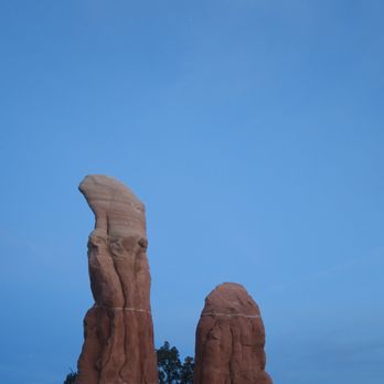
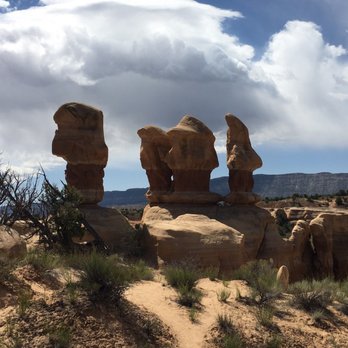
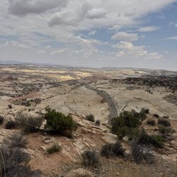
    Years ago, Devils Garden was my introduction to Grand Staircase. This otherworldly rock garden is compact and cozy so it makes for a fun romp. The rock formations here have a lot of personality so this visit was like checking in with old friends. Grand Staircase is a mostly sun-exposed landscape so the shade provided by these stone sentinels makes this garden a relaxing place to have a picnic and take a break before getting back on the washboard dirt road back to Highway 12.

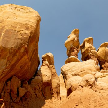
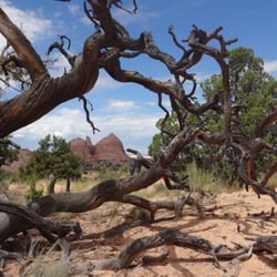
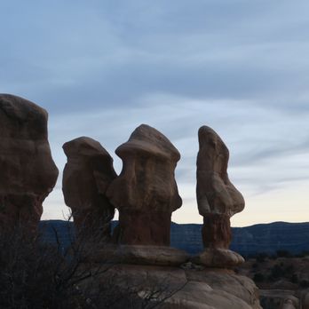
    Just a couple of the amazing hoodoos in Devil's Garden
    Steve J.

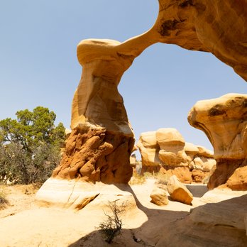
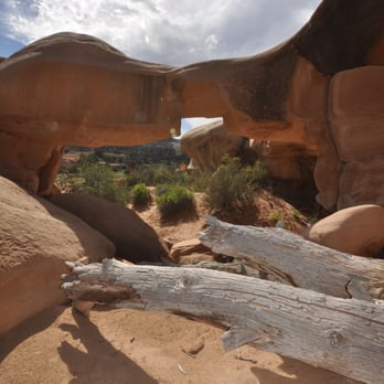
    Amazing collection of hoodoos a ways down a rocky, bumpy, rattly road. We drove this in two cars, one of which got a flat somewhere along the way. Fortunately, we got the flat fixed in town without much trouble. The hoodoos feature numerous natural arches, wind caves, fine sand, and long views to mesas and canyons in the distance. Go another mile and a half down Hole in the Wall Road, and see dinosaur tracks too!

    Nancy H.

    Such a great place to take children who may not be up to more strenuous hikes. The beautiful rock formations offer plenty of opportunity for kids (and adults, as well) to ramble around and climb. The views are amazing. You can spend an hour here, or several. It's definitely worth the trip out the dirt road to get here.

    Hoodoos
    Sydney B.

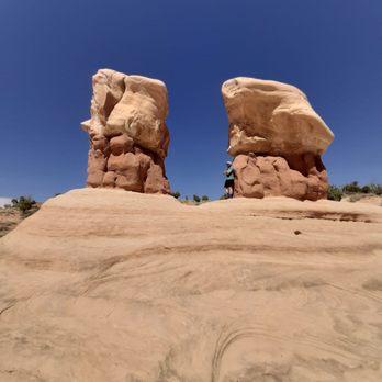
    I loved seeing the hoodoos and reading the information about how they are formed. It was fun to walk around at. Very bumpy dirt road so make sure you have a car that handles that well or it will take you a long time to get there. Dog friendly but must stay on leash. No shade.

    Julie L.

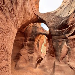
    Devil's Garden is a must see if you are at Escalante National Park. Hike is easy and doesn't require a far walk before you discover the main attractions. The trail is flat with no inclines. We walked less than a 1mile round trip and was able to check out the arch rock formations and other huge rock stand alone. You can spend about 1 hour to check out the area. Make sure you bring plenty of water!

    This is a past the entrance.  Theres so much to see.
    Alex L.

    It's a hidden gem. I loved it, next time I would go earlier to avoid the heat. It was bigger than it looks. And then you can't beat the entrance price: free!!!' The photos don't capture the live beauty.

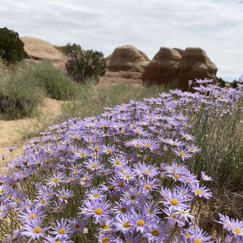
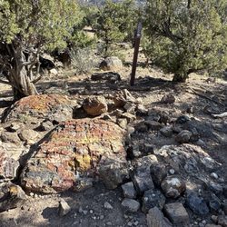
    Very plastic looking flower...

    See all

    8 months ago

    Helpful 0
    Thanks 0
    Love this 0
    Oh no 0

    9 months ago

    Simply beautiful and a must see. We had an amazing time walking and exploring the area.

    Helpful 0
    Thanks 0
    Love this 0
    Oh no 0
    Photo of Kaori M.
    269
    1740
    1484

    2 years ago

    Helpful 2
    Thanks 1
    Love this 2
    Oh no 0
    Photo of Paul L.
    296
    1237
    28734

    5 years ago

    Helpful 7
    Thanks 0
    Love this 5
    Oh no 0

    3 years ago

    Helpful 0
    Thanks 0
    Love this 0
    Oh no 0

    4 years ago

    Helpful 2
    Thanks 0
    Love this 2
    Oh no 0

    6 years ago

    Helpful 1
    Thanks 0
    Love this 1
    Oh no 0

    8 years ago

    Helpful 1
    Thanks 0
    Love this 0
    Oh no 0

    9 years ago

    Helpful 2
    Thanks 0
    Love this 1
    Oh no 0
    Photo of Alex L.
    1108
    74
    93

    6 years ago

    Helpful 0
    Thanks 0
    Love this 1
    Oh no 0

    5 years ago

    Helpful 1
    Thanks 0
    Love this 1
    Oh no 0

    11 years ago

    Helpful 1
    Thanks 0
    Love this 0
    Oh no 0

    13 years ago

    Helpful 2
    Thanks 0
    Love this 0
    Oh no 0

    9 years ago

    Helpful 0
    Thanks 0
    Love this 0
    Oh no 0

    10 years ago

    Helpful 0
    Thanks 0
    Love this 0
    Oh no 0
    Photo of Thalia F.
    20
    749
    25

    13 years ago

    Helpful 0
    Thanks 0
    Love this 0
    Oh no 0

    Ask the Community - Devils Garden

    Review Highlights - Devils Garden

    Such a delightful adventure to run and play among the hoodoos, arches, sand and rocks.

    Mentioned in 5 reviews

    Read more highlights

    Verify this business for free

    Get access to customer & competitor insights.

    Verify this business

    Escalante Natural Bridge - Some of the scenery along the hiking trail.

    Escalante Natural Bridge

    4.0(2 reviews)
    1.1 km

    This is Escalante Natural Bridge within the heart of Grand Staircase Escalante National Monument…read more It stands at 130 feet high and is located along a 2-mile trail each way just off Highway 12 in Escalante, Utah. To be more precise, the parking lot and trailhead sit 14 miles outside the small town of Escalante. I wasn't so impressed with this Escalante Natural Bridge. If you look up at it...it sort of blends in with the rest of the backdrop. It doesn't really stand out shining by itself high above the canyon floor. My best interpretation of how I witnessed it was like trying to find a hidden object within a colorful collage. And I don't mean to be so specific...but all I'm saying is that overall, the view didn't really "wow" me. I guess I had high expectations since everything in Utah seems to be wondrous...just after trekking all the way to arrive at it, the appearance fell flat. Let me explain the 4-mile roundtrip hike along this Escalante Natural Bridge Trail.... It was difficult. And I don't mean in terms of strenuous...the trail is all along flat ground. I'm talking about having to cross 4 different rivers/streams just to make it here! Yes, be prepared to either take your shoes off and walk barefoot (which I did) or come with water shoes or flip flops! And the water in the rivers (for me being 5 foot 10 inches) actually got up to my knees. I was a little scared traversing these sections. Biggest point of all is that I highly advise you to be mindful about the path of the trail. There are no signs, and you just have to follow footprints embedded in the sand. At times, trust the most logical pathway of the trail. I can't recall the number of moments I had to pause from hiking and backtrack because I took a wrong turn! The 2 miles each way were tough and I had to take my time going slowly. It felt as if the journey lasted 10 miles to get to this Escalante Natural Bridge! In total, I at least used half the day grinding the 4 total miles...grrr! This Escalante Natural Bridge is one of the big highlights for exploring Escalante NM and, there is a 5th stream you can cross to try and capture better/more accessible views looking up at the bridge. Overall, the appearance wasn't so rewarding in my opinion. I tried finding better vantage points but wasn't successful. Though...when I looked at pictures on the internet, I did find more scenic photos than the area I was standing in front of. For those adventurous ones out there hoping to discover better spots for what makes this Escalante Natural Bridge so special...then maybe you can go ahead at your leisure and climb more rocks or even continue further along the trail. I decided to call it quits and return to the trailhead. I accepted my journey's fate and was okay with leaving with the pictures I had taken. Oh well. Not everything can be perfect. I would like to quickly recommend another hike right nearby that was the ultimate best memory from my time in Grand Staircase Escalante. It's called Lower Calf Creek Falls. This was a 6-mile roundtrip trail that took me to Lower Calf Creek Waterfall...simply a stunning waterfall that is an absolute MUST DO! So majestic! I'd say Lower Calf Falls is maybe 3 miles down the road from here on UT - Highway 12. So, although this Escalante Natural Bridge was okay...it's worthwhile in that it can be paired together with Lower Calf Creek Falls. You might as well hike both of them since they're so close to each other. And then for those spontaneous travelers out there...you can actually camp out for the evening in Lower Calf Creek Campground...a terrific setting in nature. Just some final details about Escalante Natural Bridge.... I visited on a Saturday in late July of 2021, and I was virtually the only person hiking on this trail. It's pretty remote and quiet. You can use Google Maps to find the trailhead for not just here at Escalante Bridge, but for Lower Calf Creek Falls as well. In general, Grand Staircase Escalante NM is mostly navigated along dirt roads. It'd be very helpful if you had a 4x4 vehicle to drive to some of the hard-to-reach landmarks. For myself I only had a compact car, so I was limited in the amount of exploring I was able to do. Before coming here and to Lower Calf Creek...you can first stop in at the Escalante Interagency Visitor Center. Park rangers provide maps, and they'll offer any advice and itineraries for helping you plan out your days. Alright. This is Escalante Natural Bridge along a 2-mile pathway here in Grand Staircase Escalante National Monument.

    Nice little visitor center in Big Water, on the south side of the Monument. Very good scientific…read morereview of the Staircase.

    Photos
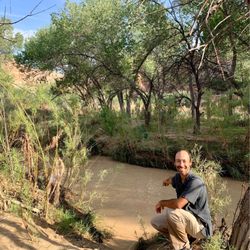
    Escalante Natural Bridge - Crossing another river to get to the bridge. Don't be frustrated. Try to embrace it, lol.

    Crossing another river to get to the bridge. Don't be frustrated. Try to embrace it, lol.

    Escalante Natural Bridge - Standing under a tree looking up at the bridge. It wasn't so scenic because the bridge blended in with the background.

    Standing under a tree looking up at the bridge. It wasn't so scenic because the bridge blended in with the background.

    Escalante Natural Bridge - This is Escalante Natural Bridge.

    See all

    This is Escalante Natural Bridge.

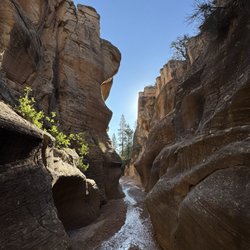
    Grand Staircase - Escalante National Monument - Willis Creek Narrows

    Grand Staircase - Escalante National Monument

    4.8(32 reviews)
    43.0 km

    The Toadstool Hoodoos are cool rock formations formed by differential erosion. They look like…read moremushrooms, as the harder rock caps and protects the softer rock underneath. The hike is an easy 1.5 miles. The views at the end are worth it, and you can get close to the rock formations as you like (although don't topple the rocks!). It's suitable for families with small children. If you don't mind driving on an unpaved road (I did it in a 2WD sedan), check out House Rock Valley Road for unparalleled views of the landscape with swirling sandstone, painted hills, and other cool rock formations. Check out the Wire Pass Trail for amazing slot canyons, although check the weather. If there's any chance for rain, do not enter the slot canyons since the formations channel water and form deadly floods in the canyon. The visitor center in Kanab is huge, with lots of good pamphlets and displays about the geology and archaeology of the area.

    This feels like a review in progress because the area is so large - but was pleasantly surprised by…read morehow much more I want to explore this region. We did Willis Creek Narrows and Lower Calf Creek Falls - both incredible. Now adding to the wish list for return trips. The drive along US 12 is just spectacular. Definitely recommend a high clearance vehicle with 4WD to access some of the more remote locations. Be prepared to adventure and bring what you need as this is not a manicured national park, but more a haven for those looking for an off-grid escape.

    Photos
    Grand Staircase - Escalante National Monument - Visitor center

    Visitor center

    Grand Staircase - Escalante National Monument - Visitor center

    Visitor center

    Grand Staircase - Escalante National Monument

    See all

    Peek-a-boo & Spooky Slot Canyon - Desert Skies

    Peek-a-boo & Spooky Slot Canyon

    4.7(17 reviews)
    36.8 km

    Peek-a-boo is tight, fun and fairly easy with amazing colors and really interesting rock…read moreformations. Spooky is a lot harder. We had a guide, Gary, from Roam outdoor adventures and glad we did. His help in navigating how to get down from spots through the rocks/boulders that can be rather daunting and dangerous. Though the slots aren't really long, navigating through them is not a quick pass through. They take time. The site could use some signs to get people to start at the right side. Some start at the wrong end and there is no place in these slots for anyone to pass by you. It can get really hot in the summer so 2 liters of water is recommended along with snacks. The ruts in the road can be passed by in a regular car but you will wind up with loose bolts. The road is partially paved there and dirt the rest of the way. Very dusty. Excellent experience. No fee required but donations at the parking lot and restrooms appreciated. Please pack out what you packed in and leave no trace. Some have started writing on the walls of these areas and it's not only awful to have to see but ruins these old sights for everyone. Very disappointing.

    Let me set the record straight, slot canyons are my jam! I will go anywhere there is an opportunity…read moreto walk, shimmy, or rappel into a slot canyon. I just think they are the most interesting Mother Nature created places to explore. We came here on a July 4th holiday with some friends of my husbands. The road out here can be rough in spots and does require a 4X4 to get out here, but we made it safely to the canyon. These slot canyons are located within the Grand Staircase-Escalante National Monument in the beautiful state of Utah. This land is run by the BLM. Talk about beautiful! The canyon walls with their orange/red colored Navajo sandstone just envelopes you as you walk through this slot canyons. So many twists and turns with lots of crevices to peer or climb into. Be sure to pack plenty of water, sunscreen, good trail shoes (not Skechers HA! HA!), a hat and a small pack so you can move through the slot canyons comfortably. Both of these canyons are so worth the drive and the time. Most of all remember to Leave No Trace. Happy Adventuring!

    Photos
    Peek-a-boo & Spooky Slot Canyon - Peek-a-boo

    Peek-a-boo

    Peek-a-boo & Spooky Slot Canyon - Spooky slot canyon

    Spooky slot canyon

    Peek-a-boo & Spooky Slot Canyon - Ancient Moqui Steps in the sandstone

    See all

    Ancient Moqui Steps in the sandstone

    Mossy Cave Trail

    Mossy Cave Trail

    4.6(38 reviews)
    46.2 km

    This review is for Mossy Cave Turret Arch and Little Windows Trail which was a ~0.9 miles round…read moretrip that took ~30 minutes to complete. Short and easy hike with a nice views of Tropic Ditch Falls. The Mossy Cave was underwhelming and inaccessible. Where the trail splits; the left takes you to Mossy Cave and the right takes you to Tropic Ditch Falls. Limited parking spots (~10 cars). Short video of the hike for those interested! https://youtu.be/eJfn0TT_nZw

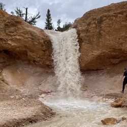
    Mossy Cave Trail is outside the fee area for Bryce Canyon Canyon National Park, and I'm not sure if…read morethe rangers check if you've paid. Anyways, I have an annual pass so I didn't worry about it. This is one of the lowest elevation hikes in the park as well as one of the only hikes that begins with a climb and ends with a descent, so if you're not sure about your endurance and want an easy, safe hike where you won't get stuck, this hike is for you! You can see hoodoos, and also Tropic Ditch Falls. It's not a waterfall in the usual sense, as it's a result of a man-made canal that diverted water from East Fork of the Sevier River to Bryce Canyon. I would say that the view was....ok. The trail also leads you to Mossy Cave, which isn't a cave but a sheltered overhang. I was in the season where there wasn't any moss, nor any icicles. It was pretty cold temperature-wise in the grotto. This is a low-effort, low reward type of hike, which is ok. In comparison to the beautiful views that you can get in the scenic drive inside the park, I would say skip this trail if you're short on time and wanting views.

    Photos
    Mossy Cave Trail
    Mossy Cave Trail - Trail in to Cave.

    Trail in to Cave.

    Mossy Cave Trail - There it is!

    See all

    There it is!

    Navajo Loop - By Wall Street, near the end

    Navajo Loop

    4.9(58 reviews)
    52.1 km

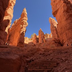
    Highly recommend!! I…read moredid the the Figure-8 Combination hike, which combines three amphitheater hikes, Queen's Garden, Navajo Loop, and the Peekaboo Loop. The NPS recommends to do the hike in a clockwise direction due to the elevation slope at the end of the hike, but I wanted to be contrarian haha. It wasn't bad! I liked how there were some tunnels going through some of the hoodoos, and there were various parts of the trail in the shade and in the sun just by going around the rock formations. It was absolutely beautiful when I went, with great cottony white clouds against an azure sky. Do note that there's no water on the trail, and seasonal pit toilets on Peekaboo Loop, but otherwise no restrooms on this portion of the trail. I spent the morning hiking, and then went back to town for a buffet. I couldn't image hiking on a stuffed stomach.

    This hike is iconic, probably the most famous in the park. The rec is to do this hike as a loop…read morecoupled with queen's garden for a 4-5 mile round trip trek. You get up close to the hoodoos and see lots of beautiful vantage points in the park. It was closed for a while in early 2026 because of a mud slide but reopened in March and as far as I know has remained open since I was there in April 2026. You can do this hike either clockwise (starting near sunrise viewpoint) or counterclockwise (starting near sunset viewpoint). I was recommended to do it clockwise. There was plenty of parking near sunrise view point, I had no trouble on a Sunday in early April. Took me a couple hours to do the whole thing from start to finish. Overall if you have time for only one hike in Bryce, this is the one I'd rec! You'll see so many iconic and beautiful spots here.

    Photos
    Navajo Loop
    Navajo Loop
    Navajo Loop

    See all

    Devils Garden - hiking - Updated July 2026

    Loading...
    Loading...
    Loading...