1. Divide Creek Campground

    1. Divide Creek Campground

    0

    Babb, MT

    Cancel

    Open app

    Search

    Divide Creek Campground

    5.0 (5 reviews)

    Divide Creek Campground Photos

    You might also consider

    More like Divide Creek Campground

    Recommended Reviews - Divide Creek Campground

    Your trust is our priority, so businesses can't pay to alter or remove their reviews. Learn more about reviews.
    Yelp app icon
    Browse more easily on the app
    Review Feed Illustration
    Photo of T G.
    0
    455
    113

    11 months ago

    Helpful 1
    Thanks 0
    Love this 1
    Oh no 0

    3 months ago

    Helpful 0
    Thanks 0
    Love this 0
    Oh no 0

    3 years ago

    Helpful 1
    Thanks 0
    Love this 2
    Oh no 0
    Photo of Stasia W.
    212
    10
    0

    5 years ago

    Helpful 0
    Thanks 0
    Love this 0
    Oh no 0

    5 years ago

    Helpful 1
    Thanks 0
    Love this 1
    Oh no 0

    Ask the Community - Divide Creek Campground

    Verify this business for free

    People searched for Campgrounds 124 times last month within 15 miles of this business.

    Verify this business

    Grinnell Lake - Along the hike, looking back upon beautiful Many Glacier Hotel and the mountains.

    Grinnell Lake

    4.0(1 review)
    7.3 mi

    For me, Grinnell Lake gets 4.5 stars. The ONLY REASON why I didn't give it 5 stars is because when…read moreI visited in the afternoon, the magnificent backdrop was set against the sun....and admiring this setting against the sun prevented me from capturing the perfect photos. This was quite frustrating! I had read and heard wonderful reviews about this place...the lake and the hike to get here in general. Unfortunately, when I arrived about 3pm, you could pretty much say the sun was a huge obstacle and quite a hindrance on my memories from here. Ultimately, I had to wait for clouds and or move myself to different spots to avoid the sun's beams. Regardless.....everything about this hike was pretty good. Grinnell Lake is located in the more secluded section of the Many Glacier area of Glacier National Park. When I visited last month, I had to wait in a line of cars just to gain access to Many Glacier. Because this popular part of Glacier NP is quite small in circumference....park rangers were only permitting a limited amount of visitors. Wow, that was quite annoying. Fortunately for me, since I planned my itinerary ahead of time, I was spending the evening here in Many Glacier and told the park ranger that I was sleeping the night at the Swiftcurrent Motor Inn, (which was the actual truth)...so he allowed me to pass. The trail for Grinnell Lake starts right next door on the grounds of Many Glacier Hotel. You can park wherever...on the side of the streets or in the parking lot. If you have a free moment, absolutely venture inside Many Glacier Hotel and along the grounds as the hotel exudes a rustic/European style - Swiss chalet - certainly lending itself to the heart of this outdoorsy - natural - setting along Josephine Lake. For Grinnell Lake, look for signs for the Swiftcurrent Lake Loop Trail. Here is where you want to go. It's situated towards the rear of Many Glacier Hotel. Ask someone inside the lodge if you need assistance finding the trailhead. From the Swiftcurrent Foot Trail, Grinnell Lake is 3.4 miles EACH WAY! Yes...that's almost 7 miles round trip! And, you could venture further towards Grinnell Glacier....another fantastically recommended trail, but....to Grinnell Glacier, it's 5.9 miles EACH WAY, - and for me....this was too far and took too much time out of the day. Also, it's mentioned in your park's map guide that Grinnell Glacier is a STRENUOUS TRAIL....where - as just hiking to Grinnell Lake is a moderately navigated passageway. Upon trekking beside Josephine Lake making my way towards Grinnell Lake, there were plenty of photo opportunities as the lake was quite picturesque, especially when the sun was at my back. Past Josephine Lake, the surroundings were just alright. Please understand though, this trail is great for those looking to get away and immerse themselves in the back country woods. You can find an easier way to arrive at Grinnell Lake by taking a boat towards the other end of Josephine Lake, getting out and then trekking the remaining distance on. For me, I was okay simply hiking as I didn't want to pay a fee and then wait for a boat to launch. Finally coming upon Grinnell Lake, yes...the hike was worth it. The calm waters here were immaculate. Absolutely perfect....colorful blue/green and turquoise. Along with the majestic and scenic background....you're confronted with a lush green mountain carved away with a running waterfall centered in the heart of it all. This spot and panoramic view was worth it all! All the time spent hiking and traversing my way, coming here made for witnessing this grand view. I was totally impressed! Yeah...leisurely, unobtrusively sitting down and appreciating this landscape is the reason why you come here. I spent a good 45 minutes just relaxing, taking photos and reflecting on how beautiful this place was. And like I mentioned earlier, had it not been for the sun in my way, Grinnell Lake absolutely would have been 5 stars. Lol....so when all is said and done....I HAVE TO RECOMMEND TO ANYONE WHO READS THIS....HIKE TO GRINNELL LAKE IN THE MORNING!!! And although from here, it's only a couple more miles along towards Grinnell Glacier (which was highly recommended), I was satisfied that I had explored enough and ventured back towards the Many Glacier Lodge. In all, I spent about 4 - 5 hours hiking over to Grinnell Lake. If you're spending time in this Many Glacier section of Glacier National Park, Grinnell Lake is quite the highlight and should not be missed.

    Photos
    Grinnell Lake - Stopping at pretty Josephine Lake before heading on to the main event....Grinnell Lake!

    Stopping at pretty Josephine Lake before heading on to the main event....Grinnell Lake!

    Grinnell Lake - On the edge of Grinnell Lake....the waters quite calm and colorful.

    On the edge of Grinnell Lake....the waters quite calm and colorful.

    Grinnell Lake - Almost there....

    See all

    Almost there....

    St. Mary Falls Trailhead

    St. Mary Falls Trailhead

    4.2(12 reviews)
    15.9 mi

    I know there's plenty of wonderful hikes out there. Everyone has their favorites....well, for me,…read moreSt. Mary Falls paired with immaculate Virginia Falls was one of the BEST HIKES I did in all of Glacier National Park!!! This trailhead is located along Going to the Sun Road, past the apex of Logan Pass near the St. Mary section of the park. In all, I'd say it's situated about 12 miles from the eastern entrance of Glacier. There's a parking lot that is relatively small. It certainly fills up at peak times. And...along the road, I didn't find much parking space available. I visited during the afternoon around 4pm and got lucky to find a spot. Here goes, wow....normally I'm just okay with visiting a couple of waterfalls. Here at this St Mary Trail, you can hike to 3 waterfalls....Baring Falls, St. Mary Falls and Virginia Falls. The prior day I had visited Baring Falls from the Sun Point Trailhead (which is worthwhile!) so for arriving here at St. Mary, I just had 2 falls to explore. And...a great aspect in navigating to these falls is that they're not too far of a journey. First up, St. Mary Falls is only 1.2 miles from the beginning, and it goes along a very scenic hike with beautiful mountain vistas in the distance. Upon reaching St. Mary Falls, the cascades were quite impressive and beautiful. It was a little congested with plenty of tourists typically hogging space for photo time. Ultimately, I got the opportunity for my own pics and they came out well. Repeating again....the setting is quite tranquil and peaceful with the jagged mountain peaks hovering all around. Also, it's not a strenuous hike getting here. I spent 15 minutes or so staring at St Mary's Falls before continuing on. Now comes to what truly BLEW ME AWAY!. Lol...I know, it's just waterfalls, but Virginia Falls was one of the BEST SIGHTS I ENCOUNTERED IN GLACIER! Truly. From St. Mary Falls it's only 7/10's of a mile further along the trail. Though...getting to Virginia Falls is uphill, more strenuous than getting to St. Mary, but nothing difficult or out of the ordinary. Along this 7/10's of a mile, you will pass another set of chuting waterfalls (much smaller in stature and there's no name for them), but certainly worthy of a picture. Finally! Arriving at Virginia Falls, wow what a wonderful and mesmerizing waterfall! Set against a cliff backdrop with the rushing torrent dropping down like a picture perfect postcard....I was so impressed! Lol....it happened to rain along my hike to Virginia Falls so plenty of visitors went away hiding and I actually had the falls to myself. I couldn't believe my good fortune. So, yeah...before soaking up and immersing myself in the pure scenic joy of this outpouring of water, it was necessary to capture 20 or so photos, both horizontally and vertically....(however I was maneuvering my camera, I couldn't go wrong)... for that glistening "money shot" image! I guess, what I'm trying to explain is the height at which Virginia Falls starts and how it ceremoniously drops from it's peak....it was inspiring. I was truly humbled by the sight. Once I took my full complement of pictures, I had to sit down. Regardless of whether it was wet outside from the rain....here was an opportunity, a moment, to bask in nature and one of the prettiest waterfalls I had confronted in recent memory. I took a good chunk of time here to reflect on where I was, at Glacier National Park....in such a surreal setting. It gave me a chance to reflect on how traveling, engaging the outdoors and tackling the stunning wonders of the world is one of my passions in life. And I don't take for granted, anything, ever. Finally, from Virginia Falls you can continue on the loop eventually making your way to Baring Falls, though according to the map....it looked like a much further trek going forward along the trail (possibly a few more miles). Instead, I turned around and ventured back the way I originally began. In all the path to Virginia Falls, combined with St. Mary Falls along the way...is 3.8 miles round trip. The trek is absolutely worthwhile and not difficult. For the chance to witness these brilliant and radiant waterfalls, St. Mary Hike and Trail is 5 stars as good as it gets and cannot be missed!

    After a day of long strenuous hikes I wanted to end it with a nice and easy hike. I came here at…read morearound 8pm on a Saturday and there were lots of parking spots in the small parking lot. This trail is closer to the St. Mary entrance of the park but if you're driving through the entirety of the Going-to-the-Sun Road you'll stop by this trailhead. The trail to the St. Mary waterfall is only about 1 mile from the parking lot and there's no elevation at all which makes for a very easy hike. From the St. Mary waterfall you can continue on to the Virginia Falls but I chose not to as the sun was going down and I didn't want to be out on a hike by myself in the near darkness, but the hike to Virginia Falls is not that much further or harder.

    Photos
    St. Mary Falls Trailhead
    St. Mary Falls Trailhead
    St. Mary Falls Trailhead

    See all

    Grinnell Glacier

    Grinnell Glacier

    4.8(9 reviews)
    30.6 mi

    We were able to hike the Grinnell Glacier Trailhead through Many Glacier on the last day it was…read moreopen for the season (9/19/21) but unfortunately the weather wasn't on our side. It was a constant mist/rain the entire hike and then getting into Grinnell Glacier it was snowing! We arrived at the parking lot by 7AM and there were already 10 cars parked and we started the hike around 7:30. By the time we got back, around 1PM, the lot was full but the rain started coming down more so people were leaving. It's about a 10-11 mile hike RT. During the summer, you can opt to pay to take a boat across Lake Josephine to shorten the hike, but that was the easiest part. The part of the hike where you walk above Lake Josephine is probably the most picturesque - so gorgeous but a little foggy. When you finally get to the Glacier you're greeted with the bluest water bend and snow covered mountains. For this hike, the way back is easier and we were happy about that because we were cold and starting to feel miserable. Would love to do this hike again with better weather but it was still a beautiful one to do! We drove Going-to-the-Sun road and round the Rising Sun Boat Deck parking lot (which was empty during this time) and it was the perfect spot for a nap.

    My friends and I hiked to Grinnell Overlook via the Granite park trail. The whole trail was out and…read moreback and a total of about 11.4 miles with around 3500 ft of elevation. Not gonna lie, the last stretch (the Garden Wall) was pretty rough as the trail was very narrow and incredibly rocky, and the wind was constantly screaming and whipping your face (definitely bring a windbreaker and protect your hats!!!). But despite the difficulty for us average hikers and the sad state of our feet afterwards, my friends and I absolutely loved the experience. It wasn't just about the view at the top for us. The entire trail was stunning and since we hiked late September, the red and golden foliage all around us made us feel like we were in another world. We saw various wildlife as well - mostly deer and chipmunks!

    Photos
    Grinnell Glacier
    Grinnell Glacier
    Grinnell Glacier

    See all

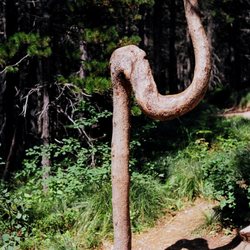
    Redrock Falls - This is the second tree with the strange U-shape, that I saw on the trail to Redrock Falls.  - - Tom Brody

    Redrock Falls

    5.0(1 review)
    13.6 mi

    REDROCK FALLS can be reached by a trail that starts at the parking lot by Swiftcurrent Inn. The…read moretrail is 2 miles, each way. On the way, you can see strange trees where the trunk has a U-shape, and where the U-shape occurs at about five feet above the ground. I posted two photographs of these strange trees, where each has the U-shape in the tree trunk. During the hike, and also at Redrock Falls, you can see Mount Grinnell, which is south of the trail, and Mount Wilbur, which is north of the trail. Redrock Falls is actually a series of small cascades, and it is not comparable to the iconic Yosemite Falls in California, or to the drop-dead gorgeous North Falls at Silver Falls State Park in Oregon. During my family's hike, I was treated to a "dance-of-the-clouds" where the wind-blown movements of the clouds resulted in intermittent illumination of various regions of Mount Grinnell and of Mount Wilbur. Your hike to Redrock Falls will provide motivation to learn about the Grinnell Formation. Grinnell formation is colored red, and it consists of something called, "shaly argillites. The shaly argillites lies on top of something called the "Appekunny." Mingled with the red argillites are thin white layers of quartzite, a former sandstone which has been converted by pressure into an extraordinarily hard, dense rock. The red color is due to iron oxide occurring as a cement between the sand and mud grains (info from, The Geologic Story of Glacier National Park, Special Bulletin No. 3, Glacier Natural History Association). PHOTOGRAPHS. Please click on each of my photographs so that you can see the entire image. VISITOR CENTERS. Glacier National Park has several visitor centers. This is a warning. If you fail to buy at least fifty dollars worth of souvenirs during your visit to Glacier National Park, you will regret it for many years. Your regret will build up more and more, with every passing decade. What I recommend most, is buying the model of the red bus that is used for transporting tourists up and down Going-To-The-Sun Road. What I also recommend is buying a plush moose. The word "plush" is used to refer to toy animals such as birds and dogs that are made of soft fluffy cloth.

    Photos
    Redrock Falls - Tree with strange U-shape, on trail to Redrock Falls.  I found two trees like this. - - Tom Brody

    Tree with strange U-shape, on trail to Redrock Falls. I found two trees like this. - - Tom Brody

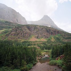
    Redrock Falls - View of the mountains from Redrock Falls.  Mountain to the north is Mt.Wilbur, and to the south, Mt.Grinnell.

    View of the mountains from Redrock Falls. Mountain to the north is Mt.Wilbur, and to the south, Mt.Grinnell.

    Redrock Falls - View to the north of Redrock Falls.  To the north, is Mt.Wilbur, to the south is Mt.Grinnell.

    See all

    View to the north of Redrock Falls. To the north, is Mt.Wilbur, to the south is Mt.Grinnell.

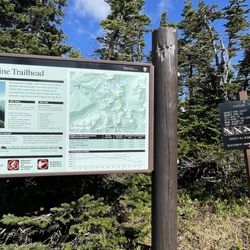
    Highline Trail - Trailhead sign

    Highline Trail

    5.0(5 reviews)
    16.1 mi

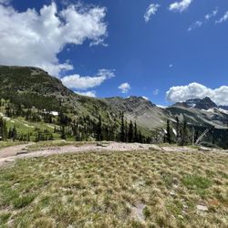
    Full disclosure - I only hiked like 5 mins of this trail, but that's because it was closed for the…read morewinter still despite being Sunday June 29! The trail actually opened in full that Wednesday, so I came just slightly too early. That said, I hiked the loop trail up to the intersection of the highline trail, and walked along to near glacier junction. You can see the continuation of the trail in the distance and it is obviously a gorgeous trail - and quite challenging given the distance, although I'm told the incline is actually fairly gradual. Overall: I'm planning a trip back to glacier next summer a little bit later specifically to do this trail out to grinnell glacier overlook along the garden wall. My trip along the loop was absolutely stunning, so I want to make it out to granite peak chalet again another way. And while it likely won't come as a surprise to anyone planning to hike this trail, do bear in mind the warnings about safety including taking enough water/food, bear spray, and ideally going with someone else (particularly given doing this trail takes pretty much all day).

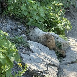
    Difficult but great trail. We did the 3.5 mile each way stretch starting at Logan Pass and ending…read moreat Haystack pass, where we stopped for a picnic lunch. Lots of people made it more difficult, but the reviews were amazing. We even saw our first marmots too. I'd highly recommend this one while at Glacier.

    Photos
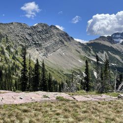
    Highline Trail - This is the view from granite chalet facing the glacier junction (connection of the loop trail with the highline and Grinnell overlook)

    This is the view from granite chalet facing the glacier junction (connection of the loop trail with the highline and Grinnell overlook)

    Highline Trail
    Highline Trail - Pano of the view from the chalet facing the highline trail intersecting with the loop trail and the hill up to grinnell glacier overlook

    See all

    Pano of the view from the chalet facing the highline trail intersecting with the loop trail and the hill up to grinnell glacier overlook

    Divide Creek Campground - campgrounds - Updated September 2026

    Loading...
    Loading...
    Loading...