Donner Pass Railroad Tunnel Hike Photos


You might also consider


More like Donner Pass Railroad Tunnel Hike
Recommended Reviews - Donner Pass Railroad Tunnel Hike
Start your review...


Reviews With Photos


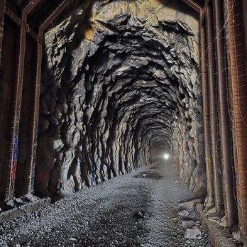
I've lived in Reno since 1979, and I've never been to the tunnels?! It was so fun! Incredible views. No snow yet, making the tremendous rock formations visible. A lot of people, and dogs. A few bikers, of which, I was one. Everyone was friendly and courteous with their pups, and kids. Parking was easy in the lot by Sugar Bowl Ski Resort. If biking, I recommend a fat tire bike as the gravel is deep in random spots in the tunnels. Water trickles through in several spots. I recommend a head lamp in addition to your fully charged bike light, some tunnels are really dark, and long!
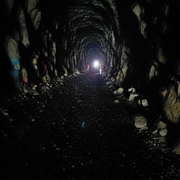

Tip: bring a flashlight and wear sturdy shoes to hike in wet and rocky places. This hike has been on my list for years and I'm happy to have had the opportunity to finally do it today. Beautiful weather. My Chinese grandmother would always mention her uncle coming from China to work on the tunnels and railroad, and what an opportunity to see the evidence of hardworking, strife, and even death to make this possible. The challenge of the walk were the rocks, but without that, it'd be an i significant walk. Must see if you are in the area.


Our second time to visit the tunnels. A very unique experience. These old train tunnels have become an iconic landmark right by Donner Ski Ranch. Easy access, perfect footpaths and the artwork/ graffiti is phenomenal. Pack a lunch, escape the heat and enjoy a couple of hours chilling in the tunnels. You'll be talking about them for years to come...


Such-ma play ground for adults. Weather you into rock climbing, biking, hiking, exploring historical sights this is the place and then you have lake below. A two miles Thur the tunnels. Flash light recommend.


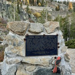
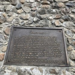
Back in 2017, a friend who I had met through Yelp first introduced me to this hike. At the time, I remember one of the women in our carpool referring to it as "China Wall," but I never really knew what that name meant, until yesterday. I had set out to hike to Donner Pass and back from the I-80 PCT trail head, but, once I got to Summit Haus, I decided that I wanted to continue on to the tunnels. Even though it was close to 9am on Sunday, I seemed to be the only person there. This surprised me, because it's usually more on the crowded side. Back in 2017, a few of us had wanted to hike through all of the tunnels, but not everyone in our group agreed. To be fair, it was only June, and we were wading ankle-deep in snow melt. Ever since then, I've wanted to come back and hike through all of the tunnels. Yesterday, I was able to make that dream come true (by myself). As you can see from my photos, I was walking for a long time. I didn't track the mileage, but it felt like I walked well over a mile each way. I must have been out there for over two hours, because I didn't get back on the PCT at Donner Pass until noon (after a detour by Donner Ski Ranch). In mid-August, there was barely any melted snow left on the ground. There were puddles in the middle of the tunnels, but they were relatively easy to avoid by walking closer to the walls. However, at the end of the hike, where the tunnel disappears all the way into the pitch black mountain, I noticed icicles still hanging from the ceiling. The further I hiked, the more bats I heard, smelled, and eventually saw. Some of the videos I took near the end of the tunnel show dozens of bats flying around. If you are afraid of bats, this might not be the right hike for you. To be honest, the graffiti art inside of the tunnels has always been one of the features that has drawn me back to this hike repeatedly. I enjoy walking through miles of graffiti. Some of it is really good. But, once I reached the spot where the graffiti stopped, I saw the tunnels differently. There was something majestic and almost spiritual about the place where the sunlight stops shining into the caverns. Here, you could clearly see what looked like infinite amounts of chisel marks. The rock surface was unlike any other I had ever seen. Back at the other end of the tunnels (two miles away?), I noticed a mother discussing a sign very intensely with her son. The sign asked visitors not to leave graffiti, explaining: "The Chinese railroad workers spent two years on Donner Summit risking their lives and health to lay the rails and build the summit tunnels of the transcontinental railroad. They faced avalanche, accident, pneumonia, explosion, rock slide, disease, and cold, continual cold, in winter. The railroad was the engineering marvel of the 19th Century. It opened California to the world and the world to California. The sacrifices of the Chinese changed California and the nation. Their legacy and memorial are important features on Donner Summit-- the summit tunnels and the snowsheds. They celebrate the heroism of the Chinese and as such, are almost sacred spots." After going home and reading a lot more about the Chinese railroad workers, I agree that something should be done to protect the tunnels, going forward. On the other hand, a lot of people enjoy the miles of graffiti, to the extent that it's practically a landmark of its own. Maybe there could be a compromise where certain sections can be used for graffiti, while the rest are better maintained and protected. Whether you are more interested in the history or the art, the tunnels are definitely worth checking out. The path at the top of the hill ends just across the street from the Pacific Crest Trail from Donner Summit to Castle Pass and Summit Lake. Nearby places to eat include Summit Haus and Donner Ski Ranch.


Super easy "hike". Lots to see and you get great views randomly. Hiking boots helped quite a bit it as the gravel is loose and the boots gave me more stability. Also... there's nothing at the end if you go through all the tunnels.


Just a few photos from this hike! Personally I could stare at this view all day. The views of the lake from up there are breathtaking! One of my best friends is from Truckee/Donner Lake area; she brought me here years ago. The history behind these tunnels are very interesting. It is one of my destinations during the winter months. I love the snow and my kids like to sled nearby. It's fun for the whole family! I'm looking forward to some snow; we usually warm up at locally owned Squeeze in! If you're ever in the area no matter what the season is; it's worth the stop. While nearby check out all of the locally owned restaurants in town! I'm very much looking forward to hanging with my kids here once we get some snow this way.


Amazing art inside! Wear hiking waterproof shoes, I stepped my foot all the way into the puddles and came out with my entire socks wet. I think I heard bats in a few tunnels?! Bring a headlamp or a vert bright flashlight, some long dark stretches inside a few tunnels.
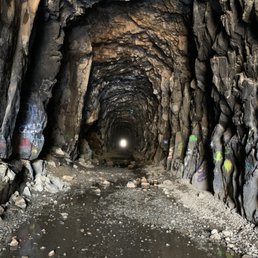

After seeing a review of this from fellow Yelper, Lynda B., we had to check it out and added it to our bookmarks for later. We weren't exactly sure where to go but based on others reviews we used Sugar Bowl Ski Resort as our destination. Once you get off I-80 and drive along Donner Lake and then begin climbing in elevation the views become very beautiful. Since we visited in early May there were some pretty waterfalls due to the snowmelt. We kept going past the scenic viewpoint to Sugar Bowl. Once we got to the parking lot for Sugar Bowl we inquired with someone there and they confirmed we could park (for free) and walk across the street to the entrance of the first tunnel. It was a really cool experience walking the first two tunnels. We didn't attempt to go further because there was a large pile of snow at the entrance of the third tunnel. Given that this year had a very light snowpack the best time to probably visit would be June through September ish. Tips: Bring your camera - the views are beautiful and the tunnels offer a unique photo opportunity; Bring a flashlight or headlamp (preferably one for each member of your party, the tunnels are dark); Don't wear your best shoes - the tunnels have some water that you have to navigate through but that may not be a concern later in the year; Wear layers - we both put our sweatshirts on since the tunnels are significantly cooler. This is an easy walk for all ages and fitness levels!


This hike is really incredibly cool. There isn't much like it in the area. I've done it a few times and it is still really neat. I love to take people who have never been, they usually are very surprised. Parking is a huge lot that has never been full when I've been. Navigating is very easy, gps will take you right to the first tunnel. It's really cold inside the tunnels so make sure you bring layers. In the winter, it gets very dangerous. There are giant icicles inside that fall pretty easily, and the ground is very slick and slippery. Because of this I do not recommend going in the winter, but I have done it and it is definitely beautiful. Some of the art is really beautiful, and is constantly changing. You definitely need to bring a source of light if you want to get a good look. I also recommend climbing the rock (be super careful!!) to get on top of the tunnels. The views from there are beautiful. Dogs are allowed, just supposed to be leashed.


Amazing hike. We only made it the first three tunnels. We got soaked from the melting snow. My 13 year old loved it!


Getting to this place is slightly tricky given the fact that it's not as easily discoverable on Google Maps. There's ample parking available once you get here ! In terms of the tunnel, there's a lot of historical significance attached with this place and I'd highly recommend reading up about it before actually getting here. The walk is a 20 minute easy trail through the tunnel and there's not a ton of documentation available at the location. Also, you don't need head gear/ night vision while walking through the tunnel.. the torch of your phone should suffice. The tunnel itself isn't as clean or well maintained but on the other side are some great views of Donner lake


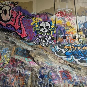
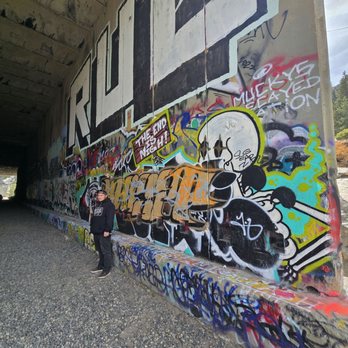
The Donner Pass Railroad Tunnel Hike was one of the reasons for our trip to the area. My boyfriend had always wanted to check out the Donner Petroglyphs, and I stumbled across the rail tunnels when looking for things to do while in the area. We parked at the Donner Ski Summit - if you are looking to check out this hike, that is the best place to park and access the start of the tunnels. I truly enjoyed this hike, but was ill prepared. I was fully committed once we were in the tunnels & I should have went back to the car and swapped my "barefoot" style shoes for my hiking boots. The large chunk gravel path killed my feet with the thin soles of the shoes I wore. We hiked through about 5-6 tunnels before heading back. We did a total of 6 miles in and back. There were alot of beautiful street art within the tunnels, we found 19 cave ghosts along the trail as well as some other reoccurring variations of different items over the course of the trail. I would like to eventually take the trail past the last tunnel and to the next set of tunnels some day. This is a trail we would do again next time we are in the area. Though the weather was nice, we both wore hooded sweatshirts as the are in the tunnels got quite chilly. If you plan on checking these trails out, take well charged flashlights or head lights with extra batteries. The tunnels can be PITCH Black when you are in the heart of them. Overall this was a really cool thing to see and I would love to do it again with the correct shoes! read more




1 year ago
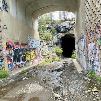
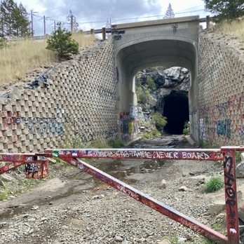
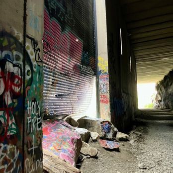
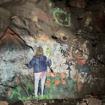
We had out of town family in town last week and we made it back to the Donner (Railroad) Tunnels. I love the tunnels! It's SO beautiful. And as it was a railroad, it's level and easy, and as it's in the tunnels, you're mostly protected from the weather. Bring good trail walking shoes and a flashlight. (And park across from the Donner Ski Ranch.) read more





4 months ago
Came here a few years ago & could not get into the tunnels because the entrance was frozen over. Well today it's a different story. Beautiful place & something the kids will enjoy. Only thing you should definitely have is... Boots, water, protein bars, portable charger. You have those few things & you will have a good time. read more


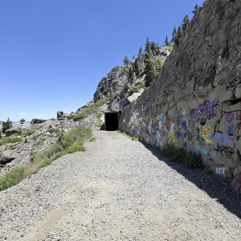


I've lived in Reno since 1979, and I've never been to the tunnels?! It was so fun! Incredible views. No snow yet, making the tremendous rock formations visible. A lot of people, and dogs. A few bikers, of which, I was one. Everyone was friendly and courteous with their pups, and kids. Parking was easy in the lot by Sugar Bowl Ski Resort. If biking, I recommend a fat tire bike as the gravel is deep in random spots in the tunnels. Water trickles through in several spots. I recommend a head lamp in addition to your fully charged bike light, some tunnels are really dark, and long! read more

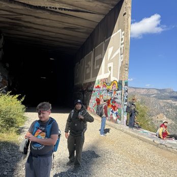


Tip: bring a flashlight and wear sturdy shoes to hike in wet and rocky places. This hike has been on my list for years and I'm happy to have had the opportunity to finally do it today. Beautiful weather. My Chinese grandmother would always mention her uncle coming from China to work on the tunnels and railroad, and what an opportunity to see the evidence of hardworking, strife, and even death to make this possible. The challenge of the walk were the rocks, but without that, it'd be an i significant walk. Must see if you are in the area. read more
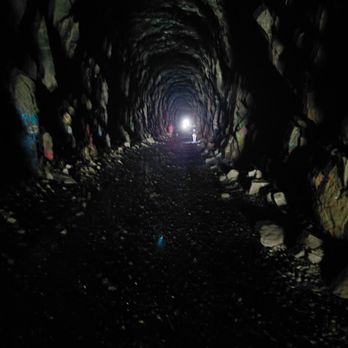


Our second time to visit the tunnels. A very unique experience. These old train tunnels have become an iconic landmark right by Donner Ski Ranch. Easy access, perfect footpaths and the artwork/ graffiti is phenomenal. Pack a lunch, escape the heat and enjoy a couple of hours chilling in the tunnels. You'll be talking about them for years to come... read more


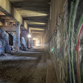

3 months ago

1 year ago


3 years ago
Back in 2017, a friend who I had met through Yelp first introduced me to this hike. At the time, I remember one of the women in our carpool referring to it as "China Wall," but I never really knew what that name meant, until yesterday. I had set out to hike to Donner Pass and back from the I-80 PCT trail head, but, once I got to Summit Haus, I decided that I wanted to continue on to the tunnels. Even though it was close to 9am on Sunday, I seemed to be the only person there. This surprised me, because it's usually more on the crowded side. Back in 2017, a few of us had wanted to hike through all of the tunnels, but not everyone in our group agreed. To be fair, it was only June, and we were wading ankle-deep in snow melt. Ever since then, I've wanted to come back and hike through all of the tunnels. Yesterday, I was able to make that dream come true (by myself). As you can see from my photos, I was walking for a long time. I didn't track the mileage, but it felt like I walked well over a mile each way. I must have been out there for over two hours, because I didn't get back on the PCT at Donner Pass until noon (after a detour by Donner Ski Ranch). In mid-August, there was barely any melted snow left on the ground. There were puddles in the middle of the tunnels, but they were relatively easy to avoid by walking closer to the walls. However, at the end of the hike, where the tunnel disappears all the way into the pitch black mountain, I noticed icicles still hanging from the ceiling. The further I hiked, the more bats I heard, smelled, and eventually saw. Some of the videos I took near the end of the tunnel show dozens of bats flying around. If you are afraid of bats, this might not be the right hike for you. To be honest, the graffiti art inside of the tunnels has always been one of the features that has drawn me back to this hike repeatedly. I enjoy walking through miles of graffiti. Some of it is really good. But, once I reached the spot where the graffiti stopped, I saw the tunnels differently. There was something majestic and almost spiritual about the place where the sunlight stops shining into the caverns. Here, you could clearly see what looked like infinite amounts of chisel marks. The rock surface was unlike any other I had ever seen. Back at the other end of the tunnels (two miles away?), I noticed a mother discussing a sign very intensely with her son. The sign asked visitors not to leave graffiti, explaining: "The Chinese railroad workers spent two years on Donner Summit risking their lives and health to lay the rails and build the summit tunnels of the transcontinental railroad. They faced avalanche, accident, pneumonia, explosion, rock slide, disease, and cold, continual cold, in winter. The railroad was the engineering marvel of the 19th Century. It opened California to the world and the world to California. The sacrifices of the Chinese changed California and the nation. Their legacy and memorial are important features on Donner Summit-- the summit tunnels and the snowsheds. They celebrate the heroism of the Chinese and as such, are almost sacred spots." After going home and reading a lot more about the Chinese railroad workers, I agree that something should be done to protect the tunnels, going forward. On the other hand, a lot of people enjoy the miles of graffiti, to the extent that it's practically a landmark of its own. Maybe there could be a compromise where certain sections can be used for graffiti, while the rest are better maintained and protected. Whether you are more interested in the history or the art, the tunnels are definitely worth checking out. The path at the top of the hill ends just across the street from the Pacific Crest Trail from Donner Summit to Castle Pass and Summit Lake. Nearby places to eat include Summit Haus and Donner Ski Ranch. read more


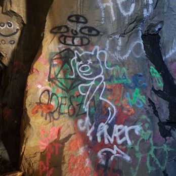


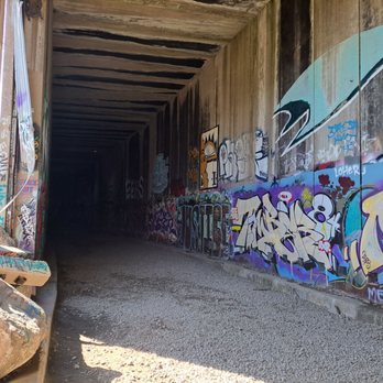

Super easy "hike". Lots to see and you get great views randomly. Hiking boots helped quite a bit it as the gravel is loose and the boots gave me more stability. Also... there's nothing at the end if you go through all the tunnels. read more


Just a few photos from this hike! Personally I could stare at this view all day. The views of the lake from up there are breathtaking! One of my best friends is from Truckee/Donner Lake area; she brought me here years ago. The history behind these tunnels are very interesting. It is one of my destinations during the winter months. I love the snow and my kids like to sled nearby. It's fun for the whole family! I'm looking forward to some snow; we usually warm up at locally owned Squeeze in! If you're ever in the area no matter what the season is; it's worth the stop. While nearby check out all of the locally owned restaurants in town! I'm very much looking forward to hanging with my kids here once we get some snow this way. read more


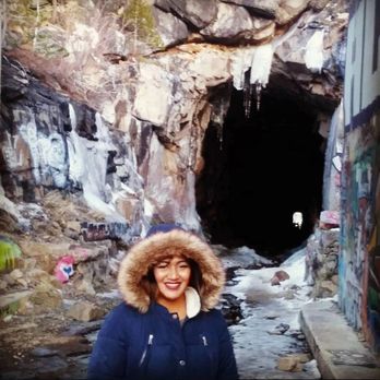

Amazing art inside! Wear hiking waterproof shoes, I stepped my foot all the way into the puddles and came out with my entire socks wet. I think I heard bats in a few tunnels?! Bring a headlamp or a vert bright flashlight, some long dark stretches inside a few tunnels. read more


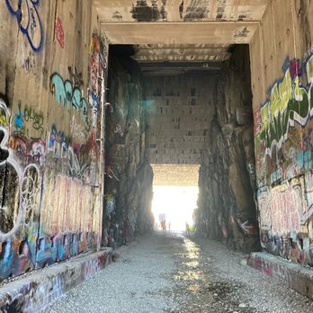


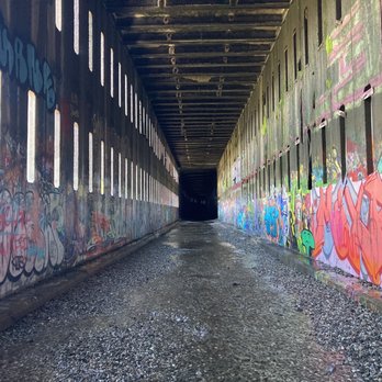

After seeing a review of this from fellow Yelper, Lynda B., we had to check it out and added it to our bookmarks for later. We weren't exactly sure where to go but based on others reviews we used Sugar Bowl Ski Resort as our destination. Once you get off I-80 and drive along Donner Lake and then begin climbing in elevation the views become very beautiful. Since we visited in early May there were some pretty waterfalls due to the snowmelt. We kept going past the scenic viewpoint to Sugar Bowl. Once we got to the parking lot for Sugar Bowl we inquired with someone there and they confirmed we could park (for free) and walk across the street to the entrance of the first tunnel. It was a really cool experience walking the first two tunnels. We didn't attempt to go further because there was a large pile of snow at the entrance of the third tunnel. Given that this year had a very light snowpack the best time to probably visit would be June through September ish. Tips: Bring your camera - the views are beautiful and the tunnels offer a unique photo opportunity; Bring a flashlight or headlamp (preferably one for each member of your party, the tunnels are dark); Don't wear your best shoes - the tunnels have some water that you have to navigate through but that may not be a concern later in the year; Wear layers - we both put our sweatshirts on since the tunnels are significantly cooler. This is an easy walk for all ages and fitness levels! read more
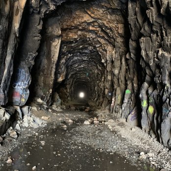
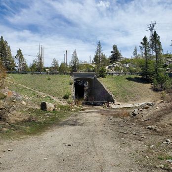


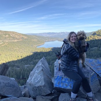
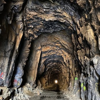
This hike is really incredibly cool. There isn't much like it in the area. I've done it a few times and it is still really neat. I love to take people who have never been, they usually are very surprised. Parking is a huge lot that has never been full when I've been. Navigating is very easy, gps will take you right to the first tunnel. It's really cold inside the tunnels so make sure you bring layers. In the winter, it gets very dangerous. There are giant icicles inside that fall pretty easily, and the ground is very slick and slippery. Because of this I do not recommend going in the winter, but I have done it and it is definitely beautiful. Some of the art is really beautiful, and is constantly changing. You definitely need to bring a source of light if you want to get a good look. I also recommend climbing the rock (be super careful!!) to get on top of the tunnels. The views from there are beautiful. Dogs are allowed, just supposed to be leashed. read more





2 years ago

2 years ago

3 years ago

3 years ago
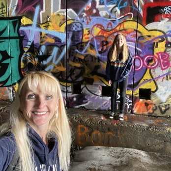
Amazing hike. We only made it the first three tunnels. We got soaked from the melting snow. My 13 year old loved it! read more




6 years ago
Getting to this place is slightly tricky given the fact that it's not as easily discoverable on Google Maps. There's ample parking available once you get here ! In terms of the tunnel, there's a lot of historical significance attached with this place and I'd highly recommend reading up about it before actually getting here. The walk is a 20 minute easy trail through the tunnel and there's not a ton of documentation available at the location. Also, you don't need head gear/ night vision while walking through the tunnel.. the torch of your phone should suffice. The tunnel itself isn't as clean or well maintained but on the other side are some great views of Donner lake read more


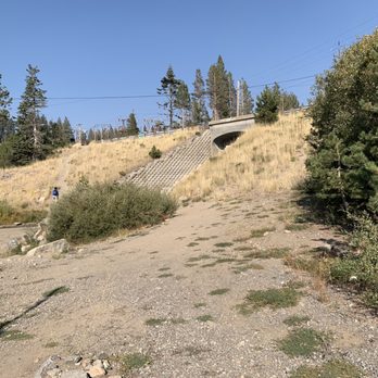


Five miles round trip. More graffiti than I've ever seen in my life. Neat hike. FYI if you have dogs~There is standing water in parts of the tunnels. My dogs were muddy after and needed a bath. Make sure you bring a flash light or head lamp. Parts of tunnels you can't see your feet. There are big rocks ever so often you could trip on. Flat gravel/dirt surface most of the hike. Shade in tunnels. Exposure to sun when in between tunnels. Sunscreen/water! Don't go alone. Not a lot of people on hike when we were there. *Worth the trip! I would go again. read more


2 years ago


6 years ago
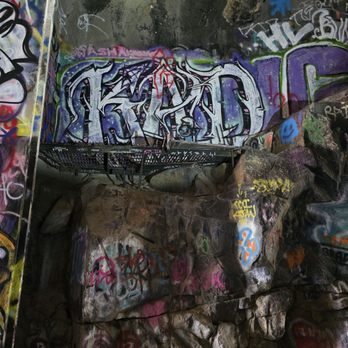
Long post, but some tips & suggestions that may help: I came here a couple days ago, and I am so happy I did. Such a dope, unique, and must see when in Lake Tahoe. That is if you are into: -Graffiti/art , some which is beautiful & so cool. And some, well not so much. You are allowed to graffiti on the walls so bring some spray paint with you and add your mark. I was so bummed I didn't bring mine but ended up finding a can, broken sprayer but I made it work & and got to add my mark. -Darkness, I mean DARK tunnels. We used our phone lights, but having a flash light helps. Then you can record and have light -Bats, don't worry they won't bother you. I for sure saw them though, flying around. And if you don't get the pleasure of seeing them, just know those squeaks you hear. Yes, that's them! -Coolness, inside the tunnels are definitely cooler then when outside them, all the reviews before suggested bringing a jacket, so I did. Ended up never using it, for me, I enjoy cold so it was a perfect balance once the sun starts getting hot when you are outside the tunnel you enter the tunnel and it's a refreshing break. But all up y to you! Also, I'm sure winter months or cooler months a jacket would be absolutely needed but in July it's a great crisp refresher! The trail is all straight with loose rock and wet puddles, I walked along the edge and barely got my feet wet. Wear sturdy shoes and ones you don't mind getting a little wet. It's a great view if you decide to take the opportunity to get on top of the second tunnel. I ended up only going to the 5th tunnel then turning back around! Parking- Turn right onto dirt road, you will see a tunnel on the left and the dirt lot is right there. I went on a Tuesday about 8:30am and there were only 2 other cars in the lot. Came back about 10:30am and there were maybe about 10 cars. So not too crowded on a weekday. I will for sure be back to go through all the tunnels and bring my paint! read more

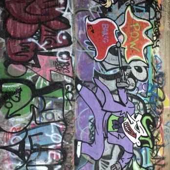


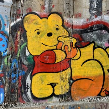

Wow!! What a great and free activity to do in Truckee!! We walked about 4 miles and saw some unique graffiti and gorgeous views of Donner lake. Bring a flashlight and wear comfortable shoes, the ground is rocks and som parts it's wet. I loved how cool it felt inside the tunnels on a hot August day! read more
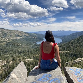
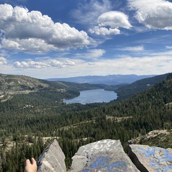


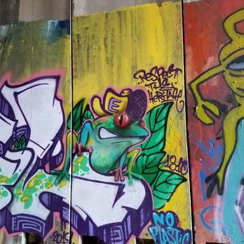
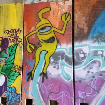
We finally made Donner Pass Railroad Tunnel Hike with this being on our list for several years. We followed directions with a wee bit of difficulty coming up Lincoln Highway, noticing the vehicles parked along the road. We opted to continue, parking across from Sugar Bowl to start at the first tunnel. Either way you will still enjoy all that the tunnel hike has to offer. Suggestion from us as we came first week in November with temperatures outside in high 60s, bundle up because inside the tunnels were very chilly. I had gloves, my fleece ear warmer (aka earmuff), several layers on, and waterproof shoes plus our headlamps (tunnels can get very dark in some areas). We also had our doggies with us that always enjoy our hikes - please be aware that it is very rocky with lotsa loose gravel but a flat hike with puddles and potential ice inside the tunnels, there were even moments inside the tunnels where we could see our breath - yeppers that kinda cold. I would venture to say that during the summer this would be an ideal hike for keeping cool. Totally worth the little over 5 mile round trip (one direction/you will turn around and go back through the same tunnels) for the abundance of colorful and eclectic graffiti strewn about that captures your eye from decades ago to latest & greatest showing us their love lost, forever love or "Tools Of the Trade" your eyes will definitely be bouncing from side to side throughout your journey in the tunnels. Inside the railroad tunnels besides the graffiti were the intricate way the large rock like brick were laid on top of one another to form some of the tunnels and then we realized that WOW the railroad workers blasted their way straight through the inside of the mountain so the locomotives could pass atop here looking down upon Donner Lake this was just AMAZING, standing inside these massive corridors were the trains once passed!! Views from up here were breathtaking, looking down at Donner Lake, the valley and stepping outside the Donner Pass Railroad Tunnel Hike periodically to warm up in the inviting sunshine was very welcoming. This is a unique hiking experience that gives you a little bit of history with Union Pacific Railroad with the creative & unique graffiti art greeting you throughout the tunnels, plus parking along the Lincoln Highway will give you a chance to see some petroglyphs on the way up to the tunnels while having the picturesque view of the surrounding area. So GO and enjoy this hike - We DID! It's always a GREAT day to get out to #moveyourbody!! read more




3 years ago

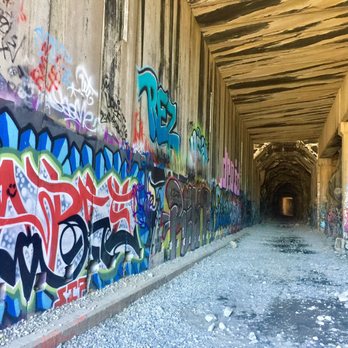
I have been to Truckee several times in my life but have never had the privilege to do this amazing walk/hike. It's directly off of the China Wall turnout, directly and next to the Donner Pass summit and Rainbow Bridge. The walk to the tunnels is short but can be steep pitched at times and you will have to be very careful as you probably will slip on some loose rocks and sediment as you go up. You start directly off of Donner Pass Road and then step over a small stream and then go over the 4,000 year old petroglyphs carved into the stone. A short, steep incline and then a steeper pitch get you directly up to the spot where the tunnels are. You can go to the left or right. Be prepared for some amazing sights as you walk thru. These tunnels were actually built by the Chinese in the late 1800's . They were paid $35 a month to work sun up to sun down 7 days a week. When the Chinese went on a boycott and asked for $40 a week and to work no more than 10 hours per day, the railroad cut off their food and starved them until the ultimately conceded and went back to work. It was estimated that over 1,200 Chinese died in making these tunnels due to severe Winter conditions and the dangers of blasting thru the rock with the dynamite and nitroglycerin. As you walk thru the tunnels, you will be in awe at the size of them. Several areas have been taken over by graffiti artists which add to the uniqueness of the site. You could literally walk for miles down the left side but we chose to go only about a mile or so. In addition, there are small openings to the Lake every 1/4 mi or so which give you sweeping wires of Donner Lake and the landscape. Do yourself a favor and try to do this walk next time you are near there. read more




6 years ago
This hike is amazing, especially on a hot day. All the other reviews nailed the tips, but I will just highlight a couple: - The inside of the caves is nice and cool so bring a jacket if you get cold easily. - Be sure to look outside the tunnels for an amazing view - Wear sturdy shoes you don't mind getting wet/dirty - Bring a paint pen and leave your mark! - Plan to take you time if you are interested in graffiti art, there is SO MUCH read more


3 years ago
3 years ago
2 years ago

7 years ago
This was a pretty cool hike! It was flat so was a pretty easy walk. I recommend bringing a flashlight for the tunnels as the longer ones get pretty dark. We found really easy parking outside of the Sugar Bowl ski area, it was free and gave easy access to the first tunnel. Only reason I'm not giving it a 5 was the hike is pretty much all in the tunnels. I would have preferred more outdoor scenery but definitely still an enjoyable experience! read more


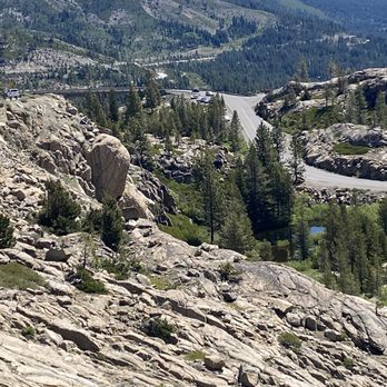
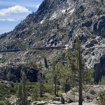
I have been visiting the Truckee area for many years yet I had never heard of this place. If you have driven along Highway 50, you have probably seen the train tunnels up on the mountain across a ravine south of the highway. Well, those are them! They were built by Chinese manual labor many years ago and they did a magnificent job, even by today's standards. The tracks have been removed so you walk on gravel and rocks. There are at least six tunnels and some have concrete siding and ceilings while others have exposed granite. You can walk as far or as short as you would like. We ended up putting in about four miles. Once you get to the tunnels, there is very little elevation change. The only thing that could impact that is your choice of parking (see below). The views of Donner Lake are stunning, as are the tunnels. It's just too bad that so many knuckleheads had to deface a lot of it with graffiti, although some of that is very artistic (but I would prefer to live without it). It is free of charge! Tips: -Park in the lot at Donner Ski Ranch and there is just a small hill to descend before you reach Tunnel 6, the longest of the bunch. We were not given that information so we had to navigate a steep hill on uneven rocks, still doable but more of a workout (and I'm old). -Wear comfortable shoes and bring an extra pair of shoes and socks as there are some puddles and even a small waterfall or two, depending on when you visit. -Wear warm clothing as it gets cold in the tunnels. -Each person should have their own flashlight as it can get dark in the tunnels. However, you should still be able to see without one. read more





4 years ago
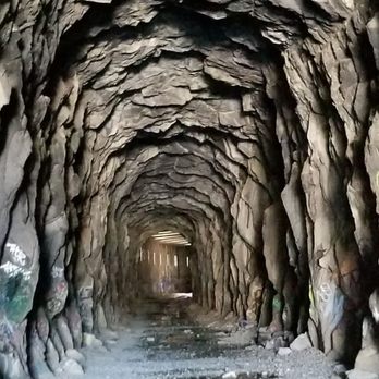
This is an absolutely amazing experience. I am so happy this is still available. Very unassuming but the tunnel is awesome. You can still see the chisel and blast marks and the China wall is an inspiring work of engineering. This is a must see. read more


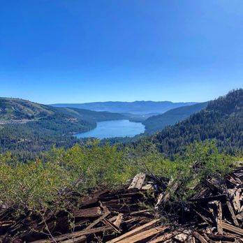
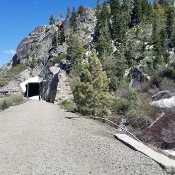
Super cool day trip if you're in the Reno/N. Nevada area. Roughly 1 hour from Reno. Parking is a little scarce, so get there early (search China wall on nav or gps) Ancient petroglyphs welcome you once you start the trek up the hill towards the tunnels. Although the Union Pacific railroad owns the area the tracks and tunnels are on and technically its private property, you won't have any issues. The tunnels in late August still had some water in them from the snowmelt, but were mostly dry. Bring s strong flashlight if you plan to travel further than tunnel 9 or 8 as tunnel 7 is probably half a mile long with almost no light inside. read more




7 years ago
Why this isn't on every Tahoe and Truckee visitors guides I have no idea. One of the coolest, creepiest, yet amazing places I've seen in this area. Pictures do it no justice. My wife was going for me, and wasn't interested, yet she thoroughly enjoyed it and said she is so happy she did not miss it. I did some reading about it, and found that these tracks were active until 1993 with the railroad made a new tunnel about a mile south through the Judah mountain. They quickly removed all the railroad tracks and reusable items leaving the snow sheds and tunnels abandoned. I recommend doing some internet searches afterwards because there's some great articles out there. This one has a great description of the history and have some great tips on what to bring, and how to dress depending on the time of year. http://www.calexplornia.com/donner-summit-train-tunnels-historical-journey-abandoned-train-tunnels/ Hike was not that hard if you go up through the petroglyphs. Kids should be able to make it no problem, however it's definitely not wheelchair or stroller-friendly. I would say the hike up to the China wall is moderate. If you were in the Tahoe Truckee area you do not want to miss this! Probably the creepiest thing was when my wife and I were deep in tunnel eight and it's the longest, we both heard a train horn. ( Yes probably someone playing it on their phone, or maybe you can hear from the new tracks/ tunnel) but that was freaky. It's not scary, but eerie, creepy and amazing all at once read more


3 years ago

8 years ago
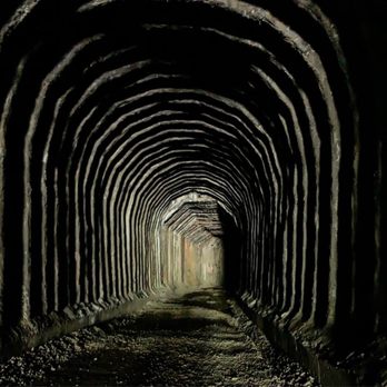
This is a perfect hike for a hot day. You spend most of the time in the shade completely shielded from the sun. Few of the tunnels are so long that once you get to the middle you will be in complete darkness, so don't forget to bring a flashlight with you. However if you do forget a flashlight, no need to panic because your eyes will adjust to the darkness. This is one cool hike because you will be walking through a once 1,659 foot working railroad tunnel. A lot of work was put into making these tunnels. It is said that this railroad was build mostly by the Chinese. The first train that went through this tunnel was in 1868 and the last in 1993. We have seen the railroad tunnel as we passed by but we never knew that one could actually hike through it. But even without the history it is a huge street art exhibition. Some of it is not worth paying attention to but every now and then you will come across a really nice piece of art which will make you want to capture it. Also as you make your way through the dark tunnels you will hear bats and see a few bats now and then throughout the hike. In some areas there are lots of them. We came on a Saturday and it was pretty active with other hikers. This is one of those places you might want to bring someone with you. Here you are guaranteed to have a different kind of hiking experience. Located near Soda Bowl Ski Resort or Just before Donner Summit Bridge. There are a few different ways to enter the tunnels. read more


Page 1 of 2
More info about Donner Pass Railroad Tunnel Hike
China Wall
Donner Pass Rd
Truckee, CA 96161
Directions
Hours
Indoor Amenities
Outdoor Amenities
Ask the Community - Donner Pass Railroad Tunnel Hike
How many tunnels and how long are they? In case someone in my party is worried about nearest exit.
There are five or six tunnels with the first one taking about 10 minutes from entrance to exit The longest is maybe 25 -30 if you take your time and really spend some time…
Is this possible to see for someone who has some mobility challenges? I can walk in short spurts but cannot "hike"/climb, but I'd love to check some of these tunnels out if parking is nearby.
I think the hardest part for you may be getting to the tunnels. If you park at the Dinner Ski Ranch, there is a small hill to traverse to get to the tunnels. However, the tunnels themselves are very flat and easily negotiated.
Review Highlights - Donner Pass Railroad Tunnel Hike
You might also consider














Why does Yelp recommend reviews?
2 reviews that are not currently recommended
The reviews below are not factored into the business's overall star rating.

2 years ago
8 years ago


