Easton Mountain Retreat Photos


You might also consider


More like Easton Mountain Retreat
Recommended Reviews - Easton Mountain Retreat
Start your review...



5 months ago
3 years ago
Great place for Gay men to vacation and do stuff Great workshops Great Staff Lovely men participating All ages Wide range of people Fun Peaceful Good Food Responsive staff. The place is run with integrity I've been going annually for about 14 years ! read more

16 years ago
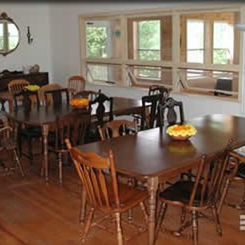
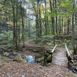
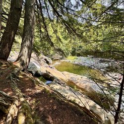
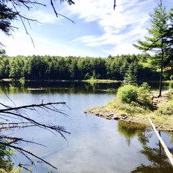
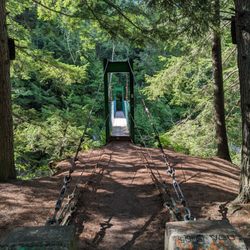
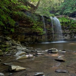
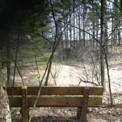
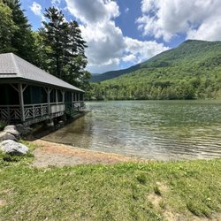
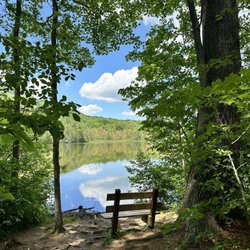
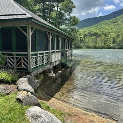
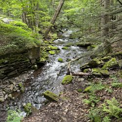
I'm just back from a weekend spent at Easton Mountain, and I think I'm in love. I'll get to the facility in a second, but the natural habitat of this retreat is stunning. Easton is nestled in 175 expansive acres of natural beauty and wilderness in upstate New York. Nature trails (appropriately mapped out in every color of the rainbow, as this is a retreat run by and largely targeted at gay men) abound. There are so many pockets of land to get lost in, whether hiking or stepping off the beaten path. This Texan was happy to see the last bits of fall foliage still clinging to the trees, and even witnessed a snowstorm (which has nothing to do with Easton review-wise, but nonetheless was breathtaking). The facility, too, is great. There are a few options for lodging. You can opt to stay in the Guest House in a single, double, or quad (think bunk beds/dorm setup) room, each equipped with a private bathroom, or you can stay in the Garden House, which has 5 bunk beds and shares the bathroom in the public lodging area. The rooms are a little on the sparse side, and there are no TVs, but that seems appropriate in this context. I'm fine to sacrifice luxurious linens in favor of communing with nature in a gorgeous setting as long as I know that's what I'm signing up for. (Obviously, the cost isn't that of a fancy hotel, either.) The lodge is the main public area at Easton, and houses the dining hall, spa area, and great room. The great room, let me say, is wonderful. It's huge (something like 60' x 40') and has hardwood floors, large window panels on three walls, and a fireplace. The workshop that I attended at Easton did all of our work in this area, and it was really magical to be in such a wonderful space. The dining area has bench-style seating; all meals are served buffet style. And let me say that my expectations in this particular area were blown out of the water. I did not expect to have such fresh, healthy, and delicious food served, but the staff at Easton served us really flavorful and nutritious food for every meal that weekend. Amongst said delicious meals were scrambled eggs with fresh fruit and yogurt for breakfast, salads of both the nicoise and cobb varieties for lunch, and dinners like chicken with roasted root vegetables and sesame-crusted salmon with sauteed kale and swiss chard. Vegetarian and gluten-free options were also available. Desserts were handmade, as well-- yummy blueberry pie and apple crisp and pound cake. MMM. There were also several varieties of tea and coffee available all day, as well as a regularly replenished fruit bowl. (My particular workshop was alcohol-free, but the space was rented for this occasion, soI'm not sure of their official policy.) And the spa, oh yes. The sauna is located a small hike away from the main area, but it's worth it to go. It's wood-fired, and built in an octagonal shape (kind of yurt-like), and absolutely gorgeous. The hot tub is located on the lower level of the public lodging area, and was wonderful to soak in after long days of workshopping. I must also mention that the staff members were all so friendly and accommodating to any particular requests any of us had. It really helps to feel welcome when the staff is that gracious and warm. I had a wonderful stay at Easton. If you're looking for a little solitude with fantastic views and hiking trails to boot, I highly recommend it. read more


12 years ago

7 years ago

11 years ago

8 years ago
5 years ago
More info about Easton Mountain Retreat
391 Herrington Hill Rd
Greenwich, NY 12834
Directions
(518) 692-8023
Call Now
Visit Website
http://www.eastonmountain.org
Hours
Indoor Amenities
Outdoor Amenities
Other Amenities
From the Business
Ask the Community - Easton Mountain Retreat
You might also consider
















Easton Mountain Retreat - healthretreats - Updated August 2026
Best of Greenwich
People found Easton Mountain Retreat by searching for…
Hiking Trails With Waterfalls in Greenwich, NY
Public Shower in Greenwich, NY
Spiritual Centers in Greenwich, NY
Ev Charging Stations in Greenwich, NY
Beautiful Views in Greenwich, NY
Running Trails in Greenwich, NY
Off Road Trails in Greenwich, NY
Walking Trails in Greenwich, NY
Gym With Steam Room in Greenwich, NY
Retreat Centers in Greenwich, NY
Trending Searches in Greenwich, NY
Antiques near Easton Mountain Retreat
Barbershop For Men near Easton Mountain Retreat
Bike Shop near Easton Mountain Retreat
Cliff Jumping near Easton Mountain Retreat
Consignment Shops near Easton Mountain Retreat
Ear Piercing near Easton Mountain Retreat
Eyebrow Threading near Easton Mountain Retreat
Flower Fields near Easton Mountain Retreat
Kids Haircut near Easton Mountain Retreat
Lakes near Easton Mountain Retreat
Mini Golf near Easton Mountain Retreat
Parks near Easton Mountain Retreat
Pedicure near Easton Mountain Retreat
Permanent Makeup near Easton Mountain Retreat
Picnic Areas near Easton Mountain Retreat
Preschools near Easton Mountain Retreat
Public Golf Courses near Easton Mountain Retreat
Public Pools near Easton Mountain Retreat
Swimming Holes near Easton Mountain Retreat
Trading Card Shops near Easton Mountain Retreat
Used Furniture Stores near Easton Mountain Retreat
Browse Articles
Browse Nearby
Browse Brands
Related Cost Guides
Related Searches in Greenwich, NY
Affordable Canoe Rental Options in Greenwich, New York
Affordable Kayak Rental Services in Greenwich, New York
Best Dog Hiking Trails Around Greenwich, New York
Best Fishing Locations and Guides in Greenwich, New York
Best Infrared Sauna Experiences in Greenwich, New York
Best Places for Horseback Riding in Greenwich, New York
Best Waterfalls and Swimming Holes in Greenwich, New York
Book Psychic Readings With Experts in Greenwich, New York
Browse Yoga Classes and Schedules in Greenwich, New York
Certified Health Coach Services in Greenwich, New York
Certified Personal Trainer Available in Greenwich, New York
Discover Great Fitness Classes Available in Greenwich, New York
Discover Peaceful Yoga Retreat Options in Greenwich, New York
Discover Top Boat Tours in Greenwich, New York for All Ages
Discover a Spiritual Shop in Greenwich, New York
Discover a Yoga Studio in Greenwich, New York
Discover the Best Beaches in Greenwich, New York
Discover the Best Night Hike Trails in Greenwich, New York
Dog-Friendly Hikes With Dogs in Greenwich, New York
Enjoy Camping Adventures Around Greenwich, New York
Enjoy Exciting Mountain Biking Adventures in Greenwich, New York
Enjoy Off Leash Dog Hikes in Greenwich, New York
Enjoy Tent Camping Spots Around Greenwich, New York
Enjoy the Best Tubing Experiences in Greenwich, New York
Enjoy the Best Walking Trails in Greenwich, New York
Experience Energy Healing Services in Greenwich, New York
Experience Halotherapy Sessions Near Greenwich, New York
Experience Sweat Lodge Ceremonies in Greenwich, New York
Experienced Psychic Mediums Near Greenwich, New York
Explore Ayurveda Services and Centers in Greenwich, New York
Explore Beautiful Parks and Green Spaces in Greenwich, New York
Explore Chakra Healing Therapies in Greenwich, New York
Explore Easy Hikes Perfect for All in Greenwich, New York
Explore Fun Activities to Do in Greenwich, New York
Explore Meditation Centers Near Greenwich, New York
Explore Pilates Reformer Classes Available in Greenwich, New York
Explore Popular Campgrounds Near Greenwich, New York
Explore Popular RV Parks Around Greenwich, New York
Explore Tantra Experiences and Services in Greenwich, New York
Explore Top Dog Parks in Greenwich, New York Near You
Explore Top Gyms in Greenwich, New York Now
Explore Top Spiritual Centers Around Greenwich, New York
Explore Top Water Parks in Greenwich, New York Today
Explore Top Womens Gym Options in Greenwich, New York Today
Explore the Best Barre Classes Available in Greenwich, New York


