Elowah Falls Photos



You might also consider


More like Elowah Falls
Recommended Reviews - Elowah Falls
Start your review...


Reviews With Photos


I found this hike to the waterfall listed as easy so I decided to do it solo shortly after sunrise one morning. I passed an old wooden water tank not far from the parking lot and found the initial part segment of the hike easy, but just when the falls come into view through the trees, the trail gets a little dangerous, at least for this senior. It would have been doable had I possessed trekking poles, but those were back home in CT so I decided discretion was the better part of valor and turned around at that point.


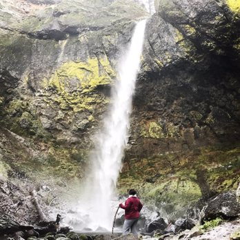
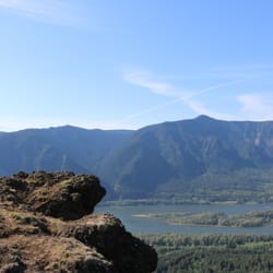
My first business add on yelp! Although this isn't a business, I'm adding this hike on yelp for all the outdoor enthusiasts out there. Elowah Falls Trail is a great hike - easy to moderate but you will be in store for two great waterfall sightings. The trail is marked and easy to find right off the highway along the Columbia Gorge. Elowah Falls hike is only 0.8 mi. and it's a gradual climb. I recommend bringing hiking poles just bc it can be quite wet and slippery along the way. Elowah Falls is beautiful and secluded enough that you can have a serene hike and not run into a ton of tourists (especially on a weekday). Elowah falls is beautiful! Be prepared to get wet because you'll get sprayed for sure! To get to the top of Elowah Falls, take the Upper Mccord Falls Trail. That is 1.1 mi from the start, so if you double back, the distance is a little less than that. You'll climb up the mountain side and see views of the Columbia River and the WA state side. It's nice to get another view of Elowah Falls from the top to get a perspective of how high it cascades. Mccord Falls flows down and becomes Elowah. Mccord is very special because it splits into two falls and looks like a double waterfall. Absolutely breathtaking. Great hike, great scenary and good exercise (especially after having consumed some Voodoo Doughnuts). Enjoy!


Very easy hike. Gorgeous views of the landscape throughout the hike. Saw folks bringing their dogs and kids on the hike. Loved that you can take a dip in the water to get to the bottom is the falls (I didn't. It was cold since we hiked during the late afternoon). We went on a Saturday and had no issue getting parking. You can take other trails nearby as well if you want a longer trip, but I didn't so I'm not sure how great those will be. TLDR: short easy hike with great photo opportunities and you can swim out walk to the bottom of the falls.
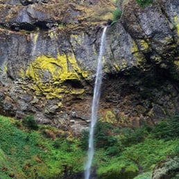

Short hike. Make sure you after you go down to Elowah, to go up to Upper McCord Creek Falls. Falls is much better during rainy season. The basalt and moss is gorgeous.


It's like walking through a postcard. Plus the hike is fairly mild (though there are hills: at the very least wear good sneakers), not very long, and the landscape (as I've already alluded to) is beautiful. I highly recommend this hike if you're trekking out to the gorge. You won't regret it, and if you do, you must not enjoy beauty, nature, or fun.


This waterfall is very beautiful. As of early March 2017 the trail is not well maintained and is therefor a little more difficult to traverse. The view at the end is worth it, if you can handle the slightly rough patch. The hike is .8 miles, 1.6 round trip.


Surprised I haven't reviewed this waterfall before. It is absolutely gorgeous (thought a little dangerous in the winter). Of course, I happened to wear the wrong shoes the day I went (as it was more of a spontaneous stop) but Elowah Falls during the snowy months is a winter wonderland.


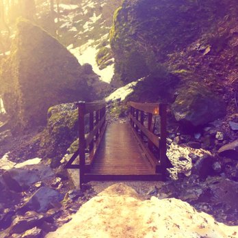
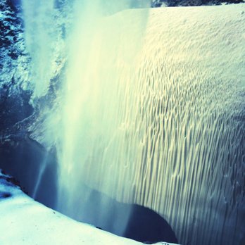
Just hiked in January, sheets of ice abound so it was a challenge for only a .7 mile hike. Totally worth seeing in winter but be careful about falling ice around the falls right now. I climbed to the back of the falls and when it warms all of the area around the falls will send you into water suddenly (it is snow covered water right now). For dogs totally safe and wonderful, for humans have a walking stick in winter and really good gloves and hiking boots.


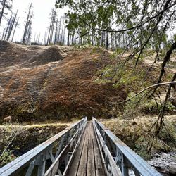
Another beautiful waterfall just past multnomah off of the 84. Don't get me wrong Multnomah is beautiful but I think this waterfall is just so much more beautiful and the scenery to get there is amazing. I love the bridge right in front of it, allowing some amazing photos. It was just breathtaking! And it was a quiet trail not much foot traffic. The trail was quite easy, a little steep on one switchback but a very easy trail. What's nice about it is that if you're not a regular hiker this trail is definitely one to take.


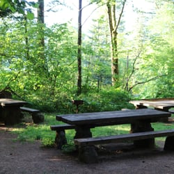
This was a sweet, short hike. Loved the falls n the bridge. An amazing view. The wind was blowing a little so we got to feels the mist on our face...what an experience! Didn't get to check out the other falls in this area because the trail was closed. That was a bummer...prob next time!! After you pass the waterfall keep going on the path. There is a picnic table to sit at. We walked maybe 10 min passed that picnic table but turned back. Only negative thing i have to say is too close to freeway. Go check it out!!


5 years ago
What a gem of a spot! The varied views, vegetation, and falls are totally worth the short 1.1 mile hike up, up, up. Treat yourself. Bring a sandwich. Plan to spend some time enjoying the peace and views. In November. Eliwah and Upper McCord are rushing and roaring!! read more
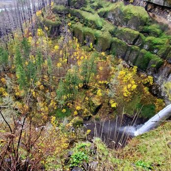


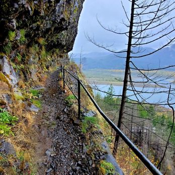


Low to moderate .8 mile hike to Elowah Falls. Beautiful backdrop, but waterfall is a bit wimpy. After crossing the bridge I continued on for .5 mile, but the path just seemed to parallel loud I-84. Upper McCord Creek Falls is peaceful 1.3 mile moderate hike via mainly switchbacks. What was particularly pleasing was the catwalk views of the Gorge and flat paths among the trees. It's far from busy, very tranquil people-wise compared to other falls in the area. The parking lot is small. read more


4 years ago
The top part was closed due to the aftermath of the fires like the trail. We went trough the lower trail and it was an easy hike except for a part where the trail was very thin to the point it felt like we were gonna fall. Either then that I would say beatiful view! read more


5 years ago

4 years ago


I found this hike to the waterfall listed as easy so I decided to do it solo shortly after sunrise one morning. I passed an old wooden water tank not far from the parking lot and found the initial part segment of the hike easy, but just when the falls come into view through the trees, the trail gets a little dangerous, at least for this senior. It would have been doable had I possessed trekking poles, but those were back home in CT so I decided discretion was the better part of valor and turned around at that point. read more


8 years ago


My first business add on yelp! Although this isn't a business, I'm adding this hike on yelp for all the outdoor enthusiasts out there. Elowah Falls Trail is a great hike - easy to moderate but you will be in store for two great waterfall sightings. The trail is marked and easy to find right off the highway along the Columbia Gorge. Elowah Falls hike is only 0.8 mi. and it's a gradual climb. I recommend bringing hiking poles just bc it can be quite wet and slippery along the way. Elowah Falls is beautiful and secluded enough that you can have a serene hike and not run into a ton of tourists (especially on a weekday). Elowah falls is beautiful! Be prepared to get wet because you'll get sprayed for sure! To get to the top of Elowah Falls, take the Upper Mccord Falls Trail. That is 1.1 mi from the start, so if you double back, the distance is a little less than that. You'll climb up the mountain side and see views of the Columbia River and the WA state side. It's nice to get another view of Elowah Falls from the top to get a perspective of how high it cascades. Mccord Falls flows down and becomes Elowah. Mccord is very special because it splits into two falls and looks like a double waterfall. Absolutely breathtaking. Great hike, great scenary and good exercise (especially after having consumed some Voodoo Doughnuts). Enjoy! read more


11 years ago
Very easy hike. Gorgeous views of the landscape throughout the hike. Saw folks bringing their dogs and kids on the hike. Loved that you can take a dip in the water to get to the bottom is the falls (I didn't. It was cold since we hiked during the late afternoon). We went on a Saturday and had no issue getting parking. You can take other trails nearby as well if you want a longer trip, but I didn't so I'm not sure how great those will be. TLDR: short easy hike with great photo opportunities and you can swim out walk to the bottom of the falls. read more


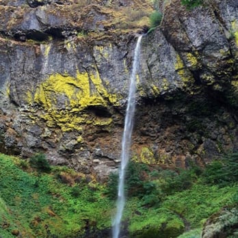

It's like walking through a postcard. Plus the hike is fairly mild (though there are hills: at the very least wear good sneakers), not very long, and the landscape (as I've already alluded to) is beautiful. I highly recommend this hike if you're trekking out to the gorge. You won't regret it, and if you do, you must not enjoy beauty, nature, or fun. read more


9 years ago
This waterfall is very beautiful. As of early March 2017 the trail is not well maintained and is therefor a little more difficult to traverse. The view at the end is worth it, if you can handle the slightly rough patch. The hike is .8 miles, 1.6 round trip. read more

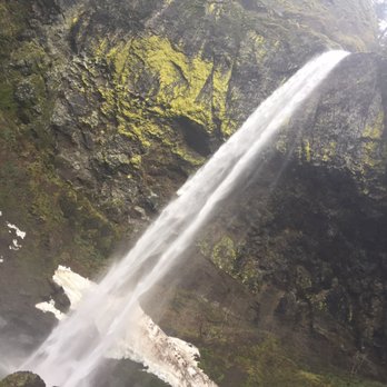


Surprised I haven't reviewed this waterfall before. It is absolutely gorgeous (thought a little dangerous in the winter). Of course, I happened to wear the wrong shoes the day I went (as it was more of a spontaneous stop) but Elowah Falls during the snowy months is a winter wonderland. read more


Just hiked in January, sheets of ice abound so it was a challenge for only a .7 mile hike. Totally worth seeing in winter but be careful about falling ice around the falls right now. I climbed to the back of the falls and when it warms all of the area around the falls will send you into water suddenly (it is snow covered water right now). For dogs totally safe and wonderful, for humans have a walking stick in winter and really good gloves and hiking boots. read more






10 years ago
Another beautiful waterfall just past multnomah off of the 84. Don't get me wrong Multnomah is beautiful but I think this waterfall is just so much more beautiful and the scenery to get there is amazing. I love the bridge right in front of it, allowing some amazing photos. It was just breathtaking! And it was a quiet trail not much foot traffic. The trail was quite easy, a little steep on one switchback but a very easy trail. What's nice about it is that if you're not a regular hiker this trail is definitely one to take. read more



10 years ago
This was a sweet, short hike. Loved the falls n the bridge. An amazing view. The wind was blowing a little so we got to feels the mist on our face...what an experience! Didn't get to check out the other falls in this area because the trail was closed. That was a bummer...prob next time!! After you pass the waterfall keep going on the path. There is a picnic table to sit at. We walked maybe 10 min passed that picnic table but turned back. Only negative thing i have to say is too close to freeway. Go check it out!! read more


10 years ago
Nice short hike for are last waterfall of are vacation to Oregon . This wasn't as crowed since it's one of the farthest east at the end of historic hwy 30. I looked up online the old wooden water reservoir at the beginning of the trail. Cool history, it fed a pulp mill down the hill towards the river. There's some cool old pictures online. read more


9 years ago

11 years ago
10 years ago

11 years ago
More info about Elowah Falls
Cascade Locks, OR 97014
Directions
Hours
Outdoor Amenities
Ask the Community - Elowah Falls
Review Highlights - Elowah Falls














Why does Yelp recommend reviews?
2 reviews that are not currently recommended
The reviews below are not factored into the business's overall star rating.
4 years ago
13 years ago
Elowah Falls - hiking - Updated August 2026
Best of Cascade Locks
People found Elowah Falls by searching for…
Hiking Trails With Waterfalls in Cascade Locks, OR
Things to Do in Cascade Locks, OR
Dog Friendly Hiking Trails in Cascade Locks, OR
Off Road Trails in Cascade Locks, OR
Sunrise View in Cascade Locks, OR
Scenic Drive in Cascade Locks, OR
Waterfalls in Cascade Locks, OR
Waterfalls and Swimming Holes in Cascade Locks, OR
Secret Spots in Cascade Locks, OR
Photo Spots in Cascade Locks, OR
Scenic View in Cascade Locks, OR
Hiking With Kids in Cascade Locks, OR
Hikes With Dogs in Cascade Locks, OR
What to Do in Cascade Locks, OR
View Points in Cascade Locks, OR
Off Leash Dog Hikes in Cascade Locks, OR
Easy Hikes in Cascade Locks, OR
Parks for Kids in Cascade Locks, OR
Swimming Lakes in Cascade Locks, OR
Stroller Friendly Hikes in Cascade Locks, OR
Beautiful Views in Cascade Locks, OR
Trending Searches in Cascade Locks, OR
Barbershop For Men near Elowah Falls
Consignment Shops near Elowah Falls
Cruising Spots near Elowah Falls
Dog Friendly Things To Do near Elowah Falls
Ear Piercing near Elowah Falls
Elementary Schools near Elowah Falls
Eyebrow Threading near Elowah Falls
Hair Braiding near Elowah Falls
Kids Haircut near Elowah Falls
Lookout Points near Elowah Falls
Picnic Areas near Elowah Falls
Public Golf Courses near Elowah Falls
Public Pools near Elowah Falls
Running Trails near Elowah Falls
Scenic Overlook near Elowah Falls
Sunrise View near Elowah Falls
Swimming Holes near Elowah Falls
Trading Card Shops near Elowah Falls
Browse Articles
Browse Nearby
BEST of Cascade Locks, Oregon Coffee near Elowah Falls
BEST of Cascade Locks, Oregon Restaurants near Elowah Falls
BEST of Cascade Locks, Oregon Things to Do near Elowah Falls
BEST of Cascade Locks, Oregon Shopping near Elowah Falls
BEST of Cascade Locks, Oregon Breakfast near Elowah Falls
Browse Brands
Related Searches in Cascade Locks, OR
Affordable Kayak Rental Services in Cascade Locks, Oregon
Best Dog Hiking Trails Around Cascade Locks, Oregon
Best Fishing Locations and Guides in Cascade Locks, Oregon
Best Places for Horseback Riding in Cascade Locks, Oregon
Discover Dog Friendly Trails to Explore in Cascade Locks, Oregon
Discover Lakes & Ponds to Explore in Cascade Locks, Oregon
Discover a Hiking Trail in Cascade Locks, Oregon
Discover the Best Fishing Lake in Cascade Locks, Oregon
Discover the Best Night Hike Trails in Cascade Locks, Oregon
Dog-Friendly Hikes With Dogs in Cascade Locks, Oregon
Enjoy Camping Adventures Around Cascade Locks, Oregon
Enjoy Kayaking Adventures in Cascade Locks, Oregon
Enjoy Off Leash Dog Hikes in Cascade Locks, Oregon
Enjoy Tent Camping Spots Around Cascade Locks, Oregon
Enjoy a Beautiful Waterfall Hike in Cascade Locks, Oregon
Enjoy the Best Walking Trails in Cascade Locks, Oregon
Experience Thrilling White Water Rafting in Cascade Locks, Oregon
Explore Beautiful Parks and Green Spaces in Cascade Locks, Oregon
Explore Easy Hikes Perfect for All in Cascade Locks, Oregon
Explore Fun Activities to Do in Cascade Locks, Oregon
Explore Popular Campgrounds Near Cascade Locks, Oregon
Explore Scenic Lakes to Visit in Cascade Locks, Oregon
Explore Top Dog Parks in Cascade Locks, Oregon Near You
Explore the Best Beach Spots in Cascade Locks, Oregon
Explore the Best Swimming Holes Around Cascade Locks, Oregon
Family Friendly Hiking With Kids in Cascade Locks, Oregon
Find Beautiful Views in Cascade Locks, Oregon
Find Popular Ziplining Spots Around Cascade Locks, Oregon
Find Top-Rated Waterfalls in Cascade Locks, Oregon Now
Find the Best Parks for Picnics in Cascade Locks, Oregon
Find the Best Playgrounds to Visit in Cascade Locks, Oregon
Find the Best Scenic View Locations in Cascade Locks, Oregon
Hiking Trails With Waterfalls in Cascade Locks, Oregon
Off Leash Dog Hiking Trails in Cascade Locks, Oregon
Perfect Spots to Watch Sunset in Cascade Locks, Oregon
Plan a Scenic Drive Route Near Cascade Locks, Oregon
Popular Fishing Spots to Explore in Cascade Locks, Oregon
Popular Outdoor Activities to Try in Cascade Locks, Oregon
Safe River Swimming Areas in Cascade Locks, Oregon
Safe and Fun Parks for Kids in Cascade Locks, Oregon
Top Hiking Trails to Explore in Cascade Locks, Oregon
Top Playgrounds for Kids to Enjoy in Cascade Locks, Oregon
Top Running Trails to Explore in Cascade Locks, Oregon
Top Swimming Lakes to Enjoy in Cascade Locks, Oregon
Top Swimming Spots and Pools in Cascade Locks, Oregon
Top-Rated Camping Sites in Cascade Locks, Oregon
Walk Dog Friendly Hiking Trails in Cascade Locks, Oregon
Walk the Best Paved Walking Trails in Cascade Locks, Oregon
Where to Catch the Best Sunrise View in Cascade Locks, Oregon


