Euchre Bar Trail Photos


You might also consider

More like Euchre Bar Trail
Recommended Reviews - Euchre Bar Trail
Start your review...



4 years ago

8 years ago
Like the other reviewers we just hiked the 1.5 miles to the bridge and back up, would not recommend for beginners. But the view is worth it! read more


10 years ago
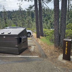
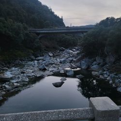
Euchre Bar Trail Hike (Starting from Iron Point and Euchre Bar Trailhead) Hiked Sunday, May 22, 2016 A total of 3.5 miles in 4 hours This was a very short hike to explore a different section of the North Fork of the American River. The trailhead began about 3 miles from the Alta Exit off of Interstate-80. We didn't go far on the trail. Our mission was to visit the suspension foot bridge that was built in 1965 during the Gold Mining era. We arrived at the trailhead (near Iron Point) around 7AM and parked by the bathrooms. There is also additional parking on Iron Point Road, a little farther away from the trailhead. The view of the morning mist and canyons was mesmerizing. Perhaps because of the rain the night before, the morning mist was thick and white as snow. It felt like we were up above with the clouds. We were at approximately at 4,000+ feet elevation. It was 45 degrees fahrenheit when we began our hike. My fingers felt numb. The clouds lingered pretty low over our heads and before we knew it, the mist and mountains were already towering over us. We descended pretty quickly. The sun rays made all the morning dew look like diamonds sparkling all around us. The moss on the trees had a fluorescent green glow against the sunlight. There were a lot of poison oak (a lot!!!), so we made sure to watch our footing. It would be painful to trip and fall into all the lush layers of poison oak. We hiked 1.5 miles to the bridge, and descended 1,800 feet total, all downhill switchbacks. There was never a point where the trail leveled out except for maybe at one or two of the hairpins of the switchbacks. It was pretty rough on our knees. The trail is pretty rocky for the first half mile and then it cleared up, but the fallen leaves still made it slippery. It took us about 1 hour to get down. We saw some tents at the bottom, but the campers were still asleep (backpacking goals!!!). We decided not to go any further on the trail because we just wanted a short and sweet hike. It was extremely peaceful and quiet, just the two of us hanging out by the bridge listening to the American River flowing below, and just imagining what it must have been like in 1965. After 45 minutes of indulging in the sweetness of Mother Nature (and our "breakfast"), we prepped ourselves for the monster uphill return. Surprisingly, the hike back up wasn't as rough as we thought it would be. We kept a good constant pace and before we knew it, we were back at the Euchre Bar Trailhead sign. Go check it out for yourself. It's a great hike for your legs, heart, and mind. I'm rating this based on just our short hike from the trailhead at Iron Point Road to the suspension foot bridge. The trail continues on to other sections of the American River and ends at the other trailhead starting point on the other side (from Foresthill Exit). Tips: The road from I-80 to the trailhead is pretty narrow and some tough spots on the road. Big cars are probably best, although we did see sedans parked at the trailhead on our return. We're glad we drove our pilot though. Walking sticks are highly recommended for those with knee problems. Bring bugspray. And as always, take lots of pictures. read more


13 years ago

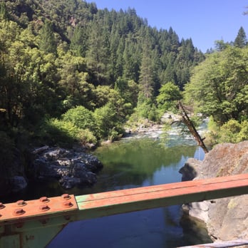
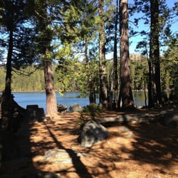
I love knowing another trail to access the North Fork and get in a tough descent and climb, too. It is pretty much straight down to the bridge over the river in about 1.5 miles; we then followed along the trail upstream until it ran into an access road, another 2.5 miles or so. Lots of poison oak on the far side, so wear Technu or bring some Dawn dishwashing liquid to scrub down afterward. Multiple fantastic swimming holes or picnic or camping spots. Very cool mining artifacts left over from the gold mining era, and we ran into a fellow who comes in for several days of panning for gold regularly. We were here on a warm day in late May, and are used to hard hiking, so while the way out was good training, it was not absurd. It did help to jump off a rock into the river for a very brisk swim before heading out! I would definitely use this for training for Grand Canyon hiking or other heat/hill training. Easy to get to, lovely views and the glorious N Fork as a reward! (Note: there is a FS composting toilet at trailhead, but no water.) read more



9 years ago
More info about Euchre Bar Trail
Interstate Hwy 80
Alta, CA 95701
Directions
Hours
Outdoor Amenities
Ask the Community - Euchre Bar Trail














Euchre Bar Trail - hiking - Updated August 2026
Best of Alta
People found Euchre Bar Trail by searching for…
Trending Searches in Alta, CA
Barbershop For Men near Euchre Bar Trail
Bike Shop near Euchre Bar Trail
Bird Sanctuary near Euchre Bar Trail
Cliff Jumping near Euchre Bar Trail
Consignment Shops near Euchre Bar Trail
Dog Friendly Things To Do near Euchre Bar Trail
Ear Piercing near Euchre Bar Trail
Elementary Schools near Euchre Bar Trail
Eyebrow Threading near Euchre Bar Trail
Hair Braiding near Euchre Bar Trail
Kids Haircut near Euchre Bar Trail
Lookout Points near Euchre Bar Trail
Outdoor Activities near Euchre Bar Trail
Pedicure near Euchre Bar Trail
Picnic Areas near Euchre Bar Trail
Public Golf Courses near Euchre Bar Trail
Public Pools near Euchre Bar Trail
Rock Quarry near Euchre Bar Trail
Sunrise View near Euchre Bar Trail
Swimming Holes near Euchre Bar Trail
Trading Card Shops near Euchre Bar Trail
Uniforms near Euchre Bar Trail
Browse Articles
Browse Nearby
BEST of Alta, California Coffee near Euchre Bar Trail
BEST of Alta, California Restaurants near Euchre Bar Trail
BEST of Alta, California Things to Do near Euchre Bar Trail
BEST of Alta, California Breakfast near Euchre Bar Trail
BEST of Alta, California Parks near Euchre Bar Trail
BEST of Alta, California Swimming Holes near Euchre Bar Trail
BEST of Alta, California Campgrounds near Euchre Bar Trail
Browse Brands
Related Searches in Alta, CA
Best Dog Hiking Trails Around Alta, California
Best Fishing Locations and Guides in Alta, California
Best Places for Horseback Riding in Alta, California
Best Sightseeing Experiences Available in Alta, California
Best Sledding Spots and Fun in Alta, California
Best Waterfalls and Swimming Holes in Alta, California
Discover Dog Friendly Beaches Near Alta, California
Discover Dog Friendly Trails to Explore in Alta, California
Discover Popular Bike Trails in Alta, California
Discover a Hiking Trail in Alta, California
Discover the Best Night Hike Trails in Alta, California
Dog-Friendly Hikes With Dogs in Alta, California
Enjoy Camping Adventures Around Alta, California
Enjoy Kayaking Adventures in Alta, California
Enjoy Off Leash Dog Hikes in Alta, California
Enjoy a Beautiful Waterfall Hike in Alta, California
Enjoy the Best Picnic Spots and Ideas in Alta, California
Enjoy the Best Walking Trails in Alta, California
Explore Beautiful Parks and Green Spaces in Alta, California
Explore Easy Hikes Perfect for All in Alta, California
Explore Fun Activities to Do in Alta, California
Explore Nature Spots Around Alta, California
Explore Popular Campgrounds Near Alta, California
Explore Popular State Park Destinations in Alta, California
Explore Top Dog Parks in Alta, California Near You
Explore the Best Beach Spots in Alta, California
Explore the Best Swimming Holes Around Alta, California
Family Friendly Hiking With Kids in Alta, California
Find Beautiful Views in Alta, California
Find Popular Ziplining Spots Around Alta, California
Find Top-Rated Waterfalls in Alta, California Now
Find the Best Parks BBQ Grills in Alta, California
Find the Best Parks for Picnics in Alta, California
Find the Best Playgrounds to Visit in Alta, California
Hiking Trails With Waterfalls in Alta, California
Off Leash Dog Hiking Trails in Alta, California
Plan a Scenic Drive Route Near Alta, California
Popular Outdoor Activities to Try in Alta, California
Popular Picnic Spots to Visit in Alta, California
Safe River Swimming Areas in Alta, California
Safe and Fun Parks for Kids in Alta, California
Top Hiking Trails to Explore in Alta, California
Top Playgrounds for Kids to Enjoy in Alta, California
Top Running Trails to Explore in Alta, California
Top Swimming Spots and Pools in Alta, California
Top Things to Do With Kids in Alta, California
Top-Rated Camping Sites in Alta, California


