Ferguson Canyon Photos


You might also consider


More like Ferguson Canyon
Recommended Reviews - Ferguson Canyon
Start your review...


Reviews With Photos


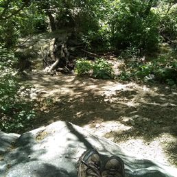
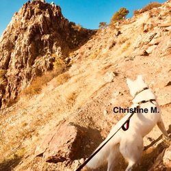
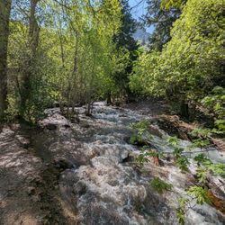
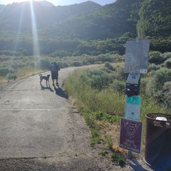
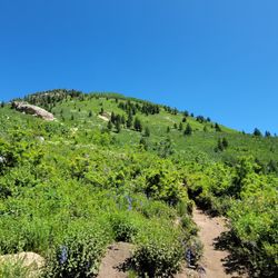
I have done this trail before and loved it. When it's warmer you'll run into people rock climbing along the way. This is the earliest in the year I've gone and it was very muddy. Definitely need some hiking boots for now unless you have a pair of tennis shoes that you don't care about. It is also a dog friendly trail as long as they are on leash. I took mine off to take a pic . I have also heard about people breaking Into the cars parked so make sure you don't have any valuables left in your car. A lot of the hike is shaded and you constantly get to what the water running from the stream. There are so many yellow flowers out towards the beginning of the trail right now It's beautiful!

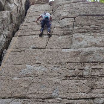
Ferguson Canyon is a great in town hike if you're looking for something that involves some shade. It starts out pretty sunny but quickly goes into shade. This hike is extremely steep so I wouldn't recommend it for anyone with a heart condition or with issues adjusting to the elevation. The hike more or less follows the stream so it's easy to stay on trail if you follow the stream. Without knowing this fact, it can be easy to lose the trail. When I hiked this trail over the weekend, the route was full of rock climbers! This must be a good spot for rock climbing in town. They say that when you get to the top, you will find a "bird man" shaped rock but I climbed so far that I started getting to a really sketchy area that was probably unsafe. I probably should have turned back when I found myself climbing through brush and slipping on high rocks covered in moss. Anyhoo, I climbed and climbed and never saw any "bird man" shaped rock! I would recommend turning back earlier than I did! I probably could have injured myself! Wearing proper footwear is a must on this hike!


3 years ago
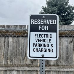
This trail on the southeast side of town is beautiful, well shaded, and right along a stream. The trailhead is in a neighborhood. There are some parking spaces flanking the trail, and overflow parking down the street. Other parking along the street is permit only, with warning signs that threaten fines and towing without notice. A paved ramp and amphitheatre sit trail adjacent. The beginning of the trail looks tame and fairly pleasant (except for all the dog poo bags littered about; carry the poo out, people). But don't be fooled! It quickly turns rocky and the are some steep areas. After rain, the sandy spots can be a bit slick. The bubbling water and shade are quite pleasant on a hot day. But it can be a bit buggy. I was bitten by what looked to be some black flies and mosquitoes. The trail isn't well marked and there are a few offshoots that lead in different directions. Some parts seem narrow and overgrown. For the most part, follow the water to stay on the trail. I didn't see many people. Most people appeared towards the beginning of the trail; most with dogs off leash. A nice trail for respite from the sun, but is not really a beginner's trail. Footwear with good grip and ankle support recommended. read more


Oh man if you are looking for a challenging hike this one is for you. I had no idea this trail even existed so close to the city until, I ran across a review from an old friend of mine on google maps. Cool that there is a hike that's close to the city and is dog friendly. I used google maps to get me to this hike. It's in a neighborhood, and has very limited parking. There isn't parking on the street in front of the houses, unless you have a permit, your car will be towed. (there is overflow parking about a block or so down the street) Now back to the trail review... At first the trail is pretty easy, and I had my dog on a leash obeying the signs. Pretty quickly the trail starts to get a bit rocky, and you run into some make shift stairs going down closer to the river, which you can hear right away. Then the elevation gain starts, and doesn't end until you come down from your hike. The trail is beautiful, and has a good amount of shade and water. The trail is not well defined as far as signage goes. At one point I came to a stand still because I didn't know where to go. The trail I was on came right up to the river, and I couldn't see a trail beyond if you crossed it, and there definitely wasn't a defined trail to my right. I thought what do I do now cross the river? Thankfully a family with small children came around the rocky bend and I asked them which way to go. They said they always take the rocky way through the river. It's a good thing I had my hiking boots on. Most of this hike is ROCKY, climbing over boulders and very large rocks on very sandy soil. It didn't help that it rained this morning. I was slipping and sliding. At this point I took my dog off her leash. It's not in your best interest or the dogs to be dragged on this rocky trail ,with a leash around it's neck, getting pulled here and there. There was one point on the trail that was almost a 99% vertical climb that I sat down with tears in my eyes. I was scared. I kept thinking I have to come down this when I turn around. I should just turn around now, but I wanted to finish to the end to feel a sense of accomplishment. There are no switchbacks on this trail that would have helped with this section, so I made my own, and got past this section. I was holding on to what I could and said "I don't care if there are any snakes I have to get out of here". (as luck would have it there wasn't any, I think I would have passed out if there was coming face to face with a rattler) Each part of the trail became more beautiful, and more changeling. I ran across a section where you could tell a rock slide happened, and you just kept climbing over the boulders. "I can make it, I know I can." There were two sections that you have to walk through the river to continue on the trail. I don't know how the river is at any other time of the year, but it wasn't rushing so fast that you couldn't pass it if you want to go to the end. You have to pass it. I logged on the the all trails app to make sure I was on the trail. It said I was and I only had a little ways left to go to the end. Rain clouds were forming and I thought I better turn back because the trail was slippery enough I didn't need to be caught on the trail when it was a down pour. Plus my little doggy was doing this trail as well, I had to think of her too. There was hardly any people on this trail today, but when I did run across any, they had younger kids with them. Mind you All Trails has this trail rated as Hard. The rain clouds started to form so I turned around. I have to say it was easier to come down than it was to go up. When I came down I ran into a couple of people learning how to mountain climb. I guess this is a popular spot to do that. I would like to go back, and climb all the way to the top. Next time I'll know what to expect, but seriously doubt I'll make it. read more



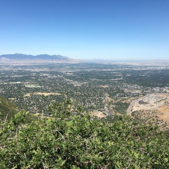
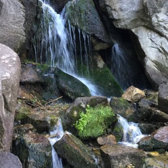
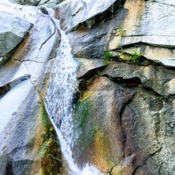
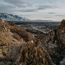
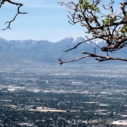
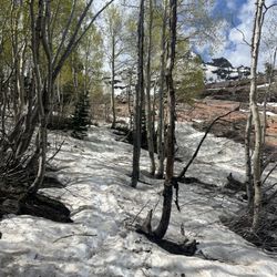
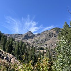
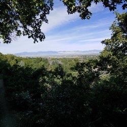
Sometimes I've looked up at a mountain, and wondered if I could just march straight to the top. No trail, no switchbacks, just go for it. From a distance, it doesn't seem that challenging, but I'm here to tell you that (surprise?) it actually requires a great deal of effort! I first attempted this hike during the winter, and, when unfamiliar with a particular trek, I often unthinkingly follow the snowy footprints of previous adventurers. Upon reaching the beginning portion of the trail that either goes straight (marked by a plain wooden sign with nothing actually on it), or right and uphill, we went with the latter, as it appeared to be more traversed. You will want to do the same if you would like to check out the cave (it is a true cave, in fact, quite neat as, even with a flashlight, I could not see the back, but the opening is quite small, and it was littered with trash - c'mon people! - so I did not attempt to go inside. It is probably worth seeing once, but not going out of your way for). It is only a short ways up the trail on the left, and then you can head back to the main portion, as we should have. Instead, we kept pushing forward, even though it was so steep we were basically crawling up the mountain. We kept commenting that this seemed so intense, and it would be a challenge to get down, and finally after a mile, we checked the Alltrails app and discovered we were terribly off course! Again, we were following footprints, so others obviously hike the area at least on occasion. I think it would be much more enjoyable without snow, as, on the way down, even with crampons, we were slipping around rather dangerously. Eager to redeem myself and this rookie mistake, I returned a few weeks later to hike the true trail. Wow, what an improvement! It is still decent elevation as you gain about 1.5k feet over the 1 1/2 miles to the overlook, and then, you must watch your knees on the steep descent back, but this is great for conditioning, and a short enough hike that you shouldn't wear yourself out. Most of the trail follows a creek, or at least what would be one as much of the bed was dry. A pretty (on our visit, frozen) waterfall is a nice spot of beauty about halfway along. Giant rocks the height of buildings border portions of the trail, and they give it a striking and very different look than some other local spots. The point at which you'll begin to loop back is a view out over the SLC valley, and that is fine and all, but not really my style as I would prefer a view of nature and no people, but you do you! This is one of the few area trails I am aware of that allows dogs (leashed, though near every dog encountered was off-leash). The location is great if you don't want to drive too far into the mountains. There is plenty of parking at the trail head, and even a mini amphitheater. People are definitely sledding on this trail, creating very icy and slick spots. That, combined with the steepness of certain areas, make crampons or spikes a must in winter. The trail forks and breaks off in multiple areas. It was easier to follow in the snow, though still gave me pause at points, and at other times of the year this could absolutely cause confusion. We have better hikes in the area, but this is worth doing once, and especially useful for some quick up and downhill conditioning. read more


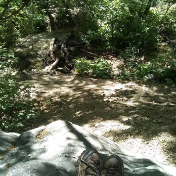
I have done this trail before and loved it. When it's warmer you'll run into people rock climbing along the way. This is the earliest in the year I've gone and it was very muddy. Definitely need some hiking boots for now unless you have a pair of tennis shoes that you don't care about. It is also a dog friendly trail as long as they are on leash. I took mine off to take a pic . I have also heard about people breaking Into the cars parked so make sure you don't have any valuables left in your car. A lot of the hike is shaded and you constantly get to what the water running from the stream. There are so many yellow flowers out towards the beginning of the trail right now It's beautiful! read more


3 years ago

7 years ago
Ferguson Canyon is a great in town hike if you're looking for something that involves some shade. It starts out pretty sunny but quickly goes into shade. This hike is extremely steep so I wouldn't recommend it for anyone with a heart condition or with issues adjusting to the elevation. The hike more or less follows the stream so it's easy to stay on trail if you follow the stream. Without knowing this fact, it can be easy to lose the trail. When I hiked this trail over the weekend, the route was full of rock climbers! This must be a good spot for rock climbing in town. They say that when you get to the top, you will find a "bird man" shaped rock but I climbed so far that I started getting to a really sketchy area that was probably unsafe. I probably should have turned back when I found myself climbing through brush and slipping on high rocks covered in moss. Anyhoo, I climbed and climbed and never saw any "bird man" shaped rock! I would recommend turning back earlier than I did! I probably could have injured myself! Wearing proper footwear is a must on this hike! read more


9 years ago
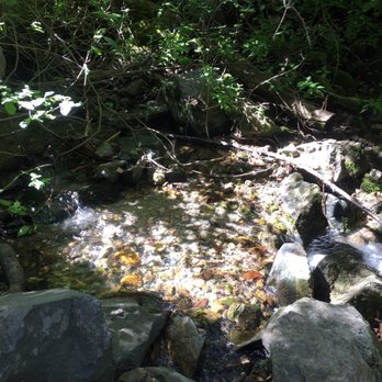
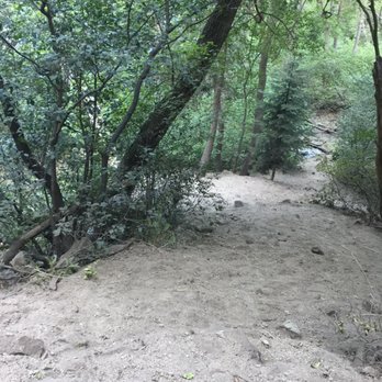
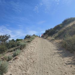
*Rattlesnake alert* We accidentally got to close to a partially hidden rattlesnake on the way down near the steep sandy hill about halfway down. It rattled at us but stayed put. Use extreme caution. (Timestamp: Friday June 30, 2017 12:00p). This hike was easy to find and well marked. It was quite difficult though. It has rocks, a river, it's steep, has many plants (some brush your legs), there's bugs by the river (I recommend bug spray but was only bitten once). It's shaded a lot initially (we even started at 9a). There was a very sandy hill with little traction that I had a little spill on. Quite difficult but very fun. Not kid friendly. Dogs ok. read more






More info about Ferguson Canyon
Ask the Community - Ferguson Canyon
You might also consider


























Ferguson Canyon - hiking - Updated August 2026
Best of Cottonwood Heights
People found Ferguson Canyon by searching for…
Parks in Cottonwood Heights, UT
Beautiful Views in Cottonwood Heights, UT
Hiking Trails With Waterfalls in Cottonwood Heights, UT
Scenic Overlook in Cottonwood Heights, UT
Walking Trails in Cottonwood Heights, UT
Free Things to Do in Cottonwood Heights, UT
Easy Hikes in Cottonwood Heights, UT
Secret Spots in Cottonwood Heights, UT
Running Trails in Cottonwood Heights, UT
Make Out Spot in Cottonwood Heights, UT
Caves in Cottonwood Heights, UT
Dog Friendly Hiking Trails in Cottonwood Heights, UT
Hiking With Kids in Cottonwood Heights, UT
Climbing in Cottonwood Heights, UT
Off Leash Dog Hikes in Cottonwood Heights, UT
Stair Climbing in Cottonwood Heights, UT
Lookout Points in Cottonwood Heights, UT
Things to Do on a Rainy Day in Cottonwood Heights, UT
Secluded Spots in Cottonwood Heights, UT
Hikes With Dogs in Cottonwood Heights, UT
Scenic View in Cottonwood Heights, UT
Fun Things to Do With Kids in Cottonwood Heights, UT
Trending Searches in Cottonwood Heights, UT
Barbershop For Men near Ferguson Canyon
Bike Shop near Ferguson Canyon
Bird Sanctuary near Ferguson Canyon
Cliff Jumping near Ferguson Canyon
Consignment Shops near Ferguson Canyon
Dog Friendly Things To Do near Ferguson Canyon
Ear Piercing near Ferguson Canyon
Eyebrow Threading near Ferguson Canyon
Flower Fields near Ferguson Canyon
Hair Braiding near Ferguson Canyon
Kids Haircut near Ferguson Canyon
Lookout Points near Ferguson Canyon
Mini Golf near Ferguson Canyon
Permanent Makeup near Ferguson Canyon
Picnic Areas near Ferguson Canyon
Public Golf Courses near Ferguson Canyon
Public Pools near Ferguson Canyon
Rock Quarry near Ferguson Canyon
Scenic Night View near Ferguson Canyon
Scenic Overlook near Ferguson Canyon
Sunrise View near Ferguson Canyon
Swimming Holes near Ferguson Canyon
Trading Card Shops near Ferguson Canyon
Used Furniture Stores near Ferguson Canyon
Browse Articles
Browse Nearby
BEST of Cottonwood Heights, Utah Restaurants near Ferguson Canyon
BEST of Cottonwood Heights, Utah Coffee near Ferguson Canyon
BEST of Cottonwood Heights, Utah Things to Do near Ferguson Canyon
BEST of Cottonwood Heights, Utah Breakfast near Ferguson Canyon
BEST of Cottonwood Heights, Utah Shopping near Ferguson Canyon
BEST of Cottonwood Heights, Utah Thrift Stores near Ferguson Canyon
BEST of Cottonwood Heights, Utah Snow Tubing near Ferguson Canyon
Browse Brands
Related Searches in Cottonwood Heights, UT
Affordable Kayak Rental Services in Cottonwood Heights, Utah
Best Dog Hiking Trails Around Cottonwood Heights, Utah
Best Fishing Locations and Guides in Cottonwood Heights, Utah
Best Gym With Sauna Amenities in Cottonwood Heights, Utah
Best Gymnastics for Kids Activities in Cottonwood Heights, Utah
Best Places for Horseback Riding in Cottonwood Heights, Utah
Best Racquetball Court Options in Cottonwood Heights, Utah
Best Rock Climbing Gyms to Try in Cottonwood Heights, Utah
Best Sightseeing Experiences Available in Cottonwood Heights, Utah
Best Spinning Classes Offered in Cottonwood Heights, Utah
Challenge Yourself With an Obstacle Course in Cottonwood Heights, Utah
Check Out Off Road Trails in Cottonwood Heights, Utah
Discover Dog Friendly Trails to Explore in Cottonwood Heights, Utah
Discover Fun Activities to Do in Cottonwood Heights, Utah
Discover Popular Bike Trails in Cottonwood Heights, Utah
Discover Popular Ropes Course Options in Cottonwood Heights, Utah
Discover Powerlifting Gym Near Cottonwood Heights, Utah
Discover Rock Climbing Walls in Cottonwood Heights, Utah
Discover a Hiking Trail in Cottonwood Heights, Utah
Discover a Yoga Studio in Cottonwood Heights, Utah
Discover the Best Night Hike Trails in Cottonwood Heights, Utah
Dog-Friendly Hikes With Dogs in Cottonwood Heights, Utah
Enjoy Camping Adventures Around Cottonwood Heights, Utah
Enjoy Hiking Adventures in Cottonwood Heights, Utah
Enjoy Kayaking Adventures in Cottonwood Heights, Utah
Enjoy Off Leash Dog Hikes in Cottonwood Heights, Utah
Enjoy Scenic Places to Walk in Cottonwood Heights, Utah
Enjoy Tent Camping Spots Around Cottonwood Heights, Utah
Enjoy a Beautiful Waterfall Hike in Cottonwood Heights, Utah
Enjoy the Best Bouldering Experiences in Cottonwood Heights, Utah
Enjoy the Best Picnic Spots and Ideas in Cottonwood Heights, Utah
Enjoy the Best Walking Path in Cottonwood Heights, Utah
Enjoy the Best Walking Trails in Cottonwood Heights, Utah
Experience Aerial Yoga Sessions in Cottonwood Heights, Utah
Explore Beautiful Parks and Green Spaces in Cottonwood Heights, Utah
Explore Boxing Classes for Fitness and Skill in Cottonwood Heights, Utah
Explore Boxing Gyms in Cottonwood Heights, Utah
Explore Climbing Gyms in Cottonwood Heights, Utah Near You
Explore Easy Hikes Perfect for All in Cottonwood Heights, Utah
Explore Fun Activities to Do in Cottonwood Heights, Utah
Explore Gyms With Pool Access in Cottonwood Heights, Utah
Explore Indoor Tennis Courts in Cottonwood Heights, Utah
Explore Martial Arts Options in Cottonwood Heights, Utah
Explore Popular Campgrounds Near Cottonwood Heights, Utah
Explore Top Dog Parks in Cottonwood Heights, Utah Near You
Explore Top Parkour Spots and Activities in Cottonwood Heights, Utah
Explore Top Trampoline Parks in Cottonwood Heights, Utah


