Fire Wave Trail Photos


More like Fire Wave Trail
Recommended Reviews - Fire Wave Trail
Start your review...


Reviews With Photos


Accessibility: not wheelchair accessible at all. Do not attempt. It is also too far for anyone who has difficulty or pain in walking. This trail has lots of up and downhill steps and has slippery spots from the dirt/sand, and It has many uneven surfaces. Experience: this is by far my favorite trail and view at the park, and it's not as long as some other trails. I never get tired of seeing this place. This one you HAVE to see in your lifetime.


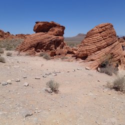
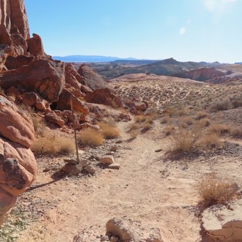
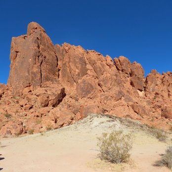
The Fire Wave Trail has become the most popular one in Valley of Fire. The hike was named the Fire Wave after the hike in Utah/Arizona. Tourists thought this area reminded them of that wave and nicknamed this area the Fire Wave. I'd recommend going during the week and early in the morning to avoid lots of people. Two of us went Christmas Day and started the hike about 9:15. There were probably 10 cars in the parking area when we got there. When we finished the hike, there were at least double that and people were using the lot on the trail side of the road. After paying the fee as you enter from the west side of the park, continue driving past Atlatl Rock and turn left onto the road that goes to the Visitor Center. Almost immediately, you turn left onto White Domes Road which also shows on some GPS units as Mouses Tank Road. Continue for several miles to parking area #3. This is the lot for the Fire Wave Trail. Cross the road and the hike begins. The interp marker says it's 1.5 miles roundtrip, but it's more like 1.25 but that depends on how much exploring you do at the wave. The first part is fine sand. In about 2/10 of a mile, you reach a large red sandstone outcrop. From here, the trail goes downhill to the sandstone below. The trail is marked along the way, so there's no fear in getting lost. Once you arrive at the Fire Wave, take the opportunity to explore. There is a lot of beautiful sandstone and you can hike over the sandstone. If it's wet, it can be a bit slippery, but given our lack of rain, you normally don't have to worry about that. I like this trail This was the second time I've hiked it. I did get the chance to hike The Wave in Utah 110 years ago. There is a similarity, but this cannot compare with The Wave in Utah but since that one is limited to 20 hikers per day and getting a pass is difficult, this is a good second choice. The way back is harder because you're going uphill, part of it over fine sand. This makes a good short hike. Try and enjoy!


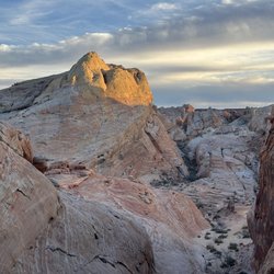
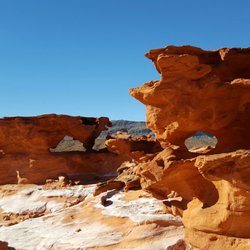
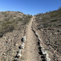
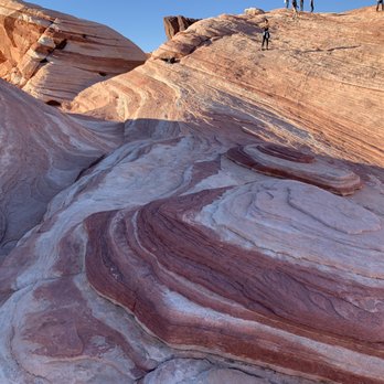
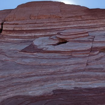
The Fire Wave trail is a 1.5 mile out-and-back trail located within the Valley of Fire state park. With an average time of completion as 41 minutes this trail is one of the most popular spots within the State park. The trail is open year-round and is beautiful to visit anytime and also pet friendly although dogs are welcome, they must be on a leash. The trail itself is an easy hike to an amazing sandstone formation in the it resembles an ocean wave with swirling patterns of red, white, and pink sandstone. With a beautiful backdrop this is one of the best, if not the best hike in the park. The trail is sandy at the beginning of the hike and transitions into sandstone. Rock cairns (small stacks of rocks) lead the way on the sandstone to the Fire Wave. Hikers are typically recommended to do this hike in the cooler months of the year. During the summer, the temperature is well over 100 degrees and there is no shade on the trail. The Fire Wave is best photographed in the late afternoon and early evening. If you're visiting the Vally of Fire State park, I'd recommend keeping this as #1 on your bucket list of things-to-do.


Fire Wave!!! Located in the Valley of Fire, 50 miles outside of Vegas. The trail itself is about 15 miles away from the 15 freeway side entrance. Entry into the park is $10 per car. There is parking for this trail, look for the P #3 parking lot. Decent amount of parking. Came at 2 pm on a Saturday and it was pretty packed but there was some parking. Took about 15 minutes to walk to the actual wave from the parking lot. Kid friendly. Less then a mile walk. My 3 year olds did it with only some assistance. A lot busier then expected during COVID. Amazing site to see. Worth a visit if you want to do something different in Vegas.


This was a relatively simple and easy hike for me to complete last Saturday. I got to the parking area around 7 AM and it wasn't too busy. It was a lot more crowded when I left in the afternoon. Hordes of annoying tourists were hounding me for my spot as I left. The hike is a lot of fun. Don't forget to bring a water bottle. You'll get thirsty during the hike. A lot of the rocks around here are cool colors. You'll feel very romantic and artistically-inspired after completing this hike. This is supposedly one of the best hikes in Valley of Fire State Park. Don't step in the bighorn poop!


My first time visiting this famous spot and it did not disappoint. Next up is hiking to fire wave for some photo ops. The key to finding parking is to look for pastel (pink) canyon trail and hike from there to fire wave. Do not go to fire wave trailhead as the parking there is horrible. Too many people start there and the hike is longer as well. Trust me on this.


Fire Wave Trail was my favorite hike in Valley of Fire because of the amazing swirl of colors in the sandstone. It's a nice little walk from Parking lot #3. Like others have mentioned, you feel like you are on another planet because the rock feels and looks very different from the rest of the area. I also got a hankering for swirl yogurt because of the rocks. It's hard to imagine the amount of time, wind, water, and other elements that helped in the formation of these rocks. It's also wild to see them just sitting there all by their lonesome. * Don't be a hog with the top of the dome. While we were there, this one group of 3 girls took an extreme amount of time and poses- enough to fill an entire catalog. A crowd of other people were waiting to climb to the perch to get their picture taken. We decided it was not worth the wait.


We came to this place after spending a day at Vegas. We need a break from neon lights and wanted to burn some of the calories from the unlimited buffet. And we did no want to miss a chance to hike the Fire Wave Trail. And oh my! We were so glad that we did not miss it! It is a 1.5 mile round trip and it is an easy hike, unless you have some hangover from the previous night Vegas festivities. As you start hiking your way into the formations, you can start seeing mounds that provide a sneak peek of the view. The only difficulty in the hike is the temperature, the Nevada heat can get to you. I would recommend doing this hike early in the mornings and stay hydrated! If you have kids, they are going to love it!


The Fire Wave is fabuloso. We ventured out to Valley of Fire and got here before anyone else except a couple of other explorers on a recent Saturday morning. It's quite easy to find: just park at Parking Lot #3 and there is signage right across the street for the Fire Wave Trail. Follow the stakes along the way on the trail (only .6 miles) and then you are at the wave itself. Picturesque to say the least, the wave formation is so colorful and we were lucky that there were no crowds so we could get our pics of the stone. As we headed back to our car around 9:00am, there were groups of folks showing up so try getting there early is recommended not only to avoid crowds, but so it's cooler as we head into the higher temps.


Whimsical landscape & formations... This hike is located in Valley of Fire State Park. It's an easy hike, about a mile long and starts off from parking lot #3. Cross the street and follow the signs, remaining on the trail. You'll begin descending down into a sandy canyon that is both shaded and in direct sun. Eventually you'll start inclining towards the Wave itself. I've been here twice now and find that the colors on the wave are most dramatic as the sun begins to set. If your schedule doesn't permit that don't worry and still hike out here because it's gorgeous either way. Tips: Wear appropriate shoes to keep you from sliding. You'll be walking on sandy rocks that can be slippery. Bring water, sunglasses and a hat. There's lots of direct sun on this trail, even in the winter. Pet friendly trail. Played with lots of fur babies! Most importantly, take pics and just have fun. This place is stunning! The wave itself reminded me of Thai tea swirls and even bacon! It's beautiful...


The Fire Wave is in the Valley of Fire. It's our version of The Wave in Arizona. Here's the good news...you don't need a permit or get in a lottery to get in. The Fire Wave looks enormous from a distance. In actuality, the Fire Wave is small and still a beautiful piece of sandstone. The Fire Wave Trail will lead you to the Fire Wave. The hike is about a mile in length and pretty easy. However, the hike can be tough if you're doing it during the middle of summer or if you do not follow the trail/trail stakes. The wave itself is a sight to be seen. The pinkish, orange, red, and white colors of the sandstone combined with the backdrop gives that appearance that you're actually on a wave. Cowabunga!! Take my advice, bookmark this hike. Pretty cool stuff! 2017 Hike Review #9 /2017 Yelp Review #71
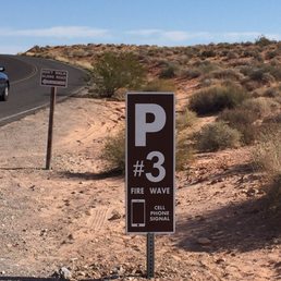

This has been one of my many bookmarks in terms of local hiking for quite some time. Thanks to fellow Yelper and friend Terri R. I finally made it out here. Hubby and I got up early and headed out to this trail. Easy to find as parking lot #3 but the trail is across the street so don't get lost. This little trail is pretty easy but as I always say when hiking, take water with you. Even though it was November, the heat was on this day. You begin a consistent descent down into this little valley on soft red sand. There are a couple of rock crannies along the way that provide shade and are fun to climb around in. As you make your way, you come across the rocky surface and then begin to ascend out of the valley. Once you reach the top, there lies these endless colorful waves of rock all connected thus getting its name "Fire Wave Trail". The trail is easy to maneuver provided one is wearing solid shoes. Once we arrived, we just sat down and took in our surroundings and the beauty of the fire wave. There were so many colors from pinks to oranges to reds and even a tinge of green. From sandstone to limestone. At one point we were the only people out there and it was so quiet. Just us and Mother Nature, pretty cool I must say. The hike is out is only .06 miles and it is easy to moderate for those that are active. I highly suggest you wear the right shoes and of course take water! I saw way too many people hiking out here with no water.....duh it is a desert people!! And don't wear flip flops as you can slip on the rock if you are not careful. This is definitely a place you want to check out early so you don't have to share with anyone. Enjoy this awesome place and keep on traveling in Nevada! We have a whole lot to offer outside!!


This trail is located in Valley of Fire State Park and is absolutely gorgeous. It is about an hour's drive from Las Vegas, the Valley of Fire is a wonderful break from the city. For $10, you can visit stunning rock formations and petroglyphs. Go to parking lot #3 and on the opposite side is the trail. It is also known as "The Wave", and parts of it looks like slices of bacon. The hike is 1.5 mile and starts on a white sand trail leading toward a rocky hill. Once the trail swings around the hill, the fire looking ground comes into view. You will see red and white striated formations stretch into the distance and become the trail. Just follow the main established trail and you will soon be walking in an increasingly dramatic and out of the world landscape. We hiked yesterday. The best time is Spring and Fall to hike. Make sure you bring water, sunscreen, and a hat. Happy Hiking!!


4 months ago
This trail (with the seven wonders loop) is my fave in VOF state park. If you only do one, this is the one I'd recommend! I love the variety of vistas along the trail, and the scenic viewpoint is so colorful and lovely. The pastel canyon trail is also really cute and unique - it's short but I love the pink sand, it felt like getting the pink sand dunes experience There's also plenty of parking at the trailhead despite it being a very popular trail. Def recommend :) read more


The Fire Wave trail in Valley of Fire state park connects to the Seven Wonders trails to make about a 1.5 miles trail. Parking is on either side of White Dome road with one side of the parking area actually starting at the fire wave trail, and the other side being the Seven Wonders trail. The views, and the colors of the rocks are amazing, even if you don't have time to do the entire hike you can just step out and walk a little bit one either side of the trail and take in some spectacular views. read more

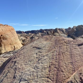

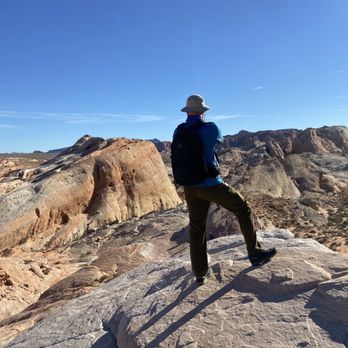

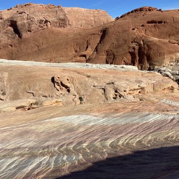

Accessibility: not wheelchair accessible at all. Do not attempt. It is also too far for anyone who has difficulty or pain in walking. This trail has lots of up and downhill steps and has slippery spots from the dirt/sand, and It has many uneven surfaces. Experience: this is by far my favorite trail and view at the park, and it's not as long as some other trails. I never get tired of seeing this place. This one you HAVE to see in your lifetime. read more


The Fire Wave Trail has become the most popular one in Valley of Fire. The hike was named the Fire Wave after the hike in Utah/Arizona. Tourists thought this area reminded them of that wave and nicknamed this area the Fire Wave. I'd recommend going during the week and early in the morning to avoid lots of people. Two of us went Christmas Day and started the hike about 9:15. There were probably 10 cars in the parking area when we got there. When we finished the hike, there were at least double that and people were using the lot on the trail side of the road. After paying the fee as you enter from the west side of the park, continue driving past Atlatl Rock and turn left onto the road that goes to the Visitor Center. Almost immediately, you turn left onto White Domes Road which also shows on some GPS units as Mouses Tank Road. Continue for several miles to parking area #3. This is the lot for the Fire Wave Trail. Cross the road and the hike begins. The interp marker says it's 1.5 miles roundtrip, but it's more like 1.25 but that depends on how much exploring you do at the wave. The first part is fine sand. In about 2/10 of a mile, you reach a large red sandstone outcrop. From here, the trail goes downhill to the sandstone below. The trail is marked along the way, so there's no fear in getting lost. Once you arrive at the Fire Wave, take the opportunity to explore. There is a lot of beautiful sandstone and you can hike over the sandstone. If it's wet, it can be a bit slippery, but given our lack of rain, you normally don't have to worry about that. I like this trail This was the second time I've hiked it. I did get the chance to hike The Wave in Utah 110 years ago. There is a similarity, but this cannot compare with The Wave in Utah but since that one is limited to 20 hikers per day and getting a pass is difficult, this is a good second choice. The way back is harder because you're going uphill, part of it over fine sand. This makes a good short hike. Try and enjoy! read more





4 years ago
The Fire Wave trail is a 1.5 mile out-and-back trail located within the Valley of Fire state park. With an average time of completion as 41 minutes this trail is one of the most popular spots within the State park. The trail is open year-round and is beautiful to visit anytime and also pet friendly although dogs are welcome, they must be on a leash. The trail itself is an easy hike to an amazing sandstone formation in the it resembles an ocean wave with swirling patterns of red, white, and pink sandstone. With a beautiful backdrop this is one of the best, if not the best hike in the park. The trail is sandy at the beginning of the hike and transitions into sandstone. Rock cairns (small stacks of rocks) lead the way on the sandstone to the Fire Wave. Hikers are typically recommended to do this hike in the cooler months of the year. During the summer, the temperature is well over 100 degrees and there is no shade on the trail. The Fire Wave is best photographed in the late afternoon and early evening. If you're visiting the Vally of Fire State park, I'd recommend keeping this as #1 on your bucket list of things-to-do. read more




Fire Wave!!! Located in the Valley of Fire, 50 miles outside of Vegas. The trail itself is about 15 miles away from the 15 freeway side entrance. Entry into the park is $10 per car. There is parking for this trail, look for the P #3 parking lot. Decent amount of parking. Came at 2 pm on a Saturday and it was pretty packed but there was some parking. Took about 15 minutes to walk to the actual wave from the parking lot. Kid friendly. Less then a mile walk. My 3 year olds did it with only some assistance. A lot busier then expected during COVID. Amazing site to see. Worth a visit if you want to do something different in Vegas. read more




4 years ago
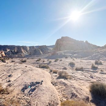
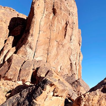
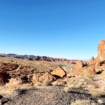
This was a relatively simple and easy hike for me to complete last Saturday. I got to the parking area around 7 AM and it wasn't too busy. It was a lot more crowded when I left in the afternoon. Hordes of annoying tourists were hounding me for my spot as I left. The hike is a lot of fun. Don't forget to bring a water bottle. You'll get thirsty during the hike. A lot of the rocks around here are cool colors. You'll feel very romantic and artistically-inspired after completing this hike. This is supposedly one of the best hikes in Valley of Fire State Park. Don't step in the bighorn poop! read more


My first time visiting this famous spot and it did not disappoint. Next up is hiking to fire wave for some photo ops. The key to finding parking is to look for pastel (pink) canyon trail and hike from there to fire wave. Do not go to fire wave trailhead as the parking there is horrible. Too many people start there and the hike is longer as well. Trust me on this. read more


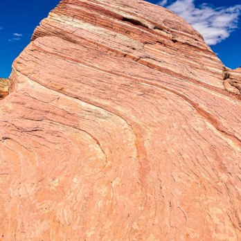

Fire Wave Trail was my favorite hike in Valley of Fire because of the amazing swirl of colors in the sandstone. It's a nice little walk from Parking lot #3. Like others have mentioned, you feel like you are on another planet because the rock feels and looks very different from the rest of the area. I also got a hankering for swirl yogurt because of the rocks. It's hard to imagine the amount of time, wind, water, and other elements that helped in the formation of these rocks. It's also wild to see them just sitting there all by their lonesome. * Don't be a hog with the top of the dome. While we were there, this one group of 3 girls took an extreme amount of time and poses- enough to fill an entire catalog. A crowd of other people were waiting to climb to the perch to get their picture taken. We decided it was not worth the wait. read more

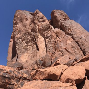

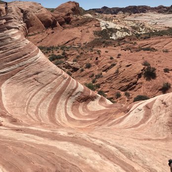


We came to this place after spending a day at Vegas. We need a break from neon lights and wanted to burn some of the calories from the unlimited buffet. And we did no want to miss a chance to hike the Fire Wave Trail. And oh my! We were so glad that we did not miss it! It is a 1.5 mile round trip and it is an easy hike, unless you have some hangover from the previous night Vegas festivities. As you start hiking your way into the formations, you can start seeing mounds that provide a sneak peek of the view. The only difficulty in the hike is the temperature, the Nevada heat can get to you. I would recommend doing this hike early in the mornings and stay hydrated! If you have kids, they are going to love it! read more

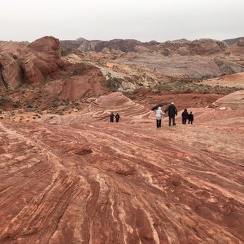


The Fire Wave is fabuloso. We ventured out to Valley of Fire and got here before anyone else except a couple of other explorers on a recent Saturday morning. It's quite easy to find: just park at Parking Lot #3 and there is signage right across the street for the Fire Wave Trail. Follow the stakes along the way on the trail (only .6 miles) and then you are at the wave itself. Picturesque to say the least, the wave formation is so colorful and we were lucky that there were no crowds so we could get our pics of the stone. As we headed back to our car around 9:00am, there were groups of folks showing up so try getting there early is recommended not only to avoid crowds, but so it's cooler as we head into the higher temps. read more



8 years ago

Whimsical landscape & formations... This hike is located in Valley of Fire State Park. It's an easy hike, about a mile long and starts off from parking lot #3. Cross the street and follow the signs, remaining on the trail. You'll begin descending down into a sandy canyon that is both shaded and in direct sun. Eventually you'll start inclining towards the Wave itself. I've been here twice now and find that the colors on the wave are most dramatic as the sun begins to set. If your schedule doesn't permit that don't worry and still hike out here because it's gorgeous either way. Tips: Wear appropriate shoes to keep you from sliding. You'll be walking on sandy rocks that can be slippery. Bring water, sunglasses and a hat. There's lots of direct sun on this trail, even in the winter. Pet friendly trail. Played with lots of fur babies! Most importantly, take pics and just have fun. This place is stunning! The wave itself reminded me of Thai tea swirls and even bacon! It's beautiful... read more


The Fire Wave is in the Valley of Fire. It's our version of The Wave in Arizona. Here's the good news...you don't need a permit or get in a lottery to get in. The Fire Wave looks enormous from a distance. In actuality, the Fire Wave is small and still a beautiful piece of sandstone. The Fire Wave Trail will lead you to the Fire Wave. The hike is about a mile in length and pretty easy. However, the hike can be tough if you're doing it during the middle of summer or if you do not follow the trail/trail stakes. The wave itself is a sight to be seen. The pinkish, orange, red, and white colors of the sandstone combined with the backdrop gives that appearance that you're actually on a wave. Cowabunga!! Take my advice, bookmark this hike. Pretty cool stuff! 2017 Hike Review #9 /2017 Yelp Review #71 read more


This has been one of my many bookmarks in terms of local hiking for quite some time. Thanks to fellow Yelper and friend Terri R. I finally made it out here. Hubby and I got up early and headed out to this trail. Easy to find as parking lot #3 but the trail is across the street so don't get lost. This little trail is pretty easy but as I always say when hiking, take water with you. Even though it was November, the heat was on this day. You begin a consistent descent down into this little valley on soft red sand. There are a couple of rock crannies along the way that provide shade and are fun to climb around in. As you make your way, you come across the rocky surface and then begin to ascend out of the valley. Once you reach the top, there lies these endless colorful waves of rock all connected thus getting its name "Fire Wave Trail". The trail is easy to maneuver provided one is wearing solid shoes. Once we arrived, we just sat down and took in our surroundings and the beauty of the fire wave. There were so many colors from pinks to oranges to reds and even a tinge of green. From sandstone to limestone. At one point we were the only people out there and it was so quiet. Just us and Mother Nature, pretty cool I must say. The hike is out is only .06 miles and it is easy to moderate for those that are active. I highly suggest you wear the right shoes and of course take water! I saw way too many people hiking out here with no water.....duh it is a desert people!! And don't wear flip flops as you can slip on the rock if you are not careful. This is definitely a place you want to check out early so you don't have to share with anyone. Enjoy this awesome place and keep on traveling in Nevada! We have a whole lot to offer outside!! read more
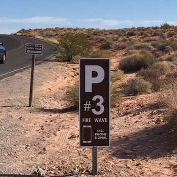


This trail is located in Valley of Fire State Park and is absolutely gorgeous. It is about an hour's drive from Las Vegas, the Valley of Fire is a wonderful break from the city. For $10, you can visit stunning rock formations and petroglyphs. Go to parking lot #3 and on the opposite side is the trail. It is also known as "The Wave", and parts of it looks like slices of bacon. The hike is 1.5 mile and starts on a white sand trail leading toward a rocky hill. Once the trail swings around the hill, the fire looking ground comes into view. You will see red and white striated formations stretch into the distance and become the trail. Just follow the main established trail and you will soon be walking in an increasingly dramatic and out of the world landscape. We hiked yesterday. The best time is Spring and Fall to hike. Make sure you bring water, sunscreen, and a hat. Happy Hiking!! read more


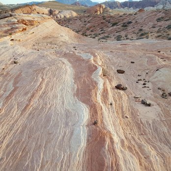

Do yourself a favor and visit Valley of Fire State park. Make a day out of if and check out Fire Wave Trail. You're going to be in the sun most of the so don't forget the SPF. The trail is 1.5 miles in length (out and back). Keep your eyes peeled! You will come up on the fire wave like point before you know it. I encourage hikers to take the time to climb some of the surrounding boulders. The views are 100% worth the work. This trail is popular so prepare for the photo lines during peak hours. Happy hiking! read more


9 years ago
More info about Fire Wave Trail
Mouse's Tank Rd
Overton, NV 89040
Directions
Hours
Outdoor Amenities