Cancel

    Open app

    Search

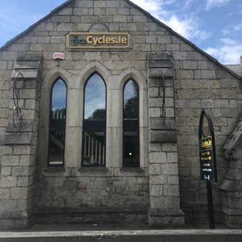
    Fitzcycles

    3.0 (4 reviews)

    Fitzcycles Photos

    Recommended Reviews - Fitzcycles

    Your trust is our priority, so businesses can't pay to alter or remove their reviews. Learn more about reviews.
    Yelp app icon
    Browse more easily on the app
    Review Feed Illustration
    Photo of Ben R.
    3
    20
    0

    13 years ago

    Helpful 1
    Thanks 0
    Love this 1
    Oh no 0

    9 years ago

    Helpful 0
    Thanks 0
    Love this 0
    Oh no 0

    11 years ago

    Helpful 0
    Thanks 0
    Love this 1
    Oh no 0

    9 years ago

    Helpful 0
    Thanks 0
    Love this 0
    Oh no 0

    Verify this business for free

    Get access to customer & competitor insights.

    Verify this business

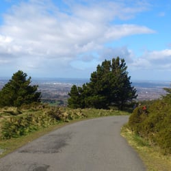
    Ticknock - View on the way back down

    Ticknock

    4.4(5 reviews)
    4.8 km

    A lovely place. Great scenery on top with nice rocks. You can see the whole Dublin…read more Coming here mostly with a road bike. A good challenge to get up there. You may park at the bottom and walk up. Be prepared to sweat a little bit. There're at least two ways. I tried the other one and it was all gravel. No good for road bike. But nice walking experience.

    Ticknock has up to 10 km of mountain and forest walks catering to seasoned hikers, mountain bikers,…read moreskateboarders, mountain runners, Sunday strollers and everyone in between with fantastic views from Dublin City to Bray Head. The forest has an extensive network of forest trails managed by Coillte and Ticknock is part of the Dublin Mountains Partnership which aims to improve the recreational use of the Dublin Mountains. The area comprises Two Rock, Three Rock, Kilmashogue and Tibradden Mountains. There are two trails specific to just Ticknock with the addition of the Wicklow Way Trail. The first trail 'Mountain Access Route' starts and finishes at the Ticknock Forest carpark. It meanders through the woodland paths before going straight up to the summit of Two Rock at Fairy Castle. This trail comes back down the same way. It's an 800m walk which takes about 20 mins. It's marked by Coillte and the Dublin Mountain Partnership as moderate and it seems to be used by runners a lot for training, as well as the occasional skateboarder on the lower part of the trail where it is tarmacadamed (I know this isn't a word, but you get what I mean!). I tend not to do this trail as it's a bit too short. The ground is partially forest walk, partially forest road and partially uneven mountain trails. It's a nice short, steep walk to the great views from Fairy Castle. The second trail 'The Fairy Castle Loop' starts and finishes at the same point but covers 5.5km and takes an estimated 1hr 45mins although as we took the wrong path for a little while on Sunday it took us closer to two hours, but hey, it was a lovely sunny day so no harm done The trail is also considered moderate. It's grand, a little uneven in places and some parts are a little on the steep side, but if you have any level of fitness you should be fine. This trail loops past Fairy Castle at the summit and passes Three Rock on the way back down (or up if you go in the opposite direction). Another thing to note is that the Dublin/Wicklow Way also runs through this part of the mountains, and so there are often other walkers coming from further afield. You can also extend your walk by heading along the Wicklow Way to either Tibradden Wood and joining the 'Tibradden Mountain Trail' or to Kilmashogue Forest which is another lovely walk. The Coillte and Dublin Mountains Partnership websites both have handy downloadable free maps which I would recommend taking if you're unsure of the trails and you don't want to bring an OSI map with you. The trails are well marked in places but not at every possible diverging fork. There is quite a lot of parking available at Ticknock as it is a very well used part of the mountains. Apparently the 44B is the closest public transport but I've had a look and it seems the closest stop might be at Lamb Doyle's.

    Photos
    Ticknock
    Ticknock - Ticknock

    Ticknock

    Ticknock - View on the way back down

    See all

    View on the way back down

    Djouce Wood - Powerscourt Waterfall from the Deerpark Trail (red).

    Djouce Wood

    4.0(1 review)
    15.2 km

    Djouce wood is an extensive area of forest managed by Coillte and bordered to the south west by…read moreDjouce mountain close to Dublin in the Wicklow mountains. The wood is a mix of forest roads, trails and paths laid out and useable by walkers and mountain bikers alike. The area was once part of the Powerscourt Estate. The trails in the forest offer excellent views over the River Dargle valley to the Powersourt Waterfall which is the highest waterfall in Ireland and to Djouce Mountain (725m). The area has many other great walking trails including accessing the mountain area of Djouce, War Hill, White Hill and Maulin. It also gives access to the Wicklow way heading north through Crone and Lackan or south to Ballinastoe. There are two specific trails in Djouce wood, the red (Deerpark) and the blue trail. The red trail is approximately 3 hours long and deemed a moderate level walk. It's along mostly forest paths and a few forest roads. It can be quite wet, muddy, and open to the elements so this trail is best approached with appropriate wet gear and walking shoes or boots. The blue trail at one and a half hours is an easier route on drier woodland trails which wouldn't require the same level of dressing for the weather and environment. The carpark is well maintained and at the moment is open until 4pm in the afternoon. Coillte's website www.coillteoutdoors.ie provides driving directions and maps of the trails available in this wood.

    Photos
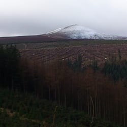
    Djouce Wood - Views from the Djouce Deerpark Trail.

    Views from the Djouce Deerpark Trail.

    Djouce Wood - Views from the Deerpark Trail (red).

    Views from the Deerpark Trail (red).

    Djouce Wood

    See all

    Fitzcycles - mountainbiking - Updated May 2026

    Loading...
    Loading...
    Loading...