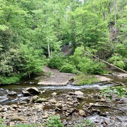
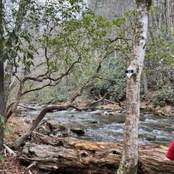
Georgia Mountain Falconry Educational Services Photos


You might also consider
More like Georgia Mountain Falconry
Recommended Reviews - Georgia Mountain Falconry
Start your review...

3 years ago


More info about Georgia Mountain Falconry
Cleveland, GA 30528
Directions
(404) 538-4355
Call Now
Hours
Payment methods
Indoor Amenities
Outdoor Amenities
Other Amenities
Ask the Community - Georgia Mountain Falconry
What are the prices? And can a 7 year old come in?


Georgia Mountain Falconry - educationservices - Updated June 2026
Best of Cleveland
People found Georgia Mountain Falconry by searching for…
Browse Brands
Trending Searches in Cleveland, GA
Beaches near Georgia Mountain Falconry
Black Owned Nail Salons near Georgia Mountain Falconry
Boat Rental near Georgia Mountain Falconry
Movie Theatre near Georgia Mountain Falconry
Nurseries & Gardening near Georgia Mountain Falconry
Pedicure near Georgia Mountain Falconry
Pick Your Own Farms near Georgia Mountain Falconry
Public Pools near Georgia Mountain Falconry
Splash Pad near Georgia Mountain Falconry
Strawberry Picking near Georgia Mountain Falconry
Summer Camps near Georgia Mountain Falconry
Swimming Holes near Georgia Mountain Falconry
Swimming Lakes near Georgia Mountain Falconry
Browse Nearby
BEST of Cleveland, Georgia Coffee near Georgia Mountain Falconry
BEST of Cleveland, Georgia Things to Do near Georgia Mountain Falconry
BEST of Cleveland, Georgia Restaurants near Georgia Mountain Falconry
BEST of Cleveland, Georgia Summer Camps near Georgia Mountain Falconry
BEST of Cleveland, Georgia Preschools near Georgia Mountain Falconry
BEST of Cleveland, Georgia Art Classes near Georgia Mountain Falconry
BEST of Cleveland, Georgia Gymnastics near Georgia Mountain Falconry
BEST of Cleveland, Georgia Dance Studios near Georgia Mountain Falconry
BEST of Cleveland, Georgia Breakfast near Georgia Mountain Falconry
Browse Articles
People who viewed Georgia Mountain Falconry also viewed
North Georgia Wildlife Park
83 reviews
Chestatee Wild Life Preserve
63 reviews
The Pearce Creative
1 review
Atlanta Motorsports Park
71 reviews
Appalachian Outfitters
51 reviews
Glass Blowing Shop
7 reviews
The Axe Armory
2 reviews
Unicoi Outfitters
10 reviews
Glassblowing Shop
23 reviews
Blood Mountain Wilderness Area
25 reviews