1. Great Sur Vista Point

    1. Great Sur Vista Point

    0

    Carmel, CA

    Cancel

    Open app

    Search

    Great Sur Vista Point

    4.0 (1 review)

    Great Sur Vista Point Photos

    You might also consider

    Recommended Reviews - Great Sur Vista Point

    Your trust is our priority, so businesses can't pay to alter or remove their reviews. Learn more about reviews.
    Yelp app icon
    Browse more easily on the app
    Review Feed Illustration

    1 month ago

    Helpful 5
    Thanks 0
    Love this 6
    Oh no 0

    You might also consider

    Verify this business for free

    People searched for Parks 1,714 times last month within 15 miles of this business.

    Verify this business

    Pfeiffer Big Sur State Park

    Pfeiffer Big Sur State Park

    4.4(407 reviews)
    9.3 mi

    Great campground with the Big Sur river running right through it. Loved the quick hike up to the…read morewaterfall through the redwoods. Lots of great shady sites and some really nice sites right on the river. Showers were nice and reasonably priced. If you are feeling lazy and don't want to cook, you can check out the restaurant/ coffee shop, also a nice little gift shop. There is also a store at the back of the campground that has ice , snacks , firewood and a small laundry facility which was super convenient !! Great woodsy campground with great amenities!!

    BEST SPOT TO SEE RED WOODS. Pfeiffer Big Sur State Park is a sprawling, 1,000-acre sanctuary…read morecentered around the pristine Big Sur River. Often nicknamed "mini Yosemite," it trades direct beach access for dramatic inland scenery, boasting spectacular valleys, forested peaks, and dense groves of ancient coast redwoods. Ancient Redwood Groves: The park is famous for its majestic coast redwoods, with some trees measuring over 1,000 years old. Accessible walkways, like the Redwood Deck, allow visitors to stand among these towering giants. Diverse Hiking Trails: Trails cater to all skill levels, ranging from the flat and easy Nature Trail loop to the challenging, steep ascent up the Buzzards Roost Trail, which rewards hikers with panoramic views of the ocean and mountains. On-Site Lodging and Camping: Unlike many rugged coastal stops, this park features developed accommodations, including a large campground alongside the river and the historic Big Sur Lodge, which provides comfortable cabins and a restaurant. The redwoods you see growing in Pfeiffer Big Sur State Park (as well as nearby Julia Pfeiffer Burns State Park are Coast Redwoods (Sequoia sempervirens), the tallest living species of tree on Earth. The groves found throughout the park are particularly special because they mark the southernmost boundary of where the coast redwood species naturally thrives in significant numbers. Because they are located at the southern edge of their natural geographic range, the climate here is slightly drier and warmer than the dense, misty rainforests of Northern California. While they generally do not reach the record-shattering heights of their northern cousins in Humboldt or Redwood National Park, they are incredibly impressive, with many individual trees in the park towering well over 200 feet tall and thriving for upwards of 800 to 1,000 years. They rely heavily on the marine fog flowing through the Big Sur River gorge to stay hydrated during the dry summer months

    Photos
    Pfeiffer Big Sur State Park - Family Camping September 12-14, 2025

    Family Camping September 12-14, 2025

    Pfeiffer Big Sur State Park - Family Camping September 12-14, 2025

    Family Camping September 12-14, 2025

    Pfeiffer Big Sur State Park - Family Camping September 12-14, 2025  THE JOY LUCK CLUB

    See all

    Family Camping September 12-14, 2025 THE JOY LUCK CLUB

    Bixby Bridge - This little guy buzzed by and seemed to want its picture taken...planted itself right in front of me.

    Bixby Bridge

    4.7(275 reviews)
    1.5 mi

    I love this bridge. From the classic arch to the concrete columns in perfect symmetry that bridges…read moreHighway 1, which straddles the cliffside where the Pacific meets Central California. Whether shrouded in fog or on a crystal-clear day, the view still captures people's hearts with awe and amazement. It was completed in 1932 and soars 260 feet above the coastline floor. Now in order to view this magnificent engineering marvel with one of nature's most spectacular backdrops, one has to stop, get out of the vehicle, and take the time to absorb what's around you. If just driving across, you can't see the good angles, and you'll be out of view within seconds. Because this is a narrow highway on a cliffside, there simply is not a lot of room to park and gaze for the amount of people this spot attracts. I passed by on my way to check into my campsite on a Sunday afternoon and it was packed to where standstill traffic occured. People were literally waiting for a parking spot to open up, so I had to hop on the opposing side of traffic for a bit to get past the congestion. I came back Monday morning around 8 am and I was the only person there. So timing is of essence here. There are a few viewing spots. 2 from the front (North and South ends) and one from the back. All are different angles with their own unique perspective. The one from the front on the North end is the most popular and have the most spots to park and view. And that viewing spot from that corner actually has a trail created by people that go down the cliffside about a 1/3 of the way down surprisingly. And the views changes pretty dramatically the further you go down. But you have to be very bold and somewhat athletic to go down that far. There are no barricades or safety measures so one slip could be an irreversible accident. I went down so far that on the way back up there were spots where you have to use all your limbs to scale back up, can't just simply walk back. I wouldn't have attempted this if there were dozens of people I had to navigate around. But on a quiet morning without another soul there, it was extremely peaceful filled with veneration and awe. I'll include a part of a poem by Robinson Jeffers who settled in this area in the middle part of the 20th century, and fell in love with the environment here. I totally get it. "I gazing at the boundaries of granite and spray, the established sea-marks felt behind me. Mountain and plain, the immense breadth of the continent before me and the mass and doubled stretch of water."

    An architectural marvel and one of the most photographed bridges in California…read more Spans a deep, rugged canyon with breathtaking canyon-to-ocean perspectives. this iconic concrete arch bridge is the definitive landmark of Highway 1. Best Viewpoints: Pull off into the designated parking areas on the north side of the bridge just before crossing to get the classic postcard shot framing the bridge against the coastline.

    Photos
    Bixby Bridge - Bixby Bridge on 07.27.2024. Gorgeous sight on a gorgeous day!

    Bixby Bridge on 07.27.2024. Gorgeous sight on a gorgeous day!

    Bixby Bridge - March 2024

    March 2024

    Bixby Bridge - March 2024

    See all

    March 2024

    Pfeiffer Beach - Outhouses

    Pfeiffer Beach

    4.5(344 reviews)
    9.0 mi

    The most famous beach with purple sand, Pfeiffer Beach is located in BIg Sur, requiring a 2 mile…read moredrive down a one-lane road to reach. It also costs $15 to park here. Our family thought it was worth it. Pfeiffer Beach was our eighth and longest stop during our southbound journey on the Cabrillo highway through Big Sur. Access is through Sycamore Canyon Road (one lane) which is extremely easy to miss from the highway. It is a one lane road but has many areas where one can turn off to let oncoming cars pass, though I can imagine when it gets busy how much more difficult it would become. We had left Carmel early in the morning, so it was about 07:48 when we reached the bottom. As we drove down, my wife noticed a lone, empty chair about halfway down. Later we realized that that is where a ranger would sit to tell cars to go back up, once the limited parking lot near the beach got full. The car entrance had yet to be manned, so we paid per vehicle fee via cash in an envelope deposited in a fee drop box. The tear off stub is then displayed on your dash. Later when we were leaving, there were employees manning the area, accepting payment, with credit cards being accepted. The parking is administered by a private company so our America the Beautiful National Park pass did not work here. We were the 2nd car in the lot. There are angled handicap spots, motorcycle parking, and bathrooms (outhouse style) in the parking area. There is definitely more beach space than there are parking spots, so if you are able to get to the beach, one can easily find a secluded spot. Though as the no refund sign warned, there is high winds and blowing sand on the beach so not the best place for a warm, sunny beach day. There are streaks of purple sand along the beach (learned that the purple is caused by garnet powder that washes down from surrounding areas). It made the white sand look like it had dirt spots. I did have time to walk to both ends of the beach, and discovered that at the north end, there are pockets of sand further away from the ocean where the garnet sand is a lot more prevalent. The beach is named after the pioneer, Michael Pfeiffer. Many other places in the area (Pfeiffer Big Sur State Park, Julia Pfeiffer Burns State Park) are named after his descendants. The beach is for day use only, and is open from sunrise to sunset. What's interesting about this is how many reviews are on Yelp for this beach, even though there was no cell service when we went. It clearly shows a lot of Yelpers are coming to this beach, and taking the effort to write about it once they get back to an area that has internet. But there are no reviews for any of the vista points in the surrounding areas. Maybe they aren't being approved by Yelp to be searchable?

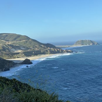
    super windy (our hat flew off!).. and curiously purple patterned sand. This beach is a must see in…read morethe Big Sur exploration. Pfeiffer Beach is one of the most famous and visually striking beaches in Big Sur, known for its dramatic rock formations and unique landscape. Here is a summary of what makes it special: Key Highlights The Purple Sand: The beach is globally famous for patches of violet and deep purple sand. This unusual coloring comes from manganese garnet washed down from the surrounding hillsides after it rains. Keyhole Rock: This massive, iconic rock formation sits just off the shore. It features a natural archway carved out by the ocean. During sunset, the evening light beams directly through the "keyhole," creating a spectacular glow that attracts photographers from all over. Rugged Scenery: Surrounded by towering cliffs and sea stacks, the beach offers a raw, wild, and incredibly photogenic slice of the California coast. What to Know Before You Go The Road Down: The beach is located down Sycamore Canyon Road, which is a narrow, winding, one-lane road with sharp turns. It is not recommended for RVs or large trailers. Hidden Entrance: The turnoff from Highway 1 is unmarked and easy to miss--it is located just south of the Big Sur Ranger Station. Parking & Fees: There is a standard vehicle day-use fee. Because it is highly popular and the parking lot is quite small, it can fill up quickly on weekends and nice days. If the lot is full, staff will turn vehicles away at the highway, so arriving early or late in the afternoon is ideal. Conditions: It is notoriously windy, so packing a jacket is wise. The water features incredibly strong rip currents and hidden rocks, making it great for beachcombing and photography, but unsafe for swimming.

    Photos
    Pfeiffer Beach - Velella velella

    Velella velella

    Pfeiffer Beach
    Pfeiffer Beach

    See all

    Garrapata State Park - Gorgeous mix of rocks, water, cliffs.

    Garrapata State Park

    4.7(137 reviews)
    6.3 mi

    Had been meaning to check out this park for a long time, but usually got pulled away to Point…read moreLobos. A few weekends ago we were down in Carmel for the long weekend with some friends and got a later start to the morning. Anticipating that Point Lobos would be super crowded, I picked out a few hikes at Garrapata State Park, just a few miles south. We parked near the Soberanes Canyon trailhead and hiked the Soberanes Point trail, first going north, then doubling back to take the loop around (and up) Whale Peak. I was worried about leading a group of 20 astray (with kids who had different tolerance levels for hikes), but my fears were immediately put to ease by the gorgeous oceanside views, full of greenery, wildflowers, and the powerful ocean waves hitting the rocks below. We even spotted a sea otter in the surf. Got some nice photos and everyone made it back. At this point our group split up. A few of us went down to Calla Lily Valley. The lilies were beautiful (though I heard they were cut down recently), but there were a ton of people, and the trail was quite muddy. The beach nearby was really nice - the kids spent some time playing there. Parking immediately near the valley is tight but there is parking at this beach and trails to both the beach and the valley from there. Will definitely be back, love that there's an alternative to Point Lobos so close by.

    First time in Carmel with the wife and we decided to walk the area in the noon time . A nice stroll…read morefrom the main downtown area. A nice trail to walk around. And views you can't miss. Definitely a spot worth hitting if you want to make your stay worth it. Even the dog got to enjoy some views and the walk!

    Photos
    Garrapata State Park
    Garrapata State Park
    Garrapata State Park

    See all

    Great Sur Vista Point - parks - Updated July 2026

    Loading...
    Loading...
    Loading...