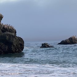
1. Hurricane Point Vista Point

    1. Hurricane Point Vista Point

    0

    Carmel, CA

    Cancel

    Open app

    Search

    Hurricane Point Vista Point

    4.0 (1 review)

    Hurricane Point Vista Point Photos

    You might also consider

    More like Hurricane Point Vista Point

    Recommended Reviews - Hurricane Point Vista Point

    Your trust is our priority, so businesses can't pay to alter or remove their reviews. Learn more about reviews.
    Yelp app icon
    Browse more easily on the app
    Review Feed Illustration

    1 month ago

    Helpful 4
    Thanks 0
    Love this 4
    Oh no 0

    You might also consider
    Verify this business for free

    People searched for Hiking 1,046 times last month within 15 miles of this business.

    Verify this business

    Pfeiffer Big Sur State Park

    Pfeiffer Big Sur State Park

    4.4(407 reviews)
    9.8 mi

    Great campground with the Big Sur river running right through it. Loved the quick hike up to the…read morewaterfall through the redwoods. Lots of great shady sites and some really nice sites right on the river. Showers were nice and reasonably priced. If you are feeling lazy and don't want to cook, you can check out the restaurant/ coffee shop, also a nice little gift shop. There is also a store at the back of the campground that has ice , snacks , firewood and a small laundry facility which was super convenient !! Great woodsy campground with great amenities!!

    BEST SPOT TO SEE RED WOODS. Pfeiffer Big Sur State Park is a sprawling, 1,000-acre sanctuary…read morecentered around the pristine Big Sur River. Often nicknamed "mini Yosemite," it trades direct beach access for dramatic inland scenery, boasting spectacular valleys, forested peaks, and dense groves of ancient coast redwoods. Ancient Redwood Groves: The park is famous for its majestic coast redwoods, with some trees measuring over 1,000 years old. Accessible walkways, like the Redwood Deck, allow visitors to stand among these towering giants. Diverse Hiking Trails: Trails cater to all skill levels, ranging from the flat and easy Nature Trail loop to the challenging, steep ascent up the Buzzards Roost Trail, which rewards hikers with panoramic views of the ocean and mountains. On-Site Lodging and Camping: Unlike many rugged coastal stops, this park features developed accommodations, including a large campground alongside the river and the historic Big Sur Lodge, which provides comfortable cabins and a restaurant. The redwoods you see growing in Pfeiffer Big Sur State Park (as well as nearby Julia Pfeiffer Burns State Park are Coast Redwoods (Sequoia sempervirens), the tallest living species of tree on Earth. The groves found throughout the park are particularly special because they mark the southernmost boundary of where the coast redwood species naturally thrives in significant numbers. Because they are located at the southern edge of their natural geographic range, the climate here is slightly drier and warmer than the dense, misty rainforests of Northern California. While they generally do not reach the record-shattering heights of their northern cousins in Humboldt or Redwood National Park, they are incredibly impressive, with many individual trees in the park towering well over 200 feet tall and thriving for upwards of 800 to 1,000 years. They rely heavily on the marine fog flowing through the Big Sur River gorge to stay hydrated during the dry summer months

    Photos
    Pfeiffer Big Sur State Park - Family Camping September 12-14, 2025

    Family Camping September 12-14, 2025

    Pfeiffer Big Sur State Park - Family Camping September 12-14, 2025

    Family Camping September 12-14, 2025

    Pfeiffer Big Sur State Park - Family Camping September 12-14, 2025  THE JOY LUCK CLUB

    See all

    Family Camping September 12-14, 2025 THE JOY LUCK CLUB

    Point Lobos State Natural Reserve - Point Lobos State Natural Reserve

    Point Lobos State Natural Reserve

    4.9(1.1k reviews)
    13.7 mi

    While visiting the Carmel/Monterey area a month ago we wanted to take in some of the local scenery…read more Point Lobos State Natural Reserve came highly recommended, and it did not disappoint Located just 10 minutes outside of Carmel, this incredibly picturesque seascape is a must see while visiting. There are multiple trails through the Point, and each of them showcase stunning views of the sea and saw well as flora and fauna It was barely raining while we were there and it never dampened our spirits. The trails got a little slick, but nothing too dangerous. In fact, this is more of a seaside walking path than a physical intensive hike We saw many seals and otters on our hike. There was also a rest stop that had park rangers and an interactive exhibit that was very cool. You could feel the skin of a seal, otter, and even the baleen from a whale Some tips: If you haven't explored Carmel or Monterey you are just a short drive away There are many coastal hikes and scenic points/beaches to explore. We also enjoyed a more physical hike at the Pinnacles, but that is an hour or so away Cheers!!

    Adj: beautiful, breathtaking natural reserve…read more Always a nice place to visit and "hike" (really just trail walking). I love coming here. It's so serene, scenic, natural, cool, and both the botanical plantlife as well as the animals (air, land, and ocean wildlife) you can find and view here are just so amazing. Being it's in the Monterey Bay, it's almost always cool when it's hot in the valley, so it's another great place to escape to. It's just a very nice and unique point in the bay and although you can spend the whole day here, or even several days, a couple of hours will also be very rewarding for a change of scenery for those of us who are urban dwellers who want to reconnect with God's natural wonders once in awhile. Overall, Point Lobos is an authentic, breathtaking, and calming place for those who enjoy seeing the ocean and taking in all the native plants, vegetations, and all the air, land, and sea creatures one can encounter or at least observe here.

    Photos
    Point Lobos State Natural Reserve - Point Lobos State Natural Reserve

    Point Lobos State Natural Reserve

    Point Lobos State Natural Reserve - Point Lobos State Natural Reserve

    Point Lobos State Natural Reserve

    Point Lobos State Natural Reserve - Point Lobos State Natural Reserve

    See all

    Point Lobos State Natural Reserve

    Sykes Hot Springs - Hot Spring

    Sykes Hot Springs

    5.0(1 review)
    8.5 mi

    At the end of Summer, my friend suggested a backpacking trip to Skyes Hot Springs - 20 miles out…read moreand back with 5380 ft elevation gain. (more challenging than Bright Angel Trail to bottom of Grand Canyon) Arrived at Big Sur Station at 9am. Paid $20 overnight parking fees, used toilet, snapped group photo then began hiking at 9:30. Half hour lunch break at 11:45 Terrace Creek Camp, and finally arrived to Skyes Camp by 3pm. In route to camp, we crossed 7 creeks each way. I was a bit anxious of slipping cuz I had less confidence than I used to. I think it would have been easier and more fun if I had power thr them with momentum. No mosquitoes sightings in mid Nov. Lots of poison oaks along the trail but not overgrown; I wore shorts with no problem, just clouds of dust from our own stompings. Our friend impaled a bunch of splinters from a burr plant. I visited many of our camp neighbors in search of a tweezer; fortunately, the last of the spikes expelled itself in the hot spring waters. Hiking downriver in search of the hot springs was not easy. When located at 5pm, the large tub was occupied, we tested all of the other 3 smaller tubs then settled in at the one on the river level, it was a tight squeeze for 4 people but we sardined to fit. Our inlet source was a water fall from the tub above which some of us used as a shower over our heads. It was a relaxing time with beautiful surroundings and good company. The water was lukewarm with lots of earthy debris, so it does not compare to the numerous fancy Onsens I have visited in Japan. But things are more valuable when it is earned by hard work - the miles, inclines, sun, sweat, dust, creek crossings, obstacles, and heavy pack; great feelings of accomplishment, and endorphins too. It was wise of us to leave the springs at 6pm since sunsets at 6:30. Due to the heavy forest, we were not able to sight the supermoon nor the comet in the night sky. Sleeping with the ripple sounds of the Big Sur River close by was soothing. Our return trip started at 9:30 and ended at the parking lot by 1pm, 4.5 hours was very fast pace. We were eager to celebrate our trip with a lunch in a sit down restaurant, Big Sur Roadhouse. Another great adventure with friends. Treasure memories.

    Photos
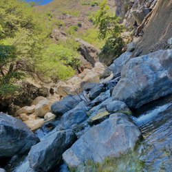
    Sykes Hot Springs - Creek crossing

    Creek crossing

    Sykes Hot Springs - Camp

    Camp

    Sykes Hot Springs - Big Sur River

    See all

    Big Sur River

    McWay Falls - Tunnel that takes you underneath the highway to McWay Falls

    McWay Falls

    4.6(192 reviews)
    18.8 mi

    McWay Falls is one of the most iconic and photographed landmarks along the Big Sur coast, famous…read morefor its ethereal, postcard-perfect scenery. Located within Julia Pfeiffer Burns State Park, it is one of the few waterfalls in California that empties directly into the ocean. Unique Tide Falls: The stunning 80-foot waterfall flows year-round from McWay Creek, dropping over a jagged granite cliff directly onto the pristine sands of a picturesque, turquoise cove, or into the waves at high tide. Effortless Viewpoint Trail: The falls are reached via an exceptionally short and accessible 0.5-mile round-trip trail, making it a quick and highly rewarding stop right off Highway 1. This trail was unfortunately closed during my visit, but we could still see the falls

    Located within the Julia Pfeffer Burns State Park, the McWays Falls (named after an early settler…read moreof Big Sur) Vista Point was the fourteenth (09:53) and furthest south stop of our southbound scenic car tour through Big Sur. The trail down to get a close up view of the falls continues to be closed (there is no estimated reopen date). However there is a vista point off the highway that you can walk to (need to hop over a railing) from a safer parking spot, that provides a clear aerial view of the waterfall (one of the few in the world that dumps directly into the ocean...learned that those are called a tidefalls [another one in California is Alamere Falls near SF]).

    Photos
    McWay Falls - Parking is $10 at the trailhead across the highway

    Parking is $10 at the trailhead across the highway

    McWay Falls
    McWay Falls

    See all

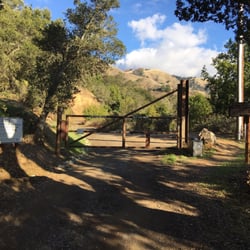
    Coast Ridge Road Hike - Don't be intimidated by the gate, pedestrians can walk around, it's a govt fire road.

    Coast Ridge Road Hike

    5.0(3 reviews)
    12.1 mi

    Stayed at the Alila Ventana Big Sur and this hike was one of the activities. We started off from…read morethe property onto a dirt road like path up the hills passing a few homes along the way. The first part of the hike is nice and shady with redwoods surrounding you. Eventually, you go beyond the redwoods where it's a little hotter but you get a beautiful view of the coast. This hike is relatively easy with a slight incline. Definitely recommend. Will need to go back next time to do the full hike.

    I'm a happily sedentary person, but Big Sur is so uniquely, astonishingly beautiful, I think it…read morewould've offended even my conscience to spend three days there without at least one good hike. We asked someone at our hotel to recommend an easy hike and he suggested Coast Ridge Road. It was a great recommendation, one I'll pass onto anyone else in pitiable physical condition who would nonetheless like to get outside, walk uphill, and drink in some views. I did make the mistake of underestimating either the hike's difficulty or my own decrepitude. It would've been fine if I'd just taken a bottle of water, but I didn't want to carry it and quickly regretted my decision. We walked from the Post Ranch Inn to the Ventana, where the hike begins, and I was already kind of tired by the time we reached the bottom of the trail. Going up a noticeable incline for several more minutes was just kind of a challenge, and I complained heartily and made a few stops before I got accustomed to the elevated activity level. Once I did, though, I really enjoyed the hike. The trail was, objectively, not hard, and it was lush and pretty the whole way through. We walked past tons of trees, which also afforded us cover from the son, and even a lovely waterfall. I don't know how far the trail went, but people were going up there with overnight camping gear. We stopped walking shortly after we lost tree cover and that felt like a good end point. We got to stand on the mountain and admire the endless sky and Big Sur laid out below us, the drama of all that coast and sparkling water. This was a lot of exercise for a lazy person, but it was definitely worthwhile. It was a great way to soak up the beauty of Big Sur.

    Photos
    Coast Ridge Road Hike - The trail head

    The trail head

    Coast Ridge Road Hike
    Coast Ridge Road Hike

    See all

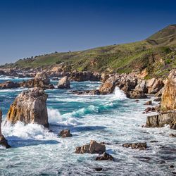
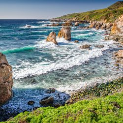
    Garrapata State Park - Gorgeous mix of rocks, water, cliffs.

    Garrapata State Park

    4.7(137 reviews)
    5.8 mi

    Had been meaning to check out this park for a long time, but usually got pulled away to Point…read moreLobos. A few weekends ago we were down in Carmel for the long weekend with some friends and got a later start to the morning. Anticipating that Point Lobos would be super crowded, I picked out a few hikes at Garrapata State Park, just a few miles south. We parked near the Soberanes Canyon trailhead and hiked the Soberanes Point trail, first going north, then doubling back to take the loop around (and up) Whale Peak. I was worried about leading a group of 20 astray (with kids who had different tolerance levels for hikes), but my fears were immediately put to ease by the gorgeous oceanside views, full of greenery, wildflowers, and the powerful ocean waves hitting the rocks below. We even spotted a sea otter in the surf. Got some nice photos and everyone made it back. At this point our group split up. A few of us went down to Calla Lily Valley. The lilies were beautiful (though I heard they were cut down recently), but there were a ton of people, and the trail was quite muddy. The beach nearby was really nice - the kids spent some time playing there. Parking immediately near the valley is tight but there is parking at this beach and trails to both the beach and the valley from there. Will definitely be back, love that there's an alternative to Point Lobos so close by.

    First time in Carmel with the wife and we decided to walk the area in the noon time . A nice stroll…read morefrom the main downtown area. A nice trail to walk around. And views you can't miss. Definitely a spot worth hitting if you want to make your stay worth it. Even the dog got to enjoy some views and the walk!

    Photos
    Garrapata State Park
    Garrapata State Park
    Garrapata State Park

    See all

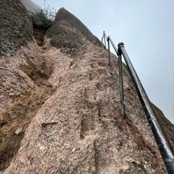
    High Peaks Trail - Going up the railing

    High Peaks Trail

    4.8(6 reviews)
    43.1 mi

    Absolutely amazing trail that I've done twice in 100° weather. The views are great, and the trail…read moreis well groomed. But, oh my god, it is straight uphill. With extreme heat I literally thought I was going to die. Do it in the winter.

    one of the many, many wonderful trails at pinnacles nat'l park. from the apex, you can see almost…read morethe entire park on a clear day, the beautiful balconies, ridges, forestry and wildlife that belongs to pinnacles. you can access this trail from: +west side: chaparral trailhead parking lot, 1.8mi hike to western trailhead of high peaks +east side: old pinnacles trailhead, 1.3mi hike to eastern trailhead of high peaks +east/south side: bear gulch parking lot, 0.5mi to southern trailhead of high peaks we chose to start from the east side, hike the old pinnacles trail to balconies, break at the chaparral trailhead for lunch, then return east via the high peaks trail. this was a TOUGH climb up, especially since it was only a little after noon, the sun was strong, and we'd already hiked 4+ miles from the east. many breaks were taken, call it "photo pace" hiking, and after some time, we finally reached the western side of the high peaks trail...more climbing awaited us, as did awesome views of this treasured park. there were many switchbacks, each turn offering a different view, so of course, i had to pause each time to snap a pic! there are no restrooms, water fountains, or other amenities here. due to the time of day we were here, there also wasn't much shade. definitely bring plenty of water, wear a hat, sunscreen, and light clothing if coming here during summer/autumn months.

    Photos
    High Peaks Trail - Top of High Peaks

    Top of High Peaks

    High Peaks Trail - Instagram: @telephonesmoothie

    Instagram: @telephonesmoothie

    High Peaks Trail - Instagram: @telephonesmoothie

    See all

    Instagram: @telephonesmoothie

    Limekiln State Park

    Limekiln State Park

    4.4(143 reviews)
    32.2 mi

    I fell I love with this beach many years ago. The drive here is INCREDIBLE! I literally have dreams…read moreabout driving under the bridge! You go under to get to this secluded beach off of Hwy 1. I had no idea that you could choose between 3 different campsites until I decided I HAD to be under the moonlight at the beach on 2.22.22 at 2:22 pm. And the views are BREATH TAKING from the beach campsite. They were also freezing, windy, and WET in February! And all of the trails were closed when we visited due to the fire, but it was like a little slice of Heaven to disconnect and spend 2 nights off the grid with great folks. The rangers who serve this place are BEYOND friendly, and they do an awesome job of keeping the bathrooms clean. I believe they were cleaned 3 times a day. And the campsites were so self contained, you really had no idea there were up to 29 sites there. Camping on the beach meant you heard the crash of waves all night long. It was so very peaceful! And while the view looked almost warm, there was NOTHING warm about being there in February. But if you had a camper, and the right gear, the rain and wind would be worth it just to burn that image eternally into your mind! I hope I can snag this location during the warmer months. I'm just in love with everything about LimeKiln.
    This review is for the Limekiln campground. We camped at…read moresite #17. The Redwood campground (sites #17-#29) is basically a big dirt parking lot divided into tiny "campsites." There's a creek running behind the big dirt parking lot and lots of big trees on the perimeter of the big dirt parking lot. But there's no trees or plants in the tiny "campsites." So forget hanging a hammock or having any sense of privacy. We could barely fit a 6-person tent in site #17. The creek was pretty. The bathrooms were decent and have flush toilets. Our campsite was, at most, a 2-minute walk to the ocean, which was pretty cool.

    Photos
    Limekiln State Park
    Limekiln State Park
    Limekiln State Park - Flocks of birds and otters hang out just offshore

    See all

    Flocks of birds and otters hang out just offshore

    Hurricane Point Vista Point - hiking - Updated July 2026

    Loading...
    Loading...
    Loading...