Cancel

Open app

Search

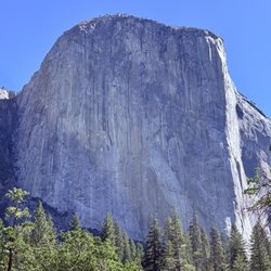
Half Dome View

5.0 (3 reviews)

Half Dome View Photos

Recommended Reviews - Half Dome View

Your trust is our priority, so businesses can't pay to alter or remove their reviews. Learn more about reviews.
Yelp app icon
Browse more easily on the app
Review Feed Illustration

1 year ago

Helpful 0
Thanks 0
Love this 0
Oh no 0
Photo of Daw M.
286
989
7097

4 years ago

Helpful 4
Thanks 0
Love this 4
Oh no 0

6 years ago

Helpful 13
Thanks 0
Love this 13
Oh no 0

Verify this business for free

People searched for Parks 114 times last month within 15 miles of this business.

Verify this business

Hite Cove Trail - 4.15.18

Hite Cove Trail

4.8(5 reviews)
10.7 km

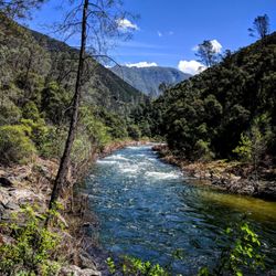
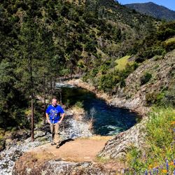
Beautiful trail just outside of Yosemite off of Highway 140 in El Portal. My husband and I hiked…read moreabout 2.5 miles of the trail mid June. The whole trail is 4.5 miles one way- about 9 miles round trip if you want to go all the way to Hite Cove. We wanted to go all the way to the end, however temperatures in the canyon rise fast during the summer and it was easily 100 degrees by noon. The trail follows up above the Merced River. There were a few times when you can get right down to the river. About 1.5-2 miles in, there is a section with rocks that looks like it is made for jumping in the river. The trail is entirely single track with some areas with steep drop offs. Make sure to pack plenty of water, sunscreen, and bug spray. There is very little shade and the trail is almost completely exposed. To find the trail, just look for the Red Bud Lodge and park right across the street. There is a sign that points just to the trailhead next to the lodge. I would recommend to come as early as possible if you are coming in the summertime.

Considering that everything else in El Portal is some pee stained remnant from the Sears catalog,…read morewe didn't have high hopes for the 'trail' that came recommended. It's not that encouraging as you drive up either. Seems very average and nondescript. As it was our first night in the greater Yosemite area, we definitely wanted to get out and so we went for it. In retrospect, I would say it was one of the nicer hikes we went on. You walk high above the Merced River on a narrow trail amongst wild flowers and with a beautiful view of the mountains. The power of the river and the beauty of the land impressed all of us. It and easy/intermediate hike. One drawback is that it's not a loop. So you can go as long as you want (to the end even) and come back. We went and hour and turned around. Recommend.

Photos
Hite Cove Trail - 4.15.18

4.15.18

Hite Cove Trail - 4.15.18

4.15.18

Hite Cove Trail - 4.15.18

See all

4.15.18

Panorama Trail

Panorama Trail

4.7(19 reviews)
5.6 km

BEWARE TOURISTS. THIS HIKE IS NOT FOR YOU…read more I'm in my thirties and not an avid hiker. I'm not going to sugar coat this review because of the views. I'm going to be brutally honest about this trail, which changes from nicely paved dirt path to treacherous piles of jagged rocks (sometimes slippery if you're at Mist trail) that you need to figure out how to get down or up (depending on what direction you are taking) without falling and hurting yourself badly. Also, keep in mind there are other people sharing this path with you in the opposite direction so you not only need to navigate through the treachery of the rocks but also the people sharing them with you. I had planned to do the four mile trail (from Glacier point) because it was shorter but the Glacier point gift shop employee Jeremy said he had done this hike in 2 hours with his 40 year old mom and all he took was one water bottle with no problem. LIES!! The other gift shop employee Olivia said panorama trail was longer but definitely easier than four mile because it was less steep and all downhill. MORE LIES!!! Its because of what they both said that changed my mind to switch from four mile to panoramic trail. This trail is labeled as strenuous but should have "treacherous" added to it. There are parts of the trail where there are no signs and you lose your way because there is no clear path on where to go. At Vernal Falls, after you cross the bridge, you have to walk up a huge slab of rock to figure out which direction to go to continue on (you go right). It was late in the afternoon for us so there wasn't anyone around for us to follow. The bad signage, or lack thereof, was frustrating. If you see squiggly marks on the map (that you can get at the visitor centers) it means you have to walk down jagged/slippery rocks. 99% do not have rails. You could fall hard on your way to Neveda Falls or fall straight down slippery rocks at Mist trail (your shoes will get wet--mine were completely soaked). Some of the trail were paved dirt roads (which was what I was expecting, including the switchbacks) but many parts of this trail were just rocks stacked on top of rocks done by Yosemite staff to create a challenging hiking experience. You are climbing down these rocks for miles non stop. Your knees will hate you. There are no bathrooms. The first bathroom is at Nevada Falls. The first place where you will see a water fountain to refill your water is after Vernal Falls on the Mist trail and before you reach the Happy Isles Nature Center. After you reach the Happy Isles Nature center, you still have to walk a bit to the #16 shuttle stop. Our driver was ending her shift so she was making select stops. Thankfully she stopped at stop #8 to the Yosemite Valley Lodge where we had left our car. We got to our car by 8pm and took off for our hotel by 830pm. We were exhausted and now had to drive home down a winding trail to exit the park in the dark. It was a tough drive back to our hotel and we didn't expect to have a day like this. This trail is not all downhill from Glacier point. You have a good 2 miles of steep uphill hiking. There was not a lot of shade in the day hours during summer. I carried with me 3 waters, 1 gatorade, 1 snapple (bought at gift shop located at Glacier Point) and it was not enough to last me the 9 hours it took for us to complete this trail. I recommend bringing more if you plan to do this complete 9 mile route. Also, I recommend bringing a walking stick (or buying one at the gift shop for $22.99) and a bucket hat for $32.00). These are definitely worth the investment or added weight to your gear because in the 90 degree heat and the treacherous areas of the trail you will be so thankful to have had them. All in all, the waterfalls started to look the same to me. Illilouette Fall and Nevada falls looked very similar. If you want to get misty, do lower yosemite falls and walk towards the bottom of the falls (off trail) instead of Vernal Falls. Or take shuttle #16 and walk to Vernal Falls instead of seeing it from panoramic trail. In my opinion this trail was not worth the energy, sweat and tears. I was more impressed by Igazu falls and Niagara Falls when I visited them. I thought this trail would be like others I've taken when visiting other National parks or International parks. I thought it would be a cleared dirt path. I was WRONG. If you want to get great pictures of everything from Panoramic trail, I recommend breaking up your trip in two. First trip: park at Glacier point, walk to Illilouette Fall, then turn back. Second trip: take shuttle to #16 stop, walk Mist trail to see Vernal Fall and Nevada Fall. In my opinion, this is a much less strenuous and treacherous itinerary and you can see everything you would have seen on the Panoramic trail without the pain and stress.

1. This hike has been called by many as the most beautiful hike in Yosemite. Ok, if not many…read morepeople, at least me, who has done almost all the hikes in this park, except Half Dome. 2. We drove in just as Glacier Point was opening for the season in May 2015 . This year being El Nino with huge snowdrifts, Glacier Point road will be closed until June 2016. 3. We did both the Taft Point and Sentinel Dome hikes, using the single pit toilet bathroom at the trailhead, just in time ahead of a bus load of hikers. 4. Drove to nearby Glacier Point, overrun with tourists, checking out the views of the Yosemite Valley 3000 feet below, taking in awesome sights of El Capitan, 2425' Upper and Lower Yosemite Falls, tallest waterfall in North America, before heading onto the Panorama Trail. 5. Hardly a person on the Panorama Trail at 7,200 feet elevation, with an in your face view of Half Dome. This massive granite mountain is an awesome sight, dominating the landscape. 6. The trail becomes a series of downhill switchbacks, through vast forests of trees. In the distance we can see Vernal and Nevada Falls coming closer, roaring full blast in the late Spring, but disappearing by late Fall. 7. We walk along the edge of a cliff, fronting the Yosemite Valley, somewhat similar to walking along the south rim of the Grand Canyon. Great photographer's spots everywhere, of Half dome, and the two waterfalls, framed between the trees, as we go downhill. 8. Walk down the path two miles to the Illilouette Fall, and then on the John Muir trail to Nevada Falls, and then to Vernal Falls, and down the 700+ granite stairs of the Mist trail. We go past the Vernal Falls footbridge, onto the lower mist trail, all alongside the raging Merced river, swollen by the melted snow of winter. 9. People wade in the water in the summer, when the falls are a trickle, only to slip on the wet rocks, and fall into the river and become one of 200+ people each year who need to be rescued, and taken out on a stretcher on an equipment cart on the paved Lower Mist Trail 10. The entire trail is 8.5 miles one way, starting at 7,200 feet and ending at 4,020 feet elevation, taking about 8 hours, open from June to October. 11. We walk only two hours, one hour from Glacier Point, and one hour back, taking in the best views of the Panorama trail -the time limit for the wife before making another pit stop! 12. We come back in time to enjoy a awesome view of the sun glimmering on Half Dome, and then the sunset on the Dome, before a harrowing drive in the darkness along the winding Glacier Point mountain road at night, with speeding tailgaters close on my tail.
Photos
Panorama Trail
Panorama Trail - Half Dome from the Panorama Trail

Half Dome from the Panorama Trail

Panorama Trail - Panorama Point

See all

Panorama Point

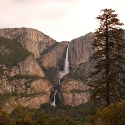
Four Mile Trail - View of Yosemite Falls from 4 Mile Trail

Four Mile Trail

4.4(56 reviews)
5.7 km

The Four Mile Trail is reviewed as having the best views for a hike from the valley and I agree. It…read morehas the best ROI for views as there are constant changing views of Yosemite Valley and Yosemite Falls. The hike can be difficult at times as much of it is exposed to the sun, so I recommend going as early as possible. We also encountered rattlesnakes going up and coming back down, so it might be good to be cautious during the rocky middle section. Glacier Point at the end of the trail is absolutely beautiful. It has views of all of the major peaks around. There's also a store with cold drinks and snacks to fuel your way back down.

Because Glacier Point Road was closed for construction (all of 2022 unfortunately), there were only…read more3 ways to reach Glacier Point. All 3 are very strenuous and at least 9 miles round trip, but the 4-mile trail is the least intensive. However this is not stroll in the park. My mother and I (between beginner and intermediate in physical ability and hiking experience) hiked from 7am - 2pm round trip. It took us 3.5 hrs to reach Glacier point from the valley (4.6 miles), we spent about an hour at the top, then took another 2.5 hrs to hike down. We stopped often for pictures and short breaks. The views get better along the way, but it probably wasn't until 2 miles into the hike that they became more spectacular and we started taking photos. The trail itself is easy to follow, dry, and easy to descend. It has roughly 3 sets of switchbacks, the 1st which gets you roughly 2 miles in (start of nice views), the 2nd which takes you to Union point (3 miles in, has a descent panoramic view of valley), and the last set which brings you close to glacier point. There aren't really any easier parts of the trail, it's a constant ascent (3200 feet total). It is a tougher trail, but if you start early enough in the day, bring lots of water and snacks, and take breaks when needed, it is do-able. The views at the top make it all worth it!

Photos
Four Mile Trail - Boooo!

Boooo!

Four Mile Trail - About half way up--views of Yosemite Falls.

About half way up--views of Yosemite Falls.

Four Mile Trail

See all

Cascade Falls - Hail on my jacket. It snowed, hailed and rained. Such an awesome time of the year.

Cascade Falls

5.0(3 reviews)
2.6 km

This is a hike I would recommend to friends and you. I was there on a gloomy day when all of the…read morefalls in Yosemite were going like gang busters. This was due to a Snow Melt in May 2019 from a 160 Percent to Average Snow Fall. Take your time and you may notice some special sights like the Moss covered Heart Shaped Rock which is about Four Feet across. The Popcorn look alike I believe is Tree Resin. It did look good enough to eat. Notice the Rock Overhang and be sure you do not hit your head! Be sure to check the trail instructions from Forevermemorable F.. Without them and the pictures he posted I would not have found the trail. I would recommend you use Hiking Poles to help you descend the trail. If you would like to see the upper part of this falls take a ride on "Big Old Flat Road", Location 37.727751,-119.713163. Here you will find a small Parking Lot across the road from the upper falls. Walk on the bridge and check for the cascades. One nice aspect of this spot is that even when the park is packed the are no crowds here. I think it is more interesting to view than Bridal Veil Falls and you can get very close to it. Please check my pictures to see what I mean.

The hike to the waterfall is less than 15 minutes but the trail is hidden. 99% of visitors stop off…read moreand stay in/around the parking lot. I went in the Spring when the waterfall was moving and grooving. Much too fast and powerful to get much closer. Check out the pics of my April visit. This place would be great to visit in the Summer and just chill in the pool just under the waterfall. If you need trailhead info PM me.

Photos
Cascade Falls - Just starting my hike in the early am!

Just starting my hike in the early am!

Cascade Falls - The cascades!

The cascades!

Cascade Falls - From the top of the cascades

See all

From the top of the cascades

Half Dome View - parks - Updated July 2026

Loading...
Loading...
Loading...