Harrisburg Covered Bridge Photos


More like Harrisburg Covered Bridge
Recommended Reviews - Harrisburg Covered Bridge
Start your review...


Visiting and driving through a covered bridge has been on my bucket list and the Knoxville area was just the place to check it off. Take a scenic afternoon drive through Sevierville and see one of the many covered bridges in Tennessee. Nothing fancy but oh so quaint. Be respectful of the neighbors and pull off on to a small spot for a quick picture. You wont regret the drive. read more


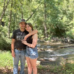
I love chasing covered bridges and this one in Tennessee didn't disappoint! This king post truss bridge spans over Little Pigeon River and still is used for through traffic. It's nestled off a quiet road so your gps will lead you there. While visiting TN and the Great Smoky Mountains, we wanted to explore a few covered bridges as well! This rustic one has undergone several renovations and restorations and it's on the National Register of Historic Places, I'm glad this gem of a bridge was saved!! It's in a little neighborhood which is pretty cool! The lattice work is beautiful and the stone foundation is impressive! Built in 1875, this bridge is 83 feet long and it was a thrill to drive through it! Now only about 20 vehicles pass through it daily, but it stands as a proud reminder of days gone by and a historic testament of architectural design and a wonderful legacy to those who love to keep the past alive! read more


This is actually an old bridge, not a "modern built" which I think is awesome. The Harrisburg Covered Bridge was built by Elbert Stephenson in 1875. It got a full restoration in 1972 and another in 2005. It was originally a replacement for the McNutts Bridge that was here prior but washed away during a flood. The latest restoration appears to have flood-proofed it with some strengthened piers. The bridge is open to traffic but the single lane has only a 9'6" clearance so I did not try it with the Sprinter van that runs close to 10'. There is a small turnaround on the west side of the bridge that I was able to park in while I walked the bridge. The main span is 64 feet and while there is not a pedestrian lane or any electrical lighting, there is a raised spar on each side where you could stand while traffic passes. The bridge is a King Post Truss design and crosses the East Fork of the Little Pigeon River. As the bridge is only 10 minutes from downtown Sevierville, I'm surprised that it does not have more reviews! [Review 1173 of 2024 - 489 in Tennessee - 22196 overall] read more


1 year ago
It's a neat little attraction. Built in 1875 (with two updates/refreshes) and still going strong! It is a working bridge, one lane, so be careful if you're going to walk across. read more


7 years ago
Free to see! Very pretty area! The bridge was redone & it was loud & cool to drive over . One lane be careful! read more


More info about Harrisburg Covered Bridge


Harrisburg Covered Bridge - landmarks - Updated July 2026
Best of Sevierville
People found Harrisburg Covered Bridge by searching for…
Scenic Drive in Sevierville, TN
Places to Take Pictures in Sevierville, TN
Things to Do in Sevierville, TN
Scenic View in Sevierville, TN
Scenic Overlook in Sevierville, TN
Fun Things to Do at Night in Sevierville, TN
Photo Spots in Sevierville, TN
Tourist Attractions in Sevierville, TN
Attractions in Sevierville, TN
Historical Sites in Sevierville, TN
Places to Walk at Night in Sevierville, TN
View Points in Sevierville, TN
Sightseeing in Sevierville, TN
Public Services & Government in Sevierville, TN
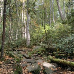
Places to Walk in Sevierville, TN
Trending Searches in Sevierville, TN
Boating near Harrisburg Covered Bridge
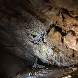
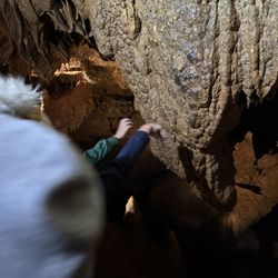
Caves near Harrisburg Covered Bridge
Cliff Jumping near Harrisburg Covered Bridge
Day Trips near Harrisburg Covered Bridge
Dog Swimming near Harrisburg Covered Bridge
Free Things To Do near Harrisburg Covered Bridge
Gold Panning near Harrisburg Covered Bridge
Hidden Gems near Harrisburg Covered Bridge
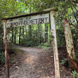
Historical Sites near Harrisburg Covered Bridge
Jet Skis near Harrisburg Covered Bridge
Kayak Rental near Harrisburg Covered Bridge
Kids Activities Indoor near Harrisburg Covered Bridge
Lakes near Harrisburg Covered Bridge
Landmarks & Historical Buildings near Harrisburg Covered Bridge
Lookout Points near Harrisburg Covered Bridge
Peach Picking near Harrisburg Covered Bridge
Places To Visit near Harrisburg Covered Bridge
Public Art near Harrisburg Covered Bridge
River Swimming near Harrisburg Covered Bridge
Scenic Restaurants near Harrisburg Covered Bridge
Secluded Spots near Harrisburg Covered Bridge
Sightseeing near Harrisburg Covered Bridge
Small Venues & Event Spaces near Harrisburg Covered Bridge
Surf Shop near Harrisburg Covered Bridge
Swimming Holes near Harrisburg Covered Bridge
Things To Do On A Rainy Day near Harrisburg Covered Bridge
U Pick Farms near Harrisburg Covered Bridge
Browse Articles
Browse Nearby
BEST of Sevierville, Tennessee Restaurants near Harrisburg Covered Bridge
BEST of Sevierville, Tennessee Coffee near Harrisburg Covered Bridge
BEST of Sevierville, Tennessee Breakfast near Harrisburg Covered Bridge
BEST of Sevierville, Tennessee Things to Do near Harrisburg Covered Bridge
BEST of Sevierville, Tennessee Shopping near Harrisburg Covered Bridge
BEST of Sevierville, Tennessee Mini Golf near Harrisburg Covered Bridge
BEST of Sevierville, Tennessee Hotels near Harrisburg Covered Bridge
Browse Brands
Related Searches in Sevierville, TN
Best Fun Things to Do in Sevierville, Tennessee
Best Lookout Points to Visit in Sevierville, Tennessee
Best Waterfalls and Swimming Holes in Sevierville, Tennessee
Book Engaging Historical Tours in Sevierville, Tennessee
Book a Mansion Tour in Sevierville, Tennessee
Discover Charming Historic Homes in Sevierville, Tennessee
Discover Famous Monuments in Sevierville, Tennessee
Discover Historic Sites and Places in Sevierville, Tennessee
Discover Popular Landmarks in Sevierville, Tennessee
Discover Popular Photo Spots in Sevierville, Tennessee
Discover Stunning Skyline View Spots in Sevierville, Tennessee
Discover the Best Caves to Explore in Sevierville, Tennessee
Discover the Best Military Museum in Sevierville, Tennessee
Enjoy the Best Family Activities in Sevierville, Tennessee
Enjoy the Best Walking Trails in Sevierville, Tennessee
Explore Beautiful Botanical Gardens in Sevierville, Tennessee
Explore Beautiful Castles and Landmarks in Sevierville, Tennessee
Explore Beautiful Parks and Green Spaces in Sevierville, Tennessee
Explore Children's Museums Near Sevierville, Tennessee
Explore Free Things to Do Around Sevierville, Tennessee
Explore Fun Activities to Do in Sevierville, Tennessee
Explore Fun Field Trips in Sevierville, Tennessee
Explore Popular Scenic Overlook Points in Sevierville, Tennessee
Explore Popular Scenic Views Near Sevierville, Tennessee
Explore Secret Spots Worth Visiting in Sevierville, Tennessee
Explore Venues & Event Spaces in Sevierville, Tennessee
Explore the Crime Museum Exhibits in Sevierville, Tennessee
Explore the Top Car Museum in Sevierville, Tennessee
Explore the Wax Museum Attractions in Sevierville, Tennessee
Find Beautiful Views in Sevierville, Tennessee
Find Top Art Museums in Sevierville, Tennessee
Find the Best Bridge Spots in Sevierville, Tennessee
Find the Best Playgrounds to Visit in Sevierville, Tennessee
Great Things to See and Do in Sevierville, Tennessee
Must-See Tourist Attractions Around Sevierville, Tennessee
Plan a Scenic Drive Route Near Sevierville, Tennessee
Popular Places to Take Pictures in Sevierville, Tennessee
Popular Things to Do in Sevierville, Tennessee
Popular Things to See in Sevierville, Tennessee
Top Hiking Trails to Explore in Sevierville, Tennessee
Top Places to Visit in Sevierville, Tennessee for Sightseeing
Top-Rated Plantation Tours Near Sevierville, Tennessee
Tour Famous Lighthouses Located in Sevierville, Tennessee
Tour Popular Historical Sites in Sevierville, Tennessee
Visit Beautiful Gardens in Sevierville, Tennessee
Visit Popular Museums in Sevierville, Tennessee Now
Visit a Free Museum Near You in Sevierville, Tennessee
Visit the Train Museum in Sevierville, Tennessee
Walk the Best Paved Walking Trails in Sevierville, Tennessee


