Cancel

    Open app

    Search

    Heron Bay Nature Trail

    3.8 (4 reviews)

    Heron Bay Nature Trail Photos

    You might also consider

    More like Heron Bay Nature Trail

    Recommended Reviews - Heron Bay Nature Trail

    Your trust is our priority, so businesses can't pay to alter or remove their reviews. Learn more about reviews.
    Yelp app icon
    Browse more easily on the app
    Review Feed Illustration

    2 years ago

    Helpful 15
    Thanks 4
    Love this 11
    Oh no 0
    Photo of Rudy M.
    2
    322
    445

    2 years ago

    Helpful 0
    Thanks 0
    Love this 0
    Oh no 0

    7 years ago

    Helpful 9
    Thanks 1
    Love this 9
    Oh no 0

    7 years ago

    Helpful 3
    Thanks 0
    Love this 0
    Oh no 1

    You might also consider
    Verify this business for free

    People searched for Hiking 11,170 times last month within 15 miles of this business.

    Verify this business

    Siesta Valley Recreation Area - This shows how to find parking lot, and how to take the short narrow trail south to get to trailhead of main trail. - - - Tom Brody

    Siesta Valley Recreation Area

    4.0(2 reviews)
    3.4 km

    I'm not someone who suffers from a syndrome I like to call "hiking hubris", I.e., I don't…read moremindlessly skip along on loose gravel presuming I have the scaling dexterity of a Nepalese sherpa. The De La Veaga Trail is rated as "Moderate", and they're not kidding. It connects Scotts Peak off Grizzly Peak Blvd in Tilden Park with central Orinda near the BART station. I didn't think these two points connected until I saw there was a whole area called Siesta Valley. While it's rustically scenic with Mt. Diablo views, there is little else except steep hillsides and the two trails that traverse it of which the De La Veaga is the longer one. It started on a narrow but relatively flat trail that runs along Grizzly Peak judging from the sound of traffic from above. Once I turned into the valley itself, the gravel felt a lot looser, and there were long stretches of mud even though it had not rained in over three weeks. The trail climbed pretty abruptly into the ridge line overlooking Hwy 24 in the distance. There was a cattle gate that signaled the trail was going to descend. It did and right onto a fire road where the pastoral setting was interrupted by the presence of high voltage power towers. Surprisingly it was on the way down winding into Orinda where I faced most of the challenge as there wasn't much traction provided by the loose gravel on the road. I slipped several times coming down the hill to the point where I had to pause and acknowledge my age. Perhaps walking sticks are a good idea at least for a "Moderate" trail although I have to say some that are labeled in that category were not as challenging as this one. Walking back to my starting point was much more manageable because I knew the watch-out points. This is probably not a trail that I'll walk frequently. RELATED - Up for a hike? Here's a collection of trails that I've walked and reviewed: https://bit.ly/2OrC8nU

    SIESTA VALLEY RECREATION AREA is managed by East Bay Municipal Utility District (EBMUD), which has…read morea business address of 375 11th Street in Oakland, CA. Siesta Valley Recreation Area takes the form of huge series of rolling hills, mostly taking the form of grassy meadows, with scenic groves of eucalyptus trees located here and there. The attached Google map photo shows how the trail weaves through groves of trees (see, PHOTO). There is one main trail, which can best be accessed by parking at the parking lot for the Little Train. The second of the two attached Google map photos shows where to find the Little Train parking lot, and the nearby trail that leads you to the main trail in Siesta Valley (see, other PHOTO). The Little Train is well-known by most people in the East Bay, particularly by folks living in Oakland or in Berkeley. Once you have parked near the Little Train, Siesta Valley Recreation Area is best accessed by hiking south on BAY AREA RIDGE TRAIL. After about 20 minutes, you will arrive at the SCOTT'S PEAK TRAILHEAD. The trail is easy to find and easy to follow, because it takes the form of a well-groomed dirt road. The good quality and distinct nature of this dirt road trail is similar to that of EAST RIDGE TRAIL, which is located in REDWOOD REGIONAL PARK, located a couple of miles south of Siesta Valley Recreation Area. MAIN FEATURES. The trail takes about 90 minutes to hike from the western trailhead (Scott's Peak Trailhead) to the eastern trailhead (located on Camino Pablo Avenue in Orinda, CA, just north of the Orinda BART station). What is attractive about this hike are: (1) A great opportunity for aerobic exercise; (2) Grand vistas of distant Mount Diablo and, on occasion, the attractive sight of thick blankets of low-hanging cloud-cover that block the view of towns between Orinda and Mount Diablo; (3) Beautiful sculptural qualities of the rolling hills that you will see during your hike along the entire trail; (4) The opportunity to see occasional deer; (5) Wildflowers and plants such as, Fuller's teasel. The scenery and wild plants found during your hike at Siesta Valley Recreation Area are similar to that encountered on hikes in the western half of LAS TRAMPAS in Castro Valley. What is similar between this part of LAS TRAMPAS and Siesta Valley Recreation Area are the rolling hills that are mostly bare of trees, the lack of crowds of other hikers, and the need to carry an EBMUD hiking pass.

    Photos
    Siesta Valley Recreation Area - Scotts Peak Trailhead

    Scotts Peak Trailhead

    Siesta Valley Recreation Area
    Siesta Valley Recreation Area

    See all

    Bass Cove Trail

    Bass Cove Trail

    5.0(3 reviews)
    4.1 km

    A great trail on the west side of Lake Chabot!!!…read more I'm lucky I live a quick drive away from here. This is one of my go to trails when I want to get a quick mid week hike in and I don't have a lot of time. I access this trail through Chabot Park, this trail is to the left. It's all dirt, small rolling hills until you get to the camp grounds. This trail doesn't always run right next to Lake Chabot, lots of curving in and out from the lake and back with small inclines and declines along the way. This trail is mostly used by walkers and bike riders, and it's a good way to just get away from it all, at least for a little while, or as long as you feel like it!!

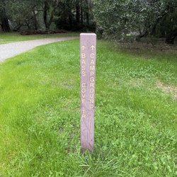
    MY PHOTOGRAPHS. (1) View to the south, of a deep canyon. At the top of my photo, you can see the…read moreBay-O-Vista neighborhood in San Leandro. (2) Later on, you pass a little peninsula of land, where people sometimes go fishing. Here and there by the water's edge there are thick patches of tall reeds. (3) Further along on Bass Cove Trail, there is a transition in the trail, where long branches from thousands of trees cover the entire trail, like a tunnel. (4) Gulch that is covered with arching trees, where the tree are covered with bright green moss. (5) Further along on Bass Cove Trail, you will encounter a second trail sign at a fork in the trail. The sign indicates the direction to Bass Cove, and the direction of Goldenrod Trail. I am posing in this photo. (6) Close up photo of one of the thousands of trees covered with bright green moss. (7) View of a beautiful little bay, located at the western edge of Lake Chabot. As you can see from this photograph, Bass Cove Trail is now about 200 feet above the Lake Chabot. (8) Photograph of several ducks. The ducks are swimming at the northern-most part of Bass Cove. BASS COVE TRAIL. The most direct access to Bass Cove Trail is by starting at the parking lot at the end of Estudillo Ave. The initial part of the hike is uphill and, once beyond the dam, it remains mostly level, where you are taking a clockwise route around Lake Chabot. Early in your hike, you will encounter a chain linked fence at the right side of the trail. Just beyond this fence is a very steep hill (almost a cliff) where a canyon resides at the bottom of the cliff. The view of the trees growing near the bottom of this canyon is beautiful. Dramatic photographs can be taken from the top of the very steep hill. Further along Bass Cove Trail, hikers will encounter a beach that has thick clusters of reeds. On occasion, one or two fishermen practice their fishing hobby near these reeds. A tiny restroom is at the edge of Bass Cove Trail, next to this beach. DISTINCTIVE STYLE OF BASS COVE TRAIL. From the beach with reeds, all the way to the northern-most area of Bass Cove, the trail consists of about 20 loops that loop inland and away from the lake, and about 20 loops that loop towards the lake. The trail loops inland where there is a gulch (the gulch is like a notch in the mountain, and the trail takes you through this notch). The trail loops towards the lake, wherever a narrow hill extends from the mountain to the west. This extending hill is sort of like an arm reaching out from the mountain to the west (here, the trail allows you to skirt this arm, and to walk around the extending arm). When hiking northwards, the gulches to your left provide opportunities for taking photographs of moss-covered trees and bushy clusters of ferns. To the right side of the trail, which is filled with gnarly-looking trees, some of them covered with electric-green moss. Because the brightly-lit waters of Lake Chabot are in back of the gnarly trees, the outlines of the gnarly trees are easier to see. DUCKS. My 300 millimeter telephoto lens enabled me to take several photographs of the ducks that make their home at the northern-most area of Bass Cove. This northern-most area had another cluster of reeds. Once at this northern-most area, hikers have the choice of continuing their clockwise hike around Lake Chabot, or continuing in the northwards direction on a straight trail (not a loop trail) that follows along Grass Valley Creek. HUMOR WHILE HIKING. Near the end of my return hike, I noticed two women walking uphill towards me, and one of them was wearing a long coat with an unusual color. I paused in my walk and said, "Can you tell me the color of your coat? I know that it is not pink or scarlet." Then, the woman with the brightly colored coat answered, "It is fuchsia ! ! !" Within a blink of an eye, I replied, "Oh, I was so CONFUCHED ! ! !" The two ladies responded with a cascade of merry laughs. Then, I continued my walk, and I was glad that their response had made my day.

    Photos
    Bass Cove Trail
    Bass Cove Trail
    Bass Cove Trail

    See all

    Lake Chabot Regional Park - Little mushrooms in the winter

    Lake Chabot Regional Park

    4.5(647 reviews)
    5.7 km

    A great place for the entire family. A beautiful park where you don't have to drive for hours to…read morevisit. On the weekends, parking is $5. Best to get there early because parking fills up quick. I was there for a BBQ on July 25th, at 10 a.m., and I was able to make parking in the overflow. There's parking on the outside street, but that fills up quick, as well. Anyway, inside the park, there's a long trail that goes all the way around the lake. There's boat rental, either kayak, paddle boat, you can rent a tour boat. I think you can bring your own boat, but it's best to call and make sure. There's BBQ and picnic benches. Volleyball court. A lot of green grass to sit, play sports. There's only one restroom near the boating area, and a few small restrooms if you trek around the lake. There are plenty of hiking trails. There's camping as well. An outdoor Cafe next to the boats. No swimming or wading. You can fish, but I wouldn't eat what you catch. There's warning signs about the water.

    So this reservoir was built in 1874 but closed to public, then opened for recreational use in the…read more60s. So the trails around the lake have matured really well. Like most parts of the paved trails are very well shaded from trees that have grown over those years. My dog and I walk for around an hour to hour and a half, so we usually pick west or east from the parking lot and return the same way. I think we've only explored like half of the lake so far. I've seen wild turkeys, deers, rabbits, and ducks around. And if you are wearing overear headphones, you get the natures remix with all the birds and insects chirping.

    Photos
    Lake Chabot Regional Park - A family that hike together, stay healthy together

    A family that hike together, stay healthy together

    Lake Chabot Regional Park - 6/1/23

    6/1/23

    Lake Chabot Regional Park

    See all

    Chabot Park - Parked the drive on hole 2

    Chabot Park

    4.0(30 reviews)
    4.0 km

    Located less than 5 minutes from 580 off of the 150th and you're in a world away. Hike, fish, bike,…read morehave a picnic or host a large party/bbq on one of several reservable areas. $5.00 plus 2 for each dog---kind of an honor system but for less than 100 you can get an EBRP year round pass that allows you to visit a lot more parks as many times as you want. Easy decision. M-F seniors get 1/2 off on boat rentals and from there you can finds the fish...if you know what you're doing ;). Anthony Chabot was a man who was instrumental in the California gold rush in the lower Sierras. He helped develop and mastered the hydraulic mining techniques required to reduce mountains to piles of rock to be sifted for gold. After those operations were shut down over environmental concerns, he brought his craft here to help make this reservoir. Amazing really. Nice spot to decompress and get right. Some areas around the lake show clear signs that hydraulic action was used. Birds, frogs, squirrels, butterflies, deer and more.

    Chabot Park is not Lake Chabot Regional Park, but it does lead to there with the trails…read more The entrance to this Park is a little dicey to get to, if you're not familiar with this area of the San Leandro/East Oakland border area, it's hard to explain how to get here. And I have a feeling the residents of this area would like to keep it that way, so I'll honor their unwritten code, lol!! The Park itself is very much like your in the woods, lots of trees and fallen trees. They do have restrooms and disc golf here, which seems to be pretty popular, someone always seem to be playing it. Lots of free parking also. But the best thing about this park is the trail that can lead you to Lake Chabot. It starts off all uphill for at least 1/2 mile, then you start downhill and can determine which way around the lake you want to go. If you stay on the paved trail, to the right, you'll cross a bridge which is the Chabot Dam and it's a faster route, although hilly, to Lake Chabot Regional Park. If you choose the dirt trail, to the left, you won't necessarily stay next to the lake the whole way, there's signs to keep you on track. Either way, it's a great walk or run, watch and listen for the bike riders, sometimes they are really speeding coming off those hills. And if you're going to walk all the way around, bring water. Also, there's not a lot of areas where you get phone service. Always enjoy coming here, convenient for me!!
    Photos
    Chabot Park
    Chabot Park - Quite the Poppy exhibit here at the park!

    Quite the Poppy exhibit here at the park!

    Chabot Park - Hole 8 tee pad

    See all

    Hole 8 tee pad

    Anthony Chabot Regional Park

    Anthony Chabot Regional Park

    3.6(121 reviews)
    6.6 km

    Review is for their large campsite at Bort Meadows. A parent in my oldest kids class reserved a…read morehuge campsite for families in the class and I'm so glad we participated. The larger site holds up to 75 vehicles and 300 people max and because only around 50 people signed up we had so much open space to ourselves. They have one water spigot, 4 non-flushing toilets, charcoal grills, tables, and 2 fire pits so for such a large campsite it's bare bones and minimal. The grass is well maintained and there was a nice small hill and plenty of open room for kids to play in at our site. The big note if you get this spot is there is a gate blocking the entrance to the lower parking lot. They give you the combination to one of the locks but there are three combination locks attached to the gate. You can still slide the gate open with them not opened as long as you have the combination to the one lock. It was perfect cooking together potluck style and all the different games and camping toys the different families brought. It's windy in this area and perfect for kites. At night it does get cold and I would position your tent in the best way where it's convenient to get to the bathroom in the dark.

    This is a review for the family campground. We had reserved camp sites 51, 52, 59, and 60 for 7…read morefamilies, with a couple sites having two families/two tents per site. The camp sites we reserved were a bit of a tight squeeze for two 6-10 person tents, mostly because of lack of flat terrain at the sites. The actual sites themselves have a fair amount of space, it's just that the space can be hilly/uneven, have sawed off tree stumps in the middle of clear spots, or be right underneath the branches of eucalyptus trees (notorious for being easier to topple/fall in windy and rainy conditions. The last you want is to have branches or the tree itself toppling onto your tent. Other than the less than ideal spaces, we did have a good time camping here. The facilities were very clean, and not needing quarters for the hot showers was a fantastic bonus. There were plenty of places for the kids to run around, and the views of Lake Chabot were breathtaking. Thankfully while we were there we didn't have any issues with noisy/disrespectful campers. Overall this is a great family camp ground that's easily accesible in the Bay Area, just be aware of some of the space limitations and plan accordingly.

    Photos
    Anthony Chabot Regional Park
    Anthony Chabot Regional Park
    Anthony Chabot Regional Park

    See all

    Heron Bay Nature Trail - hiking - Updated September 2026

    Loading...
    Loading...
    Loading...