Hieroglyphic Trail Hoa Photos


More like Hieroglyphic Trail Hoa
Recommended Reviews - Hieroglyphic Trail Hoa
Start your review...


Reviews With Photos


Highly recommended: Cool hiking trails. We like to go when the weather is cooler bring lots of water.
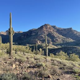


By far my favorite hike. Get there before 10am on a weekend. If not it's one way in and one way out.


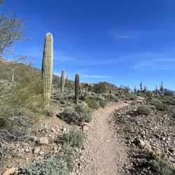
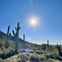
This hike is a bit of a drive from the Valley, but a really nice easy hike. After the pandemic hit, this was my first outdoor activity I did during the isolation period. Hieroglyphic Trailhead is located on the southern part of the Superstition Mountains (most of the hikes are on the north end). You have to pass through some residential areas to reach the trail. The parking lot is free and has a decent amount of spots, but gets really crowed during peak times. The Hieroglyphic Trail is easy to moderate and about a 1.5 mile trip one way. Because of the springs at the end of the trail, lots of families do this hike with their kids. You have two paths to choose from once you enter through the gated fence at the start - Hieroglyphic or Lost Gold Mine Trail. The beginning part of the hike is nice and smooth (it does get a little more rocky) and there are lots of cholla and saguaro cacti along the way. Many of the smaller cacti have beautiful pink flowers on them. Once you get near the springs at the mouth of Hieroglyphic Canyon, you will see the petroglyphs etched on the cliff walls. When the water is flowing, this is a nice area to cool off and to swim in. I pack a lunch and hang out here for a bit. Because this is a really popular hike, I recommend going earlier in the morning to get a parking spot. I personally like the early hours because sunrise makes for great rim lighting on cactus photos.
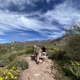

Great hike for all, if you are hiking in the late spring to late fall make sure you take extra water. Easy to access the magnificent Superstition Mountains.


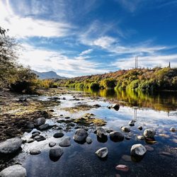
This was my first time doing this hike and it was a Friday. Also, we did this hike in March after lots of rain here in Arizona. Let me begin with the parking lot is small and it was packed. We waited for a designated parking spot so probably drove in circles for about 5 minutes. We noticed several vehicles were parked on the roadside into the parking area, where there are lots of signs of No Parking, Tow Zone. The in and back hike took us 2.5 hours and when we returned to the parking lot, at about noon, the parking area was even crazier with cars and lots more parked in the No Parking zones. The vehicles parked where they weren't supposed to be, had orange warning stickers on the driver's side windows. There was also a sheriff driving through the parking lot, still taking vehicles. Restrooms: there are Port O Johns in the parking area only. I am 56 years old and would consider myself in healthy shape. I found this hike to be a challenge and enjoyable. It is a rocky trail so you have to watch your step so as to not end up with a twisted ankle or tripping. The trail gets progressively rockier as you ascend to the top. There were several people with dogs and small children. The plant life is beautiful to see and the mountain vistas are impressive. As you look back, over the valley, you realize the elevation you've gained. Once you get to the top it's like an oasis in the desert! A lazy little creek and small waterfalls with some green grasses popping out of the rocks near the waters edge. The hieroglyphs are etched into the rocks on the west walls and they're fascinating. You have to wonder what they were communicating with these drawings. There are wide, smooth, rocks all around and the views are stunning so take some time to sit and enjoy, maybe even pack a picnic. Be prepared to pack your mess out with you, though, please. I liked this hike, so much, I'll be returning with my granddaughter this next week!


Good trail for a little day hike. It was about 3 miles round trip...1.5 miles there and then 1.5 miles back. Make sure you bring plenty of water, some sunglasses, sunscreen, and a hat because it it hot and sunny. The trail does not have much shade. The hieroglyphics were pretty cool.


Done this hike since I was a kid, beautiful, educational, and fun. I would say intermediate-beginner level hike. Not wheelchair friendly as some areas are very steep or rocky. Saw a lot of dogs and kiddos though! Hike is uphill towards the waterfall/hieroglyphics, the way back is much easier. Lots of sunshine so make sure to stay hydrated and wear sunscreen!


I went with 2 colleagues while on a business trip to Phoenix and it was a great idea to bring my hiking boots just in case we were going to use the Sunday before work for a hike. I am glad we found this hike on Yelp (please remove the HOA part in the title, as this is not the review for any homeowners association but for a real mountain!). Misleading info aside, we enjoyed the rocky path to the somewhat deceiving hyeroglyphs. If you go only for that, difficult to see and not much to see. However the scenery is superb, especially the golden hour is so pretty. The hike was more tiring that what we thought, maybe we were mentalized that was more a walk, but going all the way up was exhausting (glad we bought water on the way there). Very pleasant first approach to Supertitious Mountains.


We arrived a lil late in the afternoon. Naturally, car park was FULL. (Sad Panda) but, parking is free. The trail, the view, and vibe ... Wow! Just wow! Portajohn ... Well... (Lol) use at your local own risk. Some pups were not on leashes (they're supposed to be leashed per the website.) Trail is moderate, a lil rocky, unpaved, and ok for older kiddos ages 7 or 8 years and older.


This was a nice little trail! The listings for it online are a bit deceptive... First of all, I was under the impression that it was 6 miles from start to finish, but it was only about 3. Second of all, the address listed here is wrong... I just submitted for a change in address so hopefully that will be updated and help avoid confusion for others in the future. The address listed here leads you to a gated community, not to the trailhead. However, if you go to this address and then continue along to Baseline, you can turn right there and then follow the hiker signs to the trailhead. It was pretty easy to find once you got to the listed address, but it would be even easier if the address was correct on the site. The hike is straight up for the first mile and a half up to the pools (this time of year there's no flowing water whatsoever) and then straight back down for the hike back. It's not very steep (only about 600 ft in elevation gain) but it's consistent. Overall it's a super moderate hike. Definitely bring water though, especially when it's hot! The biggest problem we had with this hike was the bugs! I don't know if it had something to do with the time of day we went (about 10 am) or the time of year or what, but all the way from the trailhead to the pools these little gnats were landing all over our arms and faces. Yuck! By the time we went back down they were gone, thankfully. I'll probably be bringing family back to this hike at a later date.


Hiked this trail with my wife this morning and had a blast checking out the ancient Hohokam petroglyphs! The trail is not very steep and as others have described is more of a nature walk than a hike. The pools at the end of the trail were pretty awesome and I will definitely want to check them out again during/after monsoon season for some better waterfall action. In addition to the running stream and pools, there's a cool boulder cave you can explore. The one gripe I have is that certain people find it okay to go walk near the petroglyphs and spend their sweet time there while others like myself want to take a picture without anyone in it. I mean, I understand the general idea of wanting to get up close to experience them. But seriously, behave with some hiker etiquette, spend a minute or so, then move. Don't stand there for 10 minutes acting like it's your territory only.


If you're looking for a great hike in the Superstition Mountains, Hieroglyphic Trail is absolutely worth checking out. The scenery is incredible and the petroglyphs at the end make the hike feel especially rewarding. A few things to know before you go: the parking lot is pretty small and fills up fast, so getting there early is definitely recommended. Otherwise, you may end up waiting for someone to leave. I also wouldn't risk parking in a no-parking zone because I've heard they tow pretty regularly. The trail description says it's "a 1.5 mile trail that climbs a gentle slope covered with many cacti then enters the lower end of a boulder-filled canyon, ending at a rocky section where pools persist for much of the year," and that's mostly accurate. There are some sections before the canyon where you'll need to scramble over larger rocks, but overall it's manageable for most hikers. Once you reach the canyon and the petroglyph area, the terrain becomes steeper with much larger boulders. There's also a small streambed with several pools of water, which was a nice surprise. The petroglyphs themselves are amazing and can be found on both sides of the canyon. You can get fairly close to several of them, which makes the experience even better. Bring plenty of water because most of the trail is fully exposed to the sun during the day. Once you reach the petroglyphs it's a great spot to sit, rest, and recharge There is shade inside the canyon, although when we arrived most of the shady spots were already occupied by other hikers. Overall, this is a fantastic beginner-to-intermediate trail with spectacular views, unique scenery, and a rewarding destination at the end. Definitely one of my favorite hikes in the area. read more


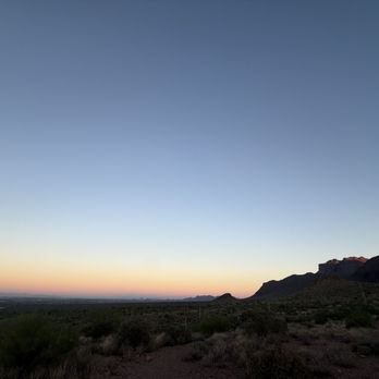
Hieroglyphic Trail is a beginner to intermediate hiking trail you can hike to see the sunrise early in the morning. There are plenty of parking spaces and the hike is not too challenging to hike even for the first timers. On either side of the trail there are beautiful landscapes be admired with mountains that can only be seen in the Arizona. With the sun slowly lightening up the trail, mid October morning was a perfect time to hike this trail. When you reach close to the summit, you will find yourself in between two rocks with hieroglyphic markings on them with the stream of water running between them. What a sight to see. We decided to hang out here for a bit enjoying the fresh breeze and the scene. No matter how many pictures and videos we take they don't do justice for this beautiful trail. We also brought some small snacks and protein bars to munch on while we planned out the rest of our day during our short visit to Arizona. Please be careful with every step. Don't leave trash behind. Take lots of beautiful photos. Let me know how much you enjoyed this! read more




5 months ago
Such a beautiful hike ! Absolutely bring water. Saw some lizards along the way and beautiful cacti. The trail is well taken care of. As always remember to pack out what you pack in. read more


3 months ago
Highly recommended: Cool hiking trails. We like to go when the weather is cooler bring lots of water. read more


10 months ago

8 months ago
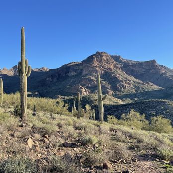
Being my first trail hike, this was a little harder than I expected. We started around 8:30 am and didn't take long to shed a layer of clothing. The scenery was absolutely beautiful. I would definitely trek along the same trail again. Looking forward to going on another! read more

2 years ago
By far my favorite hike. Get there before 10am on a weekend. If not it's one way in and one way out. read more


Came here with a friend at the perfect time..right before it gets too hot! Really enjoyed the trail, and the views were absolutely stunning. We also had a wild moment: and ran into a rattlesnake for the first time on a hike. Definitely scary, but also kind of cool. I'll for sure be back again soon. read more

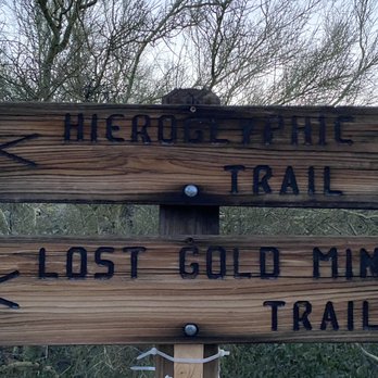
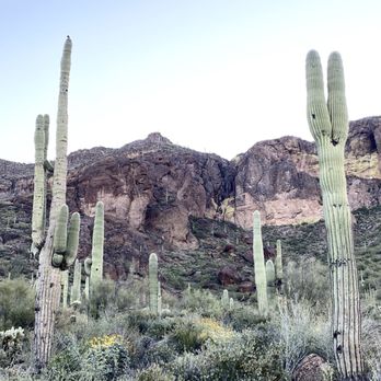
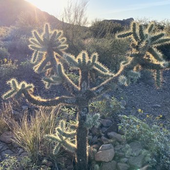
This hike is a bit of a drive from the Valley, but a really nice easy hike. After the pandemic hit, this was my first outdoor activity I did during the isolation period. Hieroglyphic Trailhead is located on the southern part of the Superstition Mountains (most of the hikes are on the north end). You have to pass through some residential areas to reach the trail. The parking lot is free and has a decent amount of spots, but gets really crowed during peak times. The Hieroglyphic Trail is easy to moderate and about a 1.5 mile trip one way. Because of the springs at the end of the trail, lots of families do this hike with their kids. You have two paths to choose from once you enter through the gated fence at the start - Hieroglyphic or Lost Gold Mine Trail. The beginning part of the hike is nice and smooth (it does get a little more rocky) and there are lots of cholla and saguaro cacti along the way. Many of the smaller cacti have beautiful pink flowers on them. Once you get near the springs at the mouth of Hieroglyphic Canyon, you will see the petroglyphs etched on the cliff walls. When the water is flowing, this is a nice area to cool off and to swim in. I pack a lunch and hang out here for a bit. Because this is a really popular hike, I recommend going earlier in the morning to get a parking spot. I personally like the early hours because sunrise makes for great rim lighting on cactus photos. read more






3 years ago
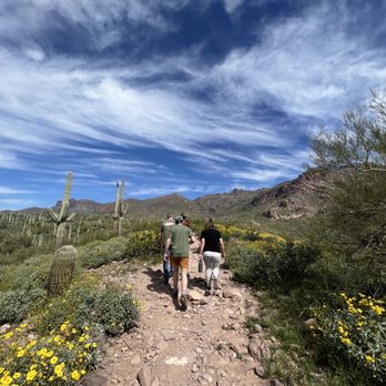
Great hike for all, if you are hiking in the late spring to late fall make sure you take extra water. Easy to access the magnificent Superstition Mountains. read more


3 years ago
This was my first time doing this hike and it was a Friday. Also, we did this hike in March after lots of rain here in Arizona. Let me begin with the parking lot is small and it was packed. We waited for a designated parking spot so probably drove in circles for about 5 minutes. We noticed several vehicles were parked on the roadside into the parking area, where there are lots of signs of No Parking, Tow Zone. The in and back hike took us 2.5 hours and when we returned to the parking lot, at about noon, the parking area was even crazier with cars and lots more parked in the No Parking zones. The vehicles parked where they weren't supposed to be, had orange warning stickers on the driver's side windows. There was also a sheriff driving through the parking lot, still taking vehicles. Restrooms: there are Port O Johns in the parking area only. I am 56 years old and would consider myself in healthy shape. I found this hike to be a challenge and enjoyable. It is a rocky trail so you have to watch your step so as to not end up with a twisted ankle or tripping. The trail gets progressively rockier as you ascend to the top. There were several people with dogs and small children. The plant life is beautiful to see and the mountain vistas are impressive. As you look back, over the valley, you realize the elevation you've gained. Once you get to the top it's like an oasis in the desert! A lazy little creek and small waterfalls with some green grasses popping out of the rocks near the waters edge. The hieroglyphs are etched into the rocks on the west walls and they're fascinating. You have to wonder what they were communicating with these drawings. There are wide, smooth, rocks all around and the views are stunning so take some time to sit and enjoy, maybe even pack a picnic. Be prepared to pack your mess out with you, though, please. I liked this hike, so much, I'll be returning with my granddaughter this next week! read more


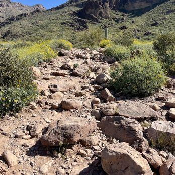


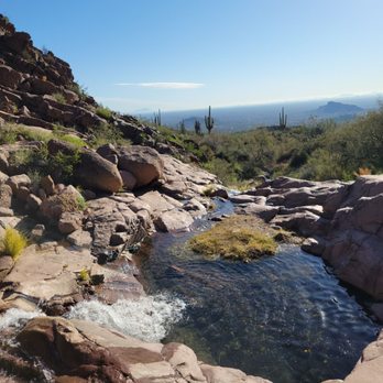
Good trail for a little day hike. It was about 3 miles round trip...1.5 miles there and then 1.5 miles back. Make sure you bring plenty of water, some sunglasses, sunscreen, and a hat because it it hot and sunny. The trail does not have much shade. The hieroglyphics were pretty cool. read more






3 years ago
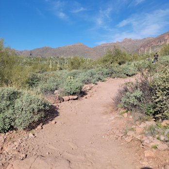
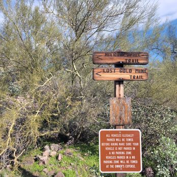
Done this hike since I was a kid, beautiful, educational, and fun. I would say intermediate-beginner level hike. Not wheelchair friendly as some areas are very steep or rocky. Saw a lot of dogs and kiddos though! Hike is uphill towards the waterfall/hieroglyphics, the way back is much easier. Lots of sunshine so make sure to stay hydrated and wear sunscreen! read more


1 year ago

3 years ago

I went with 2 colleagues while on a business trip to Phoenix and it was a great idea to bring my hiking boots just in case we were going to use the Sunday before work for a hike. I am glad we found this hike on Yelp (please remove the HOA part in the title, as this is not the review for any homeowners association but for a real mountain!). Misleading info aside, we enjoyed the rocky path to the somewhat deceiving hyeroglyphs. If you go only for that, difficult to see and not much to see. However the scenery is superb, especially the golden hour is so pretty. The hike was more tiring that what we thought, maybe we were mentalized that was more a walk, but going all the way up was exhausting (glad we bought water on the way there). Very pleasant first approach to Supertitious Mountains. read more

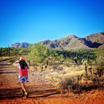


We arrived a lil late in the afternoon. Naturally, car park was FULL. (Sad Panda) but, parking is free. The trail, the view, and vibe ... Wow! Just wow! Portajohn ... Well... (Lol) use at your local own risk. Some pups were not on leashes (they're supposed to be leashed per the website.) Trail is moderate, a lil rocky, unpaved, and ok for older kiddos ages 7 or 8 years and older. read more


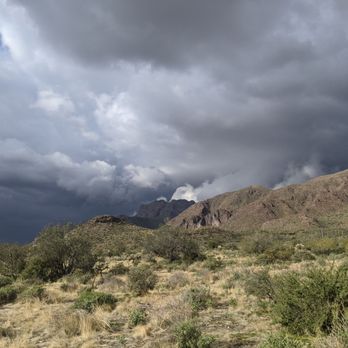


This was a nice little trail! The listings for it online are a bit deceptive... First of all, I was under the impression that it was 6 miles from start to finish, but it was only about 3. Second of all, the address listed here is wrong... I just submitted for a change in address so hopefully that will be updated and help avoid confusion for others in the future. The address listed here leads you to a gated community, not to the trailhead. However, if you go to this address and then continue along to Baseline, you can turn right there and then follow the hiker signs to the trailhead. It was pretty easy to find once you got to the listed address, but it would be even easier if the address was correct on the site. The hike is straight up for the first mile and a half up to the pools (this time of year there's no flowing water whatsoever) and then straight back down for the hike back. It's not very steep (only about 600 ft in elevation gain) but it's consistent. Overall it's a super moderate hike. Definitely bring water though, especially when it's hot! The biggest problem we had with this hike was the bugs! I don't know if it had something to do with the time of day we went (about 10 am) or the time of year or what, but all the way from the trailhead to the pools these little gnats were landing all over our arms and faces. Yuck! By the time we went back down they were gone, thankfully. I'll probably be bringing family back to this hike at a later date. read more


Hiked this trail with my wife this morning and had a blast checking out the ancient Hohokam petroglyphs! The trail is not very steep and as others have described is more of a nature walk than a hike. The pools at the end of the trail were pretty awesome and I will definitely want to check them out again during/after monsoon season for some better waterfall action. In addition to the running stream and pools, there's a cool boulder cave you can explore. The one gripe I have is that certain people find it okay to go walk near the petroglyphs and spend their sweet time there while others like myself want to take a picture without anyone in it. I mean, I understand the general idea of wanting to get up close to experience them. But seriously, behave with some hiker etiquette, spend a minute or so, then move. Don't stand there for 10 minutes acting like it's your territory only. read more


5 years ago
This is my absolute favorite hike!! The hike itself is short and just a bit steep. The end view is absolutely priceless!!! I would do this everyday if I could!!! read more

3 years ago

8 years ago
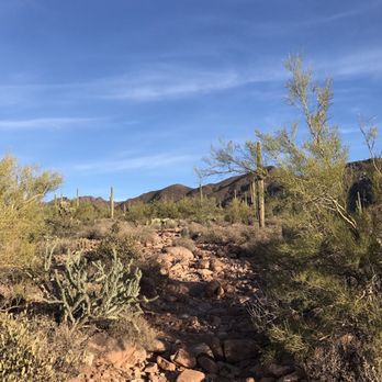
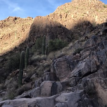
This is a beautiful, and super easy in and out hike. I love going here super early, and hiking back to one particular boulder and then plopping down enjoying the view while I eat my pb sandwich in utter human silence, and take in the history of the petroglyphs. read more




6 years ago
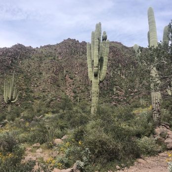
Loved this trail! It took my boyfriend and I about 40 mins to get to the waterfall at the top. The views were beautiful and I loved the yellow flowers and cacti along the trail. The path was a bit rocky so you do have to watch your step, but overall not too hard! read more


7 years ago
It rained over the weekend so we went up again to see the beautiful stream. Very easy hike and you don't have to be fit at all to see this gem in your backyard. Go early to beat foot traffic. read more


Lots of people speak about how well the trail is marked and how easy it is but I must of gotten off track and I have hiked thousands of miles. It was a very beautiful hike but made the mistake to hike it in the middle of the afternoon and even though it was November, they were experiencing record highs and a 57 day dry spell. Very beautiful trail but lost it at the very end and could not find a path to the Heiroglyphs. Take plenty of water and comfortable shoes and be prepared for a hike with no shade and lots of dry heat but awesome views. read more

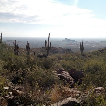


SEE FOR DIRECTIONS! Great trail for varying levels of ability. While on my hike I saw dogs, seniors, kids, young adults...it is a rocky trail that some might have difficulty with if they are unsteady on their feet. Wear shoes that have solid ankle support. It's an in and out trail; about an hour in (at a very steady pace) to the small pool of water (where the petroglyphs are located) and about an hour return. It might be difficult for some to find. You feel like you are driving through an endless mountain subdivision. If you're taking 60...... 1. Turn onto Superstition Mountain Dr. (At Chase Bank) 2. Follow. It will fork to the right. Veer R onto E Don Donnely Trl 3. Follow the curves. It turns into Golden Rim Cir (by this time you may have spotted little Hiking Man signs). 4. L on S Kings Ranch Rd 5. R on Baseline 6. L on Mohican 7. L on Valley View (curves and turns into White Tail) 8. R on Cloudview 9. Follow straight into parking lot Only after writing all of these directions did I notice that S Kings Ranch runs from 60 to Baseline. Oops! Oh well, I took the scenic route apparently! read more


7 years ago
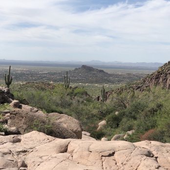
Perfect day for this trail! Restrooms located in the parking lot on the way in. It's maybe 3 mile hike in and out of here. It's rocky so easy to trip, I've done it with my daughter on my back once and once without. Gorgeous desert flowers and scenery in every direction. Take plenty of water and sunscreen often if you hike all the way back depending on the weather you likely to see a pond or two and a small waterfall. You often see dogs going on hikes here and you may even encounter a rattle snack or two. read more




6 years ago

11 years ago
I love this trail, it is fun and beautiful and perfect for a little escape. The reward of the beautiful water area also makes this hike great for showing out of towners or newbs to hiking. There are no restroom areas so make sure to go before hand! read more


Love this trail. Had a friend visit from out of town and needed an afternoon activity. Saw the reviews and thought we should try it out, glad we brought water as its not too far at a slight incline (1-2 mi) but enough that water is nice to have. Cool to see hieroglyphics at the end and the water and enjoy the view!!! I'm adding this to my portfolio of places to see/do/take visitors! read more


7 years ago
It's a very rocky trail. It's about an hour hike one way. Pretty views along the way. Once you get to the hieroglyphics it's worth! Stop, relax, then head back down. read more


This review is for the Hieroglyph Trail, not the HOA. This is a moderate hike with some nice views. At the top you will see the hieroglyphs (quite a few of them) which is a nice treat. There wasn't much water in the pools at the top but you could imagine how beautiful it would be if there was. The address we used (4467 S Kings Ranch Rd, Gold Canyon) got us close to the trail head. If you use this address, keep driving past this location until you see the small signs for hiking. Follow those. Tip: We headed to Canyon Lake and the Dolly Steamboat after the hike since we were out that direction. read more

5 years ago
Beautiful trail with serenity views. Easy dog friendly hike. No shade, Bring lots of water. read more


6 years ago

6 years ago

9 years ago
4 years ago

6 years ago
4 years ago

Page 1 of 2
More info about Hieroglyphic Trail Hoa
4467 S Kings Ranch Rd
Gold Canyon, AZ 85218
Directions
Hours
Outdoor Amenities
Ask the Community - Hieroglyphic Trail Hoa
Review Highlights - Hieroglyphic Trail Hoa



















Why does Yelp recommend reviews?
2 reviews that are not currently recommended
The reviews below are not factored into the business's overall star rating.

4 years ago

11 years ago
Hieroglyphic Trail Hoa - hiking - Updated September 2026
Best of Gold Canyon
People found Hieroglyphic Trail Hoa by searching for…
Scenic Drive in Gold Canyon, AZ
Hiking Trails With Waterfalls in Gold Canyon, AZ
Things to Do in Gold Canyon, AZ
Swimming Holes in Gold Canyon, AZ
Watch Sunset in Gold Canyon, AZ
Photo Spots in Gold Canyon, AZ
Sunrise Hike in Gold Canyon, AZ
River Swimming in Gold Canyon, AZ
Sunset View in Gold Canyon, AZ
Scenic View in Gold Canyon, AZ
Secret Spots in Gold Canyon, AZ
Walking Paths in Gold Canyon, AZ
Off Road Trails in Gold Canyon, AZ
Beautiful Views in Gold Canyon, AZ
Attractions in Gold Canyon, AZ
National Parks in Gold Canyon, AZ
Picnic Spots in Gold Canyon, AZ
Natural Hot Springs in Gold Canyon, AZ
Swimming Lakes in Gold Canyon, AZ
Trending Searches in Gold Canyon, AZ
Apple Orchards near Hieroglyphic Trail Hoa
Apple Picking near Hieroglyphic Trail Hoa
Barbershop near Hieroglyphic Trail Hoa
Bike Shop near Hieroglyphic Trail Hoa
Blowout near Hieroglyphic Trail Hoa
Casinos near Hieroglyphic Trail Hoa
Cliff Jumping near Hieroglyphic Trail Hoa
Consignment Shops near Hieroglyphic Trail Hoa
Cruising Spots near Hieroglyphic Trail Hoa
Dog Friendly Things To Do near Hieroglyphic Trail Hoa
Estheticians near Hieroglyphic Trail Hoa
Eyelash Extensions near Hieroglyphic Trail Hoa
Furniture Stores near Hieroglyphic Trail Hoa
Hiking Trails With Waterfalls near Hieroglyphic Trail Hoa
Kids Birthday Party near Hieroglyphic Trail Hoa
Lookout Points near Hieroglyphic Trail Hoa
Makeup Artists near Hieroglyphic Trail Hoa
Mattresses near Hieroglyphic Trail Hoa
Parks near Hieroglyphic Trail Hoa
Picnic Areas near Hieroglyphic Trail Hoa
Places To Take Pictures near Hieroglyphic Trail Hoa
Public Shower near Hieroglyphic Trail Hoa
Rock Quarry near Hieroglyphic Trail Hoa
Scenic Night View near Hieroglyphic Trail Hoa
Scenic Overlook near Hieroglyphic Trail Hoa
Sugaring near Hieroglyphic Trail Hoa
Sunrise View near Hieroglyphic Trail Hoa
Swimming Holes near Hieroglyphic Trail Hoa
Browse Articles
Browse Nearby
BEST of Gold Canyon, Arizona Coffee near Hieroglyphic Trail Hoa
BEST of Gold Canyon, Arizona Things to Do near Hieroglyphic Trail Hoa
BEST of Gold Canyon, Arizona Parks near Hieroglyphic Trail Hoa
BEST of Gold Canyon, Arizona Walking Trails near Hieroglyphic Trail Hoa
BEST of Gold Canyon, Arizona Restaurants near Hieroglyphic Trail Hoa
BEST of Gold Canyon, Arizona Breakfast near Hieroglyphic Trail Hoa
BEST of Gold Canyon, Arizona Taxis near Hieroglyphic Trail Hoa
BEST of Gold Canyon, Arizona Campgrounds near Hieroglyphic Trail Hoa
Browse Brands
Related Searches in Gold Canyon, AZ
Best Dog Hiking Trails Around Gold Canyon, Arizona
Best Fishing Locations and Guides in Gold Canyon, Arizona
Best Places for Horseback Riding in Gold Canyon, Arizona
Best Sightseeing Experiences Available in Gold Canyon, Arizona
Check Out Off Road Trails in Gold Canyon, Arizona
Discover Dog Friendly Trails to Explore in Gold Canyon, Arizona
Discover Easy Hiking Trails Near Gold Canyon, Arizona
Discover Kid Friendly Hiking Trails in Gold Canyon, Arizona
Discover Popular Bike Trails in Gold Canyon, Arizona
Discover Scenic Mountain Bike Trails Near Gold Canyon, Arizona
Discover Walking Parks in Gold Canyon, Arizona Near You
Discover a Hiking Trail in Gold Canyon, Arizona
Discover the Best Night Hike Trails in Gold Canyon, Arizona
Dog-Friendly Hikes With Dogs in Gold Canyon, Arizona
Enjoy Camping Adventures Around Gold Canyon, Arizona
Enjoy Kayaking Adventures in Gold Canyon, Arizona
Enjoy Off Leash Dog Hikes in Gold Canyon, Arizona
Enjoy Scenic Places to Walk in Gold Canyon, Arizona
Enjoy Tent Camping Spots Around Gold Canyon, Arizona
Enjoy a Beautiful Waterfall Hike in Gold Canyon, Arizona
Enjoy the Best Walking Path in Gold Canyon, Arizona
Enjoy the Best Walking Trails in Gold Canyon, Arizona
Enjoy the Scenic Boardwalk Attractions in Gold Canyon, Arizona
Experience Stunning Sunset Views in Gold Canyon, Arizona
Explore Beautiful Parks and Green Spaces in Gold Canyon, Arizona
Explore Easy Hikes Perfect for All in Gold Canyon, Arizona
Explore Fun Activities to Do in Gold Canyon, Arizona
Explore Popular Campgrounds Near Gold Canyon, Arizona
Explore Top Dog Parks in Gold Canyon, Arizona Near You
Explore the Best Beach Spots in Gold Canyon, Arizona
Family Friendly Hiking With Kids in Gold Canyon, Arizona
Find Top Dog Friendly Parks to Visit in Gold Canyon, Arizona
Find Top-Rated Waterfalls in Gold Canyon, Arizona Now
Hiking Trails With Waterfalls in Gold Canyon, Arizona
Off Leash Dog Hiking Trails in Gold Canyon, Arizona
Picnic Areas With BBQ Pits Available in Gold Canyon, Arizona
Plan a Scenic Drive Route Near Gold Canyon, Arizona
Popular Outdoor Activities to Try in Gold Canyon, Arizona
Popular Picnic Spots to Visit in Gold Canyon, Arizona
Popular Waterfall Hiking Trails in Gold Canyon, Arizona
Safe and Fun Parks for Kids in Gold Canyon, Arizona
Top Hiking Trails to Explore in Gold Canyon, Arizona
Top Playgrounds for Kids to Enjoy in Gold Canyon, Arizona
Top Running Trails to Explore in Gold Canyon, Arizona
Top Swimming Lakes to Enjoy in Gold Canyon, Arizona
Top Swimming Spots and Pools in Gold Canyon, Arizona
Top-Rated Camping Sites in Gold Canyon, Arizona


