Wave Cave Photos


More like Wave Cave
Recommended Reviews - Wave Cave
Start your review...


Reviews With Photos


This hike is definitely not easy, more moderate/difficult. There is no shade until you reach the wave cave. The last .4 of the hike is straight up hill climbing with your hands. We went in late May with 95° weather and I would not recommend until the cooler months or earlier in the morning (before 9am). There are a lot of loose rocks throughout the hike and this is not a popular tourist hike so there are minimal people. Gorgeous view. An overall great experience. Bring a full camelback of water and snacks because you will need them.
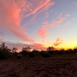

Easy to find the parking for the trailhead. The lot is small, but it wasn't busy so there was plenty of parking. The trail is also easy to follow thanks to the spray painted white arrows. The hike is rated difficult on AllTrails. I would say it's more moderate. The views are stunning and the cave is a fun way to end the hike! We came on a Sunday afternoon and there were only a few other people. We had the cave to ourselves for awhile. We saw a total of 3 tarantulas on the trail which was cool!

I arrived around 8:30 AM, and it was the perfect time to visit. The parking lot is small, but there were barely any cars when I got there. Last time, I came around 11 AM, and the lot was packed--I couldn't find a spot and ended up going elsewhere. The hike was great, though a bit challenging through the rocky sections. It's about 3.3 miles round trip from the parking lot. If you're looking for a quiet escape and an amazing view from the cave, this is the perfect spot.
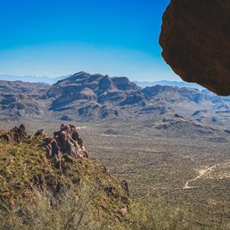
Steady, rocky, steep! Solid shoes, patience, and plenty of water are a must! Trail is about 3.4 miles and takes a little over 2 hours. 10/10 recommend! Note: the trail rating of hard is accurate. This isn't an easy trail; many challenges and steep elevation all the way up (once you clear the ground).


Don't go here, stay home, this place used to be quiet and not overrun with people. Absolutely packed by 9 AM. STAY HOME.


Have to get here earlier to bits the traffic. We got here at 9 on Monday, which was a perfect time since the morning weather is a bit chill in the winter. The parking lot or entrance to this trail is unmarked, so when you see a parking lot on your left side before Peralta Trailhead, that's the one. If you drive all the way to Peralta Trailhead then you drive to far. The trail itself very well marked with white arrows spray paint ( thank you whoever did that), but the entrance is a bit confusing. There are three trails at the entrance, one on the left and one on the right but the middle one with the barbed wires is the one. Its look like closed with barbed wires fence, you just need to go through it. This trail is a bit climb, but was fun and took us about 45 minutes going up and 35 minutes down. It might take longer for some people, but hey it's beautiful views here and take your time.


The book was quite a experience,I really enjoyed the thrill behind the book.It was a great post apocalyptic dystopian and I think I'm going to start reading more books because of this book. I definitely recommend this book to anyone trying to get into reading or even just a casual reader. Quick Sumatra:A girl named Cassie is living her life when a alien spaceship comes to earth and sends waves of human destruction till 96% of the world is wiped out.It is a fight for human survival and our primal instincts.


I cannot say I was overly excited when shawty asked "want to go for a hike at 7am?" There was approximately a 4 mile dirt road leading to the beginning of the trail head. Good thing we had a jeep. The trail begins flat and has a gradual incline. The last quarter of the trail is steeper. The view from the cave is beautiful. I'd rate this 6/10 for difficulty and 8/10 for view


I highly recommend this hiking trail. My group and I drove down early in the morning to beat the heat. Finding where the actual trail begins was a little tricky, make sure, after you park, you go through the gate entrance and through all the flat lands to start the actual hike. Also make sure to follow the white arrows to stay on the trail as it is easy to get off track. Closer to the cave the trail gets very steep. But once you reach the cave, it is truly a sight see, with amazing views of the AZ desert. On your way back down be very careful as there are lots of loose rocks, which makes it easy to slide and fall, especially if you are not wearing hiking boots.


Parking was busy at this trail on a Sunday at 10am. The trail to the wave cave is steel and has lots of loose gravel. I would recommend good tread on your hiking shoes and take caution going down! (I took a digger along with someone else in my party) Getting to the top there wasn't too much foot traffic but by noon the trail was busy.


I'll start off with the bad. Lots of cons but some great pros too. Cons: Unpaved roads for about 6-7 miles. Once you pass the Peralta elementary school on your right, driving in a tiny car is miserable and your car will look dirty AF. It was extremely bumpy and uncomfortable and a bit frightening to drive for 15 min like that. I'd prob say otherwise if I had a Jeep or a big car tho. TRAIL IS NOT MAINTAINED. The hike to the wave was fine but coming back, we got lost because there is only ONE trail marker. We were so off course that it added an extra 90 min to the hike. I wouldn't mind this normally but I came with a couple of new hikers who were not ready for that. I am not a super experienced hiker myself but I've done my fair share of trails and have never gotten lost to the extent I did today at this trail. Literally no clear signs or directions at all. Just one janky sign at the start of the trail that isn't even labeled the Wave. If you are looking to do the Wave, park at the lot with the sign "Lost Goldman". This will take you to the wave. Was oddly crowded but no one person knew where the trail was Pros: Great workout and generally a fun hike- would rate it as a moderate hike. Easier than Toms Thumb. Saw lots of children and dogs on this hike so it's not difficult. Fairly short--about a mile to get to the trailhead and then 1.7 miles each way. No admission fee to enter. Great views at the top that make for a fun photo shoot Parking is okay if it the parking lot is not full. There's overflow parking at Lost Goldman. Go there instead of parking in the mini lot right next to the main parking lot. Mini lot scratched up my car because of the boulders.
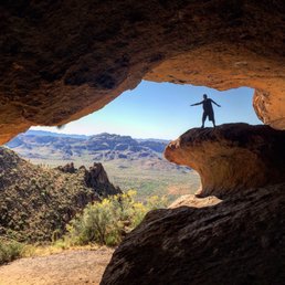

Parking lot is small; we were lucky to find a spot around noon on a Thursday. No bathrooms at the trail head and several were "popping a squat" and leaving behind their toilet paper which was kind of gross. Also no enforcement of the required permit and no other vehicles had parking passes displayed on their dash as instructed by the permit guidelines. Trail is not marked at all and we did get off trail by accident a few times coming down. The entirety of the trail is rocky, which doesn't matter as much during the first mile that is relatively flat but did require strategic footing on the way up the last half mile and extreme caution coming down. I slid several times despite being extra cautious (and saw many others sliding too) and even fell twice (luckily didn't get hurt). There was a small bee hive at the wave and bees followed us the entire way back to the parking lot. Saw some birds and lizards. Made it up in an hour and took just about the same amount of time coming down with full sun the entire time. I recommend this hike because the wave cave is a cool feature but I don't think I'd do it again because of the trail conditions and bees. read more


3 months ago

5 months ago

This hike is definitely not easy, more moderate/difficult. There is no shade until you reach the wave cave. The last .4 of the hike is straight up hill climbing with your hands. We went in late May with 95° weather and I would not recommend until the cooler months or earlier in the morning (before 9am). There are a lot of loose rocks throughout the hike and this is not a popular tourist hike so there are minimal people. Gorgeous view. An overall great experience. Bring a full camelback of water and snacks because you will need them. read more


6 months ago

Easy to find the parking for the trailhead. The lot is small, but it wasn't busy so there was plenty of parking. The trail is also easy to follow thanks to the spray painted white arrows. The hike is rated difficult on AllTrails. I would say it's more moderate. The views are stunning and the cave is a fun way to end the hike! We came on a Sunday afternoon and there were only a few other people. We had the cave to ourselves for awhile. We saw a total of 3 tarantulas on the trail which was cool! read more

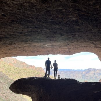
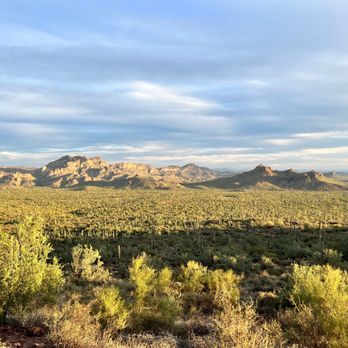


I arrived around 8:30 AM, and it was the perfect time to visit. The parking lot is small, but there were barely any cars when I got there. Last time, I came around 11 AM, and the lot was packed--I couldn't find a spot and ended up going elsewhere. The hike was great, though a bit challenging through the rocky sections. It's about 3.3 miles round trip from the parking lot. If you're looking for a quiet escape and an amazing view from the cave, this is the perfect spot. read more



3 years ago
Steady, rocky, steep! Solid shoes, patience, and plenty of water are a must! Trail is about 3.4 miles and takes a little over 2 hours. 10/10 recommend! Note: the trail rating of hard is accurate. This isn't an easy trail; many challenges and steep elevation all the way up (once you clear the ground). read more
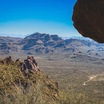


Have to get here earlier to bits the traffic. We got here at 9 on Monday, which was a perfect time since the morning weather is a bit chill in the winter. The parking lot or entrance to this trail is unmarked, so when you see a parking lot on your left side before Peralta Trailhead, that's the one. If you drive all the way to Peralta Trailhead then you drive to far. The trail itself very well marked with white arrows spray paint ( thank you whoever did that), but the entrance is a bit confusing. There are three trails at the entrance, one on the left and one on the right but the middle one with the barbed wires is the one. Its look like closed with barbed wires fence, you just need to go through it. This trail is a bit climb, but was fun and took us about 45 minutes going up and 35 minutes down. It might take longer for some people, but hey it's beautiful views here and take your time. read more



4 years ago
The book was quite a experience,I really enjoyed the thrill behind the book.It was a great post apocalyptic dystopian and I think I'm going to start reading more books because of this book. I definitely recommend this book to anyone trying to get into reading or even just a casual reader. Quick Sumatra:A girl named Cassie is living her life when a alien spaceship comes to earth and sends waves of human destruction till 96% of the world is wiped out.It is a fight for human survival and our primal instincts. read more


I cannot say I was overly excited when shawty asked "want to go for a hike at 7am?" There was approximately a 4 mile dirt road leading to the beginning of the trail head. Good thing we had a jeep. The trail begins flat and has a gradual incline. The last quarter of the trail is steeper. The view from the cave is beautiful. I'd rate this 6/10 for difficulty and 8/10 for view read more


I highly recommend this hiking trail. My group and I drove down early in the morning to beat the heat. Finding where the actual trail begins was a little tricky, make sure, after you park, you go through the gate entrance and through all the flat lands to start the actual hike. Also make sure to follow the white arrows to stay on the trail as it is easy to get off track. Closer to the cave the trail gets very steep. But once you reach the cave, it is truly a sight see, with amazing views of the AZ desert. On your way back down be very careful as there are lots of loose rocks, which makes it easy to slide and fall, especially if you are not wearing hiking boots. read more


4 years ago
Parking was busy at this trail on a Sunday at 10am. The trail to the wave cave is steel and has lots of loose gravel. I would recommend good tread on your hiking shoes and take caution going down! (I took a digger along with someone else in my party) Getting to the top there wasn't too much foot traffic but by noon the trail was busy. read more


3 years ago


I'll start off with the bad. Lots of cons but some great pros too. Cons: Unpaved roads for about 6-7 miles. Once you pass the Peralta elementary school on your right, driving in a tiny car is miserable and your car will look dirty AF. It was extremely bumpy and uncomfortable and a bit frightening to drive for 15 min like that. I'd prob say otherwise if I had a Jeep or a big car tho. TRAIL IS NOT MAINTAINED. The hike to the wave was fine but coming back, we got lost because there is only ONE trail marker. We were so off course that it added an extra 90 min to the hike. I wouldn't mind this normally but I came with a couple of new hikers who were not ready for that. I am not a super experienced hiker myself but I've done my fair share of trails and have never gotten lost to the extent I did today at this trail. Literally no clear signs or directions at all. Just one janky sign at the start of the trail that isn't even labeled the Wave. If you are looking to do the Wave, park at the lot with the sign "Lost Goldman". This will take you to the wave. Was oddly crowded but no one person knew where the trail was Pros: Great workout and generally a fun hike- would rate it as a moderate hike. Easier than Toms Thumb. Saw lots of children and dogs on this hike so it's not difficult. Fairly short--about a mile to get to the trailhead and then 1.7 miles each way. No admission fee to enter. Great views at the top that make for a fun photo shoot Parking is okay if it the parking lot is not full. There's overflow parking at Lost Goldman. Go there instead of parking in the mini lot right next to the main parking lot. Mini lot scratched up my car because of the boulders. read more


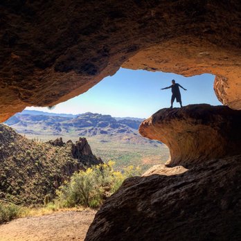
Hiked up to the Wave Cave with a group of fellow hikers this past weekend and had an absolute blast! The road was bumpy to get there (dirt and unpaved from just beyond the start of Peralta Rd) but luckily I was able to carpool with someone who had a truck. I did see some hikers take their sedans to the trailhead but would advise against it unless you're into scratches on the lower body and possible issues with your suspension. The trail itself is roughly 1.7 miles each way and about 950 feet in elevation gain. Most of that gain comes quick and steep at the end as you near the cave, so pace yourself and enjoy the incline! Once you're at the cave, it's a perfect photo op as well as a place to rest and enjoy the nice view southeast. Seriously, the views and unique experience in witnessing the wave firsthand can't be beat. The way down can be tricky as you're dealing with loose stones and sand but as long as you watch your step and stay careful, you'll be fine. Hit the trail and have some fun! read more


4 years ago
2 years ago

The hike is relatively easy for anyone in shape. The inclination at the end gets the heart rate up, but it's nothing crazy. The biggest challenge with this short hike is attempting it in temperatures above 85℉. Always bring a lot of water and be sure to hike with a friend. Again, this is a nice reasonable hike with low risks, but the Arizona climate is always an issue if you don't take it seriously. If you are getting back in shape, this is a good hike that can push you. The hike is exactly 1.54miles each way (3.08miles round trip). There is a total climb of 939 feet which adds about 25% effort to your otherwise moderate calorie burn. Important Note: finding the cave is relatively easy once you know which trail to follow. There is one crucial spot along the early part of the trail that requires you know what to do. The trailhead starts at the dirt lot where Carney Springs Rd (now just a dirt path that is not open to public vehicle traffic on a regular basis) branches off of Peralta Rd (77). You follow Carne Springs Rd until it stops. At that point, the Lost Goldmine trail is running north/south across your hiking trail. There are markers to clearly go left or right (north or south). Choosing either of those is NOT the way to Wave Cave. Instead look straight ahead and there is a cattle wire fence with a V-Gate to let you pass through. That is the direction to Wave Cave. Go straight west towards the mountains. You will see the trail continue as you cross the fence line. Assuming you make it to the cave, one of the biggest boons of this hike is the scenery. First, as you ascend to the cave you will get an increasingly beautiful panoramic view of the Gold Canyon valley which stands in the eastern shadows of the Superstition Mountain range. If hiked 3-10 days after a rainfall, the plant life, valley and mountain sides are covered with native greenery and flowers. Second, arriving at the cave is itself a unique respite for Arizona hikes. Unlike Wind Cave and other so-called "cave" trails, this ends at an actual cave that is deeply hollowed out into the side of the mountain. It is 15-20℉ cooler in the cave than outside, making it perfect for Arizona hiking. And the cave is also unique in its internal massive size which could easily fit a few hundred people. read more


6 years ago

I should preface this by saying that this hike can be extremely challenging for novice hikers. Please bring extra water, as it gets extremely hot. Also, please wear proper shoes/hiking boots because this is an extremely rocky trail and one false move could injure you! If you plan on bringing your fur babies, make sure to bring extra water for them as it can get very hot. Since it is rocky, please be mindful of your pups as they can scratch their paws/legs/etc. Take frequent breaks in between if the climb gets difficult. It's not about how quickly you can finish, it's about the journey to the destination. I felt so fortunate to be able to hike this trail during this time because the wild flowers were starting to bloom! There are two points where you can start from, with two different parking areas. each point will still take you up to the cave, but the trail we took was an extra mile longer! We got here at around 10 in the morning and while there was a nice, gentle breeze, it was hot as heck! The climb was gradual at the beginning until halfway through the trail. I would rate this as a moderate hike-- up until the very end. The last quarter mile of the hike is a continuous and very steep climb to get to the top, so take frequent breaks if needed!! Don't pass out! Once we got to the top, everything was worth it! The breeze felt amazing, the view couldn't be beat, and of course, the Wave Cave = impromptu photo shoot. The climb down is definitely a lot easier than the climb up! As always, happy training, hikers! read more


5 years ago

6 years ago
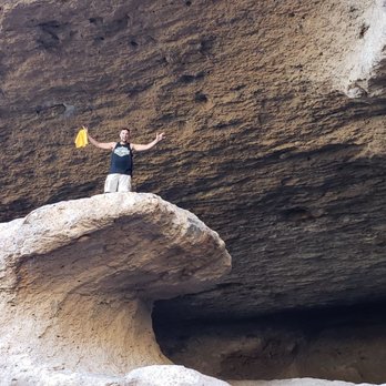
The only reason it got only 4 stars is that my mother and girlfriend were not able to make it all the way to the cave and see it. Not a hike for novice hikers, in my opinion. I hike quite a bit and the last bit of the hike up to the cave had me fairly winded. Totally worth it tho because the rock in front of the cave does look like a wave and there is a nice view looking out. read more


6 years ago
Great hike and amazing trail for a moderate challenge. Beautiful views as well. Wish I was 100% I would hike this regularly. read more


8 years ago
This is a nice hike. FYI: The road back the last 5ish miles is dirt road so expect to get that vehicle dirty. I had fun taking the truck out on this road. Its a decent road compared to the road to Sycamore Canyon. The hike was a lil butt kicking only the last lil 1/4 mile up trek. The reward at the top is a magnificent view and some calories burned. read more


Just a short drive from the valley! But it does include a windy dirt road. Parking lot is small. The trail is NOT well marked & it's very easy to wander off so be careful. Lots of loose gravel & some rocks to climb over but it's a fairly easy hike for everyone 6 and up. I took my 4 year old yesterday & she did well but needed lots of help or wanted to be carried. The last 1/4 mile is the hardest but it's not bad. So worth the pretty & Cave! The cave is larger than I thought! Lots of fine sand so be prepared to get pretty dusty & dirty! Use caution heading bavk down, it's so easy to slip. My friend brought hiking sticks & they were awesome for the hike down! Don't forget water & sunscreen, even in the winter! read more


7 years ago

7 years ago
Seriously how has it taken me this long to hike here ! Absolutely breathtaking!!!! 360 views all around, taking in the gorgeous az sun ! The trail from parking lot to the cave is about 3.5 miles up and down! It's a rocky trail with some steep areas a little of slippery worn trail in some sports as well ! We ran into a rattler in the way up and made sure to keep our eyes open the rest of the hike. Bring plenty of water it may be a short hike but you get a lot of sun most of the trail if you go in the am hours! Sunscreen water and some good shoes ! Take in the views ! I didn't bring my son because it was my first time but I definitely will next ! read more


6 years ago
Love this trail. The views are spectacular. Parking is scarce though. The hike is moderate but steep and slippery in some spots toward the top. Highly recommend. read more


8 years ago
Super easy hike to do with friends in the Superstition. Saw tons of college students and families for this quick almost 3 mile hike, round trip. Def take some shadow shots at the wave. read more


10 years ago
Great views and a nice cool breeze... Nice 3.7 mile hike from the parking lot round trip. Easy hike if not for loose rocks, that being said I would call it a moderate hike. Wear good boots and bring some water and it's a nice short hike. Parking area is on the dirt road you take to Peralta Trailhead heading north in Peralta Road in Gold Canyon Arizona. Park in the yellow fenced parking area before Peralta Trail on the left side of the dirt road as you near the mountain. It is a lot that holds about 10 cars or so. Follow the rocky dirt trail from the lot and when you reach the barbed wire fence DO NOT go right or left but go straight through the fence opening that you must zig zag to get through. Follow the trail up and keep right and you cannot miss it. read more


7 years ago
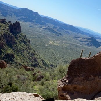
I'll start out that I very much underestimated this trail. I went through the reviews and figured since kids could do it I should be able to breeze through it. Once I started and made it roughly halfway through I strongly thought about turning back but after some thought I was determined not to let the climb win. Don't let this steer you away from attempting this though. Just make sure you are prepared. 1. Hiking shoes with long socks 2. At least 2 bottles of water 3. Gloves for when it gets very rocky and You need to climb a bit to protect them hands. 4. ARRIVE EARLY! I got there at 8 thinking i should be okay. It was tough getting a parking spot even then. It took me about 2-2.5 hours to get to the top and then about 1.5-2 hours to get down. *i was an idiot though and wore NEW hiking shoes with no show ankle socks -trust me lesson learned and I'm paying for it. About 10 mins into the hike you will stumble on a barb wire looking fence. There is a latch you can pull up on so you can move the post to get through. Also, I read you will need a permit or day pass. If you go to Safeway Or circle k gas station you can go get a day pass for $8. At the cite I didn't see to many cars though with permits on their car so take this suggestion as needed. It was my attempt of "I tried to follow the rules" read more



7 years ago
One ove my fave hikes and its definitely work it! The last little bit before the cave is pretty steep up so be ready for a good leg work out and wear good shoes it's a pretty rocky trail . It's nice they have started to make the trail so it's easier to find. It about a 3 mile hike but I would say medium to difficult but the pay off is amazing! Definitely need to do this hike at least once! read more


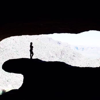
For a quick 3.5 mile hike, this one is a great one to do! We did this hike when it was 90° out, it was a bit toasty out, but there was a good amount of wind that kept us nice and cool. The first part of the hike are huge heavily trafficked trails and then once you get on the mountain the rocks are a bit loose on the trail. So make sure you have good sturdy hiking shoes on. The view of the cave was fascinating. We got some great photos of the cave and the view.. Don't want to miss this hike if you live in Arizona! Make sure you bring lots of water if you're not from here the AZ heat really creeps up on you. read more


Page 1 of 2
More info about Wave Cave
10947 E Peralta Rd
Gold Canyon, AZ 85118
Directions
Hours
Indoor Amenities
Outdoor Amenities
Ask the Community - Wave Cave
Review Highlights - Wave Cave



























Why does Yelp recommend reviews?
4 reviews that are not currently recommended
The reviews below are not factored into the business's overall star rating.

2 years ago

6 years ago

4 years ago

8 years ago
Wave Cave - hiking - Updated August 2026
Best of Gold Canyon
People found Wave Cave by searching for…
Things to Do in Gold Canyon, AZ
Photo Spots in Gold Canyon, AZ
Places to Take Pictures in Gold Canyon, AZ
Watch Sunset in Gold Canyon, AZ
Hiking Trails With Waterfalls in Gold Canyon, AZ
Off Road Trails in Gold Canyon, AZ
Secret Spots in Gold Canyon, AZ
Scenic View in Gold Canyon, AZ
Scenic Overlook in Gold Canyon, AZ
Beautiful Views in Gold Canyon, AZ
Dog Friendly Parks in Gold Canyon, AZ
Walking Trails in Gold Canyon, AZ
Playgrounds in Gold Canyon, AZ
Fun Places to Go in Gold Canyon, AZ
Sunset View in Gold Canyon, AZ
Dog Friendly Hiking Trails in Gold Canyon, AZ
Things to Do on a Rainy Day in Gold Canyon, AZ
Attractions in Gold Canyon, AZ
Trending Searches in Gold Canyon, AZ
Consignment Shops near Wave Cave
Dog Friendly Things To Do near Wave Cave
Eyebrow Threading near Wave Cave
Permanent Makeup near Wave Cave
Public Golf Courses near Wave Cave
Scenic Night View near Wave Cave
Scenic Overlook near Wave Cave
Trading Card Shops near Wave Cave
Browse Articles
Browse Nearby
Browse Brands
Related Searches in Gold Canyon, AZ
Best Dog Hiking Trails Around Gold Canyon, Arizona
Best Fishing Locations and Guides in Gold Canyon, Arizona
Best Places for Horseback Riding in Gold Canyon, Arizona
Best Sightseeing Experiences Available in Gold Canyon, Arizona
Check Out Off Road Trails in Gold Canyon, Arizona
Discover Dog Friendly Trails to Explore in Gold Canyon, Arizona
Discover Easy Hiking Trails Near Gold Canyon, Arizona
Discover Kid Friendly Hiking Trails in Gold Canyon, Arizona
Discover Popular Bike Trails in Gold Canyon, Arizona
Discover Scenic Mountain Bike Trails Near Gold Canyon, Arizona
Discover Walking Parks in Gold Canyon, Arizona Near You
Discover a Hiking Trail in Gold Canyon, Arizona
Discover the Best Night Hike Trails in Gold Canyon, Arizona
Dog-Friendly Hikes With Dogs in Gold Canyon, Arizona
Enjoy Camping Adventures Around Gold Canyon, Arizona
Enjoy Kayaking Adventures in Gold Canyon, Arizona
Enjoy Off Leash Dog Hikes in Gold Canyon, Arizona
Enjoy Scenic Places to Walk in Gold Canyon, Arizona
Enjoy Tent Camping Spots Around Gold Canyon, Arizona
Enjoy a Beautiful Waterfall Hike in Gold Canyon, Arizona
Enjoy the Best Walking Path in Gold Canyon, Arizona
Enjoy the Best Walking Trails in Gold Canyon, Arizona
Enjoy the Scenic Boardwalk Attractions in Gold Canyon, Arizona
Experience Stunning Sunset Views in Gold Canyon, Arizona
Explore Beautiful Parks and Green Spaces in Gold Canyon, Arizona
Explore Easy Hikes Perfect for All in Gold Canyon, Arizona
Explore Fun Activities to Do in Gold Canyon, Arizona
Explore Popular Campgrounds Near Gold Canyon, Arizona
Explore Top Dog Parks in Gold Canyon, Arizona Near You
Explore the Best Beach Spots in Gold Canyon, Arizona
Family Friendly Hiking With Kids in Gold Canyon, Arizona
Find Top Dog Friendly Parks to Visit in Gold Canyon, Arizona
Find Top-Rated Waterfalls in Gold Canyon, Arizona Now
Hiking Trails With Waterfalls in Gold Canyon, Arizona
Off Leash Dog Hiking Trails in Gold Canyon, Arizona
Picnic Areas With BBQ Pits Available in Gold Canyon, Arizona
Plan a Scenic Drive Route Near Gold Canyon, Arizona
Popular Outdoor Activities to Try in Gold Canyon, Arizona
Popular Picnic Spots to Visit in Gold Canyon, Arizona
Popular Waterfall Hiking Trails in Gold Canyon, Arizona
Safe and Fun Parks for Kids in Gold Canyon, Arizona
Top Hiking Trails to Explore in Gold Canyon, Arizona
Top Playgrounds for Kids to Enjoy in Gold Canyon, Arizona
Top Running Trails to Explore in Gold Canyon, Arizona
Top Swimming Lakes to Enjoy in Gold Canyon, Arizona
Top Swimming Spots and Pools in Gold Canyon, Arizona
Top-Rated Camping Sites in Gold Canyon, Arizona


