Hill 88 Photos



You might also consider


More like Hill 88
Recommended Reviews - Hill 88
Start your review...


Reviews With Photos


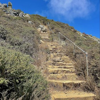
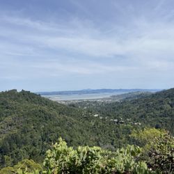
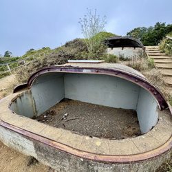
For my 88th #YelpChallenge2020 review, that honor goes to Hill 88. I just thought that would be very appropriate. So Hill 88 was originally 1053 feet above see level and was flattened on top to install a radar control station for the Nike Missile Missile Site SF-88 across and below the valley by Point Bonita Lighthouse. There's several ways and trails to get to the top and the two most popular starting points are from Muir Beach, which is the longer route and the closer Rodeo Beach, located below Marine Headlands. A third and much longer route is via the Tennessee Valley Trail from Tamalpais Valley. My usual route is the taking the Rodeo Beach Coastal Trail then switching to the Coastal Trail, which will lead directly all the way up to the top of the hill. If you want to take a loop, head back down Coastal Trail and take the Wolf Ridge Trail then switch to the Miwok Trail, which lead you back down Rodeo Lagoon. Or you can also do the reverse and start from this end. However way you want to do it, it will lead you to some great views of the entire valley. It's typically foggy in the morning and the fog would usually burn off by mid-day in the summer....or sometimes Karl just want to hang around the entire day. I've hiked when it was foggy and on a clear day, but if you want to get some views, I recommend hiking here later in the day. I've also hiked it solo a couple of times early in the morning on the mist of the fog. It was eerie getting to the top as I was the only one there and haven't seen anyone during my hike. As I was headed back down, I see a guy about 50 yards away from me and he was butt-naked. I even recorded it on my IG story as surely no one would've believed if I told 'em the story. I don't know if that encounter was scarier than being there exploring alone. We've also hiked this with a large group several times over the years, and you can always veer off any trail of your choosing depending on where you want to go on that particular day. It's quite a workout since you're constantly going up hill, but the views from up there is more than worth the reward. Make sure to stop by Battery Townsley to explore the casemates and check out the big gun. Another thing I've noticed during my many hikes are the graffiti artwork on a lot of these places. I've seen a "Pad Thai" graffiti from the North Bay, East Bay and South Bay. This guy or gal surely have been around around a lot of places. Hill 88 is a great place to hike as you will hit different peaks, valleys and different terrains. #YelpChallenge2020 review No. 88
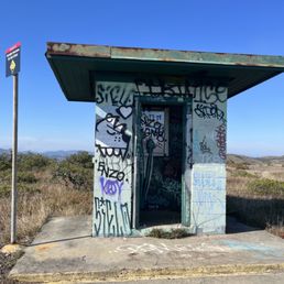

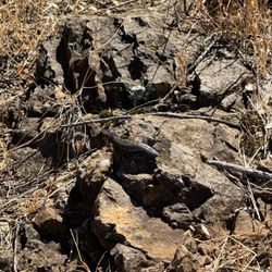
Well worth the hike, and I say this as someone who thinks 3 miles as impossible. You can hit the battery townsley and another small graffitied battery on the way up too. I went on a sunny day that turned very foggy and Misty at the end. BRING A JACKET it will be windy up there. The photos were amazing and it was nice to finally be in an urban feeling abandoned place again, the graffiti was pretty incredible and the views and wildlife on the way up are awesome. Lots of lizards and flowers. Definitely visit if you're into urbex. I'm so glad they let this be accessible instead of closing it off. It is truly the best part of this area besides the marine mammal center to me.


An amazing view of the city, Golden Gate Bridge, and Rodeo beach! You can also see the missile bunkers and an abandoned radar room from the Nike Missile program. We started from Tennessee Valley trail and it was a really nice even though gloomy and windy. The trail is pretty crowded and as always wear your mask, we were disappointed to see a number of people without.


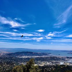
A really nice hike! Beautiful views of the coastline and the city (you can see the bridge, Baker Beach, Richmond, Twin Peaks, and Ocean Beach, just to name a few notable sites). Be aware: There is basically no cover. Be prepared to be in the sun all day. If you want to see Hill 88, head up to the north from the fort's parking lot, not down across the laguna on the beach. There are a lot of cool spots to stop and take a snack. So much so that our 5.8 miler (including our detour down the beach away from Hill 88, unbeknownst to us) took about 4.5 hours. Just know that for every spot that looks like it has a cool bunker with a really cool view, there is probably another one just a little further on that has an even cooler bunker with an even cooler view. We came in November, and while it got pretty warm in the sun, once we got past Hill 88 and took the Wolf Ridge & Miwok trails back (so as not to backtrack), these were completely in the shade as they were on the eastern side of those mountains and it got really chilly really fast. There were some people doing graffiti art on the buildings at Hill 88 as well. It looked like the start to something really cool. Trail map: http://www.yelp.com/biz_photos/hill-88-mill-valley?select=Jq7TGpIGMPxWBXXxjFEi_w#Jq7TGpIGMPxWBXXxjFEi_w


Cool hike, great views! (If it's not foggy, that is..) the hike is about 5.6 or so miles, has a good amount of elevation and a cool abandoned radar station and missile bunkers to check out on the way. We parked at rodeo beach, and started the hike off to the right side, if you're looking at the beach. The coastal trail takes you up the hill, then take the miwok trail down another mile or so to get back. We then walked along the road for a few minutes at fort Cronkite to circle back to the parking lot. Great for a Sunday hike, and dogs are allowed on the trail.


Good place for bot hiking and learning military history. Although it was foggy when I hiked here, it was interesting to see Nike missile site and learn about the Cold War.


We parked at Rodeo beach and made our way to the coastal trail. "Is this really it?" I stared at what looked like the trail, my friend said it looked more like a nature walk.. We shrugged and continued on with the two pooches we brought. Chill nature walk my butt. Because that and my thighs are what ended up on fire once we really got to the incline. Though all-trails said this one would be 3 miles out and back, we wound up veering off the coastal trail and taking an off-trail which added some distance. My mom's dog loved it. Intense cardio. Awesome views. We ended up clocking in a little over 5 miles out and back.


Lots of climbing and steps yet the views make this hike magnificent! The rocks have such fabulous colors mixed in with the chert. My first time finding the labyrinth- quite special to walk it. You are viewing the majestic Pacific Ocean yet also seeing Sutro Tower & the Golden Gate Bridge- just wow! read more


Such a great find in the Headlands, I love taking photos of old graffitied buildings and this place is one of the better ones. That being said this is a hike! I love hiking, no problem but when I first when with a photographer friend he couldn't handle the hike, so we had to turn around. Treat this as a hike first and for something easier to get in and out for photography there are many bunkers in the Headlands that are better suited for this. The hike is about 4 miles RT and uphill the whole way. It's not super steep but it's a constant incline. It took me a little more than an hour to get to the top. I thought it was quite beautiful with such a depth of field with views of the ocean, city, Tennessee Valley, Mount Tam, and the East Bay. Sounds of the ocean waves and ocean buoys were always in the distance, it felt very maritime. Tons of birds chirping and wildflowers as well. The headlands are rather cool and foggy for the majority of the time. I'd avoid this hike on a sunny 80-degree day with no clouds because there is no shade. read more


When it comes to the Marin Headlands, there are so many wonderful hiking trails to explore. The hike up Hill 88 is definitely one of them. Hiked this trail as a loop from Rodeo Beach and back last summer, and it was absolutely stunning. What I love about this hike is that you can extend or shorten it to your liking. The actual hike up to Hill 88 and back is only about 3.2 miles roundtrip, but it's all incline on the way up. As you make your climb, views of the coast will meet you at every stop. Going up the Coastal Trail is mostly paved, but once you reach the top, it turns into a dirt path surrounded by beautiful shrubbery. On the way up, you'll pass by the old Battery Townsley and several different scenic viewpoints. Once you reach the old bunker at the top, you'll know that you've made it to the end of Hill 88. From here, you can explore bunker hill, turn around and head back to the beach, or continue hiking along several different trails. I connected to Wolf Ridge and the Miwok Trail which looped me back to Rodeo Beach. If you plan on doing this loop, expect about a 5 mile-ish hike. Since it's most downhill, the descent back is pretty easy and enjoyable. There are tons of colorful wildflowers and rampant wildlife along the these trails. I would encourage anyone to start hiking as early as possible to avoid the crowds and to secure parking. I started my hike from Rodeo Beach in the morning, and there was plenty of free parking. The Coastal Trail is usually heavily trafficked, but connector trails aren't as popular. Most people were wearing masks, and many of the trails are wide enough to social distance. Also, these trails are pretty much completed exposed. Sunscreen, shades, and a hat is kind of a must (especially during the summer). It gets windy as you make your way back down, but it feels good when it's warm out. There's definitely a lot to explore on Hill 88 and beyond. Would highly recommend this hike if you're planning on traversing the headlands. read more


For my 88th #YelpChallenge2020 review, that honor goes to Hill 88. I just thought that would be very appropriate. So Hill 88 was originally 1053 feet above see level and was flattened on top to install a radar control station for the Nike Missile Missile Site SF-88 across and below the valley by Point Bonita Lighthouse. There's several ways and trails to get to the top and the two most popular starting points are from Muir Beach, which is the longer route and the closer Rodeo Beach, located below Marine Headlands. A third and much longer route is via the Tennessee Valley Trail from Tamalpais Valley. My usual route is the taking the Rodeo Beach Coastal Trail then switching to the Coastal Trail, which will lead directly all the way up to the top of the hill. If you want to take a loop, head back down Coastal Trail and take the Wolf Ridge Trail then switch to the Miwok Trail, which lead you back down Rodeo Lagoon. Or you can also do the reverse and start from this end. However way you want to do it, it will lead you to some great views of the entire valley. It's typically foggy in the morning and the fog would usually burn off by mid-day in the summer....or sometimes Karl just want to hang around the entire day. I've hiked when it was foggy and on a clear day, but if you want to get some views, I recommend hiking here later in the day. I've also hiked it solo a couple of times early in the morning on the mist of the fog. It was eerie getting to the top as I was the only one there and haven't seen anyone during my hike. As I was headed back down, I see a guy about 50 yards away from me and he was butt-naked. I even recorded it on my IG story as surely no one would've believed if I told 'em the story. I don't know if that encounter was scarier than being there exploring alone. We've also hiked this with a large group several times over the years, and you can always veer off any trail of your choosing depending on where you want to go on that particular day. It's quite a workout since you're constantly going up hill, but the views from up there is more than worth the reward. Make sure to stop by Battery Townsley to explore the casemates and check out the big gun. Another thing I've noticed during my many hikes are the graffiti artwork on a lot of these places. I've seen a "Pad Thai" graffiti from the North Bay, East Bay and South Bay. This guy or gal surely have been around around a lot of places. Hill 88 is a great place to hike as you will hit different peaks, valleys and different terrains. #YelpChallenge2020 review No. 88 read more


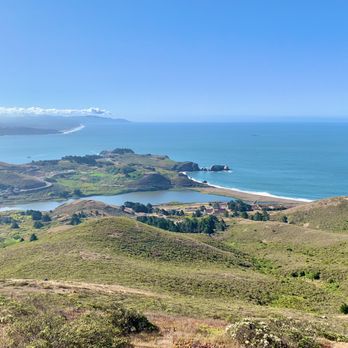


Well worth the hike, and I say this as someone who thinks 3 miles as impossible. You can hit the battery townsley and another small graffitied battery on the way up too. I went on a sunny day that turned very foggy and Misty at the end. BRING A JACKET it will be windy up there. The photos were amazing and it was nice to finally be in an urban feeling abandoned place again, the graffiti was pretty incredible and the views and wildlife on the way up are awesome. Lots of lizards and flowers. Definitely visit if you're into urbex. I'm so glad they let this be accessible instead of closing it off. It is truly the best part of this area besides the marine mammal center to me. read more


An amazing view of the city, Golden Gate Bridge, and Rodeo beach! You can also see the missile bunkers and an abandoned radar room from the Nike Missile program. We started from Tennessee Valley trail and it was a really nice even though gloomy and windy. The trail is pretty crowded and as always wear your mask, we were disappointed to see a number of people without. read more


A really nice hike! Beautiful views of the coastline and the city (you can see the bridge, Baker Beach, Richmond, Twin Peaks, and Ocean Beach, just to name a few notable sites). Be aware: There is basically no cover. Be prepared to be in the sun all day. If you want to see Hill 88, head up to the north from the fort's parking lot, not down across the laguna on the beach. There are a lot of cool spots to stop and take a snack. So much so that our 5.8 miler (including our detour down the beach away from Hill 88, unbeknownst to us) took about 4.5 hours. Just know that for every spot that looks like it has a cool bunker with a really cool view, there is probably another one just a little further on that has an even cooler bunker with an even cooler view. We came in November, and while it got pretty warm in the sun, once we got past Hill 88 and took the Wolf Ridge & Miwok trails back (so as not to backtrack), these were completely in the shade as they were on the eastern side of those mountains and it got really chilly really fast. There were some people doing graffiti art on the buildings at Hill 88 as well. It looked like the start to something really cool. Trail map: http://www.yelp.com/biz_photos/hill-88-mill-valley?select=Jq7TGpIGMPxWBXXxjFEi_w#Jq7TGpIGMPxWBXXxjFEi_w read more


Cool hike, great views! (If it's not foggy, that is..) the hike is about 5.6 or so miles, has a good amount of elevation and a cool abandoned radar station and missile bunkers to check out on the way. We parked at rodeo beach, and started the hike off to the right side, if you're looking at the beach. The coastal trail takes you up the hill, then take the miwok trail down another mile or so to get back. We then walked along the road for a few minutes at fort Cronkite to circle back to the parking lot. Great for a Sunday hike, and dogs are allowed on the trail. read more


10 years ago
We parked at Rodeo beach and made our way to the coastal trail. "Is this really it?" I stared at what looked like the trail, my friend said it looked more like a nature walk.. We shrugged and continued on with the two pooches we brought. Chill nature walk my butt. Because that and my thighs are what ended up on fire once we really got to the incline. Though all-trails said this one would be 3 miles out and back, we wound up veering off the coastal trail and taking an off-trail which added some distance. My mom's dog loved it. Intense cardio. Awesome views. We ended up clocking in a little over 5 miles out and back. read more


Hill 88 is a wild ghost town in the sky, hidden way up high in the Marin Headlands. It's on Wolf Ridge, between Fort Cronkhite/Rodeo Beach and Tennessee Valley. You can barely see it from below, and it's nothing like most of the old little rusty lifeless bunker sites. This is a crazy Cold War mega-complex teeming with tons of crows dancing in the whipping wind above huge expanses of the bay and SF. It's part of the old Nike Missile program, officially SF-88C. Was apparently the radar and control center (aka the IFC, or Integrated Fire Control area) of the Nike Missile launch site that's further down the hill to the east. At the top of Hill 88, after coming through the entry gate and guard's post (this place was only open to secret and top secret military officials when in use) you get a gorgeous view while feeling like you're in the middle of a post-apocolypse world (think mad max), or in a post-apocolypse, science fiction computer game (half-life) hiding out from assassins. It feels so abadoned but haunted. It's amazing what still lies unpreserved and raw up in those hills. What's so great is there doesn't seem to be a lot of people who go all the way up (probably because you'd never expect to find all that up there, even when just a little ways below it.) I hope this review doesn't spoil that... read more


17 years ago

14 years ago

16 years ago

14 years ago

14 years ago

11 years ago

11 years ago

15 years ago

16 years ago
13 years ago
More info about Hill 88
301 Enterprise Concourse
Mill Valley, CA 94941
Directions
(415) 331-1540
Call Now
Visit Website
http://www.nrdc.org/greengate/outside/adv4.asp
Hours
Indoor Amenities
Outdoor Amenities
Ask the Community - Hill 88
Review Highlights - Hill 88
You might also consider

























Why does Yelp recommend reviews?

Hill 88 - hiking - Updated August 2026
Best of Mill Valley
People found Hill 88 by searching for…
Abandoned Buildings in Mill Valley, CA
Scenic View in Mill Valley, CA
Off Road Trails in Mill Valley, CA
Great View Points at Night in Mill Valley, CA
Hiking Trails in Mill Valley, CA
Photo Spots in Mill Valley, CA
Secret Spots in Mill Valley, CA
Abandoned Places in Mill Valley, CA
Beautiful Views in Mill Valley, CA
Scenic Drive in Mill Valley, CA
Dog Friendly Hiking Trails in Mill Valley, CA
Dog Friendly Beaches in Mill Valley, CA
Walking Trails in Mill Valley, CA
Dog Friendly Things to Do in Mill Valley, CA
Fun Things to Do in Mill Valley, CA
Free Parking in Mill Valley, CA
Urban Exploration in Mill Valley, CA
Kids Friendly Beaches in Mill Valley, CA
Trending Searches in Mill Valley, CA
Browse Articles
Browse Nearby
BEST of Mill Valley, California Coffee near Hill 88
BEST of Mill Valley, California Things to Do near Hill 88
BEST of Mill Valley, California Restaurants near Hill 88
BEST of Mill Valley, California Scenic View near Hill 88
BEST of Mill Valley, California Parks near Hill 88
BEST of Mill Valley, California Breakfast near Hill 88
BEST of Mill Valley, California Campgrounds near Hill 88
Browse Brands
Related Searches in Mill Valley, CA
Affordable Kayak Rental Services in Mill Valley, California
Best Dog Hiking Trails Around Mill Valley, California
Best Fishing Locations and Guides in Mill Valley, California
Best Nature Trails for Hiking in Mill Valley, California
Best Places for Horseback Riding in Mill Valley, California
Best Sightseeing Experiences Available in Mill Valley, California
Check Out Off Road Trails in Mill Valley, California
Discover Dog Friendly Trails to Explore in Mill Valley, California
Discover Easy Hiking Trails Near Mill Valley, California
Discover Kid Friendly Hiking Trails in Mill Valley, California
Discover Popular Bike Trails in Mill Valley, California
Discover a Hiking Trail in Mill Valley, California
Discover the Best Night Hike Trails in Mill Valley, California
Dog-Friendly Hikes With Dogs in Mill Valley, California
Enjoy Camping Adventures Around Mill Valley, California
Enjoy Kayaking Adventures in Mill Valley, California
Enjoy Off Leash Dog Hikes in Mill Valley, California
Enjoy Scenic Places to Walk in Mill Valley, California
Enjoy a Beautiful Waterfall Hike in Mill Valley, California
Enjoy the Best Walking Path in Mill Valley, California
Enjoy the Best Walking Trails in Mill Valley, California
Explore Beautiful Parks and Green Spaces in Mill Valley, California
Explore Easy Hikes Perfect for All in Mill Valley, California
Explore Fun Activities to Do in Mill Valley, California
Explore Popular Campgrounds Near Mill Valley, California
Explore Popular Dog Walking Trails in Mill Valley, California
Explore Top Dog Parks in Mill Valley, California Near You
Explore the Best Beach Spots in Mill Valley, California
Explore the Best Swimming Holes Around Mill Valley, California
Family Friendly Hiking With Kids in Mill Valley, California
Find Beautiful Views in Mill Valley, California
Find Cozy Camping Cabins in Mill Valley, California
Find Top Dog Friendly Parks to Visit in Mill Valley, California
Find Top-Rated Waterfalls in Mill Valley, California Now
Find the Best Parks for Picnics in Mill Valley, California
Hiking Trails With Waterfalls in Mill Valley, California
Off Leash Dog Hiking Trails in Mill Valley, California
Popular Outdoor Activities to Try in Mill Valley, California
Popular Picnic Spots to Visit in Mill Valley, California
Popular Waterfall Hiking Trails in Mill Valley, California
Safe River Swimming Areas in Mill Valley, California
Safe and Fun Parks for Kids in Mill Valley, California
Top Hiking Trails to Explore in Mill Valley, California
Top Playgrounds for Kids to Enjoy in Mill Valley, California
Top Running Trails to Explore in Mill Valley, California
Top Swimming Lakes to Enjoy in Mill Valley, California
Top Swimming Spots and Pools in Mill Valley, California
Visit Popular BBQ Park Locations in Mill Valley, California
Walk Dog Friendly Hiking Trails in Mill Valley, California
Walk the Best Paved Walking Trails in Mill Valley, California


