Mt. Tamalpais East Peak Photos
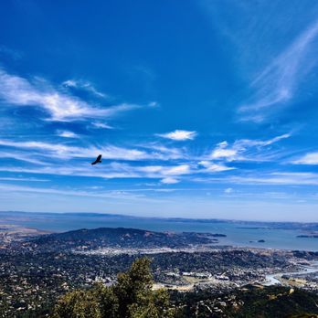


You might also consider


More like Mt. Tamalpais East Peak
Recommended Reviews - Mt. Tamalpais East Peak
Start your review...


Reviews With Photos


Once of the best views you can get of the bay if you catch it on a clear day. I recommend going in the fall as there is a better chance of no fog. There is a road and parking lot almost all the way to the top which takes about 30 minutes from Mill Valley, and it's a 10 min up-hill walk to the fire tower. View from the top is beautiful!


Review milestone 6,200. When I recently drove to the summit of Mt. Diablo, I asked myself what other mountains should I conquer in the Bay Area? OK, I didn't have a sherpa, and I get winded after five minutes on an elliptical machine, but I'm certainly not above taking a mini-road trip for my 6,200th Yelp review. Yep, I had never been to the East Peak of Mt. Tam before, and I thought for sure that it would be one of those tourist magnets where I'd be waiting in line for a parking space. That prompted me to be a masochist and face the morning rush hour. I arrived impressively at 7AM when it officially opened. However, on a Tuesday morning after a long and winding drive on the Panoramic Highway, the East Peak was as empty as a Trump rally in the Castro. The park ranger wasn't even there yet, and I was fumbling around trying to locate the little envelopes to insert the $8 parking fee. Once I figured out they were in the side of the parking box, I started my stroll on the Verna Dunshee Loop Trail, probably the most scenic trail in the North Bay if not the entire Bay Area. It was hardly a trail at all as it was flat, paved, and hardly 3/4 of a mile. Believe me, you won't break a sweat, and on a clear day, I could see the city and the north bay like I was a topographer. Somewhat more challenging was the Summit Fire Lookout Trail, which was even shorter but on a steady incline with some heavily rocky terrain after an initial plank walk. At 2,571 feet, the stone lookout tower beckons and the inevitable selfie. Oops, I forgot. On my second circuit of the loop trail, I ran into the ranger who was clearing some brush from the loop trail. He said the emptiness was pretty normal on a weekday. I was here for a couple of hours, and except for his truck, there still wasn't a single vehicle in the lot. There were a number of pullout spots along the way to enjoy more panoramic views on the Panorama Highway. Just a good reminder why I live in Northern California. RELATED - Up for a hike? Here's a collection of trails I've walked and reviewed: http://bit.ly/2OrC8nU


Long trek, but is it worth it? I'd say completely! Now you can hike up to the to the top, but let's hope you are in shape as it's a doozy. I'd preferred to drive up and park and finish the last bit up to the top where the tower is located. The views are spectacular on a clear day, and I be either sunrise or sunset are even better! Parking is quite simple, either pay in cash ($8) or download an app (Yodel Parking). To save yourself the hassle, download the app beforehand and get your pass as their WiFi really doesn't work and service is nonexistent. I will give you some fair warning, many cyclists use this massive hill as a workout, so be prepared as they are everywhere. Many brought food to the top and ate it there, but I have no clue if it's actually allowed, but no one is really monitoring. As for the final hike up from the parking lot, it can be tricky if you do not have good shoes or not good balance, so just a heads up on that one. Other than that, mark this as must do if in the area!


Wanna get away? Though not the tallest peak in the Bay Area, standing at 2,569 feet (783 meters), Mt. Tamalpais East Peak provides the best view, in my humble opinion. The highest point of Mt. Tamalpais is listed at 2,571, though it was a lot taller as huge chunks of the mountain top was removed bulldozed by the U.S. Air Force to install a station during the Cold War....but that story is for another day. Mt. Tamalapais is what the Coast Miwok named the mountain támal pájiṣ, meaning "west hill" in their native language. It remains sacred to the Native Americans and locals alike. Every time I come up here on East Peak, I feel an inner peace and calmness regardless of the weather conditions. Actually, the weather up here is different from the lowlands as on a typical foggy day, it could be nice and sunny up here as you drive above the clouds. Karl always comes in rolling from the west and it's quite a sight to behold as he blankets the Golden Gate Bridge and the wester side of San Francisco. There's a parking lot ($8) to the visitor's center, but if you're cheap like me, I often park on the side of the road (E. Ridgecrest Blvd.) on the bottom of the hill and take the trails (Eldridge Grade or Old Railroad Grade Trail) up here or just walk up the same road depending on how you want to spend your time here. The visitor's center is typically staffed by volunteers and there's a cool Gravity Car that volunteers would explain on how people used to get up there back in the day. At the base of the peak is the Verna Dunshee Loop Trail that is a must for first time visitor. It's a quick 0.7 miles around the base that provides you a view of the Bay Area from every angle. There's a lookout platform and a cool mini bridge that is absolutely stunning. Just a few steps from the mini bridge is where locals practice their rock-climbing skills. As you continue on this loop trail, you have the option of taking N. Knee Trail that connects to Eldridge Grade that will take you to Inspiration Point. But if you just want to stay at the base of the peak, you can skip that and take the trail that goes up East Peak as you circle back to the visitor's center. Getting to the top is pretty easy is it's only a short 0.3 miles hike. It starts on a wooden plank trail that transitions into dirt and rock. There's the view of the Bon Tempe Lake and reservoir to the north then San Rafael and surrounding cities below. As you make the bend, the San Rafael/Richmond Bridge, San Quentin prison, Tiburon, Angel Island and the rest comes to view. As you near the top, the Fire Lookout Tower (AKA Gardner Lookout) sits at the very top of East Peak. Again, this is manned by volunteers and they can spend the night here. One of these days, I'll volunteer on this fire lookout tower and to view the Bay Area at night must be quite an experience from up here. We've been up here several times and it always takes our breath every time. There's only a few places where you'll feel like you're on top of the world and East Peak is one of those amazing places. Several years ago, I even witnessed a guy proposing to his loved one up here, and it's certainly a great spot to do so. Better take notes, you young Romeos. Take your special someone here for that special day, or just to enjoy each other's company and soak in the stunning views. Either way, you'll be on top of the clouds. #YelpChallenge2020 review No. 100


Drive all the way up and you don't have to do a strenuous hike: choose the flat trail. If you want a strenuous hike, go to the summit. Plenty of drinking water fountains and clean restrooms. Ample parking. Download the Yodel app beforehand or use paper and cash to self park. Views are spectacular


Want a hike with spectacular views? You're in the right place. We visited Mt. Tam for the first time and we definitely found a hidden gem of spectacular views and hiking trails. We were lucky to come in a clear sunny day. We enjoyed the amazing 360 view of the Bay from the Mt. Tam lookout. We arrived around 3:30pm Sunday afternoon and surprisingly there were no crowds and plenty of parking. There's an $8 fee though to park at the East peak parking lot. Rangers were patrolling the area and collecting the fee from the deposit box. We look forward to visit again and explore nearby trails.
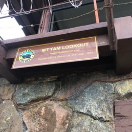

Went here for the first time. I've done some hiking on Mount Tamalpais, but never to the East Peak. First tip: Bring some dollars for parking. If you don't have change, why not leave a little extra in the envelope. It feels good to support our parks. The way I think of it, it's less than the cost of a beer in SF, and it makes you feel even better. There are restrooms available, so that is worth noting. The walk to the peak isn't arduous, but if you are not sure footed, it may be worth having a cane or walking stick. It wasn't smooth and paved, but it wasn't treacherous either. Still, I wouldn't have done the walk in sandals or flip flops. This is a fun walk, because it isn't long, and the view was absolutely wonderful. Really worth the time. If you go on a weekday, you'll be rewarded with more peace and quiet.


The drive up to the peak (from the Cataract Falls trailhead) was gorgeous and we stopped at several places just to look out into where the ocean meets the bay. My parents arrived and found parking easily on mid-Saturday afternoon. Self-paid $7 senior parking (since my parents are seniors - otherwise $8). My dad (in his 70s) and I hiked all the way up to the fire lookout together. The first half of the trail was smooth and easy with laid out stairs and pathways. The second half was a bit more rough and involved climbing up some rocks and narrow spaces, which made it more exciting for my dad and I. Each step we took, we were rewarded with a breathtaking view. I wouldn't recommend the hike to the top for seniors or the weak. The 360 degree view of the mountain, the sea, the ocean, and bridges and the SF skyline was one of my favorite experiences during my trip. From the top, it made me feel like I'm above the world despite the haze/fog. I would love to come back on a clear, fog free day! My mom was fearful of heights and didn't want to do a steep hike, so she did the handicap accessible trail loop (0.7 miles). She loved it the experience that also offered a similar 360 degree view. The bathroom was clean, nice and offered soap, which is a bonus. During the rest of our trip in the park, we've only seen porta potties. I would love to come back on a clear, fog free day!


Breathtaking! My family and I decided to have a fun girls day and incorporate a hike and a picnic brunch. We arrived at around 9am on an absolutely beautiful, sunny Saturday. The park ranger happened to be there and he was very helpful and helped give us guidance on where to start. Being that we are novice hikers we joked around and told him if he saw our car in the same spot after several hours, to send out the search team he was a good sport and joked around with us as well, but then noted on the serious side, he would definitely make sure to be aware and come searching if we were out for too long. Although funny, it set us at ease. On to the hike...stunning views of the Bay, easy trails that are wheel chair accessible. Ever person we encountered was super pleasant and friendly. Clean bathroom, clean grounds, completely relaxing. The highest part of the hike although very rocky, was actually not bad either. I've done other hikes and tapped out 10 minutes in, so this was a breeze comparatively. It can get a little warm during the summer, so make sure you have water and sunblock. You won't be disappointed.
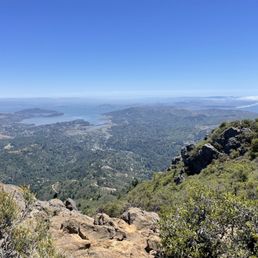

An absolute must on a clear day! If you have yet to experience the amazing views of the Bay from Mt. Tam on a clear day, the next time it's sunny out & you don't have any plans, drive on up to the East peak of Mt. Tam and soak it up. The hike up is a bit rocky, so make sure you're wearing closed-toed shoes. You can see North Bay, East Bay, SF, Mt Diablo, Mt. Sutro, San Bruno Mountain, Marin Headlands, the Bay, the Mt. Tam reservoir, and the Pacific Ocean. It's a perfect example of the magic of the Bay Area, and one of my favorite spots.


Love this hike. My friend and I parked at Mountain Home Inn and walked towards the trail entrance by the fire station. We started around 6am and hiked about 8 miles. It was summer time, so the heat and allergies definitely got to me, but I kept focusing on growing by booty and the view from the top was worth it! Aaaaaaamazing. I definitely would've taken the view for granted if I drove to the top. I'll be back!


Absolutely breathtaking view from the iconic little house at the top of Mount Tam. It was a beautiful day so we could see for miles and miles. Easy hike but definitely wear sneakers. Recommended for all ages, but ones that can walk.
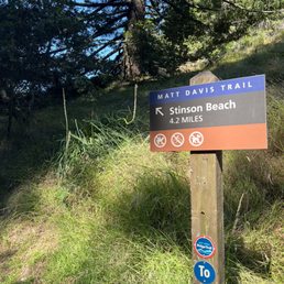

I've been wanting to come here for a long time. It was exactly what I expected! Simply amazing. The drive from Richmond was about 40 minutes- no traffic. Parking was $8 for the day pass. There were so many trails to choose from but I decided to take the Stinson Beach trail. I would consider this to be a moderate hike. I started at 10 and finished at 12. In total I did 4 miles! The trails were rocky and the view was still foggy but overall I had a great time. I'm looking forward to coming again and experiencing more of this beautiful park! I also loved that the trails were not crowded. Best part there is a Super Duper burger in town that you can stop and enjoy after a nice long hike!


GORGEOUS. The views were simply amazing at sunset! The Verna Dunshee loop is 0.7 miles and completely flat (under 20 minutes) while the East Peak trail is 0.3 miles and ~300 feet of elevation gain (around 30 minutes up-and-down). The East Peak trail was pretty challenging with uneven ground and steep elevation, but it's doable for most people as long as you take it slow. The east peak parking lot is $8 to park but super easy to access and plenty of spots available. You can scan a QR code at the entrance to the trails to pay, and wi-fi is provided. read more

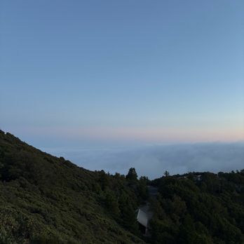
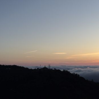
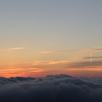


The Verna Dunchee loop is actually what brought us here. It is paved and flat and less than a mile making it an easy enjoyable peaceful walk, I did it in my fuzzy boots. When we finished my husband looked up at the fire look out and then back at me and said "you wanna?". So I returned to our vehicle put on tennis shoes and started up. The first part is wooden and easy but then all the easy stops. I am going to go ahead and call it a beginners rock scramble since you must use your hands some of the time. The views are stunning! Makes you stop and appreciate nature and all its miracles. Totally worth it but I will admit it was harder than I anticipated. The loss of the star is 8$ parking. Oh and the bathrooms were clean! Dog friendly. read more


Love coming here for sunset, it's a quick hike om the Verna Dunshee trail (less than .7 miles) to the fire station on the top. There's benches and scenic points throughout with the elevation gain. Views at the peak are amazing and you can catch the fog rolling in which makes for a really nice ambiance. Definitely worth the quick hike to get to the top! read more


3 years ago
Once of the best views you can get of the bay if you catch it on a clear day. I recommend going in the fall as there is a better chance of no fog. There is a road and parking lot almost all the way to the top which takes about 30 minutes from Mill Valley, and it's a 10 min up-hill walk to the fire tower. View from the top is beautiful! read more


2 years ago

Review milestone 6,200. When I recently drove to the summit of Mt. Diablo, I asked myself what other mountains should I conquer in the Bay Area? OK, I didn't have a sherpa, and I get winded after five minutes on an elliptical machine, but I'm certainly not above taking a mini-road trip for my 6,200th Yelp review. Yep, I had never been to the East Peak of Mt. Tam before, and I thought for sure that it would be one of those tourist magnets where I'd be waiting in line for a parking space. That prompted me to be a masochist and face the morning rush hour. I arrived impressively at 7AM when it officially opened. However, on a Tuesday morning after a long and winding drive on the Panoramic Highway, the East Peak was as empty as a Trump rally in the Castro. The park ranger wasn't even there yet, and I was fumbling around trying to locate the little envelopes to insert the $8 parking fee. Once I figured out they were in the side of the parking box, I started my stroll on the Verna Dunshee Loop Trail, probably the most scenic trail in the North Bay if not the entire Bay Area. It was hardly a trail at all as it was flat, paved, and hardly 3/4 of a mile. Believe me, you won't break a sweat, and on a clear day, I could see the city and the north bay like I was a topographer. Somewhat more challenging was the Summit Fire Lookout Trail, which was even shorter but on a steady incline with some heavily rocky terrain after an initial plank walk. At 2,571 feet, the stone lookout tower beckons and the inevitable selfie. Oops, I forgot. On my second circuit of the loop trail, I ran into the ranger who was clearing some brush from the loop trail. He said the emptiness was pretty normal on a weekday. I was here for a couple of hours, and except for his truck, there still wasn't a single vehicle in the lot. There were a number of pullout spots along the way to enjoy more panoramic views on the Panorama Highway. Just a good reminder why I live in Northern California. RELATED - Up for a hike? Here's a collection of trails I've walked and reviewed: http://bit.ly/2OrC8nU read more




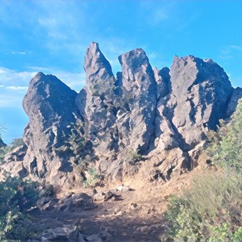


Long trek, but is it worth it? I'd say completely! Now you can hike up to the to the top, but let's hope you are in shape as it's a doozy. I'd preferred to drive up and park and finish the last bit up to the top where the tower is located. The views are spectacular on a clear day, and I be either sunrise or sunset are even better! Parking is quite simple, either pay in cash ($8) or download an app (Yodel Parking). To save yourself the hassle, download the app beforehand and get your pass as their WiFi really doesn't work and service is nonexistent. I will give you some fair warning, many cyclists use this massive hill as a workout, so be prepared as they are everywhere. Many brought food to the top and ate it there, but I have no clue if it's actually allowed, but no one is really monitoring. As for the final hike up from the parking lot, it can be tricky if you do not have good shoes or not good balance, so just a heads up on that one. Other than that, mark this as must do if in the area! read more

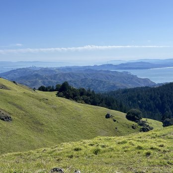


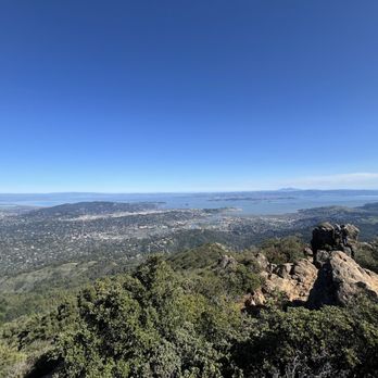


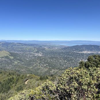

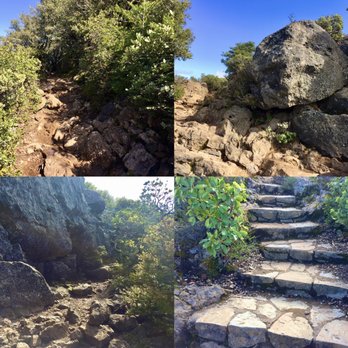
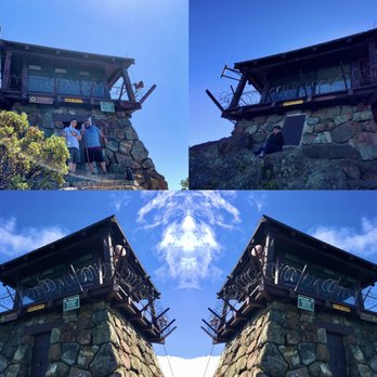
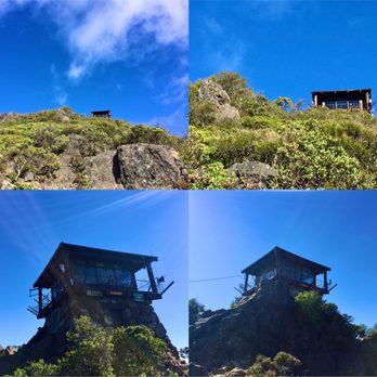
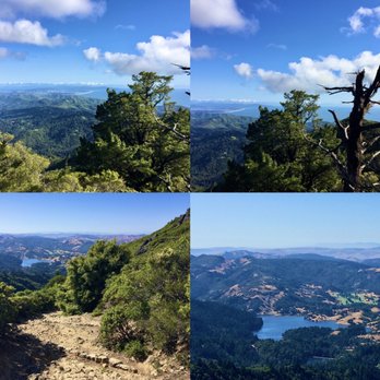
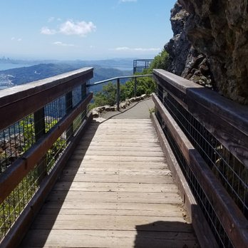
Wanna get away? Though not the tallest peak in the Bay Area, standing at 2,569 feet (783 meters), Mt. Tamalpais East Peak provides the best view, in my humble opinion. The highest point of Mt. Tamalpais is listed at 2,571, though it was a lot taller as huge chunks of the mountain top was removed bulldozed by the U.S. Air Force to install a station during the Cold War....but that story is for another day. Mt. Tamalapais is what the Coast Miwok named the mountain támal pájiṣ, meaning "west hill" in their native language. It remains sacred to the Native Americans and locals alike. Every time I come up here on East Peak, I feel an inner peace and calmness regardless of the weather conditions. Actually, the weather up here is different from the lowlands as on a typical foggy day, it could be nice and sunny up here as you drive above the clouds. Karl always comes in rolling from the west and it's quite a sight to behold as he blankets the Golden Gate Bridge and the wester side of San Francisco. There's a parking lot ($8) to the visitor's center, but if you're cheap like me, I often park on the side of the road (E. Ridgecrest Blvd.) on the bottom of the hill and take the trails (Eldridge Grade or Old Railroad Grade Trail) up here or just walk up the same road depending on how you want to spend your time here. The visitor's center is typically staffed by volunteers and there's a cool Gravity Car that volunteers would explain on how people used to get up there back in the day. At the base of the peak is the Verna Dunshee Loop Trail that is a must for first time visitor. It's a quick 0.7 miles around the base that provides you a view of the Bay Area from every angle. There's a lookout platform and a cool mini bridge that is absolutely stunning. Just a few steps from the mini bridge is where locals practice their rock-climbing skills. As you continue on this loop trail, you have the option of taking N. Knee Trail that connects to Eldridge Grade that will take you to Inspiration Point. But if you just want to stay at the base of the peak, you can skip that and take the trail that goes up East Peak as you circle back to the visitor's center. Getting to the top is pretty easy is it's only a short 0.3 miles hike. It starts on a wooden plank trail that transitions into dirt and rock. There's the view of the Bon Tempe Lake and reservoir to the north then San Rafael and surrounding cities below. As you make the bend, the San Rafael/Richmond Bridge, San Quentin prison, Tiburon, Angel Island and the rest comes to view. As you near the top, the Fire Lookout Tower (AKA Gardner Lookout) sits at the very top of East Peak. Again, this is manned by volunteers and they can spend the night here. One of these days, I'll volunteer on this fire lookout tower and to view the Bay Area at night must be quite an experience from up here. We've been up here several times and it always takes our breath every time. There's only a few places where you'll feel like you're on top of the world and East Peak is one of those amazing places. Several years ago, I even witnessed a guy proposing to his loved one up here, and it's certainly a great spot to do so. Better take notes, you young Romeos. Take your special someone here for that special day, or just to enjoy each other's company and soak in the stunning views. Either way, you'll be on top of the clouds. #YelpChallenge2020 review No. 100 read more





3 years ago
Drive all the way up and you don't have to do a strenuous hike: choose the flat trail. If you want a strenuous hike, go to the summit. Plenty of drinking water fountains and clean restrooms. Ample parking. Download the Yodel app beforehand or use paper and cash to self park. Views are spectacular read more


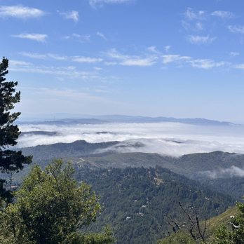


Want a hike with spectacular views? You're in the right place. We visited Mt. Tam for the first time and we definitely found a hidden gem of spectacular views and hiking trails. We were lucky to come in a clear sunny day. We enjoyed the amazing 360 view of the Bay from the Mt. Tam lookout. We arrived around 3:30pm Sunday afternoon and surprisingly there were no crowds and plenty of parking. There's an $8 fee though to park at the East peak parking lot. Rangers were patrolling the area and collecting the fee from the deposit box. We look forward to visit again and explore nearby trails. read more

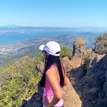
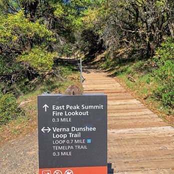

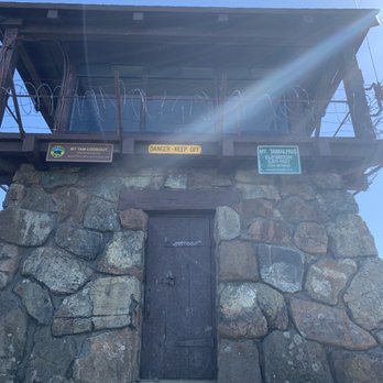


Went here for the first time. I've done some hiking on Mount Tamalpais, but never to the East Peak. First tip: Bring some dollars for parking. If you don't have change, why not leave a little extra in the envelope. It feels good to support our parks. The way I think of it, it's less than the cost of a beer in SF, and it makes you feel even better. There are restrooms available, so that is worth noting. The walk to the peak isn't arduous, but if you are not sure footed, it may be worth having a cane or walking stick. It wasn't smooth and paved, but it wasn't treacherous either. Still, I wouldn't have done the walk in sandals or flip flops. This is a fun walk, because it isn't long, and the view was absolutely wonderful. Really worth the time. If you go on a weekday, you'll be rewarded with more peace and quiet. read more
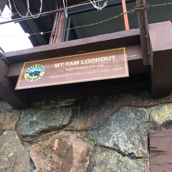
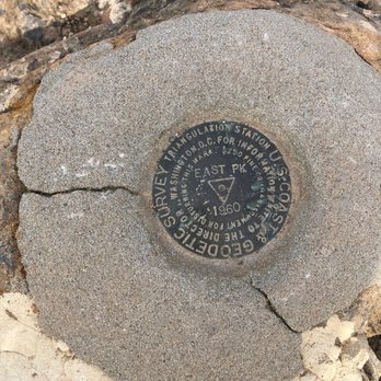

The drive up to the peak (from the Cataract Falls trailhead) was gorgeous and we stopped at several places just to look out into where the ocean meets the bay. My parents arrived and found parking easily on mid-Saturday afternoon. Self-paid $7 senior parking (since my parents are seniors - otherwise $8). My dad (in his 70s) and I hiked all the way up to the fire lookout together. The first half of the trail was smooth and easy with laid out stairs and pathways. The second half was a bit more rough and involved climbing up some rocks and narrow spaces, which made it more exciting for my dad and I. Each step we took, we were rewarded with a breathtaking view. I wouldn't recommend the hike to the top for seniors or the weak. The 360 degree view of the mountain, the sea, the ocean, and bridges and the SF skyline was one of my favorite experiences during my trip. From the top, it made me feel like I'm above the world despite the haze/fog. I would love to come back on a clear, fog free day! My mom was fearful of heights and didn't want to do a steep hike, so she did the handicap accessible trail loop (0.7 miles). She loved it the experience that also offered a similar 360 degree view. The bathroom was clean, nice and offered soap, which is a bonus. During the rest of our trip in the park, we've only seen porta potties. I would love to come back on a clear, fog free day! read more



4 years ago
Breathtaking! My family and I decided to have a fun girls day and incorporate a hike and a picnic brunch. We arrived at around 9am on an absolutely beautiful, sunny Saturday. The park ranger happened to be there and he was very helpful and helped give us guidance on where to start. Being that we are novice hikers we joked around and told him if he saw our car in the same spot after several hours, to send out the search team he was a good sport and joked around with us as well, but then noted on the serious side, he would definitely make sure to be aware and come searching if we were out for too long. Although funny, it set us at ease. On to the hike...stunning views of the Bay, easy trails that are wheel chair accessible. Ever person we encountered was super pleasant and friendly. Clean bathroom, clean grounds, completely relaxing. The highest part of the hike although very rocky, was actually not bad either. I've done other hikes and tapped out 10 minutes in, so this was a breeze comparatively. It can get a little warm during the summer, so make sure you have water and sunblock. You won't be disappointed. read more


4 years ago
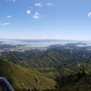
An absolute must on a clear day! If you have yet to experience the amazing views of the Bay from Mt. Tam on a clear day, the next time it's sunny out & you don't have any plans, drive on up to the East peak of Mt. Tam and soak it up. The hike up is a bit rocky, so make sure you're wearing closed-toed shoes. You can see North Bay, East Bay, SF, Mt Diablo, Mt. Sutro, San Bruno Mountain, Marin Headlands, the Bay, the Mt. Tam reservoir, and the Pacific Ocean. It's a perfect example of the magic of the Bay Area, and one of my favorite spots. read more
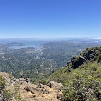


Love this hike. My friend and I parked at Mountain Home Inn and walked towards the trail entrance by the fire station. We started around 6am and hiked about 8 miles. It was summer time, so the heat and allergies definitely got to me, but I kept focusing on growing by booty and the view from the top was worth it! Aaaaaaamazing. I definitely would've taken the view for granted if I drove to the top. I'll be back! read more


5 years ago
Absolutely breathtaking view from the iconic little house at the top of Mount Tam. It was a beautiful day so we could see for miles and miles. Easy hike but definitely wear sneakers. Recommended for all ages, but ones that can walk. read more


4 years ago
I've been wanting to come here for a long time. It was exactly what I expected! Simply amazing. The drive from Richmond was about 40 minutes- no traffic. Parking was $8 for the day pass. There were so many trails to choose from but I decided to take the Stinson Beach trail. I would consider this to be a moderate hike. I started at 10 and finished at 12. In total I did 4 miles! The trails were rocky and the view was still foggy but overall I had a great time. I'm looking forward to coming again and experiencing more of this beautiful park! I also loved that the trails were not crowded. Best part there is a Super Duper burger in town that you can stop and enjoy after a nice long hike! read more
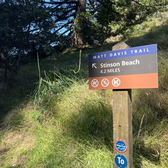


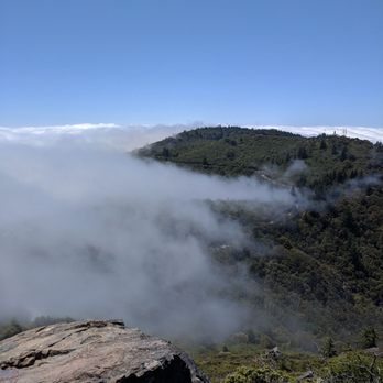
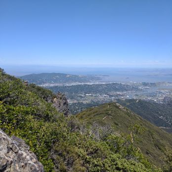
Breathtaking views at the fire watch. This is a great spot to watch the clouds sail by. The easiest way to get here is to drive up all the way (there's a $8 parking fee - no change given). Journey to the very top will be a short 0.3 mile hike with some strenuous terrain. And if you're lucky, you'll be able to glimpse catch a glimpse of the city. Definitely worth coming here on a clear day. read more




7 years ago
Google-able as "Gardner Fire Lookout", this is the crowning view of Mt. Tamalpais. This is the spot instagram hungry tourists seek and locals painstakingly hide. The easiest way is to drive up, pay $8 and park. (Bonus: decent toilet here) Alternatively, the hardest and arguably funnest way is to park down at Stinson Beach, climb through Dipsea/Matt-Davis all the way up, passing by the Inn for a lemonade break. Once you're up there, climb the 'stairway' up to the lookout and prepared to have your breath taken. View is spectacular any time of day, but if you're lucky or plan to catch it on a Karl-free, clear sunset day, you will see rolling clouds and the sun dabbing pastels all over the rolling hills, casting a glow on the spread of sea meets town. read more


How lucky I am to live in the Bay Area -- where this is in my backyard. So blessed :) What's lovely about Mt Tam is that if you start early enough, you're engulfed in a beautiful blanket of fog that you slowly ascend. You can start in many different places but we started at Mountain Home Inn. The initial climb is the hardest so be sure to wear hiking boots. I got lazy and wore flimsy Nikes... big mistake. It's about an 8 mile roundtrip loop if you take a short-cut at the end. It's about 3 hours total. Totally worth it at the top. It'll get sunny by the time you get to the top even if you start around 9ish so pack sunscreen! Must-do hike if you're a Bay Area native! read more


Sometimes the rockies paths lead to the mosy beautiful places... That view though is breathtaking for days. Takes some time to suck it in. So many trails on the east side of Mt. Tam that can you lead you into a dream world. Decided to get back on track and start hiking. For those of you that get nauseas from a winding rode, take a non drowsy dramanine because its curvy for about a good 45 mins til you get there. Blah! Yes I was feeling sick since I was not the driver lol. But the scenery made up for it. Clear sunny skies for such a beautiful day. Highly recommended to pay a visit! read more




3 years ago
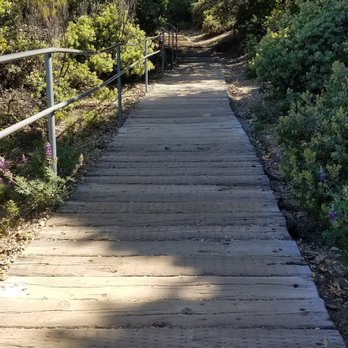
It's a curvy drive, but worth it! We arrived around 3:30 pm on a Sunday in June and the parking lot was was about three-fourths full. Parking was $8.35 through the Yodel app. The Visitor Center was open with a few rangers available. The Gravity Car Barn was also open (weekends only) with a couple of friendly and informative volunteer docents. There's a bathroom with flush toilets and a few picnic tables. We took the short trail up to the top of the East peak. It starts off with a flat path paved with wooden slats. Then, there are some steps before it become a rocky trail. At the top, you are rewarded with views in all directions. It can get windy, so hold on to those hats! You may also want a light jacket. There is a lookout tower at the top, but it seems to be a working station and is off limits. You can stand at its base but you can't go up. After coming back down from that hike, we took the Verna Dunshee loop trail - 0.7 miles and paved. According to one of the signs, it's a 20-minute walk. We had lovely weather and clear skies; it was a good Sunday afternoon outing. read more


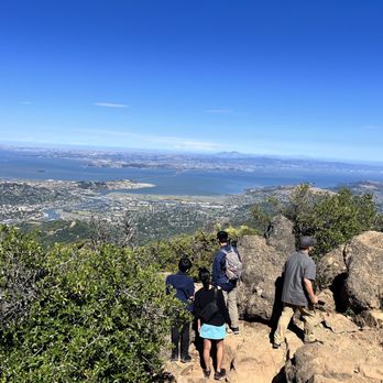


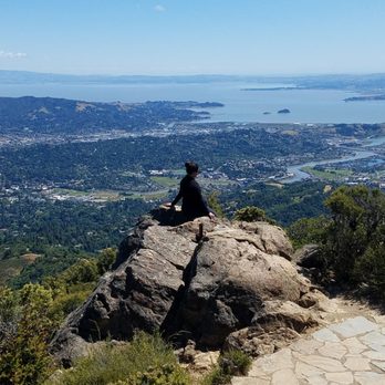
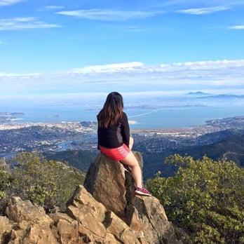
This be the place for all you peeps wanting to snap a 'gram worthy photo. (Refer to my photo *cough*). Anyway, east peak is a place for capturing the beauty within the sf Bay Area. The view on top is so perfect that it makes the mini steep ass hike all worth it! If you're a pro hiker and wants to take on a big rewarding challenge, by all means hike up to this peak from the pantoll ranger station. I'm not sure how you do that but it's possible. I just haven't done it because I'm not about to straight up vertically climb up. My hiking ability is just not there yet. This review is solely for those driving up to a parking lot and hiking maybe about 0.6 miles up to the peak. You might think 0.6 miles is easy. But, those are some very steep "easy" miles. In the beginning, there is this Boardwalk that makes it bearable. But that doesn't last very long until you are made to climb over rocks and make your way up to the peak. You will feel like you're burning in hell. You will want to give up halfway through. You might even start hallucinating and imagine the rocks as demons pushing you down. But! Just keep telling yourself that the view will be worth it. Because it is. Trust me. Look at the pictures. And see what you can be seeing, with a first row seat view. I will be back to bring some noobs for their first time at this beautiful view. But, probably will wait until the coldness dies down. Saw some ice up in those rocks because it was that cold. Aha. read more

7 years ago

7 years ago
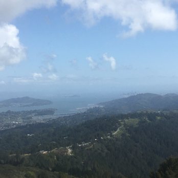
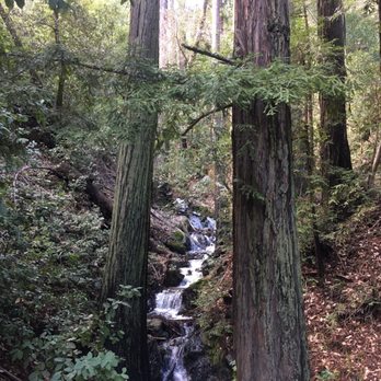
This was such a fabulous hike! I went last weekend after all the rains and started in the parking areas down by the fire station at the bottom. We arrived around noon, and there was still parking available. We took lots of different trails, but mainly the Matt Davis and the Fern Trails. They were fairly well marked, but we found it helpful to download the All Trails app so we were able to figure out where we were versus where we wanted to go. With all the rain, the waterfalls were gushing! It was gorgeous on a sunny day, and there were wildflowers and so much greenery. The trails were a little wet in spots, but they weren't muddy which was nice. The Fern Trail is basically all stairs, so keep that in mind if you have any limitations. However, there is a fire trail almost the whole way up if you need. But you'll miss all the bridges and wildlife if you stick to that, so try not to! Our hike ended up being around 7.5 miles up to the top. The peak is breathtaking and you will have the best view of the entire Bay. It's a must-do! I was also pleasantly surprised that there weren't tons of people on the trails. I'll be back very soon. read more


5 years ago
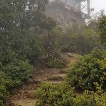
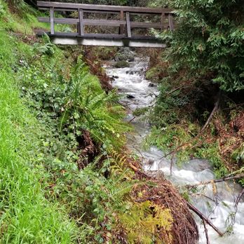
Even on a cold, foggy and rainy morning, this was a wonderful hike! With all the rain these past few days, I was really impressed with how ell maintained all of the trails were. I was expecting to drag myself through pools of mud, or slide down the mountain, but none of that happened. I know there are breath taking views from the summit, because the pictures on the internet told me so, and there is a great little visitor center, but I was brilliant enough to make this hike early Christmas morning. So, closed visitor center and zero visibility because of the rain. On the bright side, I did have the summit to myself, so that was nice! Took some hot chocolate in an insulated bottle and enjoyed it at the top, soaking in the rain, since I couldn't soak the views. Restrooms were open, clean and just as importantly, warm! I made this hike from down at Stinson Beach, going up the Dipsea and Steep Ravine trails. If the 7 mile climb to the top is too much for you, you can also drive up, but what fun is that? There was also the Matt Davis trail that I took back down from near the Pantoll Campground. Is was not nearly as forested as the Steep Ravine, but so many waterfalls! Unfortunately some cross the trail at various points and I was not careful enough to keep my feet dry, so I had to finish my last hour or two with wet, soggy feet. This trail was much muddier, though, so hiking poles came in really handy, especially since I couldn't help but slip every quarter mile or so. Had to make it more interesting, I guess. This route, start to finish, was just under 15 miles and took me right around 5 1/2 hours, including lots of stops for pictures and a quick breakfast at the summit. This could easily be done in a more relaxed 7 or 8 hours if you really want to enjoy the sights, or oxygen and prefer to take your time going up and down without rushing! read more



4 years ago

This is one of my favorite mountain biking ride destinations. You could come up the Crooked Rail way or you could just drive your car up Ridgecrest. Either way when you get up here be sure to check out the lookout which is just a short hike up The Path. There's also a visitor center with some snacks and souvenirs. Also, do not miss the area where they show you the train cars. There is a rebuilt open-air car that you could get in and see how it used to be. There are also several volunteers giving good lectures. Several of the docents gave me a little bit of a history lesson while I was there. Really nice and informative people. There are several restrooms as well as water faucets. This place can be really super busy on weekends in the spring or summer so keep that in mind. When I was here on a Saturday spring morning, there were lots of bikers around. read more


9 years ago
Mt. Tamalpias never fails to defeat me both physically and mentally, but I must admit it is one of my favorite places to hike in the Bay Area. I felt obligated to write this review to help out other hikers like us today who felt a bit lost and confused throughout the duration of our hike but eventually made it to the top. We put in the address for Mt. Tam East Peak into our GPS which led us to a parking lot across the Mountain Inn. From there, we went up the Fire Station road on the right and followed the paved road onto the trail. We started on the Matt Davis trail and went up to the Nora Trail to the West Point Inn. Beautiful views up there as well as clean restrooms, seating areas, and snacks/lemonade/maps for $1! From there, we took the Old Railroad Grade Trail to the Fern Creek Trail all the way up to East Peak. This was definitely the most exhausting part of the hike, it's a steady incline with lots of rocks and steps. After you get off the Fern Creek Trail (my least favorite trail of the day), it is about 0.2 miles to the Visitor's Area right before another 0.3 miles to the Fire Lookout on top of East Peak; also uphill. There is a parking lot near the Visitor's Area so for those who don't want to hike all the way from the bottom, there is that option. It took us about 3 hours to hike from the bottom of the hill all the way to the top of Mt. Tam and a total of around 6 miles one way. I had a mental breakdown during the Fern Creek Trail (I am not an experienced hiker) but the view from the top is truly breathtaking. You can pretty much see the entire Bay Area and there are tons of rocks to sit on and take pictures. The hike was strenuous, but definitely worth it. In the past I have hiked the Steep Ravine to the Dipsea Trail which leads to Stinson Beach. Which is also a GREAT, yet long hike. Highly recommend hiking anywhere on Mt. Tam it's amazing!! read more


16 years ago
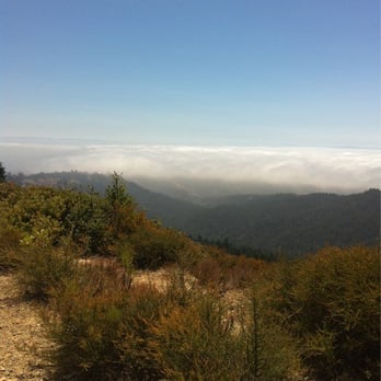
Amazing views and a pretty breezy hike! Hikers, watch out for bikers and bikers watch out for us hikers! Well groomed paths with areas of pavement, gravel or steps. It's an easy incline of a hike. It took us four hours to go up and down the peak. We left from the Visitor Center and it was roughly 4 miles to the summit. It was nice to have places to break like the inn and then bathrooms right before you reach the very top. If you aren't a hiker, its ok you can drive to the top. Park your car then take the short 15 minute hike to the summit. There are various trails to leave from which keeps it interesting. We took another way down, through Fern Creek. If you want a shady narrower path, take that trail. I really enjoyed it. There were no speedy bikers to look out for, or heat to hide from. In the end there's even a little tiny water fall. We had a beautiful day soaking up the sights of beautiful Marin County. I'm thankful for State Parks and the people who preserve nature for us to enjoy! read more


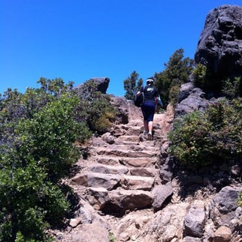

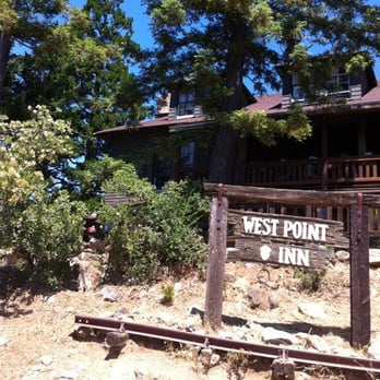


4 years ago

11 years ago
$8 for an amazing instagram picture.. hell yes! Fortunately, there was no ranger that weekend, so it was free for my friend and I. I can't get over the fact that this was probably one of the best view points that I got to experience and it's literally right in the bay! Pretty much you can drive your way up here and hike a short quarter mile to get to this bad boy. The hike isn't bad at all. It's a nice walk with some steep steps here and there, but nothing that would make you want to turn back. - Bring cash cause it seems there is no place to get change. - Mt. Tamalpais has TONS of trails that range from easy - difficult, so pick up a map at the Pantoll Ranger Station and become an explorer. - If you want a nice view, make sure to look at the weather first. My friend and I were pretty fortunate that it was only foggy in the morning, but cleared up during the day. - Come early in the morning as I am sure when the weather gets closer to the summer months, it is gonna burn. Trust me, just go.. its worth it. Just trust.. read more


One of my new favorite hikes accomplished this summer! The last time I hiked Mt. Tam was its loop hike during spring break of last year. This time I wanted to climb to the east peak to its highest elevation point. We parked across an Inn to start our hour long hike. Luckily there was an open spot for parking! Once you start hiking up past the fire station, it becomes really steep! I felt as if I needed breaks every so often, but I powered through it. There are a couple of forks along the path we took, but I wanted to get to the peak as soon as possible for my siblings sake. After half an hour or so, we arrived at the base of the top where there are bathrooms and water accessible to the public. Apparently you can park your car up there for a fee and hike to the top from there, but it wouldn't be much of a challenge anymore. Once you get to the top, you have an amazing view of the north bay and San Ramon bridge! The first time I went it was cloudy all over the SF area, but the second time it was clear to see everything. We had lunch and then headed down with ease. Overall, the hike was steep and I liked it! It took us about an hour to get to the top with at least 7 breaks. Brings lots of water! Oh I brought a Vietnamese sandwich for lunch and there were Jack wasps(?) at the top that were attracted to the sweet meat, so be careful what you bring! Use your Google maps on your phone as a map just in case you don't know which way to go. There was signal throughout the whole hike and at the top so you're fine if you need your phone! read more


Honestly I can say that I've never been to a better hike with a view. Bay area hikes all have their different unique appeal, but if you're looking for a hike with a grand view, I think this one tops them all. In comparison to other hikes, Twin Peaks is more urban-like and mainly the San Francisco skyline, and Mission Peak is more of mountains and suburbia. but with Mt. Tam East Peak, it's a greater panoramic view of the entire bay area plus the ocean. It all depends on your location really, but Mt. Tamalpais can't be beat. Reason being that it encompasses a broad range of amazing local hikes such as Muir Woods, Cataract Falls, Steep Ravine Trail, etc. Well enough about Mt. Tam as a whole, so let's review this individual hike. The hike itself isn't very tiring. I would say it takes no more than 30 minutes to reach the top from the parking lot. The parking lot has a fee of $8 per car and has an adequate amount of space. Bathroom is at the bottom beside the entrances to two different trails. I took the Plank Walk Trail which is a short 0.3 mile walk up, and once you're at the top, the view is breathtaking. I really don't know which boulders along the trail provides a better picture taking spot, but any of them will do. As for making your way back, I couldn't tell if the trail runs in a loop or not so my friend and I eventually made our way back to the original trail. For sure there's a longer trail somewhere that leads up to the peak, but if you just solely want the view, then drive on to the top. TIP: Combine this short hike with another local hike! read more


Pictures and words cannot do justice to the breathtaking views found at Mt Tam's East Peak. It is only a quarter mile hike up from the parking area to the summit. From there you can look out over the entire bay and there are stunning view in every direction. Some things to know: - There is an $8 parking fee and nowhere to make change, so plan ahead with your cash. - The drive up the two lane mountain road is narrow and mostly without guardrails. If you have a problem with heights you might want to let someone else drive. - There is a gift store next to the parking area if you want souvenirs - Bring your camera, because nothing beats these views read more


11 years ago

Page 1 of 3
More info about Mt. Tamalpais East Peak
810 Panoramic Hwy
Mill Valley, CA 94941
Directions
Hours
Outdoor Amenities
Mt. Tamalpais East Peak Reviews in Other Languages
Ask the Community - Mt. Tamalpais East Peak
Are dogs allowed?
Review Highlights - Mt. Tamalpais East Peak
You might also consider






















Why does Yelp recommend reviews?
8 reviews that are not currently recommended
The reviews below are not factored into the business's overall star rating.

8 months ago

2 years ago

12 years ago
13 years ago

16 years ago

13 years ago

13 years ago

11 years ago
Mt. Tamalpais East Peak - parks - Updated August 2026
Best of Mill Valley
People found Mt. Tamalpais East Peak by searching for…
Sunrise View in Mill Valley, CA
Watch Sunset in Mill Valley, CA
Scenic View in Mill Valley, CA
Hiking Trails in Mill Valley, CA
Attractions in Mill Valley, CA
Campgrounds in Mill Valley, CA
Waterfall Hike in Mill Valley, CA
Scenic Drive in Mill Valley, CA
Dog Friendly Hikes in Mill Valley, CA
Things to Do in Mill Valley, CA
Camping Cabins in Mill Valley, CA
Beautiful Views in Mill Valley, CA
Photo Spots in Mill Valley, CA
Redwood Trees in Mill Valley, CA
Off Road Trails in Mill Valley, CA
Picnic Spots in Mill Valley, CA
Recreation Centers in Mill Valley, CA
Walking Trails in Mill Valley, CA
Trending Searches in Mill Valley, CA
Baseball Card Shop near Mt. Tamalpais East Peak
Cinema near Mt. Tamalpais East Peak
Cliff Jumping near Mt. Tamalpais East Peak
Dog Friendly Beaches near Mt. Tamalpais East Peak
Ear Piercing near Mt. Tamalpais East Peak
Fishing Spots near Mt. Tamalpais East Peak
Flower Fields near Mt. Tamalpais East Peak
Fun Things To Do With Kids near Mt. Tamalpais East Peak
Hair Stylists near Mt. Tamalpais East Peak
Kids Haircut near Mt. Tamalpais East Peak
Lakes near Mt. Tamalpais East Peak
Movie Theatre near Mt. Tamalpais East Peak
Peach Picking near Mt. Tamalpais East Peak
Picnic Areas near Mt. Tamalpais East Peak
Playgrounds near Mt. Tamalpais East Peak
Public Beaches near Mt. Tamalpais East Peak
Public Running Track near Mt. Tamalpais East Peak
Scenic Drive near Mt. Tamalpais East Peak
Shopping Malls near Mt. Tamalpais East Peak
Souvenir Shops near Mt. Tamalpais East Peak
Sports Card Shops near Mt. Tamalpais East Peak
Sunrise View near Mt. Tamalpais East Peak
Swimming Holes near Mt. Tamalpais East Peak
Trading Card Shops near Mt. Tamalpais East Peak
Uniforms near Mt. Tamalpais East Peak
Used Book Stores near Mt. Tamalpais East Peak
Browse Articles
Browse Nearby
BEST of Mill Valley, California Coffee near Mt. Tamalpais East Peak
BEST of Mill Valley, California Things to Do near Mt. Tamalpais East Peak
BEST of Mill Valley, California Restaurants near Mt. Tamalpais East Peak
BEST of Mill Valley, California Playgrounds near Mt. Tamalpais East Peak
BEST of Mill Valley, California Hiking near Mt. Tamalpais East Peak
BEST of Mill Valley, California Breakfast near Mt. Tamalpais East Peak
BEST of Mill Valley, California Campgrounds near Mt. Tamalpais East Peak
Browse Brands
Related Searches in Mill Valley, CA
Best Off Leash Dog Parks in Mill Valley, California
Best Parks for Parties and Events in Mill Valley, California
Best Water Parks for Kids in Mill Valley, California
Check Out Great Playgrounds in Mill Valley, California
Discover Baseball Fields Around Mill Valley, California
Discover Fun Toddler Parks in Mill Valley, California for Your Little One
Discover Lakes & Ponds to Explore in Mill Valley, California
Discover Popular Bike Trails in Mill Valley, California
Discover Soccer Fields in Mill Valley, California Near You
Discover Top Nature Parks to Visit in Mill Valley, California
Discover Top State Parks to Visit in Mill Valley, California
Discover Walking Parks in Mill Valley, California Near You
Discover the Best Beaches in Mill Valley, California
Discover the Best Kids Park Spots in Mill Valley, California
Enjoy Scenic Places to Walk in Mill Valley, California
Enjoy the Best Picnic Spots and Ideas in Mill Valley, California
Enjoy the Best Walking Trails in Mill Valley, California
Explore Easy Hikes Perfect for All in Mill Valley, California
Explore Free Picnic Areas Around Mill Valley, California
Explore Fun Activities to Do in Mill Valley, California
Explore Parks With Pull Up Bars in Mill Valley, California
Explore Picnic Parks Near Mill Valley, California
Explore Popular Campgrounds Near Mill Valley, California
Explore Popular Kids Parks Throughout Mill Valley, California
Explore Popular Picnic Areas Around Mill Valley, California
Explore Popular RV Parks Around Mill Valley, California
Explore Scenic Lakes to Visit in Mill Valley, California
Explore Top Dog Parks in Mill Valley, California Near You
Explore Top Water Parks in Mill Valley, California Today
Find Great Places to Feed Ducks in Mill Valley, California
Find Parks and Recreation Activities in Mill Valley, California
Find Top Dog Friendly Parks to Visit in Mill Valley, California
Find Top Skate Parks in Mill Valley, California for All Skill Levels
Find a Kids Birthday Party Park in Mill Valley, California
Find a Park With BBQ Pits in Mill Valley, California
Find the Best Parks BBQ Grills in Mill Valley, California
Find the Best Parks for Picnics in Mill Valley, California
Find the Best Playgrounds to Visit in Mill Valley, California
Have Fun at a Splash Pad in Mill Valley, California
Locate Tennis Courts Around Mill Valley, California
Picnic Areas With BBQ Pits Available in Mill Valley, California
Play at a Splash Pad Park in Mill Valley, California
Popular Picnic Spots to Visit in Mill Valley, California
Relax in Parks With Shade Areas in Mill Valley, California
Safe and Fun Parks for Kids in Mill Valley, California
Top Hiking Trails to Explore in Mill Valley, California
Top Playgrounds for Kids to Enjoy in Mill Valley, California
Top Swimming Lakes to Enjoy in Mill Valley, California


