Holy Jim Falls Trail Photos


You might also consider


More like Holy Jim Falls Trail
Recommended Reviews - Holy Jim Falls Trail
Start your review...


Reviews With Photos


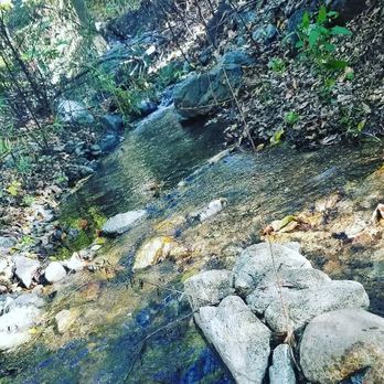
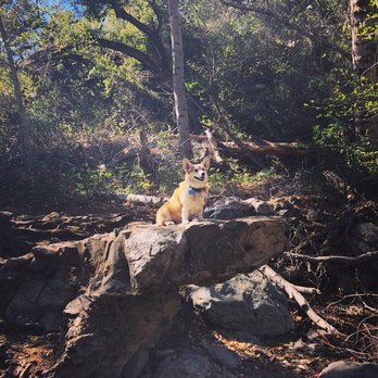
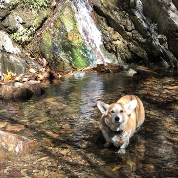
Holy shmokes the drive to the lot was brutal in an old Honda. Unless you have a reliable newer car or an and/4wd, it really is a bit sketch drive, but manageable if you take it easy. Saw a car getting towed out and a few more that turned around (to give you an idea of the road conditions) But!, This is probably one of the only dog friendly hikes that is true to nature around oc. If my 8 year old corgi can make it to the falls, I'm fairly certain most average in shape dog could as well. I went on one the coldest days this past year so I'm sure it helped with the ease of the walk but there was plenty of greenery so i think on a slightly warmer day it would still be a comfortable hike. The falls itself was pretty tiny so I'm glad the walk to it was overall a pleasant trek. You can fork off and do a longer hike if the journey to the falls isn't long enough for you. Ps. We got our adventure pass from the local store off the back road (if you're coming from live oak Rd/Santiago) and not the 5 freeway as most people probably do, so big 5 isn't a must. *Also there's no sign once you hit the end of the yelp directions but you'll go straight through the mini dirt lot and into the forever dirt path and journey to the parking area for Jim falls.
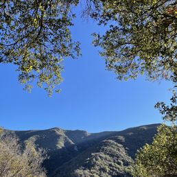

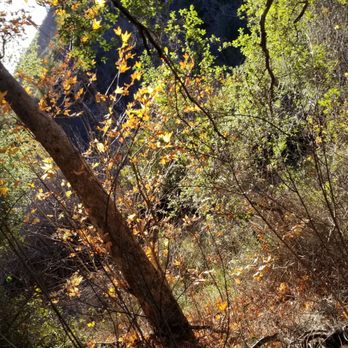
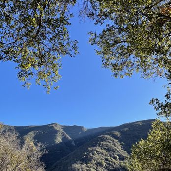
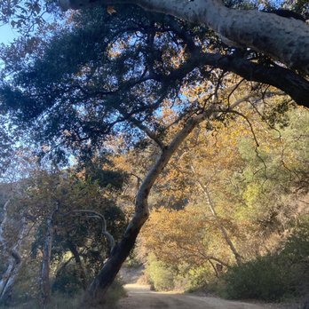
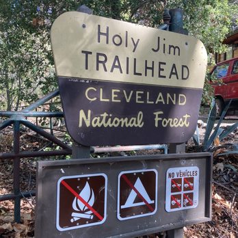
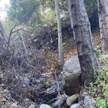
Beautiful trail with foliage red and yellow leaves. The pathway lead to trail is so beautiful. We drove long drive to start trails. There are many trail in Trabuco Canyon. Easy hike, 4 miles round trip exactly than google and maps boards in trail. Small waterfalls, cool and a lot Of shade even you hike late at 11am to 12 pm


Trail is now open! The battle against bugs was insane! Large gnats? They were hugging onto the eyes of the dogs and swarming around them like crazy! You have to swing as you hike to ward then off. Not sure if it's year round like this. Last fall when we came we didn't make it this far because of the closure. The trail is well marked by little flags on the trees. We otherwise enjoyed our time in nature with the dogs and the sights, including the small waterfall, but I couldn't give it more stars because of the overwhelming amount of bugs we kept having to swing at.
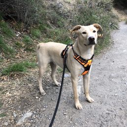

Really cool hiking trail hidden away in South Orange County! The last 4.6 mile drive to get to the trail head parking lot is ridiculously bumpy but worth the drive. The hike itself is really great; shaded for 95% of the trail, great moderate incline and there is actually water in the streams and at the waterfall!!The total RT mileage from trailhead to falls is 4 miles. Holy Jim Falls is an OC gem. **Adventure Pass required.


DOG OWNERS BEWARE! This place is infested with ticks. My chihuahua and lab both had ticks on them after this hike on 3/27/2021. It's a gorgeous walk, but be prepared with preventative for your pets, and for yourself wear long pants, high socks, and light clothing so you can see if the tick in on you.


SPOILER If you've seen my previous hike reviews as much as I am for adventures and the art of getting lost, sometimes I am on a time constraint. As much as I enjoyed the experienced and time wandering in the wild, I REALLY needed to get where I needed to be. So these are the details for the main parking. Directions: If you see an airplane billboard then you are at the right place. It warns you about if you drive closer, it may damage your car but I believe the first mile or two is not bad at all. Going deeper can cause damage to your car. Hiking Difficulty: Easy -This hike is definitely doable for everyone of all ages. You get great scenery ranging from locals, plants, and a nice small flow of the river. The big huzaah was surprisingly disappointing, this was because I compared it to streams such as hikes in Los Angeles. However it was still a simple, pleasant and relaxing hike. Advice: * Say hi to the neighbors * Beware of toll roads * Don't forget water and snacks!


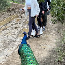
About 8 miles round trip for this hike! Very nice easy stroll for the hike, but like most reviewers have said, the drive in is like the Indiana Jones ride. Instead of going further in w/ our cars, we parked about 2-3 miles out from the entrance and hiked in to save our cars the beating. There ARE snakes here, we saw one and there are some river crossings you might get your shoes wet. Also be sure to put on your bug sprays, lots of tiny mosquitos. Plenty of shade throughout the hike! The waterfall itself wasn't exactly the waterfall I pictured it to be...It was a tiny little fall and once you see it, it's a dead end! Pretty fun hike to go on a Sunday morning :) BTW there seem to be people living here and we even saw a peacock on someone's front porch lol
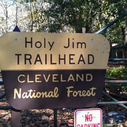

Went on a hike here the first Sunday of January 2013. In my quest to try 25 new hiking trails in 2013, I went with a rather large group of people on this hiking expedition. I read reviews on Yelp that advised driving in a truck, jeep, or any 4x4 vehicle. I made sure all of us did. The drive in is NO joke. My friends and I didn't enjoy it. The hellish part? We had to drive it back out when we were done! It's not just dips, it's literally holes in the road. They look like pock marks all over the road. You get 4 miles of this before you get to the little parking lot that leads to the trail head. The lead car in my group ignored the little parking lot and kept driving and led us to the last cabin and we parked in a 4 car parking lot there. We got to the "fall" in 35 minutes. The fall is tiny. Since it's winter, there was water. The people I went with started rock scrambling and climbing. That's where I'm out. Holy Jim Falls Trail is probably the most beautiful hike I've been on to date. I'm all about rocks and streams and leaves and trees so this was right up my alley. Plenty of shade and lots of picture opportunities! It was too short, and I didn't go on any other of the trails because I was in such a large group. My advice? Park as soon as you enter the road off the street and turn it into a 6 mile hike instead of a 2 mile :)


One of the prettier, but short hikes here in OC. For all the people that whined about the road up to the trail head, you're all pansies. First the facts: -road gets progressively "worse" as you travel towards the trail. Feel free to stop and park at the few parking lots along the way -can you get by without a truck/SUV? Yes You'll need to navigate carefully if you don't have the ground clearance of a truck, but it's absolutely doable. My BMW sedan only suffered a few light undercarriage "scruffs" here and there. Nothing major. The hike itself (from the trailhead) is only 3-4miles round trip and not that difficult. It's nice to see actual water running in creeks here in socal. The waterfall itself is pitiful if you've ever seen an actual waterfall. Nonetheless a decent hike. Also, bring bug spray!
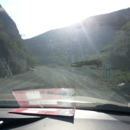

Love this hike. Supposedly around 2.8mile hike, pretty nice shady hike through dirt, some rocks and creek. Small waterfall though so don't expect too much. Moderate family hike. Bring sunblock, bug spray (if sensitive), camera, sense of adventure. Drive there is a bit tricky. Just follow the directions here: http://alltrails.com/trail/us/california/holy-jim-falls-trail Your phone will most likely give you a toll road route to the exist area. Its around $2 there, and $2 back. You can just take the 5fwy and do a local drive there. Also, the last 2.4 miles of drive left to the parking lot is a bit rough. Many cars will probably have to park back if your car can't handle the potholes or dont want to handle it. Not a bad walk but it gets tiring when coming back. Again parking requires $5 Adventure Pass I think. You can get it at alot of sport stores like Big Five.


Quite befitting that I write a review after the news fiasco that happened here last week. Haha! Anywho, its VERY VERY hard to get lost on this trail. It's in and out. (That's what she said) The most fun part of the trail is getting to the trail itself! Indiana Jones status!! Streams, rocks, and a whole lotta fun. You should have a truck/SUV because anything else WILL get damaged or you will be going 2MPH. No joke. It's a fun little trail and good for groups of all ages.


Short day hike. Hiked trail early March. The dirt road to get to the trail head is long & bumpy but doable in most vehicles. We went in a sedan. However, if there's heavy rain you'll need a suv/truck because the 'potholes' are huge and would kill a car's engine if flooded. Yes there are lots & lots of bugs! Use bug spray. The hike is short, 3-4 miles. Took us 2 ish hours. The weird thing about this hike is the strange neighborhood you walk through... There's 20+ cabins, some occupied, some vacant. No public sources available (water, sewage?). Anyway, hike is pretty, the streams brings a nice feel & background noise. But the 'waterfall' is a joke. If you've been to a real waterfall this is laughable but then again California is in a serious drought -_- Water is scarce.


My coworker told me about this trail. BF and I went to check it out last month and it was a cool experience. First of all, I'm glad my coworker told me to bring my BF's truck and not to bring my Accord. Getting to the trail was ca-ca-crazay! You really would need a truck to get through the canyon, otherwise you would have to park on the side and walk a long way to the trail. We didn't know we had to pay for parking, a couple of guys told us to just chance it, the worst that can happen is that we get a ticket that's worth $5. We took the risk and started the our hike. The hike was a breeze, hard to get lost as there are signs everywhere to the trail. There are lots of spots to stop and take some awesome pics. We got to the fall in no time, I was happy to finally see a waterfall after a hike (LOL)! I would most definitely come back here. It is definitely nothing like black star canyon, with all the crazy rock climbing. With this hike, you're pretty much just hopping from one rock to another or jumping across little streams. :) P.S. We didn't get a ticket! :)


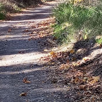
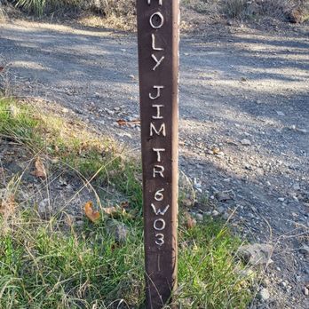
"Trail still closed as of Thanksgiving." Visiting from the bay area, I've always wanted to hike this trail. From Plano Trabuco/Trabuco Creek Road, you can still drive in, up to the gate, which is securely closed. Since I was driving someone else's car, I parked about a mile after the model airplane runway. My in-laws Toyota Camry did pretty good, and I inflicted hardly any damage to their vehicle. The day that I visited, there were four cars parked at the gate. Of course, you have to hike from that point on. It's a few miles to get to the volunteer fire station it's a nice run or hike from that point on. I had an opportunity to talk to some locals, who explained that the local fire marshal, Mike, died a few months ago. He lived in the last cabin right before the official trailhead-- the one that is now closed. So I was disappointed that the Falls trailhead is closed, but I still enjoyed running the road. read more




5 years ago
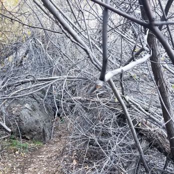
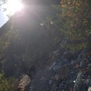
I took my first hike of the year after being out of commission for the past six months and I really enjoyed this hike. I compare this to black star canyon trail except.... This one is easier. Especially after the rain it was even more gorgeous. Difficulty- this is an easy hike, the incline is not to crazy with some minor challenges but there is quite a bit of water running through so just keep in mind there will be some crossing points where it is more slippery. Take your time especially with the kiddos. Environment- the trail is kept up pretty well but the drive out to the trail was REALLY... REALLY bumpy. There are so many pot holes even in my buddies 4wheel drive we really had to take our time. There were some Hondas they made it out there but just take your time on the road... Don't destroy your car trying to get out there quick. There were not a lot of insects and I did check my pup and I did not find any ticks. But always check your fur babies lol Traffic - we got out to the trail at about 1pm , there was not a whole lot of foot traffic so it was comfortable. I also wanted to send a thanks to the holy gym volunteer fire department. They left a wagon full of waters with a tip jar at the beginning of the trail and I thought that was pretty amazing. You don't see that very often but it was Greatly appreciated. I'll definitely be back to this hike it's great for beginners and your pups. Just come out and enjoy it . read more





1 year ago


9 years ago
Holy shmokes the drive to the lot was brutal in an old Honda. Unless you have a reliable newer car or an and/4wd, it really is a bit sketch drive, but manageable if you take it easy. Saw a car getting towed out and a few more that turned around (to give you an idea of the road conditions) But!, This is probably one of the only dog friendly hikes that is true to nature around oc. If my 8 year old corgi can make it to the falls, I'm fairly certain most average in shape dog could as well. I went on one the coldest days this past year so I'm sure it helped with the ease of the walk but there was plenty of greenery so i think on a slightly warmer day it would still be a comfortable hike. The falls itself was pretty tiny so I'm glad the walk to it was overall a pleasant trek. You can fork off and do a longer hike if the journey to the falls isn't long enough for you. Ps. We got our adventure pass from the local store off the back road (if you're coming from live oak Rd/Santiago) and not the 5 freeway as most people probably do, so big 5 isn't a must. *Also there's no sign once you hit the end of the yelp directions but you'll go straight through the mini dirt lot and into the forever dirt path and journey to the parking area for Jim falls. read more


5 years ago
Beautiful trail with foliage red and yellow leaves. The pathway lead to trail is so beautiful. We drove long drive to start trails. There are many trail in Trabuco Canyon. Easy hike, 4 miles round trip exactly than google and maps boards in trail. Small waterfalls, cool and a lot Of shade even you hike late at 11am to 12 pm read more



5 years ago
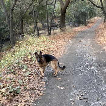
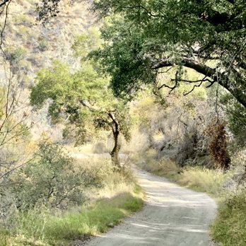
Trail is now open! The battle against bugs was insane! Large gnats? They were hugging onto the eyes of the dogs and swarming around them like crazy! You have to swing as you hike to ward then off. Not sure if it's year round like this. Last fall when we came we didn't make it this far because of the closure. The trail is well marked by little flags on the trees. We otherwise enjoyed our time in nature with the dogs and the sights, including the small waterfall, but I couldn't give it more stars because of the overwhelming amount of bugs we kept having to swing at. read more





9 years ago
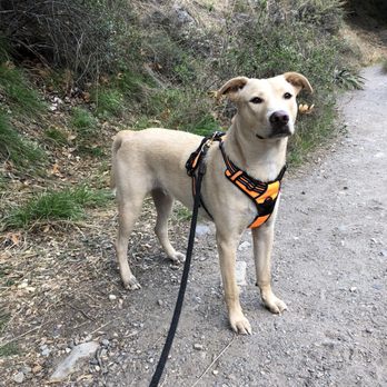
Really cool hiking trail hidden away in South Orange County! The last 4.6 mile drive to get to the trail head parking lot is ridiculously bumpy but worth the drive. The hike itself is really great; shaded for 95% of the trail, great moderate incline and there is actually water in the streams and at the waterfall!!The total RT mileage from trailhead to falls is 4 miles. Holy Jim Falls is an OC gem. **Adventure Pass required. read more


5 years ago
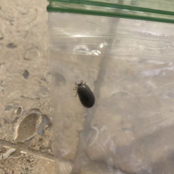
DOG OWNERS BEWARE! This place is infested with ticks. My chihuahua and lab both had ticks on them after this hike on 3/27/2021. It's a gorgeous walk, but be prepared with preventative for your pets, and for yourself wear long pants, high socks, and light clothing so you can see if the tick in on you. read more


SPOILER If you've seen my previous hike reviews as much as I am for adventures and the art of getting lost, sometimes I am on a time constraint. As much as I enjoyed the experienced and time wandering in the wild, I REALLY needed to get where I needed to be. So these are the details for the main parking. Directions: If you see an airplane billboard then you are at the right place. It warns you about if you drive closer, it may damage your car but I believe the first mile or two is not bad at all. Going deeper can cause damage to your car. Hiking Difficulty: Easy -This hike is definitely doable for everyone of all ages. You get great scenery ranging from locals, plants, and a nice small flow of the river. The big huzaah was surprisingly disappointing, this was because I compared it to streams such as hikes in Los Angeles. However it was still a simple, pleasant and relaxing hike. Advice: * Say hi to the neighbors * Beware of toll roads * Don't forget water and snacks! read more


About 8 miles round trip for this hike! Very nice easy stroll for the hike, but like most reviewers have said, the drive in is like the Indiana Jones ride. Instead of going further in w/ our cars, we parked about 2-3 miles out from the entrance and hiked in to save our cars the beating. There ARE snakes here, we saw one and there are some river crossings you might get your shoes wet. Also be sure to put on your bug sprays, lots of tiny mosquitos. Plenty of shade throughout the hike! The waterfall itself wasn't exactly the waterfall I pictured it to be...It was a tiny little fall and once you see it, it's a dead end! Pretty fun hike to go on a Sunday morning :) BTW there seem to be people living here and we even saw a peacock on someone's front porch lol read more


Went on a hike here the first Sunday of January 2013. In my quest to try 25 new hiking trails in 2013, I went with a rather large group of people on this hiking expedition. I read reviews on Yelp that advised driving in a truck, jeep, or any 4x4 vehicle. I made sure all of us did. The drive in is NO joke. My friends and I didn't enjoy it. The hellish part? We had to drive it back out when we were done! It's not just dips, it's literally holes in the road. They look like pock marks all over the road. You get 4 miles of this before you get to the little parking lot that leads to the trail head. The lead car in my group ignored the little parking lot and kept driving and led us to the last cabin and we parked in a 4 car parking lot there. We got to the "fall" in 35 minutes. The fall is tiny. Since it's winter, there was water. The people I went with started rock scrambling and climbing. That's where I'm out. Holy Jim Falls Trail is probably the most beautiful hike I've been on to date. I'm all about rocks and streams and leaves and trees so this was right up my alley. Plenty of shade and lots of picture opportunities! It was too short, and I didn't go on any other of the trails because I was in such a large group. My advice? Park as soon as you enter the road off the street and turn it into a 6 mile hike instead of a 2 mile :) read more
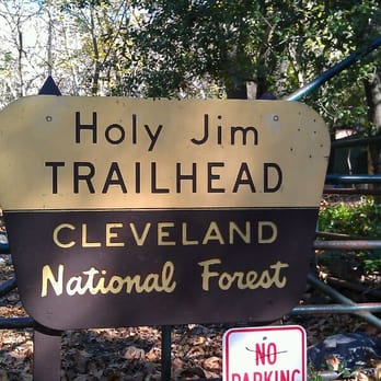


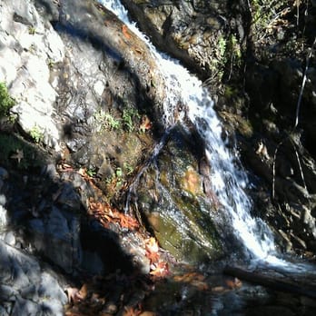
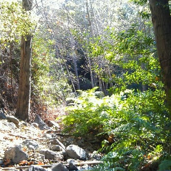
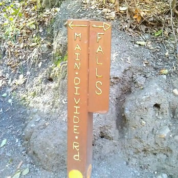
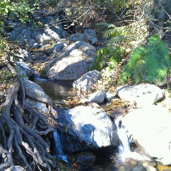


One of the prettier, but short hikes here in OC. For all the people that whined about the road up to the trail head, you're all pansies. First the facts: -road gets progressively "worse" as you travel towards the trail. Feel free to stop and park at the few parking lots along the way -can you get by without a truck/SUV? Yes You'll need to navigate carefully if you don't have the ground clearance of a truck, but it's absolutely doable. My BMW sedan only suffered a few light undercarriage "scruffs" here and there. Nothing major. The hike itself (from the trailhead) is only 3-4miles round trip and not that difficult. It's nice to see actual water running in creeks here in socal. The waterfall itself is pitiful if you've ever seen an actual waterfall. Nonetheless a decent hike. Also, bring bug spray! read more


2 years ago

Love this hike. Supposedly around 2.8mile hike, pretty nice shady hike through dirt, some rocks and creek. Small waterfall though so don't expect too much. Moderate family hike. Bring sunblock, bug spray (if sensitive), camera, sense of adventure. Drive there is a bit tricky. Just follow the directions here: http://alltrails.com/trail/us/california/holy-jim-falls-trail Your phone will most likely give you a toll road route to the exist area. Its around $2 there, and $2 back. You can just take the 5fwy and do a local drive there. Also, the last 2.4 miles of drive left to the parking lot is a bit rough. Many cars will probably have to park back if your car can't handle the potholes or dont want to handle it. Not a bad walk but it gets tiring when coming back. Again parking requires $5 Adventure Pass I think. You can get it at alot of sport stores like Big Five. read more
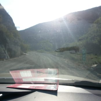
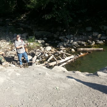
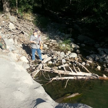


Quite befitting that I write a review after the news fiasco that happened here last week. Haha! Anywho, its VERY VERY hard to get lost on this trail. It's in and out. (That's what she said) The most fun part of the trail is getting to the trail itself! Indiana Jones status!! Streams, rocks, and a whole lotta fun. You should have a truck/SUV because anything else WILL get damaged or you will be going 2MPH. No joke. It's a fun little trail and good for groups of all ages. read more


12 years ago
Short day hike. Hiked trail early March. The dirt road to get to the trail head is long & bumpy but doable in most vehicles. We went in a sedan. However, if there's heavy rain you'll need a suv/truck because the 'potholes' are huge and would kill a car's engine if flooded. Yes there are lots & lots of bugs! Use bug spray. The hike is short, 3-4 miles. Took us 2 ish hours. The weird thing about this hike is the strange neighborhood you walk through... There's 20+ cabins, some occupied, some vacant. No public sources available (water, sewage?). Anyway, hike is pretty, the streams brings a nice feel & background noise. But the 'waterfall' is a joke. If you've been to a real waterfall this is laughable but then again California is in a serious drought -_- Water is scarce. read more




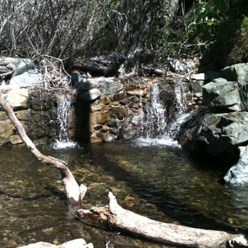
My coworker told me about this trail. BF and I went to check it out last month and it was a cool experience. First of all, I'm glad my coworker told me to bring my BF's truck and not to bring my Accord. Getting to the trail was ca-ca-crazay! You really would need a truck to get through the canyon, otherwise you would have to park on the side and walk a long way to the trail. We didn't know we had to pay for parking, a couple of guys told us to just chance it, the worst that can happen is that we get a ticket that's worth $5. We took the risk and started the our hike. The hike was a breeze, hard to get lost as there are signs everywhere to the trail. There are lots of spots to stop and take some awesome pics. We got to the fall in no time, I was happy to finally see a waterfall after a hike (LOL)! I would most definitely come back here. It is definitely nothing like black star canyon, with all the crazy rock climbing. With this hike, you're pretty much just hopping from one rock to another or jumping across little streams. :) P.S. We didn't get a ticket! :) read more



8 years ago
I did this hike for my first time today, and I have some recommendations because I think a lot of reviewers are people who normally hike and this would be my first hike since I was a kid. So this review is for beginners! 1. Take an SUV or truck. The potholes on the road really arent suitable for compact cars, you could easily break an axle or tire. 2. The road to the parking area was closed off so everyone parked at the head of that on the road. Expect an EXTRA 1.5-2 miles BEFORE you hit the trail head. We clocked 8 miles round trip and that was about a half mile before hitting the falls where we had to turn around because of time restrictions we had. 3. The trail to the falls is mostly uphill and has a LOT of loose rocks. You WILL need to cross the creek at least 4 times each way, so waterproof hiking boots are recomended, I got my feet soaked and had a very uncomfortable walk back. If you dont want to get the boots, I do suggest leaving an extra pair of shoes and socks in your car. I did and it was a godsend. 4. Get there EARLY. We parked to walk in at 8am saturday morning and it was perfect. We only saw a few people until starting back, when a mass of people were coming up the trail. It was sooo serene, full of the sounds of nature and the sunrise on the way up. 5. Bring a backpack! Look online for some things to pack for a hike. Sunscreen, a small first aid kit, sun glasses, water, protein bars, a travel pack of tissues and hand santizer for the portapotties are a good idea too. This is obviously not a really hard hike for anyone who hikes regularly but your average Joe its NOT at all an "easy" hike. read more


9 years ago
Before evening driving here, you must stop by BIG LOTS for an adventure park ticket for $5 to leave on your dashboard, or be prepared to get cited! Also no cell phone coverage up in the mountains so.... take your pictures but post them lata :) TOTALLY IG and Snap worthy. Wow, just stunned with the beautiful routes and scenery my hubbi & I discovered within such a short hike! Going uphill was a little difficult.. it took us 3 hours to the water fall, and 3 hours back down. Youre looking at about spending 6-7 hours with moderate speed and little breaks. The trail head gate for your car is actually not open to the public any longer; the park ranger informed us that due to many bonfires and crazy parties up in the mountains by teenagers taking advantage of the trail and breaking rules, the gate stays locked and only unlocked by cabin residents.. Nonetheless, beautiful mountains and cliffs, plenty of resting areas with benches and portable potties along the trails. We went around 2pm, then caught sunset by 7pm. Such a highly recommend trail if you are looking for a more relaxed terrain.. that is if you don't rub yourself out itchy, with the crazy poison ivy that seems to be EVERYWHERE stay cautious of that, and the insane amount of fruit flys, mosquitoes, and beetles buzzing HOLA! I brought my mochi poo pup, and he seemed to truly enjoy the nature of it all.. from the river stream jumping, to the tiny rocks we had to hop on, to the soaked feet we both had from the river streams.. it was all fun. read more


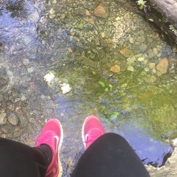



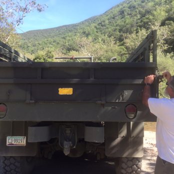

This ended up being a more adventurous hike than I thought. The ride there took about an hour and half of that was driving 3 miles on the unpaved dirt road leading until you were 1.5 miles from the parking lot. So you don't actually get to the parking lot but 1.5 miles from it. The dirt road has a lot of holes and quite bumpy but my 14 year old Corolla was able to handle it no problem. Parking is anywhere along the dirt road you can park your car. If you go early in the morning, you're gold. Parking was free since you're not actually at the lot. It took about 30 minutes or so to get from the parking area to the actual Holy Jim Falls parking lot. The walk there is very easy and picturesque. There is a lot of river crossings so beware that you'll need to cross the river using rocks and logs, so it's ideal to have pretty good balance, lest you get your feet or shoes soaked. The water is quite cold. The hike itself was moderately easy and cool and shady. It's about 3 miles roundtrip out and back. There were a few river crossings but nothing unreachable or difficult. When you get to the Falls there's actually water! Mind you, we've been getting a lot of rain lately. The Falls aren't big or long, but the hike us smoothe and a lot more beautiful and green than I expected. From the non-parking lot to the Falls took 2 hours roundtrip for a total of about 6 miles. I did run back down from the Falls to the actual parking lot since the trail was conducive to do so enjoyably. The trail was smooth and not at all steep so it was easy and even fun to just run down. The hike was peaceful and calm and facilitated meditation. This was a good hike. The only downfall was the crappy road leading up to the non-parking lot. I would give this hike at least 4-5 hours of driving and the actual hike if you're coming from North or Central Orange County. read more


4 years ago

9 years ago
If you park near the the potty, you need a permit, & it is obtain at the General Store on the main Trabaco Canyon road, $3 & they don't open unt 8am. You can also park along the washboard road with no permit. It is a moderate 2.9 mile hike, but we walk 5 mile in from the main street via a washboard road leading to the trailhead, so our total hike could have been 14 mile if we didn't ask for a ride back. There's a 20 foot waterfall at the end, mostly shaded trail with some rock climbing, & was attact by lots of bugs. read more




10 years ago
HOLY JIM, THERE'S A...!!! Nature was profaned here by the swear words flooding from the mouth of "Cussin' Jim" Smith or "Holy Jim" as he was renamed by tight-laced government surveyors who mapped the canyon in the early 1900s. Another bit of history marks the place: the last wild California Grizzly -- an old bear named "the honey thief" -- was killed at the mouth of Trabuco Canyon after robbing beehives here in 1907. STATS: Distance: 2.9 miles Elevation: 500ishl gain Time: 1-1.5 hours Trek: In & Out Trail: Graded rock, single-track, crick crossings Rating: Beginner Warning: Poison Oak, Rattlesnakes Transportation: High clearance vehicle, Four wheel drive vehicle A local OC resident offered to take me on my first ever OC hike. Yep, you read that right, I lost my OC trails virginity. Oh Holy Jim!!! This well-traveled easy to follow trail meanders through a shaded canyon, with dense scrub and several water crossings, as well as, private cabin residences, before reaching, oh Holy Jim!!! A twenty foot waterfall. Alas, at the time of our visit, the waterfall was more of a trickle. While it is only a couple miles to the falls, it is a nice leisurely stroll for all levels of hikers, including kids. Those looking for more mileage and elevation gain, Santiago Peak is waiting to be bagged. The flora is plentiful and the views are peaceful, the downside, it is a bit too popular/crowded for me. DISCLAIMER: Hiking is not something that can be taken lightly. It can be life-threatening as you see and hear on the news, people die or get lost all time. Please, if you are going to hike, never go alone and prepare for the worst, hope for the best. Remember when going for a hike, no matter how short you think it may be, always be prepared. Carry at least two liters of water for every five miles (more if the weather is warm), protein bar, nuts, and electrolytes. Wear sturdy lug sole shoes and protective clothing. Some areas the weather can change quicker than a firefighter can put on his gear. It is also very important, always always always let a family member or friend know where you are going and when you expect to be back. Lastly, have fun when you hike it up. read more


17 years ago
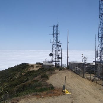
At 5,687 feet elevation, Santiago Peak is the highest point in Orange County. To get to the Holy Jim Trail trailhead, you have to drive about five miles on Trabuco Creek Road, which is a very rough, unpaved dirt road. Continue until you pass a fire station on your left. The parking lot for the trailhead is just past the fire station. See pic. At times, the road is quite rocky, and I scraped the bottom of my car a few times despite going at a crawl during the worst portions of the road. Probably took me about 30 minutes to drive this road. A SUV or truck is highly recommended, but it can be done with a regular car if you drive very slowly and navigate carefully around the bigger rocks. I made it up in my poor Honda Fit, which has very little cleareance, but I have to be honest, it wasn't the smartest thing I've done. If you get stuck or damage your car, don't blame me... The Lower Holy Jim Trail is well maintained and is easy to follow. It leads you to the Main Divide Truck Trail where you have a couple options on how to proceed. You can go left and head up the Main Divide Truck Trail to Santiago Peak, or you can go right along the Main Divide Truck Trail for a little bit until you get to the Upper Holy Jim Trail, which is marked and takes you near the peak. I wanted to take the Upper Holy Jim Trail, but I ended up taking Main Divide Truck Trail up instead. The problem with taking the Main Divide Truck Trail is that it's popular with motorcycles, trucks and SUV's, and whenever they pass by, they leave behind a large, unpleasant cloud of dust and dirt. I should note that the Lower Holy Jim Trail is very popular with mountain bikers, but I have no idea about the Upper Holy Jim Trail. After about 8 miles from the trailhead, you'll reach the summit of Santiago Peak. You really can't miss it. There are a bunch of radio towers and antennas at the top...If you look around, you can find a little bronze Geodetic Survey Marker at the highest point of the peak. See my pic. Roundtrip, it was about 17 miles with 4200 feet elevation gain, a good solid hike that took me about 6 hours. I'm deducting a star for the radio towers and antennas on the top and the motorcycles and trucks that left me inhaling dust and dirt. read more



13 years ago
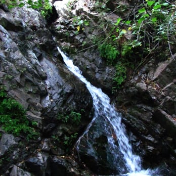
Holy Jim Falls is one of the most popular hikes in Orange County. It's probably the only waterfall in Orange County that flows consistently the whole year. In truth, it's not the best hike you'll ever do, but I think it merits at least one visit if you're an Orange County hiker. If you want a good chuckle, read the negative reviews of this hike on Yelp. A lot of people show up thinking this is an easy 1-mile hike. And it is, if your car can manage the punishing 3 mile drive down Trabuco Creek Road over streams, boulders, blind curves and the occasional mountain bike jump. They've actually fixed up Trabuco Creek Road. It was washed out a few years ago during a rainy season and had to be re-routed in several areas. It feels like a 7 lane freeway now compared to how bad it used to be, but people are probably still going to complain. There are a few good fishing spots along Trabuco Creek road. I've seen the locals pull a few decent size fish out of Trabuco Creek. If you decide not to drive down Trabuco Creek Road, consider mountain biking to the trailhead instead, but make sure the trail is dry because the mud can get insane after a rainstorm. Also, bring a lock for your bike so you can chain it up at the trailhead. I usually chain my bike to a tree behind the fire station. Walking down this road can really suck with all the cars speeding past and kicking up dirt in your face. Once you make past the fire station building to the actual Holy Jim trailhead, the hike is approximately 1.5 miles each way to the falls. This is a popular hike, so you'll probably see other people hiking on the trail. I won't bother with instructions, because you're in a canyon, so you can't really get lost. Holy Jim Falls is probably between 20-25 feet tall, but the forest here is verdant and lush, which is atypical of the rest of Orange County. The moisture in this canyon makes it a good place for bugs and salamanders. A lot of people complain about mosquitoes in Trabuco Canyon, another uncharacteristic feature for Orange County. As with all waterfalls, this hike is better after a few days of good rain if you really want to see Holy Jim in it's full subtle grandeur. I have a bunch more local OC hikes on my blog at http://www.southcaladventures.blogspot.com/ read more


10 years ago
This is a review of Santiago Peak aka Saddleback Mountain. Situated 5689' above sea level, it's the highest peak in the OC. You'll be rewarded with beautiful views after a one way hike of approx. 8 miles and around 4 hours. The trail gets a bit steep once you hit the Main Divide Rd., which is at about the 5 mile mark. Once you reach the Main Divide Rd, go left to take the Main Divide Rd (it's a fire road) the entire way to the summit OR make a right and hike about .25 miles and take the Upper Holy Jim Trail which is an easy to miss single track trail that will be on your left before the incline. The Upper Holy Jim Trail eventually joins back up with the Main Divide Rd after 1.5 miles. I hiked on 11.25.16 and there was no visible sign for the Upper Holy Jim Trail. The last 3 miles up are the steepest, most demanding. Make sure you bring enough water - I'd bring at least 2L, but would recommend a bit more. I brought 3.5 and finished about 2.5. Bring snacks, you can eat your lunch at the peak, which is dotted with antennae, as well as lookout scopes. The weather on top can be windy/cooler so wear/pack layers. Also make sure you get an early start - we left our car at 730 am and returned at 330. This is not a hike to take lightly. I found it similar to hiking up Mt. Wilson. That said, it is manageable. Tips - You need an Adventure Pass to park. Big 5 sells daily passes for $5. - Dirt road to the parking lot is bumpy and not the best maintained. I would not suggest driving in a car. read more



14 years ago
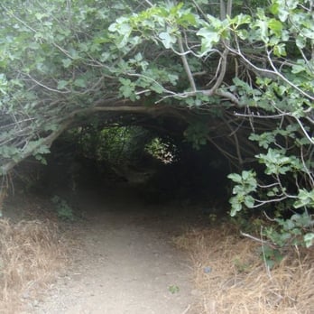
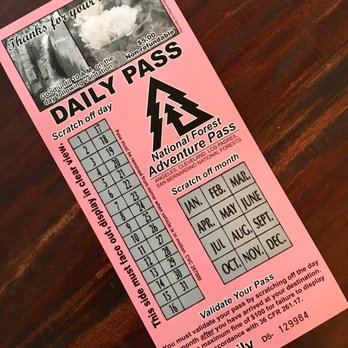
Size doesn't always matter, which may explain why 20-foot Holy Jim Falls is one of Orange County's most popular hiking destinations. Even if there isn't much water, the walk through the canyon, under oaks, alders, sycamores and fig trees, is quite enjoyable; it's a true departure from what most people might think of when Orange County comes to mind. Interpretive plaques describe the history of the canyon, which gets its name from beekeeper "Cussin' Jim" Smith (mapmakers decided that the name Holy Jim would play better.) There are a few things to keep in mind when planning a trip to Holy Jim Falls. First: reaching it requires a 4-mile (each way) drive on a rough dirt road; allow at least half an hour. A high-clearance vehicle is strongly recommended. Second: parking at the Holy Jim Trail Head requires a National Forest Service Adventure Pass. It costs $5 per day or $30 for a year, and can be used to park at any trail head in the Cleveland National Forest (where Holy Jim Falls is); also the San Bernardino, Angeles and Los Padres National Forests. Passes can be bought online (see the link below); at many sports stores such as Big 5, and sometimes at the trail head, although don't count on being able to get one there. Third: Bring bug spray. Lots of bug spray. The hike itself is a moderate trip of about 3 miles, climbing 650 feet. A few of the stream crossings can be tricky, but overall it's not too difficult. read more




15 years ago
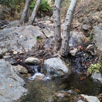
Anyone who knows me, knows that I am not outdoorsy. Having dinner or drinks on the patio is about as far as it goes. But, sometimes you need to mix it up, and see what all the fuss is about. Why not, right?! So, I am writing this review from that angle. I am rating it based upon other activities in the area, not the other hiking destinations I have been on. This was my experience, and your results may vary. Like everyone else has said, you really need a truck or some other lifted off-road type vehicle to drive the 4.7 miles to the lot. There was also some running water we had to drive through a couple of times. Nothing much, maybe just a few inches, but it is July, so maybe it is worse other times of the year. I was very happy to see a couple of Port-a-potties in the lot after all that bouncing around, and it was clean enough to use. There are several trails leading in different directions from the lot, but there is a posted map showing the right one. We walked for what felt like a long time at slight incline past houses/shacks/other various shelters until we reached the official trail head. The trail itself is rated a beginner hike, but that does not mean it is easy for someone that does not hike regularly. There are rocks to balance on to cross multiple streams and there are some slippery slopes. There are lots of flowers and mini-waterfalls due to the creek the trail seems to follow which makes it pleasant. This is the good part. Unfortunately, even using bug spray, there were swarms of bugs. I get that it is outside and all, but I am talking constantly swatting them away from your face. On some parts of the trail, we could not even stop to look around because the bugs were so bad. Once again, maybe this has something to do with the time of year (July) and the heat (mid 80s), but it was surprisingly bad. The trail sometimes splits and reconnects near the stream crossings and some routes are more difficult than others. I was just about at the point where I was over the novelty of the hike when we reached the falls. It was a pretty good payoff and worth the hike. We hung out for a few minutes, but it is not a huge area, and there were other people around so we soon started back. There was a big-dog-to-be playing in the water, and she looked like she was loving it, but I definitely was glad I did not bring my little Chug mutt with us. On our way back, we passed a family that had warned us they just saw a rattlesnake on the trail, but they "think they scared it off". Okay, not feeling great about that... Luckily, it was mostly downhill so it was easy to walk quickly back. Of course, I managed to slip on a rock and submerge up to my calf in a stream soon after we started back which was a bit of a downer. And then, about 50 ft up the trail from the parking lot, the nature gods wished to further mock the girl who thought she could dabble in the great outdoors. I hear an ominous noise and see a coil of a huge RATTLESNAKE probably less than two feet away on the trail! Of course, I do the only sensible thing which is to shriek and run like hell back to the truck, leaving my husband in my dust. Because, of course, the snake might chase me, right? read more


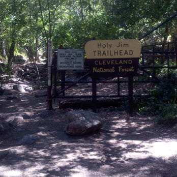


13 years ago
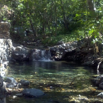
Hike is slow incline for 3 miles green and heavily shaded with oak trees, ferns, and eucalyptus The Falls itself is about 20ft. 4 stars for OC standards. Shooting: Bring a wide fast lens, some parts are heavily shaded. Polarizing filter is recommended for this hike. There are few wild flowers so not too much macro opportunities. Little wild life to be seen, I saw a squirrel and heard a bunch of frogs. Good: * Green * Easy * Lots of creek crossing * Peaceful (sometimes you forget your in orange county with all the frogs and greenery.) Bad: * Fall pool area is small (can feel crowded with 10+ people.) * Road can be sketchy if your in a sedan just drive cautiously and you'll have no problem takes about 30-40 minutes. read more
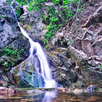

9 years ago
It was my first time hiking ever and was it such an amazing experience to see nature at its best. The best part is everyone that walks this trail are just so friendly and helpful. It definitely allows you to separate the different culture of mindsets from the city folks. Met a super kind stranger who had walked this trail before and she was ok in assisting me and my brother thru the trail when I asked. I was raised with asthma but it had improved and oh boy does it help being outdoor and feeling like you have an extra set of lungs. I was told that there hadn't been water on the past due to the drought but was able to go when there were still streams and river flowing and it definitely allows you to embrace and be grateful for what Mother Nature has provided for us. Gorgeous trail and I highly recommend walking it as a first timer. It'll be challenging but it definitely feels great and victorious. It took us about 45-60 minutes one way due to he excessive stops but I'm sure in due time it can be done within 30 minutes. read more


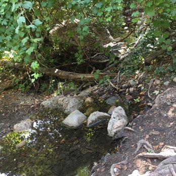

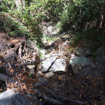

I read reviews before coming to the trail and everyone is right. Do NOT try driving the trail unless you have a truck/SUV. For those who have a regular sedan, you can park at the trail head which is about 2.5 miles before the trail. The trail itself has sooo many potholes and slopes. A promising bumpy ride for those who decide to drive through it. + Easy trail, great for beginners. It's just in and out one way so it's hard to get lost. + There is a waterfall! Something to look forward to :) read more


11 years ago
Completed the Holy Jim Trail last week on 7/28/15, it was a nice hike a lot of shade a lot of different bugs and creatures to keep us entertained during our hike. You want to make sure you show up early anything after 10:30 am is just too hot and the bugs and heat will drive you crazy. Also, I really enjoyed the different cabins at the beginning of the trail they gave it that scary movie feel since 85% of them looked to be abandoned. We did have a rough ride to get to the trail it's self the little dirt road that takes you there isn't really car friendly. I think if we didn't drive up there in a truck we definitely would have been stranded with a broken car just trying to drive to the trail it's self, way too many dirt potholes and uneven dirt. After finishing our hike we noticed that the cabin closest to the trail entry way was providing free waters or with a donation so that was nice since we were extremely thirsty. We grabbed two waters and left $2.00 in the Folgers can donation bin. :) read more


16 years ago
Holy Jim offers hikers a few options. You can hike Holy Jim Trail to the falls (think small falls) and head back down, or hike to the top of Santiago Peak/Saddleback via Main Divide Road or Upper Holy Jim Trail. Upper Holy Jim is fairly steep and doesn't offer any shade to speak of. Its the fastest way up, but takes a little more fitness then just walking on the fire road Main Divide Trail. The Holy Him Trailhead is kind of hard to find and off the beaten path for sure....its the only place in OC I've been and felt I was truly "away". At the entrance to the trail there are some old cabins that look to be off the grid! Which is a trip to find in OC. Its a good long day hike...faster for some who hike often - if you want to get to the peak. I've done it twice - once at 12 hours (the person I went with had a really hard time fitness wise) and 8 hours at a fairly steady, but not a fast pace. You'll definitely want to bring plenty of water as shade is hard to come by once you hit Main Divide Road (which is about 40-50% up) or Upper Holy Jim Trail. Great views of OC and Riverside County await those who make it to the top. PS: I did this hike in March and found 8 inches of snow near the peak! Hope this helps....happy hiking! read more


12 years ago
Fun little hike I went on. The road to get to the trail head was most definitely half the fun! The hike was modest and cool. Little trickling waterfall at the end. Cool place to climb trees and take pics. On the way back this friendly family invited us to eat breakfast with them! It was a super neat experience. read more


13 years ago
I mean, really, it's December and gorgeous outside. Get your bum up and go on an adventure. My jeep is a very dirty, dirty.... girl. Just sayin'! read more


Page 1 of 6
More info about Holy Jim Falls Trail
Live Oak Canyon Rd
Trabuco Canyon, CA 92679
Directions
(909) 736-1811
Call Now
Hours
Outdoor Amenities
Ask the Community - Holy Jim Falls Trail
Anyone know if this trail is still closed?
On their official site accessed 10/2021, it says "OPEN TO THE FALLS ONLY. NO ACCESS TO SANTIAGO PEAK."…
Does anyone know if the road leading up to the trail is also closed or can you still putt around out there?
You can still drive up the road and hang around and do a short hike alongside the creek. Only the trail is closed from the trailhead.
Does anyone know if this trail is still closed, and if so, when it will open?
It is still closed as of June 6, 2020.
Is the Holy Jim trail closed?
As of June 6, 2020, yes they are still closed. You can still drive up to the trailhead but the area to enter the trail is blocked off.
Hi, has anyone been on this hike recently? Can we access the trail or is it still closed? TIA!
Still closed
Has anyone driven the dirt road to holy Jim Falls recently that can answer if the road is narrow!? Worried about a newer Jeep getting scratched!!?? Bad potholes?
Yes. It's not too narrow. You can drive around some of the potholes. Prepare for a dirty Jeep!! And make sure you don't go if it has rained a day or 2 before...the dirt might be too soft.
Review Highlights - Holy Jim Falls Trail
You might also consider


![Falls Canyon Falls - Falls Canyon Falls/Trabuco Falls/Hidden Falls!! [?!...] - http://bit.ly/1CHQrJa](https://s3-media0.fl.yelpcdn.com/bphoto/bi3zkMU9HqPVcUKBk8AmiA/ls.jpg)


















Why does Yelp recommend reviews?
8 reviews that are not currently recommended
The reviews below are not factored into the business's overall star rating.

10 years ago

11 years ago

11 years ago

14 years ago

8 years ago

11 years ago

9 years ago

15 years ago
Holy Jim Falls Trail - hiking - Updated September 2026
Best of Trabuco Canyon
People found Holy Jim Falls Trail by searching for…
Things to Do in Trabuco Canyon, CA
Waterfall Hike in Trabuco Canyon, CA
Places to Take Pictures in Trabuco Canyon, CA
Hiking Trails in Trabuco Canyon, CA
Off Road Trails in Trabuco Canyon, CA
River Swimming in Trabuco Canyon, CA
Lookout Point in Trabuco Canyon, CA
Scenic Drive in Trabuco Canyon, CA
Fishing Lake in Trabuco Canyon, CA
Fall Foliage in Trabuco Canyon, CA
Dirt Bike Riding in Trabuco Canyon, CA
Rock Climbing in Trabuco Canyon, CA
Swimming Holes in Trabuco Canyon, CA
Abandoned in Trabuco Canyon, CA
Scenic View in Trabuco Canyon, CA
Dog Friendly Hiking Trails in Trabuco Canyon, CA
Dog Friendly Beaches in Trabuco Canyon, CA
Photo Spots in Trabuco Canyon, CA
Walking Trails in Trabuco Canyon, CA
Trending Searches in Trabuco Canyon, CA
Apple Orchards near Holy Jim Falls Trail
Apple Picking near Holy Jim Falls Trail
Archery near Holy Jim Falls Trail
Beautiful Views near Holy Jim Falls Trail
Bike Shop near Holy Jim Falls Trail
Blow Dry Bar near Holy Jim Falls Trail
Casinos near Holy Jim Falls Trail
Cliff Jumping near Holy Jim Falls Trail
Consignment Shops near Holy Jim Falls Trail
Dog Friendly Things To Do near Holy Jim Falls Trail
Dog Swimming near Holy Jim Falls Trail
Eyebrow Threading near Holy Jim Falls Trail
Eyelash Extensions near Holy Jim Falls Trail
Kids Birthday Party near Holy Jim Falls Trail
Makeup Artists near Holy Jim Falls Trail
Nail Technicians near Holy Jim Falls Trail
Off Road Trails near Holy Jim Falls Trail
Parks near Holy Jim Falls Trail
Photo Spots near Holy Jim Falls Trail
Picnic Areas near Holy Jim Falls Trail
Places To Take Pictures near Holy Jim Falls Trail
Private Schools near Holy Jim Falls Trail
Public Shower near Holy Jim Falls Trail
Rock Quarry near Holy Jim Falls Trail
Running Trails near Holy Jim Falls Trail
Scenic Night View near Holy Jim Falls Trail
Scenic Overlook near Holy Jim Falls Trail
Teeth Whitening near Holy Jim Falls Trail
Browse Articles
Browse Nearby
BEST of Trabuco Canyon, California Restaurants near Holy Jim Falls Trail
BEST of Trabuco Canyon, California Coffee near Holy Jim Falls Trail
BEST of Trabuco Canyon, California Things to Do near Holy Jim Falls Trail
BEST of Trabuco Canyon, California Parks near Holy Jim Falls Trail
BEST of Trabuco Canyon, California Walking Trails near Holy Jim Falls Trail
BEST of Trabuco Canyon, California Breakfast near Holy Jim Falls Trail
BEST of Trabuco Canyon, California Campgrounds near Holy Jim Falls Trail
BEST of Trabuco Canyon, California Motel near Holy Jim Falls Trail
BEST of Trabuco Canyon, California Taxis near Holy Jim Falls Trail
Browse Brands
Related Searches in Trabuco Canyon, CA
Affordable Kayak Rental Services in Trabuco Canyon, California
Best Dog Hiking Trails Around Trabuco Canyon, California
Best Fishing Locations and Guides in Trabuco Canyon, California
Best Nature Trails for Hiking in Trabuco Canyon, California
Best Places for Horseback Riding in Trabuco Canyon, California
Check Out Off Road Trails in Trabuco Canyon, California
Discover Dog Friendly Trails to Explore in Trabuco Canyon, California
Discover Easy Hiking Trails Near Trabuco Canyon, California
Discover Kid Friendly Hiking Trails in Trabuco Canyon, California
Discover Popular Bike Trails in Trabuco Canyon, California
Discover Walking Parks in Trabuco Canyon, California Near You
Discover a Hiking Trail in Trabuco Canyon, California
Discover the Best Night Hike Trails in Trabuco Canyon, California
Dog-Friendly Hikes With Dogs in Trabuco Canyon, California
Enjoy Camping Adventures Around Trabuco Canyon, California
Enjoy Kayaking Adventures in Trabuco Canyon, California
Enjoy Off Leash Dog Hikes in Trabuco Canyon, California
Enjoy Scenic Places to Walk in Trabuco Canyon, California
Enjoy Tent Camping Spots Around Trabuco Canyon, California
Enjoy a Beautiful Waterfall Hike in Trabuco Canyon, California
Enjoy the Best Walking Trails in Trabuco Canyon, California
Explore Beautiful Parks and Green Spaces in Trabuco Canyon, California
Explore Easy Hikes Perfect for All in Trabuco Canyon, California
Explore Fun Activities to Do in Trabuco Canyon, California
Explore Popular Campgrounds Near Trabuco Canyon, California
Explore Popular Dog Walking Trails in Trabuco Canyon, California
Explore Top Dog Parks in Trabuco Canyon, California Near You
Explore the Best Beach Spots in Trabuco Canyon, California
Family Friendly Hiking With Kids in Trabuco Canyon, California
Find Beautiful Views in Trabuco Canyon, California
Find Cozy Camping Cabins in Trabuco Canyon, California
Find Top-Rated Waterfalls in Trabuco Canyon, California Now
Find the Best Parks for Picnics in Trabuco Canyon, California
Find the Best Playgrounds to Visit in Trabuco Canyon, California
Hiking Trails With Waterfalls in Trabuco Canyon, California
Off Leash Dog Hiking Trails in Trabuco Canyon, California
Popular Outdoor Activities to Try in Trabuco Canyon, California
Popular Picnic Spots to Visit in Trabuco Canyon, California
Popular Waterfall Hiking Trails in Trabuco Canyon, California
Safe River Swimming Areas in Trabuco Canyon, California
Safe and Fun Parks for Kids in Trabuco Canyon, California
Top Hiking Trails to Explore in Trabuco Canyon, California
Top Playgrounds for Kids to Enjoy in Trabuco Canyon, California
Top Running Trails to Explore in Trabuco Canyon, California
Top Swimming Lakes to Enjoy in Trabuco Canyon, California
Top Swimming Spots and Pools in Trabuco Canyon, California
Top-Rated Camping Sites in Trabuco Canyon, California
Walk Dog Friendly Hiking Trails in Trabuco Canyon, California
Walk the Best Paved Walking Trails in Trabuco Canyon, California


