Overlook Park Photos


More like Overlook Park
Recommended Reviews - Overlook Park
Start your review...


Reviews With Photos


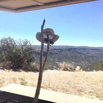
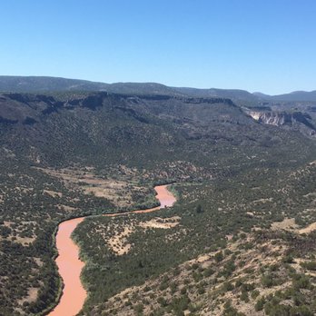
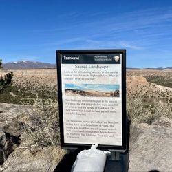
We were driving around looking for some park where we can have a picnic and enjoy some nature when we stumbled upon Overlook Park. Gorgeous views of Rio Grande, very quiet, we saw no tourists apart from us. Everyone seemed very respectful of each other's space and peace. There is something so special about the mountains, I'm always feeling like I'm in a presence of old souls. They look very alive to me, peaceful but definitely alive. If I was living around these parts, I would be returning religiously to this overlook.


Amazing views of the Rio Grande. There is also a waterfall that you can see in the distance. Easy access and plenty of areas to take pictures.


Fantastic little hike around edge of of canyon carved by Rio Grande. Very empty of Tourists. Great place for picnics, but watch the kids: steep drop. I saw Wiley E. Coyote!


Loved it, a very short distance from where I live. Amazing panoramic view of the canyon. And if you keep walking after you pass the overlook is fun and beautiful. So few people here as well!


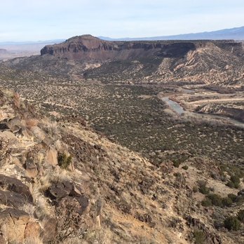
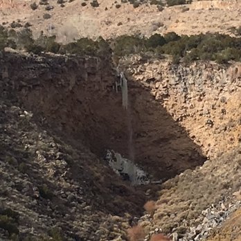
Well worth a short diversion to look at the Rio Grande Gorge from the White Rock Overlook Park. The view is breathtakingly spectacular to the valley below. On the opposite side is a tall waterfall. We could hear the fall from the park. As you drive to the overlook, the park along the road is also impressive with lots of community sports fields, toilets and large parking lots. Nice town, that recognizes what is really important and showcases this prominent overlook appropriately. If you have more time, consider hiking one of the trails.


This is one of the great views in New Mexico, a state full of great views. It's certainly one of the most easily accessible. It gets highlighted in movies (the opening scene of "Silverado" was shot here), postcards, and photo books. And when Nature wants to put on a show, it can take your breath away. On one memorable evening, a small crowd had gathered at Overlook Point to watch a spectacular thunderstorm throwing several lightning bolts per second across the valley over the Sangre de Christo range. Then the sun broke through and bathed the landscape and clouds in brilliant sunset tones. This was followed by a spectacular rainbow. As the light faded and it became clear the show was over, the crowd actually broke into applause. It can be that kind of place. If you're in the Los Alamos / White Rock / Bandelier area, I highly recommend the side trip. You have to wind your way through White Rock residential neighborhoods, followed by the extensive playing fields of Overlook Park to get to the overlook itself. A bit hard to find for visitors, but definitely worth it. Apart from the view from the overlook, the Blue Dot and Red Dot trails offer the more vigorous visitors access to the canyon depths all the way down to the Rio Grande 1000 feet below. Both trails are steep and rocky, the routes marked by the eponymous red or blue dots painted on strategic rocks along the way.


The views here are extraordinary. In addition to the view of White Rock, Black Mesa looms in the distance and the sight of steep canyons carved out of the Rio Grande is simply spectacular. I was on a tour to Bandalier National Monument, when the group stopped here. White Rock Overlook Park features a staggering 270 degree open space view of the beautiful Rio Grande River as it runs along the Jemez Mountains. It kind of reminded me of the Grand Canyon, without all the Japanese tourists. White Rock Overlook Park also has sports grounds, picnic facilities, and hosts an annual Kite Festival. The healthy local economy of White Rock, home to many a Los Alamos employee, has enabled the city to build a playground, five soccer fields, three youth baseball fields, and six softball fields here. The overlook area, from which the park takes its name, is perched on the edge of the recreation area above a huge gorge known as White Rock Canyon. You must first drive through a residential area and past all the sports parks to access the Overlook. Some people have complained online that the Overlook Park is hard to find. There is a Tourist Information Center in White Rock that will be happy to help you find your way to this not-to-be-missed viewing area.


I'll never get tired of the view towards the Rio Grande River from Overlook Park in White Rock. On every trip to Northern New Mexico (however far apart), you'll find me here (hot or not) admiring the scenery. Last week was but one experience that I hope to repeat. read more


4 months ago


3 years ago
We were driving around looking for some park where we can have a picnic and enjoy some nature when we stumbled upon Overlook Park. Gorgeous views of Rio Grande, very quiet, we saw no tourists apart from us. Everyone seemed very respectful of each other's space and peace. There is something so special about the mountains, I'm always feeling like I'm in a presence of old souls. They look very alive to me, peaceful but definitely alive. If I was living around these parts, I would be returning religiously to this overlook. read more






9 years ago
Well worth a short diversion to look at the Rio Grande Gorge from the White Rock Overlook Park. The view is breathtakingly spectacular to the valley below. On the opposite side is a tall waterfall. We could hear the fall from the park. As you drive to the overlook, the park along the road is also impressive with lots of community sports fields, toilets and large parking lots. Nice town, that recognizes what is really important and showcases this prominent overlook appropriately. If you have more time, consider hiking one of the trails. read more


10 years ago
This is one of the great views in New Mexico, a state full of great views. It's certainly one of the most easily accessible. It gets highlighted in movies (the opening scene of "Silverado" was shot here), postcards, and photo books. And when Nature wants to put on a show, it can take your breath away. On one memorable evening, a small crowd had gathered at Overlook Point to watch a spectacular thunderstorm throwing several lightning bolts per second across the valley over the Sangre de Christo range. Then the sun broke through and bathed the landscape and clouds in brilliant sunset tones. This was followed by a spectacular rainbow. As the light faded and it became clear the show was over, the crowd actually broke into applause. It can be that kind of place. If you're in the Los Alamos / White Rock / Bandelier area, I highly recommend the side trip. You have to wind your way through White Rock residential neighborhoods, followed by the extensive playing fields of Overlook Park to get to the overlook itself. A bit hard to find for visitors, but definitely worth it. Apart from the view from the overlook, the Blue Dot and Red Dot trails offer the more vigorous visitors access to the canyon depths all the way down to the Rio Grande 1000 feet below. Both trails are steep and rocky, the routes marked by the eponymous red or blue dots painted on strategic rocks along the way. read more


11 years ago
The views here are extraordinary. In addition to the view of White Rock, Black Mesa looms in the distance and the sight of steep canyons carved out of the Rio Grande is simply spectacular. I was on a tour to Bandalier National Monument, when the group stopped here. White Rock Overlook Park features a staggering 270 degree open space view of the beautiful Rio Grande River as it runs along the Jemez Mountains. It kind of reminded me of the Grand Canyon, without all the Japanese tourists. White Rock Overlook Park also has sports grounds, picnic facilities, and hosts an annual Kite Festival. The healthy local economy of White Rock, home to many a Los Alamos employee, has enabled the city to build a playground, five soccer fields, three youth baseball fields, and six softball fields here. The overlook area, from which the park takes its name, is perched on the edge of the recreation area above a huge gorge known as White Rock Canyon. You must first drive through a residential area and past all the sports parks to access the Overlook. Some people have complained online that the Overlook Park is hard to find. There is a Tourist Information Center in White Rock that will be happy to help you find your way to this not-to-be-missed viewing area. read more


10 years ago
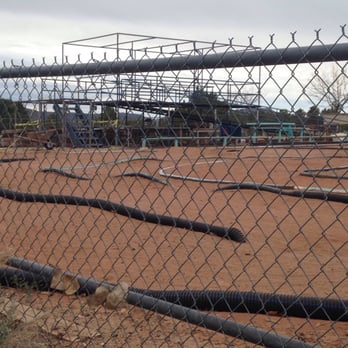
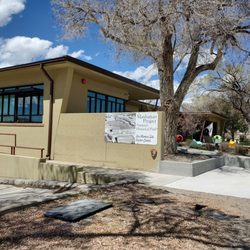
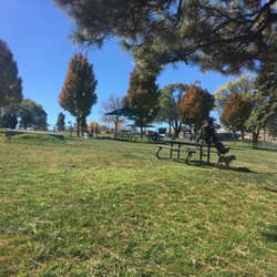
Overlook is one of those multi parks. You have baseball fields, soccer fields, picnic areas, and a beautiful view. I love walking to overlook to unwind after a long week of work and enjoy the beauty around me. When you first enter you can see both the baseball and soccer fields. A little ways down the road is the mini car track where they hold races. If you keep following the road further you will come to a an area where you can park. You won't be disappointed when you get out and take in the views. There are also trails in the area for both experienced and novice hikers so check them out. You can get maps at the visitor center down the road. Overall everyone, including pets, will enjoy themselves here. read more


5 years ago

7 years ago
More info about Overlook Park
580 Overlook Rd
White Rock, NM 87544
Directions
Hours
Outdoor Amenities
Ask the Community - Overlook Park
Is there a place where you can park and enjoy the sunset from your car?
the park itself looks east. But there's a spot closer to the ballfields where you could watch the southern part of the sunset. more like watching the anti-sunset (the effect of the sunset on the Sangre de Cristos.)
Review Highlights - Overlook Park




















Overlook Park - parks - Updated August 2026
Best of White Rock
People found Overlook Park by searching for…
Things to Do in White Rock, NM
Hiking Trails in White Rock, NM
Walking Trails in White Rock, NM
Picnic Spots in White Rock, NM
National Parks in White Rock, NM
River Swimming in White Rock, NM
Off Road Trails in White Rock, NM
Picnic Areas in White Rock, NM
Running Track in White Rock, NM
Playgrounds for Kids in White Rock, NM
Watch Sunset in White Rock, NM
Beautiful Views in White Rock, NM
Trending Searches in White Rock, NM
Barbershop For Men near Overlook Park
Consignment Shops near Overlook Park
Ear Piercing near Overlook Park
Elementary Schools near Overlook Park
Eyebrow Threading near Overlook Park
Fishing Spots near Overlook Park
Fun Things To Do With Kids near Overlook Park
Hair Braiding near Overlook Park
Kids Haircut near Overlook Park
Picnic Areas near Overlook Park
Playgrounds near Overlook Park
Public Golf Courses near Overlook Park
Public Pools near Overlook Park
Public Running Track near Overlook Park
Scenic Night View near Overlook Park
Sunrise View near Overlook Park
Swimming Holes near Overlook Park
Trading Card Shops near Overlook Park
Browse Articles
Browse Nearby
Browse Brands
Related Searches in White Rock, NM
Best Off Leash Dog Parks in White Rock, New Mexico
Best Parks for Parties and Events in White Rock, New Mexico
Best Water Parks for Kids in White Rock, New Mexico
Check Out Great Playgrounds in White Rock, New Mexico
Discover Baseball Fields Around White Rock, New Mexico
Discover Free Parking Options in White Rock, New Mexico
Discover Soccer Fields in White Rock, New Mexico Near You
Discover Top Nature Parks to Visit in White Rock, New Mexico
Discover the Best Beaches in White Rock, New Mexico
Discover the Best Kids Park Spots in White Rock, New Mexico
Enjoy the Best Picnic Spots and Ideas in White Rock, New Mexico
Enjoy the Best Walking Trails in White Rock, New Mexico
Explore Easy Hikes Perfect for All in White Rock, New Mexico
Explore Family-Friendly Zoos and Wildlife in White Rock, New Mexico
Explore Free Picnic Areas Around White Rock, New Mexico
Explore Fun Activities to Do in White Rock, New Mexico
Explore Picnic Parks Near White Rock, New Mexico
Explore Popular Campgrounds Near White Rock, New Mexico
Explore Popular Picnic Areas Around White Rock, New Mexico
Explore Popular RV Parks Around White Rock, New Mexico
Explore Scenic Lakes to Visit in White Rock, New Mexico
Explore Secret Spots Worth Visiting in White Rock, New Mexico
Explore Top Dog Parks in White Rock, New Mexico Near You
Explore Top Trampoline Parks in White Rock, New Mexico
Explore Top Water Parks in White Rock, New Mexico Today
Explore the Best Swimming Holes Around White Rock, New Mexico
Find Beautiful Views in White Rock, New Mexico
Find Great Places to Feed Ducks in White Rock, New Mexico
Find Top Dog Friendly Parks to Visit in White Rock, New Mexico
Find Top Skate Parks in White Rock, New Mexico for All Skill Levels
Find Top-Rated Waterfalls in White Rock, New Mexico Now
Find the Best Parks BBQ Grills in White Rock, New Mexico
Find the Best Parks for Picnics in White Rock, New Mexico
Find the Best Playgrounds to Visit in White Rock, New Mexico
Have Fun at a Splash Pad in White Rock, New Mexico
Hiking Trails With Waterfalls in White Rock, New Mexico
Locate Tennis Courts Around White Rock, New Mexico
Picnic Areas With BBQ Pits Available in White Rock, New Mexico
Popular Fishing Spots to Explore in White Rock, New Mexico
Popular Outdoor Activities to Try in White Rock, New Mexico
Popular Picnic Spots to Visit in White Rock, New Mexico
Popular Things to Do in White Rock, New Mexico
Safe and Fun Parks for Kids in White Rock, New Mexico
Top Amusement Parks to Visit in White Rock, New Mexico
Top Hiking Trails to Explore in White Rock, New Mexico
Top Playgrounds for Kids to Enjoy in White Rock, New Mexico
Top Running Trails to Explore in White Rock, New Mexico
Top Swimming Lakes to Enjoy in White Rock, New Mexico


