Ashley Pond Park Photos


More like Ashley Pond Park
Recommended Reviews - Ashley Pond Park
Start your review...

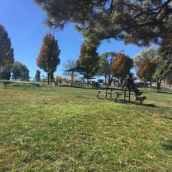
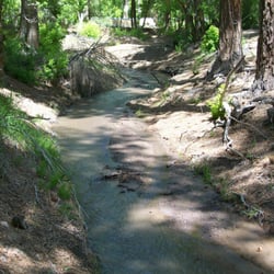
This is a belated review from my Nov 2017 visit. The parking lot was filling up around lunch time. There are a few picnic tables in the shade. We bought our lunch and ate it on a bench. The view of the pond was beautiful. The water fountain splashes water back into the pond as the ducks and white geese swim by. The rusted statue in the water wasn't there before. Thought I saw some nice looking koi in the pond. I thought someone had wipe my memory. It looked quite different from the last time I came here. The statue of the little boy is not here anymore. I later found out from Friends of Ashley Pond Park on Facebook.com that it was updated and rededicated on May 9, 2014. The geese are named Brownie and Homer, but I also read that Brownie was murdered. So sad. read more


More info about Ashley Pond Park
2300 Trinity Dr
Los Alamos, NM 87544
Directions
(505) 662-8170
Call Now
Hours
Outdoor Amenities


Why does Yelp recommend reviews?
1 review that is not currently recommended
The reviews below are not factored into the business's overall star rating.
3 years ago
Ashley Pond Park - parks - Updated June 2026
Best of Los Alamos
People found Ashley Pond Park by searching for…
Things to Do in Los Alamos, New Mexico
Playgrounds in Los Alamos, New Mexico
Places to Swim in Los Alamos, New Mexico
Picnic Areas in Los Alamos, New Mexico
Swimming Lakes in Los Alamos, New Mexico
Swimming in Los Alamos, New Mexico
Picnic Spots in Los Alamos, New Mexico
Parks for Kids in Los Alamos, New Mexico
Beautiful Views in Los Alamos, New Mexico
Photo Spots in Los Alamos, New Mexico
Water Parks in Los Alamos, New Mexico
Parks for Picnics in Los Alamos, New Mexico
Picnic in Los Alamos, New Mexico
Lakes & Ponds in Los Alamos, New Mexico
Kid Friendly in Los Alamos, New Mexico
Tourist Attractions in Los Alamos, New Mexico
Running Trails in Los Alamos, New Mexico
Places to Take Pictures in Los Alamos, New Mexico
State Parks in Los Alamos, New Mexico
Walking Trails in Los Alamos, New Mexico
Playgrounds for Kids in Los Alamos, New Mexico
Watch Sunset in Los Alamos, New Mexico
Trending Searches in Los Alamos, NM
Baseball Fields near Ashley Pond Park
Bounce House Rentals near Ashley Pond Park
Flower Shop near Ashley Pond Park
Kayak Rental near Ashley Pond Park
Movie Theatre near Ashley Pond Park
Nurseries & Gardening near Ashley Pond Park
Outdoor Activities near Ashley Pond Park
Outdoor Basketball Courts near Ashley Pond Park
Pedicure near Ashley Pond Park
Pick Your Own Farms near Ashley Pond Park
Playgrounds near Ashley Pond Park
Public Pools near Ashley Pond Park
Scenic Drive near Ashley Pond Park
Splash Pad near Ashley Pond Park
Summer Camps near Ashley Pond Park
Swimming Holes near Ashley Pond Park
Swimming Lakes near Ashley Pond Park
Swimming Pools near Ashley Pond Park
Browse Articles
Browse Nearby
BEST of Los Alamos, New Mexico Restaurants near Ashley Pond Park
BEST of Los Alamos, New Mexico Things to Do near Ashley Pond Park
BEST of Los Alamos, New Mexico Coffee near Ashley Pond Park
BEST of Los Alamos, New Mexico Hiking near Ashley Pond Park
BEST of Los Alamos, New Mexico Breakfast near Ashley Pond Park
BEST of Los Alamos, New Mexico Shopping near Ashley Pond Park
Browse Brands
Related Searches in Los Alamos, NM
Best Fun Things to Do in Los Alamos, New Mexico
Best Off Leash Dog Parks in Los Alamos, New Mexico
Best Parks for Parties and Events in Los Alamos, New Mexico
Best Water Parks for Kids in Los Alamos, New Mexico
Check Out Great Playgrounds in Los Alamos, New Mexico
Discover Baseball Fields Around Los Alamos, New Mexico
Discover Beautiful Garden Spots in Los Alamos, New Mexico
Discover Free Parking Options in Los Alamos, New Mexico
Discover Fun Activities to Do in Los Alamos, New Mexico
Discover Popular Photo Spots in Los Alamos, New Mexico
Discover Soccer Fields in Los Alamos, New Mexico Near You
Discover Top Nature Parks to Visit in Los Alamos, New Mexico
Discover the Best Beaches in Los Alamos, New Mexico
Discover the Best Kids Park Spots in Los Alamos, New Mexico
Enjoy the Best Picnic Spots and Ideas in Los Alamos, New Mexico
Enjoy the Best Walking Trails in Los Alamos, New Mexico
Explore Easy Hikes Perfect for All in Los Alamos, New Mexico
Explore Family-Friendly Zoos and Wildlife in Los Alamos, New Mexico
Explore Free Picnic Areas Around Los Alamos, New Mexico
Explore Fun Activities to Do in Los Alamos, New Mexico
Explore Popular Campgrounds Near Los Alamos, New Mexico
Explore Popular Picnic Areas Around Los Alamos, New Mexico
Explore Popular RV Parks Around Los Alamos, New Mexico
Explore Popular Recreation Centers Around Los Alamos, New Mexico
Explore Scenic Lakes to Visit in Los Alamos, New Mexico
Explore Top Dog Parks in Los Alamos, New Mexico Near You
Explore Top Gyms in Los Alamos, New Mexico Now
Explore Top Water Parks in Los Alamos, New Mexico Today
Find Beautiful Views in Los Alamos, New Mexico
Find Picnic Tables for Outdoor Fun in Los Alamos, New Mexico
Find Top Dog Friendly Parks to Visit in Los Alamos, New Mexico
Find Top Skate Parks in Los Alamos, New Mexico for All Skill Levels
Find the Best Swimming Pools in Los Alamos, New Mexico Today
Fun Things for Kids in Los Alamos, New Mexico
Great Places to Swim in Los Alamos, New Mexico
Have Fun at a Splash Pad in Los Alamos, New Mexico
Indoor Playgrounds to Explore in Los Alamos, New Mexico
Locate Tennis Courts Around Los Alamos, New Mexico
Must-See Tourist Attractions Around Los Alamos, New Mexico
Parks With Basketball Courts for Games in Los Alamos, New Mexico
Picnic Areas With BBQ Pits Available in Los Alamos, New Mexico
Popular Fishing Spots to Explore in Los Alamos, New Mexico
Popular Outdoor Activities to Try in Los Alamos, New Mexico
Popular Things to Do in Los Alamos, New Mexico
Popular Things to See in Los Alamos, New Mexico
Top Hiking Trails to Explore in Los Alamos, New Mexico
Top Running Trails to Explore in Los Alamos, New Mexico
Top Swimming Lakes to Enjoy in Los Alamos, New Mexico
People who viewed Ashley Pond Park also viewed
Randall Davey Audubon Center & Sanctuary
4 reviews
Cathedral Park
6 reviews
Las Conchas Trailhead
1 review
Black Canyon Campground
6 reviews
Deer Trap Trailhead
1 review
Bicentennial / Alto Park
1 review
Santa Fe Rafting Co & Outfitters
52 reviews
The Reel Life
24 reviews
$$$
Puzzah
7 reviews
Virgin Mesa Trail
1 review