Laurel Falls Trailhead Photos



You might also consider


More like Laurel Falls Trailhead
Recommended Reviews - Laurel Falls Trailhead
Start your review...


Reviews With Photos


I have to give the visitors of Smokey Mountain, and National Forest Rangers so many props. It doesn't matter which trail went on, They were all clean, including the roads. The only complaint I have about this trail is that it is partially paved/partially not; enough room for one 1/2 passerby's, not making it easy to have someone walk next to you or others to pass by. This is for the entire path going from parking lot to Falls. The path was completely shaded and beautiful as always.


This was absolutely beautiful and worth the hike. Be very careful with young children as there are some slightly narrow paths. Not super narrow, but narrow enough. Gorgeous scenery.


I've seen the reviews for this place and everyone like it's nice and easy. I couldn't disagree 100%. Let's talk about the parking. It's extremely difficult to park near the entrance. Each side of the road has about 10 parking spots and a few areas on the shoulder of the road. If you want to park, be prepared to wait in the parking lot until someone leaves to capture their parking spot, else be prepared to walk anywhere from 1/2 - 1 mile up hill. That's what we had to do after driving back and fourth, at once thought we'd have to walk 1.5 mile up hill to the park. But lucked out and only 1/2 mile. We started to walk the trail and it states that it's 1.3 miles to the waterfall, you can go beyond 3.7 miles to another tourist spot. If you are like me 6-7, 285 pounds and bad knees, when I say bad knees, I'm talking bone on bone from years of basketball slowly destroying my knees by the time I turned 41 years of age. One thing I learned early from my orthopedic is to stay away from hard surfaces(kind of difficult to do that), but uneven pavement is a must. Apparently this trail was paved but in 1939 and you can easily tell that over the years water and other issues have destroyed the pavement. It's uneven and quite dangerous at times. They have 0 guardrails on the trail. It's also a constant up hill. I believe it's peak is 1,800 feet, but that's a lot of uphill. Once you come to the sign that I posted in my photos about people falling to their deaths, they're not kidding, it's very narrow and broken pavement. You must be very careful when navigating along this part of the trail. I had to stop a number of times, but remember my size and bad knees. I was out of breath a bit but knew if it's wasn't the knees I could make it up quicker, if I probably was in better shape and had the best of the best of knees like my 18 year old son did. Once you make it to the top the waterfalls aren't much to look at. Is it worth the hike? 100% absolutely not, I had seen no bears nor any wildlife along my walk. I'd highly recommend considering the hike that you must make, the wear and tear to the trail, understanding that the trail isn't made for parties going up and parties going down. I was able to walk down the hill much better. I didn't stop a single time, the 1.3 miles isn't like walking on a flat surface. I walk two-three miles daily but on a flat surface and not up hill. Down hill was much better, I was able to walk the 1.3 and then 1/2 mile to my vehicle in a much quicker time span. I've read many reviews people saying this hike was fairly easy is a bold face lie, I'm sorry for the person who said that but maybe if your 18 and spry. My wife who doesn't have bad knees exercises multiple times per day and is in great shape had a difficult time climbing this trail. This is good for a intermediate to advanced hiker.


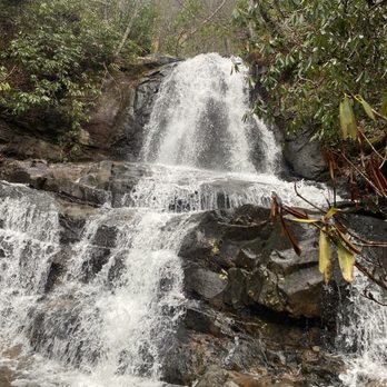
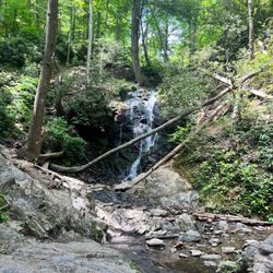
The Laurel Falls and the trail that takes you there is named for mountain laurel, an evergreen shrub found along the trail and next to the falls in May. It is one of the most popular trails in the park. Part of the trail is paved and it was originally built to allow fire crews access to the Cove Mountain area in case of a fire. The trail was completed in 1932 at a cost of $590. A fire tower was completed three years later. The roundtrip to the waterfall is 2.6 miles and takes about two hours to complete. It is all steep uphill to the waterfall so the trail is classified as moderate. Once you reach the falls you can appreciate the beautiful view. Laurel Falls is 80 feet high and it has an upper and lower section divided by a walkway. You are advised not to swim in the falls but it was ignored by almost everyone who made the hike. People were in the water in both the lower and upper sections. The rocks are slippery because of the algae and through the years several people have suffered serious death and injury from falling. In 2012 a father and son, Dwight F. Cope, 42, and Dagan Cope, 15, both of Breaux Bridge, La drowned in the lower pool of the falls. A woman visiting from Florida had to be carried out in 2018 after becoming injured at the falls. The National Park Service would like everyone to know not to feed the wildlife. This trail is well known for bear sightings. In 2010 a bear had to be euthanized after biting a hiker on the foot who had stopped to take its picture. People on the trail had been feeding the bear who lost its fear of humans. Any bear that attacks a person will be put down by the NPS. The incident was very upsetting for everyone involved so it is up to everyone who hikes the park to protect the bears by not interacting with them. I saw a rattlesnake on my way up which was very cool. I just walked past him and let him be. Respect animals by picking up your litter, not feeding them, and keeping your distance. Take nothing, leave only footprints, and have a wonderful hike.


Parking can be difficult, but it seemed like people could park along the sides when spaces were gone. We went on a Saturday and it was very busy. We were lucky enough to find a space as someone left when we arrived. The trail is very hilly going towards the falls. The pathway is small so you have to single file when others are around. Going during a busy time with Covid-19 around was a little nerve-racking. I am not an athlete; I usually go for light walks. If you're like me, I would suggest wearing a disposable, paper mask that is lighter than the cloth masks to make it easier to breathe during the hike. Most of the path is paved so the walk was not difficult. There are a few places to sit along the way for breaks. My favorite part of the trail was how encouraging everyone was. As we were hiking toward the falls, many people on their back, said things like: "it's worth it" "keep going" "you're almost there" It is like you become part of a special cool community as you hike. We made sure to do the same for others on our way down.


This is a lovely hike for practically everyone! It's definitely moderate in terms of difficulty but it's got a nicely paved trail. There are some cracks and minor gaps to watch for but overall, healthy individuals can definitely tackle this! Now that you've decided to hike Laurel, here are your tips for a great adventure: -Arrive early! Parking at the trailhead gets quite busy and the sun will start warming the trail as the day progresses. If you start at 8am, you can park seamlessly and enjoy pleasant temperatures. -Bring water, a snack, and sunscreen! These are essentials. -Wear sneakers or hiking boots. The trail is definitely uphill and you will know it immediately. Wear shoes with good traction as you'll need to be prepared in some cases for slick areas, cracks, and gaps. -Be bear aware! There have been lots of bear sighting on this trail. If you are unsure of how to behave in the presence of bears, speak w a park ranger. The risk is low but safety first! -Encourage fellow hikers on the trail and be sure to offer to take their picture at the top! You might need the favor exchanged. Have fun.


A steep climb with rough terrain. It is paved.. but it's pretty beat up; not wide enough for a stroller... However I did pass a family with one, and it looked challenging. There are some stunning taking views half way up the path, of the mountains and valleys. The water fall is beautiful. There were some kids playing in the water. You can get up close to the waterfall and cool down. A lot of rocks to sit and relax. It was pretty busy when we went. But still a nice little hike with some amazing views.


9 years ago I was first to review Laurel and several other waterfall trails in the Great Smoky Mountains. It was a different time on yelp, when very few people wrote about the great outdoors. As a matter of fact, I'll never forget getting a private message or two from other yelpers scolding me for "using yelp the wrong way." Yet 95 reviews later I get the satisfaction of knowing sometimes the crowd needs just one penguin to dive in first... which is why of all my yelp badges, MAVERICK is my favorite. So I feel a responsibility to update my original review with deep disappointment on the lack of maintenance the trail has received. It has eroded so badly that it is no longer wheel chair or stroller friendly, especially closer to the falls. Thankfully, as of 2021 there is a committee in the planning stages of refurbishing the trail surface and infrastructure, improving the viewing area and addressing the parking limits and safety issues of the massive amount of visitors who park and walk dangerously along the roadside to the trailhead when all other parking areas are at capacity. I was extremely pleased to read about this on the National Park Services website and hope they don't delay in making speedy and much needed improvements as quickly as possible. [ INTERESTING FACTS ] * The official height of the falls is 80 feet, but the trail crosses it around its midpoint, making it seem shorter. The waterfall trail is practically impassable after heavy rains as the water washes over the trail, making it dangerous to continue to the Fire Tower. * The trail was originally built to allow fire crews access to the Cove Mountain area. * It was completed in 1932 at a cost of approximately $590. * The trail is actually 4.2 miles long (one way) and continues past the falls (located @ the 1.3 mile mark) to Cove Mountain Fire Tower. * It was reconditioned, graded, and paved to halt erosion in 1963. * It is the longest of four paved trails in the park. ----- My Top 10 favorite waterfalls (in order) in the Gatlinburg area are as follows: 1) ABRAM FALLS for both the beauty of the waterfall as well as the fun factor of staying a while to play in its pool of water. It is also located in Cades Cove, so there is more to do than just hiking to the falls. 2) SPRUCE FLATS FALLS is underrated. It's one of the most visually gorgeous of all the falls and relatively short in terms of hiking. 3) RAMSEY CASCADES is probably the hardest of all the waterfall hikes, but is one of the prettiest in the Smoky Mountains. 4) LAUREL FALLS 5) THE SINKS 6) HEN WALLOW FALLS 7) GROTTO FALLS 8) MEIG'S FALLS 9) BASKIN CREEK FALLS 10) RAINBOW FALLS (depends heavily on recent rainfall, otherwise it's just a trickle). [ FINAL THOUGHTS ] Laurel Falls is one of the most popular waterfalls in the Gatlinburg area for good reason. It is not only beautiful, but is one of the most family friendly hikes and one of the most convenient to reach, BUT be sure to get here as early as possible to avoid the late morning and afternoon crowds. I've literally seen 50-60 passenger tour buses pull up loaded with people ready to hike the trail. I'll return my rating to 5 stars once the trail repairs have been made and erosion has been once again halted. In the mean time... ENJOY!!! 2022 / 87


Beautiful paved trail. We enjoyed the hike up and were able to hike down and sit near the falls off the trail. We had carried snacks and water with us and we enjoyed these while sitting on the rocks. This is not a stroller friendly trail. Steep drop off on one side but beautiful. Make sure you buy a parking pass. We had to park two lots away and walk a trail to get to the trail. We parked along the grassy island in the parking lot so not an actual spot and had a sticker on our window when we returned informing us we had illegally parked.


Very very very busy. If you want to hike in a line on a narrow path to a "viewing" area and waterfall filled with kids and parents, then this is the hike for you.


Beautiful falls and easy walk. I hesitate to even call it a hike, it was a steep walk up! Paved and pretty simple 2.6 miles round trip- uphill there, downhill back. Opens out to the falls at the top with a small footbridge and lots of rocks. When we went there was a park employee at the base and the falls, but it was a very busy day so I don't know if that's normal. When we went it was VERY busy. Like, annoyingly so. Hard to get decent photos, hard to keep a decent pace. I get it since it's a short trail to a high waterfall and it was in October. But wow! We are more seasoned hikers I guess, but were short on time and chose this one so we could see some waterfalls on our trip. I think next time we'd choose a more strenuous waterfall hike to hopefully thin the crowd.


Beautiful hike, not too steep and the path is paved for the most part. It is not stroller friendly and even with an 8 and 11 year old I was sure to hold hands around some of the bends. We were lucky enough to see a mama bear and a couple of Cubs playing in the water below. Highly recommend this hike, the only negative we're the amount of people on the trail but that's out of anyone's control. I tried to remind our group to use library voices so everyone could enjoy nature. There are also a couple of spots to stop and sit for a bit, great for a sandwich and a drink on the way down!


2 months ago

Laurel Falls is a great starter trail for Families that are introducing their children to hiking in Gatlinburg. There are plenty of interesting facts to be shared, different types of plants and wildlife along the trail. This time we didn't see many animals but the trail was a bit more crowded that day. I would not recommend taking a stroller or wheelchair on this trail. It is barely paved and there are many roots. Parts of it are very steep as well. It's a great place to practice mindfulness on the way up. There are enough roots and rocks on the path to force you to focus on being present and walking carefully. It's a peaceful trail that gives you a great view of the forest. The falls are still there but not as deep as they used to be. The rocks are very slippery! I definitely recommend water shoes if you have them. The way down is a bit harder than the way up. If you have issues with your legs or balance, I recommend using a support of some kind. There are no benches but you should be able to find large boulders to rest on. read more
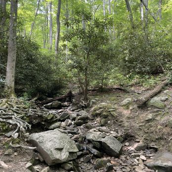

Great experience. This is not an easy trek. Yeah, it's a paved trail, but don't bring grandma on a scooter. We literally saw that, and I'm not sure how they got over the tree that had fallen over the cement trail. Get there early or park far away. Simple choices. We got there at noon and parked one mile away according to the GPS. We had a great time, and we 're all so glad we did it. I recommend it, but only if you're in decent shape. Want an honest review? Here it is. read more


5 months ago

I have to give the visitors of Smokey Mountain, and National Forest Rangers so many props. It doesn't matter which trail went on, They were all clean, including the roads. The only complaint I have about this trail is that it is partially paved/partially not; enough room for one 1/2 passerby's, not making it easy to have someone walk next to you or others to pass by. This is for the entire path going from parking lot to Falls. The path was completely shaded and beautiful as always. read more


1 year ago
Trailhead was closed during our late August visit. If you're visiting the Smokey Mountains it's advisable to check ahead of time for trail and road closures. read more


1 year ago
This was absolutely beautiful and worth the hike. Be very careful with young children as there are some slightly narrow paths. Not super narrow, but narrow enough. Gorgeous scenery. read more


3 years ago
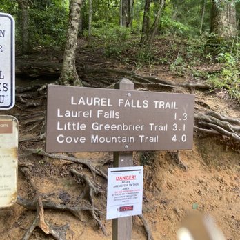
I've seen the reviews for this place and everyone like it's nice and easy. I couldn't disagree 100%. Let's talk about the parking. It's extremely difficult to park near the entrance. Each side of the road has about 10 parking spots and a few areas on the shoulder of the road. If you want to park, be prepared to wait in the parking lot until someone leaves to capture their parking spot, else be prepared to walk anywhere from 1/2 - 1 mile up hill. That's what we had to do after driving back and fourth, at once thought we'd have to walk 1.5 mile up hill to the park. But lucked out and only 1/2 mile. We started to walk the trail and it states that it's 1.3 miles to the waterfall, you can go beyond 3.7 miles to another tourist spot. If you are like me 6-7, 285 pounds and bad knees, when I say bad knees, I'm talking bone on bone from years of basketball slowly destroying my knees by the time I turned 41 years of age. One thing I learned early from my orthopedic is to stay away from hard surfaces(kind of difficult to do that), but uneven pavement is a must. Apparently this trail was paved but in 1939 and you can easily tell that over the years water and other issues have destroyed the pavement. It's uneven and quite dangerous at times. They have 0 guardrails on the trail. It's also a constant up hill. I believe it's peak is 1,800 feet, but that's a lot of uphill. Once you come to the sign that I posted in my photos about people falling to their deaths, they're not kidding, it's very narrow and broken pavement. You must be very careful when navigating along this part of the trail. I had to stop a number of times, but remember my size and bad knees. I was out of breath a bit but knew if it's wasn't the knees I could make it up quicker, if I probably was in better shape and had the best of the best of knees like my 18 year old son did. Once you make it to the top the waterfalls aren't much to look at. Is it worth the hike? 100% absolutely not, I had seen no bears nor any wildlife along my walk. I'd highly recommend considering the hike that you must make, the wear and tear to the trail, understanding that the trail isn't made for parties going up and parties going down. I was able to walk down the hill much better. I didn't stop a single time, the 1.3 miles isn't like walking on a flat surface. I walk two-three miles daily but on a flat surface and not up hill. Down hill was much better, I was able to walk the 1.3 and then 1/2 mile to my vehicle in a much quicker time span. I've read many reviews people saying this hike was fairly easy is a bold face lie, I'm sorry for the person who said that but maybe if your 18 and spry. My wife who doesn't have bad knees exercises multiple times per day and is in great shape had a difficult time climbing this trail. This is good for a intermediate to advanced hiker. read more


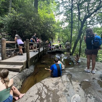
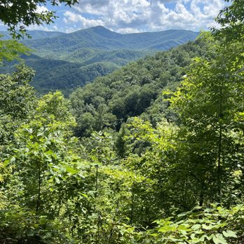

The Laurel Falls and the trail that takes you there is named for mountain laurel, an evergreen shrub found along the trail and next to the falls in May. It is one of the most popular trails in the park. Part of the trail is paved and it was originally built to allow fire crews access to the Cove Mountain area in case of a fire. The trail was completed in 1932 at a cost of $590. A fire tower was completed three years later. The roundtrip to the waterfall is 2.6 miles and takes about two hours to complete. It is all steep uphill to the waterfall so the trail is classified as moderate. Once you reach the falls you can appreciate the beautiful view. Laurel Falls is 80 feet high and it has an upper and lower section divided by a walkway. You are advised not to swim in the falls but it was ignored by almost everyone who made the hike. People were in the water in both the lower and upper sections. The rocks are slippery because of the algae and through the years several people have suffered serious death and injury from falling. In 2012 a father and son, Dwight F. Cope, 42, and Dagan Cope, 15, both of Breaux Bridge, La drowned in the lower pool of the falls. A woman visiting from Florida had to be carried out in 2018 after becoming injured at the falls. The National Park Service would like everyone to know not to feed the wildlife. This trail is well known for bear sightings. In 2010 a bear had to be euthanized after biting a hiker on the foot who had stopped to take its picture. People on the trail had been feeding the bear who lost its fear of humans. Any bear that attacks a person will be put down by the NPS. The incident was very upsetting for everyone involved so it is up to everyone who hikes the park to protect the bears by not interacting with them. I saw a rattlesnake on my way up which was very cool. I just walked past him and let him be. Respect animals by picking up your litter, not feeding them, and keeping your distance. Take nothing, leave only footprints, and have a wonderful hike. read more


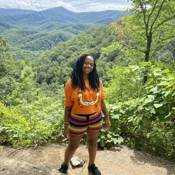
Parking can be difficult, but it seemed like people could park along the sides when spaces were gone. We went on a Saturday and it was very busy. We were lucky enough to find a space as someone left when we arrived. The trail is very hilly going towards the falls. The pathway is small so you have to single file when others are around. Going during a busy time with Covid-19 around was a little nerve-racking. I am not an athlete; I usually go for light walks. If you're like me, I would suggest wearing a disposable, paper mask that is lighter than the cloth masks to make it easier to breathe during the hike. Most of the path is paved so the walk was not difficult. There are a few places to sit along the way for breaks. My favorite part of the trail was how encouraging everyone was. As we were hiking toward the falls, many people on their back, said things like: "it's worth it" "keep going" "you're almost there" It is like you become part of a special cool community as you hike. We made sure to do the same for others on our way down. read more




5 years ago
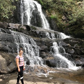
This is a lovely hike for practically everyone! It's definitely moderate in terms of difficulty but it's got a nicely paved trail. There are some cracks and minor gaps to watch for but overall, healthy individuals can definitely tackle this! Now that you've decided to hike Laurel, here are your tips for a great adventure: -Arrive early! Parking at the trailhead gets quite busy and the sun will start warming the trail as the day progresses. If you start at 8am, you can park seamlessly and enjoy pleasant temperatures. -Bring water, a snack, and sunscreen! These are essentials. -Wear sneakers or hiking boots. The trail is definitely uphill and you will know it immediately. Wear shoes with good traction as you'll need to be prepared in some cases for slick areas, cracks, and gaps. -Be bear aware! There have been lots of bear sighting on this trail. If you are unsure of how to behave in the presence of bears, speak w a park ranger. The risk is low but safety first! -Encourage fellow hikers on the trail and be sure to offer to take their picture at the top! You might need the favor exchanged. Have fun. read more



2 years ago
A steep climb with rough terrain. It is paved.. but it's pretty beat up; not wide enough for a stroller... However I did pass a family with one, and it looked challenging. There are some stunning taking views half way up the path, of the mountains and valleys. The water fall is beautiful. There were some kids playing in the water. You can get up close to the waterfall and cool down. A lot of rocks to sit and relax. It was pretty busy when we went. But still a nice little hike with some amazing views. read more


4 years ago
9 years ago I was first to review Laurel and several other waterfall trails in the Great Smoky Mountains. It was a different time on yelp, when very few people wrote about the great outdoors. As a matter of fact, I'll never forget getting a private message or two from other yelpers scolding me for "using yelp the wrong way." Yet 95 reviews later I get the satisfaction of knowing sometimes the crowd needs just one penguin to dive in first... which is why of all my yelp badges, MAVERICK is my favorite. So I feel a responsibility to update my original review with deep disappointment on the lack of maintenance the trail has received. It has eroded so badly that it is no longer wheel chair or stroller friendly, especially closer to the falls. Thankfully, as of 2021 there is a committee in the planning stages of refurbishing the trail surface and infrastructure, improving the viewing area and addressing the parking limits and safety issues of the massive amount of visitors who park and walk dangerously along the roadside to the trailhead when all other parking areas are at capacity. I was extremely pleased to read about this on the National Park Services website and hope they don't delay in making speedy and much needed improvements as quickly as possible. [ INTERESTING FACTS ] * The official height of the falls is 80 feet, but the trail crosses it around its midpoint, making it seem shorter. The waterfall trail is practically impassable after heavy rains as the water washes over the trail, making it dangerous to continue to the Fire Tower. * The trail was originally built to allow fire crews access to the Cove Mountain area. * It was completed in 1932 at a cost of approximately $590. * The trail is actually 4.2 miles long (one way) and continues past the falls (located @ the 1.3 mile mark) to Cove Mountain Fire Tower. * It was reconditioned, graded, and paved to halt erosion in 1963. * It is the longest of four paved trails in the park. ----- My Top 10 favorite waterfalls (in order) in the Gatlinburg area are as follows: 1) ABRAM FALLS for both the beauty of the waterfall as well as the fun factor of staying a while to play in its pool of water. It is also located in Cades Cove, so there is more to do than just hiking to the falls. 2) SPRUCE FLATS FALLS is underrated. It's one of the most visually gorgeous of all the falls and relatively short in terms of hiking. 3) RAMSEY CASCADES is probably the hardest of all the waterfall hikes, but is one of the prettiest in the Smoky Mountains. 4) LAUREL FALLS 5) THE SINKS 6) HEN WALLOW FALLS 7) GROTTO FALLS 8) MEIG'S FALLS 9) BASKIN CREEK FALLS 10) RAINBOW FALLS (depends heavily on recent rainfall, otherwise it's just a trickle). [ FINAL THOUGHTS ] Laurel Falls is one of the most popular waterfalls in the Gatlinburg area for good reason. It is not only beautiful, but is one of the most family friendly hikes and one of the most convenient to reach, BUT be sure to get here as early as possible to avoid the late morning and afternoon crowds. I've literally seen 50-60 passenger tour buses pull up loaded with people ready to hike the trail. I'll return my rating to 5 stars once the trail repairs have been made and erosion has been once again halted. In the mean time... ENJOY!!! 2022 / 87 read more


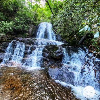
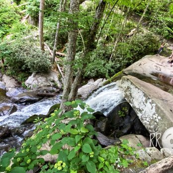


Beautiful paved trail. We enjoyed the hike up and were able to hike down and sit near the falls off the trail. We had carried snacks and water with us and we enjoyed these while sitting on the rocks. This is not a stroller friendly trail. Steep drop off on one side but beautiful. Make sure you buy a parking pass. We had to park two lots away and walk a trail to get to the trail. We parked along the grassy island in the parking lot so not an actual spot and had a sticker on our window when we returned informing us we had illegally parked. read more


4 years ago
Very very very busy. If you want to hike in a line on a narrow path to a "viewing" area and waterfall filled with kids and parents, then this is the hike for you. read more


Beautiful falls and easy walk. I hesitate to even call it a hike, it was a steep walk up! Paved and pretty simple 2.6 miles round trip- uphill there, downhill back. Opens out to the falls at the top with a small footbridge and lots of rocks. When we went there was a park employee at the base and the falls, but it was a very busy day so I don't know if that's normal. When we went it was VERY busy. Like, annoyingly so. Hard to get decent photos, hard to keep a decent pace. I get it since it's a short trail to a high waterfall and it was in October. But wow! We are more seasoned hikers I guess, but were short on time and chose this one so we could see some waterfalls on our trip. I think next time we'd choose a more strenuous waterfall hike to hopefully thin the crowd. read more


Beautiful hike, not too steep and the path is paved for the most part. It is not stroller friendly and even with an 8 and 11 year old I was sure to hold hands around some of the bends. We were lucky enough to see a mama bear and a couple of Cubs playing in the water below. Highly recommend this hike, the only negative we're the amount of people on the trail but that's out of anyone's control. I tried to remind our group to use library voices so everyone could enjoy nature. There are also a couple of spots to stop and sit for a bit, great for a sandwich and a drink on the way down! read more


Went on a Christmas Day hike. It was an easy hike but steep. Since it was so cold that day it was a little icy in some spot. Not pet or stroller friendly. Parking can get full quickly. We got there around 8 am and no one's there but when we came back, parking was full. read more


Great hiking trail and beautiful falls. Would consider this a great trail for those who are early into hiking. Absolutely glad we made the trip. The only negative was the complete lack of face coverings. My wife and I were amongst the very few people wearing masks on what was a moderately-heavily populated and somewhat narrow hiking trail. read more


5 years ago
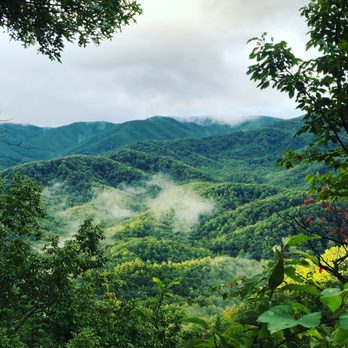
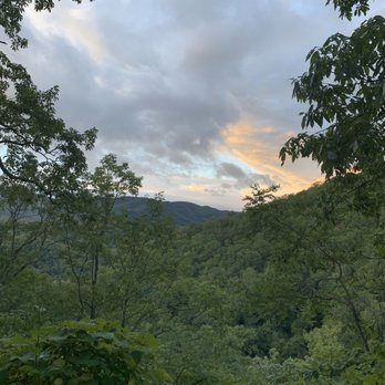
Want to be directly inside a waterfall? Hike this trail! At the end of the trail, you won't be disappointed. There's a bridge that goes across the Falls. You will get wet! Recommend bringing either a change of shoes or wearing rain-boots. Gorgeous views along the way. Easy trails. Kid friendly. read more






6 years ago
Nice family friendly hike. It's about 3 miles round trip and the beginning has a pretty good incline. We went a little late (around 2pm) on a Tuesday in August and it was rediculous my crowded. This hike would have been a 5 star, but there was no way to take a picture at the falls because of all the people around. I've been on hikes where there are a lot of people, but there were probably 60-70 people by the falls There was plenty of parking along the side of the road and a fairly large parking lot read more
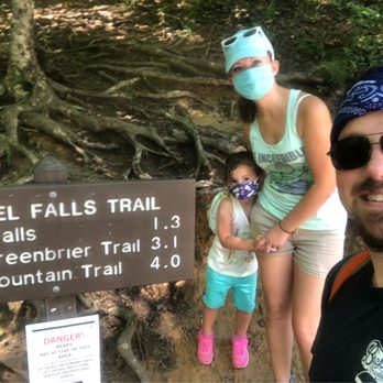


Laurel Falls is a nice hiking trail with an 80 ft. Waterfall. The trail is in the Great Smoky Mountains National Park. It seems to be a popular trail since there was a lot of people. We had to wear our mask most of the time during Covid, but people did try to stay distant. I guess we were one of the lucky ones to see a bear. It was very exciting but also frightening not knowing if the mother was close by. The bear did growl and put up its paw. There were about 20 people all trying to get the great photo. It was a hike I will never forget. read more


An absolutely beautiful family-friendly hike. When visiting the area (whilst ~ 6 months pregnant) I wanted to enjoy some nature/scenery, but at a sustainable pace. Don't get me wrong, I'm a sucker for adventure and a challenge, but wanted to err on the safe side. I did plenty of research beforehand and found on multiple sites that Laurel Falls was THE PLACE to visit. It's on the shorter side (just over 3 miles round trip) and also paved the entire way. There are a few bumps and breaks in the pavement along the way but I was comfortable navigating these - no problem. Just be cautious if you're bring along someone who isn't as steady on their feet - they should be fine but will want to pay close attention to the bumps! Honestly even for experienced hikers this would be a fun break / 'day off' trip. Highly recommended! The falls at the end of the hike are gorgeous and refreshing - dip your toes in to cool off! read more


3 years ago
Great family walk to a beautiful waterfalls. Uphill about 400' incline. If you're not used to steep drops off a side of the trail or scared of heights, beware. Fun little side trails and viewing areas we enjoyed also. Waterfalls were beautiful and well worth the hick and back. read more


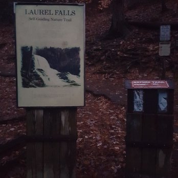
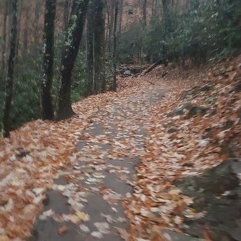
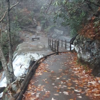
TIP - GO EARLY!! I love waking up extra early for hikes. We were staying in Gatlinburg for the weekend but because of rain, I had to postpone the hike until Sunday. I checked and the sunrise would be around 7:15 am so I made sure to leave the hotel at 6:30 am to get there because I heard about parking being limited. Thank goodness!! We weren't even the first ones there! Two other cars were already parked. Signs are easy to read and the trail is paved. It's pretty easy. All you do is walk upwards and it's not too strenuous. What I like is when we return, we would be heading down :) so that makes it easier hehe Some of the tree roots fought their way and cracked the paved trails while some water destroyed a few areas but nothing crazy. There are number signs when you head up. When you get to 10, you're almost there to the bridge. That's not the waterfall you see in photos. Cross that bridge first! What amazed me is while we got closer to the top, it started to snow!! It was so beautiful!! The waterfall is gorgeous and after the rain, it was loud and roaring! I love waterfalls when you get up close and personal. Laurel Falls is my fave destination from Gatlinburg :) 273/2019 read more







4 years ago
Easy walk for both young and old. The views along the way are fantastic. The falls are nice at the end of the trail. It gets crowded so you may have to park and walk to the trail head. read more


7 years ago
**This review is for the stroller pushing mamas** The trail gets a 5 star rating for it's beauty, relative ease, and ithas a nice waterfall at the end. However, if you have to push a stroller like I did, it's NOT an easy, stroller friendly trail. I was pushing a BOB jogging stroller with big wheels and there were parts where the trail was deteriorated and narrow that I had to lift my stroller up and over. My 2 yr Old was whining from how bumpy it was- she was getting knocked around in there. I saw a mom pushing double BOB on the way out and I wanted to tell her to turn back. I had to ditch my stroller as I got closer to the top because I couldn't manage the trail. It was easier to carry her. Also it was crowded and I needed to pull to the side a bunch to be considerate of faster moving groups. All in all- NOT STROLLER FRIENDLY but possible if you are extremely determined. read more


9 years ago

5 years ago
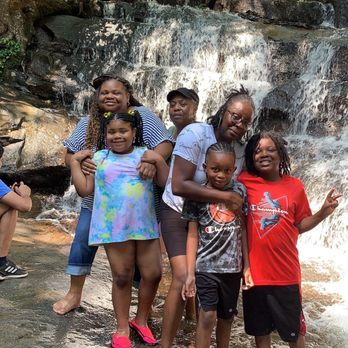
This review is for the plus size hiker. Please take water, snacks, and a hiking stick with you. This hike ain't no joke. The incline got me but we made it to the top. It says 1.3 miles but it feels like you walked 3 miles one way. I will say that the waterfall is absolutely gorgeous and cold! read more



7 years ago
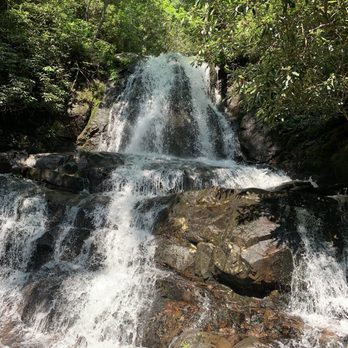
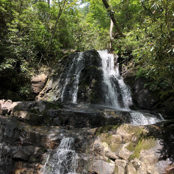
This turned out to be a great hike. We were originally going to go to Grotto Falls to hike but it was closed. This was my 1st time hiking, and it was just the right amount of time. Total time to go complete the entire hike round trip about 1.4 hrs. Not bad for the 5 of us, I think the kids would have finished sooner but they were waiting for Mom and Dad, :-). As other reviews stated it was paved the entire way, which was cool because if you follow the path you can't get lost. The only thing it can get crowded, which made me nervous at times because the pathway is not that big, so you can kindly just move to the side instead of trying to walk pass at the same time, because looking down on the side looks pretty steep. Definitely bring bottles of water and wear something comfortable. The waterfall is very nice, cool and very pretty to look it. The sound of the waterfall if you take a minute to really listen is amazing. You can sit up there for as long as you like and just admire the beauty. Overall great hike, would definitely do it again. And now maybe I will venture off into one that is more challenging, just maybe. read more




7 years ago
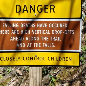
Short hike, takes about an hour, bring water though snacks aren't necessary. Watch out for inexperienced and inconsiderate hikers. They tend to walk 2, 3 and 4 abreast with their heads down, looking at their phones and ear buds in. Watch out for parents with newborns, toddlers and strollers. We saw a set of young parents with their 3 kids, newborn in a stroller, a toodler and a 5-6 year old stop in the middle of the trail for a pictiture. The stroller tipped over and the newborn inside the stroller was upside down. Too close to the drop off for comfort. Hike early to avoid the knuckleheads. Falls at the end of the trail are worth the hike. read more

4 years ago
Great easy-moderate hike. We passed many families and older people while on this hike. Not too far of a distance and the falls are beautiful. read more


7 years ago
This is about 2.5 miles trail in the Smoky Mountain and it is an easy-moderate hike trail. The path is paved for the most part, but it is relatively narrow so it is not for strollers and wheelchairs. There are a few points where I feel dangerous for little kids as there are cliffs! At the end of the 1.3 mile trail, you will see the Falls. The Falls itself isn't too tall, but it is pretty. There are lots of trees around the Falls, so we packed snacks and sat there to eat for about 20-30 minutes before we heading back. Worth to take a look and spend 2 hours hiking this trail. read more


Page 1 of 3
More info about Laurel Falls Trailhead
Ask the Community - Laurel Falls Trailhead
Are we allowed dogs on the trail?
No there are only two trails in the smokies that allow dogs.
Review Highlights - Laurel Falls Trailhead
























Why does Yelp recommend reviews?
4 reviews that are not currently recommended
The reviews below are not factored into the business's overall star rating.

9 years ago
11 years ago
11 years ago
4 years ago
Laurel Falls Trailhead - hiking - Updated September 2026
Best of Gatlinburg
People found Laurel Falls Trailhead by searching for…
Hiking Trails With Waterfalls in Gatlinburg, TN
Swimming Holes in Gatlinburg, TN
Watch Sunset in Gatlinburg, TN
Scenic Drive in Gatlinburg, TN
Off Road Trails in Gatlinburg, TN
Things to Do in Gatlinburg, TN
Dog Swimming in Gatlinburg, TN
Scenic Overlook in Gatlinburg, TN
Secret Spots in Gatlinburg, TN
Places to Take Pictures in Gatlinburg, TN
Picnic Areas in Gatlinburg, TN
Basketball Courts in Gatlinburg, TN
Walking Trails in Gatlinburg, TN
Trending Searches in Gatlinburg, TN
Apple Orchards near Laurel Falls Trailhead
Apple Picking near Laurel Falls Trailhead
Barbers near Laurel Falls Trailhead
Bike Shop near Laurel Falls Trailhead
Bird Sanctuary near Laurel Falls Trailhead
Casinos near Laurel Falls Trailhead
Cliff Jumping near Laurel Falls Trailhead
Consignment Shops near Laurel Falls Trailhead
Cruising Spots near Laurel Falls Trailhead
Dog Friendly Things To Do near Laurel Falls Trailhead
Dog Swimming near Laurel Falls Trailhead
Ear Piercing near Laurel Falls Trailhead
Eyebrow Threading near Laurel Falls Trailhead
Hair Braiding near Laurel Falls Trailhead
Hiking near Laurel Falls Trailhead
Kids Haircut near Laurel Falls Trailhead
Lakes near Laurel Falls Trailhead
Parks near Laurel Falls Trailhead
Picnic Areas near Laurel Falls Trailhead
Playgrounds near Laurel Falls Trailhead
Preschools near Laurel Falls Trailhead
Private Schools near Laurel Falls Trailhead
Public Golf Courses near Laurel Falls Trailhead
Public Running Track near Laurel Falls Trailhead
Public Shower near Laurel Falls Trailhead
Pump Track near Laurel Falls Trailhead
Rock Quarry near Laurel Falls Trailhead
Scenic Night View near Laurel Falls Trailhead
Scenic Overlook near Laurel Falls Trailhead
Star Gazing near Laurel Falls Trailhead
Sunrise View near Laurel Falls Trailhead
Swimming Holes near Laurel Falls Trailhead
Trading Card Shops near Laurel Falls Trailhead
Used Furniture Stores near Laurel Falls Trailhead
Browse Nearby
Browse Brands
Related Searches in Gatlinburg, TN
Affordable Kayak Rental Services in Gatlinburg, Tennessee
Best Dog Hiking Trails Around Gatlinburg, Tennessee
Best Fishing Locations and Guides in Gatlinburg, Tennessee
Best Off Leash Dog Parks in Gatlinburg, Tennessee
Best Parks for Parties and Events in Gatlinburg, Tennessee
Best Places for Horseback Riding in Gatlinburg, Tennessee
Best Sightseeing Experiences Available in Gatlinburg, Tennessee
Best Water Parks for Kids in Gatlinburg, Tennessee
Best Waterfalls and Swimming Holes in Gatlinburg, Tennessee
Check Out Great Playgrounds in Gatlinburg, Tennessee
Check Out Off Road Trails in Gatlinburg, Tennessee
Discover Baseball Fields Around Gatlinburg, Tennessee
Discover Dog Friendly Trails to Explore in Gatlinburg, Tennessee
Discover Fun Toddler Parks in Gatlinburg, Tennessee for Your Little One
Discover Kid Friendly Hiking Trails in Gatlinburg, Tennessee
Discover Lakes & Ponds to Explore in Gatlinburg, Tennessee
Discover Popular Bike Trails in Gatlinburg, Tennessee
Discover Scenic Mountain Bike Trails Near Gatlinburg, Tennessee
Discover Soccer Fields in Gatlinburg, Tennessee Near You
Discover Top Nature Parks to Visit in Gatlinburg, Tennessee
Discover Top State Parks to Visit in Gatlinburg, Tennessee
Discover a Hiking Trail in Gatlinburg, Tennessee
Discover the Best Beaches in Gatlinburg, Tennessee
Discover the Best Night Hike Trails in Gatlinburg, Tennessee
Dog-Friendly Hikes With Dogs in Gatlinburg, Tennessee
Enjoy Camping Adventures Around Gatlinburg, Tennessee
Enjoy Hiking Adventures in Gatlinburg, Tennessee
Enjoy Kayaking Adventures in Gatlinburg, Tennessee
Enjoy Off Leash Dog Hikes in Gatlinburg, Tennessee
Enjoy Scenic Places to Walk in Gatlinburg, Tennessee
Enjoy Tent Camping Spots Around Gatlinburg, Tennessee
Enjoy a Beautiful Waterfall Hike in Gatlinburg, Tennessee
Enjoy the Best Walking Trails in Gatlinburg, Tennessee
Explore Beautiful Parks and Green Spaces in Gatlinburg, Tennessee
Explore Easy Hikes Perfect for All in Gatlinburg, Tennessee
Explore Family-Friendly Zoos and Wildlife in Gatlinburg, Tennessee
Explore Free Picnic Areas Around Gatlinburg, Tennessee
Explore Fun Activities to Do in Gatlinburg, Tennessee
Explore Parks With Pull Up Bars in Gatlinburg, Tennessee
Explore Picnic Parks Near Gatlinburg, Tennessee
Explore Popular Campgrounds Near Gatlinburg, Tennessee
Explore Popular Picnic Areas Around Gatlinburg, Tennessee
Explore Popular RV Parks Around Gatlinburg, Tennessee
Explore Popular Scenic Views Near Gatlinburg, Tennessee
Explore Scenic Lakes to Visit in Gatlinburg, Tennessee
Explore Top Dog Parks in Gatlinburg, Tennessee Near You
Explore Top Trampoline Parks in Gatlinburg, Tennessee
Explore Top Water Parks in Gatlinburg, Tennessee Today
Explore the Best Swimming Holes Around Gatlinburg, Tennessee


