
Cataract Falls Photos


You might also consider


More like Cataract Falls
Recommended Reviews - Cataract Falls
Start your review...


Reviews With Photos

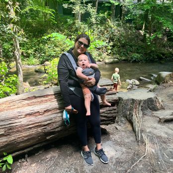
Great hike for all ages. It's a short little hike with some cool features and almost no incline.

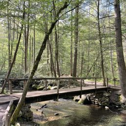
One thing about visiting this falls they have limited parking permitted. The government offices is near and you're not permitted to part there. The other locations is limited to maybe 10-15 vehicles. Recommend adding more spaces to the area. When we started the hike to the falls it wasn't more than 0.10 miles if so to the falls. Then we decided to do the entire hike around and that took maybe 2.40 miles all the way around the loop. The hike wasn't bad at all. This is an educational trail as it lists the different species that you will run into during your hike. It tells you when and where the hornets nest resides on the park and to be careful. If you are a beginner and want to see a couple cool things this is the trail to go on. They have a welcome center along the trail if you want to learn more about the trail and other trails nearby.


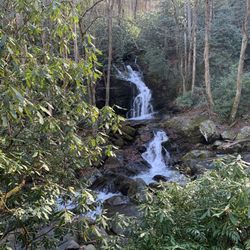
This was the first hike my friend and I did on our Tennessee trip and it was also the easiest. Located only 10 minutes from downtown Gatlinburg, the trail takes off from the left of the Sugarlands Smokey Mountains Visitor Center. The short length of the trail, only 3/4 of a mile round trip makes it easy enough for even young children. The trail starts off paved before turning to gravel. The trail is covered by a nice canopy of trees providing shade. As you go down the trail you will cross over several bridges that take you over Fighting Creek. Right before you reach the waterfall you go up small set of stairs and turn right and then you will see the falls. Cataract Falls is made of two low flow streams that drop 25 feet into a pool below. Climbing to the top of the falls is not advised. In 2015 a 7 year old girl from Kentucky fell 30 feet from the top of the falls. Fortunately she survived but it shows how quickly you can lose your footing. There is much more spectacular scenery in the park but if you are short on time and or have people in your party that can't do a more rigorous and steep trail, then this is a perfectly lovely hike.


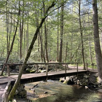
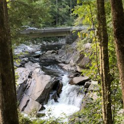
Cataract Falls is conveniently located at the Sugarlands Visitor Center within the Great Smoky Mountains National Park. It's a short hike for little ones or those with limited mobility because it is easy with no change in elevation. There is one small set of stairs. There are a few tree roots here and there. Parking can be a challenge on weekends here, so of course get here early. A plus is that there are bathrooms here as well. The walk is less than a mile one way to the falls so it is quick. There is a small stream alongside and a few bridges to cross. There is also a bridge to go under which I thought was neat. Cataract Falls itself is a small waterfall and there are signs to not get to close to it or climb the rocks. Because so many visitors come here, the park is trying to protect the falls. Overall, beautiful and convenient way to see a small waterfall and go on a short hike!


Beautiful little falls about 0.2 mile walk from the parking lot of the ranger station. It also connects to other trails including the fighting creek trail that goes behind the visitor center. It's very flat and well maintained, no climbing. While not the most impressive in the park for sure, it's a great stop if you're short on time and want to see some falls. When we stopped by, there was only 1 other group of people when we arrived then 1 when we left, so it was pretty peaceful.


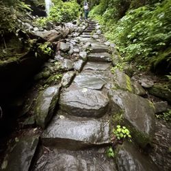
This was a great, easy hike for us. We had our daughter in the jogging stroller and found that it was manageable. There are a few stairs that make it a little more difficult but my husband and I were easily able to navigate that. It also has been raining for a few days so there were parts of the path that had deeper puddles on it. But if you have a little one who can't walk the .5 mile each way, and an amazing jogger stroller then this is manageable. Took us around 30 minutes for the whole hike (there and back). It was also a good hike as there were a few bridges and streams along the way, very scenic.


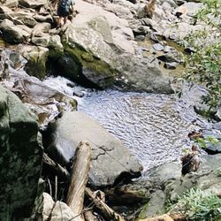
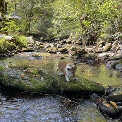
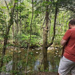
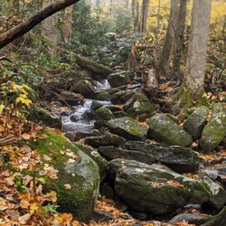
Cataract Falls is one of the easiest and most family-friendly waterfalls in the Smokies. The walk is short, mostly flat, and shaded. perfect for young kids, older adults, or anyone who doesn't want a strenuous hike. There's lots of places to walk or swim in the shallow stream with rocks the water was too cold for us Floridians but still refreshing to wash your hands in. One tip: we initially drove around trying to find the trailhead and couldn't figure out where the entrance was. We finally stopped at the Sugarlands Visitor Center gift shop and learned the trail starts directly behind the visitor center near the restrooms. You'll need a parking pass to park, but we opted for the all-day parking tag since we planned to visit multiple areas in the national park, and it was well worth it. The waterfall itself isn't huge, but it's peaceful, and a great spot for photos. If you're looking for a quick, relaxing waterfall without a long hike, Cataract Falls is definitely worth adding to your itinerary. read more


This is a nice sized waterfall. The best part is how easy it is to get to it. While others require miles of hiking... this one is under 10 mins. It's easy to access by foot with children or for older folks that can't walk far. The short walk to the waterfall from the parking lot is beautiful and shaded by trees. You walk alongside the river the entire way. Once you reach the waterfall there is a small bench to sit and admire. If your trying to find waterfalls that are safe and easy walking distance this is the perfect one to visit! Although the sign says "do not climb" plenty of kids were walking up and down the areas above and around the waterfall. I would not suggest this. Nearly gave me a heart attack when my son ran up. read more



3 years ago
One thing about visiting this falls they have limited parking permitted. The government offices is near and you're not permitted to part there. The other locations is limited to maybe 10-15 vehicles. Recommend adding more spaces to the area. When we started the hike to the falls it wasn't more than 0.10 miles if so to the falls. Then we decided to do the entire hike around and that took maybe 2.40 miles all the way around the loop. The hike wasn't bad at all. This is an educational trail as it lists the different species that you will run into during your hike. It tells you when and where the hornets nest resides on the park and to be careful. If you are a beginner and want to see a couple cool things this is the trail to go on. They have a welcome center along the trail if you want to learn more about the trail and other trails nearby. read more
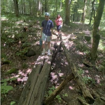
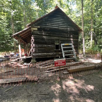


This was the first hike my friend and I did on our Tennessee trip and it was also the easiest. Located only 10 minutes from downtown Gatlinburg, the trail takes off from the left of the Sugarlands Smokey Mountains Visitor Center. The short length of the trail, only 3/4 of a mile round trip makes it easy enough for even young children. The trail starts off paved before turning to gravel. The trail is covered by a nice canopy of trees providing shade. As you go down the trail you will cross over several bridges that take you over Fighting Creek. Right before you reach the waterfall you go up small set of stairs and turn right and then you will see the falls. Cataract Falls is made of two low flow streams that drop 25 feet into a pool below. Climbing to the top of the falls is not advised. In 2015 a 7 year old girl from Kentucky fell 30 feet from the top of the falls. Fortunately she survived but it shows how quickly you can lose your footing. There is much more spectacular scenery in the park but if you are short on time and or have people in your party that can't do a more rigorous and steep trail, then this is a perfectly lovely hike. read more
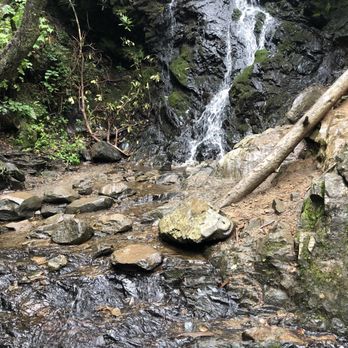


Cataract Falls is conveniently located at the Sugarlands Visitor Center within the Great Smoky Mountains National Park. It's a short hike for little ones or those with limited mobility because it is easy with no change in elevation. There is one small set of stairs. There are a few tree roots here and there. Parking can be a challenge on weekends here, so of course get here early. A plus is that there are bathrooms here as well. The walk is less than a mile one way to the falls so it is quick. There is a small stream alongside and a few bridges to cross. There is also a bridge to go under which I thought was neat. Cataract Falls itself is a small waterfall and there are signs to not get to close to it or climb the rocks. Because so many visitors come here, the park is trying to protect the falls. Overall, beautiful and convenient way to see a small waterfall and go on a short hike! read more


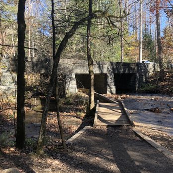


Beautiful little falls about 0.2 mile walk from the parking lot of the ranger station. It also connects to other trails including the fighting creek trail that goes behind the visitor center. It's very flat and well maintained, no climbing. While not the most impressive in the park for sure, it's a great stop if you're short on time and want to see some falls. When we stopped by, there was only 1 other group of people when we arrived then 1 when we left, so it was pretty peaceful. read more


2 years ago

This was a great, easy hike for us. We had our daughter in the jogging stroller and found that it was manageable. There are a few stairs that make it a little more difficult but my husband and I were easily able to navigate that. It also has been raining for a few days so there were parts of the path that had deeper puddles on it. But if you have a little one who can't walk the .5 mile each way, and an amazing jogger stroller then this is manageable. Took us around 30 minutes for the whole hike (there and back). It was also a good hike as there were a few bridges and streams along the way, very scenic. read more


3 years ago

7 years ago

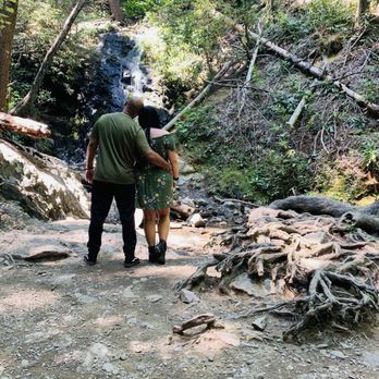
A few little paths to take. Cataract Falls was a short walk. To get to Laurel falls was another 11.2 miles so we just enjoyed the view of this fall and walked the boarded nature trail on the way back. It was a cute trail and there where kids in the water and parents with their kids just sitting with their feet in the cool water. I loved this fall and trail. read more




5 years ago

7 years ago

6 years ago
More info about Cataract Falls
Gatlinburg, TN 37738
Directions
Hours
Outdoor Amenities
Ask the Community - Cataract Falls
Review Highlights - Cataract Falls
You might also consider























Cataract Falls - hiking - Updated September 2026
Best of Gatlinburg
People found Cataract Falls by searching for…
Hiking Trails With Waterfalls in Gatlinburg, TN
Walking Trails in Gatlinburg, TN
Natural Hot Springs in Gatlinburg, TN
Waterfalls and Swimming Holes in Gatlinburg, TN
Things to Do in Gatlinburg, TN
Places to Take Pictures in Gatlinburg, TN
Visitor Centers in Gatlinburg, TN
Hiking Trails Kid Friendly in Gatlinburg, TN
Running Trails in Gatlinburg, TN
Beautiful Views in Gatlinburg, TN
Off Road Trails in Gatlinburg, TN
Stair Climbing in Gatlinburg, TN
National Parks in Gatlinburg, TN
Secluded Spots in Gatlinburg, TN
Trending Searches in Gatlinburg, TN
Apple Orchards near Cataract Falls
Apple Picking near Cataract Falls
Bird Sanctuary near Cataract Falls
Cliff Jumping near Cataract Falls
Consignment Shops near Cataract Falls
Cruising Spots near Cataract Falls
Dog Friendly Things To Do near Cataract Falls
Ear Piercing near Cataract Falls
Eyebrow Threading near Cataract Falls
Flower Fields near Cataract Falls
Hair Braiding near Cataract Falls
Kids Haircut near Cataract Falls
Mens Haircut near Cataract Falls
Picnic Areas near Cataract Falls
Preschools near Cataract Falls
Public Golf Courses near Cataract Falls
Rock Quarry near Cataract Falls
Running Trails near Cataract Falls
Scenic Night View near Cataract Falls
Scenic Overlook near Cataract Falls
Sunrise View near Cataract Falls
Swimming Holes near Cataract Falls
Trading Card Shops near Cataract Falls
Browse Articles
Browse Nearby
BEST of Gatlinburg, Tennessee Coffee near Cataract Falls
BEST of Gatlinburg, Tennessee Things to Do near Cataract Falls
BEST of Gatlinburg, Tennessee Restaurants near Cataract Falls
BEST of Gatlinburg, Tennessee Parks near Cataract Falls
BEST of Gatlinburg, Tennessee Walking Trails near Cataract Falls
BEST of Gatlinburg, Tennessee Breakfast near Cataract Falls
BEST of Gatlinburg, Tennessee Caves near Cataract Falls
BEST of Gatlinburg, Tennessee Campgrounds near Cataract Falls
BEST of Gatlinburg, Tennessee Sightseeing near Cataract Falls
Browse Brands
Related Searches in Gatlinburg, TN
Affordable Kayak Rental Services in Gatlinburg, Tennessee
Best Dog Hiking Trails Around Gatlinburg, Tennessee
Best Fishing Locations and Guides in Gatlinburg, Tennessee
Best Places for Horseback Riding in Gatlinburg, Tennessee
Best Sightseeing Experiences Available in Gatlinburg, Tennessee
Best Waterfalls and Swimming Holes in Gatlinburg, Tennessee
Check Out Off Road Trails in Gatlinburg, Tennessee
Discover Dog Friendly Trails to Explore in Gatlinburg, Tennessee
Discover Kid Friendly Hiking Trails in Gatlinburg, Tennessee
Discover Popular Bike Trails in Gatlinburg, Tennessee
Discover Scenic Mountain Bike Trails Near Gatlinburg, Tennessee
Discover a Hiking Trail in Gatlinburg, Tennessee
Discover the Best Night Hike Trails in Gatlinburg, Tennessee
Dog-Friendly Hikes With Dogs in Gatlinburg, Tennessee
Enjoy Camping Adventures Around Gatlinburg, Tennessee
Enjoy Kayaking Adventures in Gatlinburg, Tennessee
Enjoy Off Leash Dog Hikes in Gatlinburg, Tennessee
Enjoy Scenic Places to Walk in Gatlinburg, Tennessee
Enjoy Tent Camping Spots Around Gatlinburg, Tennessee
Enjoy a Beautiful Waterfall Hike in Gatlinburg, Tennessee
Enjoy the Best Walking Trails in Gatlinburg, Tennessee
Explore Beautiful Parks and Green Spaces in Gatlinburg, Tennessee
Explore Easy Hikes Perfect for All in Gatlinburg, Tennessee
Explore Fun Activities to Do in Gatlinburg, Tennessee
Explore Popular Campgrounds Near Gatlinburg, Tennessee
Explore Top Dog Parks in Gatlinburg, Tennessee Near You
Explore the Best Swimming Holes Around Gatlinburg, Tennessee
Family Friendly Hiking With Kids in Gatlinburg, Tennessee
Find Cozy Camping Cabins in Gatlinburg, Tennessee
Find Popular Ziplining Spots Around Gatlinburg, Tennessee
Find Top Dog Friendly Parks to Visit in Gatlinburg, Tennessee
Find Top-Rated Waterfalls in Gatlinburg, Tennessee Now
Find the Best Parks for Picnics in Gatlinburg, Tennessee
Hiking Trails With Waterfalls in Gatlinburg, Tennessee
Off Leash Dog Hiking Trails in Gatlinburg, Tennessee
Plan a Scenic Drive Route Near Gatlinburg, Tennessee
Popular Outdoor Activities to Try in Gatlinburg, Tennessee
Popular Picnic Spots to Visit in Gatlinburg, Tennessee
Safe and Fun Parks for Kids in Gatlinburg, Tennessee
Top Hiking Trails to Explore in Gatlinburg, Tennessee
Top Paddleboarding Activities in Gatlinburg, Tennessee
Top Playgrounds for Kids to Enjoy in Gatlinburg, Tennessee
Top Running Trails to Explore in Gatlinburg, Tennessee
Top Swimming Lakes to Enjoy in Gatlinburg, Tennessee
Top Swimming Spots and Pools in Gatlinburg, Tennessee
Top-Rated Camping Sites in Gatlinburg, Tennessee


