Cancel

    Open app

    Search

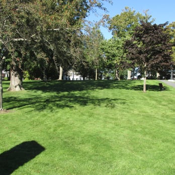
    Library Park

    4.0 (1 review)

    Library Park Photos

    Recommended Reviews - Library Park

    Your trust is our priority, so businesses can't pay to alter or remove their reviews. Learn more about reviews.
    Yelp app icon
    Browse more easily on the app
    Review Feed Illustration
    Photo of Brian S.
    255
    1992
    28197

    12 years ago
    Helpful 19
    Thanks 0
    Love this 19
    Oh no 0

    Verify this business for free

    People searched for Parks 365 times last month within 15 miles of this business.

    Verify this business

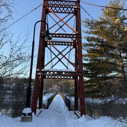
    Androscoggin Swinging Bridge - Snow covered

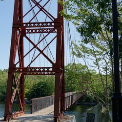
    Androscoggin Swinging Bridge

    4.9(23 reviews)
    8.0 mi

    Super cool suspended rope bridge. I went a a drizzly day and it was awesome. The parking lot is…read morereally small and has about 5 spots for cars. I walked across the the river and back. There are great views of the river. I jumped up and down at a couple of spots and could definitely feel the bridge swing. Definitely would visit again.

    We love swinging bridges so we made sure to make a stop at this one. It happened to be raining when…read morewe were on our way through this area but we didn't let that stop us. If anything, the fact that it was dusk and the rain was so gentle, kind of made the whole experience feel more visceral and intimate. The bridge itself is really beautiful with great views of the river on both sides. There's definitely enough movement so that you don't forget you're on a swinging bridge, but it didn't feel unsafe and even our little dog was fine walking back and forth across it. My husband and I hung out in the middle for a while, enjoying the views, cuddled in the cool wet air. It was actually pretty romantic. We probably spent about 15 or 20 minutes here and in that time multiple people crossed the bridge and at least five or six stopped to take photos in front of it, including a group of 4 that asked us to take their photo for them (pictured below) so this is a busy area even in the rain. But once you're here, you know why because it's a pretty cool experience. I definitely recommend a quick stop here if you can make the time.

    Photos
    Androscoggin Swinging Bridge - The bridge itself is cool.

    The bridge itself is cool.

    Androscoggin Swinging Bridge
    Androscoggin Swinging Bridge

    See all

    Coastal Maine Botanical Gardens - Coastal Maine Botanical Gardens

    Coastal Maine Botanical Gardens

    4.7(253 reviews)
    8.0 mi

    We came to see the trolls! We made a night away of coming to the Botanical Gardens to see five of…read moreThomas Dambo's troll installations and stayed to appreciate everything else. The Trolls: there are 5 trolls on an easy path on the outskirts of the Gardens. If all you want to do is see the trolls, an able bodied person could manage in about an hour. If you're slower or need assistance, it would take longer. There is a shuttle for those who want/need it to get down to the trolls farther out. There's a ton more to do than just see the trolls though. Everything else: There's a bunch of stops throughout the Gardens that kept our 3 kids (8, 11, 12) occupied. We spent a lot of time building fairy gardens, enjoying the view at the dock, and we walked out to the Guardian of the Seeds installation. The grounds themselves are meticulously maintained and it would be beautiful to walk around any day.

    We loved visiting this garden and were delighted that we could use our AHS reciprocal membership…read morehere. The trolls were certainly the highlight, enormous in scale and wonderfully set up as a scavenger hunt activity for both adults and the kids. The children's field guide was also an excellent way to keep the littles excited and searching. We loved all the wooded paths and thoughtful and well curated immersive areas from the sensory garden to the area with music inspired by the local outdoors. The children's garden is also well put together, themed after local books and with an interactive activity each, which was such a neat idea. We only wished that the maps were a bit clearer (ie they differed even better the children's map and the main one, one did not list names of the trolls, etc). We spent 2.5 hours here on our way between Bar Harbor and Portland and wished we had more time and lived closer!

    Photos
    Coastal Maine Botanical Gardens - Coastal Maine Botanical Gardens

    Coastal Maine Botanical Gardens

    Coastal Maine Botanical Gardens - Coastal Maine Botanical Gardens

    Coastal Maine Botanical Gardens

    Coastal Maine Botanical Gardens - Coastal Maine Botanical Gardens

    See all

    Coastal Maine Botanical Gardens

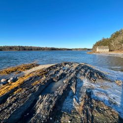
    Skolfield Shores Preserve

    Skolfield Shores Preserve

    4.8(6 reviews)
    7.0 mi

    Explored Skolfield Shores Preserve in January and it was absolutely breathtaking. I drove up from…read morethe Mississippi Gulf Coast (about 24 hours) just adventuring - as soon as I laid eyes on the end of the trail I was walking, I thought, "Now this... is what I came all this way for!" (even though this stop was a random passing selection off the map of my route). If my phone was not shutting down due to the below freezing temperatures, and if I'd been able to feel my toes, nose, and fingers longer, I could have wandered the area all day. So happy to see such a well-kept, beautiful piece of nature.

    For me, this is a destination walking trail and one I'm excited to check out again and again…read morethroughout the seasons. So if you're in the Brunswick area, be sure to make your way to Skolfield Shores Preserve - it's got a little bit of everything that makes Maine's notable natural world so great: thick forest, salt marshes, fields, ocean views, wildlife, Parking is in front of the Merruconnegan Farm (when you see the large Harpswell Heritage Land Trust kiosk, you're in the right place!) - note that this is a working farm, so be thoughtful of their privacy and stick to the trail (which is extremely well marked). The trail itself is super accessible and sort of shaped like a big figure eight (Hemlock Loop with a wooden bridge that connects to Merrucoonegan Loop) with a spur trail beforehand that leads down to a beautiful meadow, the shore, and a historic boathouse... which is a dramatic, sweeping, stunning site straight off a postcard for the state of Maine. It overlooks Middle Bay Cove and couldn't be more peaceful or lovely. Sit and stay a while; enjoy the incredible birds here (osprey, meadowlarks, eagles), the hermit crabs that apparently come out in spring, the remoteness, and the very cool broken shell "beach" area. Afterwards, continue your walk, keep an eye out for hen of the woods mushrooms, and enjoy the scenic views along the way. Please, please, please practice "carry in, carry out", be careful of tickets, and remember to wear blaze orange during hunting seasons.

    Photos
    Skolfield Shores Preserve
    Skolfield Shores Preserve
    Skolfield Shores Preserve - Trail bridge

    See all

    Trail bridge

    Cathance River Nature Reserve Trails

    Cathance River Nature Reserve Trails

    4.8(4 reviews)
    7.7 mi

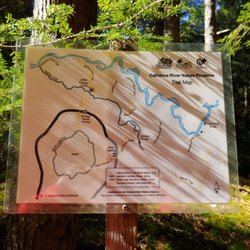
    Walking along the Cathance River reminded me a lot of Swift River in the Kancamagus - a stunning…read morehike through the forest alongside a rushing body of water (stretches of which include Class IV rapids). So much of it felt so organic too - rocks and tree roots making paths and stairs through the gently winding quiet woods. It's well marked, the directional signs are in the perfect places, and the trails are all extremely well maintained. What a fantastic way to spend an autumnal morning - had a picnic on some of the rocks that were jutting out into the river with the sun pouring down around me. For sure the way to go for maximum water views, with the most privacy, is: park at the Ecology Center, walk down to it and hook a left on Highland Trail (blue), which connects to Cathance River Trail (white), take Cathance River Trail to Rapids Trail (yellow), Rapids Trail back to Highland Trail and the Ecology Center. I say this because... You should know that this hiking area is basically within a housing development on a golf course and is currently undergoing a lot of construction on the eastern side of the trail system (anything around and beyond the actual Hiker Parking area - didn't see the wooden bridge near Old Quarry Road or the Clay Brook bridge to Head of Tide Park because I wasn't allowed to access them when I came). Also, you can hear the traffic from 295 pretty clearly throughout most of the trail system. I didn't know either of these things, so both were a bit off-putting. As an aside, I was yelled at twice: once by a golfer and once by some lady in her backyard who could see me through the trees. Both wanted to know what I was doing, why I was doing it, and where my destination was (not even kidding). It seems to me there needs to be bit more communication with these folks about the trail system here - that people actually come to hike them. Until that happens, my advice is to avoid anything and everything to do with the heath (all trails to it and around it since this is where golfing and people's backyards seem to be). I'm looking forward to coming back when construction is done and the area is a less confusing and awkward place to navigate as a hiker. But I will stick to the trails near the water!

    This was a beautiful snowshoe hike. It's a great way to clear your mind on a Sunday afternoon…read more Maybe 4 miles of trails if you want to do it all in one day. Well marked and they have maps.

    Photos
    Cathance River Nature Reserve Trails
    Cathance River Nature Reserve Trails
    Cathance River Nature Reserve Trails

    See all

    Doubling Point Lighthouse

    Doubling Point Lighthouse

    3.3(8 reviews)
    0.7 mi

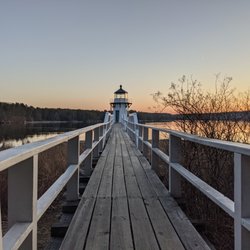
    Just at the very tail end of the day, we raced to see our final lighthouse of this Saturday tour…read more Arriving just at sunset, it is located at the end of about a mile or so of dirt road that could use some love from the local town transportation department. Yes, it's private property. And if they want to keep people off it, they can do what the folks at the Hendrick's Head Light did - post signs and enforce them. Located on the Kennebec River, the lighthouse was established in 1898 and remains an active aid to navigation today. It points out a sharp turn in the river for those going to or from the Bath Iron Works. It was listed on the National Register of Historic Places in 1988. The light station includes a tower, keeper's house, shed, and oil house. The tower is an octagonal wood frame structure, finished in wooden shingles, with an iron walkway around the lantern chamber. It is accessed via a three-span footbridge. Around the base of the lighthouse, there are some spots where you can walk out to get different angles. Some interesting driftwood on the ground if that's something that interests you. [Review 14897 overall, 399 of 2021, number 79 in Maine.]

    We visited this historic lighthouse on our recent vacation, but as others have previously mentioned…read moreI would not return because it feels like you are, and in fact you are, in someone's backyard. I have no idea how or why such an arrangement arose, but it is is odd to say the least. Also, the access road is not not well maintained so be aware. The lighthouse itself is very interesting and it affords a nice view of the Kennebec river.

    Photos
    Doubling Point Lighthouse
    Doubling Point Lighthouse
    Doubling Point Lighthouse - Doubling Point Lighthouse, Bath ME

    See all

    Doubling Point Lighthouse, Bath ME

    Thomas Point Beach & Campground - 2016- and now.

    Thomas Point Beach & Campground

    3.6(20 reviews)
    4.0 mi

    Great place!!! I did see someone posted a review from 2 months ago saying playground not…read morefunctional, it was when we were there and kids were using it. They also said pool not functional, well pool and hot tub functional and very nice. Yes it is being remodeled but we rarely heard construction equipment noise for more than a couple of minutes and it was usually a construction vehicle beeping when backing up. We had an issue with our RV and kept extending our stay waiting for a part and repair for our fridge, extending our stay was so easy. The staff was very nice. We also rented kayaks from this RV park and they were very nice kayaks. The staff at this RV park is very nice. The only minor issues we had and I know they are working on it, the RV spots are very sandy, but they are paving and growing grass. Some spots have nice lush grass not sand and while we were there, the blocked off about 4 spots because they were growing grass. Laundry was not ready to use yet, but I am sure it will be soon. If we are back in Brunswick and we probably will be back, we would stay here....also by next year would love to see all the improvements. When we are back next year, hope the same staff is there, they were all so nice and accommodating!

    Drove up to check the campground that we had stayed at for many years to see what the new owners…read moredid to change it. Glad we did before we booked Unreal what they did to a beautiful WOODED campground . Camping in a dirt parking lot will never happen . So sad - former owners put their life into creating an awesome experience that we were lucky enough to enjoy and look back on.

    Photos
    Thomas Point Beach & Campground
    Thomas Point Beach & Campground - This place is amazing! The best option for a beach outing. Stay away from the state beaches and come here.

    This place is amazing! The best option for a beach outing. Stay away from the state beaches and come here.

    Thomas Point Beach & Campground

    See all

    Captain Alfred Skolfield Nature Preserve - Well that's a view.

    Captain Alfred Skolfield Nature Preserve

    4.0(2 reviews)
    6.8 mi

    The Captain Alfred Skolfield Nature Preserve is an unassuming little spot that's nearly impossible…read moreto find (I think I would have had more luck accidentally stumbling upon it than actively seeking it out). Basically, if you're looking to come here, find Sea Grass Farm Road in Brunswick. The preserve is diagonally across the street (look for old school wooden sign). Although it's overgrown, there's a small area immediately off the road for a few cars. What I liked the most about this particular trail is that it feels a little forgotten about, like nature is taking it back slowly but surely (there's even a sign near the property line that reads "human presence is a disruption and destructive to the wildlife here") - and that's what makes it so charming. The Brunswick Topsham Land Trust has done an exceptional job at conservation here (while it's taken care of, it still has an air of genuine wilderness): it's an easily accessible, easily traversable mile (with a smaller loop to the left that connects to a larger loop on the right) through forest adjacent to the salt marshes of Middle Bay Cove and Harpswell Cove. There's a wooden bridge to cross and curved wooden seats near the water, but be sure to stay on the trails - poison ivy grows rampant here.

    A tucked away little trail with a tiny grassy parking lot that is easy to miss. The sign is nestled…read moreinto the entrance so even that can go unnoticed. A good marker is that Sea Glass Farm road is directly across from the parking. This trail is two little loops that equal to a total of .7 miles but boasts scenic views of Middle Bay half way around each. With little benches to sit and relax how could you not want to stop and take in the marsh air.

    Photos
    Captain Alfred Skolfield Nature Preserve - Meeting place?

    Meeting place?

    Captain Alfred Skolfield Nature Preserve - Information.

    Information.

    Captain Alfred Skolfield Nature Preserve - Both loops are about .7 miles long. Short walk, great views!

    See all

    Both loops are about .7 miles long. Short walk, great views!

    Library Park - parks - Updated August 2026

    Loading...
    Loading...
    Loading...