Cancel

    Open app

    Search

    Linda Vista Trail

    4.8 (8 reviews)

    Linda Vista Trail Photos
    Recommended Reviews - Linda Vista Trail

    Your trust is our priority, so businesses can't pay to alter or remove their reviews. Learn more about reviews.
    Yelp app icon
    Browse more easily on the app
    Review Feed Illustration

    Reviews With Photos

    Linda vista trail

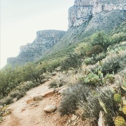
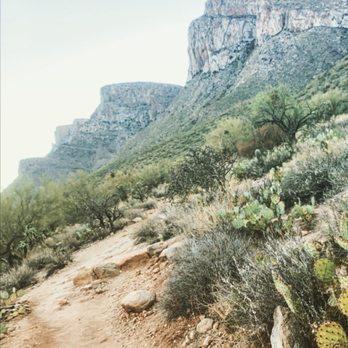
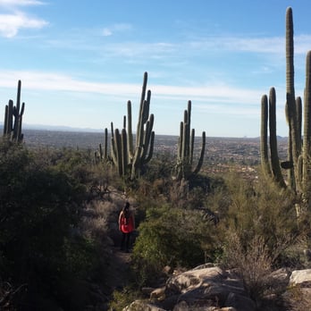
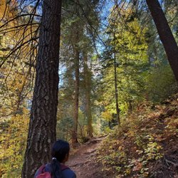
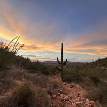
    It's a cute trail, perfect for beginners! Very beautiful and very relaxing for an early morning hike! :)

    On the way up

    See all

    Photo of Joshua D.
    0
    487
    3215

    1 year ago

    Helpful 0
    Thanks 0
    Love this 1
    Oh no 0

    1 year ago

    Helpful 0
    Thanks 0
    Love this 0
    Oh no 0

    4 years ago

    Helpful 2
    Thanks 0
    Love this 2
    Oh no 0

    5 years ago

    Helpful 2
    Thanks 0
    Love this 1
    Oh no 0

    5 years ago

    Helpful 2
    Thanks 0
    Love this 0
    Oh no 0

    9 years ago

    Helpful 2
    Thanks 0
    Love this 0
    Oh no 0

    12 years ago

    Helpful 6
    Thanks 0
    Love this 1
    Oh no 0

    11 years ago

    Helpful 5
    Thanks 0
    Love this 0
    Oh no 0

    Ask the Community - Linda Vista Trail

    Verify this business for free

    People searched for Hiking 552 times last month within 15 miles of this business.

    Verify this business

    Catalina State Park

    Catalina State Park

    4.5
    (143 reviews)
    4.9 mi

    Came here on a night walk early June. The park is well maintained and the guides were amazing. We…read moredid ice breakers to start and really enjoyed that each guide has their own expertise. We learned about the unique wildlife, rock formations, insects and constellations! I highly recommend.

    I went here for a night walk in June and had an amazing time with friends! The Rangers were so…read moreknowledgeable and friendly. I thought it was pretty cool the way they reflected pictures onto the ground of the animals they discussed. They taught us not just about the animals of the desert, but also about the rock formations, and constellations as well . They did an introduction before we set out on the trail and an icebreaker, which I also thought was a cool little activity to help us all feel more comfortable. I would definitely do this again, and recommend it for anyone who's never done it. This would be a great activity to bring an out-of-town friend on. FYI- the hell when you first start, the trail is pretty steep.. I was huffing and puffing a bit lol. If you have any knee injuries or struggle with steep land, you might want to sit this one out. The rest of the trail is flat after however the hill is needed to start and end the trail (it probably took like 1-2 minutes to scale it). Also to find the area where the hike starts, you'll want to drive all the way through the park until you get to the parking lot on the left. For some reason, I thought it would be pretty close to when you enter the park, however, it is a little drive.

    Photos
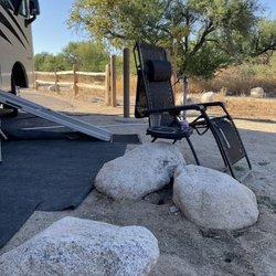
    Camp site A-8, Catalina State Park, Az May 27, 2023
    Camp site A-8, Catalina State Park, Az May 27, 2023
    Catalina State Park May 27, 2023
    Catalina State Park May 27, 2023
    Alamo Loop wildflowers

    See all

    Alamo Loop wildflowers
    Pima Canyon Trail

    Pima Canyon Trail

    4.3
    (12 reviews)
    2.0 mi

    Not one that I do real often, as I am not a big fan of the first mile or two "approach". Very…read morerocky and uneven. Once you start climbing the canyon it's fabulous. The canyon is half of the best challenging loop hike in Tucson: up Pima Canyon, down Finger Rock (or vice versa). You better be in shape for this one. Pima Canyon boasts some of the best (free) access of the Catalina trailheads. You can get there by going east on Magee from Oracle Rd, or north from Sunrise/Ina. This makes it easier to get to for us Oro Valley dwellers. This trail is *very* popular. Despite the generous parking lot it can get filled by 9AM forcing you to park on the road, so get there early.

    Hubby and I were exploring the cool city of Tucson and we were checking out some of the beautiful…read morehomes in the foothills when we came across this trail. We decided to check it out and see if we could catch a sunset. There are multiples trails that veer off this trail and it is recommended to have a compass with you as the sometimes the trails are not well marked. As you ascend, the Saguaros dot the landscape along with the wildflowers. Lots of solid and loose rock on the trail so be sure to have on good trail shoes or hiking boots. Although, we were not able to hike as far as we would have liked due to the sun setting, we still were able to catch a nice view of Tucson. I appreciate that this trail begins within a beautiful neighborhood. How lucky are these people?! It's like step out of your backyard into mother nature!

    Photos
    Pima Canyon Trail
    Pima Canyon Trail
    Pima Canyon Trail

    See all

    Vistoso Trails Nature Preserve

    Vistoso Trails Nature Preserve

    5.0
    (2 reviews)
    5.4 mi

    Vistoso Trails Nature Preserve. Oro Valley, AZ. Dec, 2025. We were staying at a resort in the Oro…read moreValley, and checking out various places to take our daily walk. My husband stumbled upon this preserve, and what a find it was! On the site of a former golf course, the preserve boosts a 6.2 mile, eight-foot-wide concrete path that winds through the property providing visitors with views of the Catalina and Tortolita mountains, examples of varied Sonoran Desert vegetation, and the opportunity to view wildlife. The Preserve is surrounded by residential neighborhoods, and we could see homes around the edges. We walked a bit over three miles, and saw a fair number of walkers and bicyclists. Virtually everyone greeted us as we passed. Based on their website, it seems that there are active efforts to protect this valuable resource. The Preserve is open from dawn to dusk and temporary parking, with a well-maintained port-a-potty is located at 945 W. Vistoso Highlands Dr.

    This location used to be a golf course which closed in 2018. Once it closed, residents of Oro…read moreValley fought to keep it as a nature preserve instead of letting developers turn it into more housing. The reisdents won and there's plans to completely redo the area into a preserve. In the meantime though, it's open to the public as a walking, hiking or biking trail. You can see the remnants of the old golf course while taking in some stunning views. The pathways are nice and wide as they used to be for the golf carts. Such a hidden gem in Oro Valley....I hope however that folks will come and explore this place. It's beautiful and absolutely deserves to stay as it is.

    Photos
    December. We had been seeing mostly greens and browns.
    December. We had been seeing mostly greens and browns.
    Dec, 2025.
    Dec, 2025.
    More desert vegetation. Dec, 2025.

    See all

    More desert vegetation. Dec, 2025.
    Bear Canyon Trail

    Bear Canyon Trail

    4.8
    (10 reviews)
    10.8 mi

    Great 17 mile loop trial in Sabino Canyon in Tucson. Bear Canyon is located in the Sabino Canyon…read moreRecreation Area of the Coronado National Forest. The trail starts at the recreation center where either you can walk to the trailhead or take a shuttle for a fee. There is another smaller parking area off of Bear Canyon Road that you can access the trailhead from that isn't in the recreation area. Once parked, you follow an easy rocky wash to the recreation area. Accessing the trail from this parking lot makes the hike a little shorter. But finding a spot to park can be difficult because the lot only holds about 15 cars. Attractions you can visit in Bear Canyon are Seven Falls and Thimble Peak. The rest of this review is for the Seven Falls Trail portion of the Bear Canyon Loop Trail. This hike reminded me of the West Fork Trail in Northern AZ but with less shade. There is a restroom at the Bear Canyon overlook picnic area. The Seven Falls trail is 8 miles out-and-back and has seven water crossings along the way. I was able to walk across the rocks, but plan on getting your feet wet (or bring water shoes). There are lots of Saguaro and Prickly Pear Cactus along this rocky path. After the crossings, there is an incline and then downhill portion until you get to the base of the falls. The waterfall cascades down a rock face and is gorgeous. This hike is really popular and gets crowded during the middle of the day and weekends. I really enjoyed hiking it. The best way to enjoy this hike and avoid lots of people is to start early. And as always when you hike in Arizona, bring water and sunscreen.

    I was in the area to hike Seven Falls which is a trail you can get off off Bear Canyon Trail. It…read moreis in in the Sabino Canyon Recreational Center and parking was $5 bucks. For Seven Falls you can start off right from the parking and work your way up to the fails or you can get tickets and a ride the tram up for 4 miles, if you take the tram, you are still hiking 8 miles so don't feel like you're not getting your distance in if that's your thing. I recommend doing the Seven Falls hike either in the early spring if the creeks aren't flowing to high or the fall, most of the hike is not shaded, but you do like 7 creek crossings and do get wet , so plan on wearing waterproof shoes. This was an Arizona bucket list hike for me so I really enjoyed it. The Seven Falls are worth it! Come early to get a parking spot . Distance (with tram ride) 8.2 Miles, but I am sure the .2 depends on where you park, elevation gain about 900ft, difficulty moderate, you don't have to scale rocks or scramble, you can easily climb. Amenities are at the center, and it's real flushing toilets. No, you can't bring your dog on this.

    Photos
    Small Waterfall on Seven Falls Trail
    Small Waterfall on Seven Falls Trail
    Bear Canyon Trail
    Gorgeous hike

    See all

    Gorgeous hike
    Mount Lemmon

    Mount Lemmon

    4.5
    (118 reviews)
    11.4 mi

    Mount Lemmon and the Catalina Highway, AZ. Early Dec, 2025. Mount Lemmon, the highest peak…read more(9,175') in the Santa Catalina Mountains near Tucson, is managed by the U.S. Department of Agriculture, Forest Service as part of the Coronado National Forest. (Fun Fact: Mt. Lemmon is named after Sara Plummer Lemmon, an amateur botanist and the first white woman to climb to the summit in 1881. It is one of the few peaks in the U.S. named after a woman). Our objective was to drive the Catalina Highway Scenic Drive (27 miles) to the Mount Lemmon summit. This is the only paved road that leads to the upper reaches of the Santa Catalina Range, and is one of the most scenic highways in the southwest. Because the road starts in the lower Sonoran vegetative life zone and climbs to high forests, it offers the biological equivalent of driving from the deserts of Mexico to the forests of Canada in only 27 miles. Before proceeding on the drive, we downloaded a free app entitled "Mt. Lemmon Science Tour" by the University of Arizona, which provided excellent commentary on the Sky islands, rocks, life zones, water, forest, and fire, that was well-synced with our drive up the mountain as it evolved. This is a windy, slow drive with the posted speed limit of 35 MPH or less on most sections. Plus, you're sharing the road with bicyclists riding in both directions. The road is paved, and is well-designed with frequent pull-offs and stops that allow for vista views or just to take a rest. A few of our favorite and recommended stops include: *Babad Do'ag for its excellent vistas of the desert environment and saguaros. *Gordon Hirabayashi Campground (and Historical Recreation Area). I've reviewed this separately on Yelp. *The Palisades Visitor Center, with family-friendly exhibits, brochures and general information, and a small gift shop. *Windy Point Vista, for sweeping views. *High-elevation picnic areas at Box Elder, Alder, Loma Linda, or Inspiration Rock. *Mt. Lemmon Ski Valley, where there is a restaurant and ski lift rides ($). We were disappointed that the entrance road to Rose Canyon Lake was closed on the day that we visited. This is a Forest Service fee area. A day-use pass is $8 per vehicle, and can be purchased on-line or at the Palisades Visitors Center on-route. We didn't have time to hike on the day that we visited but there are miles and miles of trails of varying length and difficulty. While there are restrooms with pit toilets at multiple sites, but there is no potable water nor service stations. I've posted a handout about the area that I picked up at the Visitors Center. Only Spanish-language brochures were available.

    This place has always been my go to place. I love the absolutely scenery and the view when you get…read moreto the top. This place has also some parking spots where they have a nice view and you can also walk as well to the rock place.. been coming over 4 yrs now and love when it's sunset it's a beautiful view of it. All the way to the top it's a resort when winter comes you can ski, also camping place or walking trail and picnic area as well. Pets is allowed as well. It's a must go...

    Photos
    Peak of Mount Lemmon Ski valley
    Peak of Mount Lemmon Ski valley
    Aspen Draw Trail
    Aspen Draw Trail
    Trailheads upper Hitchcock Hwy

    See all

    Trailheads upper Hitchcock Hwy
    Blackett's Ridge

    Blackett's Ridge

    5.0
    (16 reviews)
    11.0 mi

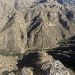
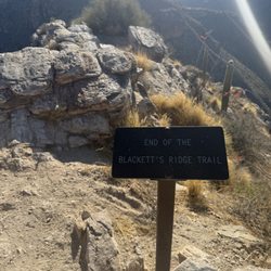
    I have been wanting to do this hike and finally got to do it today! It was low 50s when we started…read morejust before 7:00 am. Starting from the parking lot at Sabino Canyon we had plenty of sun until the Phoneline Trail split off into Blackett's Ridge. We then had some shade until we got further up the mountain. The trail is rocky with a lot of switchbacks. I would definitely recommend good hiking shoes! The trail is pretty hard since it is so steep, but it is rewarding. Getting to the top is an accomplishment the views are beautiful! If you are afraid of heights stop at the "end of trail sign" but if you are feeling good, taking a few more steps will give you an even greater appreciation of the "ridge" in Blackett's Ridge. Just be sure to take caution! I would definitely recommend this hike and I would 100% do it again!

    I had heard about Blackett's Ridge all the time while hiking in Sabino to Seven Falls, but never…read moregave it much thought until checking it out a couple months ago. The initial stage is fairly level and shouldn't tire you out; however, once you've passed that part, it's a steady set of inclined switchbacks for what seems like a good while. Upon getting to the top, you begin to realize why it was worth the ascent--a fantastic view of the Tucson valley and the surrounding mountains! Be sure to bring plenty of water (esp in summertime) to stay hydrated as there are no fountains to my knowledge beyond the parking lot/visitor center. Also, being that this is inside Sabino, be aware the charge to enter is $5, and on busy weekends there's no guarantee you will quickly find a parking spot (you sometimes have to drive around until you either see a car pulling out or see people walking toward the lot. Have fun and safe travels!

    Photos
    Very steep drop off at the end of the trail
    Very steep drop off at the end of the trail
    Sabino Canyon tram road from above
    Sabino Canyon tram road from above
    End of Trail

    See all

    End of Trail
    Tortolita Mountain Park

    Tortolita Mountain Park

    5.0
    (2 reviews)
    10.0 mi

    I like this mountain range. If it weren't a two-hour drive from Sierra Vista, I'd hike here more…read moreoften. I've done all the trails in the past five years. Because this is a low-elevation range dominated by saguaros, hiking here is best done in the cooler months. The trails are maintained by local volunteers. To get to the ample parking lot, you must drive toward the resort. Just tell the guard you are here to hike and s/he'll let you through. Ask for a map, as there aren't always maps available at the parking lot. There are flush bathrooms by the trail head. One does not need a high clearance vehicle to get to the parking lot. All trails start here by the wash. The trails are color-coordinated and well-marked. My favorite trails are the ridge trails, where views in all directions surround you. The Wild Mustang trail is perhaps my favorite, with views toward the north at Mount Lemmon. The northern part of this range was recently expanded. I've seen a few crested saguaros here. There is also an old corral there that has water in the rainy season. Trails are dog-friendly, but many dog owners just leave their bagged feces along the trail. Please take that crap with you! This is my only complaint about this park.

    Tortolita Mountain Park is a local gem with 12 trails of varying lengths and difficulty. 8 may be…read moreused for mountain biking and 2 for horseback riding. The trail system also is used for the annual Move Across 2 Ranges hosted by Marana (Tortolita Mountain Park) and Oro Valley (Catalina State Park), which always sells out. My partner and I enjoy the long-distance views of Picacho Peak from Upper Javelina Trail and views Of the Santa Ritas from Alamo Springs Trail. All of the trails are well-groomed. We always use poles and bring plenty of water so we can cover more ground.

    Photos
    Santa Ritas in the distance and we'll-groomed trail in the foreground
    Santa Ritas in the distance and we'll-groomed trail in the foreground
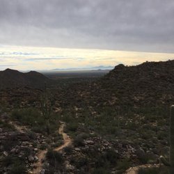
    View from the trail
    View from the trail
    Picacho Peak from Upper Javelina

    See all

    Picacho Peak from Upper Javelina

    Linda Vista Trail - hiking - Updated July 2026
    Loading...
    Loading...
    Loading...